
Guest Blog by Siddharth Agarwal
In the years 2018 and 2019, I spent months walking East across India with Paul Salopek on the Out of Eden Walk[i]. His trail started in the Great Rift Valley of Ethiopia in East Africa, roughly following the path of the early human migration out of Africa and across the globe.
The India trail of the Out of Eden Walk started from the India-Pakistan border at Wagah, Punjab. It then moved East through the Indus Basin, followed by the basins of West flowing rivers like Luni, then a large chunk through the southern Gangetic plains in Central India before crossing over to the Brahmaputra basin close to Siliguri in West Bengal. The crossover to Myanmar happened at Moreh in Manipur, also incidentally very close to the basin boundary of Brahmaputra and Irrawady. He entered India in March 2018, and crossed over to Myanmar in July 2019.
The Out of Eden Walk trail in India was ~4000kms, of which I was present for about 1500kms in different sections. These stretches were spread across Rajasthan, Madhya Pradesh, Uttar Pradesh, Bihar, West Bengal, and bit of Assam & Manipur.
A series of 3 photo blogs of which this is the second part, try and provide glimpses of the rivers we crossed while on this walk. This story is from the stretch between Bodh Gaya and Purnea, a distance of about 400 kms in Bihar that we walked in about 18 days.
See the first part here: https://sandrp.in/2020/07/15/river-stories-walking-across-india-i/
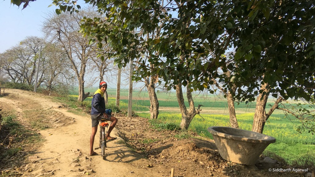
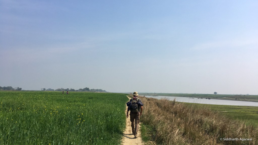
At walking pace, information is no longer limited to a scroll on the phone screen, and much more becomes visible. This pace also allows for observations that would definitely be missed if travelling at speed in a motor vehicle.
The blinding speed of modern day reality hides a lot. India and its relation with the environment – rivers, in context of this article – see a similar game play out. Large scale interventions are the mood of the day. A billion dollar package for the “Holy Ganga” is all that matters, while in reality, the river bleeds dry from a thousand cuts made all over its catchment and more – dams, floodplain encroachments, mines – are proposed to great public fanfare.

These cuts will make sense to us only if we understand the idea of interconnectedness. A river is not only a single stream of water that flows, but an ecosystem that is the sum of all that happens in its catchment. The river is a report card of the health of the catchment.
In these pieces from the walk, I also intend to share views of smaller, not so popular rivers that I was able to slow down and see while on the above mentioned walk in different geographies of India. The first part dealt with the stretch from near Gwalior to the banks of the Ganga East of Allahabad. This second part looks at rivers and rivulets, perennial and seasonal, between Bodh Gaya and Purnea. Of course we will see the popular rivers too. Let’s start with a map of the walk, also showing the popular rivers as well as the overall drainage network.
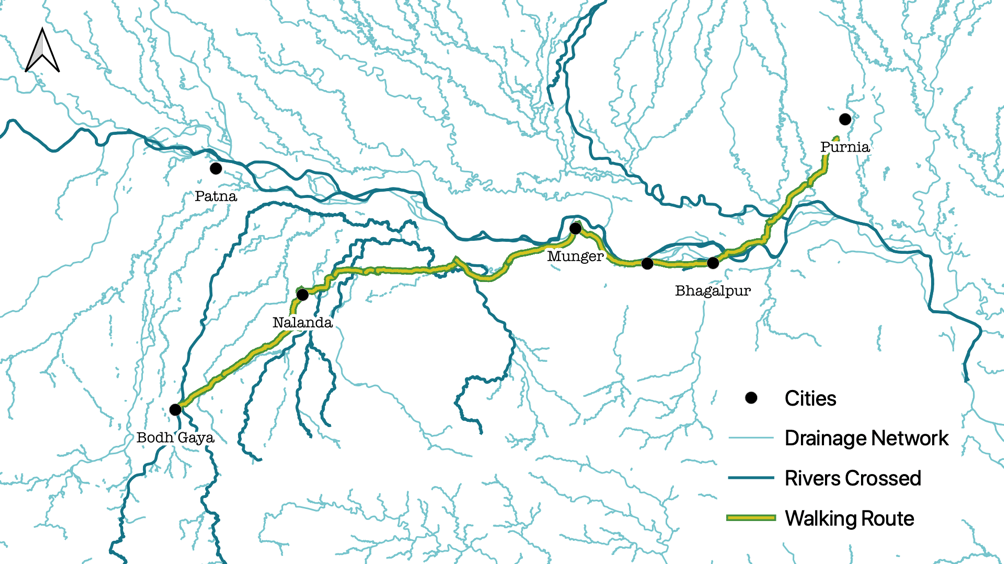
Map showing popular rivers and the overall drainage network in the region / Map design by Siddharth Agarwal / Data: Open Street Map
Here’s a small video clip from this section of the walk, of the rivers we crossed and saw, and the life around it.

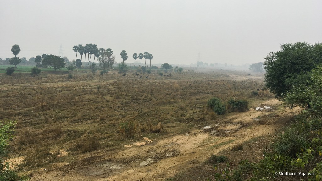
Phalgu river at Bodh Gaya, dry in the winter months. Rivers Mohana and Lilajan join to form the Phalgu a few kms upstream (South) of Bodh Gaya. Date: 21/01/19
Of course Bodh Gaya was filled with Buddhist pilgrims. On the banks of the Phalgu, referred to as River Niranjan in Buddhist scripts, the monks got into a discussion with our friend, guide and Buddhism expert Deepak Anand, about the exact spot along the river where one of the miracles related to the Buddha is said to have taken place.
‘After finishing food given to him in a golden bowl, the yet to become a Buddha flung the golden bowl into the river and said: “If I am to succeed in becoming a Buddha today, let this bowl go upstream, else let it go with the current”. And the bowl went upstream.’

It is said that on the same evening he found the Bodhi tree and sat under it to meditate. Rest as we know it, is history. Image date: 21/01/19

River Paimar, a small north flowing stream that flows parallel to the Phalgu, and then goes on to meet River Phalgu, closer to Phalgu-Ganga confluence. Date of image: 21/01/19

Vaitarni Ghat in Rajgir. It seems like a small stream called Vaitarni used to flow through the town at some point, but while we were there all we could see was a channel full of garbage, algae and hyacinth. The graffiti on the walls did carry messages about Chatth Puja. Date of image: 23/01/2019
Dry riverbed of a distributary of the Panchane River. It seemed to be a non-perennial river, but even then the embankments on both sides of this channel were difficult to miss. We walked for kilometers on this embankment. Date of image: 26/01/19

Unused boats lying on River Harohar. One can see how close villages are to the river, and how the land has been cultivated to the absolute edge of the river bank. The drainage network in this region is called the Kiul-Harohar river system. (Ref – http://fmis.bih.nic.in/tenders/Draft%20TOR%20Kiul-Harohar,%20Mahananda-ss%201.3.2019.pdf). Date of image: 27/01/19

Thousands of kilos of tomatoes were seen rotting in the Sheikhpura-Lakshisarai region. Tomatoes were being offered at a rate as low as 1 rupee per kilogram. Unfortunately, there was no guidance to be seen for local processing of these food products. Date of image: 28/01/2019
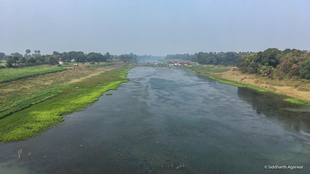
River Harohar close to where it meets River Kiul, before both join the Ganga. Date of image: 28/01/19

River Kiul as it flows past the town of Lakhisarai, right before it joins River Harohar. Dhobis – washermen were seen on the river banks. Date of image: 28/01/19

River Jhana, before it meets the Ganga. This whole region is dotted with Brick Kilns, quite a few of which now seemed defunct. Date: 28/01/19
We meet the Ganga again, and continued our walk Eastwards. The embankments here are very high. Date of image: 29/01/19

Plenty of embankment erosion protection work seems to have been initiated here using concrete porcupines. A relic channel of the Ganga can be seen in the foreground, while the whole flood plain is cultivated. Date of image: 29/01/19

Here too, one can find a series of brick kilns by the side of the Ganga river, One of them here. Date: 29/01/19
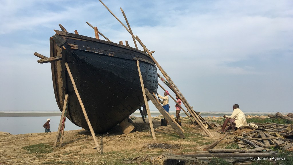
Local boat making work underway in a place called Prem Tola (love neighbourhood), occupied by migrant fish and boat workers from West Bengal. Though the man working on the boat while we were there was from Bihar itself. Date: 31/01/19

Champa Nala, as it passes by Bhagalpur on its Western Edge. ‘Nala’ is associated with small streams across Central and North India, but recently the term has become associated with ‘dirty streams’. The Champa Nala however, has also turned dirty along with the word Nala. Date of image: 01/02/19 (SANDRP has three part story of this river by Dr. Ruchi Shree[ii].)

A pair of Greater Adjutant Storks on a char (river island) as we cross the Ganga at Bhagalpur in a small country boat. Date: 05/02/2019
Walking along some inactive channels of the Ganga on the Northern side, technically also the Ganga-Kosi doab. Green as far as one could see. But locals did complain about reducing soil fertility. Date of image: 05/02/19

Crossing the Kosi a few kms upstream of its confluence with the Ganga. Photo, looking upstream from a road bridge towards electricity lines with a rail bridge on the other (downstream) side. Date of image: 06/02/19
River Barandi. Last morning of this stretch of the walk. We had slept off in a small open-air roadside dhaba on a winter night. Of course I froze, but not without the company of mosquitoes. That meant I was up extremely early to take pictures of this small river flowing by. Date of image: 07/02/19
More stories of rivers from further East and North East – some from the Brahmaputra basin – in part 3.
Siddharth Agarwal has been walking across India along rivers, trying to document and bring stories of marginalised people and the environment into the mainstream. He can be reached at asid@veditum.org or on twitter at @sidagarwal
For Part-I of this series, see: https://sandrp.in/2020/07/15/river-stories-walking-across-india-i/
END NOTES:
[i] For details, see: https://www.nationalgeographic.org/projects/out-of-eden-walk/#section-0
[ii] 1. https://sandrp.in/2020/04/05/how-did-champa-nadi-river-in-bhagalpur-bihar-become-nala-drain/; 2. https://sandrp.in/2020/04/12/champas-angpradesh-to-champa-nala-of-bhagalpur/; 3. https://sandrp.in/2020/04/22/bringing-life-back-to-champa-river/
