Sangli, on the banks of river Krishna in Western Maharashtra faced a historic flood in Aug 2019. Nearly One Lakh people were displaced and over 30 lost their lives in this district alone. While we covered the impact of floods on the agricultural and rural fabric of Sangli in the earlier photoblogs, Sangli city with a population of more than 22 Lakhs, too suffered huge losses.
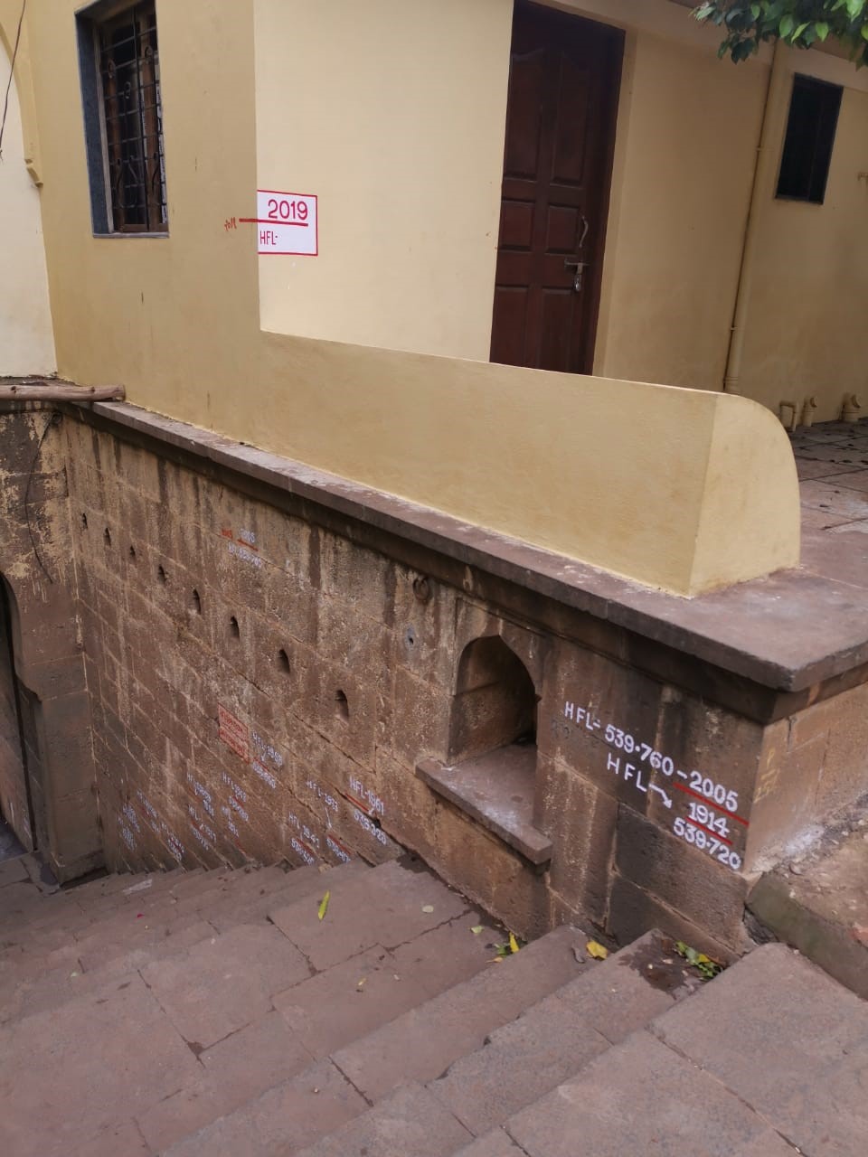
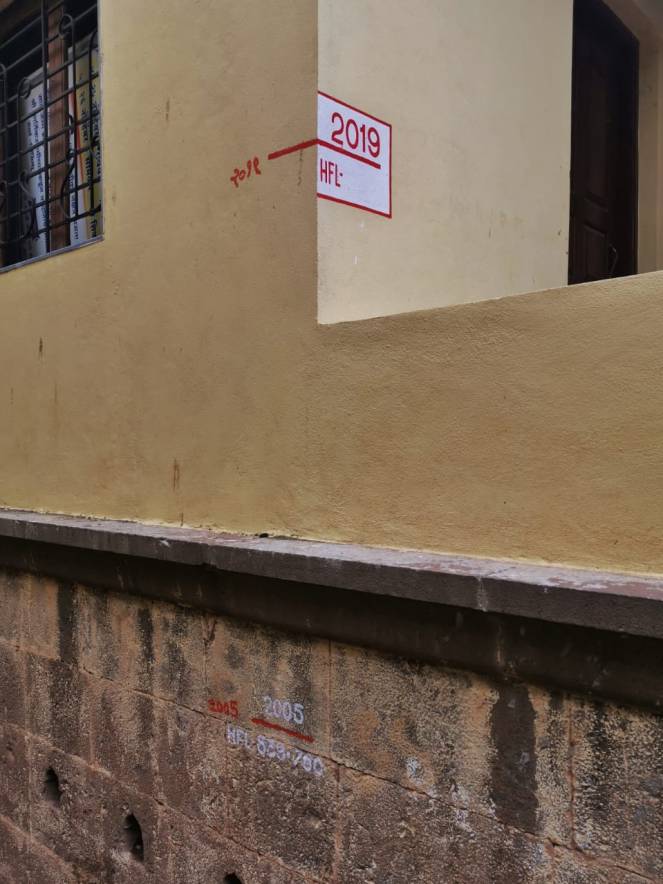
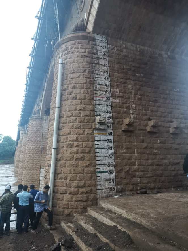
Sangli-Miraj-Kupwad Municipal Corporation is on the banks of Krishna-Warna confluence in Western Maharashtra. Both rivers reached historic High Flood Levels in the 2019 floods. Warna, in Samdoli Village, Sangli District recorded an HFL of 546.9 Meters on 09 Aug 2019, breaking all previous records. Irwin Bridge, a historic bridge built in 1929 in Sangli city, recorded a river stage that the bridge had never experienced. Sangli and the nearby region are is not new to floods and has witnessed devastating floods in 1853, 1856, 1914, 2005, 2006 and latest 2019.
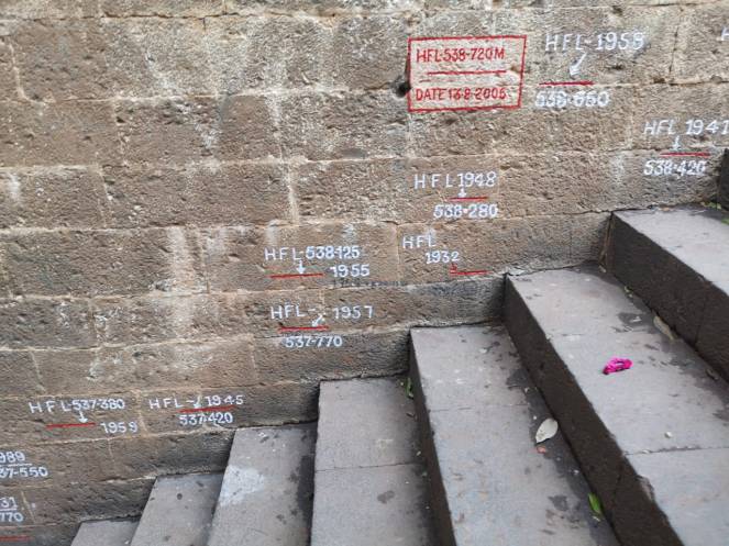
Same is the story downstream. Especially in the pilgrimage center of Narsoba Wadi near Kurundwad town of Kolhapur District. Situated at the confluence of Krishna and Panchaganga, floods are not new to Narsoba Wadi. In fact, there are elaborate flood rituals, in which the deity is moved to upper precincts after each flood event. But here too, 2019 floods broke all previous records, including the 1914 HFL.
Photos, videos and brief interviews by Abhay Kanvinde (taken in September 2019), show us the extent that Krishna waters had reached and all that they had swallowed in the first two weeks of August 2019.
Historic water levels marked at Narsoba Wadi Ghats. Oldest are 1914 Levels. 2019 Flood Levels are highest in more than 100 years. Video by :Abhay Kanvinde
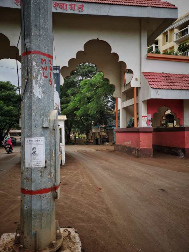
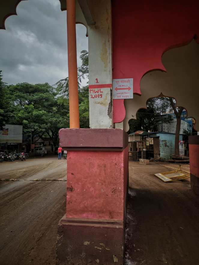
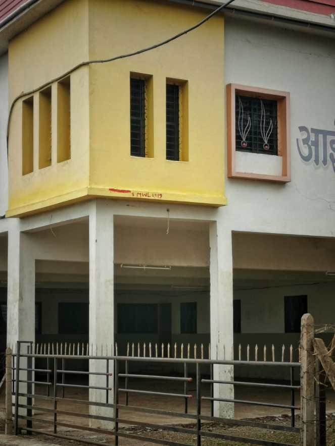
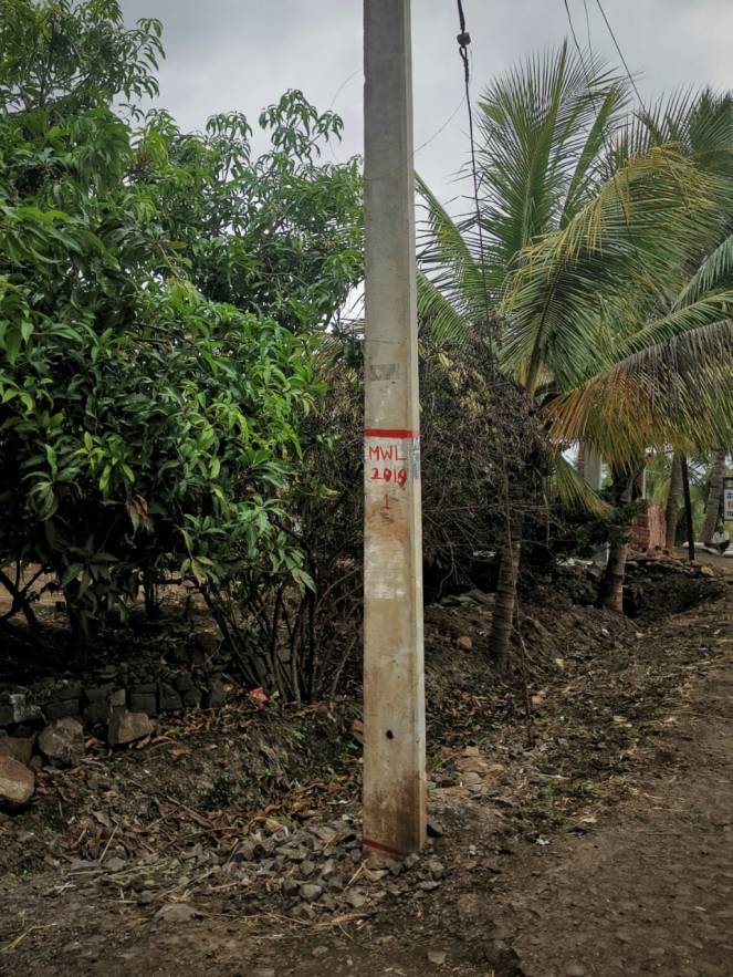
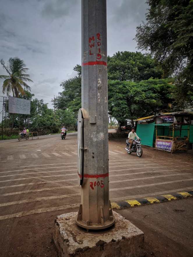
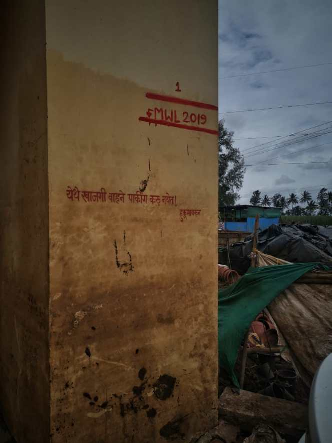
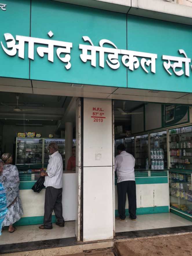
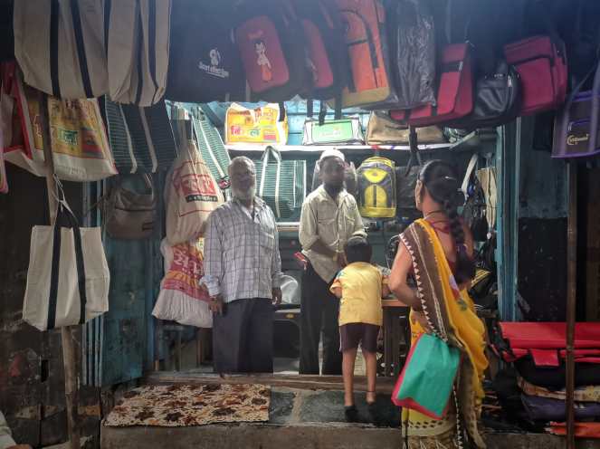
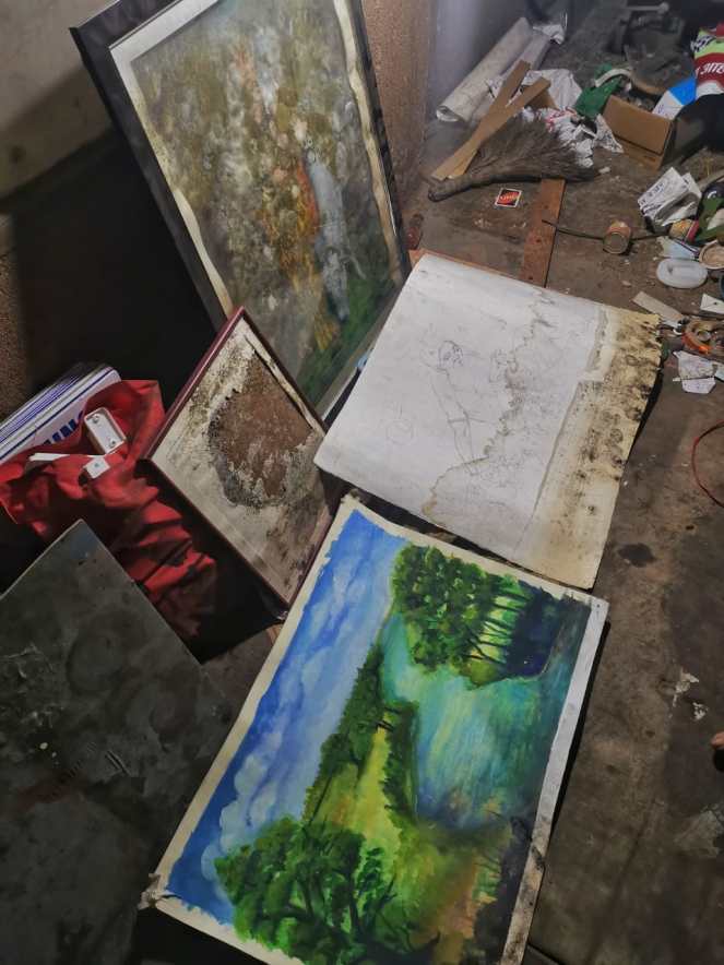
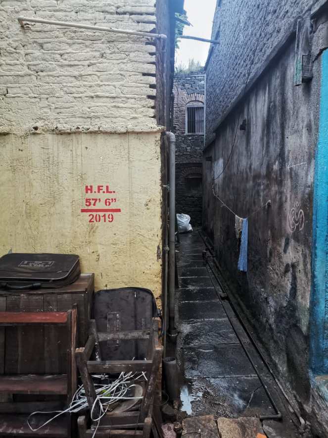
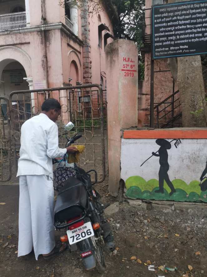
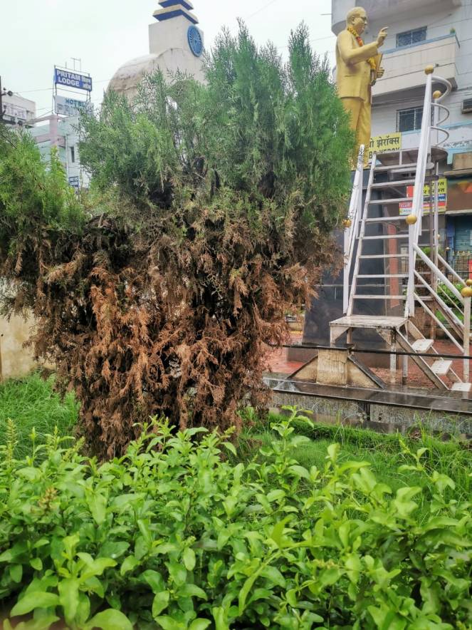
Past flood levels marked on the steps to Krishna River Ghat at Narsoba Wadi, Kolhapur situated at the confluence of Krishna and Panchaganga Photo: Abhay Kanvinde2019 HFL in Narsoba wadi, meters higher than the record levels of 2005 (539.76 meters) Photo: Abhay Kanvinde2019 HFL in Narsoba wadi, meters higher than the record levels of 2005 (539.76 meters) and also 1914 (539.70 meters) Photo: Abhay Kanvinde2019 Maximum Water Levels (MWL) marked by the Water Resources Department at entrance arch of Narsoba Wadi Photo: Abhay KanvindeMaximum Water Levels (MWL) at Narsoba Wadi, Kolhapur, marked by Water Resources Department Photo: Abhay KanvindeMaximum Water Levels (MWL) marked at Narsoba Wadi in Kolhapur on the confluence of Krishna and Panchaganga Photo: Abhay KanvindeMaximum Water Levels (MWL) marked by the Water Resources Department all over Narsoba Wadi Photo: Abhay Kanvinde2019 Maximum Water Levels (MWL) marked by the Water Resources Department all over Sangli and Narsoba Wadi Photo: Abhay KanvindeMaximum Water Levels (MWL) marked at Narsoba Wadi in Kolhapur on the confluence of Krishna and Panchaganga Photo: Abhay KanvindeIndicating Water Levels reached at Patwardhan Wada, Sangli, Photo: Abhay KanvindeRiver Stage of 57′ 6″ marked all over Sangli City indicates the extent of floods Photo: Abhay KanvindeRiver Stage of 57′ 6″ marked all over Sangli City indicates the extent of floods Photo: Abhay KanvindeLivelihoods were massively affected by floods. Babu Abbas Byapari’s shop was entirely under water causing huge losses. Photo: Abhay KanvindeMr. Bhinge’s drawings were lost and damaged when water reached first floor of his small shop in Sangli Photo:Abhay KanvindeRiver Stage of 57′ 6″ marked all over Sangli City indicates the extent of floods Photo: Abhay KanvindeRiver Stage of 57′ 6″ marked all over Sangli City indicates the extent of floods Photo: Abhay KanvindeRiver Stage of 57′ 6″ marked all over Sangli City indicates the extent of floods Photo: Abhay KanvindeWater level recorded by plants at Dr. Ambedkar Statue, Gaon Bhaag, Sangli Photo: Abhay KanvindeHistoric Irwin Bridge in Sangli, built in 1929 faced its highest floods in Aug 2019 when water reached its arches Photo: Abhay KanvindeHistoric Irwin Bridge in Sangli, built in 1929 faced its highest floods in Aug 2019 when water reached its arches Photo: Abhay Kanvinde
Babu Abbas Byapari from Sangli city tells us how 2019 flood levels were the highest he has seen so far Video:Abhay Kanvinde
Irwin Bridge, built in 1929, over River Krishna Sangli, withstood its highest flood levels in 2019 Video:Abhay Kanvinde
~ SANDRP (parineeta.dandekar@gmail.com)
NOTE: For the other three photo blogs in this series, see: