Dams

Dams, Rivers & People – April-May 2015

HYDROPOWER

“Right now, hydel is almost stalled”: Piyush Goyal (18 May 2015)

Union Power Minister makes some candid comments on Hydro: “Right now, hydel is almost stalled. We have Teesta stuck for various reasons. Subansiri, Maheshwar, Lower Subansiri, all of them have different challenges. Small hydros are facing challenges of transmission, they are facing challenges of local area problems. So, by and by, the hydro sector will need a more holistic thinking. The courts have also taken up certain matters, particularly in Uttarakhand, post the tragedy (of floods in 2013). There is the mission of Ganga to ensure that there is a reasonable flow—Aviral Ganga, which we are committed to. We are working on all of these plans… For example, Subansiri had an issue where the local population had concerns. We immediately got an eight-member very, very high-level expert committee, including Central Water Commission, Central Electricity Authority, and experts from Assam. They are all working together to see the environmental impact, structural impact, riparian state impact and riverbed impact.

http://www.livemint.com/Industry/9HtQbGUG0v4rYIczIT21hJ/Time-is-now-ripe-for-a-power-fund-says-Piyush-Goyal.html Continue reading “Dams, Rivers & People – April-May 2015”

Ministry of Environment and Forests · Ministry of Water Resources

MoWR report on “Assessment of E-Flows” is welcome, needs urgent implementation

A three member committee set up by the Union Ministry of Water Resources, River Development and Ganga Rejuvenation (MoWR for short) has submitted a report in March 2015, which makes welcome recommendation on “Assessment of Environment Flows”. These recommendations on Environmental Flows (E-Flows) need to be implemented immediately for better health of our rivers. The committee members include Dr Vinod Tare of Indian Institute of Technology Consortium (IITC), senior officials of Union Ministry of Environment, Forests and Climate Change (MoEF for short, it was represented by Dr Shashi Shekhar, Special Secretary in MoEF) and MoWR (represented by Dr Amarjeet Singh, Additional Secretary, MoWR). Sushri Uma Bharti, Union Water Resources Minister[1] and even the recent meeting of National Ganga River Basin Authority (NGBRA) on March 26, 2015[2], headed by the Prime Minister referred to this committee. Continue reading “MoWR report on “Assessment of E-Flows” is welcome, needs urgent implementation”

Hindi Blogs

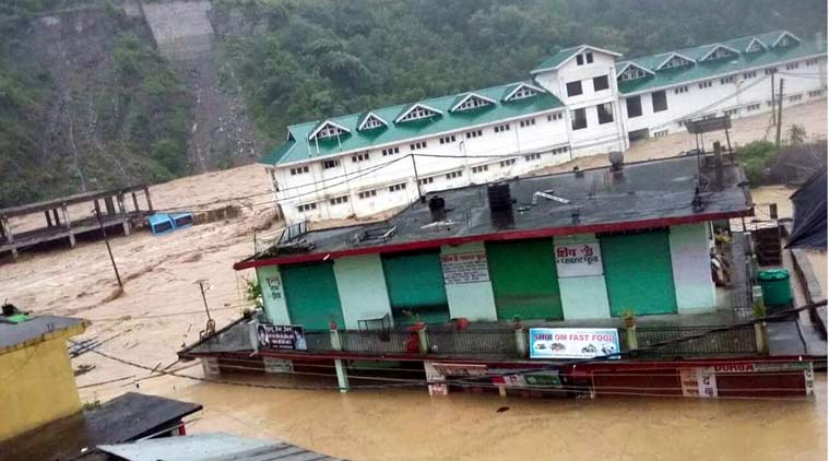
हिमालयी नदियों से खिलवाड़ और जून 2013 की उत्तराखण्ड़ त्रासदी

क्या है हिमालयी नदियों का मिजाज़ ? (एन.डी.टी.वी.- इंडिया, 20 फरवरी 2014,

http://khabar.ndtv.com/video/show/documentary-ndtv-india/what-is-the-mood-of-himalayan-river-357478)

रिपोर्टर:- सुशील बहुगुणा, कैमरामैनः- सुदीश कुमार राम, एडिटरः- कुलदीप कुमार, एन.डी.टी.वी.- इंडिया

HR NDTV 2

रिपोर्टरः- जून 2013, उत्तराखण्ड में, नदियों के साथ आई तबाही की ये तस्वीरें। तस्वीरें जो हमें मजबूर करती हैं, ये समझने को, कि आखिर ये नदियाॅ इतनी रौद्र, इतनी विकराल क्यों हो रही हैं ? ये नदियाॅ हमारे घर-आॅगन क्यों उजाड़ रही हैं ? कहीं हम ही, इन नदियों के अहाते में तो नहीं घुस गए ? कहीं हमने नदियों की लहरों में बेहिसाब बेडि़याॅ तो नहीं डाल दी ? क्या हम नदियों का मिजाज़ अब तक समझ भी पाए हैं ?

Continue reading “हिमालयी नदियों से खिलवाड़ और जून 2013 की उत्तराखण्ड़ त्रासदी”

Dams

DRP from SANDRP: January 2015

DRP from SANDRP January 2015: The following developments are about dams, rivers & people, mostly from India but also some from South Asia and rest of the world. This is for the period Jan 1 to Feb 12, 2015, we hope to publish this more frequently in future. These were put up on daily basis on SANDRP Face book page: https://www.facebook.com/sandrp.in. If you want to get it regularly, you can like the FB page.

Feedback on usefulness of this is welcome.  Continue reading “DRP from SANDRP: January 2015”

Beas · Himachal Pradesh

Larji Dam Fishladder: an unlovely trinket, a deceptive ornament

Emmanuel Theophilus[1] (etheophilus@gmail.com)

The 126 MW Larji Hydropower project near Aut on the mainstem of the Beas is run by the Himachal Pradesh State Electricity Board (HPSEB)[2]. The dam is constructed a little downstream of the confluence of the two main tributaries upstream, the Sainj and the Tirthan, at the narrowest part of a spectacular gorge, towering with limestone cliffs. The impounded waters of this dam have, since its construction in 2006, drowned the access road to the entire upper Kullu valley including Manali and the hundreds of villages upstream, including access to the entire Lahul valley and the region of Ladakh over the high passes from this end. The HPSEB then constructed a 3 km long tunnel to enable passage of traffic, and many people have warned of the hazardous nature of the tunnel. The 220 odd gods that descend from different valleys, on the backs of people to the lower Kullu valley every year in autumn however, refuse to use this tunnel. This is what compelled the HPSEB to build and maintain this tunnel, and during autumn to winter, to keep the water-storage in the dam low to enable the passage of gods, who have been traveling this route for over three and a half centuries. It is remark-worthy though, that this dam constructed as recently as 2006, seems to be heavily silted-up already and the dark shadows of sediment-shoals are visible just below the waters of the reservoir[3].

Being among the most recently completed, the Larji dam is the only dam on the Beas that has a fish-ladder, so it was of particular interest to us. Seeing no guard at the security booth, we walk in to the HPSEB dam operating office, and ask to speak to an officer about the fish ladder. To our complete surprise, we are spoken to and even taken on a tour of the ladder by a foreman who has worked on the dam for many years.

Having seen an elaborate fish ladder on the Kuri Chhu river in Bhutan of doubtful effectiveness[4], we could not help but look at this one with hope and excitement. Located at around 1,000 meters altitude, this dam was clearly in the way of a host of migratory species of fish. If this ladder design was effective, then surely the ‘barrier’ problem to seasonal migration for breeding and dispersal would have been addressed. Here though, is what we saw and heard.

  1. For one, the flow through the fish-pass seems too small to create an ‘attraction flow’ for fish. But even more obviously, the downstream entrance of the fish ladder is a steep cascade over a couple of meters of broken masonry and rock, that would clearly be un-negotiable by any fish that does not jump that high[5].
Downstream entrance of Larji fish ladder: The 2 m high jump that fish require to enter the ladder can be seen here
Downstream entrance of Larji fish ladder: The 2 m high jump that fish require to enter the ladder can be seen here (all photos by the author)

2. The outlet from the dam reservoir into the fish ladder is blocked off by a metal grill-mesh that is narrow enough to trap flotsam like Bisleri water-bottles. The mesh seemed too fine to let Mahseer of breeding-age pass through, either upstream or downstream.

3. The fish ladder was in a serious state of disrepair. To our questions about whether the ladder worked or not, the foreman says honestly that it does not. We see the reasons for this when we walk down the ̴100 meter length of the fish-pass channel.

Fishladder can be seen in serious state of disrepair and blocked by broken concrete parts can be seen here

4. The Larji fish ladder seemed to be a hash of different designs of fish passes. There were four different design elements in this one fish-pass. It had a slotted-weir fishway design, a low gradient Denil fishway, a steep-pass Denil fishway and a plain concrete culvert on a grade design. Most of these slotted weirs were clogged with fallen rocks and debris from the slope above, and in places, the pools in them were over-flowing the weir in a vertical fall almost 2 meters high.

Steep-pass Denil fishway part of the fishladder can be seen here, water is flowing too rapidly here for any fish to be able to go upstream
Steep-pass Denil fishway part of the fishladder can be seen here, water is flowing too rapidly here for any fish to be able to go upstream. The water picks up momentum down an extremely steep slope with the baffles at 45 degrees to the flow, not offset to slow the water, but concentrating the force of the water in mid-stream flow. The slope seemed to be at almost 40 degrees angle, and the water was turbulent in the extreme in this section. A workable Denilway slope, even for the strongest of swimmers among fish, is not designed to exceed a slope of 20% at most. This was close to a 100% slope

5. The oblique baffles on a Denil fishway are supposed to be placed in a manner that provides staggered partial-obstructions that slow the water down at variable velocities to make it passable for fish. However, here we saw that the water picks up momentum down an extremely steep slope with the baffles at 45 degrees to the flow, not offset to slow the water, but concentrating the force of the water in mid-stream flow. The slope seemed to be at almost 40 degrees angle, and the water was turbulent in the extreme in this section. A workable Denilway slope, even for the strongest of swimmers among fish, is not designed to exceed a slope of 20% at most. This was close to a 100% slope[6].

This part of fish ladder is less steep Denil

The last part of the fishway was a plain concrete culvert on a grade channel, essentially a sloping channel, where even the concrete sides of the channel had toppled over into the river-bed, and the final drop was over a two meter fall into the downstream flow. I asked the foreman whether he knew whether fish managed to make it over this extreme gauntlet. He said that they did not, but that he often saw fish gather and concentrate at the bottom of the dam under the sluice gates, and make futile leaps in an attempt to get over the dam. Clearly, the Larji dam fish ladder is just an unlovely trinket, a deceptive ornament.

Watch a 41 seconds video showing how fast the water is moving through the Larji Dam fishladder at: http://youtu.be/grVaxXPdeyY, Video is by the author.

It seemed to me that the dam builders and operators, the HPSEB in this case, both at the design and the executive levels, were not serious about constructing a fish-pass that would work, and neither were they serious about this at the operation and maintenance aspects. Whether they were serious at all even at the conceptual level, to put in place a mitigation measure that actually helped migratory fish bye-pass the barrier of the dam, or was this part of the design merely to obtain environmental clearance, can only be conjectured about. That hydropower projects can devise deceitful strategies for obtaining environmental clearance is one thing, but what does this tell us about the Union Ministry of Environment and Forests, the Expert Appraisal Committee on River Valley Projects appointed by MoEF, the regional office of the MoEF, the state Fisheries Department and also the state pollution Control Board, who are all variously part of the approval processes for hydropower projects, when they get their environmental clearances based on such ‘mitigation measures’?

Larji Dam - about 100 m long fishladder channel can be seen on the right side
Larji Dam – about 100 m long fishladder channel can be seen on the right side

END NOTES:

[1] This article has been extracted from SANDRP’s publication: Headwater Extinctions: Hydropower projects in the Himalayan reaches of the Ganga and the Beas: A closer look at impacts on fish and river ecosystems, authored by Emmanuel Theophilus, for details, see: https://sandrp.wordpress.com/2014/12/16/new-publication-headwater-extinctions-impact-of-hydropower-projects-on-fish-and-river-ecosystems-in-upper-ganga-and-beas-basins/

[2] The 126 MW Larji project is also infamous for being the costliest hydro-power project per unit electricity generated so far in India. Finally built at a cost of R.s 10.27 billion, which was twice the estimated cost, the Vigilance department unearthed major financial misappropriation by HPSEB officials.

[3] The Larji Dam became infamous in June 2014 when 25 students were washed away downstream from the dam due to sudden and unannounced release of water from the dam, see: https://sandrp.wordpress.com/2014/06/12/nadiya-bairi-bhayi/

[4] https://sandrp.wordpress.com/2014/02/02/fish-ladder-at-kurichhu-hydropower-project-bhutan-some-thoughts/

[5] Other than loaches, those tiny finger sized fish that can even climb (squiggle technique) up high waterfalls, provided there is something like a water-slide at the margins of the fall. They however, are not migratory fish.

[6] CIFRI recommends that the speed of flow of water in a fish-pass should not exceed 2 meters per second. Please see ‘Status of fish migration and fish passes with special reference to India’. MK Das and MA Hassan. CIFRI 2008.

Ganga · Himachal Pradesh · Himalayas · Hydropower · Uttarakhand

New Publication: Headwater Extinctions – Impacts of hydropower projects on fish and river ecosystems in Upper Ganga and Beas basins

SANDRP has just published a new report: “Headwater Extinctions- Hydropower projects in the Himalayan reaches of the Ganga and the Beas: A closer look at impacts on fish and river ecosystems”, authored by Emmanuel Theophilus. The report[i] was released at the India Rivers Week held during Nov 24-27, 2014.

Front Cover of the report HEADWATER EXTINCTIONS

Headwater Extinctions deals with impacts of hydropower projects in Beas basin in Himachal Pradesh and Alaknanda-Bhagirathi basins in Uttarakhand on river ecosystem and its components, mainly fish. While the harrowing impacts of hydropower projects on local livelihoods and social systems are being realized gradually, we are yet unclear about the extent of impacts of these so-called green projects have on fish and aquatic biodiversity.

Environmental Impact Assessments of large hydropower projects (> 25 MW as per EIA Notification 2006[2]) are supposed to assess ecological impacts of such projects, but we are yet to come across any comprehensive effort in this direction from EIA reports that we have assessed so far.

The Expert Appraisal Committee (EAC) of Union Ministry of Environment, Forests and Climate Change (MoEF & CC) which is entrusted with appraising these projects and their EIAs has paid very little attention to this issue. Since over a decade, the EAC has had expert members from Wildlife Institute of India (WII) and Central Inland Fisheries Research Institute (CIFRI). Both these institutes are supposed to have expertise on fish and aquatic biodiversity. But sadly, their presence has not helped fill the serious lacunae in appraisal and EIAs of the hydropower projects.

SANDRP had been trying to highlight the impact of hydropower on fish and the long standing problems in the so-called mitigation measures being recommended by the EAC. We thought that it may be useful to bring out a first-hand report bring out ground realities of what is happening to our rivers. Emmanuel Theophilus, based in the Dhauliganga Valley and who is an avid mountaineer, storyteller, ecologist and our ally was commissioned by SANDRP to study the impacts of hydropower on fish and ecosystems, review the EIAs as well as mitigation measures recommended by EAC as a part of Environment Management Plans of hydropower projects. We are very glad to publish the report as a first of the hopefully many steps to be taken to understand and address this important issue.

Headwater Extinctions has been written in an eminently readable style that Theo is known for, as could be seen from the earlier blogs[3] he wrote for us! The report has a section on ‘Travelogue’ which records Theo’s travels and thoughts as he visits Bhagirathi and Alaknanda sub basins in Uttarakhand and Beas basin in Himachal Pradesh. The report also brings illuminating photos from these trips. The fact that the travels happened within months of the Uttarakhand disaster of June 2013 could be seen in his photos and travel reports. It further substantives the role hydropower projects played in increasing the proportions of the disaster.

Travelogue is followed by discussions in two parts: Discussions on the impact of hydropower projects on fish and aquatic habitats along the two sub-basins and the role of EIAs, EMPs, Fisheries Plan and the government approval process. The findings of this report are valid for all Himalayan states & rivers.

Back Cover of the report HEADWATER EXTINCTIONS

Headwater Extinctions ends with some striking insights. Sample this: We are in the midst of river extinctions in the Himalaya, but are surrounded by a tragic drama of double-speak and equivocation. And a horde of jostling brokers. Ranging from reputed universities, government departments, research institutions, everyday bureaucrats, and of course, politicians and contractors from within ‘the community’[4] along the developers and regulators. They not only write the script of this drama, they even play all the part”.

The inside covers of the report have detailed maps of the two basins with locations of hydropower projects, with annexures containing lists of hydropower projects in Upper Ganga and Beas basins and also list of fish found in Upper Ganga basin.

Theo has completed this report on a stringent timeline and budget, which meant that all the proposed and implemented fisheries management plans could not be assessed. We hope Headwater Extinctions provides sufficient material and compelling reasons to overhaul the way impacts of hydropower projects on fisheries and aquatic biodiversity are treated by EIAs, EMPs and government committees. We would also urge agencies like WII and CIFRI to do justice to their work inside EAC and beyond. That they are not doing that is apparent.

For EAC and MoEF&CC, we certainly would like them to ensure proper and full impact assessment of projects on aquatic biodiversity in the EIAs. The EAC also needs to stop approving completely ineffective fish hatcheries. They could initiate a credible independent study of the costs, benefits and performance of the fisheries development plans they have been approving in recent projects. It does not only smell fishy, but more like a scam! Here is a relevant quote from the report: “I can’t help see a few things here, as perhaps you do? Bluntly put, I see slush funds being dangled to a whole range of possible collaborators. The kindest term I can find for them is ‘brokers’.”

We look forward to your comments and suggestions on all aspects of Headwater Extinctions. If you would like a hard copy, please write to us.

SANDRP (ht.sandrp@gmail.com)

END NOTES:

[1] The full report is available on our web site, at: https://sandrp.in/Headwater_extinctions221114.pdf

[2] We have been saying this for long and this report helps substantiate our contention that the assumption that projects below 25 MW are benign and do not need EIA-EMP or environmental monitoring and public consultations is wrong.

[3] https://sandrp.wordpress.com/2014/02/02/fish-ladder-at-kurichhu-hydropower-project-bhutan-some-thoughts/ and https://sandrp.wordpress.com/2013/09/27/uttarakhand-floods-of-june-2013-curtain-raiser-on-the-events-at-nhpcs-280-mw-dhauliganga-hep/.

[4] Caveat, there are honest exceptions, but this is a generalization that describes the predominant phenomenon.

Dams

Who governs our rivers: Too many cooks without care or coordination?

By law, rivers in India belong to the government, however, government has no particular agency that governs our rivers. Our constitution or law does not provide any direct protection to rivers. A large number of entities at centre and state level take decisions that affect our rivers but they do not even seem aware of such impacts. That the decisions and working of a large number of agencies affect the rivers is expected considering the landscape level existence of rivers and society’s wide ranging needs for water and other services provided by the rivers. But the complete neglect of the rivers is certainly not expected. More importantly, people seem to have no role in governance of our rivers! There seems to be neither an understanding nor a recognition that lives and livelihoods of so many people depend on rivers. Nor an understanding as to what is a river and what are its role in the ecosystem, in current and future well being of the society. These blindspots about our understanding of rivers get reflected in our governance of rivers.

NGT  Foundation Function on Oct 18, 2014 (Source: FB page of Information and Broadcasting Ministry)
Environment Minister Prakash Javdekar at NGT Foundation Function on Oct 18, 2014 (Source: FB page of Information and Broadcasting Ministry)

India remains an agrarian country, and our water use practices have prioritised use of water for irrigation. Archaic water laws during the British rule looked at water as a resource to be exploited under the jurisdiction of the government. The 1873 Northern India Canal and Drainage Act, stated ‘use and control for public purposes the water of all rivers and streams flowing in natural channels’ as a right of the Government, without any credible and democratic way of deciding what is public purpose.[1]  In the same vein the Madhya Pradesh Irrigation Act of 1931 asserted direct state control over water, which find an echo even today in the Bihar Irrigation Act, of 1997 that stresses that all rights in surface water vest with the Government.[2] In fact post colonial water governance did not see any break from the past and essentially the same paradigm prevalant during colonial times continued after independence.

Water in India, as per our constitution is a state (government) subject, and by the same logic water laws in the country too are mostly state based. Thus the state has the constitutional power to make laws, to implement & regulate water supplies, irrigation and canals, drainage and embankments, water storage & hydropower. However, there is nothing in the constitution or law that shows an understanding of what is a river, what services it provides or if there is anything worth conserving in rivers. There is no legal protection for rivers in India.

Moreover as most of the rivers flow through more than one states, the rivers become cause of major interstate disputes when they are seen as sites of big dams. Smaller projects are rarely the reason for intractable interstate disputes. Unfortunately, in post-indepednence India, politicians love big dams and they are seen as most important, if not the only saleable development projects.

The centre can intervene for any interstate differences by constituting a Water Dispute Tribunal for the mediation of the water dispute, but only if invited to do so by the state government.  It is within the Central Government powers to regulate and develop inter-State rivers under entry 56 of the constitution, but these powers are rarely used. Entry 56 reads: “Regulation and development of inter-State rivers and river valleys to the extent to which such regulation and development under the control of the Union is declared by Parliament by law to be expedient in the public interest.”

Instead many different regulatory mechanisms have been harnessed and committees formed under various ministries for water management in inter state river basins.

Let’s take a tour of the various agencies involved in governance of rivers in India.

AT THE CENTRE:

Ministry for Water Resources, River Development and Ganga Rejuvenation

MoWR

It is the apex body[3] at the union level responsible for the country’s water resources and its functions from the river perspective are:

  • Rejuvenation of Ganga River and also National Ganga River Basin Authority
  • To resolve differences relating to inter-state rivers
  • To oversee implementation of inter-state projects occasionally
  • To manage, monitor and sanction funds for centrally funded schemes like Accelerated Irrigation Benefits Program, Command Area Development, Rehabilitation of Water Bodies, Bharat Nirman, etc.
  • Operation of central network for flood forecasting and warning on inter-state rivers (CWC task)
  • Preparation of flood control master plans for the Ganga and the Brahmaputra
  • Talks and negotiations on river waters with neighbouring countries
  • Operation of the Indus Water Treaty with Pakistan, Ganga Water Treaty with Bangladesh, Mahakali, Kosi, Gandak and other treaties with Nepal, Water Cooperation with Bhutan, Exchange of Data with China under MoU, etc.
Sushri Uma Bharati, the current Minister, Ministry of Water Resources, River Development and Ganga Rejuvenation. Photo from : Jagran Post

There are a plethora of offices/bodies under the water resource ministry, who work under their control. These include the following:

Central Water Commission (CWC) Supposed to be a premier Technical Organization, the CWC[4] is responsible for schemes for control, conservation and utilization of all water resources for various purposes, which includes flood control & irrigation, and overall planning& development of river basins. It also monitors the river water quality at 396 stations located in all the major river basins of India.[5] It is also responsible for co-ordination with states for establishing River Basin Organisations [6], like

  • Krishna and Godavari Basin Organization, KGBO [7]
  • Brahmputra & Barak Basin Organisation (B&BBO)
  • Cauvery & Southern River Organisation (CSRO)
  • Indus Basin Organisation (IBO)
  • Lower Ganga Basin Organisation (LGBO)
  • Mahanadi & Eastern River Organisation (MERO)
  • Narmada Basin Organisation (NBO)
  • Central Monitoring Organisation (Mon-c)
  • Narmada & Tapi Basin Organisation (NTBO)
  • Upper Ganga Basin Organisation (UGBO)
  • Yamuna Basin Organisation (YBO)

This gives a misleading picture that for practically every river basin there is a basin organisation. In reality, review of CWC annual reports show that there is hardly any activity of these organisations, they in any case do not work to protect the rivers.

CWC is enormously powerful and a big engineering bureaucracy, that hates any sense of participatory governance & accountability. It works more like a big dam lobby, unfortunately. See for example: 1. https://sandrp.wordpress.com/2013/03/14/how-much-do-we-know-about-our-dams-and-rivers/, 2. https://sandrp.wordpress.com/2014/07/12/guesstimating-a-future-questioning-knowledge-formation-expertise-and-development-in-post-independence-india/, 3. https://sandrp.wordpress.com/2014/09/06/why-does-central-water-commission-have-no-flood-forecasting-for-jammu-kashmir-why-this-neglect-by-central-government/, 4. https://sandrp.wordpress.com/2013/06/25/central-water-commissions-flood-forecasting-pathetic-performance-in-uttarkhand-disaster/

Central Ground Water Board (CGWB)

logocgwb A  multidisciplinary  scientific  organization for the scientific & sustainable development and management of India’s ground water resources. A Central Ground Water Authority has been in 1996 through a Supreme Court order with powers under Environment Protection Act, 1986. On the face of it, CGWB and CGWA may not have any direct role in governance of rivers, the fact is they have a huge role. Firstly, destruction of rivers mean that the groundwater recharge that happens by flowing rivers would stop. CGWB and CGWA should be concerned about this, but have shown no such concern. Secondly, when there is over exploitation of groundwater, it has impact on flow of downstream rivers, particularly in lean season and in low rainfall areas.

Central Water and Power Research Station (CWPRS): A principal central agency that provides R&D, and deals with research, services and support pertaining to projects on water resources, energy & water borne transport including those related to rivers.

Central Soil and Materials Research Station (CMRS): It deals with field explorations, laboratory investigations and research in the field of geotechnical engineering and civil engineering materials, particularly for construction of river valley projects and safety evaluation of existing dams.

National Water Development Agency (NWDA)

NWDASet up in 1981-82, the main task of this organisation is to do studies related to inter-linking of rivers. In that sense, it is an anti-river organisation! An autonomous society, some of NWDA’s[8] river related functions include to:

  • Carry out detailed surveys about the quantum of water that can be transferred to other basins/States
  • Prepare feasibility report of the various components of the scheme relating to Peninsular Rivers development and Himalayan Rivers development
  • Prepare detailed project report of river link proposals
  • Prepare pre-feasibility/feasibility report of the intra-state links

NWDA has not been confident enough to put any of its work in public domain. Some feasibility reports are out following repeated Supreme Court orders in 2002. A perusal of some of these studies shows that it has no concern for the rivers or  the services provided by the rivers. It sees all water flowing to the sea as a waste! Which means rivers are a wasteful resource! In its environment impact assessments or in its cost benefit analysis  there is no accounting of the services of rivers that would be destroyed if the proposed project go ahead!

National Institute of Hydrology (NIH)

NIH A “premier” Institute in the area of hydrology and water resources, it aids, promotes & coordinates work in the field of hydrology and water resources development.[9] However, it is not known to stand up or speak up for rivers. Its classification of rivers, as mentioned in an earlier blog[10], leaves a lot to be desired. The non participatory tendencies of NIH was apparent in the way it organised a workshop on Environment Flows in Oct 2013[11]. NIH did not find it necessary to invite even the Union Ministry of Environment and Forests for the workshop! NIH also parterned with CIFRI for a flawed assessment of e-flows for Teesta IV project, among other such studies[12].

Farakka Barrage Authority It is responsible for the operation and maintenance of the Farakka Barrage Project, (FBP), which regulate the flow of water to the Bhagirathi-Hooghly through the feeder canal to maintain navigability of the Kolkata Port.

National Water Academy Earlier known as Central Training Unit, it has been established to impart in house training to water resources personnel from government organisations. Its curriculum includes watershed management, flood forecast &management, environmental management for river valley projects and workshop on River Basin Organisations.

Technical Advisory Committee (TAC) The techno-economic appraisal of irrigation, flood control and multipurpose projects proposed by the State/ Central Governments or other organisations is done by TAC of Ministry for Water Resources, River Development and Ganga Rejuvenation, for Irrigation, Flood Control and Multipurpose Projects and thereafter make appropriate recommendation. Once found acceptable by the TAC, it is recommended for investment clearance by the Planning Commission and inclusion in the Five Year Plan/Annual Plan.[13] In the functioning of TAC, lack of transparency, participatory governance is the norm[14]. TAC has no member from outside the government, nor does it put up its agenda or minutes of the meeings in public domain. At the initiative of SANDRP, following a letter written to the government in April 2011[15], minutes of some of the TAC meetings were for the first time put up in public domain, but even that has stopped since July 2012[16].

Interstate River Basin Boards For several Inter State Basins, Boards have been set up for co-ordination and implementation and to deal with individual basins/ projects/ interstate disputes. Some of them are listed here.

  • Bansagar Control Board for execution of Bansagar Dam on Sone river and connected works
  • Betwa River Board for the execution of the Rajghat Dam Project
  • Upper Yamuna River Board (UYRB), which refers to the reach of Yamuna from its origin at Yamunotri to Okhla Barrage at Delhi and includes all the states in this basin.
  • The Brahmaputra Board: Its objective is planning & integrated implementation of measures for control of floods and bank erosion in Brahmaputra and for matters connected therewith
  • Narmada Control Authority (NCA): For proper implementation of the decisions & directions of the Narmada Water Disputes Tribunal. There are number of supporting statutory mechanisms: Environment Sub Group of NCA, Rehabilitation Sub Group of NCA, Review Committee of NCA and Sardar Sarovar Construction Advisory Committee.
  • The Tungabhadra Board: Regulates water for irrigation, hydro-power generation and other uses from the Tungabhadra reservoir
  • Ganga Flood Conrol Commission has been set up for specific tasks related to floods in the Ganga basin, including coordination with upstream Nepal.

Public Sector Enterprises under Union Ministry of Water Resources:

  • Water and Power Consultancy Services (WAPCOS) Limited: Provides consultancy services in Water Resources, Power and Infrastructure Sectors. The shoddy work of WAPCOS in doing environmental impact assessment and cumulative basin level impact assessment has been repeatedly highlighted by SANDRP[17]. WAPCOS is also involved in Water projects that India funds abroad including in Afghanistan, Bhutan, etc. During a recent visit to Bhutan, SANDRP heard similar complaints about shoddy EIAs and over charging by WAPCOS and also about Bhutan government having no option, but to give the work to WAPCOS, since India as a funder was dictating the terms.
  • National Projects Construction Corporation Limited (NPCC): Carries out infrastructure work and other related activities for development of the nation that includes dam construction

Ministry of Environment, Forest and Climate Change (MoEF & CC)

MoEFThe nodal agency that plans, promotes, co-ordinates and oversees the implementation of the country’s environmental & forestry policies and programmes, its primary concern is implementation of policies and programmes relating to conserve our natural resources that includes rivers.[18]

The ministry also accords environment and forest clearance to hydropower projects and dams all over India. The Environment Clearnace is given by the ministry for hydropower projects above 50 MW and for irrigation projects with command area above 10 000 ha. For the environment appraisal of these projects, the ministry has set up Expert Appraisal Committee on River Valley and Hydropower Projects. The functioning of the ministry and EAC on this score is most shoddy, inadequate, inconsistent and far from any concern for rivers[19]. In fact if you pick up Environmental Impact Assessment of any project cleared by the EAC and the ministry, you would not find anything about the value of rivers in any of its reports.

The Forest Department (FD) under MoEF & CC governs rivers that flow through the forests. Since a huge about 23% of land of the country or about 76 million ha of land comes under this department a very large segment of India’s rivers come under the FD. However, there is no evidence of FD taking any action to protect the rivers or aquatic biodiversity. In fact we have been reading the FD proposals for diversion of forest land that come before the Forest Advisory Committee over the years and we see absolutely no concern or even recognition of the impact of such diversions on rivers or aquatic biodiversity, the FD does not even seem to acknowledge the existence of river and aquatic biodiversity.

The Wildlife Department (WLD) under MoEF & CC has powers under the Wildlife Act of 1972 to have their say whenever any activity or development project affects the aquatic life in protected areas or even flows into or out of any protected areas. However there is little evidence to show that WLD has used these powers to protect rivers, flows & aquatic life therein even as projects  are well into implementation, without even taking consent of the Chief Wildlife Warden, State Board of Wildlife or National Board of Wildlife.

The MoEF & CC has been sitting for years over a proposal to notify River Regulation Zone for protection so that riverbeds and floodplains are protected.

It is well known how important are wetlands as part of the River Basins. However, the MoEF & CC has shown little genuine action to protect wetlands. Ramsar, International Convention for Protection of wetlands, includes rivers in the definition of the wetlands. India, in spite of being signatories, has excluded rivers from the definition of wetlands. The Wetlands (Conservation and Management) Rules 2010 of MoEF & CC are not helpful in protecting our wetlands. India’s wetlands, remain in peril.

Erstwhile Environment Minister Jairam Ramesh at MoEF Photo from The Hindu

National River Conservation Directorate (NRCD) The name is  misleading here, as the name suggests it works for conservation of rivers, but its only focus is pollution. So either the name is misleading or it reflects poor understanding of the government when they equate river conservation with pollution control work. It is supposed to be governed by National River Conservaion Authority, chaired by Prime Minister, but that authority has never met during the 10 years of UPA government and now almost six months of NDA government. This shows how much of a priority rivers are for the government.

Under the MoEF & CC, NRCD[20] works for conservation of rivers, lakes and wetlands through 2 central schemes:

  • National River Conservation Plan (NRCP) : To improve water quality of rivers through implementation of pollution abatement schemes in identified polluted stretches of rivers
  • National Plan for Conservation of Aquatic Eco-systems (NPCA): To conserve aquatic ecosystems (lakes and wetlands)

Central Pollution Control Board (CPCB)

CPCBA statutory organisation, under MoEF & CC, the CPCB sets standards and regulations for prevention and control of pollution. It also monitors water quality of all important water bodies located on 206 rivers of the country. CPCB, along with state pollution control boards and the whole pollution control machinery were set up following the 1974 water pollution control act. 40 years after setting up of this elaborate bureaucracy, we have not heard of a single success story where this machinery has achieved a clean river. However, there are large number of examples of its failure and the machinery being a den of corruption. The Supreme Court of India on Oct 29, 2014 said[21]: “This is an institutional failure and your story is a complete story of failure, frustration and disaster.”

National Ganga River Basin Authority (NGRBA)

Set up in 2009 through a notification under Environment Protection Act (EPA) of 1986, it’s functions include development of a Ganga River Basin Management Plan, regulation of activities aimed at prevention, control and abatement of pollution, to maintain water flow and quality and to take measures relevant to the river ecology in the Ganga basin states. So far there has been absoltely no sign of impact of functioning of this authority on the Ganga. The authority met just three times during first five years of its existence and frustated independent members twice resigned. The NDA government at the centre that took office in May 2014 reconstituted it without either public process or even public information, in fact even the earlier members did not know they have been removed!

Water Quality Assessment Authority

Established under EPA 1986 in 2001, WQAA’s[22] functions include issuing direction and taking measures on the following matters:

  • Investigate and carry out research on problems of water pollution
  • Prepare manuals, codes or guides to prevent, control and for abatement of water pollution
  • Direct agencies to take measures to restore water quality of the river / water bodies
  • Restrict water abstraction of treated sewage / trade effluent on land, rivers and other water bodies to mitigate crisis of water quality
  • Maintain minimum discharge for sustenance of aquatic life forms in riverine system
  • Utilize self-assimilation capacities at the critical river stretches to minimise cost of effluent treatment
  • Review the status of quality of national water resources (both surface water & ground water) and identify “Hot Spots” for taking necessary actions

It is amazing that more than 13 years after constitution of WQAA, we see no sign of its functioning either on the state of our rivers or in governance of our rivers.

Ministry of Power

MoPMoP is primarily responsible for the development of electrical energy in the country and all matters relating to hydro-electric power (except small/mini/micro hydel projects of and below 25 MW capacity). It also deals with matters relating to these agencies:

  • Central Electricity Authority

CEA accords techno economic clearance to hydropower projects under Electricity Act 2003. The Section 8(2) of the Act states, “The (Central Electricity) Authority shall, before concurring in any (hydropower) scheme submitted to it under sub-section (1) have particular regard to, whether or not in its opinion,- (a) the proposed river-works will prejudice the prospects for the best ultimate development of the river or its tributaries for power generation, consistent with the requirements of drinking water, irrigation, navigation, flood-control, or other public purposes, and for this purpose the Authority shall satisfy itself, after consultation with the State Government, the Central Government, or such other agencies as it may deem appropriate, that an adequate study has been made of the optimum location of dams and other river-works”. (Emphasis added.)

This provision could have been used for the protection of rivers, since it requires the Central Electricity Authority (CEA) to give concurrence to hydro projects only after satisfying that the proposal is optimum with respect to all other uses of the rivers. Unfortunately, as the South Asia Network on Dams, Rivers and People (SANDRP) found out through applications under the Right to Information Act, while giving concurrence to hydropower schemes under this Act, the CEA consults only two organisations, namely the Geological Society of India (GSI) and the Central Water Commission (CWC). GSI and CWC evaluate the scheme from specific parameters of geology and hydrology, but do not look at basin wide issues as required under the Act. The CEA itself is not capable of ensuring basin wide optimisation that the Act requires, nor does it consult the concerned stakeholders. Thus the Act is not being followed.

  • The Damodar Valley Corporation
  • The Bhakra Beas Management Board (except matters relating to irrigation)
  • National Thermal Power Corporation Limited
  • National Hydro-electric Power Corporation Limited
  • North Eastern Electric Power Corporation Limited
  • Tehri Hydro Development Corporation
  • Satluj Jal Vidyut Nigam Ltd.
  • Power Grid Corporation of India Limited
  • Power Finance Corporation Limited
  • Centra and state electricity regulatory commissions

 All of these authorities, involved in sanctioning, developing, regulating, financing and operating hydropower projects have direct impact on rivers.

Ministry of Agriculture (MoA)

Agriculture remains the biggest user of water in India. MoA is the apex body for formulation and administration of the rules,regulations and laws relating to agriculture in India, it’s portfolio also includes research on matters relating to irrigation, flood control, anti-water-logging, drainage, soil and water conservation, watershed development and anti-erosion.

Department of Animal Husbandry, Dairying and Fisheries

This department under MoA also looks at Riverine fisheries on which more than 10 million Indians depend directly. The Department or corresponding State Fisheries Departments in respective states have absolutely no interest in welfare of rivers, despite the fact that damming and pollution is directly affecting fish yield. We looked at the way how Maharashtra Fisheries Department functions vis a vis rivers and Riverine Fisheries and we were clearly told that rivers are not a part of their jurisdiction!

Department of Agriculture And Cooperation

It focuses on sustaining the current momentum by stabilizing food grain production to ensure food security. Its water related agenda includes increased availability of irrigation water leading to increase in the irrigated area, farm productivity and crop production.

Soil and Land Use Survey of India (SLUSI), a pivotal organisation under it carries out survey and soil conservation activities for catchment of river valley projects & flood prone rivers for demarcation of watersheds.[23]

Department of Agricultural Research and Education (DARE)

It coordinates and promotes agricultural research and education.

Ministry of Rural Development

Though this nodal Ministry is mainly responsible for most of the development and welfare activities in the rural areas, water supply & sanitation schemes involve the rivers as a water source or affects rivers directly or indirectly. In some areas, projects involve rivers, as in the case  of the MGNREGS (Mahatma Gandhi National Rural Employment Guarantee Scheme) in Madhya Pradesh, which was to revive a river in Khargone district, and increase surface flows.[24]

Ministry of Urban Development

The apex body for formulation and administration of the rules and regulations and laws relating to the housing and urban development, of which urban water supply & sanitation is an essential division. Increasingly, Urban areas are dependent for its water sources on rivers from farther and farther areas and they are invariably dumping mostly untreated sewage and even solid waste into the nearby rivers without any impunity[25]. Urban areas are also destroying the water bodies in the cities and encroaching on the floodplains and even riverbeds.

National Environmental Engineering Research Institute (NEERI)

NEERI  conducts research and innovations in environmental science and engineering to help find solutions to environmental pollution and natural resource problems. It has 5 zonal laboratories at Chennai, Delhi, Hyderabad, Kolkata and Mumbai.[26] NEERI is also into the Environmental Impact Assessment business and some of the EIAs it has done of hydropoer projects are pretty shoddy[27].

State Level Agencies

As per India’s constitution, water remains a state subject and hence state governmnet role in the fate of rivers is also very crucial. At each state level, the involved agencies related to Rivers include the following :

Environment Department: Responsibility includes environment protection, pollution monitoring, control abatement and awareness. The department is also involved in regulating and sanctioning hydropower projects of 25-50 MW capacity and also smaller irrigation projects through State Environment Impact Assessment Agency and State Environment Appraisal Agency.

  • State Pollution Control Boards
  • SPCBs have been set up in all states under the Water Pollution Control Act of 1974. At the State level, this board is responsible for implementation of legislations relating to prevention & control of environmental pollution, and conservation of natural resources. The SPCBs are also required to give consent to establish and consent to operate for all the major projects, including dams and hydropower projects. They also conduct public hearings required under the EIA notification of Sept 2006. As mentioned earlier, we do not see a success story in functioning of any SPCB in either achieving a clean river or protection of rivers.

Water Resources (or Irrigation) Department: Aim is to regulate water resources within the State (e.g. Department of Irrigation, Government of Punjab[28]) as per State Water Policy and to facilitate & ensure judicious, equitable and sustainable management, allocation and utilization of water resources. Some special state level agencies include the Maharashtra Water Resources Regulatory Authority.[29] Besides these, there are Irrigation Development Corporations, to accelerate the completion of irrigation projects in Maharashtra State.[30] Such corporations have been set up in a number of states including Karnataka, Gujarat, among others.

Power Department: Responsible for generation, transmission, distribution and despatching of electric power supply, including hydropower, for example Energy & Power Department of Sikkim and Power & Electricity Department, Mizoram. Some states have also set up state level corporations for hydropower development (e.g. Himachal Pradesh Power Development Corporation).

Judiciary, Media, Religion, Civil Society & Society at large All these agencies also have a big role in deciding the fate of our rivers and need to play that role effectively. Unfortunately, considering the state of our rivers, we can conclude that inspite of some notable exceptions in case of all these, in general, we have not succeedded in protecting our rivers.

As far as role of political parties & leaders are concerned, we do not seem to have even any positive exceptions in terms of achieving better state of our rivers.

Some rare bright lights in this scenario, apart from community efforts at coordination, communication and governance include the WRIS (Water Resources Information System of India), a joint venture between MoWR and ISRO. The site is indeed a useful reference for information about many basins in the country (although the claimed focus is on “Water Resources” and not rivers!). It also includes  Watershed Atlas, River Basin Atlas of the country and individual basin profiles which look comprehensive.

In Conclusion: Rivers are more than just a  water source We have a complex network of river systems in the country. The myriad government agencies listed here majorly affect rivers, and a close co ordination and involvement between these institutions is essential to implement any river policy or project to ensure continued existence and sustenance of rivers.  River management and their judicious use encompasses a whole lot of diverse characteristics and these fall under the jurisdiction of many of the above mentioned agencies,  who need to work in a together in a cohesive manner. The river governance need to be democratic and communities should have a key role in informed, participatory decision making. This is certainly possible if there is a will.

Even though humans have built homes and civilisations along river banks since time immemorial, and water has been vital for life and growth, used for drinking, irrigation, transportation and energy sources, our society and governance system seem to have failed to understand the true value of our rivers. Today, these rivers that are our lifeline seem to be more often misused than used.

The fact that a large number of entities are involved in governing the fate of the rivers should not be such a problem as long as each of them is aware that their decisions are affecting the fate of the rivers and that they are involved  in governing the rivers. The second major problem is that there are no river specific, legally empowered coordinating agency that will ensure that rivers continue to survive and exist in a healthy state. In effect, while the government has monoploy over rivers, it is not bothered to ensure continued and healthy existence for rivers.

We may have created these techno legal frameworks for our short sighted priorities, but what would be a first step of help for rivers is recognition of rivers, its services, need for their continued and sustained existence and legal protection for the same. A legally empowered and participatory coordination mechanism that is willing to understand and speak from the rivers perspective, for each river could also help. An agency that will understand and appreciate rivers, rather than see it as a simple linear source of water, power or transport system.

Even though the new NDA govt at the centre since May 2014 has claimed that river rejuvenation is its priority, we see that the government so far has only indulged in tokenism and symbolism. On the contrary, in terms of deeds a large of their actions are against the interest of sustained existence of rivers.

Photo from NDTV
Photo from NDTV

Himanshu Thakkar, SANDRP (ht.sandrp@gmail.com), Sabita Kaushal, SANDRP (sabikaushal06@gmail.com), with inputs from Parineeta Dandekar, SANDRP (parineeta.dandekar@gmail.com) 

End Notes:

[1] Water Law in India: Philippe Cullet, IELRC,2007: http://www.ielrc.org/content/w0701.pdf

[2] Bihar Irrigation Act, 1997 , IELRC http://www.cseindia.org/userfiles/Biharirract97.pdf

[3] Ministry for Water Resources, River Development and Ganga Rejuvenation: http://wrmin.nic.in/

[4] Central Water Commission:  http://cwc.gov.in/

[5] Water Quality Hot Spots in Rivers of India:

http://wqaa.gov.in/Content/Water%20Quality%20Hot%20Spots%20in%20Rivers%20of%20India.aspx

[6]Central Water Commission: http://cwc.gov.in/RTI-Item-2.htm

[7] http://www.kgbo-cwc.ap.nic.in/

[8]  National Water Development Agency (NWDA): http://nwda.gov.in/

[9] NIH: http://www.nih.ernet.in/

[10] https://sandrp.wordpress.com/2014/11/15/know-your-rivers-a-beginners-guide-to-river-classification/

[11] https://sandrp.wordpress.com/2013/09/30/nih-roorkees-workshop-on-eflows-where-is-the-credibility/

[12] For details, see: https://sandrp.wordpress.com/2013/11/12/eflows-in-india-groping-in-darkness/

[13] Decision making process, TAC: http://www.cwc.nic.in/main/webpages/rti/rti_item3.html

[14] See for example: https://sandrp.wordpress.com/2014/03/19/lack-of-transparency-and-accountability-remains-the-norm-of-functioning-for-mowrs-advisory-committee/, https://sandrp.wordpress.com/2014/04/02/analysis-mowrs-advisory-committees-decisions-for-northeast-january-2009-to-dec-2013/

[15] See for details: https://sandrp.in/dams/Letter%20to%20Union%20Ministry%20of%20Water%20Resources%20for%20transparecny%2C%20participation%20in%20Decision%20making%20process%20APR2011.pdf, for detailed analysis of TAC miniutes, see cover story in April May 2011 issue of “Dams, Rivers & People” magazine: https://sandrp.in/drp/April%20May%202011.pdf

[16] See: http://www.cwc.gov.in/main/webpages/TAC%20minutes.html, the minutes have stopped after the July 2012 TAC meeting.

[17] For example, see: i. https://sandrp.wordpress.com/2014/08/19/sach-khas-hydro-project-in-chenab-basin-another-example-of-wapcoss-shoddy-eia/, ii. https://sandrp.wordpress.com/2014/02/22/chinki-major-irrigation-project-on-narmada-yet-another-evidence-of-mps-obsession-with-large-irrigation-dams-wapcoss-shoddy-reports/, iii. https://sandrp.wordpress.com/2013/11/15/mohanpura-dam-in-madhya-pradesh/, iv. https://sandrp.wordpress.com/2013/11/12/bansujara-irrigation-project-in-mp/, v. https://sandrp.wordpress.com/2014/03/12/tragedy-of-errors-environmental-governance-and-the-sonthi-lift-irrigation-scheme/, vi. https://sandrp.wordpress.com/2014/01/15/critique-of-the-eia_emp-kalai-ii-hep/

[18]Ministry of Environment & Forests:  http://envfor.nic.in/

[19] For detailed analysis of functioning of EAC and MoEF & CC, see: https://sandrp.in/env_governance/TOR_and_EC_Clearance_status_all_India_Overview_Feb2013.pdf and https://sandrp.in/env_governance/EAC_meetings_Decisions_All_India_Apr_2007_to_Dec_2012.pdf

[20]National River Conservation Directorate (NRCD): http://envfor.nic.in/division/national-river-conservation-directorate-nrcd

[21] http://www.firstpost.com/india/industries-polluting-ganga-sc-asks-national-green-tribunal-take-action-1778413.html

[22] Water Quality Assessment Authority: http://wqaa.gov.in/

[23] Annual Report, Department of Agriculture & Cooperation, 2011-12: http://agricoop.nic.in/imagedefault/ARE2012.pdf

[24] Greening rural development in India: http://rural.nic.in/sites/downloads/NewReleases/Greening_RD_Report.pdf

[25] For example, see in case of Mumbai Metropolitcan Region: https://sandrp.in/Dams_in_tribal_belt_of_Western_Ghats_for_the_Mumbai_Metropolitan_Region.pdf

[26] NEERI: http://www.neeri.res.in/aboutus.php

[27] For example, see: https://sandrp.in/hydropower/kw_sandrp_critq.pdf

[28] Department of Irrigation, GoP: http://www.pbirrigation.gov.in/

[29] Maharashtra Water Resources Regulatory Authority (MWRRA): http://www.mwrra.org/

[30] http://mahawrd.org/devcorpo.htm

Dams

Know our rivers: A beginners guide to river classification 

Who has not seen a river? And who has then, not been moved by a fierce emotion? The common man sees its life granting blessed form, the government or CWC engineer sees in it as a potential dam project, the hydropower developers a site for hydro project, a farmer his crop vitality, fisher folk, boatspeople and river bed cultivators a source of livelihood, the industry & urban water utilities view it as their personal  waste basket, the real estate developer as a potential land grab site, a sand miner as a source of sand and the distraught villager his lifeline. In earlier days, film makers used to see it as site for filming some memorable songs, but these days even that has become a rarity.[1]

Nadi Naare na jaao from Film Mujhe Jeene do
Song “Nadi Naare na jaao” from Film Mujhe Jeene do

Rivers truly are a complex entity that invoke varied emotions and responses!

Leh_Indus river

A river shifts in colour, shape, size, flow pattern of water, silt, nutrients and biota, in fact all its variables seem to change with time and space. The perceptions differ as one moves from mountains to plains to the deltas. The same stream displays a wide variance of characteristics that depend upon the land it flows through and the micro climate along its banks. Rivers many a times seem to mirror the local flavour of the land they flow through. Or is it the local flavour that changes with river flow? Clearly both are interdependent.

Today, as we talk of rivers, their rejuvenation and try to figure out their ecological flow and their health quotient , a good beginning  to understand the existing rivers would be their classification modules. What defines a river? Which factors are used for their classification? How do we actually classify our rivers?

As far as the first of these questions is concerned, none of the official agencies have tried to define a river!

Possiby, the first post independence classification of river basins was attempted in 1949 by precuser institute of current Central Water Commission (CWC). Since then various organisations have followed their own methodology and criteria for basin classification and arrived at different numbers.

Basin Map of Rivers by Central Water Commission

NIH (National Institute of Hydrology), Roorkee organises our 7 major rivers, that is the Brahmaputra (apparently this includes the Ganga and the Meghna), Godavri, Krishna & Mahanadi (that flow into the Bay of Bengal), and the Indus, Narmada & Tapi (which drain into the Arabian Sea) , along with their tributaries to make up the entire river system in our country.[2] This is clearly problematic and chaotic, since it leaves out vast areas of the country and the rivers that flow through them.

A quick look at the classification based on these 3 aspects –origin, topography and the basin they form.

  • Based on Origin or Source

Depending on the origin or where they begin their journey from, there are the Himalayan (perennial) rivers that rise from the Himalayas and the  Peninsular rivers that originate from the Indian plateau. The Himalayan rivers include the Ganga, the Indus and the Brahmaputra river systems along with their tributaries, which are fed throughout the year by melting ice and rainfall. They are swift, have great erosion capacity and carry huge amounts of silt & sand. They meander along the flat land, create large fertile flood plains in their wake and their banks are dotted by major towns and cities.

The peninsular rivers, on the other hand are more or less dependent on rain. These are gentler in their flow, follow a relatively straighter path, have comparatively less  gradient and include Narmada, Tapi, Godavari, Krishna, Cauveri and Mahanadi rivers, among many others.

  • Based on topography

The Himalayan Rivers flow throughout the year, are prone to flooding and include Indus and the Ganga-Brahmaputra-Meghna.

The Deccan Rivers include the Narmada and Tapi rivers that flow westwards into the Arabian Sea, and the Brahmani, Mahanadi, Godavari, Krishna, Pennar & Cauvery that fall into the Bay of Bengal.

The Coastal Rivers are comparatively small in size and numerous in number, with nearly 600 flowing on the west coast itself.

Rivers of the Inland Drainage Basin are centered in western Rajasthan, parts of Kutch in Gujarat and mostly disappear before they reach the sea as the rainfall here is scarce. Some of them drain into salt lakes or simply get lost in the vast desert sands.

Island Rivers Rivers of our islands: A&N islands & Lakshadip group of islands

  • Based on basin formed

On the basis of the basin formed, our rivers are distributed into 7 river systems. The Indus River System originates in Kailash range in Tibet, and includes Zanskar,  Shyok, Nubra ,Hunza (in Kashmir) along with Jhelum, Chenab, Ravi, Beas and Sutlej as its principal tributaries. In the Brahmaputra River System, it was earlier assumed that the Mansarovar lake is the source of the Brahmaputra river, however, now it is confirmed that Angsi Glacier is the main source (see: See: http://www.thehindu.com/news/international/china-maps-brahmaputra-indus/article2384885.ece). Most of the course of the river lies outside the country. In India it flows through Arunachal Pradesh and Assam, where it is joined by several tributaries. For more information on this river, see: https://sandrp.wordpress.com/2013/07/17/brahmaputra-the-beautiful-river-or-the-battleground/.

Mighty Brahmaputra in  Assam
Mighty Brahmaputra in Assam

The Narmada River System comprises of the Narmada River that represents the traditional boundary between North & South India and which empties into the Arabian Sea in Bharuch district of Gujarat. Tapi river of the Tapi River System rises in the eastern Satpura Range of Madhya Pradesh and then empties into the Gulf of Cambay of the Arabian Sea, Gujarat. Its major tributaries are Purna, Girna , Panzara , Waghur , Bori  and Aner rivers.

Also called the Vriddh (Old) Ganga or the Dakshin (South) Ganga,  Godavari of the Godavari River System, originates at Trambakeshwar, Maharashtra and empties into the Bay of Bengal. Summers find the river dry, while monsoons widen the river course. Its major tributaries include Indravati, Pranahita, Manjira, Bindusara and Sabari rivers.

The Krishna River System includes Krishna river, one of the longest rivers of the country,that originates at Mahabaleswar, Maharashtra, and meets the sea in the Bay of Bengal at Hamasaladeevi, Andhra Pradesh. Tungabhadra River, formed by Tunga and Bhadra rivers, is one of its principal tributary. Others are  Koyna, Bhima, Mallaprabha, Ghataprabha, Yerla, Warna, Dindi, Musi and Dudhganga rivers.

The Kaveri River System has the Kaveri (or Cauvery) river whose source is Talakaveri in the Western Ghats and it flows into the Bay of Bengal. It has many tributaries including Shimsha, Hemavati, Arkavathy, Kapila, Honnuhole, Lakshmana Tirtha, Kabini, Lokapavani, Bhavani, Noyyal and Amaravati. The Mahanadi of the Mahanadi River System,  a river of eastern India rises in the Satpura Range and flows east into the Bay of Bengal.

Broader definition: Catchment area size

River basins are widely recognized as a practical hydrological unit. And these can also be grouped, based on the size of their catchment areas (CA). This easy to understand river system classification divides them into the following categories as tabulated below:

River basin CA  in sq km No. of river basins CA in million sq. Km % area % Run off % population
Major river basin CA > 20,000 14 2.58 83 85 80
Medium 20,000<CA<2,000 44 0.24 8 7 20
Minor (Coastal areas) CA< 2,000 Many 0.20 9 8
Desert rivers Flow is uncertain & most lost in desert 0.1
Drainage System of Indian Rivers

Major river basins include the perennial Himalayan rivers- Indus, Ganga & Brahmaputra, the 7 river systems of central India, the Sabarmati, the Mahi, Narmada & Tapi on the west coast and the Subarnekha, Brahmani & the Mahanadi on the east coast and the 4 river basins of Godavri, Krishna, Pennar and Cauvery, which takes the total to 14. The medium river basins include 23 east flowing rivers such as Baitarni, Matai & Palar.  A few important west flowing rivers are Shetrunji, Bhadra, Vaitarna & Kalinadi. The minor river basins  include the numerous, but essentially small streams that flow in the coastal areas. In the East coast, the land width between the sea and the mountains is about 100 km, while in the West coast, it ranges between 10 to 40 km. The desert rivers flow for a distance and then disappear in the desert of Rajasthan or Rann of Kutch, generally without meeting the sea.[3]

A need for details

Under India-WRIS (Water Resources Information System) project too, the river basin has been taken as the basic hydrological unit, but the country has been divided into 6 water resource regions, 25 basins and 101 sub basins, which are an extension of the earlier 20 basins delineated by CWC, as detailed in the ‘River basin Atlas of India’. [4] The details of the individual catchment area of these 20 river basins is tabulated here:

S No River Basin CA (Sq. Km) Major river River Length, km
1 Indus (Upto border) 321289 Indus(India) 1114
2 Ganga- Brahmaputra-Meghna
a Ganga 861452 Ganga 2525
b Brahmaputra 194413 Brahmaputra (India) 916
c Barak & others 41723 Barak 564
3 Godavari 312812 Godavari 1465
4 Krishna 258948 Krishna 1400
5 Cauvery 81155 Cauvery 800
6 Subernarekha 29169 Subernarekha 395
Burhabalang 164
7 Brahmani & Baitarni 51822 Brahmani 799
Baitarni 355
8 Mahanadi 141589 Mahanadi 851
9 Pennar 55213 Pennar 597
10 Mahi 34842 Mahi 583
11 Sabarmati 21674 Sabarmati 371
12 Narmada 98796 Narmada 1312
13 Tapi 65145 Tapi 724
14 West flowing rivers from Tapi to Tadri 55940 Many independent rivers
15 West flowing rivers from Tadri to Kanyakumari 56177
16 East flowing rivers Between Mahanadi & pennar 86643
17 East flowing rivers Between Pennar & Kanyakumari 100139
18 W flowing rivers of Kutch & Saurashtra includes Luni 321851 Luni 511
19 Area of inland drainage in Rajasthan 60269 Many independent rivers
20 Minor rivers draining into Myanmar & Bangladesh 36202 Many independent rivers

Note: 1. River Length is only for the main stem of the river, does not include tributaries, etc.

  1. Area of inland drainage in Rajasthan is not given in this reference, it has been arrived at by inference.
  2. Indus basin is constibuted by six main rivers: Sutlej, Beas, Ravi, Chenab, Jhelum and Indus itself. Some tributaries of this system form independent catchment in India (e.g. Tawi river in Chenab basin) as these confluence with the main river only in downstream of the border.

Of course these methods only classify rivers based on their physical & geographical attributes, their drainage area, river length, volume of water carried and tributary details. For a detailed study of a river, what is also needed is its ecological assessment.  The methods for river classification may be varied and still evolving, but this information is fundamental to better understand and map the rivers that criss cross across the country.

And definitely a first step to try and understand our rivers!

Sabita Kaushal, SANDRP  (sabikaushal06@gmail.com)

END NOTES:

[1] This blog is part of a series of blogs we plan to put up in view of the India Rivers Week being held during Nov 24-27, 2014, see for details: https://sandrp.wordpress.com/2014/10/15/press-release-india-rivers-week-from-24-27-nov-2014-first-irw-event-to-be-held-in-delhi/

[2] Rivers of India: National Institute of Hydrology, Roorkee

http://www.nih.ernet.in/rbis/india_information/rivers.htm#Peninsular

[3] India’s Water Wealth: KL Rao, Orient Longman, 1975

[4] River basin atlas of India, 2012: A report by Central Water Commission and Indian Space Research Organisation: http://www.indiawaterportal.org/articles/river-basin-atlas-india-report-central-water-commission-and-indian-space-research

Ganga · Mithi · Mumbai · Narmada · Sabarmati

Riverfront Development in India: Cosmetic make up on deep wounds


There is a rush of riverfront development schemes in India. We have heard of Sabarmati Riverfront development being drummed many times, followed by the proposed rejuvenation of Ganga, supposedly on the lines of Sabarmati.

What does Riverfront Development entail? Is it River Restoration? Are the millions of rupees spent on Riverfront Development schemes justified? Will it help in saving our damaged rivers?

A cursory glance at the existing river restoration/ improvement/beautification schemes indicates that the discourse revolves mainly around recreational and commercial activities. It is more about real estate than river. Activities that are promoted on the riverfronts typically include promenades, boat trips, shopping, petty shops, restaurants, theme parks, walk ways and even parking lots in the encroached river bed.

Riverfont 1

Pioneering project in Riverfront Development was claimed to be the Sabarmati Riverfront Development project of Ahmedabad city which was supposed to be designed based on riverfronts of Thames in London and Seine in Paris. The project which began as an urban development project is lately being pushed as a role model for many urban rivers in India. This kind of riverfront development essentially changes the ecological and social scape of the river transforming it into an urban commercial space rather than a natural, social, cultural, ecological landscape. Is it wise to go for this kind of development on riverfronts? What does it do to the river ecosystem, its hydrological cycle? What does it do to the downstream of river? These questions need to be explored before accepting the current model of riverfront development as replicable or laudable.

Reclaim and beautify!

Most of the currently ongoing projects lay a heavy emphasis on beautification of rivers. Riverfronts are treated as extension of urban spaces and are often conceived as ‘vibrant’, ‘throbbing’ or ‘breathing’ spaces by the designers. Concrete Wall Embankments, reclamation of the riverine floodplains and commercialization of the reclaimed land are the innate components of these projects. Quick glimpse at various Riverfront Development Projects confirms this.

Sabarmati Riverfront Development Project

Sabarmati Riverfront Development Project of Ahmedabad city which is presented as a pioneer in urban transformation[1] has been proposed by Environmental Planning Collaborative (EPC), an Ahmedabad-based urban planning consultancy firm, in 1997 and envisaged to develop a stretch of 10.4 km of the banks on both sides of the river by creating concrete embankment walls on both banks with walkways. A Special Purpose Vehicle called the Sabarmati Riverfront Development Corporation Ltd. (SRFDCL) was formed in the same year for implementation of the project. The financial cost of the initiative was estimated to be in the range of around INR 11520 million[2]. Around two thirds of this amount has already been spent.

Construction of the project started in 2005. The project sought to develop the riverfront on either side of the Sabarmati for 10.4 kms by constructing embankments and roads, laying water supply lines and trunk sewers, building pumping stations, and developing gardens and promenades[3]. Mainstay of the project was the sale of riverfront property. Land along the 10.4 km stretch on both the banks was reclaimed by constructing retaining walls of height ranging from 4 to 6m[4]. 21% of the 185 ha of reclaimed land which was developed by concretizing the river bank[5] was sold to private developers for commercial purpose.[6] Activities hosted on this reclaimed land were recreational and commercial activities like restaurants, shops, waterfront settlements, gardens, walkways, amusement parks, golf course, water sports and some for public purpose like roads etc. The sale of reclaimed land created by the project is expected to cover the full cost of the project. Ahmedabad Municipal Corporation (AMC) claims that the after the project “river has added vibrancy to the urban landscape of Ahmadabad with its open spaces, walkways, well-designed gardens along with activities which contribute to economic growth.”[7]

Even though the project has been modeled as “best practice” by several financing institutions[8], it has also drawn severe criticism for poor rehabilitation of the displaced (rehabilitation happened only after High Court orders following a public interest petition) disrupting the nexus of shelter, livelihood and services of urban poor, lack of transparency in the execution and for tampering with the carrying capacity of the river. No Environment Impact Assessment of the project has been conducted nor any credible public consultation process held.

Sabarmati channel has been uniformly narrowed to 275 metres during the riverfront development project, when naturally average width of the channel was 382 metres and the narrowest cross-section was 330 metres[9]. In this attempt of “pinching the river”[10], the original character of the river is changed completely from seasonally flowing river to an impounded tank illegally taking water from Narmada Canal[11]. River banks have been treated as land that is wasted on which value could be created by reclaiming and not as seasonal ecological systems with floodplains as an integral part of its flows (Baviskar 2011). Seasonality of the river is destroyed and fauna and avi fauna on edges have been damaged. No thought has been given for protection, sustenance or enhancement of the riverine ecosystem. The water that is now impounded in this stretch is not even Sabarmati river water, but Narmada River Water, on which the city of Ahmedabad or Sabarmati has no right, it’s the water meant for drought prone areas of Kutch, Saurashtra and North Gujarat.

The River Sabarmati itself was a perennial river till the Dharoi Dam in the upstream stopped all water at least in non Monsoon months, making the river dry. The stretch flowing through Ahmedabad was carrying the mostly untreated sewage of Ahmedabad city and toxic effluents from the City and district industries.

In the name of Sabarmati River front development, no cleaning of the river has happened, the project has only transferred the water from both banks to the river downstream from Vasna barrage, which is situated downstream from the city. The Vasna barrage stops and stores the water released from Narmada Main Canal that crosses the river about 10.4 km upstream from the barrage. Thus this 10.4 km stretch of the river now holds the Narmada water and huge losses from the stretch are losses for the drought prone areas.

Riverfont 3

The reclaimed land and the narrowing of the channel have been tampering with the carrying capacity of the river. The project was stalled during August 2006 to March 2007 due to heavy floods[12]. Prior to the floods, the river’s maximum carrying capacity was calculated at 4.75 lakh cusecs on basis of the rainfall over last 100 years[13]. The floods however proved the calculation wrong. National Institute of Hydrology (NIH) and Indian Institute of Technology Roorkee (IITR) were asked to re-evaluate the project design, in the light of the river’s carrying capacity, and see whether the execution of the project would damage the river’s ecology[14]. Report by the NIH, Roorkee in 2007 said “the calculations did not take into account any simultaneous rainfall over the entire catchment area”[15]. This means that the carrying capacity was based only on the water flow from the Dharoi Dam (which is upstream of Ahmedabad City) and not from other places in the river’s catchment until Ahmedabad that also contribute to the volume of water in the Sabarmati. This report states that the riverfront development is “not a flood control scheme”, and that the municipal corporation will have to work out other measures to meet the impending challenge of floods.

The project is also heavily criticized for the poor rehabilitation of the evicted slum population. Large scale eviction was being carried out in an utmost non-transparent manner. A public interest litigation (PIL) was filed in the Gujarat High Court by Sabarmati Nagarik Adhikar Manch (SNAM) or Sabarmati Citizens Rights Forum, supported by several other non-governmental organisations (NGOs) to ensure that the rehabilitation plan was shared with them and to bring transparency to the process. According to the high court orders, at least 11,000 affected families were to be rehabilitated and resettled by AMC. Demolition drive went on without ensuring rehabilitation. Over 3,000 people have moved to a marshland in the outskirts of city with negligible compensation, little & infrequent access to drinking water and minimal sanitation facilities[16].

“The ecology of the river is being transformed to satisfy the commercial greed of a select few,” said Darshni Mahadevia of CEPT, expressing concerns about riverfront ‘beautification’[17].

The project that has converted the Sabarmati River into an urban space by reclaiming nearly 200 ha of land and has sustained by borrowing water from Narmada Canal today is claimed to be a role model for many riverfront development projects in the country. Should this model really be replicated? Many of the rivers like Yamuna, Ganga, Mithi, Brahmaputra etc. that are being ‘developed’, have had a flood history which is being ignored in the process. With having no regards to the hazards of floods, several riverfront projects are being pushed across the country by different government agencies.

The fact that even after a Riverfront Development Project, Water Quality of Sabarmati downstream the Vasna Barrage is extremely poor and the cosmetic treatment of flowing water stretch at Ahmedabad is actually water from Narmada, which was promised for the drought hit regions of Kutch and Saurashtra, highlights the contradictory and superficial nature of such Riverfront development schemes.

Yamuna Riverfront Development inspired from Sabarmati Model

Recently the newly elected BJP led Central Government sent a team of bureaucrats to Gujarat to study the feasibility of replicating the successful model of the Sabarmati Riverfront Development Project for cleaning the Yamuna[18]. Despite the concerns about flooding of Yamuna, the team is exploring ways of replicating Sabarmati Model. In 2009, the Sheila Dikshit administration was also planning channelizing the Yamuna and putting up a waterfront like Paris and London with recreational facilities, parking lots and promenades etc[19].

Reclamation of the floodplains to create a concrete riverfront, like in Ahmedabad, could be ecologically unsound and even dangerous for Delhi that is already extremely vulnerable to floods[20]. The sediment load in Yamuna is very high. The non-channelized river rises by over four metres during peak monsoon flooding[21]. Risk of flooding will increase multifold for a channelized river. The Inter-governmental Panel on Climate Change last year put Delhi among three world cities at high risk of floods. Tokyo and Shanghai are the two other cities.

An expert committee appointed by the Ministry of Environment & Forests (MoEF) to examine the Yamuna River Front Development Scheme of the Delhi Development Authority (DDA) recommended that DDA should scrap its ambitious plan for developing recreational facilities, parking lots and promenades. [22] The committee was formed following order from National Green Tribunal which was drawn in response to a petition filed by activists and Yamuna Jiye Abhiyaan convener Manoj Misra.[23] The committee pointed out that recreational spots located in active floodplain areas would kill the river and cause floods in the city. About the Sabarmati Model Being followed, CR Babu, Chair of the committee said: “There is no Sabarmati river. It’s stagnant water with concrete walls on two sides. The floodplains have been concretized to make pathways and real estate projects. It cannot be replicated for our Yamuna”.

The committee report says the Yamuna Riverfront Development scheme will reduce the river’s flood-carrying capacity and increase flooding and pollution and it recommended a ban on developmental activity in the river’s Zone ‘O’ and its active floodplains on the Uttar Pradesh side. It also said that a 52-km stretch of the Yamuna in Delhi and Uttar Pradesh be declared a ‘conservation zone’ as restoring the river’s ecological functions is heavily dependent on the environmental flow through this stretch, particularly in the lean season.

Manoj Misra of Yamuna Jiye Abhiyan, dismisses the Sabarmati solution saying “We cannot call it a Sabarmati model… It’s like a mirage created for a brief stretch. Let’s be clear about it. If the Delhi bureaucrats have gone there to learn from the Gujarat model, it’s up to them to figure out if it can be implemented. I cannot call the Sabarmati project a river rejuvenation project – it’s more of a real estate project… That is not advisable for Delhi.” [24]

Another important aspect which does not feature at all during the talks of Yamuna Riverfront Development is the massive displacement that will take place. Over a dozen unauthorised colonies are located on the riverbed. These colonies which have been in existence for over 40 years will have to be uprooted which again may lead to Sabarmati like situation where urban poor are brushed aside to serve interests of real estate developers and urban middle class.[25]

Riverfont 4

City of Noida on the other hand has decided to go ahead with the Rs 200 crore Yamuna Riverfront Development Project that Greater Noida Authority (GNA) has been planning[26]. The project involves developing recreational facilities like parks, Yoga centres, picnic spots and sports centres, polo grounds, golf course etc. on Hindon and Yamuna floodplains. Officials from GNA claim that these facilities will be for recreational purpose and will be developed without disrupting the natural flow of Yamuna. Here again the project has nothing to do with sustaining, cleaning, rejuvenation of the river.

Ganga cannot be ‘developed’ as Sabarmati

Prime Minister Narendra Modi made a promise during his election campaign in Varanasi to clean up Ganga.[27] The National Ganga River Basin Authority (NGRBA) was shifted from the environment ministry to the water resources ministry.[28] New name for the Ministry of Water Resources is Ministry of Water Resources, River Development and Ganga Rejuvenation. Uma Bharati was assigned with this specially created ministry for cleaning Ganga by the PM. “If Sabarmati can be cleaned, all other rivers can also be made better.” print media has quoted Uma Bharati.[29] Ms Uma Bharati seems to have no idea that Sabarmati has NOT been cleaned, the Sabarmati project just transferred the polluted water downstream of the 10.4 km stretch. Can Sabarmati Model be replicated at Ganga? Even if it is replicated, will it help the cause or river or river rejuvenation? The answer is clearly a BIG NO. A number of apprehensions have been raised in this regard. “The so-called Sabarmati model won’t work for the Ganga. The Sabarmati has neither been cleaned nor rejuvenated,” Openindia News quotes Himanshu Thakkar, environmentalist and coordinator of SANDRP[30]. He further points out that
Sabarmati Model survives on water from Narmada canal in the stretch of 10.4 km which flows through the Ahmedabad city. This is not possible in case of Ganga.

Priority for the river rejuvenation is restoring its water quality, freshwater flow and not riverbank beautification. More than Rs. 5,000 crore (some estimates this figure to be over Rs 20 000 crores) has been spent on cleaning the Ganga in the past 28 years. The Ganga Action Plan was launched in 1986 and was in 1994 extended to the Yamuna, Gomti and other tributaries of the Ganga. The second phase of the Ganga Action Plan was launched in 2000 and NGRBA was created in 2009.[31] The plan however has not achieved what it set out to achieve. Water quality for Ganga River has been declining and is unfit even for irrigation or bathing. Potable use is out of question. The count of harmful organisms, including hazardous faecal bacteria, at many locations is more than 100 times the limit set by the government. The water’s biochemical oxygen content, which is vital for the survival of aquatic wildlife, has dipped drastically.[32] Any “cosmetic treatments”[33] will not work for Ganga, like they have not worked for Sabarmati.

Several Riverfront Development Projects springing up across nation

While there are experts opposing replication of Sabarmati Riverfront Project on Ganga and Yamuna River, there are several other riverfront projects which are inspired by the Sabarmati Project and which are being pushed without any kind of studies or impact assessment. Their possible impacts on the riverine ecology, flood patterns, downstream areas etc. are going unchecked.

Brahmaputra Riverfront Development Project: Another “multi-dimensional environment improvement and urban rejuvenation project” that is set to come up with plans for reclaimed river banks is on Brahmaputra River in Guwahati[34]. While on one hand the city is struggling to cope up with the flood prone nature of the Brahmaputra River, State Government of Assam plans to take up an ambitious project to develop the city riverfront named ‘Brahmaputra Riverfront Development Project’ under the Assam Infrastructure Financing Authority. The riverfront project will be implemented by the Guwahati Metropolitan Development Authority (GMDA) in phases[35]. Foundation of the beautification project was laid by the Chief Minister Tarun Gogoi in February 2013. The project plans to achieve maximum possible reclamation[36].While the plan talks of revitalization of the river ecology and Strengthening of riverbanks through soil bio engineering it has several urban features on its agenda like promenade, Ghats, Plazas and Parks; buildings, conference facilities, Parking lots, ferry terminals, Bus and para transport stops, Urban utilities and drainage, Improved infrastructure for floating restaurants, Public amenities; Dhobi Ghats, etc.[37]

Will such a huge real estate development leave any room for river or its revitalization?

Tendency to flood is an important feature of River Brahmaputra. The river also has one of the highest sediment loads in the world. Every year during the successive floods, most of the areas in the valley of Assam remain submerged for a considerable numbers of days causing wide spread damages. In a phenomenon as recent as June 27, 2014 Guwahati experienced heavy downpour for 15 hours, setting off flash floods[38]. Half of the city was submerged under flood water. The authorities blamed illegal encroachments on watersheds across the state capital for the flash floods, which had choked the natural outlets for the gushing water. National Institute of Hydrology (NIH), Roorkee; upon being requested by the GMDA; is carrying out a study which includes river shifting analysis for studying stability of the river banks, flow variations to determine the perennial water depth, estimate of floods of various return periods for design of river embankments, estimate of water surface profiles employing hydro-dynamic river flow model and design parameters for river embankments[39]. The Bramhaputra Riverfront Development Project however has been inaugurated even before the requisite studies have been completed.

Riverfont 5

Gomti Riverfront Development Project in Lucknow: The project by the Lucknow Development Authority is based on the Sabarmati Riverfront Model. It plans to “beautify” Gomti River between Gomti Barrage and Bridge on Bye-pass road connecting Lucknow-Hardoi road and Lucknow-Sitapur road, a length of about 15 Km. According to the Technical Bid Document released by the Lucknow Development Authority, the Riverfront Project has no component of water treatment or river restoration, but is a landscape-based development project, which will also look at “reclaiming” the river banks for activities like shops, entertainment area, promenades, etc. The inspiration for the project swings from Thames Rivefront in London, to Sabarmati in Gujarat, depending on the political party in power.[40]

In all this discussion, there is no mention of maintaining adequate flow in Gomti, treating sewage, conserving its floodplains, or any other ecological angles.

River Improvement and Restoration are also about real estate!

For many government agencies, ironically, not just river beautification, but the idea of river improvement and restoration is also about channelizing rivers and providing recreational facilities.

Pune Rivefront Project: Pune Municipal Corporation, the Pune city also known for chronically polluting Mula and Mutha rivers that flow through the heart of the city, has sanctioned a River Improvement Project, under the aegis of JNNURM (Jawaharlal Nehru National Urban Renewal Mission). The Project envisages channelizing the river, introducing barrages to maintain water levels, development of riparian zone as entertainment and shopping groups, even Parking lots, introducing navigation in the river etc. There are several issues with this “improvement” project. Firstly, it is not planned according to the once in a hundred years flood in Pune, it plans to constrict the river further, thus encroaching the riverbed. Creation of stagnant pools through barrages will result in backwater effect on the many nallahs that join the river. These Nallahs routinely flood in rainy season and additional backwater in these nallahs will worsen the situation further. The project does not say a word about treating water quality, but envisages to build drainage lines inside the riverbed and carry the sewage out of Pune city limits. This hardly qualifies as river rejuvenation or restoration. A case has been filed against this project in National Green Tribunal.

Goda Park (Godavari Riverfront Project) in Nashik, Maharashtra: Godavari emerging from the Brahmagiri Hills in Nashik is famed not only for being one of the longest rivers in India, but also because Kumbh Mela is held on its banks every 12 years in Nashik. Nashik and Trimbakeshwar have had no dearth of funding for cleaning Godavari. They have received funds from the National River Conservation Directorate as well as JNNURM. Despite this, Godavari is extremely filthy in Nashik. Ignoring the pressing issues of water quality, Nashik Municipal Corporation and a specific political party have been hankering after beatification of Godavari’s banks. In fact, the project has been handed over to Reliance Foundation by the Nashik Municipal Corporation[41] without any public consultations or discussions. As per reports, the components of this 13.5 kms long project will be laser shows, musical fountains, rope-way, multi-purpose meeting hall, garden, water sports, canteen, etc.[42]

In the meantime, there are several court orders against Nashik Municipal Corporation pending about severe water pollution in the River including Ram Kund where holy dip on Kumbh Mela is supposed to be taken.

Mithi Riverfront Development: Stretch of 18 km of Mithi River flows through city of Mumbai. Course of Mithi has been modified throughout the city to host range of activities.[43] On 26 July 2005, the river flooded some of the most densely populated areas claiming nearly 1000 lives[44].

After these catastrophic floods, the Municipal Corporation of Greater Mumbai (MCGM) and Mumbai Metropolitan Region Development Authority (MMRDA) made a plan to “restore” the river. BMC and MMRDA’s definition of restoration involves desilting, beautification and building of a retaining wall. Stretch of 4.5 km of the total six km stretch of the river that falls within MMRDA’s jurisdiction is covered with mangroves. MMRDA has planned to beautify the stretch of remaining 1.5 km (10 Ha) which lies right amidst mangroves by developing a promenade. MMRDA plans developing this project on a PPP (Public Private Partnership) basis. Interestingly, the Mukesh Ambani-led Reliance Foundation and Standard Chartered bank have been selected for this project.[45]

As per the Coastal Zone Management Plan (CZMP) of the area, the proposed Mithi Riverfront Development Project falls in Coastal Regulation Zone (CRZ) II and III. The proposal was presented to CRZ authority in its 82nd meeting on 10th June, 2013[46]. CRZ authority has not allowed any reclamation or construction activities in this stretch. For Widening, lengthening & reconstruction of the existing bridge CRZ has referred the proposal to MoEF and asked MMRDA to take prior permission of High Court if the proposal involves destruction of mangroves[47].

Observer Research Foundation, a private, not for profit organization (funded by Reliance India[48]) from Mumbai has come up with a study that recommends a 21-point programme for reclaiming the Mithi, envisaging a single and unbroken river-park corridor spanning across the entire 18-km length of the Mithi with dedicated bicycle tracks, gardens, amphitheatres, sports and recreation.[49]

Riverfont 6

Riverfront Development is NOT River Restoration

As is evident, the riverfront projects discussed above are essentially river bank beautification & Real Estate Development projects and not helping restoration of the river. The projects aim at comodifying rivers to develop urban scapes. Such riverfront development changes the essential character of the river. Stream channelization and alteration of shoreline disconnects the river stretch from adjacent ecosystems and leads to risks of habitat degradation, changes in the flow regime and siltation[50].

While the water of the rivers flows in the natural landscapes, there are many processes that are happening. Sediments are carried, fertile land is created along the banks, river channel is widened, flooding, deposition of sediments during flooding, cleansing of river etc.[51] However the urban rivers are alienated from this natural landscape to such an extent that the rivers are reduced to merely nallas carrying city’s sewage and filth.

Flow, connectivity and flood are fundamental characteristics of rivers and rivers need space for that. If these are violated the river water spreads uncontrolled through the habitation causing catastrophic events like Mithi Flooding.

Creating more room for rivers

While Indian cities are busy replicating Riverfronts of Thames and Seine, there are some remarkable projects going on in some other countries which actually talk of giving more room to the rivers during floods. They are trying to restore the river and not beautify, concretize, channelise or encroach on it.

In the Netherlands, such an integrated approach has been adopted for ‘Room for the River Program’[52]. The program is currently being implemented in the Dutch Rhine River Basin of the country.

The programme started in 2006 is scheduled to be completed by 2015. The objectives of the programme are improving safety against flooding of riverine areas of Rivers Rhine and Meuse by increasing the discharge capacity and improving of spatial quality of the riverine area.

At 39 locations, measures will be taken to give the river space to flood safely through flood bypasses, excavation of flood plains, dike relocation and lowering of groynes etc. Moreover, the measures will be designed in such a way that they improve the quality of the immediate surroundings.

While Room for the River programme focuses on flood management in sustainable way, Yolo Bypass is another unique initiative aimed at keeping intact the benefits to the ecosystem without causing a negative impact on water supply[53]. The Yolo Bypass is a flood bypass in the Sacramento Valley located in Yolo and Solano Counties of California State in USA. The primary function of the bypass is flood damage reduction. It is a designated floodway that encompasses 60,000 acres in eastern Yolo County between the cities of Davis and Sacramento. All the properties within the bypass are subject to a flood easement that allows the state to flood the land for public safety and ecological benefit.

Conclusion

Riverfront of Thames in London and Seine in Paris are often cited as successful models of riverfront development in India. However, the ecological as well as social setting of Indian rivers and the challenges that we face are significantly different from these foreign models. A Blind replication will only be wastage of public funds and degradation of the rivers further. Riverfront development projects across the country seem to be alienated from the river, and talk only about its urban banks, trying to achieve cosmetic changes on deeper wounds by encroachment and real estate development on the belly of the rivers. The need of the hour is river rejuvenation and not river FRONT development. Let us hope that we see central place for rivers in all these projects. Moreover, there is neither any social or environmental impact assessment, nor any regulation or democratic participatory decision making process. Such projects will only be at the cost of the poor, the environment, future generation and to short term benefits of real estate developers and a section of urban middle class.

Amruta Pradhan, SANDRP (With Inputs from Himanshu Thakkar & Parineeta Dandekar)

amrutapradhan@gmail.com

An edited version of this article has been published at: http://indiatogether.org/gujarat-sabarmati-riverfront-development-model-for-ganga-yamuna-environment

END NOTES:

[1] http://www.egovamc.com/SRFDCL/SRFDCL.pdf

[2] http://www.egovamc.com/SRFDCL/SRFDCL.pdf

[3] http://www.frontline.in/static/html/fl2802/stories/20110128280208500.htm

[4] http://www.frontline.in/static/html/fl2802/stories/20110128280208500.htm

[5]http://www.business-standard.com/article/current-affairs/amc-bets-on-huge-returns-from-riverfront-property-sale-114032000894_1.html

[6] http://indiaenvironmentportal.org.in/files/file/Sabarmati%20Riverfront.pdf

[7] http://www.egovamc.com/SRFDCL/SRFDCL.pdf

[8] http://indiaenvironmentportal.org.in/files/file/Sabarmati%20Riverfront.pdf

[9] http://www.downtoearth.org.in/node/5786

[10] http://www.frontline.in/static/html/fl2802/stories/20110128280208500.htm

[11] http://landscapeindiapbb.wordpress.com/2013/10/30/riverfront-development-ahmedabad/

[12] http://www.downtoearth.org.in/node/5786

[13] http://archive.indianexpress.com/news/flood-control-in-sabarmati-a-challenge-for-amc/654704/

[14] http://www.downtoearth.org.in/node/5786

[15] http://archive.indianexpress.com/news/flood-control-in-sabarmati-a-challenge-for-amc/654704/

[16] http://indiaenvironmentportal.org.in/files/file/Sabarmati%20Riverfront.pdf

[17] http://www.downtoearth.org.in/node/5786

[18] http://timesofindia.indiatimes.com/city/delhi/Delhi-babu-all-praise-for-Sabarmati-plan/articleshow/36363896.cms

[19] http://timesofindia.indiatimes.com/city/delhi/Scientist-cautions-against-riverfront-plan/articleshow/38500711.cms

[20]http://timesofindia.indiatimes.com/city/delhi/River-experts-say-Sabarmati-no-model-for-Yamuna/articleshow/36222968.cms

[21] http://timesofindia.indiatimes.com/city/delhi/Scientist-cautions-against-riverfront-plan/articleshow/38500711.cms

[22]http://timesofindia.indiatimes.com/city/delhi/Scientist-opposes-Sabarmati-model-says-reclaiming-floodplain-not-a-good-idea-for-Yamuna/articleshow/36679502.cms

[23] http://www.newindianexpress.com/nation/Yamuna-Action-Plan-Soon-Promises-MoEF/2013/12/19/article1953318.ece,

http://www.indiaenvironmentportal.org.in/files/Yamuna%20River%20Front%20NGT%2018Dec2013.pdf

[24]http://timesofindia.indiatimes.com/city/delhi/River-experts-say-Sabarmati-no-model-for-Yamuna/articleshow/36222968.cms

[25] http://www.asianage.com/delhi/illegal-colonies-near-river-may-be-shifted-946

[26] http://timesofindia.indiatimes.com/city/noida/Twin-cities-to-go-ahead-with-riverfront-project/articleshow/34845006.cms

[27] http://indianexpress.com/article/india/politics/modi-assigns-task-of-cleaning-ganga-to-uma-bharti/,

http://www.firstpost.com/politics/cleaning-up-the-ganga-yamuna-why-modi-must-forget-sabarmati-model-1560939.html

[28]http://www.hindustantimes.com/india-news/clean-up-act-superbody-headed-by-pm-modi-to-drive-mission-ganga/article1-1253158.aspx

[29] http://www.firstpost.com/politics/cleaning-up-the-ganga-yamuna-why-modi-must-forget-sabarmati-model-1560939.html

[30] http://news.oneindia.in/india/sabarmati-model-not-enough-for-ganga-1478033.html

[31] http://news.oneindia.in/india/sabarmati-model-not-enough-for-ganga-1478033.html

[32] http://www.business-standard.com/article/opinion/rejuvenating-a-river-114052801804_1.html

[33] http://www.business-standard.com/article/opinion/rejuvenating-a-river-114052801804_1.html

[34] http://www.assamtribune.com/scripts/detailsnew.asp?id=aug3113/city05

[35] http://guwahatilife.blogspot.in/2011/02/cm-lays-foundation-of-beautification-of.html

[36] http://www.assamtribune.com/scripts/detailsnew.asp?id=aug3113/city05

[37] http://www.psda.in/guwahati.asp

[38] http://www.ndtv.com/article/india/flash-floods-in-guwahati-seven-dead-in-last-15-hours-548974

[39] http://www.assamtribune.com/scripts/detailsnew.asp?id=aug3113/city05

[40]http://timesofindia.indiatimes.com/city/lucknow/Lucknow-Development-Authority-to-get-new-blueprint-of-Gomti-riverfront-development-project/articleshow/19687344.cms

http://m.financialexpress.com/news/akhilesh-wants-london-eye-in-lucknow/975999/

[41] http://www.reliancefoundation.org/urban_renewal.html

[42]http://articles.economictimes.indiatimes.com/2013-09-20/news/42252355_1_goda-park-project-reliance-foundation-mns-chief-raj-thackeray

[43] The Mumbai airport has its domestic and international terminals, and its cargo complex along the Mithi River. There are five major railway stations along the Mithi River including Mahim and Bandra on the western line andSion, Chunnabhatti and Kurla on the central line. The upcoming V ersova-Andheri-Ghatkopar corridor of the Mumbai Metro project that also crosses over the Mithi River has two stations planned along the Mithi River at Marol and Saki Naka. There are also several bus stops located close to the river all along its banks.

(Source: http://orfonline.org/cms/sites/orfonline/modules/report/ReportDetail.html?cmaid=23400&mmacmaid=23401)

[44] http://orfonline.org/cms/sites/orfonline/modules/report/ReportDetail.html?cmaid=23400&mmacmaid=23401

[45] http://indianexpress.com/article/cities/mumbai/beautification-plans-of-mithi-river-promenade-stuck-over-crz-norms/

[46] https://mczma.maharashtra.gov.in/pdf/MCZMA_MoM82.pdf

[47] The proposal was cleared subject to compliance of following conditions

(i) The proposed construction should be carried out strictly as per the provisions of CRZ Notification, 2011 (as amended from time to time) and guidelines/ clarifications given by MoEF time to time.

(ii) Disposal of debris during construction phase should be as per MSW (M&H) rules. 2000.

(iii) Tidal flow of river should not be obstructed.

(iv) The project proponent should obtain prior High Court permission, if the proposal involves destruction of mangroves or construction falls with 50 nil buffer zone.

(v) All other required permissions from different statutory authorities should be obtained prior to commencement of work

[48] http://www.rediff.com/news/report/najeeb-jung-the-man-who-may-run-delhi/20131213.htm

[49]http://www.indiawaterportal.org/sites/indiawaterportal.org/files/why_mumbai_must_reclaim_its_mithi_gautam_kirtane_orf_2011.pdf

[50] http://water.epa.gov/type/wetlands/restore/principles.cfm

[51] Nature Conservation by Ketki Ghate, Manasi Karandikar

[52] http://www.downtoearth.org.in/node/5786

[53] http://www.americanrivers.org/initiative/floods/projects/yolo-bypass-and-the-fremont-weir/

Delhi · Ganga · Interlinking of RIvers

Rivers and Water in Union Budget 2014-15

In the first annual budget (for the year 2014-15) presented by the new NDA government at the centre on July 10, 2014, it is generally bad news for Ganga and other rivers. Below we have given various provisions on water and river from the budget speech of the Finance Minister Shri Arun Jaitley. Mr Jaitley said in his speech: “In the first Budget of this NDA government that I am presenting before the august House, my aim is to lay down a broad policy indicator of the direction in which we wish to take this country.” The broad policy indicators on rivers do not seem to be any good news for the rivers of the country.

RIVERS FM said, “Rivers form the lifeline of our country. They provide water not only for producing food for the multitudes but also drinking water.” This shows the limited understanding of rivers that the government has. Rivers provides so much more than water. The FM do not seem to have any good news for this lifeline as the budget has several proposals that will harm and destroy the rivers.

River Linking The PIB wrongly claims, “The Budget also contains the first ever effort to link the rivers across the country.” A sum of Rs. 100 crore in the current Budget to expedite the preparation of Detailed Project Reports has been set aside. This is waste of public money. In addition to this, there is a huge allocation for the annual budget for NWDA, whose only mandate is studies for river linking. It is existing for 22 years, but has not produced a single document that will pass independent public scrutiny, and NWDA is afraid to put any document in public domain. Why is the government spending money on such fruitless exercise?

GANGA: Integrated Ganga Conservation Mission The Finance Minister, Shri Arun Jaitley said, “I propose to set up Integrated Ganga Conservation Mission called “Namami Gange” and set aside a sum of Rs 2,037 crores for this purpose.” Shri Jaitley said that the Mission is being launched because a substantial amount of money has been spent in the conservation and improvement of the river Ganga but the efforts have not yielded desired results because of the lack of concerted effort by all the stakeholders. This is admission of even NDA’s failure, since they were in power for at least six years and have not been able to make a dent in the state of the river. They should learn from that experience before jumping into such missions.

This raises a lot of unanswered questions: There is already an existing National Mission for Clean Ganga and if this new mission will be in addition to the old one or if the old one will be abolished? What is new in the new mission? Strangely, the FM did not use the work Ganga Rejuvenation, the charge that Ms Uma Bharti has been given. Does this indicate something is amiss here?

Riverfront Development “The Finance Minister has also set aside a sum of Rs. 100 crore for Ghat development and beautification of river front at Kedarnath, Haridwar, Kanpur, Varanasi, Allahabad, Patna and Delhi in the current financial year since Riverfronts and Ghats are not only places of rich historical heritage but many of these are also sacred.”

The trouble is, this could spell disaster for the river and the cities where such development is planned, if this is going to happen on the lines of Sabarmati river front development. This is because in case of Sabarmati, the Riverfront development meant encroachment of over 200 ha of riverbed. If this is followed the river’s carrying capacity will be reduced. In changing climate, rivers need more and not less carrying capacity as the events of July 2005 in Mumbai, of August 2006 in Surat & recent years in Delhi have indicated. During Uttarakhand disaster of June 2013 the buildings that we saw collapsing were all standing on the riverbeds. That should be a warning for any riverfront development that would encroach on the riverbed.

NRI Fund for Ganga To harness the enthusiasm of the NRI Community to contribute towards the conservation of the river Ganga, an NRI Fund for Ganga will be set up which will finance special projects, the Finance Minister added.

“A project on the river Ganga called ‘Jal Marg Vikas’ (National Waterways-I) will be developed between Allahabad and Haldia to cover a distance of 1620 kms, which will enable commercial navigation of at least 1500 tonne vessels. The project will be completed over a period of six years at an estimated cost of Rs 4,200 crore.”

Watershed Development To give an added impetus to watershed development in the country, a new programme called “Neeranchal” will be launched with an initial outlay of Rs 2,142 crore in the current financial year. This could be a positive move, but we have to await the details. It is also not clear if this is in addition to the ongoing watershed development or in place of it.

Rural Drinking Water For providing safe drinking water, Rs 3600 crore has been earmarked under National Rural Drinking Water Programme in approximately 20,000 habitations affected with arsenic, fluoride, heavy/toxic elements, pesticides/fertilizers through community water purification plants in next 3 years, the Finance Minister added.

Delhi Water Reforms Rs. 500 crore for water reforms to make Delhi a truly World Class City. The budget does not say a word what these reforms would mean, but going by the track record of this government in past, when they say reforms, they mean privatisation, which will be strongly opposed in Delhi.

Allocation for Renuka has no justification The FM said, “In addition, to solve the long term water supply issues to the capital region, construction of long pending Renuka Dam would be taken up on priority. I have provided an initial sum of Rs 50 crore for this.” Firstly Renuka dam does not even have statutory forest clearance and NGT has stopped work on the project. FM, but allocating money for the project in such a situation has indicated that they do not care for statutory clearance process or judicial orders.

Moreover Delhi does not need any more water from outside. It is already privileged with per capita water availability of over 250 lpcd, which is more than most European cities. Delhi does not harvest rain water, does not use flood water to recharge, does not protect its water bodies, does not treat its sewage, does not recycle and reuse the treated sewage, does not reduce its losses, does not do demand side measures and like a spoilt kid, asks more and more water from long distance sources.

Thirdly, Delhi may want exclusive share in water from Renuka, but Upper Yamuna states of Haryana, UP, Uttarakhand, Rajasthan, Himachal Pradesh and Chandigarh are all asking for their share from the project and are ready to share the costs. Going ahead with the project without resolution of the interstate issues may land us in a soup similar to the Munak Canal.

Allocation for Statue of Unity The budget provides Rs 200 crore for ‘Statue of Unity’ in Gujarat. This project is come up in eco sensitive zone, and will affect large no of people and water body, but it has not seen any social or environmental impact assessment or participatory consultative process. It is supposed to come up in the middle of the water reservoir to be created by the proposed Garudeshwar Dam on Narmada river, but that dam has no impact assessment or clearances and stands challenged in NGT. Allocating money for the project under the circumstances is inappropriate.

Welcome Move: National Centre for Himalayan Studies in Uttarakhand “There is a great need to increase the capacity in the country for Himalayan Studies. I propose to set up a National Centre for Himalayan Studies in Uttarakhand with an initial outlay of Rs 100 crore.”

Irrigation The Budget provides Rs. 1,000 crore for Pradhan Mantri Krishi Seenchaayi Yojana. If this is for decentralized local systems, it would be a welcome move, but no details are available.

Welcome move: Organic farming in North East India Rs 100 crore has been provided in the budget to promote organic farming in Northeast India. This is a welcome move.

Welcome move: National Climate Change Adaptation fund for small farmers The FM said, “Climate change is a reality which all of us have to face together. Agriculture as an activity is most prone to the vagaries of climate change. To meet this challenge, I propose to establish a “National Adaptation Fund” for climate change. As an initial sum an amount of Rs 100 crore will be transferred to the Fund.” This is welcome, but we need to see who corners this money. It should go to the rainfed farmers.

Some other  welcome provisions: Finance to 5 lakh landless farmers through Nabard since landless are not able to get bank loans in absence of land as a guarantee; Rs 50 core set aside for blue revolution for inland fisheries. This is provided there is a move to conserve the riverine fisheries.

On the whole, in spite of some welcome moves, on the whole, the budget brings more bad news for the rivers & those depend on rivers and rains, than good.

SANDRP

Sources:

1. Budget speech of the FM: http://indiabudget.nic.in/ub2014-15/bs/bs.pdf

2. PIB Press Releases from Finance Ministry on July 10, 2014: http://pib.nic.in/newsite/erelease.aspx

Additional issues from Media:

1. The Hindustan Times reported that the budget has reduced the allocation for MEF by 15% compared to previous year: http://www.hindustantimes.com/specials/coverage/unionbudget2014/budget2014/environment-gets-raw-deal-renewable-energy-a-fillip/sp-article10-1238988.aspx

2. The Indian Express has reported that the budget provides additional provisions for shutting downNGOs and Trusts: http://indianexpress.com/article/business/business-others/budget-makes-it-easier-for-govt-to-shut-down-ngos-and-trusts/

3. CSE: “Budget 2014 allocates Rs 200 crore for statue and Rs 50 crore for 50 million people who depend on the handloom sector. What does this say of priorities?”

4. BJP’s maiden budget disappointing for farmers: http://www.downtoearth.org.in/content/bjp-s-maiden-budget-disappointing-farmers

5. ‘Budget silent on crucial farmer suicide issue’: http://timesofindia.indiatimes.com/City/Chandigarh/Budget-silent-on-crucial-farmer-suicide-issue/articleshow/38163502.cms

6. Good, bad and ugly – YJA ‘green’ take on the Union Budget 2014-15: https://sandrp.wordpress.com/2014/07/11/good-bad-and-ugly-our-green-take-on-the-union-budget-2014-15/