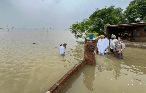
(Feature Image: Punjab WRD minister Barinder Kumar Goyal asserted that the timely release of water by the BBMB in June could have significantly reduced the damage caused by the floods.)
It is clear from the following details that the massive floods that Punjab experienced and parts continue to experience even now has a lot to do with the way Bhakra, Pong and Ranjit Sagar dams were operated. There was sufficient actionable information that was available to take advance water release action. Had these actions been taken, the proportions of the disaster could have been reduced. The risk of further floods remains considering the IMD forecast of heavy rains in catchments of these dams during the remaining weeks of SW Monsoon 2025.
The spill over effect of the sudden release of large volumes of water from Ranjit Sagar dam also affected the downstream Madhopur dam, damaging its gates and leading to washing away of one of the persons involved in trying to repair the damaged gate there. The areas downstream from the Madhopur dam also faced massive floods.
Bhakra Beas Management Board (BBMB) that operate the Bhakra and Pong dams and the Punjab government that operates the Ranjit Sagar dam have a lot to answer. Even Central Water Commission, the national flood forecaster, also has a lot to answer. There is not too much hope from either the central government as BBMB & CWC are central government organisations. Or from the state government that operates the Ranjit Sagar dam. The only hope is that may be Judiciary will set up such an inquiry.
Punjab floods Till late in the evening (Aug 25), 1,21,963 cusecs of water flowed into the Ranjit Sagar dam and 83,472 cusecs was released. While 81,137 cusecs of water flowed into the Bhakra dam, 43,800 cusecs was released. The highest inflow of water was seen in the Pong Dam at 2,07,544 cusecs, of which 65,761 cusecs was released.
Aug 27At the Pong Dam, the current water level is 1388.22 feet, FRL of 1,390 feet. The water inflow was 1.71 lakh cusecs, while 60,215 cusecs is being released into the Beas through turbines and spillway gates. The water level in the Ranjit Sagar Dam is 527.14 m (1729.46 ft). The FRL is 527.91 meters (1,731 feet). The water inflow is 81,074 cusecs, while 77,027 cusecs is being released downstream into the Ravi.
The water level at Bhakra Dam was 1670.70 feet, against FRL of 1680 feet. The inflow was 84,283 cusecs, while 43,152 cusecs of water is being released through the dam’s turbines.
Grim Flood situationThe flood situation remained grim in eight districts of Punjab—Pathankot, Gurdaspur, Fazilka, Kapurthala, Tarn Taran, Ferozepur, Hoshiarpur, and Amritsar. Some 518 villages have been affected by the floods in seven districts of the state. Sources said that 150 villages in Gurdaspur, 115 villages in Kapurthala, 100 villages in Amritsar, 65 villages in Ferozepur, 50 villages in Taran Taran, 23 villages in Pathankot and 15 villages in Fazilka distrct have been effected due to the floods. At least three people have died.
On Aug 28, at Bhakra dam, the water level was recorded at 1671.85 feet, with inflow at 38,583 cusecs and outflow at 52,584 cusecs. Pong dam stood at 1,393.36 feet, exceeding its maximum capacity of 1,390 feet, with inflow at 57,183 cusecs and outflow at 94,845 cusecs. Ranjit Sagar dam, which has a maximum limit of 527.91 meters, was at 525.49 meters, registering an inflow of 56,572 cusecs and outflow of 1.01 lakh cusecs. At Shahpur Kandi dam, the water level touched 399.60 meters against a maximum of 405 meters, with outflow at 89,932 cusecs.
Pong Dam inflow highest, says Tribune “This monsoon, the inflow into the Pong reservoir between July and August has been 9.68 billion cubic metres (BCM), which is the highest-ever since inception of the project,” an official of the Bhakra Beas Management Board (BBMB) said. The earlier highest recorded inflow was 7.70 BCM in 1988 and 9.19 BCM in 2023. (Inflow for flood management should be given in flow per unit time, not in monthly or two monthly term. This may be high, but it is a misleading, possibly an attempt to say that Dam could not have been operated any better.)
The seasonal rainfall from June 1 till the morning of August 28 has been above normal in the flood-affected states. Monsoon has been above the long period average by 31 per cent in Himachal, 25 per cent in Jammu and 24 per cent in Punjab. The India Meteorological Department (IMD) says north India has so far recorded the wettest monsoon since 2013, with 21 extremely heavy rain events being recorded till August 25, a significant increase compared to 14 such events last year. (These figures, if marshalled to justify dam operation, are not useful to defend wrong dam operation.)
BBMB officials say “rule curves” were developed by the Central Water Commission (CWC) in 2024 for the operation of Bhakra and Pong dams and that these are being implemented this year. The water releases from dams are decided by the technical committee, comprising senior officials from BBMB, chief engineers from the partner states, officials from the CWC and a special invitee from the IMD. During the current monsoon season, all the decisions such as the commencement of spillway operation, quantum of releases and outflow, and the schedule of release, etc., have been taken by the technical committee after obtaining consensus in an informed and transparent manner, according to BBMB officials. The committee conducted seven meetings in August 2025 to decide the release. (The least BBMB can do is to put out the minutes of meetings of this technical committee, along with the new rule curves in public domain, along with daily inflow, outflow, reservoir level and storage. This will help everyone see how correct are these claims.
“The regulation of BBMB reservoir operation in 2025 has been done keeping in view the relevant factors such as the upper rule curve, the carrying capacity of the Beas river downstream of Pong Dam, sufficient storage for the upcoming depletion phase and avoiding damages on account of synchronisation of streams and rivulets in the downstream region, etc.,” a BBMB official said. “Due to a consistently higher inflow, the enhancement of release from BBMB reservoirs has been very gradual keeping in view the safety of the dam as well as downstream areas by the technical committee in a transparent manner,” he added. (Most interesting part here is that this BBMB official remains un named. What is the meaning of that? If they put out all the information as suggested earlier, everyone can verify how true these claims are.)
Army help sought as Sutlej maroons Firozpur villages The flood situation turned grim in Ferozepur district on Aug 26 as the Sutlej water entered homes and fields in at least 60 villages situated near the India-Pakistan border, necessitating a large-scale rescue operation involving the Army and the National Disaster Relief Force. The administration has identified nearly 10,000 people who need immediate support. The water discharge upstream Harike was 2.73 lakh cusecs. At Hussainiwala headworks, the upstream discharge was over 2.30 lakh cusecs. Three villages near Hussainiwala — Tendi Wala, Dheera Ghara and Kaluwala — were the worst-hit, with the river water submerging the entire fields and entering all houses.
Flooding in Pathankot villages The water has been released from the dam at Shahpurkandi, Pathankot on Aug 24-26, leading to widespread flooding in nearby villages. Also, the Ujh and Jalalia rivers overflowed, severely affecting villages in Narot Jaimal Singh and Bamial blocks. On Aug 26 alone, 1,10,000 cusecs of water were released from the dam, resulting in flooding in Makhanpur, Pola, Tas, and Bahadurpur, where the Ravi River is flowing at critical levels.
Punjab shares blame for floods Silting up of riverbed between embankments, ill maintained drains and canals are some of the key reasons within Punjab for the floods, this article says.
Q: On the night of August 26, the water level at the Ranjit Sagar Dam crossed the danger mark. Why was so much water being held back, for a lot of water was released in the following days?
Barinder Kumar Goyal: There wasn’t really any ‘holding’ – the upstream inflow suddenly surged. There was also an increase in the water level downstream in Himachal Pradesh. The dam was releasing water regularly, and full monitoring was being done. Water is released after assessing that it would not cause any sudden excessive damage downstream.
Q: From August 24 to 26, inflow remained above outflow, and the water level in the dam rose to 527.13 metres. After August 26, outflows increased markedly compared with inflows, and the water level eased from 527.13 metres to 525.65 metres. Shouldn’t more water have been released on August 25, while it was raining upstream?
Goyal: Let me tell you frankly. What happened was totally unexpected. No one had imagined it would be like this. All calculations were upended; flows came from the upper rivers in Himachal, as well as from the Pathankot side.
So, when floodwaters from the upper reaches came down, even if less water was released from the dam, everything downstream would have been overwhelmed anyway.
Moreover, if there’s any risk to the dam, then water has to be released. The dam cannot be endangered.
Q: There is a perception that water is suddenly released by BBMB or other dam authorities as part of a ‘water bomb’ conspiracy to devastate people downstream.
Goyal: Such feelings are natural to arise in people’s minds in such a situation. Roughly, three lakh acres of crops are affected, and that is a huge loss for Punjab’s economy.
Q: People allege that BBMB keeps holding water till the last moment and then, suddenly, releases it.
Goyal: This is absolutely correct. We had asked them to release water when the water level in the dam was at 1,660 feet, and there was a possibility of more rain. But BBMB said ‘no’, they told us they will release water only after the water level reaches 1,665 feet.
Fix accountability for devastating floods: Pandher Sarwan Singh Pandher, the president of Amritsar-based Kisan Mazdoor Sangharsh Committee demanded an impartial probe by the AAP led Punjab government and the Union government into the Punjab floods: “Will CM Bhagwant Mann raise this issue with the center government? Punjab did not face incessant rains, it was the heavy discharge of water from Bhakra, Pong and Ranjit Sagar dams that led to floods. The Punjab government should fix accountability for the devastating floods. Who asked the Dam officials to stop water earlier and then release it later?”
“As three rivers met at the junction of Makora Pattan – Ujh, Jalali and Ravi – it led to a surge in the river water flow resulting in flooding of all the villages,” said a villager from Bamiyal. Similarly, people in Tur, Lassian, Jaidepur, Kajla, Bhagwal and Makhanpur villages situated on the international border in Gurdaspur were affected. The other flood affected villages include Jaidepur, Bamiyal, Bhagwal and Kohliya.
PIL in Punjab & Haryana HC about floods The PIL, which is likely to be taken up next week, has been filed by a lawyer, Shubham, a resident of Fazilka and practising in high court. It also demands Centre be directed to activate and disclose emergency action plans for Pong and Bhakra reservoirs under the Dam Safety Act, 2021.
HYDROPOWER PROJECTS
Adi Students Union concerned about SUMP The Adi Students’ Union (AdiSU) has appealed to Arunachal Pradesh Chief Minister Pema Khandu to address concerns regarding the proposed Siang Upper Multipurpose Project (SUMP). In a memorandum submitted on Aug 25, AdiSU opposed the deployment of paramilitary forces in Siang and Upper Siang districts for the project’s pre-feasibility report (PFR), saying it was done without prior consultation with local villagers and has caused fear and unrest in the region. The union also alleged illegal encroachment on government school premises in Boleng, Pangin, Kaying, and Pessing in connection with project activities. AdiSU further expressed concern over the suspension of several gaon burahs (GBs) and head gaon burahs (HGBs), which it said has intensified dissatisfaction among local communities.
Former CM Apang says SUMP is man-made disaster in the making Longest serving Chief Minister of Arunachal Pradesh Gegong Apang has strongly opposed construction of Siang Multi-purpose Dam, cautioning that if the dam bursts, it will submerge Lower Arunachal, Assam and even Bangladesh. This, he warned, is nothing less than a man-made disaster in the making.
Govt sets aside green rules for Indus hydel projects, cites data leak The Environment Ministry has exempted hydroelectric projects on the Indus river basin from comprehensive environmental studies. The ministry clarified that a cumulative impact assessment (CIA) and carrying capacity study (CCS) for the Indus, Chenab and Jhelum river basins in Jammu & Kashmir would be “administratively impractical and scientifically unviable” as a significant portion of these basins lies outside India.
While granting in-principle approval to the 1865 MW Sawalkot hydroelectric project, which requires 847.17 hectares of forest land, the forest advisory committee cited an observation of the Ministry of Home Affairs, which identified the project as strategically important and warned that conducting broad basin studies could risk the exposure of sensitive hydrological data.
Video film on Teesta 3 HEP disaster in SikkimThis excellent 25 minute video by News Reel Asia producer Surabhi SIngh explains the struggle against the 1200 MW Teesta III Hydro Project in Sikkim that got washed away on Oct 3 2023, following GLOF. It shows the Dzongu area and its rich biodiversity that is at the core of the lives of the Lepchas there and how they fought against the project.
DAMS
International Experts criticise slow progress in Polavaram An international team of experts visited the Polavaram Project on Friday. They will inspect various construction works at the project site until Sept 1. Officials from the water resources department and representatives from construction companies are participating in the reviews conducted by the panel of experts (PoE), which includes Gianfranco DiCicco (USA), Richard Donnelly (Canada), and David Paul (USA). The team expressed dissatisfaction with the progress of the diaphragm wall, reiterating earlier concerns that the slow pace could hinder timely completion of project milestones. The PoE strongly recommended the immediate enforcement of the quality control and assessment framework.
103 yr old Pocharam Dam withstands 1.82 lakh cusecs flood Telangana Irrigation minister N. Uttam Kumar Reddy said “happy to share with all, our 103-year old Pocharam reservoir has bravely withstood a massive flood inflow of 1,82,000 cusecs, far beyond, its maximum flood discharge of 70,000 cusecs.” There is 5 m long breach in the bund, which will be repaired. The Pocharam reservoir with a dam and bund stretching 1.7 kilometres and standing 21 feet tall, has 58 kilometres of canals, and 73 distributaries spread over Nagireddypet, Yellareddy in Kamareddy district and Medak.
DAM FLOODS
Ten gates of Tenughat Dam opened on Aug 25 According to the Flood Control Cell of Tenughat Dam Division, 32,300 cusecs of water were released by 7pm through eight radial gates, each with a 6.56ft height, and two 5ft-high undersluice gates. At 6am on Aug 25, the water level in the reservoir stood at 852.10ft (259.72 m), slightly above the maximum conservation level of 852ft. The gross storage was 444.07 MCM, live storage 282.02 MCM.
25 workers trapped after sudden release from Dharoi Dam on Sabarmati rescued On Aug 24, amid the rising water levels, 25 workers trapped near Bakrol village in Sarkhej were rescued. The workers, engaged in the construction of an overbridge on the Sabarmati, were caught in the sudden surge of water after release from the upstream Dharoi and Sant Sarovar dams. Near Subhash Bridge, equipment related to the Mumbai-Ahmedabad bullet train project was reportedly swept away in the strong river current. As of Aug 24, the Dharoi Dam is over 94% full, receiving 59,444 cusecs of inflow. To manage water levels, authorities have opened four gates, releasing 58,880 cusecs into the Sabarmati.
Bargi Dam on Narmada: Nine gates opened on Aug 26 Authorities opened nine gates of the Bargi Dam (water storage already at 100.8% of full capacity) in Jabalpur by around 0.78 m each on Aug 26 at 11 hrs, releasing 1,097 cubic meters water per second (38741 cusecs) into the Narmada river, prompting an alert in riverside villages of Mandla, Narsinghpur and Narmadapuram. Inflow into the dam was 1585 cumecs.
Mumbai Dams storage 1400.2 MCM 96.74% on Aug 27 Is this an invitation to possible flood disaster for downstream areas? Modak Sagar, Vihar and Tulsi lakes are all 100% full, Tansa is 99.1% full. Bhatsa (the biggest one), Upper and Middle Vaitarna are each over 95% full.
Surwal Dam Floods in Sawai Madhopur-Rajasthan While DDMP mentions that there has been no dam related disaster in the district so far, we hope after this disaster the state government will institute an independent inquiry to understand reasons and impacts related to this disaster and also suggest lessons and ways to fix accountability as necessary. It will also provide an opportunity to review the disaster potential in the context of changing climate, particularly intensification of rainfall in Eastern Rajasthan.
Aug 2025: Ravi Flood damages Madhopur Barrage gates in Punjab The second power house of the Shahpur Kandi Dam (SKD) is located just upstream the Madhopur barrage. The scale of flood this time has certainly submerged the powerhouse. However, there is no information whether the power house has faced any damages. This is also true for the Shahpur Kandi dam structure located about 7 km upstream of the Madhopur barrage.
FLOOD 2025
While Beas is in flood rage, CWC has just 3 flood monitoring sites on the entire river in Himachal Pradesh that too in Kullu district only. Of these Solang site is inactive for months, Manali hydrograph has water level missing for hours. There is No warning, danger & Highest Flood Levels marked on Manali & Kullu sites.
Over 3 lakh cusecs hourly water volume recorded at Hathni Kund barrage for 7 hours today.
08:00 hour 3,11,029
09:00 hour 3,29,313
10:00 hour 3,21,653
11:00 hour 3,19,367
12:00 hour 3,23,180
13:00 hour 3,22,416
14:00 hour 3,03,519
15:00 hour 2,96,810
16:00 hour 2,93,848
The flood spell is expected to reach Delhi in next 36 hours. CWC has forecasted the flood level to cross 206 meter at Delhi Railway Bridge site between 17:00-20:00 hour on 02.09.2025. SM video Yamuna in flood spate at HKB in morning hour today.
HFL BREACH
Jammu Kashmir: Tawi river at Sidhara site in Jammu town has registered about 05 meter rise in last 10 hours and breached its 318.85 meter HFL dated 06.09.2014 at 14:00 hour on 26.08.2025 and is flowing in extreme flood situation with rising trend.
Jammu & Kashmir: Flood level in River Jhelam at Khanabal site in Anantnag district increased by 5.61 meter in 16 hours to attain new peak level 1594.84 meter at 05:00 hour on 27.08.2025 after a decade. The HFL for the site 1594.5 meter dated 25.06.2015 was breached at 23:00 hour on 26.08.2025. Present flood level is 1594.72 meter at 09:00 hour on 27.08.2025 with declining trend.
CWC: River water levels from CWC Jammu network (Jhelum river). Khanabal, Sangam sites-Anantnag district, Rammunshibagh – Srinagar dist., Safapora – Bandipora dist.
Chhattisgarh: Flood level in Dantewara river at Tumnar site in Dantewara district has increased by 9.72 meter in 12 hours and after 31 years the river has breached HFL 326.83 meter dated 04.09.1994 at 19:00 hour on 26.08.2025. Present flood level is 327.857 meter at 20:00 hour on 26.08.2025 with rising trend.
URBAN FLOODS
Doobo-meter: How fast our cities submergeHere’s a Doobo-meter to reveal how much rain it takes to submerge our cities, and which one drowns the fastest. How much rainfall in 24 hours drowns our cities? For Doobo-meter, we take some of the worst-hit spots in the metro cities. Reading is 200 m for Mumbai & Chennai, 100-150 mm for Delhi, 50-60 mm in few hours for Hyderabad, 50-100 mm for Bangalore, 30-50 mm for Gurgaon.
Jammu floods were disaster foretold Anmol Ohri narrates the Jammu floods disaster that started on Aug 24, and says it was something activists had warned the authorities about, in the context of the Tawi River Front Development Project, but their warnings were ignored.
MONSOON 2025
Seems like very dangerous situation with following rainfall figures for 24 hrs ending 0830 hrs Aug 26 morning for respective states/ district:
Punjab: 54 mm
Amritsar: 97.4
Barnala: 103
Ferozepur: 65.8
Gurdaspur: 155.8
Moga: 72
Pathankot: 82.2
Tarn Taran: 92.4
HP: 49.2
Chamba: 99.6
Kangra: 84
Kullu: 65.5
Una: 59.5
J&K: 34.2
Doda: 107.2
Kthua: 112.2
Jammu: 48.5
Reasi: 66.6
Samba: 99.5
Ramban: 31.6
Udhampur: 55.2
Ladakh Leh: 22.3
When this is combined with the already high water levels in Dams in Sutlej, Ravi and Beas basins, and state of landslides and muck in the river, It can be a very worrying combination.
IMD: Record-Breaking Rainfall Alert! Jammu and Udhampur witnessed historic 24-hour cumulative rainfall from 0830 hrs on 26 Aug 2025 to 0830 hrs on 27 Aug 2025:
Jammu: 296.0 mm (Previous record: 272.6 mm on 09 Aug 1973 Broken)
Udhampur: 629.4 mm (Previous record: 342.0 mm on 31 Jul 2019 Broken)
HIMALAYAN DISASTERS
2025 Western Himalayan Floods: What can be done to reduce disastrous impacts Is any of this asking for too much? Without all this, can we address the increasing threat of flood disasters that Western Himalayan states are facing? The fact is, without all these, we will be facing increasingly bigger disasters and progressing towards the Supreme Court Prognosis about Himachal Pradesh disappearing from the map. Let us work to ensure that SC’s prognosis does not become a reality for the Western Himalayan states. In fact the Himalayas and Himalayan rivers have been speaking louder and much earlier than SC. If only we care to hear through the commotion of almost daily din of disasters. If only we would pay heed. Earlier the better.
Vulnerable Nallahs in the Himalayas need Urgent AttentionWhile being the lifelines of the mountains, nallahs can also bring together disasters in the whole watershed. Water, snow, debris, trees, boulders etc., accumulate in the nallah. They flow downstream, creating a positive feedback loop. This process causes further erosion and gains destructive power. Glacial Lake Outburst Floods, Landslide dam outburst floods and avalanches also roar downstream through nallahs. Their proximity to settlements and their docile nature during dry season makes them particularly dangerous in the monsoons.
Parineeta Dandekar compiles a preliminary list of such dangerous Nallahs in Chenab, Sutlej and Beas basins in J&K and HP and lists some urgent steps necessary: “These are some basic steps to be taken for the highlighted vulnerable streams/ places. Such lists need to be strengthened and built further with the help of stakeholders from the ground to the scientific community.”
Aug 2025: Chenab-Tawi and Tributaries Cross HFL, muck dumping worsens the impacts Parineeta Dandekar gives a snapshot here of developing situation in several districts of J&K in Tawi and Chenab basins following heavy rainfall on Aug 25-27, prognosis of more rainfall from IMD, extreme flood situation reported by CWC and situation worsening due to muck dumping in rivers in violation of laws and norms.
Ecological imbalance: HP Govt seeks 6 months from SC to prepare roadmap Acknowledging that “there are shortcomings in the existing measures” to deal with ecological imbalance in the state, the Himachal Pradesh Government on Monday sought “at least six months” from the Supreme Court to prepare a roadmap to deal with the situation. In an affidavit, the state government emphasised “the need for their (shortcomings’) identification, along with the formulation of a comprehensive future action plan to effectively address the disastrous situations witnessed in recent years as well as the continuing challenges.”
As the matter ‘IN RE: ISSUES RELATING TO ECOLOGY AND ENVIRONMENTAL CONDITIONS PREVAILING IN THE STATE OF HIMACHAL PRADESH BY COURTS MOTION’ came up for hearing before the bench of Justice Vikram Nath and Sandeep Mehta, the affidavit was filed detailing the current mechanisms and steps taken to arrest the situation. “To this end, the Respondent State intends to constitute a Core Group comprising of concerned officers, subject matter experts such as Geologists, Hydrologists, Climate Change Experts etc. from various institutions, and community representatives to identify these shortcomings and suggest a roadmap for the future,” the state government said in its affidavit.
Expressing serious concerns over ecological imbalance in Himachal Pradesh, the Supreme Court had on July 28 in a suo motu matter warned: “We want to impress upon the State Government and (the) Union of India respectively that earning revenue is not everything. Revenue cannot be earned at the cost of the environment and ecology. If things proceed, the way they are as on date, then the day is not far when the entire State of HP may vanish in thin air from the map of the country,” a Bench led by Justice JB Pardiwala had said.
Uttarkashi Locals call halt to Char Dham Project Residents of Uttarkashi have demanded an immediate stop to the Border Roads Organisation’s proposed Char Dham project within the Bhagirathi Eco-Senitive Zone (BESZ), a legally protected stretch of high-altitude terrain already showing signs of environmental stress. In a letter addressed to three Union ministries and a retired Supreme Court judge, endorsed by members of the Himalayan Nagrik Drishti Manch, they called for the cancellation of the proposed Netala bypass on the Uttarkashi-Gangotri route — a bypass the high-powered committee (HPC) of the Supreme Court had rejected in 2020 due to concerns over environmental destabilisation and the impact on local communities. The letter demands three immediate actions: halting the Char Dham project within the BESZ, cancelling the Hina-Tekhla (Netala) bypass, and initiating a joint inspection of the affected stretch by all stakeholders. Netala lies in the Bhagirathi Eco-Sensitive Zone (BESZ), created to protect the Ganga and its watershed from Gaumukh to Uttarkashi, an expanse of nearly 4,157 sq km. Over the years, the valley has witnessed both extensive infrastructure works and rapid ecological deterioration.
Residents contend that the project violates the spirit of the court and the oversight committee. Their letter was sent to the secretaries of the ministries of defence, road transport, and environment, as well as to Justice (retd) A K Sikri, chair of the HPC. They also cited fresh damage in the region. “After the Dharali deluge, the highway up to Bhatwadi was badly affected. Since then, many new landslides have emerged between the Sainj-Maneri stretch.”
A BRO officer deployed in Uttarakhand said on condition of anonymity, “We haven’t started work yet. We do look forward to meetings with stakeholders to reach consensus before work begins, as these are matters of strategic importance.”
GLACIERS
Himachal creating Glaciers Register The Himachal Pradesh government through State Remote Sensing Cell is actively working on creation of a state-level glacier registry as the overall area under glaciers has reduced, indicating a gradual shrinkage of glaciers. This information was shared in the state assembly on Aug. 25 in reply to a question. The state has five major river systems — Satluj, Beas, Ravi, Yamuna, and Chenab. These rivers are fed by about 800 glaciers located in the upper reaches, covering an area of 3,124.713 sq. km. Together, the five river basins span 53,311 sq. km.
WETLANDS
Supreme Court gives two months to complete boundary demarcation of wetlands “The statistics furnished would also reflect that wetlands, which are less than 2.25 ha, are required to be identified as prescribed under the extant rules and the affidavits of the state governments of wetland authorities shall also delve upon as to the manner and method in which steps have been taken or being taken to protect these wetlands which are less than 2.25 hectares, which according to the statistics is around 5,55,557 as mentioned in the Wetland Atlas”. The number of wetlands above 2.25 ha area are 231 195.
The top court bench of Justices Aravind Kumar and N V Anjaria made clear that inaction on the part of these State Wetland Authorities would compel it to pass coercive orders against those States which have failed to comply with the direction issued earlier. Noting that state wetland authorities are moving at a snail’s pace, the Supreme Court has directed States to expedite the ground truthing and boundary demarcation of wetlands within two months. “In the light of the wetlands having been identified, it is incumbent upon the State Wetland Authorities to publish the same in the respective State Governments’ website… Let the affidavit of compliance be filed immediately after such an exercise being undertaken and at any rate before the next date of hearing,” the bench said in its August 19 order. The top court was hearing a PIL by bird enthusiast Anand Arya, advocate M K Balakrishnan and NGO Vanashakti. Next hearing on Oct 7.
Rethinking Wetlands conservation and Climate Resilience in India From flood control to carbon storage, wetlands are India’s invisible lifelines. The National Water Mission’s 60th Water Talk, featuring insights from Dr. Jayshree Vencatesan, explored how protecting them is key to climate resilience, biodiversity, and community well-being. Dr. Jayshree is co-founder of Chennai’s Care Earth Trust and the first Indian recipient of the Ramsar Award for “Wise Use of Wetlands.” She worked to transform Chennai’s Pallikaranai Marsh from a garbage dump into a biodiversity hotspot in the early 2000s. While India has more than 80 Ramsar sites, Dr. Vencatesan noted that their protection and use remain inconsistent.
She highlighted efforts like wetland “health cards” in Punjab and Jammu & Kashmir, but argued that stronger integrated management plans, stricter enforcement, and even civil penalties for violations are necessary. “There is a need for a clearer, though not uniform, definition of wetlands and enhanced inter-sectoral coordination,” she added, pointing out that wetlands are too often viewed only as environmental concerns rather than water resources. Dr. Vencatesan’s concluding remark struck both as a warning and a promise: “Delay is no longer an option, or ecosystems won’t forgive us.”
SOUTH ASIA
Bhutan: Punatsangchhu II completed The 1020 MW Punatsangchhu-II Hydroelectric Project in Bhutan has been completed with the synchronisation of its last unit, Unit 6 (170 MW), with the power grid, the Embassy of India in Thimphu said on Aug 27. The project has been much delayed, as been under construction for 14 years.
Pakistan: Mudslide lake in GB province a threat A 7-km lake in northern Pakistan, created by a mountain mudslide, is threatening to burst and unleash potentially “catastrophic” floods downstream, officials warned on Aug 23. The mud flow descended into the main Ghizer River channel and blocked it completely on Aug 22, creating the lake in Gilgit Baltistan province, the National Disaster Management Authority said. Four downstream districts – Ghizer, Gilgit, Astore and Diamer – face a serious threat. Black mud flows landed in the river from different mountainsides, said provincial government spokesperson. Nearly 200 people in dozens of scattered houses tucked in the mountainsides and the river’s surroundings were rescued after a shepherd boy alert the people. The lake has started discharging water, meaning the threat of a burst is reducing.
22 more killed as flood waters enter Pak’s Punjab At least 22 people died in 24 hours on Aug 28-29 and around nine residential localities got submerged due to the floodwater entering Lahore city in Pakistan’s Punjab province. At least 1,700 villages across Punjab have been inundated while grain crops on thousands of acres of land have been submerged. The rescue teams have evacuated over one million people so far. Extremely high floods were seen in eastern rivers — the Sutlej, Ravi and Chenab.
The floodwater in the Ravi River entered Lahore’s nine residential localities, inundating roads and damaging houses and other infrastructure. Ravi had flows of nearly 220,000 cusecs, whereas the designed capacity of the river is 250,000 cusecs in Lahore. Unprecedented monsoon rain and the release of excess water from the Indian side swelled the three eastern rivers. This is the highest flood here since 1988.
India has opened all the gates of its Thein Dam on the Ravi River, prompting the Punjab administration to call in the Pakistan Army in eight districts — Lahore, Okara, Faisalabad, Sialkot, Narowal, Kasur, Sargodha and Hafizabad — of Punjab to assist civil authorities in rescue and relief operations. Pakistan had also received a warning from India that it intends to release water from the rapidly filling Madhopur Dam. Both dams are on the Ravi River, which flows from India into Pakistan.
Up to 800,000 cusecs of water can pass through the Chenab River system in the next 48 hours, threatening widespread devastation. Due to flooding in the Chenab, more than one million people have been evacuated and relocated to safe locations so far, as per Pak’s National Disaster Management Authority (NDMA). It further said in the Ravi, around 80 villages were submerged. Around 11,000 people have been evacuated and relocated to safe locations so far. A total of 361 villages have been submerged by the overflowing Sutlej River. Nearly 127,000 people have been evacuated and relocated to safe locations so far.
THE WORLD
UN Water Conference 2026The upcoming UN Water Conference in 2026 has proposed ‘Water in Multilateral Processes’ and ‘Water for Cooperation’ as critical thematic areas. It aims to integrate water into the ‘global, multilateral, and intergovernmental dialogues’ and facilitate transboundary water cooperation. Individual countries, and their leadership too, should infuse the required political capital to fulfil the mandate of the SDG Agenda 2030.
-SANDRP
