A new surge in the developmental interventions in the rivers in India is seen with the implementation of National Inland Waterways Act, 2016. Under this Act, 138 stretches of the rivers, creeks, backwaters, estuaries, etc. in 24 states and 2 union territories will be developed as the ‘national inland waterways’ for the transportation of huge cargo and passenger vessels. Being declared as “national” means that the control and regulation of these waterways will be in the hands of the central government and not state governments. This project of Central Government is being pushed forward with the claims of inland water transport being cost-effect, environmental friendly and safe for the transportation of hazardous goods. However, these so called benefits are neither universal nor automatic as they will be dependent on certain conditions, and will accrue if and when those conditions are met. Development of these waterways will be controlled and regulated by Inland Waterways Authority of India (IWAI).
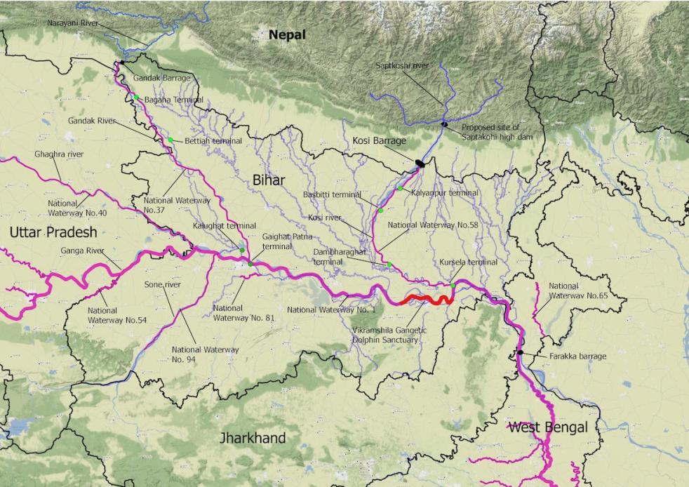
Seven of the rivers of Bihar – Ganga, Gandak, Ghaghra, Kosi, Karamnasa, Sone and Punpun are amongst the 111 declared national waterways of India. The waterways planned on Ganga, Gandak and Kosi rivers in Bihar are of specific strategic importance as these waterways are amongst the 37 waterways which have been prioritised for development by 2019. National Waterway-1, declared a national waterway in 1986, is planned on Ganga –Bhagirathi and Hooghly river system and passes through the states of Uttar Pradesh, Bihar, Jharkhand and West Bengal. Whereas the newly declared National Waterway – 37 (Gandak river) and National Waterway – 58 (Kosi river) are predominantly situated in Bihar with only a part of Gandak waterway proposed in Uttar Pradesh. Moreover, a recent joint announcement by the Governments of India and Nepal[i] has declared that Kosi and Gandak would be developed as international Indo-Nepal waterways, to provide sea connectivity to Nepal.
The planned capacity of ships / cargo vessels on waterways proposed on Kosi and Gandak is relatively small (100 ton capacity) when compared with the vessels proposed in the Ganga waterway which are up to 1500-2000 ton capacity. This is the capacity proposed in the Detailed Project Reports of Kosi and Gandak waterways which were prepared before the decision to extend these waterways to Nepal. It appears that with the extension of the waterways in to there are also plans to increase the tonnage of the vessels that will ply on these waterways, which in turn will also mean the need for a larger channel.
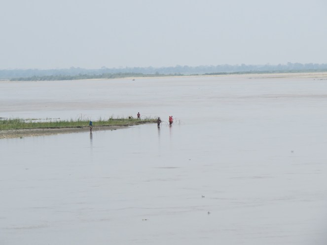
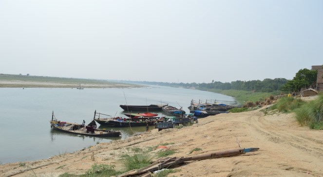
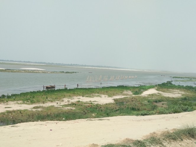
Ganga, Gandak and Kosi are the eccentric alluvial rivers of India. These are known for their meandering and braiding characteristics. Kosi and Gandak are the rivers known for shifting their channels and changing their course. Even the construction of barrages and embankments has not proved very effective in containing the flow and vagaries of these rivers in the past. These rivers are also characterised with very heavy sediment load. To present an idea of the sediment load of Kosi alone in Bihar, Dr. D.K. Mishra in ‘Trapped! Between the devil and the deep waters – The story of Bihar’s Kosi River’ describes the sediment load of Kosi as,
“The amount of sediments that annually come down the Kosi can be assessed from the fact that if a wall of one meter by one meter cross-section is constructed with them, it will go nearly two and half times round the equator.”
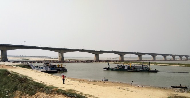
Developing these waterways to allow large barges to transport cargo requires creation of channels in these rivers with adequate depth and width to allow these vessels to move. Rivers in Bihar do not have this adequate depth naturally because of the heavy sediment load. Moreover, these rivers form extensive shoals and sandbars. Hence, the water channel would be developed using the process of dredging – cutting and excavating the riverbed – and/or by building barrages.
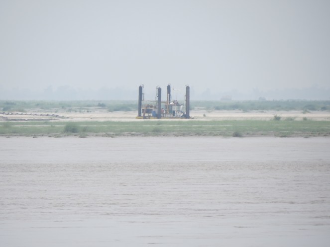
Dredging is a huge intervention in the river in itself[ii], and has been listed in the activities which require environmental clearance as per the Environment Impact Assessment Notification, 2006, though this is not being following in terms of conducting credible Environment Impact Assessments, holding public consultations and ensuring independent appraisal, clearances and monitoring. Dredging increases the turbidity in water which affects the penetration of sunlight required for many aquatic plants and animals to thrive. Dredging also physically damages the habitats in the river. Dredging is in these rivers has the potential of adversely affecting the rich biodiversity, especially the endangered Gangetic Dolphins[iii] found in almost all parts of these rivers. Ecologically sensitive and protected areas such as Valmiki Tiger Reserve, and Vikramshila Dolphin Sanctuary are situated very close to or within the waterways. The local population dependent on fisheries in these rivers for subsistence as well as for their livelihood are also vulnerable to the impacts of dredging in Bihar. Dredging can also affect the river banks, bank stability and safety in approaching the river from river banks.
The high sediment load in these rivers means that heavy costs will be incurred for dredging and disposal of dredged material for these waterways. Since flowing rivers keep bringing silt into such navigation channels, dredging is required in an ongoing manner in most waterways. This is called maintenance dredging. In Kosi, Gandak and Ganga, the waterways would have to be dredged more frequently to maintain the channel of navigation because of the high silt load and formation of shoals. This raises the issue of the higher costs, impacts and ultimately the viability of the waterways.
Further these rivers keep shifting their channels. They have even changed their course in the past. Shifting channels again would mean higher cost of maintaining them, and it is quite possible that location of the terminals, jetties, and other associated infrastructure have to be redeveloped and relocated frequently. During our visit to the location of the proposed Kursela terminal on the Kosi river, we found that while surveys conducted several years back showed the terminal on the bank of the river channel, when we visited, the channel had shifted more than 500 m away from the terminal location.
The issue of silt in the rivers of Bihar in the context of the development of waterways has also been reiterated by the Government of Bihar. As recently as in July 2018, Chief Minister of Bihar, Shri Nitish Kumar while addressing the ‘East India Climate Change Conclave 2018’ flagged[iv] the issue of silt while emphasising that even the national waterway-1 on Ganga (especially in Bihar) will not be successful until the issue of silt is addressed and resolved.
In addition to dredging, the channels will need river straightening and training works, bank protection works and removal or rebuilding of obstacles like low rail or road bridges etc. The waterways will also need construction of related infrastructure like terminals, jetties, warehouses etc. for storage and handling of cargo. All these interventions are highly critical from the perspective of the viability and sustainability of these waterways. Further, they represent massive interventions and huge costs in the rivers with significant adverse impacts.
The extension of these waterways into Nepal through Gandak or Kosi waterways also raises questions of viability and feasibility, apart from social and environmental impacts. There are already built barrages on Kosi and on the Gandak river at the Indo-Nepal border which currently are also the end points of Indian section of these waterways. It is not very clear as to how the waterways will be extended into the Nepal given that no provision has been revealed about the passage of cargo vessels through these barrages. Moreover, an intermodal terminal is also proposed on National Waterway-1 on Ganga at Kalughat in Bihar. This terminal will be constructed to cater to the cargo containers exclusively for Nepal. However, the selection of Kalughat as the key terminal for the Indo-Nepal waterway and its link to the sea via the Ganga is puzzling. Kalughat is towards the west (or upstream side on the Ganga) from the confluence point of the Kosi and the Ganga. This means that vessels coming in from Nepal via the Kosi would have to go westward (upstream) to Kalughat and then come back east (or downstream) to go towards the sea (Kolkata/Haldia).
The other important link which was found as being completely ignored in these developments in Bihar is the consultation with the local population and other stakeholders such as academicians, civil society organisations and experts. Even the issues, mainly relating to siltation, raised by the Bihar Chief Minister repeatedly have not been addressed. There are many comprehensive studies about the social and ecological aspects of the development of these waterways which needs to be done and discussed on a wider public platform.
Given the huge financial outlay and serious impacts of these waterways, we urge that till such studies are completed, and extensive discussions held involving governments, local communities, civil society, independent experts, the work on the waterways should be put on hold. They should be taken up only if a consensus emerges from such discussions that the waterways are found viable and desirable through such an informed and democratic process.
Avli Verma, Jinda Sandbhor, Shripad Dharmadhikary,
Manthan Adhyayan Kendra (manthan.shripad@gmail.com)
Note: Manthan has been following the developments on the waterways in Bihar. Extensive analysis of the documents and studies related to the development of waterways in Bihar and a field visit in the encompassed areas of Bihar and Nepal where these waterways have been planned has resulted in its new report[v] on ‘National Inland Waterways in Bihar: A Profile’ which presents a broad overview of the waterways in Bihar. In addition to this, Manthan has also released another report[vi] on ‘National and International Inland Waterways in Kosi and Gandak rivers: A Preliminary report.’ Even though this report is based on detailed analysis, this report should be treated as a preliminary report as there are several aspects which we feel need to be studied further.
END NOTES:
[i] http://pibphoto.nic.in/documents/rlink/2018/apr/p20184703.pdf
[ii] https://sandrp.in/2016/08/11/impacts-of-ganga-waterways-plan-on-its-ecology-and-the-people/
[iii] https://sandrp.in/2016/10/19/turning-blind-eyes-do-we-care-for-river-dolphins-or-their-habitat/, https://sandrp.in/2016/06/21/in-the-pits-the-ganga-river-dredged-to-death/, https://sandrp.in/2015/12/28/four-boats-at-a-river-crossing/
[iv] https://timesofindia.indiatimes.com/india/nw-1-will-fail-unless-siltation-issue-is-addressed-nitish-kumar/articleshow/64722176.cms
[v] http://www.manthan-india.org/wp-content/uploads/2018/07/Bihar-Waterways-Profile.pdf
[vi] http://www.manthan-india.org/national-and-international-inland-waterways-in-kosi-and-gandak-rivers-a-preliminary-report/

2 thoughts on “National Inland Waterways in Bihar: Viable or desirable?”