
-Guest Blog by Vidyadhar Atkore
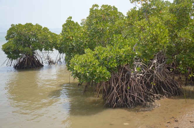
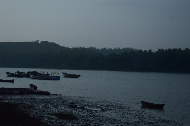
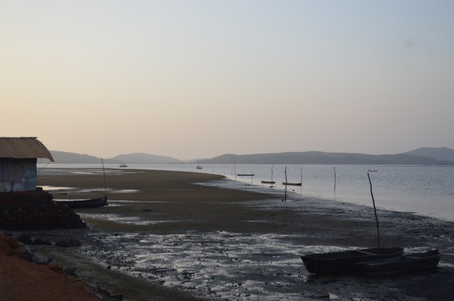
Aghanashini –is a small village situated on the southern bank of Aghanashini River in the Kumta taluka of Uttar Kannada district in Karnataka state. River Aghanashini draws its name from this village, it is also known as Tadri river as Tadri village is situated on the river mouth on the north bank. Vast estuary and open sea at the village makes you humble. A drive along the bank of estuary is pleasant experience in the hot summer. On one side, big coconut trees and on other side, isolated, stunted mangrove patches draw your attention.
Under a project titled ‘Assessing Ecosystem Responses and Socio-Economic Impacts of Altered and Free-flowing Rivers’, my friend Tarun Nair and me visited the Aghanashini sub-basin from 18th to 25th March 2016 to gather preliminary information on water quality, status of economically important fishes, bivalve production and fishery related dependent livelihoods. We identified potential sampling locations for measuring water quality parameters and fish diversity, the idea being to investigate the influence of river discharge on productivity and diversity in the Aghanashini river and estuary.
Free-flowing rivers are special as they flow continuously from the source to mouth without any disturbance in their course. Free flowing rivers are formed over a long evolutionary period of time and are dynamic in nature. They continue to nourish human civilization and are able to invoke social, cultural and poetic imagination about their generous life-giving ability.
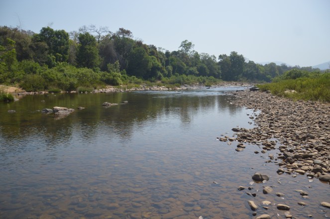
Free flowing rivers have a natural flow regime, carry sediment downstream thus shaping and maintaining natural riverine habitats (runs, pools, riffles and cascades) to which aquatic life adapts. For instance, many riverine fishes are known to partly utilise each of these habitats to complete their entire life cycle (Schlosser, 1991). Fully and partly submerged rocks/boulders are breeding ground for aquatic insect larvae. Similarly aquatic vegetation is a key refuge for surface, mid-column and bottom dwelling fish species. One can easily encounter hundreds of Freshwater pipefish (Microphis sp) in a partly submerged coconut branch (Pers.comm with a local fisherman). Similarly if you carefully sample submerged vegetation along a flowing, healthy river in these parts of Western Ghats, you are likely to observe Badis sp (belong to the Percomorpha Order). However, we still lack comprehensive ecological understanding on the behaviour and breeding biology of many riverine dependent species. These few examples illustrate the persistence and adaptation of aquatic life-forms to the natural flow regimes of the rivers. Apart from offering numerous ecological services, free-flowing rivers also occupy a significant position in our Indian mythology both spiritually as well as culturally.

However, free flowing rivers are a rarity, not only in India, but across the world. Incessant damming, diversions, encroachments, mining and pollution have ensured that most of our rivers are dissected in pieces and have lost their true ecological character. In many sense, free flowing rivers are the ancient universities of how a river behaves, how it nourishes its surrounding and brings bounty to the land. Of the world’s 177 largest rivers, only one-third are free flowing, and just 21 rivers longer than 1,000 km retain a direct connection to the sea. Damming has led to species extinctions, loss of prime farmland and forests, social upheaval, loss of clean water supplies, desiccated wetlands, destroyed fisheries and more.
Ecologically, free flowing rivers have huge significance. Natural flow levels support specific ecological functions, including groundwater recharge, nutrient balancing in soils, fish spawning, the movement of sediments, and more.[i]
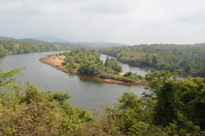
Four major rivers flows through Uttar Kannada district namely, Kali, Gangavali/Bedati, Aghanashini, and Sharavati. Of these, the Aghanashini and Bedati are undammed west flowing rivers in the district. Aghanashini river originates in the Western Ghats at Gadihalli at an altitude of 667 m above mean sea level in Sirsi Town and flows a total distance of 117 km and finally meet Arabian Sea near Kumta (Bhat 2003). River traverse through forested, agricultural landscape and covers total catchment area of about 1350 sq. km. Among all the four rivers, the Aghanashini provides substantial livelihood opportunities to fishers and non-fishers through fish, bivalve, rice and salt production.
Mudflats (also called tidal flats) are sediment deposits and a unique feature of the inter-tidal zone. The Aghanashini village has an area of about 200 ha of mudflats. Apart from Brahminy kites, a few plovers, reef egrets and pond herons were seen feeding on the mudflats. Previous studies have shown many reasons for rich productive estuary. For instance, the nutrient/organic matters are flushed out from the forested region in the upstream to estuary, and more than 120 species of birds contribute to this productivity through nutrient cycling in the form of potash and nitrogen source (Bhat et al 2014, Bhoominathan et al 2014, 2008).
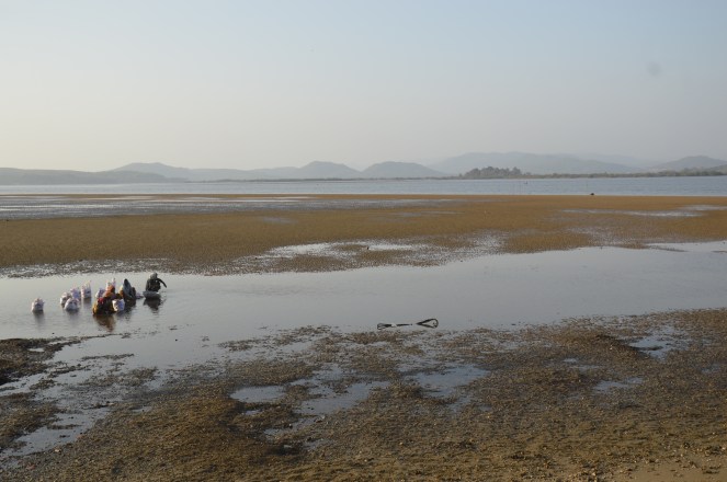
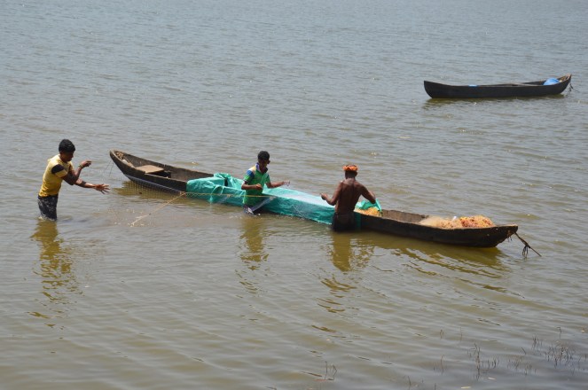
Bivalves are – one of the most nutritious and tasty natural resource and form an important part of diet among the coastal population. Bivalves are both marine and freshwater animals belonging to a phylum Mollusca (mollis means soft in Latin). Typically they have laterally compressed bodies covered by a shell consisting of two hinged parts. They include clams, oysters, mussels, scallops etc. Bivalves require brackish water for their growth, as they are found on the mudflats as well as in the bottom. They grow on the soft/hard rocks as well as they bury themselves in the sand to avoid predation. They are rich source of calcium. Locally they are called belche. During low tide they are collected either by using sickle or small stick. Often women folks dive to the bottom of estuary to collect them.
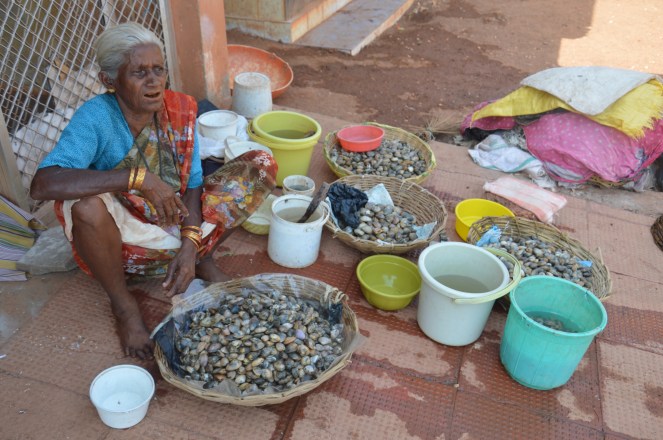
Researchers from the Centre for Ecological Science, of the Indian Institute of Science have identified more than four species of bivalves found in the Aghnashini estuary (Bhoominathan et al 2008). Local residents reported a sharp decline in bivalve production over the last 2-3 years, and have now resorted to using mussel seed from Kerala. The reason is unclear – some believe it is due to a decline in river water quality, while others blame the tsunami. However, Dr. Prakash Pandit from Dr. A.V. Baliga College of Arts and Science, Kumta thinks otherwise and cites the overharvesting of bivalves as primary reason.
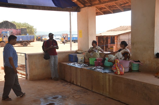
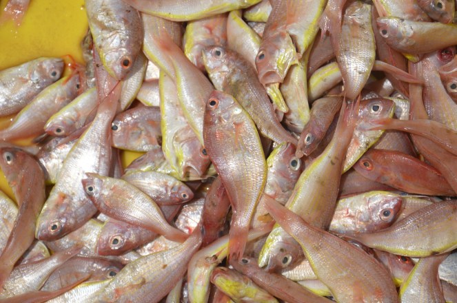
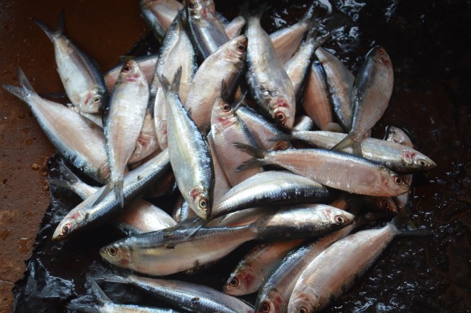
This author and Tarun visited a fish market in Kumta where mostly women folks were selling fresh marine fish along with bivalves. Apart from pomfret and shark, bivalves were relatively more expensive than most other fishes in the market. Bivalve production in the estuary was noteworthy few years back. It was estimated to be 22,006 ton/year generating a net annual income of Rs 57.8 million from bivalve collection. The Aghanashini village alone earns Rs. 33 million per year from bivalve collection. (Bhoominathan et al., 2008).
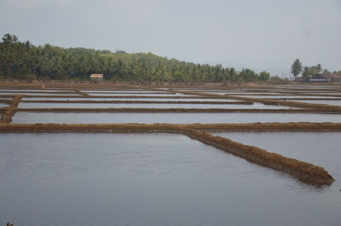
A unique salt tolerant, pest resistant and environmental stress free variety of rice – Kagga is grown in coastal Karnataka and is a feature of Aghanashini estuary. Earlier the more than 2000 ha of Kagga rice was cultivated in the estuary but the area now has reduced less than 1000 ha. Local says, the Kagga rice serve as coolant especially its ganji (a soup made out of kagga rice) prevents heat strokes (Pallavi 2014).
A highly productive area of about 728.44 ha of the Aghanashini estuary was leased for Industrial salt production in 1970’s (Bhoominathan et al 2008). But, the project did not last long and failed due to management (Pallavi 2014). Subsequently, in last few years a lot of productive estuarine area had been converted in to shrimp farming thus it took a heavy toll on the estuary. It has destroyed luxuriant mangrove forest area and native Kagga rice fields. Clear evidences of human encroachment in the form of building construction on the mangrove habitat is another reason for their decline.

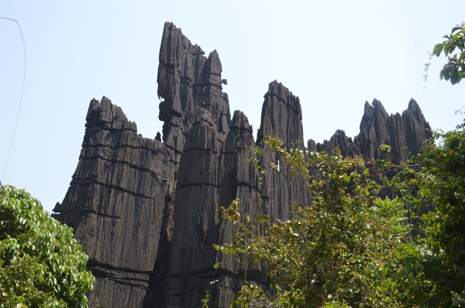
We also sampled the headwaters of the Chandika river (a tributary of the Aghanashini) near the unusual karst limestone formations at Yana. The calcium carbonate from these limestone formations are potentially a major contributing factor to the productivity in the estuary and will be further investigated. While the upper section of the Chandika was flowing, we noticed that the river was reduced to series of disconnected pools in its middle reaches. Enquiries with local farmers revealed the excessive withdrawal for arecanut and coconut plantations as the primary reason for depleted water levels. They also reported that the river’s flow was restored ‘if the power fails for 2 days’.
Measuring freshwater flow is a vital component in river ecology. We refer two important definitions here with reference to increasing anthropogenic pressures (mainly dams & water diversion via irrigation canals). Ecological flow means ‘minimum amount of flow that is required to maintain the functioning of river biota’. On the other hand, an environmental flow is slightly different from ecological flow, which means that, a system for managing the quantity, timing, and quality of water flows below a dam, with a goal of sustaining freshwater and estuarine ecosystems and the human livelihoods that depend on them (International Rivers). However, a free flowing rivers surpasses both these definitions and is a true representation of what a river can provide.
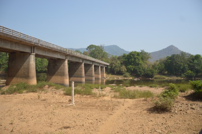
The Centre Water Commission (CWC) operates a hydrological gauging station near Santeguli village, about 37 km upriver from Aghanashini village and the river mouth. The CWC measures discharge twice a day from the Santeguli bridge. To do this, one needs to take several measurements (take water velocity reading using water velocity meter – record number of revolutions per minutes (at 5 m distance along the bridge) at certain fixed distance depends on the size of a stream or river. Depth of a water level is also recorded along these measurements to calculate amount of discharge flowing at a particular time of the day.
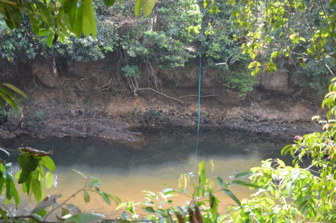
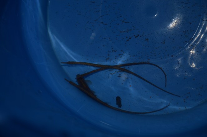
We visited Santeguli to meet the station staff, enquired about their data collection and to do some preliminary sampling of our own. River water near the bridge was clear at most locations. We encountered several animal signs as we walked up along the riverbank. There was an otter-like spraint (faecal matter), a common cobra’s (Naja naja) skin was found in a thorny bush, grass roots along the bank were devoured leaving aside green shoots by wild boars perhaps from the previous night. A racket tailed drongo (Dicrurus paradiseus) was a delightful sighting perched on a raktarjun tree (Terminalia elliptica) situated on the other bank. We sat just below the bridge observing fishes. There were many slender Rasbora (Rasbora daniconius), filament barb (Dawkinsia filamentosa), tank goby (Glossogobius giuris), few Pethia species and a remarkable fish called pipefish (Microphis cuncalus) dwelling on the stream edges. We were thrilled to see this in a wild. This individual was a juvenile floating and subsiding, hiding in the submerged leaves.

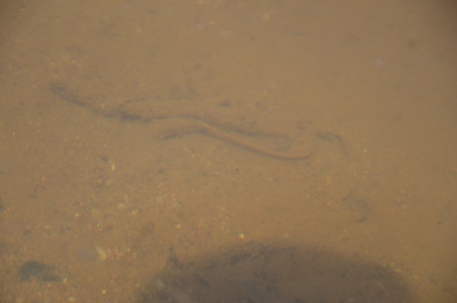
Pipefishes are marine dwellers, only few inhibit freshwater rivers and estuaries. Freshwater dwelling pipefishes are the only relative of Sea horse (Hippocampus sp). The mode of reproduction is Ovoviviparous that means they produce eggs but, instead of laying the eggs, the eggs develop within the mother’s body. The male carries the eggs in a brood pouch present under its tail prior to giving the live birth (Breder and Rosen, 1966).
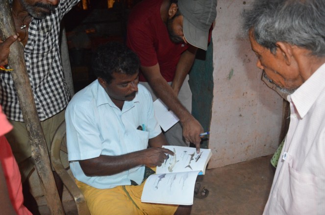
Informal conversations with local fisher folk gave us deep insights on the aquatic resources that they value not just because their livelihood is dependent on them but also for the sake of their own existence. We showed young boys at Aghanashini images of marine and freshwater fish, and almost everybody identified these fishes and provided us with local names for those species in a short while. At the end of this exercise, we listed out 30 odd species! It was refreshing to see these young men rooted in their fishing culture and did not give up their profession unlike many inland fishers.
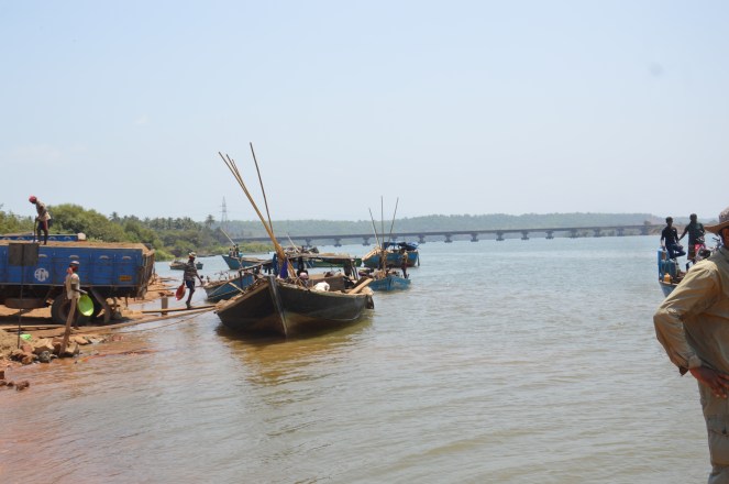
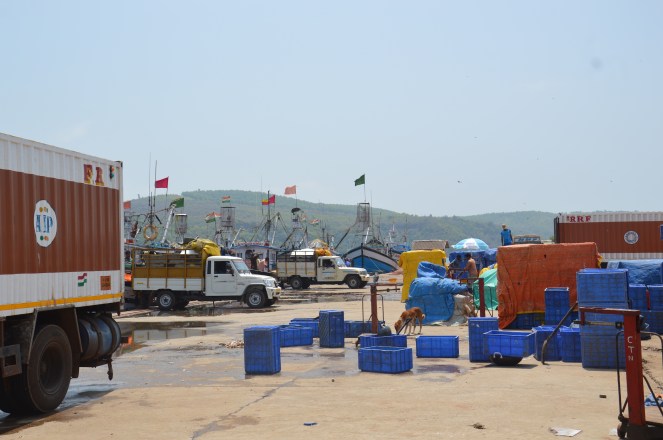
Tadadi port development at the mouth of Aghanashini and its implications to the local ecology
However, a bigger threat looms over the rich and biodiverse Aghanashini Estuary today in the form of Tadidi Port Development.
So far Karnataka state has one major port i.e. the Mangalore port. And several other ports are minor ports these includes Karwar port, Honnavar port and Tadadi port etc. Government of Karnataka (GoK) is planning to expand Tadadi port to make it a major port. Recently, there has been increasing emphasis on boosting infrastructure developmental projects by GoK. As a result, the GoK has set a target of 12% growth rate per annum to boost its various infrastructural projects in the state. The expansion of Tadadi port under Public Private Partnership is one such example. The idea is to boost cargo-handling work which include iron ore, coal and steel products. The proposed port is likely to have a capacity of about 34.25 million tonnes per annum (MTPA) to 62.36 MTPA to handle cargo. An estimated cost for this expansion will be Rs. 38,000, crores (Anonymous, 2015).
EIA study
In the year 2010, the National Environmental and Engineering Research Institute (NEERI), Nagpur started an environment impact assessment (EIA) study for the Tadri Port in the Aghanashini river estuary. The EIA report was submitted in the year 2015. The study was conducted in the post monsoon season and identified three alternative sites for the development of port. One site lies in the Mithal Gazani (N14.542 E74.364), second is at Small Hell beach (N14.516, E74.337) and third one is at Kagal (N14.498 E74.359). Of the three, the report finds Mithal Gazani site as an ideal for the port development in the future (Anonymous, 2015).
Damage to the local ecology
Tadadi port receive a special importance since the port is situated on the mouth of Aghanashini river. The project site falls under eco-sensitive area under Coastal Regulation Zone – CRZ I (A) and CRZ I (B)[ii] which means that major development on such areas should undergo a critical scrutiny from the Ministry of Environment and Forest and Climate Change (MOEFCC) before giving a clearance to the project. The current location of the port is N14.523 E74.355 and proposed location will be at N14.542 E74.364 which is situated at Mithal Gazani village north east of the current location.
If the Expert Appraisal Committee[iii] of MoEF for “Infrastructure and Miscellaneous Projects + CRZ” and the Ministry gives a green signal for the proposal for “Multi-purpose all weather port at Tadadi, Karnataka”, then the local ecology and dependent livelihood will be severely threatened. At present the bed depth measured near the proposed site ranges from 0.40 to 1.2 m which is unsuitable for a big vessel to pass. Therefore, additionally a depth up to 16 m will be dug up by dredging to allow at least 100,000 DWT vessels to pass and keel along the channel (Anonymous 2015). The carrying capacity of a ship (the amount of weight a cargo ship can safely carry) is referred as dead weight tonnage (DWT). This dredging will be a death knell to the unique estuarine habitat which is a nursery for not only the freshwater and estuarine fish, but marine fish as well.
If the port plans to expand its base at this location then the ship traffic will be rampant. As it will cut across the proposed Aghanashini Biodiversity Heritage Park, which presently occupy the central position adjacent to the river mouth.
The NEERI report acknowledges that the damage to the local ecology will be irreversible and therefore it suggest the development of the port along with the proposed Heritage Park. But all available evidence shows this is not feasible.
This might just sound fine on the paper but not on the ground as it will be an ecological disaster in the region:
- dredging operation might cause oil spill from the ship or cargo vessels that will cover the mudflat habitat where the edible bivalve reproduce as a result, the fragile mudflats eventually will vanish forever.
- sediment churning will make the water highly turbid and affect nursery ground for many marine/estuarine and freshwater fish species.
- the high sedimentation load is also likely to affect their navigation ability as many fish species sense their prey by using eye sight as well as through their lateral line (run horizontally along the mid-dorsal body) thereby reducing their feeding behaviour and migration from freshwater to sea and vice-versa.
Implications
The EIA report has grossly undermined the fish biodiversity of the region. Our recent systematic fish sampling effort in the pre-monsoon season in 2017 (from Santeguli to Aghanashini estuary) has shown more than fifty fish species which include fishes from the marine/estuarine and freshwater habitat.
EIA studies conducted so far clearly lack comprehensive ecological understanding and their appraisal therefore is seriously flawed and hence taking up the project under these circumstances would be disastrous for the people, the river, estuary and the environment.
The need of hour is to undertake multi-disciplinary long term research initiative involving local institutions such as research organizations, colleges and Universities, fishery and forest departments, fisher folks and port development authorities to safeguard this estuarine heritage for future generation to enjoy.
Aghanashini is one of the last remaining free flowing rivers in the country, a gem in the world Heritage Site of the Western Ghats and it deserves protection in its form for the current and future generations.
The last time when the MoEF’s EAC considered this project on Oct 24, 2016[iv], it concluded: “It was noticed that a number of representations have been received against the proposals. It was decided that the Member Secretary of the Committee would forward all the representation received against the project to the project proponents who would give a reply to the representations which would be examined by the members of the committee. Any decision will be taken thereafter.”
This means that there is still some hope and we urge people to write in large numbers to the EAC members raising concerns about this proposal.
Acknowledgements
I would like to thank Dr. Jagdish Krishnaswamy, Senior Fellow at Suri Sehgal Centre for Biodiversity Conservation and Dr. Shrinivas Badiger, Fellow at Land, Water and Livelihood program at Ashoka Trust for Research in Ecology and the Environment (ATREE), Bangalore for their guidance. Special thanks to Tarun Nair who accompanied me in carrying out the field survey and providing critical comments on earlier version of this article. Dr. MD Subhash Chandran from Centre for Ecological Science field station, Kumta for in-depth discussion on Aghanashini river and livelihood aspect. Last but not the least, I am grateful to Parineeta Dandekar and Himanshu Thakkar for providing useful references and valuable suggestions.
Vidyadhar Atkore (vidyadhar.atkore@atree.org)
PS: The EAC recommended the project for clearance in its meeting in Dec 2016, see: http://environmentclearance.nic.in/writereaddata/Form-1A/Minutes/160120174ZLWP9L4Finalmiutes12EAC.pdf
2. As can be seen from the screenshot of the MoEF’s site on May 11, 2019, the project is categorised as “Under Process in division” and has not yet been issued Environment Clearance letter. 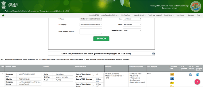
References
Anonymous (2015). Environmental Impact Assessment studies for Development of Sea Port at Tadadi, Karwar, Karnataka. Karnataka State Industrial and Infrastructural Development Corporation Ltd., Bangalore. CSIR-National Environmental Engineering Research Institute, Nehru Marg, Nagpur – 440 020. Pp567. See: http://environmentclearance.nic.in/writereaddata/EIA/17102015UREKTEFCRevisedTadadi-EIAreport-October2015.pdf
Atkore, V and Tarun Nair. 2016. Summary report: Field visit to Aghanshini River and estuary. Under the project titled “Assessing Ecosystem Responses and Socio-economic impacts of altered and free flowing rivers”, Norwegian Royal Embassy – ATREE, Bangalore. 19th to 24th March 2016. Pp 21.
Bhat, M. V. N. Nayak, M. D. Subhas Chandran and T. V. Ramachandra. 2014. Impact of hydroelectric projects on finfish diversity in the Sharavati River Estuary of Uttar Kannada District, central west coast of India. International Journal of Environmental Sciences. Vol. 5 (1): 1-9.
Bhoominathan M, G. Ravikumar, M. D. Subhas Chandran and T. V. Ramchandra. 2014. Impact of Hydroelectric Projects on Commercial bivalves in South Indian West Coast Estuary. Journal of Biodiversity. 5 (1, 2):1-9
Bhoominanthan M, M.D. Subhas Chadran, T. V. Ramchandra. 2008. Economic valuation of Bivalves in the Aghanashini estuary, west coast, Karnataka. ENVIS Technical Report No. 30. http://wgbis.ces.iisc.ernet.in/biodiversity/pubs/ETR/ETR30/index.htm
Pallavi A. 2014. Kagga in Peril. Down to Earth. http://www.downtoearth.org.in/coverage/kagga-in-peril-43130.
Bhat 2002. A study of the diversity and ecology of freshwater fishes of four river systems of the Uttara Kannada District, Karnataka, India. PhD thesis submitted to Centre for Ecological Sciences, Indian Institute of Science, Bangalore. Pp. 178.
Schlosser, I. J. (1991). Stream Fish Ecology: A Landscape Perspective. BioScience, 41(10), 704-712. DOI: 10.2307/1311765
END NOTES:
[i] https://www.internationalrivers.org/resources/where-rivers-run-free-1670
[ii] CRZ I A includes the areas that are ecologically sensitive and the geomorphological features which play a role in the maintaining the integrity of the coast and CRZ I B includes the areas between Low Tide and High Tide Line.
[iii] The EAC discussed this project in its meetings on Dec 21-22, 2015 and Oct 24, 2016, without recommending Environmental Clearance. So the Environmental Clearance has not yet been given.
[iv] See minutes of the EAC dated Oct 24, 2016 at: http://environmentclearance.nic.in/writereaddata/Form-1A/Minutes/15112016BJTRVQ92Minutes10EAC.pdf

Very nice n quite informative from various angles just I hv analysed the nomenclature of the term aghanashini which is a combination of two words i.e agha means sons n nashini means eradicating or destroying i.e destroying sons n I think mythological importance must be there behind this .my suggestion is make this paper be published in any reputed peer review journal
LikeLike
Many thanks, Mamjushree, great to see this. I did not know about the nomenclature… pls share if you have further info or reference or perspective. I am sure Vidyadhar, the author wil be publishing this elsewhere.
Himanshu Thakkar
LikeLike
Dear friend,
You have really done your work brilliantly.I was totally amazed to read your paper and quite surprised to know about the facts.It ia a piece of great imporatnce that need to known to public and govt bodies.The impact on environment,ecology,biodiversity and livelihood of natives of the village have been completely taken for granted.
I request you to put this article in news and social media so that something can be done for conservation
LikeLike
Dear Sir Himamshuji,
Compliments for the brilliant informative article on AGHANASHINI. Today we were shown equally brilliant documentary on free flowing river Aghanashini. The documentary is worth watching by any nature loving person.
I am benefited a lot by SANDRP works.This article by Vidyadhar needs appreciation.
Regards
Dr.Rajendra Poddar
Professor, University of Agricultural Sciences, Dharwad.
LikeLike