Arunachal Pradesh · Expert Appraisal Committee

Hydromania in Arunachal Pradesh: Massive 1850 MW Dam Planned Without Any Basic Data, Not even Water Flow Data…

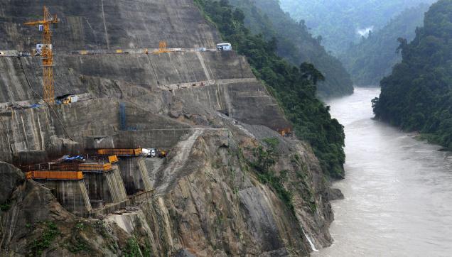
‘MoU Virus’ was the term used by former environment minister Jairam Ramesh in May 2008 to describe the speed at which the Memorandum of Understanding or MoUs for hydropower projects were signed by Arunachal Pradesh government. Five years after that virus attack, the ill-effects are clearly visible. The construction of Lower Subansiri hydropower project has been stopped for 26 months now. Environment and Forest clearances are yet to be accorded to 3000 MW Dibang Multipurpose dam, even though the foundation stone for this dam was laid by none other than the Prime Minister Dr. Manmohan Singh on 31st January 2008. Lower Siang hydropower project public hearing was vehemently opposed by people. But learning no lesson from these, the government of Arunachal Pradesh and the center is going ahead with its gigantic plan to make Arunachal Pradesh the ‘future powerhouse’ of the country. In doing so scientific studies and ground realities have been blatantly neglected.

Oju hydropower project in the Subansiri river basin with a proposed installed capacity of 1850 MW is the latest example of the hydromania, which has gripped the government of Arunachal Pradesh and the center. Oju HEP is the upper most project proposed on the Subansiri river in the Upper Subansiri district with a catchment area of 9827 sq. km. up to the dam site. The project was considered for Terms of Reference (TOR) or first stage of environmental clearance by the Expert Appraisal Committee on River Valley and Hydroelectric projects (EAC) in its 72nd meeting held on 20th and 21st February this year. But there is little information available about the actual situation of the project area.  Before going any further, consider the following situations –

Any scientific study is yet to be done at the dam site. Water flow data which is a prerequisite for construction of a hydropower dam is not available for the proposed dam site. No gauge and discharge measurement site at the project site or anywhere in the catchment of the dam.

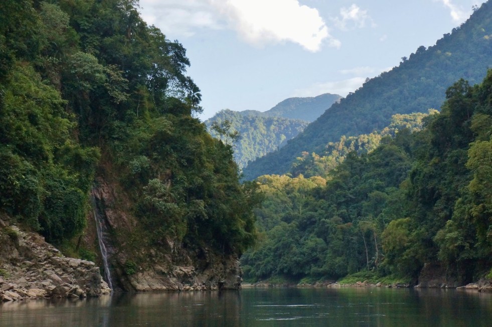
The project area is totally under forest cover. It holds rich biodiversity which is yet to be explored.

* There is no road to reach the project area. The distance between the dam site of Oju hydropower project and Limeking town, the last point of motarable road is 60 km. From Daporijo, the headquarters of Upper Subansiri district, the dam site is 210 km away. 

Tentative Road Network to Project Site Source: Oju PFR
Tentative Road Network to Project Site
Source: Oju PFR

A small hydropower project is proposed to be constructed in a nearby stream in order to fulfill the electricity requirement during the construction of the project.  

SNC-Lavalin, the consultants hired for preparation of detailed project report, is known to be one of most corrupt engineering firms in the world.

All the situations mentioned above are drawn from the project documents submitted to MoEF. It was shocking to find that without any environmental baseline assessment, the Pre Feasibility Report and Form I made all kinds of sweeping assertions. This hydromania is leading to nothing but ignorant, unscientific and corrupt decision making. 

SANDRP after reviewing the project documents, made a detailed submission to EAC on February 13th pointing out the critical issues related with Oju HEP. We asked the EAC not to consider the project for TOR clearance. We also demanded that the project proponent should  be  asked  to  get  at  least  five  years’  daily  water  flow, gauge, rainfall and sediment data at the project site before applying for TOR clearance. The critical issues mentioned in SANDRP’s submission on Oju HEP to EAC are listed below.

Critical Issues of Oju HEP

No More Projects Should be Cleared in Subansiri basin before Completion of Basin Study From 20007 to 2013, four projects in Subansiri basin has been considered by EAC along with one sub-basin study. All the four projects have been given TOR clearance. Subansiri Upper HEP has been given TOR extension on 6th June 2013. The total installed capacity of these projects are 4960 MW. It is also important to note that 2000 MW Lower Subansiri project is in under construction phase. This implies that nearly 6960 MW of capacity has already been given clearance by EAC without any cumulative impacts assessment study of Subansiri basin being completed through a participatory process. This capacity is in addition to the small hydropower projects in the basin.

The Subansiri sub-basin study was discussed for the first time in 68th EAC meeting in 2013. In that meeting the EAC had stated that “optimal number and locations of HEPs and similar projects to be planned in the basin conforming strictly to ecological and environmental sustainability is to be clearly delineated.” This can only be known once the basin study is completed.

In this situation, no more projects in Subansiri basin should be given any clearance till the cumulative study is being completed. Besides, the EAC must take into account the fact that cumulative impact assessment study of the basin is major demand of the organizations whose agitation has stopped the construction work of Lower Subansiri with the support of the people of Assam. Therefore it is very essential that a through and detailed cumulative impact assessment study is done for Subansiri in participation with all the people of the basin. Without this, clearances given to projects would face the same fate as the Lower Subansiri project is now facing: Work stopped for 26 months till now.

A list of projects cleared by EAC in Subansiri basin is given below.

Sl. No Project State Sub-Basin Ins Cap Status Meeting date Total Area Req. ha Forest Land, ha
1. Subansiri Lower AP Subansiri 2000 Under construction EC on 16-07-03 4111 4039.9
2. Subansiri Middle AP Kamla 1600 TOR Approved 25-09-10 3180 1333
3. Nalo HEP AP Subansiri 360 TOR Approved 11-12-11 662.94
4. Naba AP Subansiri 1000 TOR Approved 03-05-13 658
5. Subansiri Upper AP Subansiri 2000 TOR Ext Granted 06-06-13 3155 2170

Premature application Reading the PFR and Form I on the EAC website shows that project has come rather prematurely for TOR clearance. There is no gauge and discharge measurement site at the project site or anywhere in the catchment, the nearest site is at Upper Subansiri dam site with catchment area about 50% higher than that of Oju HEP. Even for this site, the flow measurement observations are available only for 6 years. How can optimum parameters of a massive project with 1850 MW capacity be formulated without any flow measurements, which is the most important parameter for hydropower project. Even now the flow measurements do not seem to have begun. There are no roads to the project area. It should be remembered that this is a virgin site, and there have been no environmental baseline assessments and yet the PFR and Form I are making all kind of sweeping assertions. The PP should be asked to get back with such an application only after they have at least five years of observation data of water flow and other parameters. That the application is premature is also apparent from the drastic changes the project capacity has gone through so far, as described in PFR. 

Oju HEP's nearest gauge is located in Menga, also the site for Subansiri Upper HEP. But there are four hydropower projects planned between Oju and Subansiri Upper.  Source: Form I of Oju HEP
Oju HEP’s nearest gauge station is located at Menga which the site for Subansiri Upper HEP. But there are four hydropower projects planned between Oju and Subansiri Upper. Source: Form I of Oju HEP

This premature-ness of the proposal is further confirmed when we see contradictory figures in the submitted documents about basic project parameters. For example dam height is given as 110 m (sec 8) at one place and 115 m at another place. Live Storage capacity is given as 2.065 MCM at some place, 3.3 MCM elsewhere (e.g. sec 4.4 of PFR). Power intake design discharge is given as 327.4 cumecs at some places and 333.39 cumecs elsewhere (e.g. sec 2.2 of Form 1).

Proposal in contradiction with Cumulative Impact Assessment This proposal before EAC for a 1850 MW Oju project is in contradiction with what is given in the Cumulative Impact Assessment (CIA) commissioned by the CWC and which was discussed in the 68th meeting of  EAC. The CIA says (see para 3 of Ex Summary) that there are two Oju projects: “Oju – I (1925 MW), Oju – II (2580 MW)”. However, the proposal now before the EAC is one project with capacity lower than any single project! However, Table on page 15 of CIA says Oju I has 700 MW and Oju II has 1000 MW capacity! The CIA says the submergence area of Oju I is 72.3 ha, though the proposal now before EAC for the same dam says the dam has submergence area of 42.3 ha! CIA says design flood is 10500 cumecs for Oju I (same dam as Oju now before EAC), but the proposal before EAC says PMF is much lower at 5983. This shocking series of numbers show that both the reports of Oju project before EAC and the CIA are misleading and do not seem to know what they are talking about. This is not an exhaustive list of contradictions, there are many more, this is only for illustration. 

Map of Subansiri RIver Basin  Source: https://sandrp.in/basin_maps/Subansiri_River_Basin.pdf
Map of Subansiri RIver Basin
Source: https://sandrp.in/basin_maps/Subansiri_River_Basin.pdf

Proposal different than allotment The PP was allotted two separate projects Oju I and II by Arunachal Pradesh government, but they have decided to club the two, but there is no agreement between Arunachal Pradesh and PP for the new parameters in the project proposed before EAC. Without such an agreement, EAC consideration of the project would be vacuous.

Huge Land Requirement The Form I of Oju project states that the area which will come under submergence due to the formation of the reservoir excluding the river bed is 34.3 ha. Including the river bed the total submergence is 43.2 ha. But the total land requirement is 760 ha implying that the required for dam, water conductor system, power house and other project appurtenances is about 727 ha. It is not clear why 760 ha of land is required for the project when reservoir submergence is 43.2 ha.

Contradictory figures about Land Requirement The Form I in the table providing basin information about the project states that “The total land to be acquired for the project is 760 ha.” But the PFR in section 12.2 in page 15 states “It is estimated that about 790 Ha of land would be required for development of the Project.” This shows that the project proponent is not clear about the land requirement for the project. 

Threat to Huge Forest area The construction of Oju HEP will be a threat to a huge forest area. Page 17 the Form I states “…760 ha of land with forest cover is to be acquired for the project. Forest cover is also observed within the project as well as area within 15 km from the project site.” But the PFR does not specify how much forest area will be actually diverted. 

River Subansiri flowing through its lush green valley

Installed Capacity is more than 1850 MW The installed capacity of Oju project is more than 1850 MW since a dam toe power house of 28 MW is also planned. This makes the total installed capacity in 1878 MW. The documents in most of the places mentioned installed capacity of the project as 1850 MW. The EAC therefore should ask the project proponent to apply for fresh TOR clearance with renewed installed capacity.

Oju Project Proponent aims to Construct Three Projects in the Name of One: Small Hydro project to Power the Construction Work The EAC should take a note that project proponent of Oju, is aiming to construct three hydro power projects in the name of one. We have already mentioned about the first two. Now in section 10.7 of page 10-7, the PFR documents states “The power requirement for construction activities is estimated to about 25.0 MVA taking into consideration the capacity of electric driven equipments which are to work during the construction period and lighting. The possibility of constructing small hydro power plants on streams in the vicinity of the project would also be explored at DPR stage.”

The Form I also mentioned about small HEP in page 10 -“The estimated peak requirement of power is about 25MW required for construction activity of major works such as tunnels, adits, barrage area and power house complex. Construction power requirement is proposed to be met by DG Sets/Small HEP.” Full details including impact assessment of this small HEP should be included in the TOR.

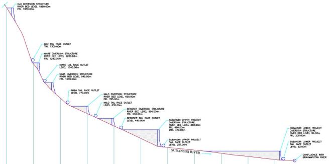
Stretch of Free Flowing River between Two Projects on Subansiri It is not clear how much flowing river stretch is available between Oju and downstream Nare HEP. According to the minimalist norms followed by EAC the free flowing stretch between two projects should be minimum one kilometer. But the PFR of Oju HEP have not clearly mentioned this distance anywhere. The Cascade development figure given in the PFR says that the elevation difference between TWL of Oju (1300 m) and FRL of Nare (1280 m) is just 20 m. If we look at the average slop at the site, this translates to about half a km. The PP should be asked to change the parameters to increase this to more than a km at least.

It is also important to specify this distance between two projects because of the cumulative impacts of the project. The Siang basin study in its recent version, which will be discussed in the same 72nd EAC meeting has asked to change the FRL and TWL of some of the projects because they have not kept minimum distance of one kilometer between projects. The basin study report in section 12.1.3 stated “…..it is recommended that FRL of three projects viz. Tato II, Naying and Siyom Middle should be slightly reduced so that free flowing river stretches of 1 Km can be maintained between FRL and TWL of these four projects in cascade.”

Therefore Oju HEP PFR should clearly mention the distance between its TWL and FRL of the downstream project. EAC also should make this compulsory for all the projects in other river basins.

Form I and PFR contradictory about the Generating Units The Form I of Oju HEP in page 20 states that the installed capacity of 1850 MW will be generated through eight units of 231.25 MW each. But PFR on the other hand, in section 9 of page 8 states “The underground powerhouse, housing eight units of 225 MW each, is proposed on the right bank of the river Subansiri.” It is surprising to find such contradictions in the Form I and PFR of Oju project.

The PFR in page 13 again states “As mentioned earlier, project’s installed capacity has been fixed at 1850 MW and correspondingly, eight generating units of 231.25 MW, each, are proposed in the powerhouse.”

Huge Diversion of the River The Oju HEP will divert a huge length of the river. Page 1 of the PFR states, “The dam site is located at about 60 km upstream of Limeking and powerhouse site is located at about 40 km upstream of Limeking on the right bank of Subansiri river.” This implies that the river has been diverted for 20 km between the dam site and the power house (The head race length is 14.82 km). . This is a huge diversion of the river Subansiri which will have disastrous impacts on the health and ecosystem of the river. But neither the Form I nor the PFR provide what is the length of the river to be diverted for the project.

Subansiri carries significant amount of sediment The PFR report of Oju project in section 7.5.2 states “Since Subansiri River is expected to carry some amount of sediment during monsoons, effective management of sediment removal from the reservoir should be ensured.” Stating that the river carries some sediment is not correct since this river system is known for high sedimentation due to its location in the young Himalayan mountain range.

Reference to this can be found in the January-March, 2003 issue Ecologist Asia (page 12) which was focused on dams in northeast “The catchments of the Brahmaputra and its tributaries show significantly high rates of basin denudation especially after the great earthquake of 1950. The catchments of the Subansiri, Jia Bharali and the Manas along with the Dihang (Siang) are estimated to have experienced an average denudation of 73-157 cm./1000 years over just 24 years (1955-79). The increasing amounts of sediment and water yields downstream indicate an increase in sediment yield by a whopping 240% accompanied by an equally significant rise of nearly 120% in water yield during the period 1971-1979 between Tsela D’Zong (China) and Ranaghat (India).

Therefore first the sediment flow should be properly assessed.

Detailed and Thorough Options Assessment A detailed and through options assessment should be done for Oju project. There can be several other cost effective options for power generation in this area and options assessment should look into all such options. The options assessment should also look at whether the local people or the state needs such a huge capacity hydropower project.

It is important here to note that successful sub-megawatt capacity hydropower projects (Less than 1 MW) are currently under operation in Anjaw district of Arunachal Pradesh. (see – Anjaw shines in hydro power sector).

The TOR for the project does not include the following key aspects:

1. Issues related to cumulative impact assessment due to various components of the project and various projects in the basin.

2. The disaster vulnerability of the area on various aspects like landslides, earthquakes, floods, etc and how these will change with changing climate and how the project will change the disaster vulnerability of the area. There should be a separate chapter in EIA on this.

3. The project should do actual environment flow assessment and not just take the EAC norms as given. There should be separate chapter in EIA on this. The statement in Form 1 section 1.24 “Environmental Flows as per MOEF norms shall be released” is thus clearly premature and unwarranted. Eflows should be on daily changing basis and not seasonal averages.

4. Full Downstream social and environmental Impact Assessment

5. Impacts Peaking Power Operations

6. Assessment of impact of reservoir operation and mechanism to achieve transparent, accountable reservoir operation.

7. Impacts of Silt Management operations at various points of time and space.

8. Impacts of Tunneling and Blasting

9. Impacts of Mining of materials for the project.

10. Impacts of Backwater Effects of the reservoir in flood season

11. Impacts of Climate Change on dam

12. Impacts of the project on the adaptation capacity of the people in view of changing climate

13. Impact of peaking operation of the project on downstream areas and communities

No de-sanding chambers proposed in Silt Laden River The PFR in section 7.5.2 in page 7-5 states that “In this regard, it may be noted that no de-sanding chambers are proposed in the project in view of a relatively high dam with reservoir extending to almost 3.13 km.” Keeping no provision of de-sanding or de-silting chamber in the dam could have serious impacts on reservoir operations.

Form 1 undertaking not signed Page 2 of Form 1 is supposed to be an undertaking about the accuracy of information in Form 1, but there is no name, place or date for the signatory, all places are blank.

Poor reputation of consultants The PP has hired SNC Lavalin as consultant for DPR. However, SNC Lavalin has poor reputation in their country of origin (Canada[1]), globally[2] and even in Indian state of Kerala[3]. How dependable would the work of such an agency be is a big question mark.

Parag Jyoti Saikia (with inputs from Himanshu Thakkar)


[1] Out of  over 250 companies on World Bank’s current black listed from bidding on its global projects under its fraud and corruption policy, 115 are from SNC Lavalin and its affiliates, see: http://business.financialpost.com/2013/09/18/canada-now-dominates-world-bank-corruption-list-thanks-to-snc-lavalin/

[2] See: http://www.huffingtonpost.ca/daniel-tencer/snc-lavalin_b_4110591.html, the company has been banned by the World Bank due to corruption issues: “SNC-Lavalin, the engineering giant based out of Montreal that has now pretty much become a national (and international) embarrassment.” Its CEO has been arrested more than once for corruption charges.

[3] See: http://en.wikipedia.org/wiki/SNC_Lavalin_scandal, there was a CBI inquiry in relation to hydropower projects related work and several politicians have been charge sheeted.

Arunachal Pradesh · Environment Impact Assessment · Expert Appraisal Committee · Hydropower

Subansiri Basin Study – Another Chapter of Environment Subversion in Northeast

The Study The study has been done by IRG Systems South Asia Private Limited (http://www.irgssa.com/, a subsidiary of US based IRG Systems) and http://www.eqmsindia.com/[i]. It is supposed to be a Cumulative Impact Assessment of 19 HEPs planned in the basin, out of which PFRs of 7 are available, DPR of two, and one of which, the 2000 MW Subansiri Lower HEP is under construction.

Subversion of Environment Governance in the Subansiri basin While looking at this basin study, the subversion of environment governance in Subansiri basin this very millennia should be kept in mind. A glimpse of it is provided in Annexure 1. In fact, one of the key conditions of environmental clearance to the 2000 MW Lower Subansiri HEP was that no more projects will be taken up in the basin upstream of the Lower Subansiri HEP, which essentially would mean no more projects in the basin, since LSHEP is close to the confluence of the Subansiri River with Brahmaputra River. That condition was also part of the Supreme Court order in 2004. The need for a carrying capacity study was also stressed in the National Board of Wild Life discussions. We still do not have one. In a sense, the Subansiri basin is seeing the consequences of that subversion.

Map of Subansiri RIver Basin  Source: https://sandrp.in/basin_maps/Subansiri_River_Basin.pdf
Map of Subansiri RIver Basin
Source: https://sandrp.in/basin_maps/Subansiri_River_Basin.pdf

Information in public domain not known to consultants The report does not even state that Middle Subansiri dam have also been recommended TOR in 41st EAC meeting in Sept 2010. This project will require 3180 ha of land, including 1333 Ha forest land, and 2867 ha area under submergence. Even about Upper Subansiri, the consultants do not know the area of forest land required (2170 ha). So the consultants have not used even the information available in public domain in EAC meetings.

Study based on flawed and incomplete Lohit Basin Study The Study claims that it is based on Lohit Basin Study done by WAPCOS. Lohit Basin Study is an extremely flawed attempt and does not assess cumulative impacts of the cascade projects. Civil society has written about this to the EAC and the EAC itself has considered the study twice (53rd and 65th EAC Meetings), and has not accepted the study, but has raised several doubts. Any study based on a flawed model like Lohit Basin Study should not be acceptable.

A house in the upstream of Subansiri River  Source: http://cooperfreeman.blogspot.in/2012/12/the-wild-east-epic.html
A house in the upstream of Subansiri River
Source: http://cooperfreeman.blogspot.in/2012/12/the-wild-east-epic.html

No mention of Social impacts Major limitation of the study has been absolutely no discussion on the severe social impacts due to cumulative forest felling, flux of population, submergence, livelihoods like riparian farming and fishing, etc. Though this has been pointed out by the TAC in its meeting and field visit, the report does not reflect this.

Some key Impacts Some of the impacts highlighted by the study based on incomplete information about HEPs are:

Þ    The length of the river Subansiri is 375 km up to its outfall in the Brahamaputra River. Approximately 212.51 km total length of Subansiri will be affected due to only 8 of the proposed 19 HEPs in Subansiri River basin.

Þ    Total area brought under submergence for dam and other project requirements is approx. 10, 032 ha of eight proposed HEPs. The extent of loss of forest in rest of the 9 projects is not available.

Þ    62 species belonging to Mammals (out of 105 reported species), 50 Aves (out of 175 reported species) and 2 amphibians (out of 6 reported species) in Subansiri Basin are listed in Schedules of Wildlife Protection Act, 1972 (as amended till date).

Þ    99 species belonging to Mammals (out of 105 reported species), 57 species belonging to Aves (out of 175 reported species), 1 Reptilian (out of 19 reported species), 2 Amphibians (out of 6 reported species), 28 fishes (out of 32 reported species), 25 species belonging to Odonata of Insecta fauna group (out of 28 reported species) are reported to be assessed as per IUCN’s threatened categories.

Even this incomplete and partial list of impacts should give an idea of the massive impacts that are in store for the basin.

Cumulative impacts NOT ASSESSED Specifically, some of the cumulative impacts that the report has not assessed at all or not adequately include:

1. Cumulative impact of blasting of so many tunnels on various aspects as also blasting for other project components.

2. Cumulative impact of mining of various materials required for the projects (sand, boulders, coarse and fine granules, etc.)

3. Cumulative impact of muck dumping into rivers (the normal practice of project developers) and also of also muck dumping done properly, if at all.

Subansiri River in the Upper Reaches  Source: Lovely Arunachal
Subansiri River in the Upper Reaches
Source: Lovely Arunachal

4. Changes in sedimentation at various points within project, at various points within a day, season, year, over the years and cumulatively across the basin and impacts thereof.

5. Cumulative impact on aquatic and terrestrial flora and fauna across the basin due to all the proposed projects.

6. Cumulative impact of the projects on disaster potential in the river basin, due to construction and also operation at various stages, say on landslides, flash floods, etc.

7. Cumulative dam safety issue due to cascade of projects.

8. Cumulative change in flood characteristics of the river due to so many projects.

9. Cumulative impacts due to peaking power generation due to so many projects.

10. Cumulative sociological impact of so many projects on local communities and society.

11. Cumulative impact on hydrological flows, at various points within project, at various points within a day, season, year, over the years and cumulatively across the basin and impacts thereof. This will include impacts on various hydrological elements including springs, tributaries, groundwater aquifers, etc. This will include accessing documents to see what the situation BEFORE project and would be after. The report has failed to do ALL THIS.

12. Impact of silt laden water into the river channel downstream from the dam, and how this gets accumulated across the non-monsoon months and what happens to it. This again needs to be assessed singly and cumulatively for all projects.

13. Impact of release of silt free water into the river downstream from the power house and impact thereof on the geo morphology, erosion, stability of structures etc, singly and cumulatively.

14. Impact on Green House Gas emissions, project wise and cumulatively. No attempt is made for this.

15. Impact of differential water flow downstream from power house in non-monsoon months, with sudden release of heavy flows during peaking/ power generation hours and no releases during other times.

16. Cumulative impact of all the project components (dam, tunnels, blasting, power house, muck dumping, mining, road building, township building, deforestation, transmission lines, etc.,) for a project and then adding for various projects. Same should also be done for the periods during construction, operation and decommissioning phases of the projects.

17. Cumulative impact of deforestation due to various projects.

18. Cumulative impact of non compliance of the environment norms, laws, Environment clearance and forest clearance conditions and environment management plans. Such an assessment should also have analysed the quality of EIA report done for the Subansiri Lower hydropower project.

Wrong, misleading statements in Report There are a very large number of wrong and misleading statements in the report. Below we have given some, along with comment on each of them, this list is only for illustrative purposes.

Sr No

Statement in CIA

Comment

1 “During the monsoon period there will be significant discharge in Brahmaputra River. The peaking discharge of these hydroelectric projects which are quite less in comparison to Brahmaputra discharge will hardly have any impact on Brahmaputra.” This is a misleading statement. It also needs to be assessed what will be the impact on specific stretches of Subansiri river. Secondly, the projects are not likely to operate in peaking mode in monsoon.
2 “However, some impact in form of flow regulation can be expected during the non-monsoon peaking from these projects.” This is not correct statement as the impact of non-monsoon peaking is likely to be of many different kinds, besides “flow regulation” as the document describes.
3 “Further, during the non-monsoon period the peaking discharge release of the projects in upper reaches of Subansiri basin will be utilized by the project at lower reaches of the basin and net peaking discharge from the lower most project of the basin in general will be the governing one for any impact study.” This is again wrong. What about the impact of such peaking on rivers between the projects?
4 “The construction of the proposed cascade development of HEPs in Subansiri basin will reduce water flow, especially during dry months, in the intervening stretch between the Head Race Tunnel (HRT) site and the discharge point of Tail Race Tunnel (TRT).” This statement seems to indicate that the consultants have poor knowledge or understanding of the functioning of the hydropower projects. HRT is not one location, it is a length. So it does not make sense to say “between HRT and the discharge point of TRT”.
5 “For mature fish, upstream migration would not be feasible. This is going to be the major adverse impact of the project. Therefore, provision of fish ladder can be made in the proposed dams.” This is simplistic statement without considering the height of the various dams (124 m high Nalo HEP dam, 237 m high Upper Subansiri HEP dam, 222 m high Middle Subansiri HEP dam), feasibility of fish ladders what can be optimum design, for which fish species, etc.
6 “…water release in lean season for fishes may be kept between 10-15% for migration and sustaining ecological functions except Hiya and Nyepin HEP. Therefore, it is suggested that the minimum 20% water flow in lean season may be maintained at Hiya and Nyepin HEP for fish migration.” This conclusion seems unfounded, the water release suggested is even lower than the minimum norms that EAC of MoEF follows.

Viability not assessed The report concludes: “The next steps include overall assessment of the impacts on account of hydropower development in the basin, which will be described in draft final report.”

One of the key objective of the Cumulative Impact assessment is to assess how many of the planned projects are viable considering the impacts, hydrology, geology, forests, biodiversity, carrying capacity and society. The consultants have not even applied their mind to key objective in this study. They seem to assume that all the proposed projects can and should come up and are all viable. It seems the consultant has not understood the basic objectives of CIA. The least the consultant could have said is that further projects should not be taken up for consideration till all the information is available and full and proper Cumulative impact assessment is done.

The consultants have also not looked at the need for free flowing stretches of rivers between the projects.

Section on Environmental Flows (Chapter 4 and 9): The section on Environmental flows is one of the weakest and most problematic sections of the report, despite the fact that the Executive summary talks about it as being one of the most crucial aspects.

The study does not use any globally accepted methodology for calculating eflows, but uses HEC RAS model, without any justification. The study has not been able to do even a literature review of methodologies of eflows used in India and concludes that “No information/criteria are available for India regarding requirement of minimum flow from various angles such as ecology, environment, human needs such as washing and bathing, fisheries etc.”

This is unacceptable as EAC itself has been recommending Building Block Methodology for calculating eflows which has been used (very faultily, but nonetheless) by basin studies even like Lohit, on which this study is supposedly based. EAC has also been following certain norms about E flow stipulations. CWC itself has said that minimum 20% flow is required in all seasons in all rivers. BK Chaturvedi committee has recently stipulated 50% e-flows in lean season and 30% in monsoon on daily changing basis.

The assumption of the study in its chapter on Environmental Flows that ‘most critical reach is till the time first tributary meets the river” is completely wrong. The study should concentrate at releasing optimum eflows from the barrage, without considering tributary contribution as an excuse.

First step of any robust eflows exercise is to set objectives. But the study does not even refer to this and generates huge tables for water depths, flow velocity, etc., for releases ranging from 10% lean season flow to 100% lean season flow.

After this extensive analysis without any objective setting, the study, without any justification (the justification for snow trout used is extremely flawed. Trouts migrate twice in a year and when they migrate in post monsoon months, the depth and velocity needed is much higher than the recommended 10% lean season flow) recommends “In view of the above-said modeling results, water release in lean season for fishes maybe kept between 10-15% for migration and sustaining ecological functions except Hiya and Nyepin HEP. Therefore, it is suggested that the minimum 20-25% water flow in lean season may be maintained at all HEP for fish migration and ecological balance.”

The study does not recommend any monsoon flows. Neither does it study impact of hydro peaking on downstream ecosystems.

Shockingly, the study does not even stick with this 20-25% lean season flow recommendation (20-25% of what? Average lean season flow? Three consecutive leanest months? The study does not explain this). In fact in Chapter 9 on Environmental Flows, the final recommendation is: “Therefore, it is suggested that the minimum 20-25% water flow in lean season may be maintained at Hiya and Nyepin  HEP or all other locations for fish migration.” (emphasis added)

So it is unclear if the study recommends 20-25% lean season flows or 10-15% lean season flows. This is a very flawed approach to a critical topic like eflows.

The study keeps mentioning ‘minimum flows’ nomenclature, which shows the flawed understanding of the consultants about e-flows.

The entire eflows section has to be reworked, objectives have to be set, methodology like Building Block Methodology has to be used with wide participation, including from Assam. Such exercises have been performed in the past and members of the current EAC like Dr. K.D. Joshi from CIFRI have been a part of this. In this case, EAC cannot accept flawed eflows studies like this. (DR. K D. Joshi has been a part of a study done by WWF to arrive at eflows through BBM methodology for Ganga in Allahabad during Kumbh: Environmental Flows for Kumbh 2013 at Triveni Sangam, Allahabad and has been a co author of this report)

Chocolate Mahseer in Subansiri  Source: http://www.flickr.com/photos/8355947@N05/7501485268/
Chocolate Mahseer in Subansiri
Source: http://www.flickr.com/photos/8355947@N05/7501485268/

Mockery of rich Subansiri Fisheries Subansiri has some of the richest riverine fisheries in India. The river has over 171 fish species, including some species new to science, and forms an important component of livelihood and nutritional security in the downstream stretches in Assam.

But the study makes a mockery of this saying that the livelihoods dependence on fisheries is negligible. The entire Chapter on Fisheries needs to be reworked to include impacts on fisheries in the downstream upto Majuli Islands in Assam at least.

No mention of National Aquatic Animal! Subansiri is one of the only tributaries of Brahmaputra with a resident population of the endangered Gangetic Dolphin, which is also the National aquatic animal of India (Baruah et al, 2012, Grave Danger for the Ganges Dolphin (Platanista ganegtica) in the Subansiri River due to large Hydroelectric Projecthttp://link.springer.com/article/10.1007/s10669-011-9375-0#).

Shockingly, the Basin Study does not even mention Gangetic Dolphin once in the entire study, let alone making recommendations to protect this specie!

Gangetic Dolphin is important not only from the ecological perspective, but also socio cultural perspective. Many fisher folk in Assam co-fish with the Gangetic River Dolphin. These intricate socio ecological links do not find any mention in the Basin study, which is unacceptable.

Agitation Against Lower Subansiri Dam in Assam Source: SANDRP
Agitation Against Lower Subansiri Dam in Assam
Source: SANDRP

Lessons from Lower Subansiri Project not learnt A massive agitation is ongoing in Assam against the under construction 2000 MW Subansiri Lower HEP. The people had to resort to this agitation since the Lower Subansiri HEP was going ahead without studying or resolving basic downstream, flood and safety issues. The work on the project has been stopped since December 2011, for 22 months now. In the meantime several committee have been set up, several changes in the project has been accepted. However, looking at this shoddy CIA, it seems no lessons have been learnt from this ongoing episode. This study does not even acknowledge the reality of this agitation and the issues that the agitation has thrown up. There is no reflection of the issues here in this study that is agitating the people who are stood up against the Lower Subansiri HEP. The same people will also face adverse impacts of the large number of additional projects planned in the Subansiri basin. If the issues raised by these agitating people are not resolved in credible way, the events now unfolding in Assam will continue to plague the other planned projects too.

Conclusion From the above it is clear that this is far from satisfactory report. The report has not done proper cumulative assessment on most aspects. It has not even used information available in public domain on a number of projects. It does not seem to the aware of the history of the environmental mis-governance in the SubansiriBasin as narrated in brief in Annexure 1. For most projects basic information is lacking. Considering the track record of Central Water Commission functioning as lobby FOR big dams, such a study should have never been given to CWC. One of the reasons the study was assigned by the EAC to the Central Water Commission was that the CWC is supposed to have expertise in hydrological issues, and also can take care of the interstate issues. However, the study has NOT been done by CWC, but by consultants hired by CWC, so CWC seems to have no role in this except hiring consultant. So the basic purpose of giving the study to CWC by EAC has not been served. Secondly the choice of consultants done by the CWC seems to be improper. Hence we have a shoddy piece of work. This study cannot be useful as CIA and it may be better for EAC to ask MoEF for a more appropriate body to do such a study. In any case, the current study is not of acceptable quality.

South Asia Network on Dams, Rivers & People (https://sandrp.in/https://sandrp.wordpress.com/)

ANNEXURE 1

Set Conditions to be waived Later – The MoEF way of Environmental Governance

In 2002, the 2,000 MW Lower Subansiri hydroelectric project on the Assam-Arunachal Pradesh border came for approval to the Standing Committee of the Indian Board for Wildlife (now called the National Board for Wildlife) as a part of the Tale Valley Sanctuary in AP was getting submerged in the project. The total area to be impacted was 3,739.9 ha which also included notified reserved forests in Arunachal Pradesh and Assam.  The Standing Committee observed that important wildlife habitats and species well beyond the Tale Valley Sanctuary, both in the upstream and downstream areas, would be affected (e.g. a crucial elephant corridor, Gangetic river dolphins) and that the Environmental Impact Assessment studies were of a very poor quality. However, despite serious objections raised by non-official members including Bittu Sahgal, Editor, Sanctuary, Valmik Thapar, M.K. Ranjitsinh and the BNHS, the Ministry of Environment & Forests (MoEF) bulldozed the clearance through in a May 2003 meeting of the IBWL Standing Committee. Thus a project, which did not deserve to receive clearance, was pushed through with certain stringent conditions imposed (Neeraj Vagholikar, Sanctuary Asia, April 2009).

Lower Subansiri HEP Source: The Hindu
Lower Subansiri Dam
Source: The Hindu

The EC given to the project was challenged in Supreme Court (SC) by Dr L.M Nath, a former member of the Indian Board for Wildlife. Nath pleaded, these pristine rich and dense forests classified as tropical moist evergreen forest, are among the finest in the country. Further the surveys conducted by the Botanical Survey of India and the Zoological Survey of India were found to be extremely poor quality. The Application mentions that the Additional DG of Forests (Wildlife) was of the view that the survey reports of the BSI and ZSI reports were not acceptable to him because these organisations had merely spent five days in the field and produced a report of no significance.

The SC gave its final verdict on 19-4-2004, in which the Court upheld the EC given by MoEF to NHPC but with direction to fulfill some important conditions. Out these conditions there were two conditions which were very significant – “The Reserve Forest area that forms part of the catchment of the Lower Subansri including the reservoir should be declared as a National Park/ Sanctuary. NHPC will provide funds for the survey and demarcation of the same.”, and “There would be no construction of dam upstream of the Subansri River in future.” These conditions were also mentioned in the original EC given to the project in 2003.

In May 2005, two years after the EC was given the Arunachal Pradesh govt and NHPC approached the SC to waive or modify the above two conditions. The state government calimed that following these conditions would imply loss of opportunity to develop 16 mega dams in the upstream of Lower Subansiri (this including 1,600 MW Middle Subansiri and 2,000 MW Upper Subansiri to be developed by NHPC). The SC sent it back to National Board for Wildlife to review the conditions.

The petition was done strategically. “The strategy of the dam proponents is simple. They raised no objection to the terms until the construction of the Lower Subansiri project had proceeded beyond a point when it could have been cancelled. Armed with this fait accompli, they asked for a review of the clauses on the very basis on which the original clearance – laid down by members who were subsequently dropped from the wildlife board – was granted.”[ii]

Then nonofficial members of NBWL expressed their dissent to the proposal. In a May 2008 communication to the Chairman of the NBWL Standing Committee, member Dr. Bibhab Talukdar observed: “If the Standing Committee agrees to waive the conditions, we would be setting a dangerous precedent and sending a wrong signal regarding the credibility of decision-making by us. This would mean that projects impacting rich wildlife habitats can receive clearances based on stringent conditions, only to be up for review later. Such an approach is undesirable both from a perspective of good governance as well as the long-term interest of wildlife in the country.”

Dr. Asad Rahmani of the BNHS, who was part of a sub-committee of the NBWL Standing Committee conducting a site visit to the project area, stated in his report: “Under no circumstances should new projects be allowed in the Subansiri river basin until an advance cumulative assessment of proposed projects and a carrying capacity study of the Subansiri river basin are completed.”

In the December 12 2008 meeting of NBWL Standing Committee, even after these dissenting opinions from nonofficial members MoEF managed to do a dilution of the above two conditions. Assam that time was witnessing a major protest concerning the downstream impacts of Lower Subansiri HEP but it was not even consulted. Shockingly the “no dam upstream” condition was removed and it was decided that “any proposal in the upstream of the SubansiriRiver would be considered independently on its merit by the Standing Committee as and when submitted by the proponents”.

Now the Arunachal Pradesh government needs to declare a smaller area of 168 sq. km. as a sanctuary and “make serious efforts” to bring an additional 332 sq. km. reserved forest under the category of Conservation Reserve (CR) in consultation with the MoEF. The latter part of the condition (declaration of CR) is non-enforceable because of the choice of words. Even the demand to at least conduct an advanced cumulative impact assessment of proposed projects and a carrying capacity study of the Subansiri river basin has been ignored[iii].

As Bittu Sahgal, Editor, Sanctuary Asia says, “The Lower Subansiri is one such, where the PMO has placed a very dubious role in forcing clearances, agreeing to clearance conditions and then starting the project, only to loosen the environmental conditions. In this whole scam the Zoological Survey of India and the Botanical Survey of India have been co-conspirators that have suppressed the ecological value of the forests to facilitate the building of the dam, which will drown pristine elephant, tiger and clouded leopard forests and cause havoc downstream as well.”

The above sequence of events are very pertinent to remember as we see the Subansiri basin study.

END NOTES:


[i] Website says: “More than 200 successful environmental Impact Assessment Clearance from Ministry of Environment & Forests, Government of India for Industry, Infrastructure & Construction projects” Sounds strange from an EIA consultant.

[iii] For more details please see – “Forest Case Update”, Issue 1, June 2004 and “The Subansiri Subversion” by Neeraj Vagholikar published in Sanctuary Asia, April 2009 issue