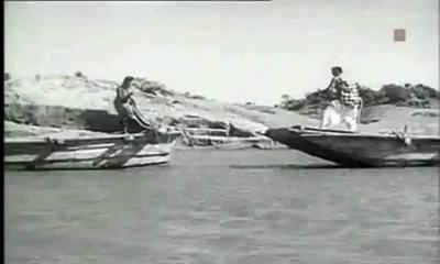
Who has not seen a river? And who has then, not been moved by a fierce emotion? The common man sees its life granting blessed form, the government or CWC engineer sees in it as a potential dam project, the hydropower developers a site for hydro project, a farmer his crop vitality, fisher folk, boatspeople and river bed cultivators a source of livelihood, the industry & urban water utilities view it as their personal waste basket, the real estate developer as a potential land grab site, a sand miner as a source of sand and the distraught villager his lifeline. In earlier days, film makers used to see it as site for filming some memorable songs, but these days even that has become a rarity.[1]
Song “Nadi Naare na jaao” from Film Mujhe Jeene do
Rivers truly are a complex entity that invoke varied emotions and responses!
A river shifts in colour, shape, size, flow pattern of water, silt, nutrients and biota, in fact all its variables seem to change with time and space. The perceptions differ as one moves from mountains to plains to the deltas. The same stream displays a wide variance of characteristics that depend upon the land it flows through and the micro climate along its banks. Rivers many a times seem to mirror the local flavour of the land they flow through. Or is it the local flavour that changes with river flow? Clearly both are interdependent.
Today, as we talk of rivers, their rejuvenation and try to figure out their ecological flow and their health quotient , a good beginning to understand the existing rivers would be their classification modules. What defines a river? Which factors are used for their classification? How do we actually classify our rivers?
As far as the first of these questions is concerned, none of the official agencies have tried to define a river!
Possiby, the first post independence classification of river basins was attempted in 1949 by precuser institute of current Central Water Commission (CWC). Since then various organisations have followed their own methodology and criteria for basin classification and arrived at different numbers.
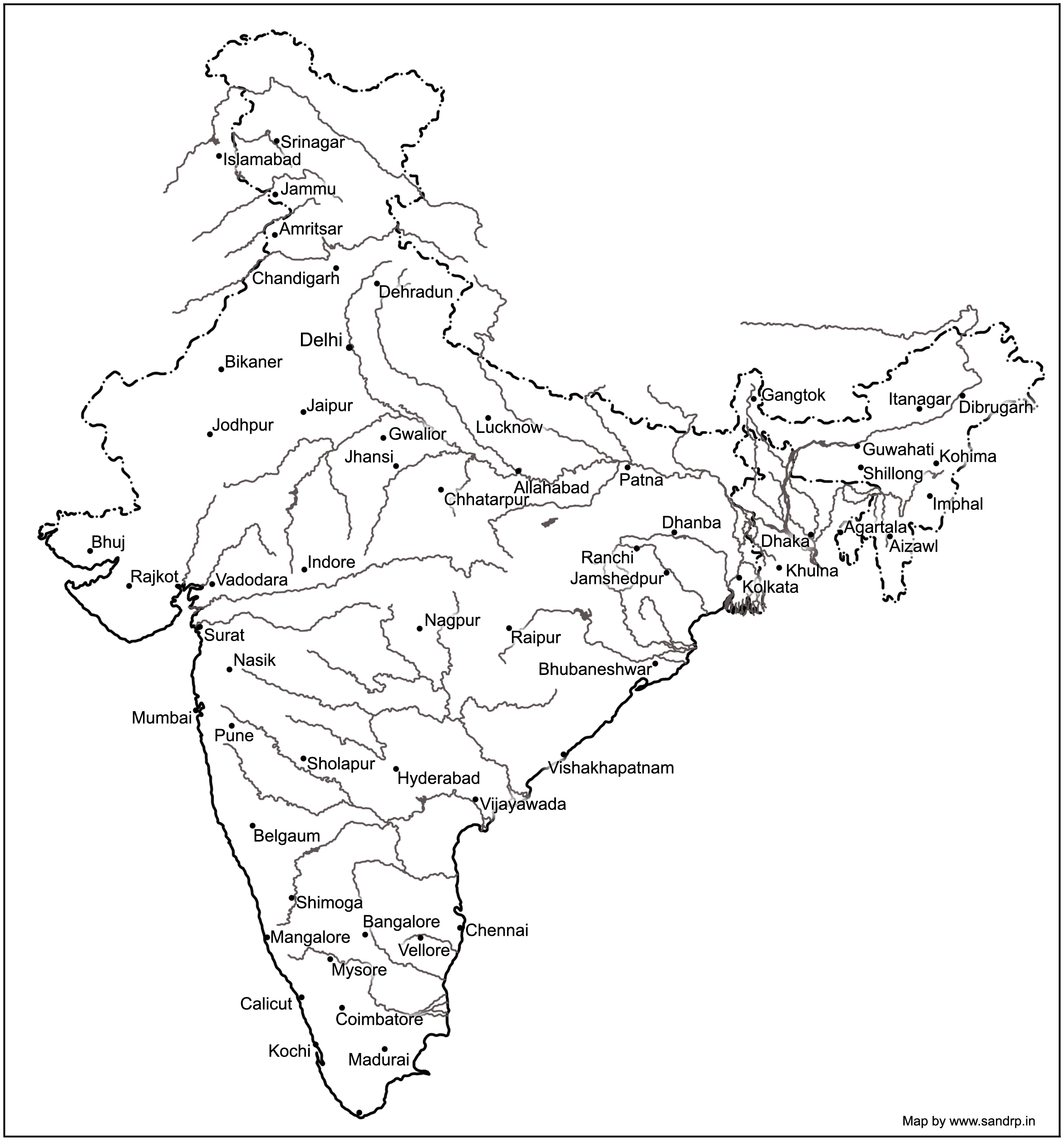
Basin Map of Rivers by Central Water Commission
NIH (National Institute of Hydrology), Roorkee organises our 7 major rivers, that is the Brahmaputra (apparently this includes the Ganga and the Meghna), Godavri, Krishna & Mahanadi (that flow into the Bay of Bengal), and the Indus, Narmada & Tapi (which drain into the Arabian Sea) , along with their tributaries to make up the entire river system in our country.[2] This is clearly problematic and chaotic, since it leaves out vast areas of the country and the rivers that flow through them.
A quick look at the classification based on these 3 aspects –origin, topography and the basin they form.
Based on Origin or Source
Depending on the origin or where they begin their journey from, there are the Himalayan (perennial) rivers that rise from the Himalayas and the Peninsular rivers that originate from the Indian plateau. The Himalayan rivers include the Ganga, the Indus and the Brahmaputra river systems along with their tributaries, which are fed throughout the year by melting ice and rainfall. They are swift, have great erosion capacity and carry huge amounts of silt & sand. They meander along the flat land, create large fertile flood plains in their wake and their banks are dotted by major towns and cities.
The peninsular rivers, on the other hand are more or less dependent on rain. These are gentler in their flow, follow a relatively straighter path, have comparatively less gradient and include Narmada, Tapi, Godavari, Krishna, Cauveri and Mahanadi rivers, among many others.
Based on topography
The Himalayan Rivers flow throughout the year, are prone to flooding and include Indus and the Ganga-Brahmaputra-Meghna.
The Deccan Rivers include the Narmada and Tapi rivers that flow westwards into the Arabian Sea, and the Brahmani, Mahanadi, Godavari, Krishna, Pennar & Cauvery that fall into the Bay of Bengal.
The Coastal Rivers are comparatively small in size and numerous in number, with nearly 600 flowing on the west coast itself.
Rivers of the Inland Drainage Basin are centered in western Rajasthan, parts of Kutch in Gujarat and mostly disappear before they reach the sea as the rainfall here is scarce. Some of them drain into salt lakes or simply get lost in the vast desert sands.
Island Rivers Rivers of our islands: A&N islands & Lakshadip group of islands
Based on basin formed
On the basis of the basin formed, our rivers are distributed into 7 river systems. The Indus River System originates in Kailash range in Tibet, and includes Zanskar, Shyok, Nubra ,Hunza (in Kashmir) along with Jhelum, Chenab, Ravi, Beas and Sutlej as its principal tributaries. In the Brahmaputra River System, it was earlier assumed that the Mansarovar lake is the source of the Brahmaputra river, however, now it is confirmed that Angsi Glacier is the main source (see: See: http://www.thehindu.com/news/international/china-maps-brahmaputra-indus/article2384885.ece). Most of the course of the river lies outside the country. In India it flows through Arunachal Pradesh and Assam, where it is joined by several tributaries. For more information on this river, see: https://sandrp.wordpress.com/2013/07/17/brahmaputra-the-beautiful-river-or-the-battleground/.
Mighty Brahmaputra in Assam
The Narmada River System comprises of the Narmada River that represents the traditional boundary between North & South India and which empties into the Arabian Sea in Bharuch district of Gujarat. Tapi river of the Tapi River System rises in the eastern Satpura Range of Madhya Pradesh and then empties into the Gulf of Cambay of the Arabian Sea, Gujarat. Its major tributaries are Purna, Girna , Panzara , Waghur , Bori and Aner rivers.
Also called the Vriddh (Old) Ganga or the Dakshin (South) Ganga, Godavari of the Godavari River System, originates at Trambakeshwar, Maharashtra and empties into the Bay of Bengal. Summers find the river dry, while monsoons widen the river course. Its major tributaries include Indravati, Pranahita, Manjira, Bindusara and Sabari rivers.
The Krishna River System includes Krishna river, one of the longest rivers of the country,that originates at Mahabaleswar, Maharashtra, and meets the sea in the Bay of Bengal at Hamasaladeevi, Andhra Pradesh. Tungabhadra River, formed by Tunga and Bhadra rivers, is one of its principal tributary. Others are Koyna, Bhima, Mallaprabha, Ghataprabha, Yerla, Warna, Dindi, Musi and Dudhganga rivers.
The Kaveri River System has the Kaveri (or Cauvery) river whose source is Talakaveri in the Western Ghats and it flows into the Bay of Bengal. It has many tributaries including Shimsha, Hemavati, Arkavathy, Kapila, Honnuhole, Lakshmana Tirtha, Kabini, Lokapavani, Bhavani, Noyyal and Amaravati. The Mahanadi of the Mahanadi River System, a river of eastern India rises in the Satpura Range and flows east into the Bay of Bengal.
Broader definition: Catchment area size
River basins are widely recognized as a practical hydrological unit. And these can also be grouped, based on the size of their catchment areas (CA). This easy to understand river system classification divides them into the following categories as tabulated below:
River basin
CA in sq km
No. of river basins
CA in million sq. Km
% area
% Run off
% population
Major river basin
CA > 20,000
14
2.58
83
85
80
Medium
20,000<CA<2,000
44
0.24
8
7
20
Minor (Coastal areas)
CA< 2,000
Many
0.20
9
8
Desert rivers
Flow is uncertain & most lost in desert
–
0.1
–
Drainage System of Indian Rivers
Major river basins include the perennial Himalayan rivers- Indus, Ganga & Brahmaputra, the 7 river systems of central India, the Sabarmati, the Mahi, Narmada & Tapi on the west coast and the Subarnekha, Brahmani & the Mahanadi on the east coast and the 4 river basins of Godavri, Krishna, Pennar and Cauvery, which takes the total to 14. The medium river basins include 23 east flowing rivers such as Baitarni, Matai & Palar. A few important west flowing rivers are Shetrunji, Bhadra, Vaitarna & Kalinadi. The minor river basins include the numerous, but essentially small streams that flow in the coastal areas. In the East coast, the land width between the sea and the mountains is about 100 km, while in the West coast, it ranges between 10 to 40 km. The desert rivers flow for a distance and then disappear in the desert of Rajasthan or Rann of Kutch, generally without meeting the sea.[3]
A need for details
Under India-WRIS (Water Resources Information System) project too, the river basin has been taken as the basic hydrological unit, but the country has been divided into 6 water resource regions, 25 basins and 101 sub basins, which are an extension of the earlier 20 basins delineated by CWC, as detailed in the ‘River basin Atlas of India’. [4] The details of the individual catchment area of these 20 river basins is tabulated here:
S No
River Basin
CA (Sq. Km)
Major river
River Length, km
1
Indus (Upto border)
321289
Indus(India)
1114
2
Ganga- Brahmaputra-Meghna
a
Ganga
861452
Ganga
2525
b
Brahmaputra
194413
Brahmaputra (India)
916
c
Barak & others
41723
Barak
564
3
Godavari
312812
Godavari
1465
4
Krishna
258948
Krishna
1400
5
Cauvery
81155
Cauvery
800
6
Subernarekha
29169
Subernarekha
395
Burhabalang
164
7
Brahmani & Baitarni
51822
Brahmani
799
Baitarni
355
8
Mahanadi
141589
Mahanadi
851
9
Pennar
55213
Pennar
597
10
Mahi
34842
Mahi
583
11
Sabarmati
21674
Sabarmati
371
12
Narmada
98796
Narmada
1312
13
Tapi
65145
Tapi
724
14
West flowing rivers from Tapi to Tadri
55940
Many independent rivers
15
West flowing rivers from Tadri to Kanyakumari
56177
16
East flowing rivers Between Mahanadi & pennar
86643
17
East flowing rivers Between Pennar & Kanyakumari
100139
18
W flowing rivers of Kutch & Saurashtra includes Luni
321851
Luni
511
19
Area of inland drainage in Rajasthan
60269
Many independent rivers
20
Minor rivers draining into Myanmar & Bangladesh
36202
Many independent rivers
Note: 1. River Length is only for the main stem of the river, does not include tributaries, etc.
Area of inland drainage in Rajasthan is not given in this reference, it has been arrived at by inference.
Indus basin is constibuted by six main rivers: Sutlej, Beas, Ravi, Chenab, Jhelum and Indus itself. Some tributaries of this system form independent catchment in India (e.g. Tawi river in Chenab basin) as these confluence with the main river only in downstream of the border.
Of course these methods only classify rivers based on their physical & geographical attributes, their drainage area, river length, volume of water carried and tributary details. For a detailed study of a river, what is also needed is its ecological assessment. The methods for river classification may be varied and still evolving, but this information is fundamental to better understand and map the rivers that criss cross across the country.
And definitely a first step to try and understand our rivers!
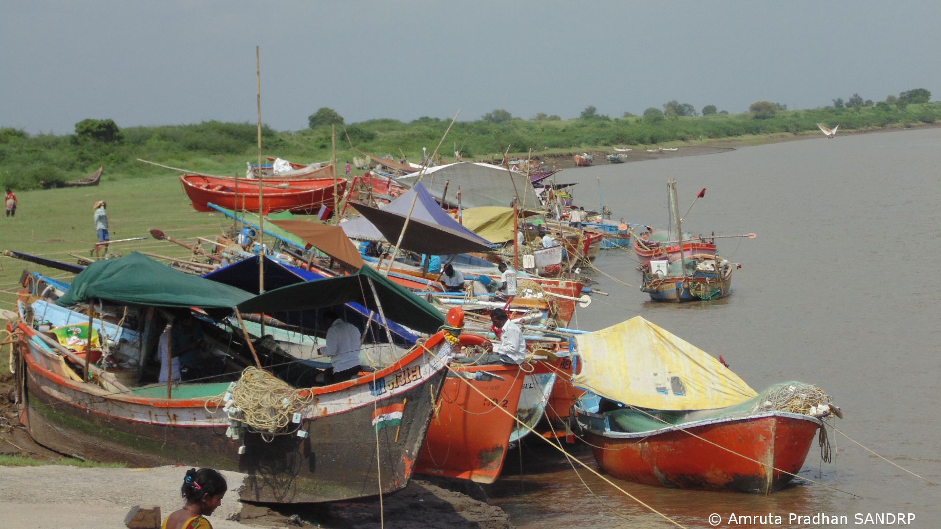
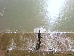
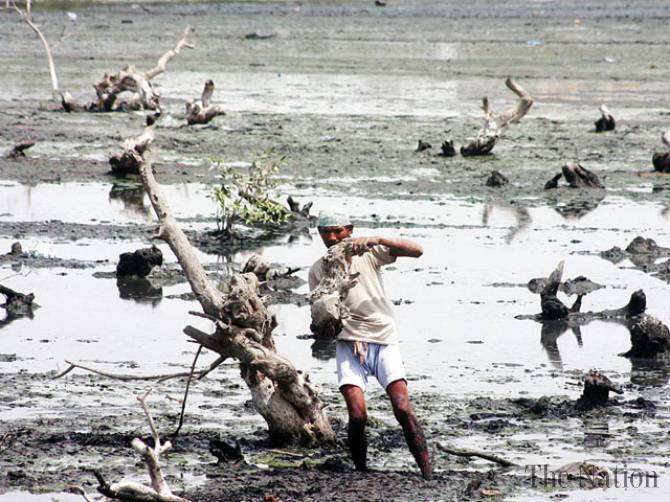
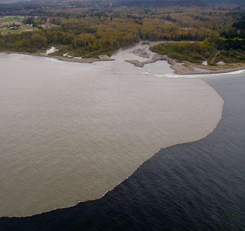
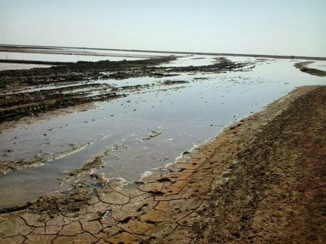
Pungent fishy smell is the first thing that grabs your attention in Bhadbhut village in Bharuch District of Gujarat, which lies on the estuary of the mighty Narmada River, as it meets the Arabian Sea. Every alternate shop in every small lane sells fresh fish and by 11 in the morning, first lot of fresh fish is ice packed in thermocol boxes, all set for far off places like Kolkata and Delhi. Before I was told, I saw for myself that fishing in the Narmada Estuary is the backbone of coastal Bharuch district.
Bhadbhut Village
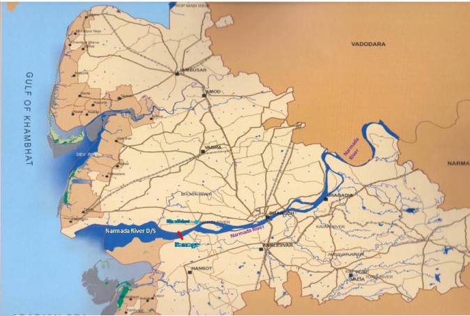
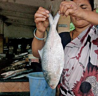
Just 5.15 kilometers from here is the planned Bhabhut Barrage on the Narmada River. What will happen to Bharuch if barrage is constructed? This is the reason why I am here. To understand the implications of this barrage on lives of thousands of fisherfolk from this estuary and on the famed Hilsa fish, that mysterious silver river migrant, on which the fishing economy depends nearly exclusively.
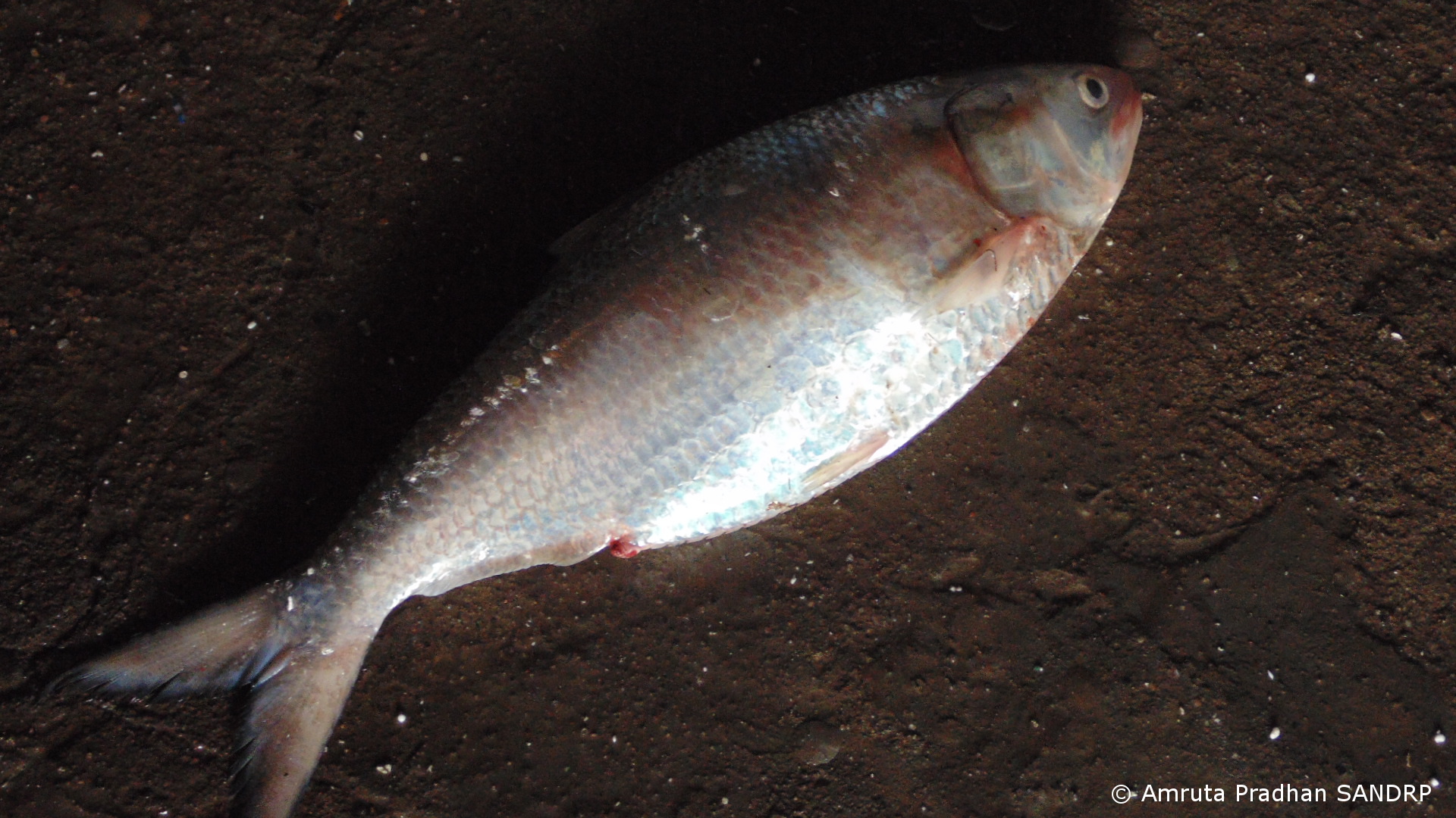
Hilsa is a marine fish that arrives in the brackish water of estuary for spawning normally inhabiting the lower region of the estuaries and the foreshore areas of the sea. For India the peak upstream migration of hilsa in most of the rivers is generally in the monsoon months of July and August and continues upto October or November.
Hilsa
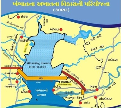
Bhadbhut barrage will be constructed at 5.15 km downstream of village Bhadbhut and 25 km upstream of river mouth. It is part of a gargantuan Kalpasar project pushed by the State Government. Kalpasar (pragmatic critics hold that Kalpasar is in fact an abbreviation of Kalpanic Sarovar, an imaginary reservoir) project which is supposed to be one of the biggest in the world proposes to construct a 30 km long dam (one of the longest in the world) across the Gulf of Khambhat between Bharuch and Bhavnagar districts[i]. The reservoir is supposed to trap the water of twelve rivers that empty their water in the gulf, including Narmada, Mahi, Sabarmati, Dhadar and some Saurashtra rivers. It is expected to create a reservoir of 2000 sq km area, over five times the area of Sardar Sarovar, the reservoir capacity is expected to be over 10 billion cubic meters, that is larger than the SSP reservoir capacity. The project is being pushed ignoring serious issues like hydrological-geological-structural feasibility and needless to say, it’s impacts on environment and fisherfolk. The project will destroy the coastal and deltaic fisheries and wetlands.
As SANDRP has been highlighting for some time now, riverine fisherfolk are one of the most disadvantaged and deprived sections in the dam debate throughout the country. It is no different in Narmada. Livelihood of the fisherfolk from Narmada Estuary has been threatened by several industrial estates established across the district and is now on the verge of being destroyed. Yield of Hilsa has been steadily decreasing (from 15319 tonnes to 4866 tonnes during 1993 to 2004[ii]) since commissioning of Sardar Sarovar Project (SSP) canal and power house in 2006. SSP is built on the Narmada River about 130 km upstream from the estuary. Another dam, Garudeshwar Dam, is under construction downstream from SSP.
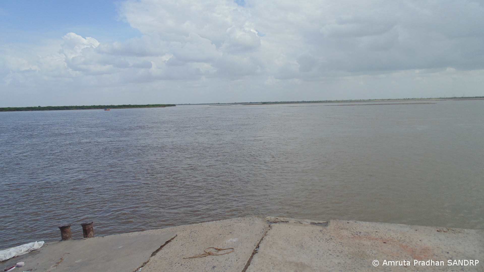
Narmada Estuary
Are people here in the estuary aware of the scale of the Kalpasar project? What do these local fisherfolk have to say about this? How have they been coping with the impacts of SSP?
On the lack of study of the downstream environment, the first paragraph from the chapter on this issue from the report of the Independent Review of the Sardar Sarovar Project instituted by the World Bank is worth quoting in full [iii]:
“From the Sardar Sarovar dam to the ocean, the Narmada River runs for 180 kilometers through a rich lowland region which represents about 10% of its catchment area. In the course of our environmental review we sought information that described the ecology of this lower reach of the river, the estuary, and near shore region in the Gulf of Cambay. We hoped to find a description of the aquatic ecosystem, including parameters indicating the quality and quantity of water and its seasonal changes, biological species, processes, and resource linkages. We looked forward to finding a systematic treatment of flow regimes and geomorphology. We expected to find systematic documentation of resource use, from drinking water to fisheries. We thought there would be documents establishing the kinds of physical, biological and socioeconomic changes to be expected as the Sardar Sarovar Projects are brought on stream and more and more of the natural flow is stored, used or diverted out of the river. We looked for a set of ameliorative measures that would be implemented to mitigate impacts. We thought these measures would be scheduled to begin with phased development of the Sardar Sarovar Projects. We hoped they would also be related to the cumulative effects of other developments on the Narmada further upstream, in particular the Narmada Sagar Projects, and to the expansion of industrial activity in the downstream rive basin in Gujarat itself.
In all our expectations we have been disappointed.” (Emphasis Added.)
The paragraph speaks eloquently and what it says it true even till date.
FIELD VISIT:
Eager to find answers to these questions, I along with Bhupat Solanki a volunteer from Paryavaran Mitra, an Ahmedabad based NGO, first met Praveen Madhiwala, a fish trader and exporter. As I explain the purpose of my visit to him, his first reaction is “if the dam at Bhadbhut comes up, Hilsa will be finished. Not only that, but the dam will prove to be destructive to the entire estuary.” He explains, “Tidal flow of water spreads 60 KM from sea shore to upstream of the estuary. They are planning to build the barrage just 25 KM upstream of the sea shore. What will happen then to the incoming salt water during high tide? It is bound to spread laterally along the barrage spreading in the coastal region and will be destructive to the settlements along the coastline. Calculating all these numbers on paper is very different than experiencing the destructive power of sea. We know what the sea can do.”
Destruction of Hilsa and other fish by Sardar Sarovar
Kamalesh Madhiwala, an advocate from Bhadbhut adds further. “Yield of Hilsa has drastically reduced after Sardar Sarowar Dam has been built. There has been a reduction of 65 to 70%. Overall water level of the estuary has gone down. Post monsoon the river becomes so dry that we can walk across the riverbed. This had never happened in the past before Sardar Sarovar.” When asked about the claim by Narmada Control Authority that it constantly releases 600 cusecs (cubic feet per second) of water from the dam[iii] to maintain the health of the river and the estuary, he says “We don’t think water is released from the SSP. There is no mechanism to monitor this. If you approach government they will show you on paper that they release 600 cusecs of water every day. But no one maintains the on ground data.” According to him the SSP has affected overall fish variety of the estuary as well. “A decade ago there used to be 70 to 80 types of fish varieties available in the estuary. Now we get only about 10 to 12 fish varieties. Earlier along with Hilsa many other riverine species like Prawns, Mahseer etc. have been commercially equally important which Sardar Sarovar has vanquished. Now the fisher people’s income is solely dependent on Hilsa which is very sensitive species. Reduction of water flow in the river immediately affects the yield of Hilsa. Even though Hilsa is available only for about 4 months of the year, 70% of the income of fisherfolk at present is from sale of Hilsa alone.”
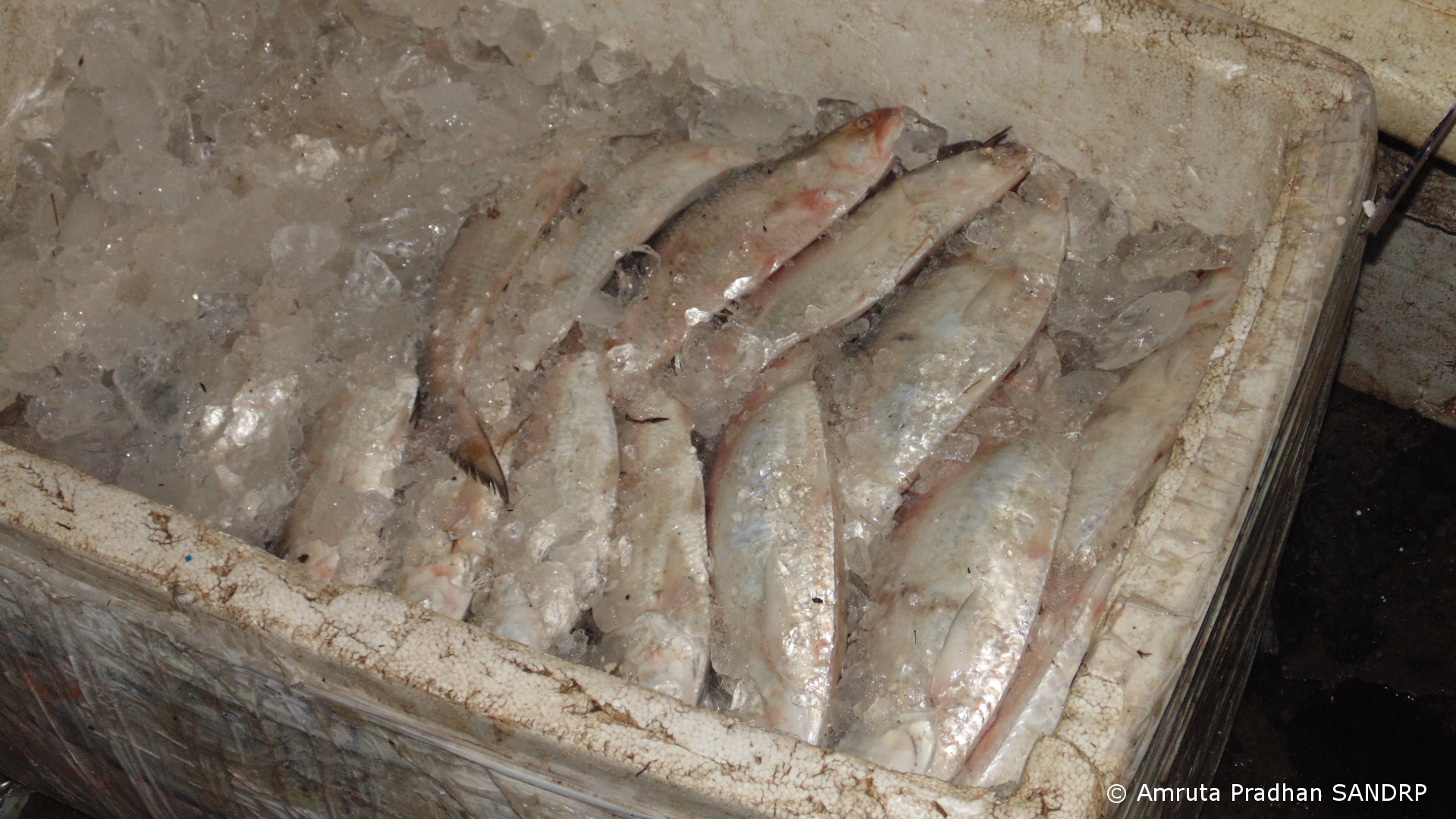
Hilsa ice packed to be transported70% of the income of fisherfolk is from sale of Hilsa
Farcical EIA of proposed Bhadbhut barrage by NEERI
Kamalesh Bhai also points out several lacunae in the Environmental Impact Assessment (EIA) report that National Environmental Engineering Research Institute (NEERI) has prepared for Bhadbhut Barrage. “The entire study has been an absolute farce. First of all none of the local people were aware of any such study going on. It also grossly underestimates the total population of fisherfolk that will be affected by the Bhadbhut dam.” The report considers the total number of fisherfolk residing in 21 villages to be 12,638 based on more than a decade old data from Census 2001.[iv] According to Kamlesh bhai the actual population residing in the estuary region whose livelihood will be affected by barrage is close to 35 to 40 thousand!
SANDRP had sent detailed critique of the EIA to the Gujarat State Environment Impact Assessment Authority before the public hearing for the project held on July 19, 2013. An excerpt from the critique:
“Unclear objectives of the project The objectives of the project stated in the EIA of the project are:
Protection of water quality of Narmada river from salinity due to tidal influence and checking the problems of salinity ingress and deterioration of ground water quality in the upper reaches of Narmada river;
Storage of the regulated release of water from SSP and runoff from free catchment for irrigation, domestic and industrial water supply;
Flood protection of about 400 sq km low lying area covering 17 villages on the left bank of river Narmada;
and Road connectivity between left and right banks, shortening route from Surat/Hajira to Dahej region.
The EIA agency has uncritically accepted these objectives, without assessing if the barrage with low water storage can really fulfill the second the third objective and considering the low salinity level reported by the EIA (mainly based on data provided by the project authorities, again uncritically accepted by NEERI), is the first objective relevant. The fact that the Kalpsar department played such an important role and the fact that it is public knowledge that the barrage is part of the propose Kalpsar project should have been taken note by NEERI. NEERI should have also questioned as to why is this small part of the larger Kalpsar project applying for such piecemeal clearances which is actually in violation of the Supreme Court orders. It should be added here that the Kalpsar project had applied for the TOR clearance from Union Ministry of Env and Forests. The project came up before the MoEF’s Expert Appraisal Committee on River Valley Projects. SANDRP had then sent a letter to the EAC, saying that based on information provided, the project should not be considered for clearance. In its 41st meeting in Sept 2010, the EAC declined to give TOR clearance to the project, saying that the documentation provided are highly inadequate and need to be more holistic and uptodate pre-feasibility report needs to be provided. The project there after has not gone back to EAC.
However, a small part of that same project, the Bhadbhut barrage is now proposed before the Gujarat State Environment Impact Assessment Authority (http://seiaa.gujarat.gov.in/).”
An edited version of letter about the inadequacies of the EIA report sent from Paryavaran Mitra director to Gujarat Pollution Control Board which has been published by Counterview states that the report fails to assess severity of impact on Hilsa and other migratory fishes and instead tries to imply that fishing activity is only a part time employment for fisher community, which is entirely incorrect.[v] The report proposes fish ladder as a mitigation measure with no specific details. Fisherfolk are not impressed. “Tell me madam, have you ever seen a fish climb a ladder?” asks Kamlesh bhai laughing.
While a fish ladder may or may not work (it is not likely to work for Hilsa and other important fish species, it has not worked anywhere in India so far), the fisher folk are not wrong in ridiculing it. Fish ladders have never been taken seriously by the proponents who put them in. Case in point is Farakka Barrage in West Bengal, where too, a fish lock was supposedly made for Hilsa. It has not been operated for over a decade and current officials have no idea that such a thing exists.
Cover Page of the controversial NEERI EIA of Bhadbhut Barrage Project
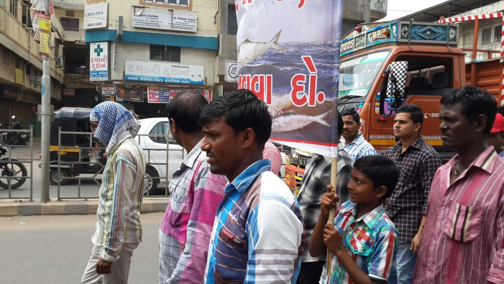
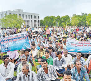
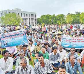
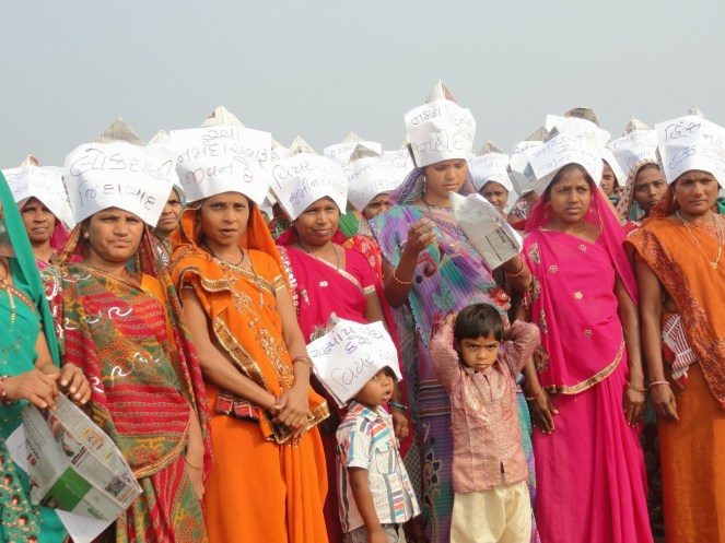
“The NEERI EIA is a complete copy paste job. It has several incidences of plagiarism. It mentions names of places that are found nowhere in this region. This region also comes under PCPIR[vi] project. The PCPIR EIA report does not talk about impact on Hilsa at all!”- Bhupat Bhai adds. “That’s true” says Kamlesh Bhai. “Even after the NEERI completed the report none of the local people had any idea about the project and its impacts. Now we are raising awareness. On 7th July 2014 local fisherfolk organized a protest rally at the District Magistrate office and more than 4000 fisher people were a part of this. This is our fourth rally opposing the project.” When asked if any compensation is being offered for those getting affected by the barrage, I am told none. According to them in the entire argument about the barrage, its impacts etc. there is absolutely no talk about compensating the fisherfolk. They also raised their voices in the public hearing of the project. 1500 farmers and fisherfolk attended the public hearing on July 19 and walked out soon after sharply registering their protest against the proposed project and naming it as “anti-people”.[vii]
Protest March organized on 7th July 2014 (Photo by Kamlesh Madhiwala)
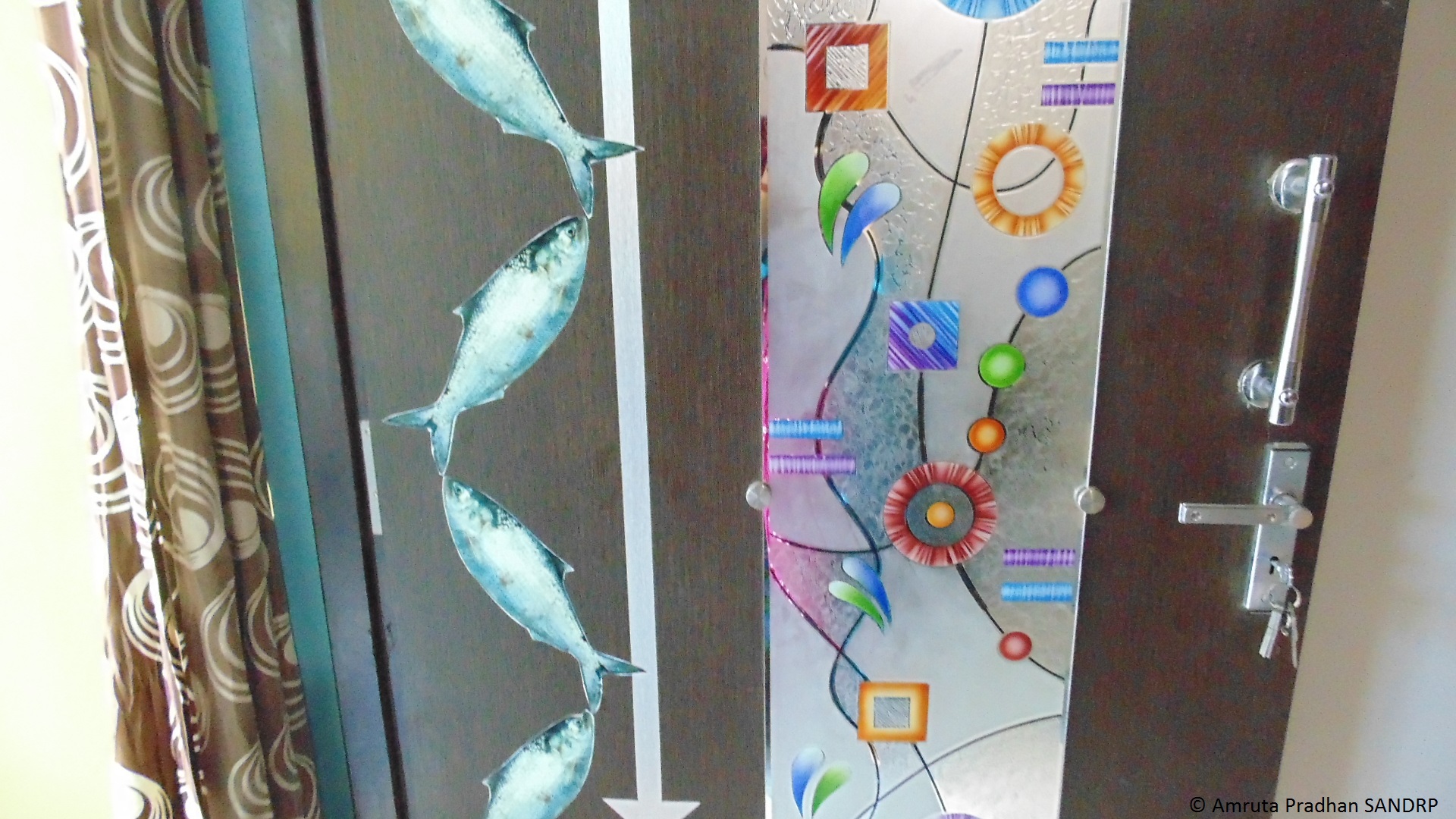
When we arrive at Praveen Macchi’s house, his door is adorned with images of Silvery Hilsa. His family has been involved in fishing from generations. When asked about estuary’s overall condition after SSP he confirms the facts stated earlier by Praveen Bhai and Kamalesh Bhai. “We don’t think water is released from SSP and even if it is, it is so meagre that it is nearly useless. The estuary receives water only when the dam overflows. In 2014 the dam overflowed only once which was as late as September. Other than dam overflow only other source of water is releases from River Bed Power House of SSP, leakage from below the dam wall and some water from downstream streams.” Fish yield of this year is about 30% lower than last year when the estuary received water from dam overflow 4 to 5 times in year. “Now water from SSP has been diverted for hydropower generation. After power generation at Canal Head Power House water is released into Narmada canal instead of river/ estuary.”
Hilsa used as a decorative element
Pressures on Narmada estuary and livelihoods of thousands
When asked as to how does the Hilsa survive without freshwater water released in the estuary, Praveen Bhai explains “As of now Hilsa arrive at least during monsoon as the river stretch of 130 KM holds rain water. If Bhadbhut barrage is built there will be no free flowing river stretch to support fish breeding. Yield of Hilsa will be hard hit and so will be the fishing industry. Entire population dependent on fishing will lose its livelihood.”
If Bhadbhut barrage is built there will be no free flowing river stretch to support fish breeding
Praveen Bhai told me that the fisher people’s cooperative ‘Bhadbhut Matsya Udyog Sahakari Mandali’ is preparing to file a Public Interest Litigation challenging the barrage project. Is livelihood of more than 30000 people getting affected reason enough to argue for stoppage of the project? Will the courts understand this implication? They did not when impact of SSP on fisher people was argued earlier. Let us hope judiciary is more sensitive to the fisher people’s issue this time.
Gujarat Government Map showing Kalpasar and Bhadbhut project locations
Praveen Bhai further informs that the overall salinity of the estuary has gone up due to severely restricted freshwater flow into the estuary. Fish diversity has reduced and riverine fish movement is obstructed due to SSP (Sardar Sarovar Project). Hilsa which would be available till December – January is now seen hardly till September as the salinity levels rise rapidly after monsoon. Says Praveen Bhai: “Narmada has been Hilsa’s favoured habitat. Earlier Hilsa was found in Tapi estuary near Surat as well. But after the Ukai dam was constructed only 2 to 5% of Hilsa arrive at the Tapi estuary. Lives of fisherfolk in the estuary have been devastated. The problem of livelihood of these people became so serious that there are instances where women of the community had to get into prostitution.”
The Narmada estuary is already facing growing pressures from industrial estates. Bharuch District has 13 industrial estates with 137 medium and large scale units of chemicals, textiles, plastics, fertiliser related industries etc. Industrial estate of Dahej which is in close proximity to Bhadbhut releases its untreated effluent in the sea near Bharuch. This is affecting the overall water quality of the estuary. Praveen Bhai points out to a very peculiar phenomenon. A completely different genre of crime has evolved in the industrial estates near Bharuch where youth blackmail the companies when the companies discharge untreated effluent into the sea. The companies, hand in glove with police, bribe the blackmailers for keeping quite. Effluents meanwhile go untreated in the river and sea. This is also true of effluents from Ankaleshwar and other industrial estates. The SSP has worsened this situation due to drastic reduction in freshwater flow that earlier used to dilute the industrial, urban and other effluents.
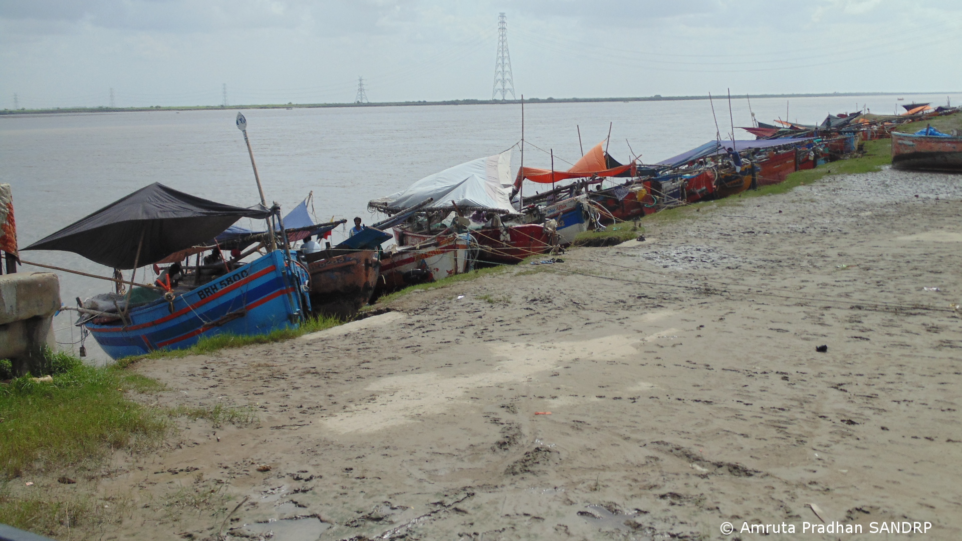
Concerns of fisherfolk We now move towards the banks of Narmada to meet artisanal fisher people there. Boats which can contain upto 5 to 6 people are parked along the banks. Since it is a noon time, hurry burry of fish packing is settling down. One by one tempos from the market are arriving and picking up the packed fish. As we talk with a bunch of fisher people, their worries and concerns tumble out. Several issues emerge while talking to them.
“Government is all set to build a dam destroying our livelihood. As it is government is not extending any kind of support to us river fisherfolk. No bank provides us with loans” one of them speaks.
“Yield of fish has also reduced due to reduced water level of the estuary. Sea water gets contaminated by the untreated effluent that Dahej & other Industrial estates disposes in the sea. This sea water that is highly contaminated with chemicals and heavy metals enters estuary during high tide. This polluted water has also affected the overall fish quality and there is hardly any freshwater from upstream to dilute it because of the dam.Earlier single Hilsa fish used to weigh more than two kilograms. Now it hardly weighs one to 1.25 kgs” says another one.
“With all this polluted water how will the fish grow? It naturally starves” says yet other.
“If Bhadbhut Barrage comes up, Hilsa will no more come here. Our livelihood will be destroyed. Government is not even offering any compensation. No one has been compensated for the impact we have already felt due to the SSP.” They all keep talking anxiously.
They further inform that several farmers in Bharuch who have lost their land in PCPIR project or other industrial estates have shifted to fishing creating more stress in the industry that is already facing a steep decline. Farmers, who are new fisherfolk lack the traditional skills or patience and often fence the estuary and sea with fishing nets in hope of catching Hilsa, which prevents the fishermen’s traditionally used small boats from entering the sea. As they speak, every concern raised is met by a nod by the entire group.
Fishing boats along the banks of river Narmada
Contrary to this scenario the EIA report summary by NEERI states “… the fresh water storage in upstream of the barrage will provide a favourable environment for intensive fresh water fishery and provision of fish ladder with shiplocks would enhance the fishery activities and fetch greater economic benefits to the people.”[viii] Fisherfolk when asked about this conclusion show the other side of the argument. Fisheries department floats tender for fishing in the dam reservoir. Only big contractors can afford to obtain the contracts. “It’s not a job for small fishermen like us. If the dam comes up all these small boats you see will vanish” they say.
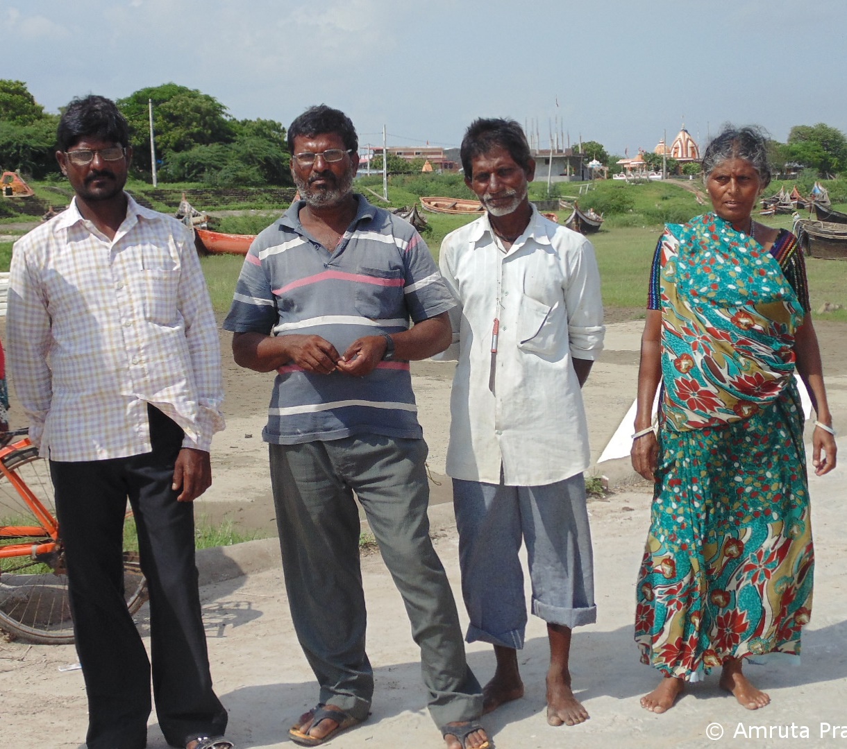
Fisherfolk from Bhadbhut
Other than the threatened livelihood, the fisher families in the estuary are also facing several other issues. Wells of fresh water now contain saline water. Many of them used to rely on Narmada River for drinking water. Since the river has gone dry after SSP, they no more receive drinking water from Narmada River. As the water from the estuary has reduced, the wells which have traditionally been an important source of drinking water are now dry or saline. Villages which are closer to the sea are experiencing saline water and also polluted chemical water ingress. “Many of us are having skin problems because we have to go in the chemical water.” I wonder with fishing industry plagued with so many problems if younger generation is at all willing to continue in the same occupation. When asked about this they tell me that for now the traditional skills is the only real education the younger generation has.
Many of them have protested the project at the public hearing. “We all are opposing the dam. Building dams might to do good for contractors, but what about us? Are we not people?” they ask.
The proposed Garudeshwar Dam on Narmada immediate downstream of SSP will further stop the water flow to estuary as it is designed to pump back to SSP the water released from River Bed Power House. The fisherfolk here do not know about this, nor has the government bothered to tell them or do any impact assessment or prepare any rehabilitation or management plan. The only hope is the petition lying before the National Green Tribunal against the Garudeshwar Dam.
I come back with more questions than answers. Praveen Bhai’s home, with his welcoming door adorned with the silvery Hilsa remains in my thoughts for a long while.
There is a rush of riverfront development schemes in India. We have heard of Sabarmati Riverfront development being drummed many times, followed by the proposed rejuvenation of Ganga, supposedly on the lines of Sabarmati.
What does Riverfront Development entail? Is it River Restoration? Are the millions of rupees spent on Riverfront Development schemes justified? Will it help in saving our damaged rivers?
A cursory glance at the existing river restoration/ improvement/beautification schemes indicates that the discourse revolves mainly around recreational and commercial activities. It is more about real estate than river. Activities that are promoted on the riverfronts typically include promenades, boat trips, shopping, petty shops, restaurants, theme parks, walk ways and even parking lots in the encroached river bed.
Pioneering project in Riverfront Development was claimed to be the Sabarmati Riverfront Development project of Ahmedabad city which was supposed to be designed based on riverfronts of Thames in London and Seine in Paris. The project which began as an urban development project is lately being pushed as a role model for many urban rivers in India. This kind of riverfront development essentially changes the ecological and social scape of the river transforming it into an urban commercial space rather than a natural, social, cultural, ecological landscape. Is it wise to go for this kind of development on riverfronts? What does it do to the river ecosystem, its hydrological cycle? What does it do to the downstream of river? These questions need to be explored before accepting the current model of riverfront development as replicable or laudable.
Reclaim and beautify!
Most of the currently ongoing projects lay a heavy emphasis on beautification of rivers. Riverfronts are treated as extension of urban spaces and are often conceived as ‘vibrant’, ‘throbbing’ or ‘breathing’ spaces by the designers. Concrete Wall Embankments, reclamation of the riverine floodplains and commercialization of the reclaimed land are the innate components of these projects. Quick glimpse at various Riverfront Development Projects confirms this.
Sabarmati Riverfront Development Project
Sabarmati Riverfront Development Project of Ahmedabad city which is presented as a pioneer in urban transformation[1] has been proposed by Environmental Planning Collaborative (EPC), an Ahmedabad-based urban planning consultancy firm, in 1997 and envisaged to develop a stretch of 10.4 km of the banks on both sides of the river by creating concrete embankment walls on both banks with walkways. A Special Purpose Vehicle called the Sabarmati Riverfront Development Corporation Ltd. (SRFDCL) was formed in the same year for implementation of the project. The financial cost of the initiative was estimated to be in the range of around INR 11520 million[2]. Around two thirds of this amount has already been spent.
Construction of the project started in 2005. The project sought to develop the riverfront on either side of the Sabarmati for 10.4 kms by constructing embankments and roads, laying water supply lines and trunk sewers, building pumping stations, and developing gardens and promenades[3]. Mainstay of the project was the sale of riverfront property. Land along the 10.4 km stretch on both the banks was reclaimed by constructing retaining walls of height ranging from 4 to 6m[4]. 21% of the 185 ha of reclaimed land which was developed by concretizing the river bank[5] was sold to private developers for commercial purpose.[6] Activities hosted on this reclaimed land were recreational and commercial activities like restaurants, shops, waterfront settlements, gardens, walkways, amusement parks, golf course, water sports and some for public purpose like roads etc. The sale of reclaimed land created by the project is expected to cover the full cost of the project. Ahmedabad Municipal Corporation (AMC) claims that the after the project “river has added vibrancy to the urban landscape of Ahmadabad with its open spaces, walkways, well-designed gardens along with activities which contribute to economic growth.”[7]
Even though the project has been modeled as “best practice” by several financing institutions[8], it has also drawn severe criticism for poor rehabilitation of the displaced (rehabilitation happened only after High Court orders following a public interest petition) disrupting the nexus of shelter, livelihood and services of urban poor, lack of transparency in the execution and for tampering with the carrying capacity of the river. No Environment Impact Assessment of the project has been conducted nor any credible public consultation process held.
Sabarmati channel has been uniformly narrowed to 275 metres during the riverfront development project, when naturally average width of the channel was 382 metres and the narrowest cross-section was 330 metres[9]. In this attempt of “pinching the river”[10], the original character of the river is changed completely from seasonally flowing river to an impounded tank illegally taking water from Narmada Canal[11]. River banks have been treated as land that is wasted on which value could be created by reclaiming and not as seasonal ecological systems with floodplains as an integral part of its flows (Baviskar 2011). Seasonality of the river is destroyed and fauna and avi fauna on edges have been damaged. No thought has been given for protection, sustenance or enhancement of the riverine ecosystem. The water that is now impounded in this stretch is not even Sabarmati river water, but Narmada River Water, on which the city of Ahmedabad or Sabarmati has no right, it’s the water meant for drought prone areas of Kutch, Saurashtra and North Gujarat.
The River Sabarmati itself was a perennial river till the Dharoi Dam in the upstream stopped all water at least in non Monsoon months, making the river dry. The stretch flowing through Ahmedabad was carrying the mostly untreated sewage of Ahmedabad city and toxic effluents from the City and district industries.
In the name of Sabarmati River front development, no cleaning of the river has happened, the project has only transferred the water from both banks to the river downstream from Vasna barrage, which is situated downstream from the city. The Vasna barrage stops and stores the water released from Narmada Main Canal that crosses the river about 10.4 km upstream from the barrage. Thus this 10.4 km stretch of the river now holds the Narmada water and huge losses from the stretch are losses for the drought prone areas.
The reclaimed land and the narrowing of the channel have been tampering with the carrying capacity of the river. The project was stalled during August 2006 to March 2007 due to heavy floods[12]. Prior to the floods, the river’s maximum carrying capacity was calculated at 4.75 lakh cusecs on basis of the rainfall over last 100 years[13]. The floods however proved the calculation wrong. National Institute of Hydrology (NIH) and Indian Institute of Technology Roorkee (IITR) were asked to re-evaluate the project design, in the light of the river’s carrying capacity, and see whether the execution of the project would damage the river’s ecology[14]. Report by the NIH, Roorkee in 2007 said “the calculations did not take into account any simultaneous rainfall over the entire catchment area”[15]. This means that the carrying capacity was based only on the water flow from the Dharoi Dam (which is upstream of Ahmedabad City) and not from other places in the river’s catchment until Ahmedabad that also contribute to the volume of water in the Sabarmati. This report states that the riverfront development is “not a flood control scheme”, and that the municipal corporation will have to work out other measures to meet the impending challenge of floods.
The project is also heavily criticized for the poor rehabilitation of the evicted slum population. Large scale eviction was being carried out in an utmost non-transparent manner. A public interest litigation (PIL) was filed in the Gujarat High Court by Sabarmati Nagarik Adhikar Manch (SNAM) or Sabarmati Citizens Rights Forum, supported by several other non-governmental organisations (NGOs) to ensure that the rehabilitation plan was shared with them and to bring transparency to the process. According to the high court orders, at least 11,000 affected families were to be rehabilitated and resettled by AMC. Demolition drive went on without ensuring rehabilitation. Over 3,000 people have moved to a marshland in the outskirts of city with negligible compensation, little & infrequent access to drinking water and minimal sanitation facilities[16].
“The ecology of the river is being transformed to satisfy the commercial greed of a select few,” said Darshni Mahadevia of CEPT, expressing concerns about riverfront ‘beautification’[17].
The project that has converted the Sabarmati River into an urban space by reclaiming nearly 200 ha of land and has sustained by borrowing water from Narmada Canal today is claimed to be a role model for many riverfront development projects in the country. Should this model really be replicated? Many of the rivers like Yamuna, Ganga, Mithi, Brahmaputra etc. that are being ‘developed’, have had a flood history which is being ignored in the process. With having no regards to the hazards of floods, several riverfront projects are being pushed across the country by different government agencies.
The fact that even after a Riverfront Development Project, Water Quality of Sabarmati downstream the Vasna Barrage is extremely poor and the cosmetic treatment of flowing water stretch at Ahmedabad is actually water from Narmada, which was promised for the drought hit regions of Kutch and Saurashtra, highlights the contradictory and superficial nature of such Riverfront development schemes.
Yamuna Riverfront Development inspired from Sabarmati Model
Recently the newly elected BJP led Central Government sent a team of bureaucrats to Gujarat to study the feasibility of replicating the successful model of the Sabarmati Riverfront Development Project for cleaning the Yamuna[18]. Despite the concerns about flooding of Yamuna, the team is exploring ways of replicating Sabarmati Model. In 2009, the Sheila Dikshit administration was also planning channelizing the Yamuna and putting up a waterfront like Paris and London with recreational facilities, parking lots and promenades etc[19].
Reclamation of the floodplains to create a concrete riverfront, like in Ahmedabad, could be ecologically unsound and even dangerous for Delhi that is already extremely vulnerable to floods[20]. The sediment load in Yamuna is very high. The non-channelized river rises by over four metres during peak monsoon flooding[21]. Risk of flooding will increase multifold for a channelized river. The Inter-governmental Panel on Climate Change last year put Delhi among three world cities at high risk of floods. Tokyo and Shanghai are the two other cities.
An expert committee appointed by the Ministry of Environment & Forests (MoEF) to examine the Yamuna River Front Development Scheme of the Delhi Development Authority (DDA) recommended that DDA should scrap its ambitious plan for developing recreational facilities, parking lots and promenades. [22] The committee was formed following order from National Green Tribunal which was drawn in response to a petition filed by activists and Yamuna Jiye Abhiyaan convener Manoj Misra.[23] The committee pointed out that recreational spots located in active floodplain areas would kill the river and cause floods in the city. About the Sabarmati Model Being followed, CR Babu, Chair of the committee said: “There is no Sabarmati river. It’s stagnant water with concrete walls on two sides. The floodplains have been concretized to make pathways and real estate projects. It cannot be replicated for our Yamuna”.
The committee report says the Yamuna Riverfront Development scheme will reduce the river’s flood-carrying capacity and increase flooding and pollution and it recommended a ban on developmental activity in the river’s Zone ‘O’ and its active floodplains on the Uttar Pradesh side. It also said that a 52-km stretch of the Yamuna in Delhi and Uttar Pradesh be declared a ‘conservation zone’ as restoring the river’s ecological functions is heavily dependent on the environmental flow through this stretch, particularly in the lean season.
Manoj Misra of Yamuna Jiye Abhiyan, dismisses the Sabarmati solution saying “We cannot call it a Sabarmati model… It’s like a mirage created for a brief stretch. Let’s be clear about it. If the Delhi bureaucrats have gone there to learn from the Gujarat model, it’s up to them to figure out if it can be implemented. I cannot call the Sabarmati project a river rejuvenation project – it’s more of a real estate project… That is not advisable for Delhi.” [24]
Another important aspect which does not feature at all during the talks of Yamuna Riverfront Development is the massive displacement that will take place. Over a dozen unauthorised colonies are located on the riverbed. These colonies which have been in existence for over 40 years will have to be uprooted which again may lead to Sabarmati like situation where urban poor are brushed aside to serve interests of real estate developers and urban middle class.[25]
City of Noida on the other hand has decided to go ahead with the Rs 200 crore Yamuna Riverfront Development Project that Greater Noida Authority (GNA) has been planning[26]. The project involves developing recreational facilities like parks, Yoga centres, picnic spots and sports centres, polo grounds, golf course etc. on Hindon and Yamuna floodplains. Officials from GNA claim that these facilities will be for recreational purpose and will be developed without disrupting the natural flow of Yamuna. Here again the project has nothing to do with sustaining, cleaning, rejuvenation of the river.
Ganga cannot be ‘developed’ as Sabarmati
Prime Minister Narendra Modi made a promise during his election campaign in Varanasi to clean up Ganga.[27] The National Ganga River Basin Authority (NGRBA) was shifted from the environment ministry to the water resources ministry.[28] New name for the Ministry of Water Resources is Ministry of Water Resources, River Development and Ganga Rejuvenation. Uma Bharati was assigned with this specially created ministry for cleaning Ganga by the PM. “If Sabarmati can be cleaned, all other rivers can also be made better.” print media has quoted Uma Bharati.[29] Ms Uma Bharati seems to have no idea that Sabarmati has NOT been cleaned, the Sabarmati project just transferred the polluted water downstream of the 10.4 km stretch. Can Sabarmati Model be replicated at Ganga? Even if it is replicated, will it help the cause or river or river rejuvenation? The answer is clearly a BIG NO. A number of apprehensions have been raised in this regard. “The so-called Sabarmati model won’t work for the Ganga. The Sabarmati has neither been cleaned nor rejuvenated,” Openindia News quotes Himanshu Thakkar, environmentalist and coordinator of SANDRP[30]. He further points out that
Sabarmati Model survives on water from Narmada canal in the stretch of 10.4 km which flows through the Ahmedabad city. This is not possible in case of Ganga.
Priority for the river rejuvenation is restoring its water quality, freshwater flow and not riverbank beautification. More than Rs. 5,000 crore (some estimates this figure to be over Rs 20 000 crores) has been spent on cleaning the Ganga in the past 28 years. The Ganga Action Plan was launched in 1986 and was in 1994 extended to the Yamuna, Gomti and other tributaries of the Ganga. The second phase of the Ganga Action Plan was launched in 2000 and NGRBA was created in 2009.[31] The plan however has not achieved what it set out to achieve. Water quality for Ganga River has been declining and is unfit even for irrigation or bathing. Potable use is out of question. The count of harmful organisms, including hazardous faecal bacteria, at many locations is more than 100 times the limit set by the government. The water’s biochemical oxygen content, which is vital for the survival of aquatic wildlife, has dipped drastically.[32] Any “cosmetic treatments”[33] will not work for Ganga, like they have not worked for Sabarmati.
Several Riverfront Development Projects springing up across nation
While there are experts opposing replication of Sabarmati Riverfront Project on Ganga and Yamuna River, there are several other riverfront projects which are inspired by the Sabarmati Project and which are being pushed without any kind of studies or impact assessment. Their possible impacts on the riverine ecology, flood patterns, downstream areas etc. are going unchecked.
Brahmaputra Riverfront Development Project: Another “multi-dimensional environment improvement and urban rejuvenation project” that is set to come up with plans for reclaimed river banks is on Brahmaputra River in Guwahati[34]. While on one hand the city is struggling to cope up with the flood prone nature of the Brahmaputra River, State Government of Assam plans to take up an ambitious project to develop the city riverfront named ‘Brahmaputra Riverfront Development Project’ under the Assam Infrastructure Financing Authority. The riverfront project will be implemented by the Guwahati Metropolitan Development Authority (GMDA) in phases[35]. Foundation of the beautification project was laid by the Chief Minister Tarun Gogoi in February 2013. The project plans to achieve maximum possible reclamation[36].While the plan talks of revitalization of the river ecology and Strengthening of riverbanks through soil bio engineering it has several urban features on its agenda like promenade, Ghats, Plazas and Parks; buildings, conference facilities, Parking lots, ferry terminals, Bus and para transport stops, Urban utilities and drainage, Improved infrastructure for floating restaurants, Public amenities; Dhobi Ghats, etc.[37]
Will such a huge real estate development leave any room for river or its revitalization?
Tendency to flood is an important feature of River Brahmaputra. The river also has one of the highest sediment loads in the world. Every year during the successive floods, most of the areas in the valley of Assam remain submerged for a considerable numbers of days causing wide spread damages. In a phenomenon as recent as June 27, 2014 Guwahati experienced heavy downpour for 15 hours, setting off flash floods[38]. Half of the city was submerged under flood water. The authorities blamed illegal encroachments on watersheds across the state capital for the flash floods, which had choked the natural outlets for the gushing water. National Institute of Hydrology (NIH), Roorkee; upon being requested by the GMDA; is carrying out a study which includes river shifting analysis for studying stability of the river banks, flow variations to determine the perennial water depth, estimate of floods of various return periods for design of river embankments, estimate of water surface profiles employing hydro-dynamic river flow model and design parameters for river embankments[39]. The Bramhaputra Riverfront Development Project however has been inaugurated even before the requisite studies have been completed.
Gomti Riverfront Development Project in Lucknow: The project by the Lucknow Development Authority is based on the Sabarmati Riverfront Model. It plans to “beautify” Gomti River between Gomti Barrage and Bridge on Bye-pass road connecting Lucknow-Hardoi road and Lucknow-Sitapur road, a length of about 15 Km. According to the Technical Bid Document released by the Lucknow Development Authority, the Riverfront Project has no component of water treatment or river restoration, but is a landscape-based development project, which will also look at “reclaiming” the river banks for activities like shops, entertainment area, promenades, etc. The inspiration for the project swings from Thames Rivefront in London, to Sabarmati in Gujarat, depending on the political party in power.[40]
In all this discussion, there is no mention of maintaining adequate flow in Gomti, treating sewage, conserving its floodplains, or any other ecological angles.
River Improvement and Restoration are also about real estate!
For many government agencies, ironically, not just river beautification, but the idea of river improvement and restoration is also about channelizing rivers and providing recreational facilities.
Pune Rivefront Project: Pune Municipal Corporation, the Pune city also known for chronically polluting Mula and Mutha rivers that flow through the heart of the city, has sanctioned a River Improvement Project, under the aegis of JNNURM (Jawaharlal Nehru National Urban Renewal Mission). The Project envisages channelizing the river, introducing barrages to maintain water levels, development of riparian zone as entertainment and shopping groups, even Parking lots, introducing navigation in the river etc. There are several issues with this “improvement” project. Firstly, it is not planned according to the once in a hundred years flood in Pune, it plans to constrict the river further, thus encroaching the riverbed. Creation of stagnant pools through barrages will result in backwater effect on the many nallahs that join the river. These Nallahs routinely flood in rainy season and additional backwater in these nallahs will worsen the situation further. The project does not say a word about treating water quality, but envisages to build drainage lines inside the riverbed and carry the sewage out of Pune city limits. This hardly qualifies as river rejuvenation or restoration. A case has been filed against this project in National Green Tribunal.
Goda Park (Godavari Riverfront Project) in Nashik, Maharashtra: Godavari emerging from the Brahmagiri Hills in Nashik is famed not only for being one of the longest rivers in India, but also because Kumbh Mela is held on its banks every 12 years in Nashik. Nashik and Trimbakeshwar have had no dearth of funding for cleaning Godavari. They have received funds from the National River Conservation Directorate as well as JNNURM. Despite this, Godavari is extremely filthy in Nashik. Ignoring the pressing issues of water quality, Nashik Municipal Corporation and a specific political party have been hankering after beatification of Godavari’s banks. In fact, the project has been handed over to Reliance Foundation by the Nashik Municipal Corporation[41] without any public consultations or discussions. As per reports, the components of this 13.5 kms long project will be laser shows, musical fountains, rope-way, multi-purpose meeting hall, garden, water sports, canteen, etc.[42]
In the meantime, there are several court orders against Nashik Municipal Corporation pending about severe water pollution in the River including Ram Kund where holy dip on Kumbh Mela is supposed to be taken.
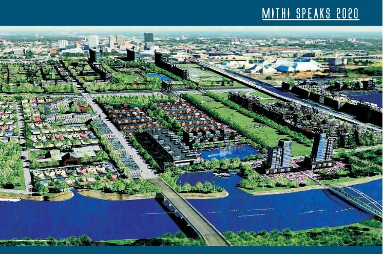
Mithi Riverfront Development: Stretch of 18 km of Mithi River flows through city of Mumbai. Course of Mithi has been modified throughout the city to host range of activities.[43] On 26 July 2005, the river flooded some of the most densely populated areas claiming nearly 1000 lives[44].
After these catastrophic floods, the Municipal Corporation of Greater Mumbai (MCGM) and Mumbai Metropolitan Region Development Authority (MMRDA) made a plan to “restore” the river. BMC and MMRDA’s definition of restoration involves desilting, beautification and building of a retaining wall. Stretch of 4.5 km of the total six km stretch of the river that falls within MMRDA’s jurisdiction is covered with mangroves. MMRDA has planned to beautify the stretch of remaining 1.5 km (10 Ha) which lies right amidst mangroves by developing a promenade. MMRDA plans developing this project on a PPP (Public Private Partnership) basis. Interestingly, the Mukesh Ambani-led Reliance Foundation and Standard Chartered bank have been selected for this project.[45]
As per the Coastal Zone Management Plan (CZMP) of the area, the proposed Mithi Riverfront Development Project falls in Coastal Regulation Zone (CRZ) II and III. The proposal was presented to CRZ authority in its 82nd meeting on 10th June, 2013[46]. CRZ authority has not allowed any reclamation or construction activities in this stretch. For Widening, lengthening & reconstruction of the existing bridge CRZ has referred the proposal to MoEF and asked MMRDA to take prior permission of High Court if the proposal involves destruction of mangroves[47].
Observer Research Foundation, a private, not for profit organization (funded by Reliance India[48]) from Mumbai has come up with a study that recommends a 21-point programme for reclaiming the Mithi, envisaging a single and unbroken river-park corridor spanning across the entire 18-km length of the Mithi with dedicated bicycle tracks, gardens, amphitheatres, sports and recreation.[49]
Riverfront Development is NOT River Restoration
As is evident, the riverfront projects discussed above are essentially river bank beautification & Real Estate Development projects and not helping restoration of the river. The projects aim at comodifying rivers to develop urban scapes. Such riverfront development changes the essential character of the river. Stream channelization and alteration of shoreline disconnects the river stretch from adjacent ecosystems and leads to risks of habitat degradation, changes in the flow regime and siltation[50].
While the water of the rivers flows in the natural landscapes, there are many processes that are happening. Sediments are carried, fertile land is created along the banks, river channel is widened, flooding, deposition of sediments during flooding, cleansing of river etc.[51] However the urban rivers are alienated from this natural landscape to such an extent that the rivers are reduced to merely nallas carrying city’s sewage and filth.
Flow, connectivity and flood are fundamental characteristics of rivers and rivers need space for that. If these are violated the river water spreads uncontrolled through the habitation causing catastrophic events like Mithi Flooding.
Creating more room for rivers
While Indian cities are busy replicating Riverfronts of Thames and Seine, there are some remarkable projects going on in some other countries which actually talk of giving more room to the rivers during floods. They are trying to restore the river and not beautify, concretize, channelise or encroach on it.
In the Netherlands, such an integrated approach has been adopted for ‘Room for the River Program’[52]. The program is currently being implemented in the Dutch Rhine River Basin of the country.
The programme started in 2006 is scheduled to be completed by 2015. The objectives of the programme are improving safety against flooding of riverine areas of Rivers Rhine and Meuse by increasing the discharge capacity and improving of spatial quality of the riverine area.
At 39 locations, measures will be taken to give the river space to flood safely through flood bypasses, excavation of flood plains, dike relocation and lowering of groynes etc. Moreover, the measures will be designed in such a way that they improve the quality of the immediate surroundings.
While Room for the River programme focuses on flood management in sustainable way, Yolo Bypass is another unique initiative aimed at keeping intact the benefits to the ecosystem without causing a negative impact on water supply[53]. The Yolo Bypass is a flood bypass in the Sacramento Valley located in Yolo and Solano Counties of California State in USA. The primary function of the bypass is flood damage reduction. It is a designated floodway that encompasses 60,000 acres in eastern Yolo County between the cities of Davis and Sacramento. All the properties within the bypass are subject to a flood easement that allows the state to flood the land for public safety and ecological benefit.
Conclusion
Riverfront of Thames in London and Seine in Paris are often cited as successful models of riverfront development in India. However, the ecological as well as social setting of Indian rivers and the challenges that we face are significantly different from these foreign models. A Blind replication will only be wastage of public funds and degradation of the rivers further. Riverfront development projects across the country seem to be alienated from the river, and talk only about its urban banks, trying to achieve cosmetic changes on deeper wounds by encroachment and real estate development on the belly of the rivers. The need of the hour is river rejuvenation and not river FRONT development. Let us hope that we see central place for rivers in all these projects. Moreover, there is neither any social or environmental impact assessment, nor any regulation or democratic participatory decision making process. Such projects will only be at the cost of the poor, the environment, future generation and to short term benefits of real estate developers and a section of urban middle class.
[43] The Mumbai airport has its domestic and international terminals, and its cargo complex along the Mithi River. There are five major railway stations along the Mithi River including Mahim and Bandra on the western line andSion, Chunnabhatti and Kurla on the central line. The upcoming V ersova-Andheri-Ghatkopar corridor of the Mumbai Metro project that also crosses over the Mithi River has two stations planned along the Mithi River at Marol and Saki Naka. There are also several bus stops located close to the river all along its banks.
[47] The proposal was cleared subject to compliance of following conditions
(i) The proposed construction should be carried out strictly as per the provisions of CRZ Notification, 2011 (as amended from time to time) and guidelines/ clarifications given by MoEF time to time.
(ii) Disposal of debris during construction phase should be as per MSW (M&H) rules. 2000.
(iii) Tidal flow of river should not be obstructed.
(iv) The project proponent should obtain prior High Court permission, if the proposal involves destruction of mangroves or construction falls with 50 nil buffer zone.
(v) All other required permissions from different statutory authorities should be obtained prior to commencement of work
To
Sushri Uma Bharati
The Honourable Minister
Ministry of Water Resources, River Development and Ganga Rejuvenation
Government of India
New Delhi
minister-mowr@nic.in, psmwr-mowr@nic.in, mod-mowr@nic.in, secy-mowr@nic.in, mwp@nic.in
Copy to:
1. Shri Santosh Kumar Gangwar, Minister of State for Water Resources, River Development and Ganga Rejuvenation
2. Shri Alok Rawat, Secretary, Ministry of Water Resources, River Development and Ganga Rejuvenation and ex-officio Chairman of the Narmada Control Authority
3. Shri A. Mahendran, Executive Member (Additional Charge), Narmada Control Authority
Respected Madam,
We the undersigned are deeply concerned about the recent decision of the Narmada Control Authority (NCA) to raise the height of the Sardar Sarovar dam by 16.76 metres taking the height to the designed final height of 138.68 metres.
We think this decision of the NCA is unjustified and unwise. 1) It will cause huge additional displacement, when rehabilitation of the people affected even at the current height is incomplete. 2) As everybody agrees and experience has shown, even at current height, Gujarat is in a position to take the water stored to virtually any part of the designed command area, and can draw its share of water as per the Narmada Water Disputes Tribunal (NWDT) award. Moreover, it has been able to utilise only a small portion of the water available at current height. So there are no compelling reasons for raising the height on this count.
Under these circumstances, the decision taken by the newly formed government at the centre and the NCA to raise the height of the dam within two weeks of oath by the new government is a hasty, unwise and disastrous decision. We earnestly appeal to you and the government to immediately withdraw the decision to raise the height of the dam.
More importantly, the issues related to the dam have festered over more than 30 years of its troubled history because governments have tended to take a legalistic stand rather than initiate an inclusive dialogue on the substantive issues about the project amongst all concerned, particularly those adversely affected. We appeal to you to start such an inclusive process of reflection and dialogue to arrive at a broad social consensus on four critical issues about the Sardar Sarovar Project (SSP) as outlined below.
1. Height of the dam: What is the height of dam needed for Gujarat to utilise its share of Narmada waters and take water to all its designated command? As already mentioned above, Gujarat is in a position to take water anywhere in the designated command area. There are studies and alternatives which indicate that Gujarat may be able to utilise its share of Narmada waters at current height and no further height increase may be required on this count. Doing away with the installation of the 16.8 meter high gates does not have any structural implications for the dam. So far as power generation is concerned, major power benefit is transitional, falling off as the states utilise their share of water and final residual power benefit is small. Moreover, even today, as per Central Electricity Authority (CEA) figures, at current height SSP generated 5,882 Million Units of Power in 2013-14, which is more than what SSP was envisaged to generate. The biggest beneficiary of power generated at SSP is Madhya Pradesh, but it forms a small percentage of its present power capacity and generation while virtually the entire brunt of massive displacement has to be borne by it. So, it may be optimal for Madhya Pradesh to trade off much of its transitional power benefit with the greatly reduced submergence and displacement with a dam at the current height. Thus there is a distinct possibility that optimal solutions exist at current height and they need to be explored.
2. Equitable distribution, sustainable use and participatory and efficient management of stored water: Given the ability to carry water to all parts of Gujarat at current height, it is more important to concentrate on issues of how water is used now. Criticism on these counts comes from some of the strongest proponents of the project. The project has been criticised, among other things, on account of gross underutilisation of the stored water, irrigation water not reaching the drought prone areas of Kachch, Saurashtra and North Gujarat, diversion of water for unplanned uses (for example, river front development, urban and industrial use south of Sabarmati), non existence of water users’ associations (WUAs) for most part of the command, lack of proper drainage in the command area, and inefficient and inequitable use.
3. Status of displacement and rehabilitation: There is a large gap in the perceptions and articulations of state and various groups and individuals including those from the adversely affected, both about the exact numbers involved as well as about the quality of rehabilitation. While the authorities have generally been claiming satisfactory rehabilitation, there is every indication that the rehabilitation even at current height falls quite short of what is legally required or what basic human justice demands. Since the submergence and displacement that would take place between 121.92 metres and 138.68 metres would be massive, there is every indication that effective rehabilitation would be intractable and virtually impossible. It becomes much more urgent to bridge this gap and come to a consensus on the actual extent and quality of rehabilitation already carried out before causing further massive displacement.
4. Environment and Climate Change: Environment and climate change issues that are important in the long run have not been given due attention. Downstream impacts of SSP on environment and livelihoods have not been properly assessed, environment-flows and requirements have not been studied and management plans have not been formulated or implemented. Climate change experts emphasise the importance to reevaluating the costs, benefits, impacts and optimality of projects and it is high time we initiated studies and discussion on these with respect to the SSP. If rejuvenation of rivers is to receive a central place in water resources development and the Narmada is to remain alive these issues need to be brought into discussion and resolved as soon as possible.
Good governance entails making socially and environmentally just decisions within a deliberative democratic framework and it is the lack of this that has resulted in three decades history of conflict and polarisation around SSP. We sincerely hope you will put us on a path of better governance, the professed aim of the new government, by revoking the decision to increase the height of the SSP from the current 121.92 m to 138.68 m and initiating a comprehensive dialogue on the substantive issues surrounding it.
Yours sincerely,
A. C. Bhagabati,
A. Latha,
A. Vaidyanathan,
Achyut Das,
Amita Baviskar,
Ashish Kothari,
Bharat Patankar,
Brij Gopal,
Devaki Jain,
Dinesh Abrol,
Dunu Roy,
Ghanshyam Shah,
Himanshu Thakkar,
Himanshu Upadhyaya,
K. J. Joy,
Kanchan Chopra,
M K Prasad,
Mamata Dash,
Manoj Mishra,
N. C. Narayanan,
Nafisa Bharot,
Prashant Bhushan,
Rajeswari Sarala Raina,
Ramaswamy R. Iyer,
S. Janakarajan,
Sanjay Kak,
Seema Kulkarni,
Sharachchandra Lele,
Shripad Dharmadhikary,
Sudarshan Iyengar,
Sudhirendar Sharma,
Suhas Paranjape,
Vimalbhai,
Viren Lobo.
Names added subsequently:
Persis Ginwalla,
Rohit Prajapati
V N Sharma
For any further details and follow up please contact:
Ashish Kothari (chikikothari@gmail.com);
Himanshu Thakkar, (ht.sandrp@gmail.com);
Himanshu Upadhyaya (himanshugreen@gmail.com);
K. J. Joy (joykjjoy2@gmail.com);
Shripad Dharmadhkari (manthan.shripad@gmail.com);
Suhas Paranjape (suhas.paranjape@gmail.com)
Above: Hilsa fishers in Bangladesh setting out for their journey Photo: with thanks from Arati Kumar-Rao
In addition to the Gangetic Fisheries Primer, SANDRP will shortly publish a Primer documenting the Impacts of dams on Riverine Fish and Fisher Communities. One of the most profound impacts of dams on fish is blocking migration routes and perhaps no other fish symbolizes this impact as dramatically as the Hilsa: the Silver Queen of the River.
Glimpses of the impacts of dams on Hilsa in South Asia.
Arguably, Hilsa is not just a tasty and healthy fish species that migrates from the sea up the river to spawn. It is a cultural icon that binds Bengalis, whether from West Bengal or Bangladesh, together in their shared love for Ilish Machch. Pohela Baishakh or the new year day’s meal is not complete without Ilish. Though Hilsa is celebrated fervently by the Bengalis, it is prized in all estuaries of South Asia, from Narmada, Mahanadi, Godavari, Cauvery to Indus and Irrawaddy and takes the name of Chaski, Palva, Ilishii, Palla, Pulasa, etc. It is also found at confluence of Tigris and Euprates in Iran, where it is as prized and known as Sbour. The fish flavours several poems, folklore, songs and phraseologies of the entire South Asia. In cultural terms, the significance of Hilsa is comparable only to Salmon and Mahseer.
Ilish fish and rice, a religious offering and cultural fare on Pohela Baishakh Photo: Flickr
Tenualosa ilisha, Hilsa or Indian Shad belongs to the sub family Alosinae of Family Clupeidae. Commercially, it is the most important fisheries in the estuaries, especially in the Ganga-Hooghly region.It occurs in marine, estuarine and riverine environments and is found in Indus of Pakistan, Irrawaddy of Myanmar and Indian rivers like Ganga, Bhagirathi, Hooghly, Rupanarayan, Brahmaputra, Godavari, Narmada, Cauvery, Tapti, coastal rivers like Padma, Jamuna, Meghana, Karnafuly and others in Bangladesh. It is seen to migrate up smaller estuaries like Pennar too.
Hilsa, by habitat, is a marine fish but migrates in estuaries and rivers for spawning, normally inhabiting the lower region of the estuaries and the foreshore areas of the sea. Hilsa ascends the rivers for spawning and the spent fish and their progeny migrate down the river towards lower estuaries and coastal areas, moving in shoals. The peak upstream migration of Hilsa in most of the rivers of the country is generally in the monsoons months of July and August and continues upto October or November. The spring spawners that enter the river for spawning in January-March return to the sea during July-August when these are caught in good numbers. The monsoon spawners that enter the river during September- October return to the sea after spawning and these spent fishes are caught in good numbers during January- March. Similarly, the off springs of spring-spawners make journey for the sea from the river during November- January, whereas the off springs of monsoon spawners return to the sea from the river during July- September. (Bhaumik et al, CIFRI, 2012)
Obstruction to undertaking this spawning migration by dams and barrages has been singled out as the primary reasons for the fall of Hilsa fisheries in India as well as Bangladesh. The trade of this commercially important fish species constitutes upto 1.5% of Bangaldesh’s National Gross Domestic Product and about 2 million fishers are estimated to depend on Hilsa fisheries in Gangetic estuaries. Till August 2014, Bangladesh has stopped Hilsa exports to India to contain astronomic price rises in Bangladesh as the costs of the fish are becoming uncontainable due to its cultural importance on one hand and dwindling supply on the other. India has requested Bangladesh to lift the ban of Hilsa export, but it is yet to relent, due to a number of socio-political reasons. [2]
Fishers setting off for Hilsa from the Bangladesh Sunderbans Photo: With thanks from Arati Kumar-Rao
One of the main reasons for the phenomenal fall of Hilsa in Gangetic delta has been the Farakka Barrage built by India in the 1970’s, just a few kilometers upstream the India –Bangladesh border, to divert water from Ganga into the Hooghly river, to keep the Kolkata Port at the mouth of Hooghly, free of sediments.
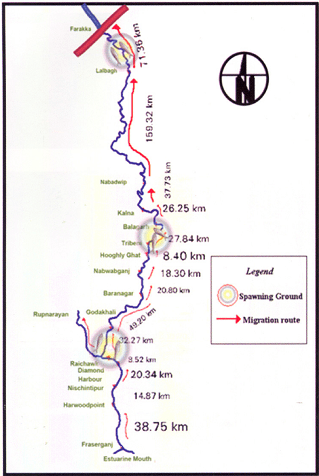
Prior to commissioning Farakka Barrage in 1975, there are records of the Hilsa migrating from Bay of Bengal right upto Agra, Kanpur and Delhi covering a distance of about 1400 kms. Maximum abundance was observed at Buxar, near Allahabad, at a distance of about 650 kms from river mouth. Post Farraka, Hilsa is unheard of in Yamuna in Delhi and its yield has dropped to zero in Allahabad, from 91 kg/km in 1960s. Studies as old as those conducted in mid-seventies[3] single out Farakka’s disastrous impacts on Hilsa, illustrating a near 100% decline of Hilsa above the barrage post construction.
Migration route of Hilsa, Pre Farakka Barrage spanning about 1400 kms Source: CIFRI 2012Highly restricted range of Hilsa post Farakka Source: CIFRI
An obligatory Fish lock provided in Farakka Barrage is non-functional and tagging experiments reveal that Hilsa cannot move across the barrage due to obstruction of three-tire sluice gates.[4] For more on how Farakka has failed its objective and continues to impact livelihoods: https://sandrp.wordpress.com/2014/11/25/lessons-from-farakka-as-we-plan-more-barrages-on-ganga/
Fishers who live off the Ganges strongly feel the pressure of dams, personified by Farakka. In north India, ‘Farakka’ –the word doesn’t mean a village on the Bangladesh border anymore, but means destruction by dams. The local Hindi dialects have borrowed new phraseology: “Farakka hua, tabse hilsa toh bas bhabis” (Farakka happened, and then Hilsa exist only in imagined future)”. The same phrase repeats up to the Yamuna River! In a recent status survey of Gangetic fisheries almost 75-80% of fishers singled out ‘Farakka’ as the root cause of all their miseries. They actually referred to multiple barrages built on the respective rivers. But destruction had a common name: Farakka.[5]
Bangladesh has been making several serious attempts to revive Hilsa fisheries and implements a strict fishing ban in certain months to avoid fishing “jatkas” or small Hilsa. It has also declared several Hilsa Sanctuaries to protect the fish and is witnessing small and steady improvements in the population. India has hardly taken any steps to protect this specie. IUCN has led a program called Ecosystems for Life: A Bangladesh-India Initiative and Hilsa fisheries is a part of this project. There is also a Norwegian project on Hilsa Aquaculture [7] ( All prior efforts of Hilsa Aquaculture have failed). However, the primary need to address the giant problem of the Farakka Barrage is being unaddressed. The barrage and reduced freshwater in the downstream is also exacerbating other stressors like sedimentation of the river mouth, high fishing pressure on limited stocks, concentrated pollution, etc.
Hilsa in other Rivers (would taste as sweet!) Hilsa is found not only in Ganges delta but most of the estuaries in India. In all of these places, Hilsa fishery is primarily affected by dams and barrages near the estuaries, blocking spawning migration and reducing freshwater from upstream.
Hilsa in Cauvery: A century of impacts In Tamizh, Hilsa caught at Sea is Kadal Ullam and the one in the River is the Aattu Ullam. Here, the impact of Mettur dam on valuable Hilsa fisheries in the Cauvery has been recorded as early as 1939 in an issue of Current Science, where it is stated: “Unfortunately the effect of the dam (Mettur on Cauvery) on the fisheries below was disastrous. The number of valuable Indian Shad or Hilsa, the most important sea fish ascending the Cauvery for breeding purposes, declined as the high floods which enabled them to ascend the rive no longer occur. The serious decline of fisheries in Cauvery would be evident from the fact that the fishery rental of the river below the dam which used to amount to 80000 Rs. annually has steadily declined since the formation of the dam to about 42,900 rupees.”[8]Puntius species also disappeared in Cauvery post dam, which formed 28% of the landings prior to dam construction.[9]
As per the Report “Fishing the Cauvery: How Mettur Changed it all,” by Ramya Swayamprakash published by SANDRP[10], It was Sir Aruthur Cotton himself, way back in 1867 who alerted the erstwhile government about the damages wrought by weirs on river fisheries. Immediately, Dr. Francis Day was commissioned to investigate the impact on fisheries and subsequently appointed Inspector-General of Fisheries in India. In his report on the fisheries of India and Burma, Day condemned dams as insurmountable barriers to fish passage; he designed a fish passage which was on the Lower Anicut on the Kollidam. The pass was primarily designed for the Hilsa who could not ascend it, as it was too wide. According to the Madras Fisheries department in 1909, the fish pass did not ensure Hilsa migration because of various practical and technical difficulties; in the first place, the expenses for the construction of a fish pass were not commensurate with the expected results and secondly, sufficient water could not be provided for the efficient working of the pass. Interestingly, Hilsa was sought to be cultivated and exported along the lines of the Salmon in north-western United States. So important was the Hilsa that a stuffed specimen made its way into the exhibits sent to the Great Exhibition from the Bombay Presidency, in 1851!
Fishing at the Lower Anicut on Cauvery Photo: Wikimedia Commons
Today, the Hilsa is unknown on the Cauvery. According to fish biologists, the Hilsa ascended the anicuts on the Cauvery up to Mettur to spawn overcoming the low anicuts. But the coming of the Mettur Dam formed an impassable barrier.
Hilsa in Godavari is known as Pulasa when caught i the river and Vilasa when caught n the sea! Here too, the fish is declining and main reasons are said to be declining water levels and the Dowleswaram Barrage [11] (Arthur Cotton Barrage). In Andhra villages too Pulasa has a huge cultural significance.
This author made a presentation to the Standing Committee of the Lok Sabha, the lower house of Indian Parliament in June 2012 about the impacts of dam on riverine fish and discussed Hilsa, when an MP from Coastal Godavari district in Andhra Pradesh said, “I know Pulasa! My constituency depends on riverine fisheries like Pulasa, and not marine fisheries, but we end up talking only about marine fish and not river fish and Pulasa and the impacts of upstream projects on livelihoods of river fishers”
Pulasa/ Hilsa of the Godavari Photo: The Hindu
In Mahanadi, Orissa, Hilsa has been hit by dams and is recording a declining trend[12]. Paradip recorded about 500 tonnes Hilsa, but prices have increased astronomically.[13]
Hilsa in Narmada, Sardar Sarovar and the proposed Bhadbhut Barrage The narrative of damming the Narmada by the Narmada Valley Projects is one of the most significant stories of an on-going struggle against modifying a river and way of life of her people. Although there are many facets to the story ranging from displacement, false benefits and true costs, forest loss, non-existent rehabilitation and an all-pervasive insensitivity of the government towards weaker communities, the impacts of this project on riverine fisheries have been equally profound. Narmada River system experienced a nearly 70% decline in Hilsa catches in just a decade between 1993 to 2004 ( From 15319 t to 4866 t ) and this decline was prominently recorded from 1998-99 onwards.[14] As per CIFRI, the most stressed species after Sardar Sarovar Project (SSP) construction is the Hilsa and Macrobrachium prawn (Jumbo River Prawn). CIFRI made some prediction about impacts of the dam after 35 years, calling it a ‘critical period’ when fisheries will be nearly lost. Shockingly, these conditions are already being witnessed in Narmada Estuary in Bharuch which records nearly 30% Inland Fish production. More than 12,000 people from 21 villages in Bharuch alone depend on Narmada Estuary for fisheries.
Assessment of impact of commissioning of Sardar Sarovar dam and other projects in 2009 by CIFRI revealed that SSP will retain 96% of the sediment, adversely affecting biological productivity of the downstream including Narmada estuary.[17] However, already the Sardar Sarovar and upstream dams in Narmada Basin have already resulted in retention of about 95% sediment, cutting off the delta from nutrient rich silt. Historical sediment discharge of Narmada was 61 million tonnes and the current sediment discharge (average of last ten years of the study) was found to be 3.23 million tonnes.[18]
According to CIFRI, “While the annual inflow is 23.68 MAF (1981-1990), it will be reduced to 15.9 MAF after 10th year of SSP, to 4.34 MAF at the 30th year and will cease at the 45th year. This freshwater decline will severely affect Hilsa fishery and prestigious fishery contributed by M rosenbergii (Jumbo River Prawn)”. As freshwater declines, there will be “Steep hike in salinity regime with tidal ingress. Fishery not tuned to such enhanced salinity will succumb to such pressure. Mangroves will also be affected and this will impact marine fish production as Mangroves are nurseries of many marine fish.”
Gujarat Government has agreed to release 600 cusecs water from Sardar Sarovar and Bhadbhut Barrage as environmental flows. There is no study as to whether this amount is sufficient for estuarine balance, for ecological needs of Hilsa or other species, for spawning migration, etc. Also, there is no guarantee that Gujarat will release this meagre quantity. Ironically, the minimum flows of 600 cusecs agreed to be released by Gujarat through SSP come to 532. 9 Million Cubic Metre (MCM) water annually and CIFRI’s warning of a sharp fisheries decline at 30th year was for 4.34 MAF or 5353.4 MCM! So, 532.9 MCM released now as minimum flows is barely 10% of a dire scenario predicted at 30th year of commissioning SSP[i]!
It is hardly a wonder that Hilsa is falling sharply in Narmada Estuary and fishers are directly blaming the Sardar Sarovar for this decline.[19]
Last Straw for Narmada Hilsa: Bhadbhut Barrage: Gujarat Government is planning to build Bhadbhut Barrage about 17 kms from Bharuch, directly affecting the Narmada estuary and the Hilsa and Prawn fishery. The Barrage is planned for SEZ and also water sports and is a part of an infeasible scheme known as the Kalpasar project which plans to dam almost all rivers as they meet the Gulf of Khambat.
Slogans against Bhadbhut Barrage say: “The Dam will kill the fishers: This government is killing people”
The Bhadbhut Barrage is being fiercely opposed by fishers in Bharuch because of its serious impacts on their livelihoods and Hilsa fisheries. Public Hearing of Bhadbhut Barrage was held in July 2013, wherein the fisher community staged a walk out, stressing that the EIA had under-reported Hilsa fisheries in the region, number of fishers and their dependence on the Estuary for fish. The walkout took place immediately after Pravin Tandel, the fisherfolks’ local leader, spoke saying the project would “adversely affect the fish catch, especially Hilsa, once it is implemented. Currently, Hisla fetches Rs 1,200 per kg, and is our main source of livelihood.”[20]
Fisherfolk protesting against Bhadbhut Barrage Photo: Counterview.org
Hilsa in the Indus: In the Indus too, Hilsa fisheries, known as Palla are the main stay of local fisher communities. Hilsa fish is a highly contested territory due to declining catches.
Before the construction of the Sukkur Barrage, the Palla used to reach to Multan as per records of 1907. The Sukkur Barrage and then later the Kotri Barrage severely restricted Palla’s range, affecting the fish and its fishers. According to M. R. Quereshi, ex-Director of Marine Fisheries Department of Pakistan, the Palla used to ascend the river (Indus) to spawn in the middle of June but its ascent is now delayed by at least one month owing to late freshets. Kotri Barrage near Hyderabad has severely restricted its breeding range. Like the Cauvery, in Kotri too the fish ladders do not work due to faulty designs and Hilsa is unable to ascend them, consequently prevented from going up to the upper reaches of the river. As a result the Hilsa fishery is being depleted and immediate action is imperative to increase its production. “Failing this, the fish will eventually disappear from the river.”
Palla/Hilsa fishers at Kotri, on the banks of Indus circa 1890. Photo from British Library, UK
To conclude, the fate of this silvery fish hangs in a fine balance. Not only does the Hilsa enjoy huge cultural significance, it also supports millions of livelihoods. In the United States, several dams, like the recent Glines Canyon Dam on the Elwha, have been decommissioned for their impacts on migrating fish and dependent communities. Elwha river dams came down in a biggest decommissioning effort because the indigenous Klallam tribe asserted its rights on traditional Salmon fisheries which were blocked by these dams. In Japan too, Arase Dam was decommissioned because of its impact on Ayu fish and fishers.
What has happened in India to the Hilsa fish and fishers is far more serious.
Hilsa has a striking ecological, economic and cultural significance. Till date, ranching or farming of Hilsa has not worked. Till date, fisher communities continue to face conflicts, hardships and risks, go deeper and deeper in the sea to gather a few Hilsa. Till date, dam operations have not changed, nor have the fish passes been designed, built, operated or monitored to help the fish. Till date, none of the fisher communities who suffered colossal losses when a dam affected Hilsa, have been compensated for their loss.
Is it not time to rethink these dams, to help the fish and our fishers?
Hilsa as a sacred offering Photo from Flickr, with thanks to Arup Kanjilal
[1] Dugan, 2008, Quoted in FAO Report No. 7, Sustainable Fisheries and Aquaculture for food security and nutrition, 2014
[2] Chief Minister Mamata Banerjee refused to share the Teesta waters with Bangladesh, the neighbouring country has imposed a ban on export of the silver-scaled fish.
[3] Ghosh, 1976 quoted in Review of the biology and fisheries of Hilsa, Upper Bengal Estuary, FAO, 1985
[4] Bhaumik and Sharma, Present status of Hilsa in the Hooghly Bhagirathi River, CIFRI, 2012
[14] Milton, STATUS OF HILSA (Tenualosa ilisha) MANAGEMENT IN THE BAY OF BENGAL: AN ASSESSMENT OF POPULATION RISK AND DATA GAPS FOR MORE EFFECTIVE REGIONAL MANAGEMENT, Report to FAO Bay of Bengal Large Marine Ecosystem Project , 15 February 2010
[15] CIFRI, River Narmada, Its Environment and Fisheries, 2009
[i] While we do not know the schedule through which Gujarat Government plans to release this water, the fact remains that this figure of 600 cusecs is not supported by any studies.
Why this hurry to submerge tribals and farmers under
Narmada waters?
In a shocking decision[1] on June 12, 2014, the Narmada Control Authority (NCA), headed by the secretary, Union Ministry of Water Resources (MWR), & which includes secretary of Ministry of Environment and Forests (MEF) and senior officials of four states of Gujarat, Maharashtra, Madhya Pradesh & Rajasthan, have sanctioned, in what The Hindu called “emergency meeting” (http://www.thehindu.com/news/national/narmada-dam-to-be-higher-by-17-m/article6108571.ece) installation of 17 m high gates on the Sardar Sarovar Dam on Narmada River in Gujarat, taking the effective current height of the dam from 121.92 m to 138.68 m. This has been done after the Rehabilitation sub group (RSG) of the Narmada Control Authority, chaired by secretary, Union Ministry of Social Justice and Empowerment (MSJE) has also cleared this decision. This decision implies submergence of thousands of ha of land and displacement of lakhs of tribals and farmers in three states of Gujarat, Madhya Pradesh and Maharashtra, when their rehabilitation, as legally required, has not been done.
Strangely, the government that talks about transparency, had nothing to report on its website (either PIB website or MWR website till 12 noon on June 6, 2014) about this decision, who will be affected, reason for such emergency decision or basis for the decision.
More importantly, Gujarat & Rajasthan can get their share of water from Narmada river without this height increase and are not able to use even 20% of the water already available to them at the current height. This is clearly unnecessary, unjust and unwarranted decision that is not likely to have even legal sanction. Only additional benefit that increase in height can provide is additional water storage, which will imply about 10-20% additional power generation, in which Gujarat’s share is only 16%: 57% share goes to MP and 27% share goes to Maharashtra.
There is some misinformation that this height increase is required to take the water to Kutch, Saurashtra and North Gujarat. This is completely wrong. The Full Supply Level of Narmada Main Canal is 110 m and once water enters this level in the dam, water can be taken to the canals. Once water enters the main canal, it can be taken to the Kutch, Saurashtra and N Gujarat. Based on information we have obtained from SSNNL under RTI, we have seen that Gujarat can get its full share of 9 Million Acre Feet of water at current height and no height increase is necessary. Had Gujarat built the necessary canal distribution system with branch canals, distributary canals, minors, sub minors and field canals to fields in Kutch, Saurashtra and N Gujarat, it could have taken Narmada water to these regions even eight years ago. To suggest that height increase will achieve this is clearly spreading misinformation. Similarly, as far as providing drinking water to the drought prone areas is concerned, height increase is not required to complete that.
Gujarat, in the meantime have increased the share of drinking water (1 MAF) and industrial Water (0.22 MAF) from 0.87 MAF for these combined sectors, at the cost of irrigation, without any participatory or transparent process. (see new share in this report in The Hindu on June 12, 2014: http://www.thehindu.com/todays-paper/tp-national/a-long-wait-ends-for-gujarat/article6109547.ece).
It is shocking that all the officials of the central and state governments and all the concerned ministers (including Water Resources Minister Ms Uma Bharti, Environment Minister Mr Prakash Javdekar, Social Justice Minister Mr Thaawar Chand Gehlot, Maharashtra Chief Minister Prithviraj Chavan in addition to Gujarat and MP Chief Ministers) have towed the line dictated by Prime Minister Mr Modi and Gujarat Government in this regard, within two weeks of new government taking over. No additional rehabilitation could have been accomplished in these two weeks, which seems to indicate that a political decision has been taken, without considering the ground realities, merits or justification of the decision or necessity of the decision. This does not bode good for the functioning of the new government.
It should be noted here that the installation of gates will take three years, and in any case, for closing the gates, the project will need clearance from Environment Sub Group, RSG and NCA again. Secondly, the gates have been lying in the yard of Sardar Sarovar Narmada Nigam Limited (SSNNL) for many years and a question mark was raised about the safety of the gates in a recent meeting of the Sardar Sarovar Construction Advisory Committee. Now, as The Times of India reported on June 13, 2014 (http://timesofindia.indiatimes.com/city/ahmedabad/Use-of-30-year-old-gates-worries-experts/articleshow/36453333.cms), even former Gujarat Government officials are raising the issue of old technology of 30 year old gates when new technology gates would be also be safer. In view of all this, it may have been better, as Narmada Bachao Andolan has suggested, for the government to first take proper stock of the situation rather than rush into this “emergency” decision on the eve of the monsoon, when no work is in any case possible in monsoon.
It is also shocking that even before the RSG and NCA were to take the decision; Gujarat Government was already busy preparing for celebratory meeting at the Dam site. This shows that the functioning of the statutory bodies has been taken for granted and their decision was pre-determined, as directed by higher authorities.
Gujarat can get its water share without increase in height The new government wants to take the SSP Dam from its current height of 121.92 m to its final design height of 138.68 m. Firstly, there are serious doubts if this height increase is required since it can be shown that Gujarat and Rajasthan can get their share of water from Narmada without this increase in height. Secondly, Gujarat is not even in a position to use more than 20% of the water it already gets from the river at current height of the dam for the purposes for which the project was designed: providing water for the drought affected regions in Kutch, Saurashtra & North Gujarat. On the other hand, urban centres, industrials areas, SEZs, cosmetic river beautification schemes have appropriated a large chunk of SSP waters without legal, democratic sanction or justification. Gujarat really does not have a case for increasing the height of SSP Dam.
Moreover, this will also entail such massive additional submergence, displacement and disruption of lives of tribals and farmers that it is sure to create huge opposition. Narmada Bachao Andolan estimates that an additional 2.5 lakh people will face unjust submergence in three states of Gujarat, Madhya Pradesh and Maharashtra. The just rehabilitation of already affected people is far from complete, in fact, most of the affected population has not been given minimum 2 ha of land required under the Narmada Tribunal award and subsequent accepted policies.
Mr Modi during his tenure of 13 years as Chief Minister of Gujarat failed to complete the canal network of SSP in the drought prone areas in whose name the project has always been justified. It needs to be noted that the agitation against SSP did not stop Gujarat government from going ahead with construction of canal network. It was not for lack of finances that SSP could not complete the canal network. SSP has been getting largest quantum of money from the Government of India’s Accelerated Irrigation Benefits Programme ever since the AIBP scheme started in 1996. This support to SSP from AIBP was clearly wrong since SSP was never the last mile project for which AIBP was meant, but the big dam lobby in Union Water Resources ministry and Gujarat government were hand in glove in this misallocation of AIBP money for SSP. In fact, Mr Modi arm-twisted the Planning Commission in 2011-12 to sanction the escalated costs for SSP even when the issues raised by Planning Commission officers remained unanswered.
It is the ineptitude of Gujarat Government under Mr Modi that is on show as to why it could not complete the canal network on drought prone areas in Gujarat. Mr Modi would do well to remember the reasons for that failure before he considers the mega projects agenda as Prime Minister.
Moreover, on SSP, the issues of completing repairs of the damages the Sardar Sarovar dam structure suffered four years ago & related issue of safety of the dam are yet to be resolved[2] and Gujarat has embarked on building another Garudeshwar Dam in immediate downstream without any impact assessments, participatory democratic process or required sanctions[3]. The legality of the Garudeshwar Dam work stands challenged in the National Green Tribunal by the affected tribals.
Conclusion This unnecessary, unwarranted and unjust decision is not going to go down well with any right thinking person. The new government at the center is clearly treading a path that is bound to raise huge uproar and make the common person on street question: for whom and for what purpose is this government working. It would be in best interest of everyone if the government was so confident, to get this debated in the Parliament.
“We enjoy Pushing Rivers Around” –An early Hydraulic engineer in California (from Patrick McCully’s Silenced Rivers, 1996)
“We can tame the mighty rivers. We are an example of human will and endeavor”
-Sutlej Jal Viduyt Nigam Limited, damming the entire Satluj Basin in India.
“A river flowing to the sea is a waste”- a view held by several water resource developers in India
Welcome to Anthropocene [1],says James Syvitski, a leading oceanographer, geologist and hydrologist from Colorado University who has been studying subsidence of deltas.
Some scientists are now placing Anthropocene, an era marked with human interference with natural systems, at par with geological epochs like Pleistocene and Holocene. It is manifested in many ways. Rivers and associated systems like deltas and floodplains possibly have had to face the maximum brunt of the Anthropocene.
Cutting edge scientists like Prof. Syvitski who study the changes in our deltaic systems seem to reach to a common conclusion: Delta subsidence is now the main driving force for effective sea level rise for many coastal environments. This subsidence is more influential than sea level rise related to global warming and any deltas are sinking much faster than the sea level is rising.
But why are deltas sinking? What is the main reason behind this subsidence which is eating away land and making millions of people more vulnerable?
It has been established that the main reason behind delta subsidence is drastically reducing sediments reaching the delta.Studies estimate that during the past century, there has been a 94% reduction in Krishna’s sediment reaching the delta, 95% reduction from historic load in Narmada, 80% reduction in Indus, 80% reduction in Cauvery, 96% reduction in Sabarmati, 74% reduction in Mahanadi, 74% reduction in Godavari, 50% reduction Brahmani, etc.[2],[3]
But why are sediments not reaching the delta?
Almost unanimous agreement between scientists indicates that the reason behind this drastic decline in sediments is sediment retention by dams and reservoirs in the upstream[4].(Walling and Fang (2003), Vörösmarty et al., 2003; Syvitski et al.,(2005), Erisson et al, (2005), Walling (2008), K Rao et al (2010), H Gupta et al (2012) ). This has been reiterated in IPCC WG II Report, April 2014.[5]
Bhola Island in Bangladesh, eroded by Meghana River. PhotoSrestha Banerjee, Green Clearance Watch
Prof. Syvitski wrote a few words on the issue for SANDRP. He says, “A delta can form only where the sediment volume supplied from a river can overwhelm the local ocean energy (waves, tides, currents). Ocean energy is ceaseless. Engineering of our river systems, largely through the construction of upstream dams and barrages, has reduced this sediment supply. Consequently ocean energy has begun to reduce the size of our deltas, and coastal retreat is presently widespread. Deltas, once the cradle of modern civilizations, are now under threat — some deltas are in peril of lasting only the next 100 years. Sea level is rising due to ocean warming and glacier melting. Incessant mining of groundwater from below a delta’s surface, along with oil and gas extraction, further contribute to our disappearing deltas. At risk are the residences of more than 500 million people, the loss of biodiversity hotspots, major infrastructure (e.g. megacities, ports), and the rice and protein bowls of the world. Every year thousands of people drown due to storm surges and other coastal flooding. Sinking deltas are evidence of the magnitude of the human footprint on our planetary environment. We must learn to do better.” Professor J P Syvitski (U Colorado, Boulder, USA), Chair — International Geosphere-Biosphere Programme (ICSU), Executive Director, the Community Surface Dynamics Modeling System
Large reservoirs trap as much as 80% of the upstream silt. As a result, most rivers are carrying much less sediment, and some rivers (like Krishna, Indus, Nile, and Colorado) transport virtually no sediment! In the last 50 years, the combined annual sediment flux of the large Chinese rivers has been reduced from 1800 million tons (Mt) to about 370 Mt[6]mainly due to frenzied dam building. The impact of dams and reservoirs on sediment retention has been so significant that the resultant reduced sediment load represents a volume of about 730 km3, equivalent to an area of 7300 km2 assuming a 10 m thick bed[7]. Waling (2008) states that about 25 Gt/year of sediment are trapped by large dams each year. IPCC Report (Assessment Report 5, 2014) refers that 34 rivers with drainage basins of 19 million km2 in total show a 75% reduction in sediment discharge over the past 50 years due to reservoir trapping.
Delta Subsidence and Effective Sea Level Rise (ESLR)
While this delta subsidence and sediment retention has several impacts on dense delta population and coastal ecosystems which offer important services, one of the most serious impacts is its direct role in Effective Sea Level Rise. Ericsson and Vorosmarty et al, 2012[8], concluded that decreased accretion of fluvial sediment resulting from sediment retention and consumptive losses of runoff from irrigation (also due to dams) are the primary determinants of ESLR in nearly 70% of studied deltas.
More and more scientists are concluding that climate related sea level rise has a ‘relatively minor influence on delta conditions’, as compared to anthropogenic reasons. As seen above, there is an almost unanimous agreement that dams are the most important factor influencing contemporary land-ocean sediment fluxes.[9] Globally, greater than 50% of basin-scale sediment flux in regulated basins is potentially trapped in artificial impoundments of approximately 45,000 reservoirs (with dams 15 m high) (Vörösmarty et al., 2003; Syvitski etal., 2005) and sediment delivery to deltas has been reduced or eliminated at all scales.[10]Other reasons for delta subsidence include flow diversion by dams, sediment compaction due to groundwater abstraction, oil and gas exploration and mining, etc,.[11]
Deltas, formed by centuries of accretion of rich sediment, are one of the most fertile and densest populated regions across the world. It is estimated that close to half a billion people live on or near deltas, often in megacities.[12] Although constituting a mere 5% of the total landmass, coastal regions sustain almost three-quarters of the world’s population and yield more than half of global gross domestic product (Vorosmarty et al.,2009).
The direct impacts of ESLR and delta subsidence include inundation of coastal areas, saltwater intrusion into coastal aquifers, increased rates of coastal erosion, an increased exposure to storm surges, etc. These threats have implications for hundreds of millions of people who inhabit the deltaic as well as the ecologically sensitive and important coastal wetland and mangrove forests.
Already, some studies are ringing alarm bells. It is estimated that if no mitigation measures are undertaken and sediment retention continues, then by 2050, more than 8.7 million people and 28,000 km2 of deltaic area in 33 deltas studied including Ganga-Brahmaputra, Indus, Krishna and Godavari could suffer from enhanced inundation and increased coastal erosion. In addition, a larger population and area will be affected due to increased flood risk due to storm surges[13]. Conservative estimates state that delta area vulnerable to flooding could increase by 50% under the current projected values for sea-level rise in the 21st century and this could increase if the capture of sediment upstream persists and continues to prevent the growth of the deltas.[14]
The Intergovernmental Panel on Climate Change (IPCC) projects that sea level will rise by another 21 to 71 cm by 2070, with a best estimate of 44 cm averaged globally. This will further compound impacts of delta subsidence and sediment trapping.
It has been estimated that even in the case of debilitating floods, sediment has not reached rivers in the deltas.[15]In 2007–08 alone Ganges, Mekong, Irrawaddy, Chao Phraya, Brahmani, Mahanadi, Krishna and Godavari flooded with more than 100,000 lives lost and more than a million habitants displaced. Most of the deltas that suffered from floods did not receive a significant input of sediment, and this lack of sediment can be attributed to upstream damming.[16] Some studies demonstrate that storage of sediment-laden water of major flood events leads to huge sediment trapping behind mega dams.[17]
Above: Global distribution of ESLR under baseline for each of the 40 deltas studied by Ericsson et al, 2006.From Ericsson et al, 2006
Fluvial Sediments and Deltas in India
Rivers are not only conduits of water. They are a complex, moving systems carrying sediment, nutrients, organisms, ecosystems, energy, material and cultures in their wake.
There are three kinds of sediments: suspended, bed load and wash load. Here we are referring to mainly the suspended sediments in the rivers. Sediments play a significant role in the river geomorphology, defining the river channel, its shape and structure. Sediment deposits form alluvial floodplains, deltas, levees, beaches, ox bow lakes and lagoons and creeks. The sediment load and composition changes according to the river, the geological landscape it flows in, its length, flow, structure, etc. While much of the sediment is deposited by the river on its banks, the delta of the river is primarily formed of rich sediments. Through this deposition, the river may form distributaries at its mouth, like in case of Ganga, Brahmaputra or Mahanadi systems. Ganga-Brahmaputra Delta, shared by India and Bangladesh is one of the largest delta systems in the world, spanning more than 100,000 km2[18]carrying more than one billion tonnes of sediments annually.[19]
Deltaic populations in shared rivers of India, Bangladesh and Pakistan: Population of Ganga-Brahmaputra-Meghana Delta is more than 147 million people with a population density of more than 200 people per km2 (520 people per square mile), making it one of the most densely populated regions in the world . The Krishna Godavari twin deltas supports 9·26 million people inhabiting the 12,700 km2 area at 729 persons per km2, which is more than double the country’s average.[20] Cauvery delta supports 4.4 million people[21] while the Mahanadi Delta too supports millions. Only two districts of Cuttack and Jagatsinghpur have a population more than 3.7 million. (Census 2011) in addition, the contribution of deltas to economics, food production, transport, ecosystem services etc., is immense, making it a very valuable ecosystem which deserves protection. Indus Delta in Pakistan supports more than 900,000 people.
Deltas in Peril: Impact of damming on deltas in India
1. Krishna-Godavari Delta: In 2010, a team led by K Nageswar Rao of Dept of Geo Engineering, Andhra University, carried out an assessment of the impacts of impoundments on delta shoreline recession in Krishna and Godavari Delta.[22] The study revealed a net erosion of 76 km2 of area along the entire 336-km-long twin delta coast during the 43 years between 1965–2008 with a progressively increasing rate from 1·39 km2 per year 1965 and 1990, to 2·32 km2 per year during 1990–2000 and more or less sustained at 2·25 km2 per year during 2000–2008.
For Krishna, flows as well as suspended sediments in the delta have nearly reached zero. Suspended sediment loads decreased from 9 million tons during 1966–1969 to negligible 0·4 million tons by 2000–2005. Syvitski et al in their 2009 assessment place Krishna in the category of “Deltas in Greater Peril: Virtually no aggradation and/or very high accelerated compaction.”
In the case of the Godavari delta, there has been almost a three-fold reduction in suspended sediment loads from 150·2 million tons during 1970–1979 to 57·2 million tons by 2000–2006. Syvistki et al classify Godavari delta as “Deltas in greater risk: reduction in aggradation where rates no longer exceed relative sea-level rise”. H Gupta et al (2012) suggest that decline in historic sediments of Godavari post damming has been as high as 74%.
Above: Graph indicating decadal sediment and water flow trends at Prakassam Barrage, across Krishna. Dam building also marked. From Rao et al, 2010
According to Dr. Rao, a comparison of data on annual sediment loads recorded along the Krishna and Godavari Rivers shows consistently lower sediment quantities at the locations downstream of dams than at their upstream counterparts, holding dams responsible for sediment retention. Reports based on bathymetric surveys reveal considerable reduction in the storage capacities of reservoirs behind such dams. Authors say: “Sediment retention at the dams is the main reason for the pronounced coastal erosion along the Krishna and Godavari deltas during the past four decades, which is coeval[23] to the hectic dam construction activity in these river basins.”
Impacts of this can be seen in destroyed villages like Uppada in Godavari delta, destruction of Mangrove forests and shoreline. Similarly Krishna delta is losing land at the rate of 82·5 ha per year, leading to destruction of mangrove forests and loss of land.
The study concludes: “If the situation continues, these deltaic regions, which presently sustain large populations might turn out to be even uninhabitable in future, considering conditions elsewhere, such as in southern Iraq, where the farmers downstream of dams across Tigris River in Iraq, Syria and Turkey are being forced to migrate to urban centres as the reduced river flows become overwhelmed by seawater.”
I talked with Dr. Rao and asked him, if his disturbing study had any impacts. He said, no one from the administration has contacted him ever about this issue.
Above: Sediments measured at Sir. Arthur Cotton Barrage across Godavari near the Delta from Rao et al, 2010
A similar study by IWMI[24] concludes: “Coastal erosion in the Krishna Delta progressed over the last 25 years (is) at the average rate of 77.6 ha/ yr, dominating the entire delta coastline and exceeding the deposition rate threefold. The retreat of the Krishna Delta may be explained primarily by the reduced river inflow to the delta (which is three times less at present than 50 years ago) and the associated reduction of sediment load. Both are invariably related to upstream reservoir storage development.”
Krishna Basin Water Disputes Tribunal Award, though mentions dam siltation (it mentions that in 5 decades, Tungabhadra Dam has silted up to 22% of its capacity), does not say anything about flow for flushing sediments or its importance to the delta in Andhra Pradesh, or if the “minimum instream flow” recommended by the Tribunal will address this issue. This is a major limitation of the tribunal, when advanced studies have been conducted on the Krishna River delta condition and its relation to upstream dams has been established beyond doubt. Only at one place does it mention that to reduce siltation of the Almatti Dam, sluice gates should be opened when water is flowing above the crest.
However, the Award states that issues like minimum in stream flows are not decided once for all and it is an evolving process. Let us hope that there is some space to address the issue of shrinking deltas through this.
Above:Decreasing Sediments of Krishna down the years from K Rao et al, 2010
In the upstream Maharashtra, more and more dams are under construction in the Krishna Godavari Basin. One of the proposed dams called Kikvi, at the headwaters of Godavari in Trimbakeshwar was cleared by the Forest Advisory Committee recently. Ironically, the proponent (Water Resources Department, Maharashtra and Nashik Municipal Corporation) justified this dam which will submerge more than 1000 hectares of land, by stating that one more large dam close to Kikvi: Gangapur Dam is heavily silted up. [25]Rather than desilting Gangapur Dam, the administration wants to build one more dam.
Above: Trends in Sediments in Godavari and dam building activity. From K Rao et al
Many dams in Krishna Godavari Basin in Maharashtra have been criticised for not contributing to increasing irrigation.[26]These dams are not only obstructing river flow, but are also acting as sediment traps. Unfortunately, the MoEF is not even considering impacts of sediments while appraising dams. In Karnataka, major projects are being undertaken by fraud, without environmental appraisal, violating Environment laws, [27]similarly in Andhra Pradesh, many projects are being pushed illegally without environmental appraisal and which involve huge corruption[28].
2. Cauvery Delta: Although detailed studies have not been carried out, there is a clear indication of salt water intrusion and delta erosion in this over developed basin, due to upstream dams. The saline-freshwater boundary map indicates a steady migration inland.
A study by Gupta et al, 2012, indicates that historical sediment flux of Cauvery was 1.59 million tonnes, which is now 0.32 million tonnes (average of 10 years) and hence, there is a whopping 80% reduction in sediment flux of the river.
Unfortunately, the Cauvery Water Disputes Award Tribunal between Karnataka and Tamilnadu does not even mention the word ‘sediment’ in its award. There has been no justification for 10 TMC feet (Thousand Million Cubic feet) water recommended by the Tribunal for Environmental purposes and its possible impact on sediment carrying (or even environment for that matter).
Pennar showed 77% reduction and Mahanadi showed 67% reduction in amount of silt reaching the delta in recent years. (Gupta et al, 2012)
3. Narmada Delta: The west flowing rivers like Narmada and Tapi do not form extensive deltas like the east flowing rivers. Nonetheless, sediments from a huge river like Narmada play an important part in the stability of Narmada delta and villages and ecosystems around it.
Above: From: H. Gupta et al, 2007 and 2012
Gupta et al (2012 and 2007) assessed daily water discharge and suspended sediment load data measured by CWC at two gauging stations, one upstream of the Sardar Sarovar dam (Rajghat), and another downstream of the dam (Garudeshwar).
Historical sediment discharge of Narmada was found to be 61 million tonnes and the current sediment discharge (average of last ten years of the study) was found to be 3.23 million tonnes, indicating a reduction of 95% sediment discharge.[29] The presence of dam reduces 70–90% of coarse and approximately 50% of medium-sized particles on their way downstream, allowing them to settle in the reservoir Comparative studies of average suspended sediment load at various locations on the Narmada River for more than two decades, show overall reduction in suspended sediment load in the river.
The study indicated 96% reduction in suspended silt flux in Sabarmati, 41% reduction in Tapi and 68% in Mahi.
4. Ganga- Brahmaputra Delta: Different studies put different values for individual and combined sediment load of the Ganga Brahmaputra system, which carries one of the highest sediment loads in the world. According to Islam (1999)[30] Ganges and Brahmaputra rivers in Bangladesh transport 316 and 721 million tonnes of sediment annually. Of the total suspended sediment load (i.e. 1037 million tonnes) transported by these rivers, only 525 million tonnes (c. 51% of the total load) is delivered to the coastal area of Bangladesh and the remaining 512 million tonnes are deposited within the lower basin, offsetting the subsidence. Of the deposited load, about 289 million tonnes (about 28% of the total load) is deposited on the floodplains of these rivers. The remaining 223 million tonnes (about 21% of the total load) is deposited within the river channels, resulting in aggradation of the channel bed at an average rate of about 3.9 cm/yr sediment.
Across the 20th Century, Syvitski et al suggest about 30% reduction of silt load in the river system. Gupta et al [31] suggest that the observed decrease in sediment load could be due to construction of several mega dams in the Ganga basin, closure of Farakka barrage (1974) and diversion of sediments laden water into the Hooghly distributary. They also caution that dams in Ganga and Brahmaputra can worsen the situation.
5. Indus Delta: Inam et al (2007) assessed annual sediment loads of the Indus river at Kotri Barrage (270 km upstream from river mouth) during the last 73 years. The study indicates that annual sediment load of the Indus river has reduced drastically from 193 Mt (between 1931 and 1954) to 13 Mt (between 1993 and 2003). According to them, construction of three large dams on the Indus river, namely Kotri Barrage, Mangla and Terbela led to this situation causing annual water discharge to reduce from 110 km3 to 37 km3, with disastrous impacts on the delta ecosystem and population.
Above: Variation of water and sediment discharge below Kotri Barrage in Indus basin: Inam et al
Dying mangroves in Indus Delta Photo: The Nation
Inam states : “Currently the Indus river hardly contributes any sediment to the delta or Arabian Sea.The active delta is reduced from 6200 km2 before construction of dams to 1200 km2. The sea water has travelled upstream upto 75 kms, combined loss of freshwater and sediment has resulted in loss of large areas of prime delta agricultural land and submergence of several villages in the coast. This has caused desertification and displacement of several hundred of thousands of local residents. Study of records and bathymetric maps from 1950 indicate widespread coastal retreat…The life on the delta is dependent on availability of freshwater and sediment. Severe reduction of both as a result of dams and barrages and associated structures in the upstream has resulted in pronounced erosion in parts of the delta and reduction in mangroves. Environmental studies to be extended to the entire Indus ecosystem from the mountains to the Arabian sea.”
Conclusions
It is clear that deltas and dependent populations and ecosystems have suffered due to near total ignorance about the impact of dams on sediment and deltas and if immediate action is not taken then, this will impact a huge population and a large eco-region in Indian subcontinent, as elsewhere.
The impacts of nutrient rich sediment retention and flow reduction is not limited to teh delta, but has also affected marine fish production[32]
The issue of impact of a dam on the sediment regime of the river is not being studied or considered at all while conducting Environmental Impact Assessments of projects, appraising the project for options assessment, environmental clearance, cost benefit analysis or through post clearance monitoring and compliance.
Sediment release and sediment transport through rivers is not being raised in trans-boundary river negotiations.
Looking at the severity of the issue and its far reaching impacts on millions of people in India and across the world, there is a need for adopting urgent and strong mitigation measures against sediment trapping in dams.
It has to be remembered that for older dams, older hydropower projects and most irrigation projects, there is no mechanism available to flush the accumulated silt.
Sediment retention also reduces the life of the dam, while starving the river and delta in the downstream of sediment. As per a study by SANDRP in 2006, India may be losing 1.95 Billion Cubic Meters of Storage capacity of its reservoirs annually.[33] This implies that the rivers are losing at least that quantity of sediment annually.
The frantic dam activity in Indian Himalayas at this moment will have a serious impact on Ganga Brahmaputra Delta in India and Bangladesh and Indus Delta in Pakistan. There is an urgent need to, firstly, acknowledge these links, assess the impacts, include them in cost benefit and options assessment, address the issues and implement mitigation measures, where relevant, abandon the projects where impacts are unacceptable projects unviable.
In case of the Ganga Brahmaputra delta, recent studies have indicated that the main source of sediment in the river is the Himalayas[34]. Of the entire sediment load of Ganga catchment (This study assumed it to be 794 million tonnes/year), 80+/-10 % comes from High Himalayas and 20+/-10 % comes from Lesser Himalayas.
Bumper to bumper dam/ hydropower project building is occurring in almost all of the Himalayan states in India, which is poised to make Indian Himalayas most densely dammed region in the world. All of these dams are located in the downstream of the Greater and straddling Lesser Himalayas and can together have a tremendous impact on Ganga’s sediment load. Uttarakhand is planning and building nearly 336 Hydroelectric projects,[35]while Sikkim and Himachal Pradesh too are building hundreds of hydro projects. Arunachal Pradesh intends to dam most of its rives to produce hydropower.
No studies on impact of these projects on sediment regime of the rivers are being carried out for; neither does the MoEF insist that projects will not be cleared unless such studies are carried out. Even Cumulative impact assessments are not assessing this aspect.
Some stark examples:
The Cumulative Impact Assessment Report of the Upper Ganga Basin in Uttarakhand [36](where more than one hundred dams are planned and under construction back to back) was doen by IIT Roorkee. This cumulative impact assessment did not study any cumulative impacts due to reduced silt load of the river following major dam push.
The Lohit Basin Study done by WAPCOS[37]which involves more than 12 dams across the Lohit River, one of the three main segments that form Brahmaputra, does not mention anything about impacts of dams on sediments. The only thing it states is very worrying : “Due to substantial storage capacity, the Demwe Upper reservoir will have high sediment retention capacity and a large proportion of sediments carried by the Lohit River will get settled in the reservoir.”
Siang Basin Study [38](by RS Envirolinks Pvt Limited), which involves three mega dams across the main stem Siang, completely obliterating free flowing stretches in the river,in addition to 42 hydropower dams, does not mention anything about sediment regime, although being specifically asked to address this issue by the Expert Appraisal Committee, Union Ministry of Environment & Forests (MoEF).
1500 MW Tipaimukh Mega Dam near Bangladesh Border, which has received Environmental Clearance from MoEF does not study the impacts of sediment retention on downstream Bangladesh, and this concern has been raised by the groups in that country. The Environment Management Plan of this project which can submerge 25000 hectares of forests does not even mention the word “sediment”.
The bumper to bumper dam building activity in Himachal Pradesh in Satluj, Beas, Chenab and Ravi [39]rivers will have a major impact on silt load reaching the Indus river Basin and the Indus Delta in Pakistan. However, none of the EIAs or EMPs mention any impact of the dams on the sediment regime of the river.
In conclusion, although the risks of delta subsidence, effective sea level rise and its impact on a huge population and ecosystems has been established, these risks are being entirely ignored in the current governance surrounding rivers and deltas.
National Centre for Sustainable Coastal Management It is unfortunate to see that MoEF’s National Centre for Sustainable Coastal Management, supported by MoEF and World Bank does not allude to this issue or raise it through any publications.[40] In conversation with SANDRP, Director R. Ramesh said that the center may look at these issues in the future. However, its publications on National Assessment of Shoreline Changes on Tamilnadu and Odisha[41] do not mention upstream dams, although robust evidence exist that Cauvery delta and Mahanadi, Brahmani and Baitarni deltas are eroding due to sediment retention. Let us hope this institute will try to highlight the impact of dams on deltas with the seriousness it deserves.
Recommendations
1. Urgently study impacts of sediment retention by dams on delta population and ecosystems: MoEF, Ministry of Rural Development and Urban Development should conduct an in-depth study to understand the scale of the problems and the extent of affected people and ecosystems due to sediment impoundment by upstream dams.
2.Urgently study the optimal level of sediments (and water regime) needed for stabilising deltas and reducing subsidence.
3. Urgently institute a study to assess the extent of sediment and flows needed to be released from upstream dams and feasibility of such releases on regular basis, mimicking the river’s hydrograph. Where dams have sluice gates, these should be opened in monsoons where feasible, to allow sediment flushing. Even in dry and stressed river basins like Colorado in the United States, such high releases for redistributing sediments have been conducted in the 1990s and again in 2013 with proper planning and impact assessment.[42]
4. In Krishna and such other basins, where delta subsidence, coastal erosion and related impacts like salinity intrusion and storm surges has reached serious proportions, specifically problematic dams should be considered for decommissioning.
Environmental Appraisal Process
Study of impact on sedimentation and siltation should be a part of the environmental impact assessment, environmental appraisal and clearance process.
There should be a separate section in EIA for e-flows and sedimentation studies. Similarly such studies should be mandatory part of cumulative impacts, carrying capacity and basin studies.
More dams in basins which support large deltaic populations and those having significant impacts of sediment retention by reservoirs should not be cleared.Let us hope that this chronically neglected issue receives the attention it deserves. Delta subsidence and ESLR due to upstream damming again highlights the complex and interconnected nature of the riverine ecosystem. The environmental governance in India ( as also South Asia) surrounding rivers has been treating rivers with an extremely piecemeal approach. It is clear that with the herculean challeneges we face now, such an approach is no longer affordable.
~~~~
…especially in the part called Delta, it seems to me that if the Nile no longer floods it, then, for all time to come, the Egyptians will suffer – Herodotus, History, c 442 BC (stated in Patrick McCully’s Silenced Rivers)
For PDF file of this blog, see: https://sandrp.in/Shrinking_and_sinking_delta_major_role_of_Dams_May_2014.pdf
Above: Sediment laden waters of River Elwha reaching the coastal waters after Elwha Dam Removal. From: gallery.usgs.gov
Bibliography
Patrick McCully, Silenced Rivers: The Ecology and Politics of Large Dams, Zed Books, 1996
Islam et al, The Ganges and Brahmaputra rivers in Bangladesh: basin denudation and sedimentation, Hydrological processes, 1999
R.J. Wasson, A sediment budget for the Ganga–Brahmaputra catchment, Current Science, 2003
B Hema Mali et al, Coastal erosion and habitat loss along the Godavari Delta Front: a fallout of dam construction (?), Current Science, 2004
Syvitski et al, Impact of Humans on the Flux of Terrestrial Sediment to the Global Coastal Ocean, 2004
Jason P. Ericsson, Charles J. Vörösmarty S. Lawrence Dingmanb,2Larry G. Ward Effective sea-level rise and deltas: Causes of change and human dimension implications, 2006
Michel Meybeckve et al Sea-level rise and deltas: Causes of change and human dimension implications
Inam et al The Geographic, Geological and Oceanographic Setting of the Indus River, Wiley and Sons, 2007
Walling et al, The Changing sediment loads of world’s rivers, Annals of Warsaw University of Life Sciences, 2008
Syvitski et al, Sinking deltas due to human activities, Nature Geoscience, 2009
Gamage et al. Do river deltas in east India retreat? A case of the Krishna Delta, Geomorphology, Volume 103, Issue 4, 15 February 2009
K Nageswar Rao et al Impacts of sediment retention by dams on delta shoreline recession: evidences from the Krishna and Godavari deltas, India, Earth surface processes and landforms, 2010
James Syvitski et al, Sediment flux and the Anthropocene published 31 , doi: 10.1098/rsta.2010.0329 369 2011 Phil. Trans. R. Soc. A, January 2011
H Gupta et al , The role of mega dams in reducing sediment fluxes: A case study of large Asian rivers, Journal of Hydrology, 2012
[6] The role of mega dams in reducing sediment fluxes: A case study of largeAsian riversHarish Guptaa,⇑, Shuh-Ji Kaoa,b, Minhan Daia
[7] Sediment flux and the Anthropocene James P. M. Syvitski and Albert Kettner January 2011, published 31 , doi: 10.1098/rsta.2010.0329 369 2011 Phil. Trans. R. Soc. A
[8] Effective sea-level rise and deltas: Causes of change and human dimension implications
Jason P. Ericsona, Charles J. Vörösmartya,b,1, S. Lawrence Dingmanb,2Larry G. Ward
b, Michel Meybeckve Sea-level rise and deltas: Causes of change and human dimension implications Jason P. Ericson a,⁎, Charles J. Vörösmartya,b,1, S. Lawrence Dingmanb,2Larry G. Ward b, Michel Meybeck
[9] Walling and Fang (2003), Vörösmarty et al., 2003; Syvitski et al.,(2005), Erisson et al, (2005), Walling (2008)
[10] Syvitski et all 2009
[11] Sinking deltas due to human activities, Syvitski et al, 2009, Nature Geoscience
[12] Sinking deltas due to human activities, Syvitski et al, 2009, Nature Geoscience
[13] Ericsson et all, 2006, Effective sea-level rise and deltas: Causes of change and human dimension implications
[14] Sinking deltas due to human activities, Syvitski et al, 2009, Nature Geoscience
[15]Syvitski et al 2009
[16]Syvitski et all 2009
[17] Harish Guptaa, et al The role of mega dams in reducing sediment fluxes: A case study of large Asian rivers
[20] K Nageshwar Rao et al, 2010, Impacts of sediment retention by dams on delta shoreline recession: evidences from the Krishna and Godavari deltas, India Earth surface processes and landforms
[22] K Nageshwar Rao et al, 2010, Impacts of sediment retention by dams on delta shoreline recession: evidences from the Krishna and Godavari deltas, India Earth surface processes and landforms
[23] Time period or age
[24] Do river deltas in east India retreat? A case of the Krishna Delta Nilantha Gamage Geomorphology, Volume 103, Issue 4, 15 February 2009, Pages 533–540
Imagine that a state government wants to build a Big Dam, with height of 31.75 m on a Big River. The River has already seen a large number of dams, agitations, controversies and legal disputes.
This dam is going to cost several hundred crores of rupees, just the initial civil works’ cost is Rs 299.43 Crores[1] out of approved construction cost (alone) of Rs 438.18 Crores[2].
But this dam will not provide any irrigation. Not supply any water to anyone. Will not do any flood control. Will not be a net generator of power. In short it can claim none of the benefits that a standard dam project claims.
And yet it will have fairly serious impacts. Hundreds of hectares of fertile, useful land will be destroyed. River itself and biodiversity of the river will be destroyed. In the downstream too there will be huge adverse impacts. Hundreds of tribal families will be adversely affected. Almost all of them have been affected by an upstream dam project. The government has refused to answer any of their concerns. The people are already agitated and have declared their opposition[3],[4] and have also legally challenged the project.
However, we do not know full social or environmental impacts of the dam, since such an impact assessment has never been done. The work on this project according to the government started in Feb 2013. Any such dam project would require impact assessment, management plan, public hearings, environmental appraisal, clearance, monitoring and compliance mechanism. But this one had none of it and does not want to do any of it! It does not have even a Rehabilitation Plan. Not even one on paper, as most such plans are.
Majority of the purported benefits of the project are supposed to legally go to another state, but that state has said it does not want the dam, nor does it want to share costs or benefits. And still the state government has started work on the dam.
We are used to telling a lot of bad dam stories. But this one seems to be a unique one.
Why does the state government want to build this dam? What are the benefits and for whom? Why is the Union Environment Ministry allowing such an illegal dam? Is this not dam fundamentalism?
Ok, enough of mystery. Let us understand what this project is about.
Garudeshwar Dam This story is about Garudeshwar dam[5] on Narmada River in Bharuch district in Gujarat. With height of 31.75 m, it is a major dam, since any dam above 15 m height is considered big dam by national and international definitions. The Garudeshwar Dam will create a huge 12 km long reservoir.
Ongoing work at Garudeshwar Dam site. Photo: SANDRPSardar Sarovar Dam in the upstream of Garudeshwar dam. Photo – SANDRPMap of Garudeshwar dam affected area. It also shows the Sardar Sarovar on right side. Photo: SANDRP
It is proposed just downstream from the most controversial Sardar Sarovar Dam Project (SSP). The SSP is being constructed under the Narmada Water Disputes Tribunal Award of 1979. The Garudeshwar Dam is proposed as part of the power component of the SSP, to act as downstream storage when the 1200 MW River Bed Power House (RBPH) of SSP will act in a Pump Storage Supply (PSS) mode. This means that Garudeshwar Dam’s basic function is to store the water released from RBPH during peak hour power generation. This water stored in the Garudeshwar dam is then to be pumped back to the SSP reservoir during off peak hours. Pumping the water back to the reservoir typically takes about 20% more power. This is in comparison with the power generated when a unit of water was released from the upstream dam (SSP in this case) during generation mode. It means that Garudeshwar Dam will be net consumer of electricity. This kind of project could have economic viability when there is additional tariff for power available during peak hours, which is not the case today. In absence of such valuation, such projects are not even economically viable.
According to the NWDT award, Madhya Pradesh gets majority, or 57% share in the power benefits (and costs) from SSP, Maharashtra gets 27% and Gujarat 16%.
Another objective of the Garudeshwar Dam[6] is to create a reservoir surrounding Statue of Unity, being propagated as the world’s highest statue on a small island 3 km downstream of the SSP Dam.
None of the required Statutory clearances obtained The minutes of the 80th meeting of SSCAC (Sardar Sarovar Construction Advisory Committee, the statutory interstate body to coordinate construction of SSP, it is chaired by Secretary, Union Ministry of Water Resources and includes senior officials of Gujarat, Madhya Pradesh, Maharashtra and Rajasthan, in addition to Narmada Control Authority) held in March 2013 notes on the issue of Garudeshwar Dam, “The work to be taken up by GOG in compliance of all statutory clearances. The committee accordingly directed GOG to take further follow up actions.” It was no secret to SSCAC that GOG had taken no clearances, how could then SSCAC wash its hands off with such a statement?
As per Supreme Court Order of Oct 2000 (Narmada Bachao Andolan vs Union of India and Others), as also earlier statutory orders under NWDT, the sanction of Rehabilitation Sub Group and Environment Sub Group of Narmada Control Authority is to be obtained prior to every stage of work related to SSP. No such sanction has been obtained by these authorities. In fact, as per letter written by Shekhar Singh, a member of ESG of NCA on March 24, 2013, there has not even been impact assessment of the Garudeshwar Dam, which is necessary before ESG can consider clearing the work on Garudeshwar work:
“Garudeshwar weir, to be built 12 km downstream of the SSP dam with a live storage capacity of 32.9 Million Cubic Meters is a component of the Sardar Sarovar Project, as was envisaged by the Narmada Water Disputes Tribunal Award of 1979. However, as far as I recollect, the environmental and social impacts of construction and operation of Garudeshwar weir (GW) have never been brought before the ESG of NCA. In my estimation, the construction and operation of the GW will have significant social and environmental impacts, since it will entail a reservoir of about 12 km in length and unknown width and submergence area. The weir will have the potential of affecting the fisheries in the immediately surrounding areas and also of affecting the downstream river and its biodiversity, and other related aspects. This is especially because the weir will control the flow of water and silt downstream. However, I do not know whether there has been a comprehensive assessment of the environmental and social impacts of the GW and its contribution to the cumulative impact of all the projects and activities in the area. And if there has been, I do not believe that this has been put up to the ESG for its approval.”
River Narmada from Indravarna village which will be affected due to construction of Garudeshwar dam. This image speaks volumes about Narmada, the river in reality and the river locked between two dams as there in the map. Photo: SANDRP
Similarly, since it is a work under SSP, the R&R policy of SSP is suppose to apply to the people affected by the Garudeshwar Dam. This also means that a R&R Plan have to be prepared and consent of the affected people taken and R&R completed a year before the construction work, which too has not been done, nor a sanction of RSG of NCA taken.
The reservoir upstream of the Sardar Sarovar Dam has been declared eco sensitive zone and protected area. The Garudeshwar Dam will create a reservoir that will be affecting the river close to the SSP Dam and thus will be within the eco sensitive zone and legally, such a work requires clearance from National Board of Wildlife, but such a clearance has not been taken.
Since Garudeshwar Dam is proposed in tribal area, consent of the gram sabhas is also legally required. No such consents have been taken.
Thus, the work that has been going on is completely illegal.
State benefiting the most, questions need for the Garudeshwar Dam Official documents obtained by SANDRP under RTI Act shows that GoMP has repeatedly shown their disagreement with the need for Garudeshwar Dam. Here are a few instances from official records. Strangely, in spite of this clear disagreement from a majority beneficiary state, the decision to go ahead with the project was taken by Gujarat and endorsed by SSCAC. The other statutory bodies like the Narmada Control Authority and its Environment Sub Group and Rehabilitation Sub Group were not even consulted.
June 2011 The minutes of the 101st meeting of the PSC of SSCAC held in June 2011 noted, “Summing up the discussion the Chairman observed that the extent of disagreement is now so acute that the very need of Garudeshwar Weir is being questioned.”
July 2011 The events thereafter moved rapidly. Following a request letter of GOG on July 21st, 2011, Secretary to Union Water Resources Ministry (also chairman of SSCAC and NCA) called a meeting of participating states on 25th July, 2011. At this meeting, Madhya Pradesh continued its disagreement with the need for the Garudeshwar weir, as recorded in the minutes of the meeting[7], providing reasons of their opposition: “The representative from Govt of MP also informed the stand of their government on the construction of the said weir mentioning that State of Madhya Pradesh will become surplus in power by the year 2014 and as such, Madhya Pradesh may not like to avail such a costly peak power. According to their calculations, the tariff for peak power may be more than Rs 6 per unit. In view of this, State of Madhya Pradesh is not in the favour of the proposal of the Garudeshwar Weir requiring the sharing of the cost of construction and the energy required for reversible operations.”
The response of the Secretary (MoWR) was strange[8], “GOMP to review their stand of surrendering their share of peak hour power generation by reversible operation on RBPH machines and confirm about the same for further course of action.”
The fact that GOG and Union Govt (even as opposite parties were ruling the state and the centre, showing amazing collusion of pro dam fundamentalism) were so much hand in glove that the secretary, brushing aside the objections of the majority beneficiary state of MP, decided to push unwanted dam down the unwilling state’s throat: “Secretary (MOWR) while concluding the meeting, stated that the construction of Garudeshwar Weir needs to be taken up urgently & completed expeditiously…”.
March 2012 The Government of Madhya Pradesh (GoMP) pointed out in their letter dated 21.03.2012 to SSCAC[9]), “there is no mention about Garudeshwar Weir in the NWDT Award”.
The GoMP also made it clear in this letter that GoMP does not concur with the proposal in view of “the change in power tariff scenario”.
Aug 2012: The 104th meeting of PSC of SSCAC records on this agenda Item no 104-5, “The representative of GOMP conveyed that, at this stage, they don’t agree with above decision and a note of dissent in this regard will be sent soon.”
So the state that was supposed to get 57% benefits and also pay same proportion of costs, has refused to concur with the scheme.
Status of work According to the Agenda notes for the 81st meeting of SSCAC held on March 28, 2014, till Dec 2013, 6.88% of excavation was the only physical progress on the Garudeshwar weir. Financial Progress achieved was even less, at 3.19%.
Some recent Developments:
Oct 2013 The affected people and eminent Gujarat citizens write to MoEF and GOG[10] to immediately stop illegal work on Garudeshwar Dam. Affected people and their leaders were put under house arrest when Chief Minister and former Deputy PM L K Advani came to the Kevadia Colony to lay foundation stone for the proposed Statue of Unity.
Jan 3, 2014 Gujarat Government[11] is considering use of force to suppress the movement against the illegal work on Garudeshwar Dam.
Jan 27, 2014 Tribal women of 70 villages to be affected by the Garudeshwar dam go to the site of ongoing work and ask the contractor to stop the work as it is illegal, without necessary clearances, impact assessments and consents.
Jan 31, 2014 National Green Tribunal order (Lakhan Musafir & Anr Vs. Sardar Sarovar Narmada Nigam Ltd and others – Application 10/2013 WZ): “We deem it proper to grant three (3) weeks time to Respondent No.1 to file reply affidavit and make it clear that in the meanwhile if any work done, it will be subject to final outcome of the present Application, without claiming any right of equity arising out of execution of construction work and without pleadings in advance of any ‘fait Accompli’.
Feb 25, 2014 NGT order: “Learned Additional Advocate General, seeks time to file comprehensive reply affidavit, as regards the nature of project in question. He submits that filing of such affidavit requires co-ordination of various departments and Agencies, which will take certain time. He, therefore, seeks reasonable time to complete the exercise of preparing reply affidavit. He undertakes to maintain directions as regards keeping of equity, in the light of earlier order dated 31st January, 2014.” The application next comes up for hearing on May 9, 2014.
April 1, 2014 People of 70 villages affected by Garudeshwar Dam hold protest demonstration in Vadodara.
April 14, 2014 Blasting at Garudeshwar village for the dam leads to rock fall on people, endangering lives of children and also shaking of houses.
A milestone on the way to Sardar Sarovar, with the dam in the background. Photo: SANDRP
Conclusion It is clear that Garudeshwar Dam does not have any justification, any impact assessment study, any required statutory clearances, any consents from affected Gram Sabhas and or even from the state which is supposed to get majority of the questionable claimed benefits. This dam seems like a symbol of Gujarat Government’s dam fundamentalism.
The reason as to why the Union Ministry of Environment and Forests is not taking action against this illegal work or why the Union Water Resources Ministry is supporting the work or why the political opposition in Gujarat is silent on this dam is still a mystery. However, under the current circumstances, the project must be stopped immediately. We hope NGT takes this step urgently. It is high time that political parties fighting elections in the area and Gujarat take a stand on this dam immediately.
Himanshu Thakkar (ht.sandrp@gmail.com)
END NOTES:
_________________________________
[1] “The letter of acceptance-cum-work order for the construction of Garudeshwar Weir across river Narmada near village Garudeshwar has been issued to agency M/s Rithwik Project Pvt Ltd, Hyderabad by SSNNL, Gandhinagar vide letter No. CPC/ Garudeshwar Weir/ 2011/657-P-II dated 04.05.2012”, as per Minutes of 104th meeting of PSC of SSCAC held on Aug 23, 2012.
[2] Minutes of 104th meeting of Permanent Standing Committee of SSCAC held on Aug 23, 2012, obtained by SANDRP under RTI.
[3] That the officials knew about the opposition is clear from the Gujarat Samachar clipping of Oct 22, 2012, carrying warning from affected people that if their issues are not settled, the work on the dam will be stopped. This clipping was included in the agenda notes for the 80th meeting of SSCAC held on March 25, 2013.
[4] The minutes of the 105th meeting of the PSC of SSCAC held in Feb 2013 noted on the issue of Garudeshwar dam, “The representative of GOG informed that work is delayed due to objection of the local peoples for giving better R&R package”.
[5] Calling is weir is clearly an attempt to mislead everyone, giving an impression that is a low dam, which it is not.
An analysis of the available information on water levels and live storage % during February and March 2014 raises questions marks about the reasons for depletion of water levels in these dams when there was no apparent need. It prime facie seems to indicate that this has been done to generate more electricity in view of impending elections. However, this is likely to threaten water security of the people of Madhya Pradesh and Gujarat during coming summer months. It could also raise difficulties in post summer period if monsoon is deficit as seems to be indicated by the rapidly developing El Nino conditions. In table below we have given these figures for the Sardar Sarovar and Indira Sagar Dams, the biggest dams on Narmada in Gujarat and Madhya Pradesh.
Intake well at Kasrawad. Last intake hole is above the water level Photo: Pancham Choyal, Badwani Bureau chief of Patrika
Level change in SSP and NSP between Feb 6 and April 9, 2014
Project
Particulars
Feb 6
Feb 13
Feb 20
Feb 27
Mar 6
Mar 13
Mar 20
Mar 27
Apr 9
SSP
level m
121.47
120.88
119.8
117.79
117.31
115.62
115.12
113.88
114.82
% live storage
95 (58)
88 (55)
76 (51)
59 (48)
53 (58)
38 (60)
33 (57)
22 (53)
31 (58)
ISP
level m
255.27
254.7
254.38
254.11
253.76
253.49
253
252.5
251.39
% live storage
47 (48)
43 (47)
41 (47)
40 (46)
37 (41)
35 (39)
34 (35)
31 (34)
26 (28)
Note: figures in bracket with those % live storage levels are the figures for % live storage same date last year.
It is clear from the above figures that level and % live storage of water in Sardar Sarovar Project (SSP, on Narmada River in Gujarat, considered Gujarat’s lifeline by Gujarat politicians and government) has drastically reduced from 95% on Feb 6, 2014 to just 22% on March 27, to rise slightly to 31% on April 9. The level last year remained almost constant between 58% and 53% during the same period.
In case of upstream Indira Sagar Project (ISP) in upstream on Narmada River in Madhya Pradesh too the level has been drastically reduced from 47% on Feb 6, 2014 to 26% on April 9, 2014. There was no need for this depletion and water stored could have been of use during summer. Here too it seems level has been reduced to generate more power, again at the cost of water security for people of Madhya Pradesh and Gujarat.
bank of Narmada at Rajghat. Gandhi Samadhi is also being seen in the background Photo: Pancham Choyal, Badwani Bureau chief of Patrika
It should be noted here that the storage gets depleted to the extent water is released from dams for hydropower generation and when water is released from 1200 MW River Bed Power House (RBPH) of SSP, it is not even useful for irrigation. Only water released through the 250 MW Canal Head Power House (CHPH) of SSP goes into canals and can be used for irrigation or water supply.
Overflowing Sardar Sarvor Dam in Monsoon 2013: Source: PTI
There was no need for this depletion and considering the impending summer and likelihood of deficit monsoon in view of developing El Nino conditions[1]. It seems the level has been depleted for generating extra electricity in view of ongoing elections, risking the water security for the Gujarat’s drought prone areas in coming summer. It should be disturbing that water level in SSP should reach such low level of 22% by March 27 this year when the monsoon was above average and water level at SSP reached its highest level till date in the monsoon. This mismanagement also punctures the hole in the oft repeated claim of the Gujarat government that Gujarat is suffering as it is not allowed to increase the dam height. If Gujarat cannot use water available at current dam height in optimal way, where is the case for increasing dam height?
Narmada river be between Kasrawad and Rajghat Photo: Pancham Choyal, Badwani Bureau chief of Patrika
Hydropower Generation The figures of electricity generation from these projects (and also Omkareshwar also on Narmada in Madhya Pradesh between ISP and SSP) from the official website of Central Electricity Authority (http://cea.nic.in/monthly_gen.html) for Feb and March 2014 and 2013 are given below.
Project
Power stations
February
March
2014
2013
2014
2013
SSP
RBPH
340.96
51.74
301.61
154.89
CHPH
48.48
17.09
44.3
47.92
Total
389.44
68.83
345.91
202.81
NHDC
ISP
230.76
120.67
242.94
223.21
OHP
106.23
68.08
109.18
116.75
Total
336.99
188.75
352.12
339.96
Note: All figures in Million Units (One Unit is one Kilowatt hour). All figures from Central Electricity Authority Website. The figures for March 2014 are tentative, but the final figures do not change much as past experience shows. RBPH: River Bed Power House; CHPH: Canal Head Power House; OSP: Omareshwar Hydropower Project; NHDC: Earlier known as Narmada Hydroelectric Development Corporation (http://www.nhdcindia.com/ a joint venture of Govt of Madhya Pradesh and NHPC Ltd)
It is clear from these figures that electricity figures at SSP and NHDC hydropower stations have certainly been much higher during Feb-March 2014 compared to the same months the previous year. For SSP, the total power generation during Feb March 2014 was 735.35 Million Units, compared to 271.64 MU during the same period last year, the increasing being huge 171% in 2014 compared to the same in 2013. In case of NHDC stations, the generation during Feb Mar 2014 was 689.11 MU, compared to 528.71 in Feb Mar 2013, increase in 2014 period being 30.33% higher in 2014. Thus it is clear that much higher amount of power has been generated during Feb Mar 2014 at SSP and NHDC stations compared to same period previous month, at the cost of depletion of water level in the SSP and ISP. The power benefits from SSP are shared in the ratio of 57: 27: 16 % for MP: Maharashtra: Gujarat.
While people in Gujarat and Madhya Pradesh are likely to suffer in coming summer and monsoon due to this unjustifiable depletion of these reservoirs, some people are already suffering. For example, as reported by newspapers[2], Badwani city water supply in Madhya Pradesh has already suffered as the water level in the river has gone the lowest intake level. The report says that Badwani does not even get regular electricity to lift water from the river for city water supply. So even as SSP and NHDC power stations are generating extra power, it is not being made available to such small towns. Worse days are in store, it seems. With electricity demand and rates in Feb and March being lower than in summer, it also raises the question as to how prudent it was to generate this power in winter and not in summer when demands and rates of electricity are higher.
As Energylineindia.com reported on April 14, 2014, “in February 2014, the PLF of thermal power plants was at 68.44% against the target of 71.3% on account of weak off-take of power… reason for lower thermal PLF is higher hydro generation. Hydel plants in February 2014 reported a 7.70% higher generation than what was programmed for the month. Hydel power generation is up by a whopping 25.98% in February 2014 as compared to the corresponding period in the previous year.” This also seems to be the case for March 2014. Thus, higher hydro generation during Feb-March 2014 actually led to backing down of thermal power plants, thus the Plant Load Factor of thermal power plans was lower in these winter months when electricity demands are not at peak. However, when electricity demand will be at peak in coming summer, these projects wont have water to generate power! Who will hold the operators of these projects accountable for this questionable decisions?
Reservoir storage at all India level At all India level, Central Water Commission provides storage situation for 85 reservoirs (37 of these reservoirs have hydropower component with installed capacity over 60 MW and total live storage capacity of 111.73 BCM) in its weekly bulletins, these reservoirs have total live storage capacity of 155.05 BCM (Billion Cubic Meters). On Feb 6, 2014, these reservoirs had a healthy 88.934 BCM in live storage, amounting to 57% of live storage capacity. By April 9, 2014 (the latest CWC bulletin), the storage in these reservoirs had dwindled to 59.581 BCM, just about 38% of live storage capacity. We hope these reservoirs are not further depleted in view of ongoing elections.
Not for the first time This is not happening for the first time in India[3]. During 2004 and 2009 elections too reservoir levels were unjustifiably depleted for additional electricity generation and people suffered in following monsoon when there were deficit monsoons. While in case of Narmada dams, the responsible agencies for reservoir operation decisions are state governments, Narmada Control Authority and Union Ministry of Water Resources in case of other dams, Central Water Commission is also responsible.
This again raises the recurring issue of more transparent, accountable and participatory reservoir management, which is completely absent in India. Without such a regime, politicians are likely to use the reservoir water as per their own agendas, to the detriment of the people and economy.
Small temple on the Rajghat Ghat submerged Sardar Sarovar Dam, In the background are Rajghat bridge and Chikhalda village Photo: Pancham Choyal, Badwani Bureau chief of Patrika
ARTICLE IN HINDI TRANSLATED BY REHMAT OF MANTHAN ADHYAYAN KENDRA:
ज्यादा बिजली बनाकर नर्मदा का जलस्तर घटाया
मध्यप्रदेश और गुजरात में पेयजल सुरक्षा खतरे में
सरदार सरोवर और नर्मदा सागर बाँधों के जलस्तर और उनके उपयोगी भण्डारण (प्रतिशत में) के फरवरी और मार्च 2014 के आँकड़ों के विश्लेषण से इन बाँधों का जलस्तर घटाने पर गंभीर सवाल खड़े हुए हैं क्योकि जाहिर तौर पर ऐसी कोई जरूरत नहीं है। प्रथमदृष्टया यह आम चुनाव के मद्देनज़र ज्यादा बिजली उत्पादन के लिए किया जाना प्रतीत होता है। जलस्तर कम किए जाने से आगामी गर्मी में नर्मदा किनारे स्थित मध्यप्रदेश और गुजरात की शहरी आबादियों की जल सुरक्षा खतरे में पड़ने की संभावना है। यदि अल नीनो प्रभाव के कारण बारिश में कमी हुई तो गर्मी के बाद भी जलसंकट बना रह सकता है। इस स्थिति को स्पष्ट करने के लिए नीचे की तालिका में नर्मदा पर गुजरात और मध्यप्रदेश में बने सबसे बड़े बाँधों क्रमशः सरदार सरोवर और इंदिरा सागर के आँकड़े दिए गए हैं।
6 फरवरी से 9 अप्रैल 2014 के मध्य जलाशयों के जलस्तर में बदलाव
परियोजना का नाम
विवरण
6फरवरी
13फरवरी
20फरवरी
27फरवरी
6 मार्च
13मार्च
20मार्च
27मार्च
9 अप्रैल
सरदार सरोवर
जलस्तर, मीटर में
121.47
120.88
119.8
117.79
117.31
115.62
115.12
113.88
114.82
उपयोगी जल भण्डार, प्रतिशत में
95 (58)
88 (55)
76 (51)
59 (48)
53 (58)
38 (60)
33 (57)
22 (53)
31 (58)
इंदिरा सागर
जलस्तर, मीटर में
255.27
254.7
254.38
254.11
253.76
253.49
253
252.5
251.39
उपयोगी जल भण्डार, प्रतिशत में
47 (48)
43 (47)
41 (47)
40 (46)
37 (41)
35 (39)
34 (35)
31 (34)
26 (28)
नोट – उपयोगी जल भण्डार के प्रतिशत वाली पक्ति में कोष्ठक में दिए गए आँकड़े पिछले वर्ष के इन्हीं तारीखों के हैं। इन आँकड़ों का स्रोत केन्द्रीय जल आयोग द्वारा साप्ताहिक जारी किए जाने वाले जलाशयों के स्तर संबंधी अपडेट है। आश्चर्यजनक रूप से 3 अप्रैल 2014 को जारी बुलेटिन में जलाशयों के कोई आँकड़े नहीं दिए गए हैं। इन बुलेटिनों को यहाँ देखा जा सकता है –https://docs.google.com/folderview?usp=sharing&id=0B2IHafYlWNipTm1wVXhXelV4RDg
उपरोक्त आँकड़ों से स्पष्ट है कि सरदार सरोवर जलाशय (नर्मदा पर बने इस बाँध को गुजरात के राजनेता और सरकार गुजरात की जीवनरेखा बताते हैं) का उपयोगी जलभण्डारण 6 फरवरी से 27 मार्च 2014के मध्य 95% से घटकर मात्र 22% रह गया था जो 9 अप्रैल को हल्का सा बढ़कर 31% हुआ है। पिछले वर्ष इसी अवधि में ये आँकड़े 58 से 53% के मध्य स्थिर थे।
नर्मदा के ऊपरी क्षेत्र मध्यप्रदेश में बने इंदिरा सागर जलाशय में भी 6 फरवरी से 27 मार्च 2014 के मध्य जलभण्डारण 47% से घटाकर मात्र 27% कर दिया गया है। इस उपलब्ध जलभण्डारण को गर्मी के दिनों के लिए सुरक्षित रखने के बजाय अनावश्यक रूप से कम किया जा रहा है। ऐसा लगता है कि चुनावी फायदे के लिए अधिक बिजली उत्पादन कर जल भण्डारण में कमी कर मध्यप्रदेश और गुजरात के लोगों की जल सुरक्षा को दाँव पर लगा दिया गया है।
आसन्न ग्रीष्म ऋतु और अलनीनो प्रभाव के कारण अगले मानसून में कमी[i] की आशंका के मद्देनज़र भण्डारित जल में कमी करना उचित नहीं है। ऐसा लगता है कि वर्तमान में जारी लोकसभा चुनाव के कारण अतिरिक्त बिजली पैदा करने हेतु जलाशयों को खाली किया जा रहा है जिससे गुजरात के सूखा प्रभावित क्षेत्रों की जल सुरक्षा खतरे में पड़ गई है। आगामी मानसून में बारिश में कमी या देरी से नर्मदा जल पर आश्रित भोपाल और इंदौर जैसे शहरों में भी जल उपलब्धता प्रभावित हो सकती हैं। हाल ही में जोरशोर से प्रारंभ की गई नर्मदा-क्षिप्रा पाईप लाईन योजना भी नर्मदा में पानी की कमी के कारण अनुपयोगी हो सकती है। यह दुःखद है कि गर्मी का मौसम शुरू होने के पहले 27 मार्च को ही सरदार सरोवर में जलभण्डारण घटाकर मात्र 22% कर दिया गया था जबकि पिछले वर्ष पूरे देश में औसत से अधिक बारिश हुई है और मानसून में सरदार सरोवर जलाशय अपने उच्चतम स्तर तक भर गया था।
गुजरात सरकार दावा करती है कि सरदार सरोवर की ऊँचाई नहीं बढ़ाए जाने के कारण उनका राज्य पीड़ित है। लेकिन सरदार सरोवर के पानी के इस कुप्रबंधन से इस दावे की हवा निकल गई है। यदि गुजरात सरकार बाँध की वर्तमान ऊँचाई पर उपलब्ध जलभण्डार का ही महत्तम उपयोग करने में ही सक्षम नहीं है तो फिर बाँध की ऊँचाई बढ़ाने का सवाल ही कहाँ उठता है?
पनबिजली उत्पादन – केन्द्रीय विद्युत प्राधिकरण (http://cea.nic.in/monthly_gen.html) द्वारा जारी इन परियोजनाओं (औंकारेश्वर परियोजना सहित) से फरवरी-मार्च 2014 और 2013 के बिजली उत्पादन के आँकड़े निम्नानुसार है –
नोट-आँकड़े मिलियन यूनिट में है (एक यूनिट एक किलोवाट घण्टा के बराबर होता है)। सारे आँकड़े केन्द्रीय विद्युत प्राधिकरण की वेबसाईट से लिए गए हैं। मार्च 2014 के आँकड़े अनंतिम है लेकिन पिछले अनुभवों से स्पष्ट है कि अंतिम आँकड़ों में भी कोई खास बदलाव नहीं होता है। नर्मदा हाईड्रोइलेक्ट्रिक डेवलपमेंट कार्पोरेशन (http://www.nhdcindia.com/ )मध्यप्रदेश सरकार और राष्ट्रीय पनबिजली निगम का संयुक्त उपक्रम है।
उपरोक्त आँकड़ों से स्पष्ट है कि सरदार सरोवर और एनएचडीसी (नर्मदा हाईड्रोइलेक्ट्रिक डेवलपमेंट कार्पोरेशन) के पन बिजलीघरों से पिछले वर्ष के फरवरी-मार्च महीनों की अपेक्षा इस वर्ष के फरवरी-मार्च महीनों में विद्युत उत्पादन काफी अधिक था। सरदार सरोवर परियोजना से फरवरी-मार्च 2014 में 735.35 मिलियन यूनिट बिजली का उत्पादन किया गया जबकि पिछले वर्ष इसी अवधि में 271.64 मिलियन यूनिट था। इस वर्ष बिजली उत्पादन में 171% की भारी वृद्धि की गई है। एनएचडीसी के बिजलीघरों से फरवरी-मार्च 2014 में 689.11 मिलियन यूनिट बिजली उत्पादित की गई जबकि पिछले वर्ष इसी अवधि में 528.71 मिलियन यूनिट बिजली का उत्पादन किया गया था। इस प्रकार पिछले वर्ष की अपेक्षा यहाँ भी 30.33% बिजली उत्पादन बढ़ाया गया है। इस प्रकार स्पष्ट है कि सरदार सरोवर और एनएचडीसी के बिजलीघरों से इस वर्ष फरवरी-मार्च में पानी के भण्डारण की कीमत पर बहुत ज्यादा बिजली उत्पादन बढाया गया है। सरदार सरोवर से उत्पादित बिजली का लाभ मध्यप्रदेश, महाराष्ट्र और गुजरात को क्रमशः 57, 27 और 16% के अनुपात में मिलता है।
हालांकि जलभण्डारण में इस अनुचित कमी के कारण मध्यप्रदेश और गुजरात के लोग तो आगामी गर्मी और मानसून में प्रभावित होने वाले हैं ही लेकिन कुछ तो अभी से प्रभावित हो चुके हैं।[ii] सरदार सरोवर जलाशय के स्तर में अचानक कमी कर दिए जाने से बड़वानी की जलप्रदाय व्यवस्था बुरी तरह प्रभावित हुई है। बिजली की कटौती के कारण वैकल्पिक व्यवस्था में भी परेशानी आ रही है। सरदार सरोवर परियोजना और एनएचडीसी द्वारा भारी मात्रा में उत्पादित बिजली का लाभ भी बड़वानी जैसे छोटे कस्बों को नहीं मिल रहा है। लगता है आगे आने वाले दिन और अधिक मुश्किलों भरे होंगें। फरवरी-मार्च महीने में बिजली की माँग और राष्ट्रीय स्तर पर इसकी दरें गर्मी के दिनों के मुकाबले काफी कम होती है। यहाँ यह उल्लेखनीय है कि खेती में बिजली की माँग अभी तक शुरू नहीं हुई है। कपास की अगेती फसल (early crop)की बुआई मई के पहले सप्ताह से शुरू होती है और पानी की उपलब्धता के आधार पर जून के पहले सप्ताह तक चलती है। ऐसे में सवाल उठता है कि माँग और दरों में कमी के दौर में बिजली का भारी उत्पादन कौनसी बुद्धिमानी है?
राष्ट्रीय स्तर पर जलाशयों में भण्डारण – केन्द्रीय जल आयोग अपने साप्ताहिक बुलेटिन के माध्यम से राष्ट्रीय स्तर पर 85 जलाशयों (इनमें से 37 जलाशयों, जिनकी भण्डारण क्षमता 111.73 करोड़ घनमीटर है, में 60 मेगावाट से अधिक का पनबिजली घटक भी शामिल है।) के भण्डारण की स्थिति के बारे में जानकारी उपलब्ध करवाता है जिनकी कुल भण्डरण क्षमता 155.05 करोड़ घनमीटर है। 6 मार्च 2014 को इन जलाशयों में 88.934 करोड़ घनमीटर यानी कुल भण्डारण का 57% उपलब्ध था। लेकिन 9 अप्रैल आते तक भण्डरण मात्र 59.581 करोड़ घनमीटर यानी कुल भण्डारण का 38% ही बचा था। उम्मीद है कि ये इन जलाशयों का भण्डारण अब और चुनावी फायदों के लिए घटाया नहीं जाएगा।
ऐसा पहली बार नहीं हुआ – चुनावी लाभ के लिए ऐसा पहली बार नहीं हुआ है।[iii] वर्ष 2004 और 2009 के आम चुनावों के दौरान भी अतिरिक्त बिजली उत्पादन के लिए अनुचित तरीके से जलाशयों को खाली किया गया था और अगले मानसून में कमी के कारण लोगों को इसका खामियाजा भुगतना पड़ा था। नर्मदा पर बने बाँधों के मामले में जलस्तर का नियमन राज्य सरकारें, नर्मदा नियंत्रण प्राधिकरण और केन्द्रीय जल संसाधन मंत्रालय द्वारा किया जाता है। अन्य बाँधों के मामले में केन्द्रीय जल आयोग भी जिम्मेदार होता है।
अधिक पारदर्शी, जवाबदेह और सहभागी जलाशय प्रबंधन, जो भारत में नदारद है, का बारंबार उठने वाला सवाल यहाँ फिर उठता है। जब तक व्यवस्था में सुधार नहीं होता राजनेता जलाशयों के पानी का अपने एजेण्डे के अनुसार उपयोग करते रहेंगें और आम देशवासी और देश की अर्थव्यवस्था इसकी कीमत चुकाने को मजबूर रहेंगें।
It seems large parts of mainstream national media have gone underground these days. If you view most of the English and some Hindi news channels or most of the English and Hindi newspapers, you suddenly find proliferation of reports favouring Mr Narendra Modi and BJP. The repeated highlighting of the doctored pre poll analysis, without attempt at in-depth analysis or investigation into the credentials of the agencies doing such predictions is only one troublesome part. But even in reporting of the news, there is a clearly discernable pro-BJP tendency and an attempt to black out or under report or mis-report the news surrounding BJP’s rivals, particularly the news around Aam Admi Party (AAP). This was most evident in reporting of AAP’s trip to Gujarat in first week of March 2014.
There will be no doubt to any objective viewer that AAP’s trip punctured the well-crafted balloon of Gujarat’s development image. To many Gujaratis like me, this was not such a big breaking news. But strangely, the media that is supposed to report realities in an objective manner, should have been happy reporting this significant development. Arvind Kejriwal’s hour long speech in Ahmedabad at a hugely attended meeting should have been reported extensively in the media. Strangely, large parts of the mainstream media (both print and electronic) almost blacked this out.
This no doubt reflected poorly on the media that has been accepting the claims of Modi and BJP as gospel truths, since an independent media should have exposed the reality of these claims on its own through trips like the one AAP members did. The speech in Ahmedabad on March 8, 2014 was a good opportunity for the media to correct their own failure. In stead of using that opportunity, by not reporting or under reporting or mis-reporting, the media has further discredited itself.
It reminds one of an episode in Gujarat not long ago. “One morning some years ago, Gujarat’s residents found a newspaper on their doorsteps. They hadn’t subscribed to it, and it carried a vaguely familiar masthead. It was called Gujarat SatyaSamachar, to make it resemble the state’s largest circulated newspaper, Gujarat Samachar. It was produced by Gujarat’s information department (a portfolio held by chief minister Narendra Modi) and contained reports of the state government’s achievements”, wrote former Divya Bhaskar (Gujarati edition of paper from Bhaskar group) editor Aakar Patel in his column in Mint on March 1, 2014.
The reason Gujarat government resorted to Gujarat Satya Samachar was “belief was that the local media was either suppressing stories about government successes or was critical of Modi to the point of antagonism”. The Gujarat Satya Samachar did not run much beyond a couple of issues, since Gujarati media quickly fell in line, the way government wanted. In fact, this episode should not give a misleading picture that Gujarati media was depicting the reality of Gujarat’s development before the government resorted to Gujarat Satya Samachar. Far from it.
While traveling through various parts of Gujarat, I have seen frustration of the aam Gujarati about the way the state is ruled over the last decade and more. Repeatedly, common people on the street have told me, during my numerous trip in the state, about corruption, break down of the regular basic facilities like schooling (everyone seems to have to go for tuitions and tuition classes, “then what are the schools for?” as one frustrated autorikshaw wala told me) or electricity or water and pro-big-industries bias of the state establishment. Intellectuals and independent observers have talked about the huge gap between claims of the Gujarat government and reality for long.
Ahmedabad is supposed to be shining with Sabaramati river front development, but if you go a dozen kilometers upstream or downstream you realize that this is just for the benefit of the real estate developers of the city. The state of the river elsewhere is as bad as Yamuna in Delhi. Even the water you see in Sabarmati flows in it through a fraud. This water is from Narmada project and not a drop from it was planned or allocated for Ahmedabad city or Sabarmati River. The project was proposed and justified for drought prone areas of Kutch, Saurashtra and North Gujarat. They are not getting this water, in stead farmers of Saurashtra are fighting FIRs and cases for using Narmada water! Farmers everywhere are feeling discriminated when the state government favours big industries at their expense and without transparency or due justice or their participation. The tribal belt is not only neglected, it is facing prospects of more and more displacement and deforestation in the name of dams, river linking projects and industrial zones and corridors.
Narmada Waters flowing unused in the Rann of Kutch, harming the ecosystem and saltpan workers livelihoods Photo: Counterview.net
While traveling through the tribal areas near Sardar Sarovar dam, Savitaben Tadvi of Indravarna village told us about the repression they are facing while peacefully opposing the Garudeshwar dam on Narmada river, which has neither any valid approval nor any impact assessment or consent from the affected villages in the upstream or downstream. Lakhan Musafir of Umarva village took us to the washed out portion below the Sardar Sarovar dam, including the viewers park, about which there is so little information in public domain. Rohit Prajapati of Paryavaran Suraksha Samiti, showing the proposed site of the statue of Unity, publicized as world’s highest statue, just downstream of the Sardar Sarovar Dam, said how the foundation stone was laid on Oct 31, 2013 by arresting the peacefully opposing tribals, but that project neither has any impact assessment, nor any of the statutorily required approvals. As Nandini Oza, after traveling for over a thousand kilometers in Gujarat recently said, “You can actually smell development at Vapi, Ankaleshwar!”
Pollution of Damanganga at Vapi Photo: TehelkaProtest against the Bhadbhut Barrage also on Narmada Photo: Counterview.net
BJP’s prime ministerial candidate Narendra Modi, who as a chief minister, resorted to Gujarat Satya Samachar to show slightly critical Gujarati media its place and succeeded in arm-twisting them, has been resorting to less than Satya in his electioneering. Just to illustrate, during his trip to North East, he did not mention his support for either large hydro projects or inter linking of rivers, which are facing huge opposition in Assam, Arunachal Pradesh and other states. But during his speech in following week on February 26, 2014 in Madhya Pradesh, he talked about the North East region being “heaven for hydro power generation”. In that same state of Madhya Pradesh, his party chief Minister flashed full page advertisements (at public expense) for three straight days about Narmada Kshipra link as harbinger of the ILR dream of former prime Minister Atal Behari Vajpayee. In reality it is just a pipeline water supply project with questionable viability and justifiability, without even impact assessment or participation of the people of the Narmada or Malwa region. There is already opposition to the project from among the farmers of the Narmada Valley.
There are others who have taken an objective view of Gujarat story. Revealing research by two professors of British Columbia, Canada about GUJARAT GROWTH VS DEVELOPMENT recently[1] showed: “This is a perplexing picture of development. Gujarat has done so much better in terms of growth and so much worse in terms of development than other states. Why has the fast growth not translated into meaningful development? Finally, it is the grassroot-level institutions that run schools, health clinics, bring water and sanitation to households, and bring the fruits of growth to the multitudes. Could it be that the centralised model of governance that works well for big investment projects does not work as well for grassroot institutions? Or, is this high growth with low development model indicative of the priorities of the government of Gujarat? Or is it something else altogether? It would be good to know the answer.”
Protest against the illegal Garudeshwar Weir Photo: Counterview.net
The trouble is, large part of mainstream media has mostly blacked out all this critical news. This situation is no doubt very bad for Indian democracy. As a senior journalist from financial paper told me, whenever there is extraordinarily positive report about any company or party, first question that arises is, how much has the reporter been paid to write such a story! Media should be wary of at least such a perception.
[7] Why the growth fundamentalist THE ECONOMIST refused to back Modi: “But for now he should be judged on his record—which is that of a man who is still associated with sectarian hatred. There is nothing modern, honest or fair about that. India deserves better.” See: http://www.economist.com/news/leaders/21600106-he-will-probably-become-indias-next-prime-minister-does-not-mean-he-should-be-can-anyone?fb_action_ids=10202394265351839&fb_action_types=og.likes&fb_ref=scn%2Ffb_ec%2Fcan_anyone_stop_narendra_modi_
[8] http://indiatogether.org/could-modi-be-a-development-disaster-government by Ashish Kothri
[9] http://www.ndtv.com/elections/article/election-news/blog-gujarat-s-development-pre-dates-modi-considerably-505647?pfrom=home-topstories by Reetika Khera, Development Economist at IIT Delhi
[14] “CAG reports and data on economic and social development from various sources make it evident that the much-touted “Gujarat model” of development is non-inclusive, socially divisive and highly ineffective in key areas.”
By ATUL SOOD and KALAIYARASAN A.” Gujarat Model: Fiction and Facts: Frontline Cover Story, April 4, 2014: http://www.frontline.in/cover-story/fiction-and-facts/article5795324.ece?ref=sliderNews (needs registration to get full story)
[16] “To sum up, the “Gujarat model” story, recently embellished for the elections, is misleading in at least three ways. First, it exaggerates Gujarat’s development achievements. Second, it fails to recognise that many of these achievements have little to do with Narendra Modi. Third, it casually attributes these achievements to private enterprise and economic growth. All this is without going into murkier aspects of Gujarat’s experience, such as environmental destruction or state repression.” From Hindu article by Jean Dreze, See: http://www.thehindu.com/opinion/op-ed/the-gujarat-muddle/article5896998.ece
[17] Another warning from eminent people against voting for Narendra Modi for Prime Minister: http://www.theguardian.com/commentisfree/2014/apr/10/if-modi-elected-india-future-gujarat