Central Water Commission (CWC) monitors water level at several hundred sites in the country during monsoon every year. It publishes this information on its Flood Forecast (FF) website[I]. The website has three ways to get this information: Data Flow Map, List Based Exploration, and Hydrograph view. The Hydrograph view provides information for past 72 hours, supposed to be updated every hour. This is in addition to the list of current forecasts.
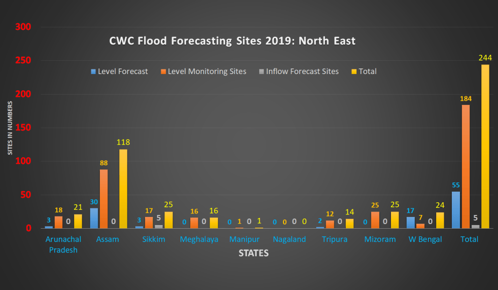
The CWC’s FF website had in 2018 monsoon, information about 226 Flood Forecast Sites in the country comprising of 166 Level Forecast Sites and 60 Inflow Forecast Sites. It also monitors 700 Flood sites, information made available through List Based Exploration and Hydrograph View. As reported below, the number of sites have gone up during 2019 monsoon, which is welcome. However, most of the new sites, along with some old ones do not have key information.
Continue reading “Overview of CWC’s Flood Forecasting Sites 2019: North East India”