This is analysis of the decisions of the Advisory Committee in the Union Ministry of Water Resources for consideration of techno-economic viability of Irrigation, Flood Control and Multi Purpose Project Proposals (TAC in short) for North East India[1] from 95th meeting of January 2009 to 122nd meeting held in December 2013. In our last analysis of TAC minutes we have covered the decision taken for NE states from July 2011 to December 2013 which is available at – https://sandrp.wordpress.com/2014/03/19/lack-of-transparency-and-accountability-remains-the-norm-of-functioning-for-mowrs-advisory-committee/. In this analysis, we have covered the same for an extended period. In these five years TAC has accepted project proposals worth of 5515.46 crores. In calculating the total cost of the projects considered we have considered only the projects whose proposals were given clearance by TAC. In these five years, some of the projects also made two appearances with revised costs. In such cases the higher revised cost has been taken into consideration, e.g. Khuga Multipurpose Project and Dolaithabi Barrage Project, both located in Manipur were accepted by the committee in its 100th meeting (held on 9th October 2009) with revised cost of Rs 381.28 crore and 251.52 crore respectively. In the 115th meeting (held on 24th July 2012) of the TAC, these two projects were considered again where the cost for Khuga Project was Rs. 433.91 cr and for Dolaithabi Project it was Rs. 360.05 Cr. The same is the case for the Thoubal Multipurpose Project which appeared in 101st and 115th meeting of the TAC.
Within these five years, TAC has given financial clearance to 26 flood and erosion control projects and majority of these projects are from Assam. The committee gave the clearance to 6 irrigation projects, 3 barrage projects and 3 multipurpose projects.[2] The committee also gave clearance to a strom water drainage improvement project below Greenfield Airport at Pakyong in Sikkim within this period.
In this period, largest no of considered (25) and approved (20) projects were from Assam. Assam also has the maximum cost of projects among all states (Rs. 2631.99 Cr). Highest number of projects were considered (16) and approved (14) in the year 2009, with total cost of Rs 2321 Crores, which too was highest among all the years.
As found in our previous analysis, in the last five year from 2009 to 2013 TAC has not rejected a single project. Five projects had been deferred but were approved in the subsequent meetings within the same period. In the 108th meeting (held on 4th January 2011), the TAC did not discuss two projects on the Brahmaputra river stating “It was observed that the flood control and anti erosion scheme of Brahmaputra Board are implemented through Central Fund, which do not require investment clearance from the Planning Commission. Therefore, these schemes need not be put up to the Advisory Committee. However, the technical aspect of such project may be looked into by Central Water Commission as per past practice.” But both these projects were reconsidered in the 110th meeting of TAC (held on 20th July 2011) and were cleared by the committee.
So this seems like a rubber stamping committee, clearing everything that comes to it. Reading of the minutes of the meetings also reveals that there are hardly any critical questions asked on merits of the questions for the massive delay and cost escalations that most of the projects suffer. Nor is there an discussion about the performance of the projects.
As we noted earlier, this committee functions in most non transparent, non participatory and unaccountable way. Neither the minutes nor the agenda notes of the meetings are in public domain. Following our letters along with TAC analysis in April 2011, addressed to Planning Commission, Union Ministry of Water Resources, Central Water Commission and members of the National Advisory Council, for the first time, TAC minutes were put up on CWC website (see: http://www.cwc.gov.in/main/webpages/TAC%20minutes.html). However, the last uploaded minutes were for the 115th meeting held in July 2012, after which minutes have stopped being uploaded. Secondly, some of the links are not working and all the files are unnecessarily large PDF files since only scanned pages of the minutes are put up, in place of the PDFs of normal word files, which would be of much smaller size. The TAC also has no independent, non government members, all the members are government officials. As we wrote to MoWR and Planning Commission in April 2011 and again in March 2014, there is urgent need for TAC to have such members so that they provide objective perspective about the projects that come up before TAC.
The importance of functioning of this committee cannot be over emphasised. As we wrote in our letter to MoWR and Planning Commission, TAC “considers dozens of such projects with huge economic, social, environmental and other implications for the country in every one of its meetings. All of these projects are supposed to be public purpose projects, and are taken up using public resources. The Planning Commission accords investment clearance to the projects only after the TAC clearance. This Committee’s decisions are perhaps the ones which impact on India as a whole the most – as they relate to land and water – which are the basic life sustaining and livelihood providing resources for the people.”
It is high time that first effective steps are taken to ensure that the functioning of this committee becomes more transparent, participatory and accountable.
State-wise list of projects cleared by TAC
State
No of Projects Considered
No of projects approved
Total cost of the projects
Arunachal Pradesh
4
4
106.6
Assam
25
20
2631.99
Manipur
10
10
2268.99
Meghalaya
1
1
5.63
Sikkim
1
1
48.55
Tripura
6
6
453.7
Note: No projects from Mizoram and Nagaland have come to TAC in this 5 years period.
Year-wise List of Projects Cleared by TAC
Year
No of Projects Considered
No of projects approved
Total cost of the projects
2009
16
14
2321
2010
5
5
663.67
2011
12
9
497.33
2012
5
5
2208.81
2013
9
9
1439.45
Meeting-wise List Projects Cleared by TAC January 2009 to December 2013
Sl. No
Meeting no
Date of meeting
No of projects considered
No projects approved
No of projects deferred
No of projects rejected
Total cost of the accepted projects, Rs Crore
95th
20.01.2009
4
3
1
0
196.07
96th
16.02.2009
2
2
0
0
168.14
100th
09.10.2009
6
5
1
0
264.73
101st
30.11.2009
4
4
0
0
77.26
102nd
28.01.2010
1
1
0
0
59.91
103rd
11.03.2010
1
1
0
0
302.22
106th
16.09.2010
3
3
0
0
301.54
108th
04.01.2011
2
0
2
0
0
109th
04.03.2011
3
3
0
0
70.13
110th
20.07.2011
5
4
1
0
211.56
111th
17.08.2011
1
1
0
0
167.09
112th
14.09.2011
1
1
0
0
48.55
115th
24.07.2012
5
5
0
0
2208.81
117th
21.03.2013
1
1
0
0
155.87
118th
30.07.2013
2
2
0
0
467.38
119th
29.08.2013
2
2
0
0
601.67
120th
13.09.2013
1
1
0
0
42.96
121st
08.10.2013
2
2
0
0
146.01
122nd
20.12.2013
1
1
0
0
25.56
Total
47
42
5
0
5515.46
95th meeting (20.01.2009): Accepted TOTAL – Rs 196.07 crores (revised costs have been taken into consideration)
SN
Project
Dist/ State
Appr. year
River/ Basin
Original (revised) Cost-CrRs
Decision
1
Protection of Sialmari Area
Morigaon/ AS
2002
B’putra
14.29 (25.73)
Accepted
2
Protection of Bhojaikhati, Doligaon and Ulubari
AS
2002
B’putra
14.52 (27.92)
Accepted
3
Protection of Majuli Island Ph II-III
AS
New
B’putra
116.02
Deferred the proposal with suggestion to prepare the cost at current prices.
4
Raising & strengthening Dyke from from Sissikalghar to Tekeliphuta including closing of breach by retirement and anti erosion measures
AS
New
B’putra
142.42
Accepted
96th meeting (16.02.2009): Accepted Total – Rs 168.14 crores
SN
Project
Dist/ State
Appr. year
River/ Basin
Original (revised) Cost-CrRs
Decision
1
Flood protection of Majuli Island Ph-II & III
AS
New
B’putra
115.03
Accepted
2
Restoration of Dibang & Lohit rivers to their original courses at Dholla Hattiguli
AS
New
B’putra
23.32(53.11)
Accepted partially & suggested that proposal of coffer dam, pilot channel, etc. may be put up to the Standing Committee for expert opinion
100th meeting (09.10.2009): Accepted: TOTAL – Rs 897.53 crores
SN
Project
Dist/ State
Appr. year
River/ Basin
L of Dam
Original (revised) Cost-CrRs
Benefit Irri CCA
Annual Irrigation
Decision
1
Borolia Irrigation Project
AS
1980
Brahmaputra
92 m
6.775 (135.93)
9717
15,000 Ha
Deferred due to non-submission of State Finance Concurrence
2
Khuga Multipurpose (Major- Revised)
Manipur
1980
Khuga/ Imphal
230 m
15 (381.28)
9575
14,755 Ha
Accepted
3
Dolaithabi Barrage Project (Med Revised)
Manipur
1992
Iril/ Manipur
79 m
18.86 (251.52)
5,500
7,545 Ha
4
Gumti Irrigation Project (Revised)
Tripura
1979
Gumti
96 m
5.88 (83.01)
4,486
9,800 ha
Accepted
5
Khowai Irrigation Project (Revised)
Tripura
1980
Khowai
96 m
7.10 (83.01)
4,515
9,320 Ha
Accepted
6
Manu Irrigation Project
Tripura
1981
Manu
82 m
8.18 (98.71)
4,198
7,600 Ha
Accepted
101st meeting (30.11.2009): Accepted TOTAL – Rs 1059.26 crores
SN
Project
State
Appr. year
River/ Basin
L of Dam
Original (revised) Cost-CrRs
Benefit Irri CCA/ flood prot.
Annual Irrigation
Decision
1
Raising & strengthening to Puthimari embankment
Assam
New
B’putra
NA
30.23
15000 Ha
NA
Accepted
2
Anti Erosion measures to protect left B’putra Dyke
Assam
New
B’putra
NA
27.97
5000 Ha
NA
Accepted
3
Protection of Gakhirkhitee and its adjoining areas
Assam
New
B’putra
NA
19.06
20,000 Ha
NA
Accepted
4
Thoubal Multipurpose Project (revised)
Manipur
1980
Thoubal/ Imphal
1074 m
47.25 (982)
21,862 ha
33,449 Ha
Accepted
102nd meeting (28.01.2010): Accepted TOTAL – Rs 59.91 crores
SN
Project
Dist/ State
Appr. year
River/ Basin
Original Cost-CrRs
Benefit-flood protsn
Decision
1
Emergent measures for protection of Rohmoria in Dibrugarh Dist
Assam
New
Brahmaputra
59.91
18,000 Ha
Accepted
103rd meeting (11.03.2010): Accepted: TOTAL Cost of approved projects: Rs 302.22 crores
Project
Dist/ State
Appr. year
River/ Basin
L of Dam
Original (revised) Cost-CrRs
CCA (Ha)
Annual Irrigation (Ha)
Decision
Champamati Irrigation Project
Chirag/AS
1980
Champamati/B’putra
258.5 m
15.32 (309.22)
17,414
24,994
Accepted
106th meeting (16.09.2010): Accepted TOTAL – Rs 301.54 crores
SN
Project
Dist/ State
Appr. year
River/ Basin
Original (revised) Cost-CrRs
Decision
1
Raising & strengthening of tributary dyke on both banks of Kopili River
Assam
New
Kopilli/ B’putra
110.72
Accepted
2
Assam Integrated Flood River Bank Erosion Risk Management Project
Dibrugarh/ Assam
New
Brahmaputra
61.33
Accepted
3
Assam Integrated Flood River Bank Erosion Risk Management Project
Palasbari/ Assam
New
Brahmaputra
129.49
Accepted
108th meeting (04.01.2011): Accepted TOTAL- Rs 0
SN
Project
Dist/ State
Appr. year
River/ Basin
Original (revised) Cost-CrRs
Decision
1
Restoration of Dibang & Lohit rivers to their original courses at Dholla Hattiguli
AS
New
Brahmaputra
23.32(53.11)
The technical aspect pf this type of project may be looked in to by CWC as per past Practices.
2
Protection of Majuli Island from flood & erosion, Ph II-III
AS
New
Brahmaputra
116.02
The technical aspect pf this type of project may be looked in to by CWC as per past Practices.
109th meeting (04.03.2011): Accepted TOTAL – Rs 70.13crores
SN
Project
Dist/ State
Appr. year
River/ Basin
Original (revised) Cost-CrRs
Decision
1
Anti Erosion & Flood Protection work in Dikrong Basin
Arunachal Pradesh
New
Dikrong
23.68
Accepted
2
Anti Erosion & Flood Protection work in Bhareli sub Basin
Arunachal Pradesh
New
Bhareli
16.81
Accepted
3
Anti Erosion & Flood Protection work in Siyom Basin
Anti erosion work along river Gumti from Dlak Samatal Para to Durgapur under Amarpur, Udaipur & Sonamura subdivision
S & West Tripura
Gumti
54.99
2209
Accepted
Anti erosion work along river Khowaii from Netajinagar to Banglahour under Telimura subdivision and from south L. N. Pur to Paharmura bridge under Khowai subvision
[1]While this article only contains the details of the North East India Projects considered in TAC for the five years, we hope to soon provide details of the projects considered by TAC from all over India.
[2] Sicne Khuga Multipurpose, Thoubal Multipurpose and Dolaithabi barrage project, all from Manipur appears twice in this period, they have calculated only for once here.
The Advisory Committee in the Union Ministry of Water Resources (MoWR) for consideration of techno-economic viability of Irrigation, Flood Control and Multi Purpose Project Proposals (TAC in short) is a very important committee. It accords the financial clearance for any irrigation, flood control and multipurpose project. TAC is supposed to discuss the techno-economic viability of projects as per the resolution published in the Union of India Gazette Notification No. 12/5/86-P-II dated Nov 27, 1987. This committee came into being replacing a similar committee that existed earlier in the planning commission. Even now, the guidelines for functioning of the committee are issued by the Planning Commission.
The Gazette notification cited above also said, “The committee may also invite representatives of any other Government organizations, scientific body of experts in the relevant fields to participate in its deliberations.” This seems like a window to appoint credible, independent, non-government persons in the committee, but this window does not seem to have been used. Among the functions of the committee listed in this notification include, “The functions of the Committee will be to examine projects proposed by State Governments, Central Government or other organizations and satisfy itself that the schemes have been prepared after adequate investigations” and “the need of environment conservation and proper rehabilitation of project-affected persons have been taken into account.” However, our perusal of the functioning of the TAC shows that TAC has failed to fulfill both these mandates.
As noted in the Guidelines for Submission, Appraisal and Clearance of Irrigation and Multipurpose Projects, 2010 available on the CWC website (see: http://www.cwc.nic.in/main/webpages/publications.html), “The project proposal, thereafter, is put up to the Advisory Committee for clearance, which is, by and large, like single window clearance.” The importance of such a single window clearance becomes all the more important. The guidelines further note, “On the basis of examination conducted by the Advisory Committee, decision on techno-economic viability of the projects is taken in the meeting of this Committee. The projects found acceptable by the Advisory Committee shall be recommended for investment clearance by the Planning Commission and inclusion in the Five Year Plan/Annual Plan.” This shows how important is the role of the TAC in judging techno-economic viability of projects and also from the point of view of prudent planning.
No Transparency, independent participation or accountability of TAC Considering the above, there is strong case for clearly defined norms for transparency, participation and accountability in (1) functioning of TAC; (2) The screening process of the projects at initial stages that also happen under these guidelines in the Central Water Commission, based on which approval for DPR preparation is given.
In view of the significance of TAC, this is SANDRP’s third analysis of the decisions taken in TAC meetings. The present analysis covers decisions taken for North East India from 110th to 122ndTAC meeting. In the two previous analysis done by SANDRP, TAC meeting decisions taken from 95th meeting to 109th meeting has been covered. Here it is important to note that lack of transparency has been observed right from the agenda and minutes of the TAC meetings. The agenda and minutes of the TAC meetings should be uploaded on CWC website but CWC website has minutes only till the 115th meeting held on 24th July 2012 and the website has been last updated on 31/08/2012.
In this analysis we have covered 13 TAC meetings held from July 2011 to December 2013. In these 13 meeting, 21 projects from 6 northeastern states have been considered. But out of the 13 meetings held, projects from northeast were considered only in 10 meetings. TAC has accepted the proposals for projects with a total cost of rupees 4075.46 crore. Majority of the projects were given clearance at the first time of consideration. Thus, on an average TAC had cleared projects worth of 407.55 crores from the North East in each of these 10 meetings. Number of the projects considered by TAC in each meeting along with their total cost is given below. A state-wise and a project-wise list is also provided.
Total Cost of Projects Cleared by TAC July 2012 to December 2013
Sl No
Meeting no
Date of meeting
No of projects considered from NE
No projects approved
No of projects deferred
No of projects rejected
Total cost of the accepted projects, Rs Crore
1
110th
20-07-11
5
4
1
0
211.56
2
111th
17-08-11
1
1
0
0
167.09
3
112th
14-09-11
1
1
0
0
48.55
4
115th
24-07-12
5
5
0
0
2208.81
5
117th
21-03-13
1
1
0
0
155.87
6
118th
30-07-13
2
2
0
0
467.38
7
119th
29-08-13
2
2
0
0
601.67
8
120th
13-09-13
1
1
0
0
42.96
9
121st
08-10-13
2
2
0
0
146.01
10
122nd
20-12-13
1
1
0
0
25.56
Total
20
4075.46
State-wise list of projects cleared by TAC
Sl. No
State
No of projects approved
Total cost of the approved projects, Rs Crore
1
Arunachal
1
36.47
2
Assam
7
1526.85
3
Manipur
7
2268.99
4
Meghalaya
1
5.63
5
Sikkim
1
48.55
6
Tripura
3
188.97
Note: No projects from Mizoram and Nagaland have come to TAC in this 30 month period.
Some observations regarding TAC meetings
1. Zero Rejections The TAC did not reject a single project. There was only one project which was deferred in the 110th meeting but it was approved in the next meeting. Rest of the new projects were were approved in the very first meeting of their consideration.
2. Lack of information The TAC minutes provide little information about projects. Specially in case of newer projects, detailed discussions should have happened. The minutes of TAC meetings do not give much of an idea about size, location, benefits of a particular project. In the project- wise list provided towards the end of this analysis, we have provided limited information available in the minutes. Some of the noteworthy missing information is listed below:
– In the 115th meeting, 5 projects from Manipur were considered. Out of these five projects, 2 were multipurpose projects and 3 were barrage projects. Surprisingly, there was no information about where these projects are located, on which river, what the size of these projects. None of the minutes mentioned about whom these projects will actually benefit. Only two projects mentioned about increase in annually irrigated land but no more detail was provided.
– In the 118th meeting, construction of embankments on both banks of river Ranganadi for flood management and river training was considered. But the cost of the project was on the higher side compared to the embankment construction work to be done on the river Dikrong, considered in the same meeting. This cost escalation may be due to the difference in the length of the projects. But this cannot be confirmed since minutes do not mention the length of the proposed embankments.
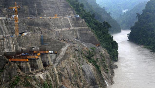
India’s First Geo-tube embankment in Matmora in Dhakuakhana sub-division of Lakhimpur district in Assam. Photo: Parag Jyoti Saikia
But the increased costs may also be due to the use of Geo bag technology for construction of Ranganadi embankments. Use of Geo-bag technology is a costly affair but nothing has been mentioned about the use of this technology in the minutes of 118th meeting. This is stated in the annexure (Annex VI as mentioned in the document) of the meeting. Interestingly this annexure too has been mentioned only as a corrigendum.
3. No Detailed Discussion on Projects Considered This was very evident in the two previous analysis done by SANDRP and situation remains the same this time as well. In case of all the projects, including the ones considered for the first time, there was no detailed information or any detailed discussion. There is no discussion on technical viability of the project. Reading through the minutes gives an impression that approval for any project considered by TAC is fait accompli.There is no discussion about whether the project is a desirable project, if there are other options available, if this is the best option and so on. Under the mandate given to it, TAC is supposed to discuss all these issues. TAC accepted projects proposals with huge cost and time overruns but little enquiry has been made why such escalation happened.
Dhansiri irrigation project This is a glaring example of cost escalation. The project was discussed in the 119th meeting on 29.08.2013 for consideration of cost of Rs 567.05 crores. But, it was surprising to find that original cost of the project in 1975 was Rs 15.83 crores as according to the information available in Assam State Irrigation Department website.[1] The same website states that project started in 1975 and supposed to be completed 35 years later in 2010. In the TAC meeting a new time schedule of March 2015 was stated. The cost of the project has increased by 35.82 times over a period of 40 years but the advisory committee accepts proposal without much scrutiny or enquiry.There was no detailed assessment of the reasons for time and cost over runs (there is no question of delay due to clearances or agitations here) or whether this project which will take 40 years just to complete will be viable or not. On the contrary, the planning commission representatives said, “the benefit cost ratio of the project was 1.2 and any further escalation in cost would result in the project becoming techno-economic unviable.”
The TAC should have done a detailed assessment why the project took so long time to complete. But it seemed to be contended with the rational that the project authorities provided which was that due land acquisition and law and order problem the project has not been completed. But in the meantime minutes of the meeting also showed that that major components of the project are in advanced stages of construction with 93% of barrage work, 99% of the canal works and about 83% of works in the distribution system were reported to have been completed. There has been no detailed assessment in to any of these aspects.
Imphal Barrage project In this project, the cost of the project mentioned in the minutes of the 115th meeting contradicted with the cost provided in the annexure. The cost of Extension, Renovation and Modernization (ERM) of the Imphal barrage project as mentioned in the minutes is Rs 16.80 crores. But a letter from the Under Secretary, Govt. of Manipur to the Chief Engineer of Irrigation and Flood Control Department, Manipur dated 21.07.2012 stated the cost of the project as 23.41 crores. This reflects the lack of serious discussion over projects in TAC. It is also surprising that TAC, being the committee which gives the techno economic clearance to projects, does not have clarity about even the cost of the project.
4. No Discussion over Social, Environmental and Other impacts of the Projects The projects cleared by TAC have serious social, environmental and other impacts but the committee never discussed these impacts. TAC does not at all take into account the impacts a project would have on the environment.
In the 118th meeting (30.07.2013), while considering the proposal for flood management of Dikrong along with river training works on both banks, the minutes stated “Effectiveness of existing embankments of river Dikrong has been deteriorating due to lack of repair, siltation of river bed and consequential change in river behaviour, change in flow pattern due to release of Ranga Nadi hydel project etc.” But this is one of the rare instances when TAC mentioned about the environmental impacts on embankments. But rather than asking for more details on these impacts or to see whether embankment would really be a viable option or not, the TAC accepted the proposal. On the other hand nowhere the committee discussed what impacts an embankment has on river bed, siltation or downstream stretches of a river.
Dikrong Power Station at Hoz where water from Ranganadi HEP is released in Dikrong/Pare. Photo: Parag Jyoti SaikiaRiver Dikrong at Dikronghat in Lakhimpur district of Assam where it erodes rapidly. The impacts of change is water flow is clearly visible. Due to release of water in upstream water at night covers the lower portion of the bank. This photo was taken around 8am in the morning when the water receded. The lower bank portion was wet in the morning. According to the local the water further recedes by the evening and again increases at night. Photo: Parag Jyoti Saikia
It is also important to note here TAC also does not take into consideration impacts of the hydropower projects on the embankments in the downstream of the river. In the above mentioned case, the increased costs of Dikrong embankment should have been charged on the Ranga Nadi HEP, but there is no discussion on this. The Pare hydropower project (110 MW) in Papumpare district of Arunachal Pradesh is currently under construction on Dikong / PareRiver. Moreover there are at least 10 hydropower projects at various stages in the combined Ranganadi-Dikrong basin in Arunachal Pradesh, including one operating, three TOR approvals given and five additional MoA signed (in addition to a proposed project). There is no provision to assess the impacts of these projects on the embankments downstream of DikrongRiver in Assam. In fact there is no provision for any impact assessment study for embankments even though studies show the disastrous impacts of embankments on environment, floods and on the lives of the people living close to the river.
5. Clearing Same Embankment Projects over Years In terms of embankments, it is observed that the TAC had cleared same projects over the years. Not emphasizing on the environmental impacts of embankment projects is one of the major reasons for this. In the 117th TAC meeting held on 21.03.2013 the proposal for “Protection of Brahmaputra dyke from Sissikalghar to Tekeliphuta at different reaches from Lotasur to Tekeliphuta from the erosion of river Brahmaputra Assam” was considered. The estimated cost of the project was Rs 155.87 crore. But on the same embankment, a project titled “Raising and Strengthening to Brahmaputra dyke from Sissikalghar to Tekeliphuta including closing of breach by retirement and anti-erosion measures (to protect Majuli and Dhakukhana areas against flood devastation by the Brahmaputra, Lakhimpur district, Assam) was accepted in the 95th TAC meeting held on 20.01.2009. The estimated cost of the earlier project was 142.42 crore.
A Hoarding on the way to Geo-tube embankment in Matmora, describing the project. Photo: Parag Jyoti Saikia
The minutes of the 117th meeting, about the previous scheme said that it “was taken up primarily for closure of breach in the then existing embankment including raising of embankment around the breach area only.” But the minutes of the 95th TAC meeting had said something totally different about the project. The minutes stated that project proposal envisaged – (i) Raising and strengthening of embankment for a length of 13.9 km, (ii) Construction of retirement bund with geo-textile tubes of length 5000 m. This shows how the discussion on the Brahmaputra dyke Sissikalghar to Tekeliphuta is 117th meeting is completely misleading. TAC does on even take into account its previous meeting discussions before clearing a project. This possibly gives a hint of a scam.
The Brahmaputra dyke from Sissikalghar to Tekeliphuta has a long history of facing severe erosions. The first geo-tube embankment was constructed on this dyke in Dec 2010. Crores have been spent for the protection of this embankment. But even after that the Dhakukhana sub-division always remained in the headlines during the flood season in Assam. There is need for area specific detailed study assessing the impact on and of the embankment, but little has been done in this regard. Besides, the Bogibeel Bridge, the fourth one on the BrahmaputraRiver, is coming up in the upstream of this embankment. Construction of this bridge would make this dyke even more prone to erosion since the length of this bridge will be 4.94 km, shrinking the wide river to great extent. In a personal visit to the area, one of the government officials informed that as a result of this “funneling action”, the force of water will increase and it will directly hit the embankment leading to more erosion. But TAC has never dealt with these issues in its meetings but cleared all the proposals that it considered. Short History Brahmaputra Dyke from Sissikalghae to Tekeliphuta[2]
6. There is no independent, critical voice in the meetings. The agenda, proceedings, or decisions of the meetings are not even in public domain.
7. There is no mechanism to hold the TAC accountable for any wrong decisions taken.
8. The TAC is clearly not fulfilling the mandate given to it in the guidelines for TAC meetings. The guidelines themselves need revision from several points.
9. There is no attempt to assess the justifiability of the kinds of projects that are being accepted and if they are indeed delivering the promised benefits.
Anti erosion work along river Gumti from Dlak Samatal Para to Durgapur under Amarpur, Udaipur & Sonamura subdivision
S & West Tripura
Gumti
54.99
2209
Accepted
2
Anti erosion work along river Khowaii from Netajinagar to Banglahour under Telimura subdivision and from south L. N. Pur to Paharmura bridge under Khowai subvision
Most of the major rivers in the North East India are largely free-flowing till date, which is a rarity in India and the world. Their basins are home to unbelievable ecological and cultural diversity. Main rivers in Arunachal Pradesh which form the mighty Brahmaputra are the Siang (the Yarlung Tsang Po), Dibang and Lohit, which meet at the trijunction to form Brahmaputra.
Massive hydropower projects are planned on these rivers in cascade. They will have irreversible destructive impacts on the society, forests, rivers, biodiversity, ecosystems, cultural identity and downstream Assam.
Hydropower Flood in Arunachal Pradesh Map: Neeraj Vagholikar, Sanctuary Asia
Siang River alone has 44 dams planned along its entire length.
Yes, 44 dams. You have read it correctly. At least 44 dams in one sub basin of Brahmaputra River Basin. This is what was meant by MOU virus as Jairam Ramesh described it.
Siang River Basin The Siang river originates in the Chemayungdung mountain ranges which nearly sixty miles south-east of Mansarovar lake in the Mount Kailash range in Southern Tibet at an elevation of 5300 m. A spring called Tamchok Khambab spills from the glaciers which later gather breath and volume to become the Tsangpo, the highest river in world. Tsangpo river flows 1625 km in Tibet parallel to the main range of Himalayas before entering India through Arunachal Pradesh.
Before entering India, the river passes Pi (Pe) in Tibet and suddenly turns to the north and northeast and cuts a course through a succession of great narrow gorges between the mountain Gyala Peri and Namjabarwa (Namcha Barwa) in a series of rapids and cascades. The river then turns south and southwest and flows through a deep gorge across the eastern extremity of the Himalayas with canyon walls that extends upward for 16,500 feet (5,000 meters) and more on each side.
The river enters Arunachal Pradesh near Gelling from where it is known as Siang. The total length of Siang River is 294 km till its point of confluence with Dibang and Lohit River. After entering India the river traverses approximately 197.0 km to join the Siyom river. From there the length of the river till Assam border is 86.3 km. Flowing further 10.6 km in Assam the river joins the confluence of Lohit and Dibang. From this point forward it flows as Brahmaputra river in Assam and traverses a distance of about 195 km up to the confluence of Subansiri river on its right bank. Further downstream it is joined by Kameng at Jamugurihat near Tezpur, after another 123 km. From here it travels for another 134 km up to Guwahati.
River Siang Photo from: Global Descents
The elevation of Siang river catchment area ranges from 90 m to around 5800 m. The total catchment area of Siang river from its origin to its confluence with Lohit and Dibang rivers is 251,521 sq km. Out of this 236555.7 sq km area lies in Tibet. The total catchment area of Siang river in India upto its confluence with Lohit and Dibang rivers is 14965.30 sq km.
A question arises here, what will be the condition of the 294 km long Siang river if the proposed 44 dams are being built on the river. The Siang river basin study has the answer for this which is actually alarming “Only 85.5 km (29%) of free flowing water regime of Siang river will be left out of its total course in India i.e. 294 km of lotic ecosystem will be converted into 208.5 km of lentic ecosystem altering the entire Siang river aquatic system which will adversely impact the aquatic biodiversity and seriously affecting fish populations and their migration behaviour.”(page 11.23)
Three dams on the main Siang will convert the free flowing river into a three-stepped reservoir, without ANY flowing length of the river! These dams alone will affect more than 18,000 hectares of forests! If all the dams are built, water level fluctuations in the downstream D’Ering Sanctuary will be more than 23 feet every single day in the winter and other non monsoon seasons!
82.26% of the Siang basin is under forest cover (more than 15,000 sq kms), it is rich in orchids (more than 100 species!), holds 16 species of rhododendrons, 14 species of Bamboos and 14 species of canes and overall 27 RET species and 46 endemic plant species. 25 (18%) mammalian species found are Schedule I of WPA (Wildlife Protection Act), while 26 are under Schedule II! There are 447 species of birds, of which 31 are Schedule I species. The single basin consists of 5 Important Bird Areas !!(IBAs)
Formation of River Siyom, which will have multiple dams in a cascade Photo from: Team BHP
This information has been collated by the CIA (Cumulative Impact Assessment)/ CCS (Carrying Capacity Study) of the Siang Basin, which was an attempt to look at the scale and cumulative impacts of projects in Siang holistically.
Has the CIA commissioned by Central water Commission and done by RS Envirolink Technologies done an objective, scientific, independent assessment?
SANDRP sent comments about this 2-volume study with over 1500 pages to the Expert Appraisal Committee, Ministry of Environment and Forests which will be considering this basin study in its upcoming meeting on Feb 20-21, 2014. Submission below highlights that the study has very serious short comings and bias. The recommendation of dropping 15 (mostly small ones, all below 90 MW installed capacity) HEPs and re-configuring some others is welcome, but far from sufficient. The study itself is disappointing:
Projects planned in the Siang Basin Phot from CIA/ CCS of Siang Basin
Time Line of Siang Basin Study
Feb 2010
Ministry of Water Resources constituted an Inter-Ministerial Group on the directions of Prime Minister’s Office with a view to evolve a suitable framework to guide and accelerate the development of hydropower in the North East and also to assess the impact of the massive hydropower development in Arunachal Pradesh on downstream areas in Assam
Nov 2010
EAC discussed TOR for the Siang Basin CIA
Dec 23, 2010
MoEF issues TORs for the Siang Basin CIA
April 2011
EAC discusses sampling locations for the CIA on request of CWC
Dec 2011
Work of CIA for Siang awarded to RSET Pvt Ltd
May 2012
RSET says draft interim report discussed by TAC, but there is no meeting of TAC in May 2012, minutes of March and July TAC meetings (the ones before and after May 2012) on CWC website also do not mention any such discussion.
Nov 2012
EAC discusses Draft Interim report
Aug 2013
Draft Final report submitted to CWC
Sept 2013
RSET says Draft final report discussed by TAC, but the minutes of the Sept 2013 meeting of the TAC obtained under RTI donot contain any reference to the Siang basin study
DEC 2013
Draft Final Report submitted to MoEF
Feb 17, 2014
Critique of the Draft Final report submitted by SANDRP to EAC
Feb 20, 2014
MoEF’s EAC to discuss the Draft Final report
To,
Chairperson and Members,
Expert appraisal Committee
Ministry of Environment and Forests
Delhi
Subject: Serious inadequacies of Cumulative Impact Assessment (CIA) and Carrying Capacity Study (CCS) of Siang Sub-basin including Downstream Impacts
Respected Chairperson and Members,
We see from the agenda uploaded on the MoEF Website that Final Report of the Siang CIA/CCS Study commissioned by CWC and conducted by RS Envirolink Technologies Pvt Ltd will be discussed in the 72nd EAC Meeting to be held on 20-21 February 2014.
SANDRP has been analysing basin studies in the Western Himalayas and Brahmaputra Basin for some time now. Looking at the aggressive cascade hydropower development and its far reaching cumulative impacts, CIA/ CCS and Basin Studies should form the backbone of informed decision making by MoEF. Unfortunately, most studies being considered by the EAC are of a sub-standard quality and are shying away from addressing the cumulative impacts [1]. EAC itself is delinking appraisal of individual projects from basin studies, rendering the crucial process meaningless which is in violation of EIA notification of Sept 2006, wherein Form 1 Section 9 actually asks for cumulative impact assessment. Some of the recent orders of National Green Tribunal also make it CIA mandatory, thus making such delinking legally untenable.
Looking at the scale of ecological and social impacts of these projects and the significance of MoEF’s and EAC’s role, we urge the EAC to consider CIA/ CCS/ Basin Studies more seriously.
Main issues with Siang Basin Study include: (These are elaborated with reasons below)
1.No mention of social and cultural impacts!
2.Downstream impacts on Assam not studied in detail
3.Cumulative Disaster vulnerability, impact of projects on such vulnerabilities, Dam Safety Assessment, risk assessment not done
4.“Cumulative” Impacts not assessed on several aspects
5.Non-compliance with critical recommendations by the EAC:
a.Study is not compatible with similar studies done worldwide
b.No suggestions about ramping to reduce downstream impacts
c.No recommendation on free flowing length between two projects
d.No mention of cumulative impact on sediment regime
e.No mention of impact of road construction
f.BBM for eflows not used, despite agreeing to use it before EAC
g.Impact of Sand mining, boulder mining not conducted
h.Impact of specific projects not clearly studied
6.Eflows, one of the most significant issues, handled erroneously: NO ACTUAL ASSESSMENT OF E-FLOWS REQUIREMENTS AS REQUIRED BY TORs
7.No mention of Climate Change, reservoir emissions vis-à-vis cumulative impacts of such massive scale, how the projects would affect the adaptation capacity of the communities and region in the context of climate change
8.No stand taken on three mega projects on Siang Main Stem and other big hydro projects
9. No conclusion about how much length of the river is to be compromised
10. Number of sampling locations: TOR not followed
11. Source of information not given
12. Inconsistency, contradictions in listing of flora-fauna
13.Unsubstantiated advocacy: going beyond the TOR & mandate
14. Other inadequacies of CIA
15.Study should not be finalised without credible Public consultation across the basin.
Division of the Siang Basin into sub basins Phot from : CIA/ CCS Report of the Siang Basin
DETAILED CRITIQUE
1. No mention of social and cultural impacts! In the entire basin study, there is no mention of social and cultural impacts by these 44 projects which will together submerge more than 21,000 hectares of forests and affect the entire Siang Basin adversely. Needless to say, local communities depend heavily on the basin resources like fish, medicinal and food plants, timber varieties for their livelihoods. For example, more than 2000 hectares of multi-cropped, irrigated rice fields will be submerged by Lower Siang Project alone.
Adi Community that will be affected by the dams on Siang Photo with thanks from : Kaushik Shil
The CIA/CCS study needs to be re-conducted, in which social and cultural cumulative impacts are assessed with participation of local communities and downstream communities from Arunachal Pradesh and Assam. It may be remembered that Public Hearing of Lower Siang (in the latest instance, slated to be held on 31st January 2014) had to be cancelled due to a number of procedural issues, and also opposition from local residents [2]. It is incomprehensible how the CIA Study has no assessment of impacts on communities!
2. Downstream impacts on Assam not studied in detail The study assesses impacts specifically on Dibrugarh, Bokaghat (Kaziranga) and Guwahati. However, there are several villages, settlements, tea estates, agriculture, forests etc., on the Right Bank of Siang in Assam after Pasighat. This includes a major part of Dhemaji District of Assam. Impact on this region needs to be assessed. There has been opposition to Siang Dams from places like Jonai from Dhemaji, which have been ignored.[3]
Meeting protesting against Public Hearing of 2700 MW Lower Siang HEP Photo: Echo of Arunachal
According to the model used, the chainage for assessing impacts at D’Ering Sanctuary is between 20-33 kms from Lower Siang Dam. The next chainage is at 102 kms at Dibrugarh. Impacts on the stretch between D’Ering and Dibrugarh, for nearly 70 kilometres are simply not assessed! What can be reason behind this?
Level fluctuations at D’Ering Sanctuary, with Lower Siang, Middle Siyom and Upper Siang Projects is to the tune of 7.2 meters (23.66 feet!!) in lean season. This highlights the need to study impacts on the intermediate zone in Assam between Dering Sanctuary and Dibrugarh. The Study should not be accepted without these assessments.
3.Cumulative Disaster vulnerability, impact of projects on such vulnerabilities, Dam Safety Assessment, risk assessment not done
Upper Siang Stage I, Stage II and Lower Siang are huge projects with direct impact on downstream state. Even as issues of dam safety and risk assessment have gained high significance in Assam as can be seen in Lower Subansiri protests, the basin study/CIA does not include a word on dam safety, cumulative risk assessment, risk of landslips and landslides, seismic zones of projects, past earthquakes in the region, possible mitigation measures, disaster management, etc. There is no assessment of baseline situation about disaster vulnerability of the region and how the projects will change that. By its nature, a CIA/CCS/ basin study is best placed to assess these impacts.
Lanslides are a common feature of this region. Pic shows Yinkiong in Siang II Sub basin where several projects are planned. Photo: Team BHP
These points have been raised by KMSS, Assam and others. The Uttarakhand disaster of June 2013 underlines this and even the Supreme Court of India has asked for an assessment of how hydropower projects contributed to disaster in Uttarakhand. Looking at Uttarakhand Disaster as well as protests from downstream Assam where dam safety is a major issue, dam safety needs to be addressed in the CIA/ CCS. In the absence of all this, projects will not be allowed by communities, as can be seen with Lower Subansiri and Lower Siang.
4.Cumulative impacts not assessed on several aspects The study has a sketchy section (Chapter 11) on Cumulative impact assessment.
The minutes of 62nd EAC meeting noted, “The main objective of the study is to bring out the impact of dams being planned on the main Siang River and its seven tributaries on terrestrial and aquatic ecology, plant and animal biodiversity, including wild life, hydrology of the basin, etc.” (Emphasis is as in original.) However, the study has not placed emphasis on assessing these impacts.
Yar Gyap Chu: a River and basin which holds high religious significance for the Buddhists Photo: Kaushik Shil
Moreover, the study does not attempt to assess cumulative impacts of all the projects due to:
Blasting and Tunnelling: This is not mentioned even once in the entire study! When the disastrous impacts of blasting, tunnelling and related activities are fresh in our minds w.r.t Uttrakhand and Himachal Disasters, it is incomprehensible to see that this section is not mentioned at all in the basin study!
Community resources: No mention on loss of agricultural lands, homesteads, displacement, loss of forest rights, etc.
Infrastructure development: No mention of the impact of workers colonies, buildings on the society, landscape and cultural aspects, etc.
Greenhouse gas Emissions: Considering submergence of more than 20,000 hectares of dense to very dense forests and building of a large number of reservoirs in tropical climate, cumulative impacts on green house gas emissions should have been assessed.
Biodiversity, RET Species, Deforestation: While the report deals with these issues very sketchily, there is no statement as to what will be the cumulative impact of 44 projects on the above issues.
5.Non-compliance with critical recommendations by the EAC Interim basin study was discussed in the 62nd EAC meeting in November 2012. The EAC had given some important recommendations at that stage to be included in the study. However, most of the recommendations have not been complied with, these include:
Study is not compatible with similar studies done worldwide: EAC had specifically recommended compatibility with global studies. However, Siang CIA is not compatible with any global Basin and Cumulative impact Assessment Study. A Cumulative Impact Assessment is a multi-stake – holder process that assesses the cumulative and indirect impacts as well as impact interactions of the proposed dam or set of dams, as well as existing and planned projects from other sectors, on ecosystems, communities, and identified Valuable Ecosystem Components (VECs) within a specific spatial and temporal boundary. [4]
No suggestions about ramping to reduce downstream impact: EAC had specifically asked for ramping study with reference to downstream impacts. However, ramping studies are not done at all, although downstream impacts of the projects in isolation as well as together are huge.
No recommendation on free flowing length between two projects Although Upper Siang I, Upper Siang II and Lower Siang have no free flowing stretch between each other, the study refrains doing any assessments or from making any recommendations in this regard, contrary to EAC’s recommendation.
No mention of cumulative impact on sediment regime 44 projects with several mega reservoirs will have a profound impact on the sediment regime of the rivers as well as downstream impacts thereof. EAC had specifically asked to include sediment balance and impact, which is not discussed in the report.
The minutes of 62nd meeting of EAC says: “The Consultants were also asked to study and recommend on silt management considering “no dam” and “with dam” scenario as silt substantially impact the ecology and cause sedimentation particularly when its velocity is affected d/s due to construction of dam.” No such study has been conducted. In fact globally, sediment balance on cascade projects is a crucial element of study, which is completely left out in the present study.
No mention of impact of road construction Roads and related activities like deforestation, slope destabilisation, blasting, mining, muck dumping, all the cumulative impacts of peaking operation (needs to be done comprehensively, including the limitations that such operation of upstream projects will impose on downstream projects), etc have a critical impact on fragile geology. Role of roads for hydel projects was significant in Uttarakhand Tragedy in June 2013. EAC had specifically asked for “Impacts due to construction of approach roads”. This point is not touched upon in the report.
BBM for eflows not used, despite agreeing to use it in front of EAC Although the consultant agreed in the 62nd meeting that BBM will be used to assess eflows regime,[5] at the insistence of the EAC, in reality BBM has not been used in the study. The reasons given [6] that BBM is a “prescriptive approach”, “it takes too much time” and “only stakeholder in the basin is river and fish” is wrong, shocking and unacceptable.
The study forgets about the people, biodiversity and other stakeholders. Requirements of BBM were known at the time consultant agreed to use this methodology before the EAC. Is fluvial geomorphology, cultural practices, hydrological requirements and sediment balance not important blocks of BBM study?
Impact of Sand mining, boulder mining not conducted EAC had specifically asked for this study. This is critical as mining of sand and boulders from river bed has severe impact on riverine ecology, bed stability, erosion, flow velocity, etc. However, the study has not even mentioned this issue.
Yargyap Chu or the Medicinal RIver Photo: Team BHP
Cumulative Impacts of projects on biodiversity in sub-basins not clearly studied While the study has done impressive job in inventorysing ecological attributes of 11 sub basins, it has fallen woefully short in clearly communicating the individual and cumulative impacts of projects on Valued Ecosystem Components (VECs). This reduces practical application of the report. EAC had brought this up during the 62nd meeting.
Length of rivers to be assessed for downstream studies As per the minutes of the 43rd meeting of EAC held in Nov 2010 the report was to recommend: “What may be criteria for downstream impact study in terms of length of the river downstream to the tail water discharge point and what may be the parameters of such a study”.
The same EAC meeting recommended: “If the states do not change their policy of allotting elevation-wise river reaches for hydropower development, what criteria the EAC may adopt in restricting the river reach for hydropower development. Alternatively, what should be the clear river length of uninterrupted flow between the reservoir tip at FRL of a downstream project and the tail water discharge point of the immediate upstream project.”
“For peaking stations, what extent of diurnal flow variation may be considered safe for the aquatic life. There are examples where the release is drastically reduced during the long time for reservoir filling and huge discharge flows through the river during the few hours of peak power generation. This is detrimental to the aquatic environment of the downstream stretch of the river.”
“For muck disposal, what may be minimum distance that must be maintained between the outer boundary of the muck disposal sites and the river bank.”
6. Eflows, one of the most significant issues handlederroneously: NO ASSESSMENT OF E-FLOWS REQUIREMENTS The CIA has not done assessment of e-flows requirements at various locations keeping in mind the upstream projects. The very crude assumption it has made is by dividing the entire basin in Mahseer and Trout Zone and assuming certain water depths for these fish in lean, monsoon and non-lean, non-monsoon months. Several fisheries scientists do not support this classification or accept these two species alone as representing the ecosystem. The study assumes 50 cms water depth for Mahseer and 40 cms depth for Trout in lean season.[7] Then flows for maintaining that particular depth are calculated and recommended. Added criteria is that depth should not be less that 50% pre-project river depth.
Luxuriant Biodiversity of the Siang basin Photo: Team BHP
Here it is worth quoting the minutes of 62nd meeting of EAC:
“The EAC asked the Consultants to take comprehensive view of the environmental flow assessment and make final recommendations for each stretch. Committee asked to study international literature available on the subject and use the best suitable methodology for this exercise suiting to Indian conditions. The Consultants said that most appropriate method such as Building Block Methodology would be used by them. Detailed habitat simulation modelling for the entire year needs to be considered so that flow release requirement can be established not only for lean season but also for monsoon season and other months… The Consultants while submitted that public hearing as such is not a part of the study as per ToR, informed that BBM entails expert and stakeholder‟s consultations and would be followed.”
This has clearly not been done.
This approach is incorrect on various counts:
The habitat requirements of Mahseer and Snow Trout are higher than the assumed 0.5 m and 0.4 m. This has been confirmed by several fisheries scientists. The WII study on Upper Ganga Projects recommends a minimum of water depth of 1 meter for adult Mahseer (Tor species) (Table 7.6, Page 148) and at least more than 50 cms for Trouts (Schizothorax sps) (Table 7.8, Page 150). Incidentally these tables from WII Cumulative Impact Assessment have been used in the report without stating the source or credit. SANDRP has interacted with several fisheries experts who claim that 0.5 meters is a completely inadequate depth for adult Mahseer.
This faulty assumption has led to low eflows recommendations of 15% of average flows in non-lean non-monsoon months for Heo and Tato I Projects, this is lower even that EACs norms. This assessment and recommendations are clearly unacceptable.
The criteria of 50% water depth wrt pre-project depth is arbitrary and without any scientific justification. For Himalayan rivers with a stable hydrograph like Siang, 50% depth reduction is very high. As can be seen from Eflows chapter, after 50% depth reduction, most river stretches have less than 100 cms depth, which is just about the minimum depth required for an adult Mahseer or a spawning snow trout. However, Mahseer and trouts are abundant in these rivers. This just indicates the problems behind 50% water depth criteria. This should not be accepted.
The entire eflows discourse is not based on assessment of environment flows for various objectives and ignores most critical requirements.
Division of the Basin into Trout and Mahseer Zones Photo: From CIA/ CCS Report of Siang Basin
7. No mention of Climate change In the entire study, there is no mention of climate change, how changing climate would affect the rivers and projects and how project construction would add to climate change impacts and how they will reduce the adaptation capacity of the people and environment to cope with the changing climate. Deforestation to the scale of 21000 hectares of thick forests and complete loss of a biodiversity rich free flowing river has strong impacts in the context of climate change and these need to be assessed.
8. No stand taken on three mega projects on Siang Main Stem and other big hydro projects Three mega projects on Siang Main stem, namely the 6000 MW Upper Siang I, 3750 MW Upper Siang Stage II and 2700 MW Lower Siang will have a huge destructive impact on the entire ecology and society of the region. These three projects together will submerge 18,100 hectares of dense forest area and will convert entire river length between these projects: 208.5 kilometers, into unbroken sequence of reservoir-dam-reservoir-dam-reservoir-dam, with no flowing river between two consecutive projects. The study has not even attempted assessment of length of flowing river required between the projects and eflows allocation for this stretch.
L Section of the Siang River with 3 mega projects which do not leave any flowing river between them. Photo from: CIA/ CCS Report of the Siang Basin
Oppsition to Public Hearing of 2700 MW Lower Siang Project Photo: Echo of Arunachal
These projects in a cascade, destroying a complete flowing river are against the principle of sustainable development and even EAC’s minimalist norm of 1 km of flowing river between projects. A CIA/ CCS study should have raised this issue strongly as these projects are undoing most of the other recommendations. However, the study refuses to take an independent stand against these projects and fails its mandate of being an independent study.
Yamne Basin, claimed to host highest biodiversity in Siang is planned to have 4 projects back to back! Photo: Abor Country Travels
Similarly the study does not take stand on other big hydropower projects proposed in the basin. Most of the projects it has recommended to be dropped are relatively smaller projects, none are big ones. This shows bias of the consultants. The report is also not in consistent in its recommendations.
Positive suggestions: The study recommends dropping 15 projects and keeping some tributaries free from any hydel development. It also calls for including small hydel projects under the ambit of EIA. These suggestions are important and should be accepted. EAC should immediately ask MoEF to recommend changes in the EIA notifications to include all hydro projects above 1 MW.
The study has also asked for change in parameters of Tato II, Hirong, Naying and Siang Middle HEPs so that at least 1 km of river is left flowing between them. This is welcome and EAC should accordingly ask for changes in these projects. But the report has not done any study in this regard.
9. No conclusion about how much length of the river is to be compromised One of the TORs of the study include, as per the minutes of the 43rd meeting of EAC held in Nov 2010: “Considering the total length of the main river in the basin and the HEPs already existing and planned for future development, how many more HEPs may be allowed to come up. In other words, how much of the total length of the river that may be tunneled inclusive of the tunnelling requirement of all the projects that have been planned for development so that the integrity of the river is not grossly undermined.” (Emphasis added.) The report does not do an assessment on this. The B K Chaturvedi committee had recommended that not more than 50% of the river can be compromised. However, this report was to study this aspect, but has neither studied this, nor done analysis or reached any conclusion.
10. Number of sampling locations The minutes of 49th meeting of EAC held in April 2011 concluded that the number of sampling locations will be decided based on this criteria: 3 sites for project with over 1000 MW installed capacity, 2 sites for projects with 500-1000 MW installed capacity and one site for projects below 500 MW installed capacity. In addition 2-3 locations will be selected in the downstream areas.
If we go by this criteria, and considering 44 planned projects listed in the CIA, there should have been 15 locations for 5 projects with capacity 1000 MW or above, 4 for two projects with 500-1000 MW capacity and 37 for projects below 500 MW capacity, in addition to the locations in downstream areas. The CIA has not followed these directions from EAC, else sampling locations would have been about 60 and not 49 as included in the report.
11. Source of information not given Several annexures in Vol II (this too should have been put up on EAC website, but has not been, we got it from other sources), including Annex I says that it is prepared from “PREPARED FROM SECONDARY DATA & FIELD SURVEYS”, but which information has been obtained from field surveys and which information is obtained from which secondary source is not given. In absence of this it is difficult to verify the claims.
12. Inconsistency, contradictions in listing of flora-fauna
– In volume II, Annex I titled “LIST OF PLANT SPECIES REPORTED FROM SIANG BASIN”, which is supposed to include data from secondary sources and field surveys lists 1249 angiosperms and 11 gymnosperms. However, the pteridophytes listed in Annex II titled “LIST OF PLANT SPECIES RECORDED FROM DIFFERENT SUB BASINS OF SIANG DURING FIELD SAMPLING” do not find mention in Annex I or Annex III a/b/c.
– Out of 11 Gymnosperms listed in Annex I, only two figure in Annex II, rest do not get listed in any of the sub basins.
– The species Dicliptera bupleuroides and Phlogacanthus thyrsiflorus listed in Annex 1 Angiosperms do not get listed in any of the sub basins.
– Section 4.1.4 says Paphiopedilum fairrieanum is an endangered and Cymbidium eburneum is an endemic and vulnerable orchid species in Siang basin, however, these species do not get listed in any sub-basins in Annexure II or in any season in Annexure III. Same is the case with endemic orchid species of Siang basin, namely Calanthe densiflora, Dendrobium cathcartii, D hookerianum, Galeola falconeri, Liparis plantaginea and Paphiopedilum fairrieanum.
– Similarly among the Rhododendron species, threatened species like Rhododendron boothii, threatened species like Rhododendron falconeri, newly discovered and critically endangered species like Rhododendron mechukae (even though it was found in Yargyap Chhu sub basin), Rare species like Rhododendron arizelum, Rhododendron dalhousieaevar. rhabdotum,Rhododendron kenderickii, and R edgeworthii are not found in Annex II or III.
Rhododendron Species of Siang Basin Photo: Abor Country Travels
– Endemic cane species Calamus leptospadix also do not figure in Annex II or III.
– The CIA says, “The Siang basin as discussed above is also very rich in floristic resources and there are still number of areas in the basin which are either under-explored or yet to be explored”, however, a CIA is supposed to make recommendation how to ensure that such areas are explored before any more projects are taken up, but this report makes no recommendation in this regard.
– The CIA says that 17 Near Threatened (regional level) medicinal plants, 46 endemic species and additional 55 endemic species are reported in Siang basin, but CIA neither gives list of them, nor locations, how these will be affected by hydropower projects or recommendations to conserve them.
– The scope of study given in Annex 1, Vol. I says: “Preparation of comprehensive checklist of flora (Angiosperms, Gymnosperms, Lichens, Pteridophytes, Bryophytes, Fungi, Algae etc.) with Botanical and local name.” However, we do not find the local names listed.
The situation with respect to fauna species is no different, with similar inconsistencies, lack of specific sub-basin wise situations and recommendations to conserve them. This is true in case of mammals, birds, butterflies, amphibians, reptiles, inspects as also aquatic biodiversity. While the report makes some impressive general statements, but is found to be lacking in specifics mentioned above.
This sample list of inconsistencies and gaps shows that there are serious problems in these lists and the consultant should be asked to remove all these inadequacies. There is also need to get these lists peer reviewed by credible independent experts like those from WII.
13. Unsubstantiated advocacy: going beyond the TOR & mandate The CIA says in last para in section 12.3 titled “Downstream Impacts”, “Keeping the substantial storage requirement in Siang, storage projects in Siang needs to be re-configured, which may lead to merging of Siang Upper Stage I and II into single project to create storage.” There are several other such sentences in this section and elsewhere. This is uncritical acceptance of CWC assertions and is an advocacy for more storage projects in the name of flood moderation. This is clearly uncalled for in a CIA report and such uncritical acceptance of CWC assertions is also not what is expected from a CIA. In any case, this is also beyond the mandate of the CIA.
14. Other inadequacies of CIA
– The CIA does not contain the TOR, the scope of the study given Annex 1 of Vol I is not the TOR.
– 49th EAC meeting had asked for inclusion of Assam Experts in the study, but the study does not mention this.
– The 43rd EAC meeting held in Nov 2010 had asked for inclusion of assessment of the impacts of the projects on wetlands, floodplains, river morphology, sediment transport/ erosion/ deposits, impact on human activities and livelihoods and recommend necessary measures in these regard. The report mentions all these aspects, but fails to assess these impacts and make necessary recommendations.
– The Preface of the CIA claims that the TAC reviewed the draft interim report in May 2012 and draft final report in Sept 2013. We have checked the minutes of the TAC meetings and find that in May 2012 there was no TAC meeting. The 114th TAC meeting happened in March 2012 and 115th TAC meeting happened in July 2012, neither of the minutes include any mention of Siang basin study.
– The Sept 2013 meeting also did not include this report in its agenda. The report seems to be making false claims in this regard, they should be asked to provide minutes of the TAC meeting where this was discussed and what were the outcomes.
15. Study should not be finalised without credible Public consultation across the basin A comprehensive Siang Basin Study will give a cumulative picture of impacts on basin and on basin residents, including downstream population in Assam. The study is supposed to include important findings, which are separate from individual EIA reports. Even MoEF’s Strategic 12th Five Year Plan notes:
Paddy feilds in Siang Basin. Agriculture finds no place in the CIA Photo: Kaushik Shil
“Of late, the limitations of project-level EIA are being realized internationally. Project EIAs react to development proposals rather than anticipate them, so they cannot steer development towards environmentally “robust” areas or away from environmentally sensitive sites. Project EIAs do not adequately consider the cumulative impacts caused by several projects or even by one project’s subcomponents or ancillary developments. The new trend is to address environmental issues earlier in planning and policy making processes. This could be done through cumulative impact assessment.”
However, such a study cannot be complete without consultations held across the basin in a credible way with full information to the communities in the language and manner they can understand. The study should not be accepted without a credible process of Public hearing [8].
CONCLUSION We would like to urge the EAC NOT TO CONSIDER INDIVIDUAL PROJECTS UNLESS THE CIA/CCS Study is APPROVED through a participatory process. In Siang basin, the EAC has already granted EC to 2 projects, Scoping clearance to 16 projects (of which PH has been held for 8 projects) and nine projects will not need EC as they are below 25 MW. This renders the whole exercise of CIA/CCS meaningless!
We urge the EAC to consider all projects from Siang Basin only after CIA-CCS is finalised and keep the scoping and environmental clearances of projects in abeyance till then.
A good report on the Siang Basin CIA: Damn that river Author: Karthik TeegalapalliPosted on: 13 Oct, 2014: http://www.downtoearth.org.in/content/damn-river
The year 2013 was an important for the water sector of northeastern states of India with several significant events. In this article I have tried to summarize some of the important events, issues and concerns of the water sector in northeast.
Massive hydropower projects considered and cleared for northeast An analysis done by SANDRP for the year 2013 has showed that massive hydropower capacity in northeast India has been considered and cleared by Expert Appraisal Committee (EAC) on River valley and Hydroelectric projects. The total installed capacity of considered by EAC for the year 2013 is 29458 MW and out of which 21805 MW (over 74% of 29458 MW) projects are in the northeast India. On the other hand out of the total capacity considered for northeast, 20180 MW (over 92.5% of 21805 MW) projects are in Arunachal Pradesh. The total number of projects considered from northeast for 2013 was 37, all (including the Dibang multipurpose project, which is basically a hydro project) are hydropower projects. Out of these 37 projects, 10 projects of 4917 MW installed capacity has been given TOR (Terms of Reference) clearance or the Stage 1 clearance. 4 projects with 953 MW installed capacity has been given final environment clearances. 13 projects with 9078 MW capacity had been given extension of their TOR validity which implies that in next 2-3 years all these projects would also come up for final environmental clearance.
Pare hydro-power project on Pare/Dikrong river in Arunachal Pradesh is currently under -construction. Photo – Parag Jyoti Saikia
India-China Water Information Sharing MoU of October 2013 One of the most important developments of the year 2013 was the signing of this Memorandum of Understanding through which it was agreed that the current hydrological data (Water Level, Discharge and Rainfall) in respect of three stations, namely, Nugesha, Yangcun and Nuxia located on river Yaluzangbu/Brahmaputra from 1st June to 15th October every year will now be extended to May 15th to Oct 15th with effect from 2014. Another important news through this agreement is that the Government of India recognizes the value of river since the agreement writes “rivers and related natural resources and the environment are assets of immense value to the socio-economic development.” But this agreement has been misread and misreported by a large section of the media. SANDRP wrote a detailed blog “Media Hype Vs Reality: India-China Water Information Sharing MoU of Oct 2013” which clears the fog around this agreement. The blog also lists formation and decisions of the meetings of the Expert Level Mechanisms (ELM) on Trans-border rivers and MoUs on Hydrological Data Sharing on River Brahmaputra / Yaluzangbu and Satluj / Langquin Zangbu.
Forest Clearance Rejected for Tipaimukh and Dibang Hydropower Projects In the year 2013 the rejection of forest clearance to 1500 MW Tipaimukh hydropower project and 3000 MW Dibang multipurpose project by the Forest Advisory Committee (FAC) of MoEF is noteworthy. Here it should be noted that the Prime Minister of India laid foundation stone for the Dibang Project in Jan 2008 when the project did not have any of the statutory clearances! However, NHPC has already started lobbying the Prime Minister headed Cabinet Committee on Investments to intervene for the forest clearance for Dibang Project and a note has already been moved for this. We hope these FAC decisions are not reversed as it happened in case of Kalu dam in Maharashtra, where the FAC decision was reversed following a letter from the Chief Minister. The stay over the construction work of Maphithel dam in Manipur by the National Green Tribunal could have been regarded as a positive sign but recent reports suggests that Union Ministry for Tribal Affairs (MOTA) had done a U-turn by going “back on its views to say that the Forest Rights Act should not apply to the acquisition of land from the Tanghkul and Kuki tribal people as a ‘rare and unique’ exception.”[1]
Two years of Anti-dam protests in Assam and Tripartite Talks The protest against large hydropower dams in Arunachal Pradesh had reached a new milestone as the stoppage of construction work of Lower Suabansiri hydropower project completed two year on 16th December 2013. This stoppage of the construction work of the Lower Subansiri project has brought the issue of downstream impacts of large dams to the forefront and also showed how a mass movement can question a top-down development project. These protests were led by Krishak Mukti Sangram Samiti (KMSS), All Assam Student Union (AASU), Asom Jatiyatabadi Yuba-Chatra Parishad(AJYCP) along with several other organizations.
KMSS president Akhil Gogoi with other members take out a procession in Guwahati on 16th December, 2013. Picture by UB Photos
On Dec 6, 2013, a tripartite discussion was held involving the central government, Government of Assam and experts protesting organizations. Though this meeting failed to come to a common resolution, it led to the expert to expert meeting on the Lower Subansiri dam issues on 22nd December 2013.
These discussions not only help in building public opinion about the issue but also provide platform to discuss the larger issues related with 168 hydropower dam proposed for Arunachal Pradesh and its cumulative impacts in the larger Brahmaputra basin.
Foreign Funding of Hydropower projects in Northeast In the year 2013 Asian Development Bank has agreed to give loan of $ 200 million to construct the Lower Kopili Hydropower project in Karbi Anglong and Dima Hasao districts Assam. This project is being constructed by Assam Power Generation Corporation Limited (APGCL) and it is 8 km downstream of Kopili hydropower project, first dam on Kopili river. It is important to note that acidic contamination of water due to unabated mining in the upstream Meghalaya is a poses a major threat for the viability of the dam and this was disclosed in a study initiated by the project proponent. This project was given TOR clearance in the 69th meeting of EAC.
Proposed Site for Lower Kopili HEP in Assam. Photo – Parag Jyoti Saikia
Foreign funding of hydropower project comes with the risk of huge cost overruns. This was evident in the case of Pare HEP on Pare/Dikrong river which NEEPCO constructing taking a loan of 80 million euros from KfW, a German Bank. Incidentally, this project was schedule to be completed in September 2013 but Central Electricity Authority status report on projects under execution now states the completion time as 2015. The cost of this project has already increased by 205% from its initial estimates. The loan amount along with the interest rest is also increasing year by year and NEEPCO’s 36th Annual Report of 2011-12 states that the loan taken from KfW is “repayable in 30 equal half yearly installments w.e.f. 30.12.2013.” This implies that even before the completion of the project the company has to start paying back the loan.
Assam’s Flood Devastation For Assam, the central state of northeast India, flood is an annual event. In the year 2013 Assam witnessed three waves of flood. The table below provides a glimpse of the extent of the flood disaster Assam faced in 2013. The data is sourced from National Disaster Management Institute under the Ministry of Home Affairs of Government of India.
Data from NDMI, Government of India
Months
No of affected People
No. of affected districts
No of affected Villages
30th June
14649
4
70
31st July
7971
4
55
31st Aug
6123
3
73
16th Sept
6123
3
73
But it was surprising to find that the numbers of affected people and villages provided by a central government organization is much less than the number provided by the disaster management department of the state government. The State Disaster Management Authority of Assam (SDMAA) provides much larger number of affected people. During the monsoon months of 2013, SDMAA published daily flood report on its website. After following the flood reports of four months, the following table with some key dates has been prepared to give an idea of the discrepancy between state government and central government data.
Data from SDMAA, Government of Assam
Months
No of People affected
No. of districts affected
No of Villages affected
30th June
22,696
7
125
16th July
31,174
4
107
31st July
7716
4
45
10th August
53,714
4
164
15th August
33,563
5
102
24th August
6123
3
73
31st August
10,851
4
70
2nd September
2714
3
55
6th September
1,45,054
8
411
7th September
3,24,531
14
572
10th September
3,54,731
13
534
16th September
2510
2
16
This discrepancy points towards the lack of the coordination between the state and the central government departments which is clearly not good sign. Floods need serious attention and such misreporting can lead to confusions which will ultimately have bearing on the people of Assam. It is important to mention that many in Assam believe that the problem of flood in Assam has not been dealt adequately by the central government. The discrepancy detailed above reinforces that belief.
False claim about climate induced displacement in Northeast India by a global agency In connection with the flood issue, the year 2013 will also be marked by the publication of the report named “Global Estimates 2012 – People Displaced by Disasters” by Internal Displacement Monitoring Centre (IDMC) based in Geneva, Switzerland. This report had stated that the largest climate induced displacement in the world for the year 2012 happened in two states of Northeast India, Assam and Arunachal Pradesh in June 2012 due to the monsoon floods which displaced 6.9 million people, constituting about 21.2% of the population of the two states. But a detailed analysis of this report by SANDPR revealed that the though these figure are highly exaggerated. This analysis is available at “2012 Floods Displaced 6.9 Million in Northeast-IDMC: Staggering but Highly Exaggerated”.
Havoc of Erosion In Assam, along with annual floods, river bank erosion by Brahmaputra and its tributaries is a major cause of concern. The year 2013 is also no exception and severe erosion was reported in several parts of the state. A report Study of Brahmaputra River Erosion and Its Controldone by IIT Roorkee, published in 2012 measured the loss of land due to erosion of Brahmaputra for nearly two decades in twelve reaches of the river. The total loss of land on both sides of the river Brahmaputra is mentioned below.
North Bank
South Bank
Total Erosion Length (km)
1990 to 2007 – 08 (in sq. km)
1997 to 2007-08 (in sq. km)
Total Erosion Length (in km)
1990 to 2007 – 08 (in sq. km)
1997 to 2007-08 (in sq. km)
353.85
538.805
327.726
389.13
914.62
730.8
This report, sponsored by National Disaster Management Authority (NDMA), was a very descriptive report from the point of information and data about the river Brahmaputra and its tributaries. But an analysis of the report done by SANDRP, found that this report was biased towards structural interventions and hydropower projects and oversimplifies the problem of erosion by identifying ‘sediment overloading’ as the main reason for erosion. This analysis can be found at “NDMA Commissioned IIT Roorkee Study on Brahmaputra River Erosion: A Biased and Structural Solution Oriented Report?”.
protest against the state governments inactiveness to prevent erosion Photo: Asomiya Pratidin
The year 2013 also witnessed people in river-rine areas of Assam demanding relief from erosion. On May 21st 2013, the people of Bahgara Dhunaguri village panchayat in the Lakhimpur district of Assam floated the effigy of State Water Resources Minister Rajib Lochan Pegu in a traditional raft in the Subansiri River in Dhunaguri Baduli Para area. The TMPK units of Dikrong Awanori and East Dikrong joined in this protest. According to the beliefs of Mishing society when someone dies due to unnatural causes, his/her body is floated in a traditional raft in flowing river. People accused that Mr. Pegu had completely failed to perform his duty as a water resource minister and he had not been able to give any relief to the people by preventing flood and erosion. Failing to perform his duty has been regarded as the ‘unnatural death’ of the minister & that was why people floated the effigy of the minster.[2]
With respect to construction and repair of embankments, some serious issues were brought to light in the year 2013. In May 2013, All Assam Water Resources Contractors’ Association revealed that out of the total embankment length of 4473.82 km in Assam, the government had repaired only 1327 km embankment, leaving 3673 km long embankment completely vulnerable to floods.
Parag Jyoti Saikia (meandering1800@gmail.com)
with inputs from Himanshu Thakkar
——————
In the year 2013, SANDRP has written 13 blogs on issues related to North East India. A list of those blogs is given below. SANDRP has also made continuous submissions on dams and basin studies from Northeast to EAC and those submissions are available in our website https://sandrp.in/.
A new report named “Climate Change, Migration and Conflicts in South Asia: Rising tension and Policy options across the sub-continent” was published in December 2012 by Center for American Progress and Heinrich Böll Foundation. This report, authored by Arpita Bhattacharyya and Michael Werz has analyzed how migration and security concerns are overlapping in the era of climate change in South Asia. Even though the title of the report mentions South Asia, it is mainly focused on India and Bangladesh. The central argument of the report is that an inevitable threat of climate change will intensify migration from Bangladesh to Northeast India, in general and Assam in particular.
In this report the authors have examined the role of climate change, migration, and security broadly at the national level in India and Bangladesh. Discussing the focus and relevance of the report the authors write “In this paper we examine the role of climate change, migration, and security broadly at the national level in India and Bangladesh—and then zero in more closely on northeast India and Bangladesh to demonstrate the interlocking problems faced by the people there and writ larger across all of South Asia.” But the report falls short of indentifying a causal relationship between climate change, migration, and conflict. This report emphasizes on understanding climate change, migration and security as three distinct layers of tension and assesses scenarios in which the three layers will overlap. The report takes Assam, the central state of northeastern border of India as a case study where the three factors converge. But the elements related to this convergence are rather inadequate that required further probing.
The report discusses the Assam movement of 1983 and the clashes which occurred in the summers of 2012 between ‘members of the Bodo tribe and and Muslim community’. Bringing climate change into the framework the report states “In assessing the security challenges of climate change, Assam provides an example of several factors coming together in a complex way. Climate change will stress existing migration patterns both locally and internationally in Bangladesh. Even more importantly, the perception that there has been an increase in immigrants has the potential to stoke tensions over immigration in Assam.” It seems to be generalization of a very complex process. We have found towering claims like this have very less linkages with the situation on ground(please see our blog – 2012 Floods Displaced 6.9 Million in Northeast-IDMC: Staggering but Highly Exaggerated). The report also mentioned that “Floods in September 2012 displaced 1.5 million people in the northeastern state of Assam” this again is not beyond doubts. The data available from National Disaster Management shows that, highest number of people affected in the floods in September 2012 is 383421.
Climate Change Scenario in India: For India the report draws from the “Climate Change and India: A 4×4 Assesment” (2010) which was prepared by the Indian Ministry of Environment and Forests for examining climate change impacts and projections through 2030 across four regions of India (the Himalayan Region, Western Ghats, Northeastern Region, and the Coastal Region) and four key policy sectors: agriculture, forests, human health, and water.
Bangladesh Discussing the situation in Bangladesh the reports deals with rising temperatures which are likely to have severe effects on agricultural production in Bangladesh due to higher rates of evaporation and changing rainfall patterns. According to the authors “Bangladesh could see up to an 8 percent reduction in rice production and a 32 percent reduction in wheat production by 2050…. With 63 percent of the population dependent on agriculture for basic livelihoods, the rise in temperatures could be crippling.”
The report warns about increases both in extent and frequency of floods in the country. Talking about rise in sea level the report states, “The Bangladeshi government projects that the sea level will rise by 5.5 inches (14 centimeters) by 2030, 12.6 inches (32 centimeters) by 2050, and 34.7 inches (88 centimeters) by 2100. Predictions about the displacement of people resulting from a 1-meter (roughly 40 inches) rise in sea-level range from 13 million to 40 million in Bangladesh alone.” The report also discusses cyclone and storm surges, river and coastal erosion and saltwater intrusion. Bringing migration into the picture, the report first discusses rural urban migration within Bangladesh and describes a situation of migrants in the capital city Dhaka “When describing why they came, migrants tell stories of flood and famine in quiet rural towns where options dwindle by the day … these villagers pour into Dhaka at a rate of about 400,000 to 500,000 each year.”
Talking about international migration from Bangladesh, the report states “More informal—but still substantial—migration takes place from Bangladesh to India, especially to the far eastern Indian states of West Bengal and Assam….. It is estimated that approximately 12 million to 17 million Bangladeshi immigrants have come to India since the 1950s, with most residing in the northeast states of West Bengal, Assam, and Tripura.” In this situation presenting the interplay of migration and climate change the report says, “How climate change will effect migration to Bangladesh’s urban centers is not exactly determined. Even more uncertain is how climate change and Bangladesh’s urban growth will interact to shape international migration, particularly to India. But given the trajectory of available climate change projections and historical precedent, India may continue to be a popular destination for many Bangladeshi migrants.” However this seems to be an opaque statement without any substantiation. Instead of pitching their argument in the ahistorical categorization between an underdeveloped Bangladesh and an emerging India, the author should consider the present human development indicators of Bangladesh vis-à-vis India (please see “Social indicators of Bangladesh are better than India”).
As a part of the solution, it suggests building of sustainable urban areas where governments manage to guarantee food security, deliver required energy resources, and develop infrastructure to more effectively protect livelihoods in rural areas. However, its suggestion that “economic growth must be maintained to accommodate growing populations and allow society to better prepare itself to deal with the impacts of climate change” seems to suggest that the authors have not understood basics of both economic growth and re-distribution as well as climate change.
The American Perspective The paper does not provide any adaptation and mitigation measures for climate change. The paper argues for changing the pathways of growth towards greater sustainability. Talking about modern sustainable urban centers the paper focuses on the areas where U.S.-Indian cooperation can happen. The report is written in order to assess how United States can play a pivotal role in the threats and consequences of climate change arena in South Asia and that is why ‘the American perspective’ on the climate change in South Asia can be all pervasively found in the report. The report propose three policy collaborations that the United States can take up with South Asian partners as complex crisis scenarios unfold in the wake of climate change – 1. High-level climate-vulnerable cities workshop, 2. A dialogue on migration and 3. Ecological infrastructure development.
Pressing Critical issues
There are a lot of critical issues with this report which needs to be addressed.
How much migration is actually happening now: The report establishes its firm belief in the fact that large scale migration from Bangladesh to northeastern parts of India is still continuing. The report should have first questioned how much migration is actually happening rather than claiming that there will be increase in migration in the near future. There were several analysis available specially drawn from Government of India’s Census data which shows a complete different picture. In an article named “Riots & the Bogey of Bangladeshis”, published in Hindu on 8th August 2012, Delhi base researcher and activist Bonojit Hussain did an analysis of census data and reported that “Even though the religion-wise census figures for 2011 are not yet available, provisional results from the 2011 census show that the decadal growth rate of population between 2001-2011 for Kokrajhar district is 5.19 per cent, interestingly, marking a decline of 9 per cent as compared to the decadal growth rate of 14.49 per cent between 1991 to 2001. (The decadal growth rate for Assam between 1991 to 2001 was 18.92 per cent and 16.93 per cent between 2001-2011)……. The other possibility, which seems more plausible, is that there has been a considerable out-migration from Kokrajhar, especially after the formation of the BTAD in 2003. Since the Bodos (who constitute 20 per cent of the population in the BTAD area) hold a monopoly over political power in the area, it is unlikely that there has been any significant out-migration of the Bodo population from Kokrajhar district. The Koch Rajbangsis, who constitute roughly 17 per cent of the total population of the BTAD, have been campaigning for and demanding a separate homeland — Kamtapur — which territorially overlaps the BTAD, thus making it unlikely that they would out-migrate, abdicating their political claim over the territory. In all probability, the out-migration involves other non-Bodo communities, including Muslims.” The report seems to ignore this reality. It is also important to note that the report has very little to substantiate its assumptions.
Social indicators of Bangladesh are better than India: The report seems to ignore the substantial improvements in social indicators in Bangladesh. A recent review of Jean Drèze and Amartya Sen’s new book ‘An Uncertain Glory,’ states the improved social conditions of Bangladesh in the following way “even Bangladesh has better social indicators than India. It has higher life expectancy (69 vs India’s 65), better sanitation (half of all homes in India have no toilets compared to 10 per cent in Bangladesh), lower infant mortality (37 versus India’s 47) and lower fertility rate (2.2 against 2.6 for India). For those arguing that Bangladesh is a much smaller country, the answer is that its GDP per capita is roughly half that of India’s.”[1]
Is urbanization the only option: The report is biased towards urbanization. The report shows no interest to discuss how rural areas can be prepared to face climate change better. Projecting sustainable urbanization as the solution for migration is presenting only one side of the story. The report also seems like an attempt to push forward American agenda in South Asia. The report laments the facts that the urbanization programmes like JNNURM is facing shortage of funds. But there are already several examples JNNURM programmes in India which are increasing the debt burden on the people and undermined the traditional sustainable systems.
Are thermal and large hydro-power projects climate friendly: The report on climate change shockingly, reemphasizes on coal based power generation. A study on climate change prescribing for coal based power generation is really very strange.
In another surprise the report, shows bias for (large) hydro power generation, even though hydro-power dams have very severe impacts on river ecology, bio-diversity and climate change. While discussing about water politics between China, India and Bangladesh the report mentioned about the fear of water diversion by China through hydro power dams and its severe impacts on flow of the Brahmaputra. But it makes no mention of more than 150 hydro power projects, which are being planned in Arunachal Pradesh and other north eastern states within the Indian territory and the downstream impacts of these. These projects will dam every major tributary of the Brahmaputra River. These tributaries collectively contribute at least four times more to the flow of the Brahmaputra than Yarlung Tsangpo or Siang, the part of Brahmaputra which flows from China. The report has no reference to any of this.
Internal migration within Assam and India: The report talks about migration from Bangladesh to Assam but it makes no mention of people migrating from rural areas of Assam to other cities due to severe flood and erosion. The report also does not take into account the case of char-dwellers (people living in sand bars) in Bangladesh and Assam. According to the Socio Economic Survey of 2003-04 in 14 districts of Assam, there were 2251 char villages with a population of 24, 90,397.[2] People who live on chars in Assam and in Bangladesh will be directly affected by any change in flow pattern in the rivers.
Spreading propaganda? Though this report is on migration from Bangladesh to Assam, the report presents very little data to back up its claims. Besides, on the issue of increasing Maoist activity in India, the report does a shoddy job. The map showing maoist activities in India is questionable. Since this report accepts the current development path of coal based and large hydro-based power generation unquestionably, the discussion on Maoist activity in India resonate with Assam’s Chief Minister Tarun Goigoi’s unfounded attempts at colouring of anti-dam struggle of the people in Assam as Maoist activity. Such uncritical acceptance of Indian government’s unfounded assertions discredits the report.
The Study The study has been done by IRG Systems South Asia Private Limited (http://www.irgssa.com/, a subsidiary of US based IRG Systems) and http://www.eqmsindia.com/[i]. It is supposed to be a Cumulative Impact Assessment of 19 HEPs planned in the basin, out of which PFRs of 7 are available, DPR of two, and one of which, the 2000 MW Subansiri Lower HEP is under construction.
Subversion of Environment Governance in the Subansiri basin While looking at this basin study, the subversion of environment governance in Subansiri basin this very millennia should be kept in mind. A glimpse of it is provided in Annexure 1. In fact, one of the key conditions of environmental clearance to the 2000 MW Lower Subansiri HEP was that no more projects will be taken up in the basin upstream of the Lower Subansiri HEP, which essentially would mean no more projects in the basin, since LSHEP is close to the confluence of the Subansiri River with Brahmaputra River. That condition was also part of the Supreme Court order in 2004. The need for a carrying capacity study was also stressed in the National Board of Wild Life discussions. We still do not have one. In a sense, the Subansiri basin is seeing the consequences of that subversion.
Information in public domain not known to consultants The report does not even state that Middle Subansiri dam have also been recommended TOR in 41st EAC meeting in Sept 2010. This project will require 3180 ha of land, including 1333 Ha forest land, and 2867 ha area under submergence. Even about Upper Subansiri, the consultants do not know the area of forest land required (2170 ha). So the consultants have not used even the information available in public domain in EAC meetings.
Study based on flawed and incomplete Lohit Basin Study The Study claims that it is based on Lohit Basin Study done by WAPCOS. Lohit Basin Study is an extremely flawed attempt and does not assess cumulative impacts of the cascade projects. Civil society has written about this to the EAC and the EAC itself has considered the study twice (53rd and 65th EAC Meetings), and has not accepted the study, but has raised several doubts. Any study based on a flawed model like Lohit Basin Study should not be acceptable.
No mention of Social impacts Major limitation of the study has been absolutely no discussion on the severe social impacts due to cumulative forest felling, flux of population, submergence, livelihoods like riparian farming and fishing, etc. Though this has been pointed out by the TAC in its meeting and field visit, the report does not reflect this.
Some key Impacts Some of the impacts highlighted by the study based on incomplete information about HEPs are:
Þ The length of the river Subansiri is 375 km up to its outfall in the Brahamaputra River. Approximately 212.51 km total length of Subansiri will be affected due to only 8 of the proposed 19 HEPs in Subansiri River basin.
Þ Total area brought under submergence for dam and other project requirements is approx. 10, 032 ha of eight proposed HEPs. The extent of loss of forest in rest of the 9 projects is not available.
Þ 62 species belonging to Mammals (out of 105 reported species), 50 Aves (out of 175 reported species) and 2 amphibians (out of 6 reported species) in Subansiri Basin are listed in Schedules of Wildlife Protection Act, 1972 (as amended till date).
Þ 99 species belonging to Mammals (out of 105 reported species), 57 species belonging to Aves (out of 175 reported species), 1 Reptilian (out of 19 reported species), 2 Amphibians (out of 6 reported species), 28 fishes (out of 32 reported species), 25 species belonging to Odonata of Insecta fauna group (out of 28 reported species) are reported to be assessed as per IUCN’s threatened categories.
Even this incomplete and partial list of impacts should give an idea of the massive impacts that are in store for the basin.
Cumulative impacts NOT ASSESSED Specifically, some of the cumulative impacts that the report has not assessed at all or not adequately include:
1. Cumulative impact of blasting of so many tunnels on various aspects as also blasting for other project components.
2. Cumulative impact of mining of various materials required for the projects (sand, boulders, coarse and fine granules, etc.)
3. Cumulative impact of muck dumping into rivers (the normal practice of project developers) and also of also muck dumping done properly, if at all.
Subansiri River in the Upper Reaches Source: Lovely Arunachal
4. Changes in sedimentation at various points within project, at various points within a day, season, year, over the years and cumulatively across the basin and impacts thereof.
5. Cumulative impact on aquatic and terrestrial flora and fauna across the basin due to all the proposed projects.
6. Cumulative impact of the projects on disaster potential in the river basin, due to construction and also operation at various stages, say on landslides, flash floods, etc.
7. Cumulative dam safety issue due to cascade of projects.
8. Cumulative change in flood characteristics of the river due to so many projects.
9. Cumulative impacts due to peaking power generation due to so many projects.
10. Cumulative sociological impact of so many projects on local communities and society.
11. Cumulative impact on hydrological flows, at various points within project, at various points within a day, season, year, over the years and cumulatively across the basin and impacts thereof. This will include impacts on various hydrological elements including springs, tributaries, groundwater aquifers, etc. This will include accessing documents to see what the situation BEFORE project and would be after. The report has failed to do ALL THIS.
12. Impact of silt laden water into the river channel downstream from the dam, and how this gets accumulated across the non-monsoon months and what happens to it. This again needs to be assessed singly and cumulatively for all projects.
13. Impact of release of silt free water into the river downstream from the power house and impact thereof on the geo morphology, erosion, stability of structures etc, singly and cumulatively.
14. Impact on Green House Gas emissions, project wise and cumulatively. No attempt is made for this.
15. Impact of differential water flow downstream from power house in non-monsoon months, with sudden release of heavy flows during peaking/ power generation hours and no releases during other times.
16. Cumulative impact of all the project components (dam, tunnels, blasting, power house, muck dumping, mining, road building, township building, deforestation, transmission lines, etc.,) for a project and then adding for various projects. Same should also be done for the periods during construction, operation and decommissioning phases of the projects.
17. Cumulative impact of deforestation due to various projects.
18. Cumulative impact of non compliance of the environment norms, laws, Environment clearance and forest clearance conditions and environment management plans. Such an assessment should also have analysed the quality of EIA report done for the Subansiri Lower hydropower project.
Wrong, misleading statements in Report There are a very large number of wrong and misleading statements in the report. Below we have given some, along with comment on each of them, this list is only for illustrative purposes.
Sr No
Statement in CIA
Comment
1
“During the monsoon period there will be significant discharge in Brahmaputra River. The peaking discharge of these hydroelectric projects which are quite less in comparison to Brahmaputra discharge will hardly have any impact on Brahmaputra.”
This is a misleading statement. It also needs to be assessed what will be the impact on specific stretches of Subansiri river. Secondly, the projects are not likely to operate in peaking mode in monsoon.
2
“However, some impact in form of flow regulation can be expected during the non-monsoon peaking from these projects.”
This is not correct statement as the impact of non-monsoon peaking is likely to be of many different kinds, besides “flow regulation” as the document describes.
3
“Further, during the non-monsoon period the peaking discharge release of the projects in upper reaches of Subansiri basin will be utilized by the project at lower reaches of the basin and net peaking discharge from the lower most project of the basin in general will be the governing one for any impact study.”
This is again wrong. What about the impact of such peaking on rivers between the projects?
4
“The construction of the proposed cascade development of HEPs in Subansiri basin will reduce water flow, especially during dry months, in the intervening stretch between the Head Race Tunnel (HRT) site and the discharge point of Tail Race Tunnel (TRT).”
This statement seems to indicate that the consultants have poor knowledge or understanding of the functioning of the hydropower projects. HRT is not one location, it is a length. So it does not make sense to say “between HRT and the discharge point of TRT”.
5
“For mature fish, upstream migration would not be feasible. This is going to be the major adverse impact of the project. Therefore, provision of fish ladder can be made in the proposed dams.”
This is simplistic statement without considering the height of the various dams (124 m high Nalo HEP dam, 237 m high Upper Subansiri HEP dam, 222 m high Middle Subansiri HEP dam), feasibility of fish ladders what can be optimum design, for which fish species, etc.
6
“…water release in lean season for fishes may be kept between 10-15% for migration and sustaining ecological functions except Hiya and Nyepin HEP. Therefore, it is suggested that the minimum 20% water flow in lean season may be maintained at Hiya and Nyepin HEP for fish migration.”
This conclusion seems unfounded, the water release suggested is even lower than the minimum norms that EAC of MoEF follows.
Viability not assessed The report concludes: “The next steps include overall assessment of the impacts on account of hydropower development in the basin, which will be described in draft final report.”
One of the key objective of the Cumulative Impact assessment is to assess how many of the planned projects are viable considering the impacts, hydrology, geology, forests, biodiversity, carrying capacity and society. The consultants have not even applied their mind to key objective in this study. They seem to assume that all the proposed projects can and should come up and are all viable. It seems the consultant has not understood the basic objectives of CIA. The least the consultant could have said is that further projects should not be taken up for consideration till all the information is available and full and proper Cumulative impact assessment is done.
The consultants have also not looked at the need for free flowing stretches of rivers between the projects.
Section on Environmental Flows (Chapter 4 and 9): The section on Environmental flows is one of the weakest and most problematic sections of the report, despite the fact that the Executive summary talks about it as being one of the most crucial aspects.
The study does not use any globally accepted methodology for calculating eflows, but uses HEC RAS model, without any justification. The study has not been able to do even a literature review of methodologies of eflows used in India and concludes that “No information/criteria are available for India regarding requirement of minimum flow from various angles such as ecology, environment, human needs such as washing and bathing, fisheries etc.”
This is unacceptable as EAC itself has been recommending Building Block Methodology for calculating eflows which has been used (very faultily, but nonetheless) by basin studies even like Lohit, on which this study is supposedly based. EAC has also been following certain norms about E flow stipulations. CWC itself has said that minimum 20% flow is required in all seasons in all rivers. BK Chaturvedi committee has recently stipulated 50% e-flows in lean season and 30% in monsoon on daily changing basis.
The assumption of the study in its chapter on Environmental Flows that ‘most critical reach is till the time first tributary meets the river” is completely wrong. The study should concentrate at releasing optimum eflows from the barrage, without considering tributary contribution as an excuse.
First step of any robust eflows exercise is to set objectives. But the study does not even refer to this and generates huge tables for water depths, flow velocity, etc., for releases ranging from 10% lean season flow to 100% lean season flow.
After this extensive analysis without any objective setting, the study, without any justification (the justification for snow trout used is extremely flawed. Trouts migrate twice in a year and when they migrate in post monsoon months, the depth and velocity needed is much higher than the recommended 10% lean season flow) recommends “In view of the above-said modeling results, water release in lean season for fishes maybe kept between 10-15% for migration and sustaining ecological functions except Hiya and Nyepin HEP. Therefore, it is suggested that the minimum 20-25% water flow in lean season may be maintained at all HEP for fish migration and ecological balance.”
The study does not recommend any monsoon flows. Neither does it study impact of hydro peaking on downstream ecosystems.
Shockingly, the study does not even stick with this 20-25% lean season flow recommendation (20-25% of what? Average lean season flow? Three consecutive leanest months? The study does not explain this). In fact in Chapter 9 on Environmental Flows, the final recommendation is: “Therefore, it is suggested that the minimum 20-25% water flow in lean season may be maintained at Hiya and Nyepin HEP or all other locations for fish migration.” (emphasis added)
So it is unclear if the study recommends 20-25% lean season flows or 10-15% lean season flows. This is a very flawed approach to a critical topic like eflows.
The study keeps mentioning ‘minimum flows’ nomenclature, which shows the flawed understanding of the consultants about e-flows.
The entire eflows section has to be reworked, objectives have to be set, methodology like Building Block Methodology has to be used with wide participation, including from Assam. Such exercises have been performed in the past and members of the current EAC like Dr. K.D. Joshi from CIFRI have been a part of this. In this case, EAC cannot accept flawed eflows studies like this. (DR. K D. Joshi has been a part of a study done by WWF to arrive at eflows through BBM methodology for Ganga in Allahabad during Kumbh: Environmental Flows for Kumbh 2013 at Triveni Sangam, Allahabad and has been a co author of this report)
Mockery of rich Subansiri Fisheries Subansiri has some of the richest riverine fisheries in India. The river has over 171 fish species, including some species new to science, and forms an important component of livelihood and nutritional security in the downstream stretches in Assam.
But the study makes a mockery of this saying that the livelihoods dependence on fisheries is negligible. The entire Chapter on Fisheries needs to be reworked to include impacts on fisheries in the downstream upto Majuli Islands in Assam at least.
No mention of National Aquatic Animal! Subansiri is one of the only tributaries of Brahmaputra with a resident population of the endangered Gangetic Dolphin, which is also the National aquatic animal of India (Baruah et al, 2012, Grave Danger for the Ganges Dolphin (Platanista ganegtica) in the Subansiri River due to large Hydroelectric Project. http://link.springer.com/article/10.1007/s10669-011-9375-0#).
Shockingly, the Basin Study does not even mention Gangetic Dolphin once in the entire study, let alone making recommendations to protect this specie!
Gangetic Dolphin is important not only from the ecological perspective, but also socio cultural perspective. Many fisher folk in Assam co-fish with the Gangetic River Dolphin. These intricate socio ecological links do not find any mention in the Basin study, which is unacceptable.
Agitation Against Lower Subansiri Dam in Assam Source: SANDRP
Lessons from Lower Subansiri Project not learnt A massive agitation is ongoing in Assam against the under construction 2000 MW Subansiri Lower HEP. The people had to resort to this agitation since the Lower Subansiri HEP was going ahead without studying or resolving basic downstream, flood and safety issues. The work on the project has been stopped since December 2011, for 22 months now. In the meantime several committee have been set up, several changes in the project has been accepted. However, looking at this shoddy CIA, it seems no lessons have been learnt from this ongoing episode. This study does not even acknowledge the reality of this agitation and the issues that the agitation has thrown up. There is no reflection of the issues here in this study that is agitating the people who are stood up against the Lower Subansiri HEP. The same people will also face adverse impacts of the large number of additional projects planned in the Subansiri basin. If the issues raised by these agitating people are not resolved in credible way, the events now unfolding in Assam will continue to plague the other planned projects too.
Conclusion From the above it is clear that this is far from satisfactory report. The report has not done proper cumulative assessment on most aspects. It has not even used information available in public domain on a number of projects. It does not seem to the aware of the history of the environmental mis-governance in the SubansiriBasin as narrated in brief in Annexure 1. For most projects basic information is lacking. Considering the track record of Central Water Commission functioning as lobby FOR big dams, such a study should have never been given to CWC. One of the reasons the study was assigned by the EAC to the Central Water Commission was that the CWC is supposed to have expertise in hydrological issues, and also can take care of the interstate issues. However, the study has NOT been done by CWC, but by consultants hired by CWC, so CWC seems to have no role in this except hiring consultant. So the basic purpose of giving the study to CWC by EAC has not been served. Secondly the choice of consultants done by the CWC seems to be improper. Hence we have a shoddy piece of work. This study cannot be useful as CIA and it may be better for EAC to ask MoEF for a more appropriate body to do such a study. In any case, the current study is not of acceptable quality.
Set Conditions to be waived Later – The MoEF way of Environmental Governance
In 2002, the 2,000 MW Lower Subansiri hydroelectric project on the Assam-Arunachal Pradesh border came for approval to the Standing Committee of the Indian Board for Wildlife (now called the National Board for Wildlife) as a part of the Tale Valley Sanctuary in AP was getting submerged in the project. The total area to be impacted was 3,739.9 ha which also included notified reserved forests in Arunachal Pradesh and Assam. The Standing Committee observed that important wildlife habitats and species well beyond the Tale Valley Sanctuary, both in the upstream and downstream areas, would be affected (e.g. a crucial elephant corridor, Gangetic river dolphins) and that the Environmental Impact Assessment studies were of a very poor quality. However, despite serious objections raised by non-official members including Bittu Sahgal, Editor, Sanctuary, Valmik Thapar, M.K. Ranjitsinh and the BNHS, the Ministry of Environment & Forests (MoEF) bulldozed the clearance through in a May 2003 meeting of the IBWL Standing Committee. Thus a project, which did not deserve to receive clearance, was pushed through with certain stringent conditions imposed (Neeraj Vagholikar, Sanctuary Asia, April 2009).
Lower Subansiri Dam Source: The Hindu
The EC given to the project was challenged in Supreme Court (SC) by Dr L.M Nath, a former member of the Indian Board for Wildlife. Nath pleaded, these pristine rich and dense forests classified as tropical moist evergreen forest, are among the finest in the country. Further the surveys conducted by the Botanical Survey of India and the Zoological Survey of India were found to be extremely poor quality. The Application mentions that the Additional DG of Forests (Wildlife) was of the view that the survey reports of the BSI and ZSI reports were not acceptable to him because these organisations had merely spent five days in the field and produced a report of no significance.
The SC gave its final verdict on 19-4-2004, in which the Court upheld the EC given by MoEF to NHPC but with direction to fulfill some important conditions. Out these conditions there were two conditions which were very significant – “The Reserve Forest area that forms part of the catchment of the Lower Subansri including the reservoir should be declared as a National Park/ Sanctuary. NHPC will provide funds for the survey and demarcation of the same.”, and “There would be no construction of dam upstream of the Subansri River in future.” These conditions were also mentioned in the original EC given to the project in 2003.
In May 2005, two years after the EC was given the Arunachal Pradesh govt and NHPC approached the SC to waive or modify the above two conditions. The state government calimed that following these conditions would imply loss of opportunity to develop 16 mega dams in the upstream of Lower Subansiri (this including 1,600 MW Middle Subansiri and 2,000 MW Upper Subansiri to be developed by NHPC). The SC sent it back to National Board for Wildlife to review the conditions.
The petition was done strategically. “The strategy of the dam proponents is simple. They raised no objection to the terms until the construction of the Lower Subansiri project had proceeded beyond a point when it could have been cancelled. Armed with this fait accompli, they asked for a review of the clauses on the very basis on which the original clearance – laid down by members who were subsequently dropped from the wildlife board – was granted.”[ii]
Then nonofficial members of NBWL expressed their dissent to the proposal. In a May 2008 communication to the Chairman of the NBWL Standing Committee, member Dr. Bibhab Talukdar observed: “If the Standing Committee agrees to waive the conditions, we would be setting a dangerous precedent and sending a wrong signal regarding the credibility of decision-making by us. This would mean that projects impacting rich wildlife habitats can receive clearances based on stringent conditions, only to be up for review later. Such an approach is undesirable both from a perspective of good governance as well as the long-term interest of wildlife in the country.”
Dr. Asad Rahmani of the BNHS, who was part of a sub-committee of the NBWL Standing Committee conducting a site visit to the project area, stated in his report: “Under no circumstances should new projects be allowed in the Subansiri river basin until an advance cumulative assessment of proposed projects and a carrying capacity study of the Subansiri river basin are completed.”
In the December 12 2008 meeting of NBWL Standing Committee, even after these dissenting opinions from nonofficial members MoEF managed to do a dilution of the above two conditions. Assam that time was witnessing a major protest concerning the downstream impacts of Lower Subansiri HEP but it was not even consulted. Shockingly the “no dam upstream” condition was removed and it was decided that “any proposal in the upstream of the SubansiriRiver would be considered independently on its merit by the Standing Committee as and when submitted by the proponents”.
Now the Arunachal Pradesh government needs to declare a smaller area of 168 sq. km. as a sanctuary and “make serious efforts” to bring an additional 332 sq. km. reserved forest under the category of Conservation Reserve (CR) in consultation with the MoEF. The latter part of the condition (declaration of CR) is non-enforceable because of the choice of words. Even the demand to at least conduct an advanced cumulative impact assessment of proposed projects and a carrying capacity study of the Subansiri river basin has been ignored[iii].
As Bittu Sahgal, Editor, Sanctuary Asia says, “The Lower Subansiri is one such, where the PMO has placed a very dubious role in forcing clearances, agreeing to clearance conditions and then starting the project, only to loosen the environmental conditions. In this whole scam the Zoological Survey of India and the Botanical Survey of India have been co-conspirators that have suppressed the ecological value of the forests to facilitate the building of the dam, which will drown pristine elephant, tiger and clouded leopard forests and cause havoc downstream as well.”
The above sequence of events are very pertinent to remember as we see the Subansiri basin study.
END NOTES:
[i] Website says: “More than 200 successful environmental Impact Assessment Clearance from Ministry of Environment & Forests, Government of India for Industry, Infrastructure & Construction projects” Sounds strange from an EIA consultant.
[iii] For more details please see – “Forest Case Update”, Issue 1, June 2004 and “The Subansiri Subversion” by Neeraj Vagholikar published in Sanctuary Asia, April 2009 issue
The Lower Kopili Hydro Electric Project(HEP) will be considered for TOR clearance in the forthcoming Expert Appraisal Committee(EAC) meeting on September 23-24, 2013. This project was first discussed in the 63rd EAC meeting held on 12-13th October, 2012. It was again discussed in the 65th meeting of the EAC held on 26-27th December, 2012 for approval of Terms of Reference (TOR) for the Environmental Impact Assessment (EIA). EAC had sent back the project proposal seeking additional information/clarification on several issues. There were several critical issues which were not raised by the EAC. We have made a submission to EAC pointing out issues which need urgent attention.
Background of Hydroelectricity Generation on Kopili River
The Kopili River: Kopili is a south bank tributary of Brahmaputra which originates in the Borail range mountains in Meghalaya at an altitude of about 1600 m and has a total length of 290 km up to its confluence with Brahmaputra. Its basin is bound by the Jaintia Hills in the west and the South Cachar and Mikir Hills in the east. Kharkor, Myntriang, Dinar, Longsom, Amring, Umrong, Longku and Langkri are its major tributaries in its upper reaches.
After entering Assam the Kopili separates the Karbi Anglong district from the Dima Hasao North Cachar Hills district up to its confluence with Diyung River on its right at 135 km. After the confluence with Diyung, Kopili flows into the Nagaon district in a north-westerly direction. The Jamuna River with a catchment of 3960 km2 flows to the Kopili at Jamunamukh. The river then flows in western direction, and further downstream, the Umkhen-Borapani River which rises in the Shillong plateau and drains an area of 2038 km2 joins Kopili at a distance of 254 km from the left. The Killing River, known as Umiam in its upper reaches draining an area of about 1445 km2, flows into Kopili from the left at about 280 km. The Kopili River finally flows to Kalang, a spill channel of Brahmaputra, near Hatimukh after traversing a distance of 290 km2. The total catchment of Kopili River is about 16,421km2.
Kopili HEP: The Kopili Hydro Electric Project (HEP) has two dams, one on the Kopili River and one on its tributary Umrang stream. This project was developed by NEEPCO (Northeast Electric Power Corporation Ltd.). The first dam with 66 m height on the Kopli River is known as Khndong dam and the second one with 30 m height is known as Kopili dam located at Umranso. Water from the Khandong reservoir is utilised in the Khandong power station through a 2852 m long tunnel to generate 50 MW (2 X 25 MW) of power. The tail water from this powerhouse is led to the Umrong reservoir. The water from Umrong reservoir is taken through a 5473 m long tunnel to the Kopili power station to generate 200 MW (4 X 50 MW) of power. An additional 25MW was added to the Khandong dam in the Stage two of the Kopili HEP, making the total power generation 275 MW. Both Khandong and Kopili dams are concrete gravity dams. The first unit of this Kopili HEP was commissioned in March 1984. Additional unit under stage two was commissioned in July, 2004.
Proposed Lower Kopili HEP: The proposed Lower Kopili HEP is coming up in Boro Longku village in Dima Hasao district. The project is developed by Assam Power Generation Corporation Limited (APGCL). The Lower Kopili dam will be a concrete gravity dam with 70.13 m high dam wall. This project will also have two power houses and the first power house, or the main power house will have an installed capacity of 110 MW (2X55MW). An auxiliary Power House with an installed capacity of 10 MW (2×2.5 MW+1×5 MW) has been planned at the toe of the dam for utilizing the mandatory releases for ecological purposes, making the total installed capacity 120 MW. The Head Race Tunnel(HRT) of the project will be 7.25 m in diameter and 3.6 km long. The total land required for this project will be 1577 ha out of which according to the revised PFR and Form-I 552 ha will fall under submergence. But the old PFR and Form-I had mentioned the size of the submergence area as 620ha. The free flowing river stretch between Full Reservoir Level (FRL) of Lower Kopili HEP and Tail Water Level (TWL) of upstream Kopili HEP is about 6 km.
The water available at Lower Kopili dam site will consists of the following components:
1. Tailrace releases from Kopili Power Station (4 x 50 MW)
2. Inflow from intermediate catchment between Khandong and Longku Dam site
3. Spill from Khandong and Umrong Reservoir.
Projects in Cascade on Kopili River
Some Key Issues Requiring Urgent Attention
After thoroughly going through Pre Feasibility Report (PFR) and Form-I of the proposed Lower Kopili HEP we have found that following issues have not been adequately dealt with by the project authorities. Infact some of them have not even been mentioned at all. EAC should not give TOR clearance to the project without satisfactory resolution of these issues.
Dam induced Flood: Experiences of the people living in downstream suggest that floods have become more recurrent after construction of the dam. The Kopili dam has changed the character of flood in the river downstream for the worse. Before the construction of Kopili dam, floods occurred mainly during monsoon season. Increase in water volume due to heavy rains used to be the reason for flood. These were normal floods which occurred not more than two or three times a year. But after the construction of the dam, number of artificial floods occurring in a year has gone upto 5- 6 times. These floods mainly occurred from the month of August to the first one or two weeks of November. Government of Assam never made an attempt to investigate the source of these floods (this information is from a field visit done to the area).
In the catastrophic floods of 2004, out of 140 revenue villages of Kampur circle of Nagaon district 132 were affected by floods with area of 135.12 sq. miles. Due to these floods 1,92,000 people were temporarily displaced. These floods also took the lives of 4 people. Even government had confirmed that the main reason for the devastation in these Nagaon and Morigaon districts was the release of the water from the NEEPCO’s Kopili project. The team that was deputed by the government found that water level of the Khandong reservoir went up to 727.70 meters against the FRL of 719.30 meters on 18th July 2004, which rolled down and led to catastrophic disaster. Flood release from the dam happened without prior warning and affected the whole valley. Kampur is one of the towns located in the downstream of Kopili dam where people were give only 2 hours to evacuate the area and move to nearby relief camps. July 18 is less than midway through the monsoon and questions arise why was the dam allowed to be filled up so soon which had led to such disaster. Had the dam operations were conducted properly the disaster could have possibly been avoided.
The issue of flash floods in Kopili River was raised in the Assam state assembly. On 8th November, 2010 former Chief Minister of Assam Mr. Prafulla Kumar Mahanta, an MLA from Nagaon district made a call attention motion in the Legislative assembly on the issue flash floods in Kopili. He stated the NEEPCO is responsible for the flash floods in the Kopili River.[1] Then Water Resource Minister Prithvi Majhi in his reply accepted this claim by saying that “the government would take up the matter of providing prior warning before release of excess water with the NEEPCO authorities.” From the above experiences of flood in Kopili River, it is clear that after the construction of the Kopili HEP (Hydroelectric Project) flood ferocity had increased in the downstream. In such situation construction of another dam in the immediate downstream of previous dam can worsen the flood scenario.
Besides, The Kopili reservoir of the Khandong dam is located at 82.5 km downstream from the origin of Kopili River. A major tributary Myntang with 512 sq kmcatchment joins Kopili at 86 km from origin[2]. This is one of the tributaries in the upstream of proposed Longku dam site. In rainy season excess of rains in the catchment of these streams can also lead to spillovers in the proposed dam itself. The PFR does not look into the cumulative impact of the operation of the two dams on the downstream riverine area.
Spillway Capacity Inadequate at Lower Kopili HEP: As per the PFR, the design spillway capacity of the proposed Lower Kopili project with catchment of 2106 sq km is 16110 cumecs. Compare this with the spillway capacity of the upstream Khandong dam on the same Kopili river with catchment area of 1256 sq km being 15471.3 cumecs. It is clear that the design spillway capacity of the proposed Lower Kopili Project is inadequate.
Acid Contamination due to Opencast Mining threatens Viability of Lower Kopili: In the item 9.9 of the Form-I it has been mentioned that the acidic mine discharge in the upper reaches of the Kopili catchment is posing serious threats to the existing Kopili HEP. The PFR states “The identified acid mine discharge has been reported to cause constant erosion/ corrosion of critical hydropower equipments leading to frequent outages of the power plants under Kopili HEP.” The minutes of 9th TCC (Technical Coordination Committee) & 9th North East Region Power Committee Meetings held on 11-12th August, 2010, stated “The Kopili HE Plant has faced an extraordinary and unprecedented situation owing to acidic nature of the reservoir water. Prima facie, the acidification of the reservoir water is caused due to unscientific coal mining in the catchment area as revealed by study through GSI, NER, Shillong. The increased wear and tear on the underwater metal parts of the Plant due to corrosive action of the acidic water has led to the increase in the number of breakdowns.” The minutes also mentioned “It is pertinent to mention here that, although massive repairing work has been carried out by NEEPCO as temporary measures; an integrated, interdisciplinary approach for preventing / tackling acidification at source must be opted for survival of the Plant.” The acidic contamination due to open cast mining is such that no living organisms could be found in the downstream of Kopili river up to Kheroni.[3] The situation is quite alarming as the PH value of the water has come down from 5.5 to 3.2 due to acidic contamination which is unfit for human consumption. State Power Minster was very much aware of the situation and expressing concerns over this he had asked the center to take up this issue with Meghalaya.[4] The PFR should have given detailed account of implication of this on the proposed Lower Kopili HEP and further downstream, but has not done that.
PFR overlooks Kopili Fault Line: The PFR of the proposed Lower Kopili HEP does not mention about the Kopili fault line[5]. In recent studies done in the Kopili river basin it has been found that the Kopili fault extends from western part of Manipur up to the tri-junction of Bhutan, Arunachal Pradesh and Assam, covers a distance of about 400 km. During the last 140 years, the Kopili fault has experienced 2 earthquakes of magnitude greater than 7 in R.S., three of magnitude 6 to 7 in R.S. and several of magnitude 4.5 to 6 in R.S.[6] The study concludes that the North East region, more specially the Kopili Fault area is a geologically unstable region, surrounded by faults and lineaments and seduction zones in the east. But the PFR of Lower Kopili, overlooking this issue states that there are only two minor faults in this area and both of them are much beyond the project area. This clearly wrong and misleading on the part of Lower Kopili PFR.
Besides, some of the EAC statements are not complete and stand in contradiction to each other. The EAC said that as the site specific seismic study had been completed by IIT Roorkee and considered it appropriate for 120 MW project. But it also mentioned “The project specific geo-morphological and neo-tectonic mapping has not been done so far. As the project area falls under the active seismic zone where the Disang-Naga Thrust and Dhauki fault merge which triggers high seismic risk, the proponent is to monitor the MEQ studies by installing a 3-4 seismograph network for a period of one year.” When EAC is aware of these site specific details, allowing an additional big dam in the area will only to increase disaster potential in the area. EAC needs to keep this in mind while considering this new dam.
Issues Tribal Land Relations: In the item 2.1 of the Form 1 the project authorities have stated that the 620 ha that will be submerged due to this project consists of medium to high density vegetation, scrubs open and barren land etc. But Dima Hasao people have expressed their fears of not getting proper rehabilitation.[7] The project seems to ignore this fact in the form 1. There can another reason also for the stating the submerged land as government land because the land holdings may not same as the ‘patta’ lands.[8] Besides, the area which has been considered for the construction of the dam is inhabited by Dimasa people who mainly depended on the system of shifting cultivation.[9] It is to be noted that in shifting cultivation there a cultivator cannot exercise permanent ownership over the land.
Defining ‘Other Forests’: The project as stated in item 1.1 of form 1 will also submerge 65 ha cultivation land. In the same item it is mentioned that an area of 585 ha will be submerged and this area has been mentioned as ‘other forests’. But the Form 1 did not define what this ‘other forests’ are or what they consists.
Impact on the Local People: In a memorandum submitted jointly by the Karbi Students’ Association (KSA), Sominder Kabi Amei (SKA) and Karbi Nimso Chingthur Asong (KNCA), to the State Power Minster Mr. Praduyut Bordoloi, the association demanded first preference in terms of employment should be given to the locally affected people. But the track record of dam building companies is very poor in this regard. The local people did not get promised employment and other benefits the in the Kopili project which came up in 1970s, 1980s and 1990s. On 20th March 2012, the Dimasa Students’ Union, Dimasa Welfare Association, Karbi Students’ Association and Sengia Tularam Club called for a 48 hours Umrangso bandh seeking “60 per cent of technical and non-technical posts in the project should be reserved for the local tribal populace, 100 per cent reservation for local tribal youths for Grade III and Grade IV posts, free electricity for locals, free treatment facilities in NEEPCO-run hospitals and so on.”[10] This is very crucial issues but surprisingly it finds no place in the PFR document.
Why the size of forest area significantly reduced: In the revised Form I and PFR, submitted on 23 August 2013, Section 1.1 mentioned that out of 1577 ha which is the total land required for the project, 552 ha will fall under submergence and 340 ha forest land will be submerged in the reservoir. But the previous Form I and PFR, submitted on 14th November 2012, stated in the same section that the land falling under submergence and land converted into reservoir area is same i.e. 620 ha. The revised document does not give any rationale for reducing size of submergence area and reservoir area. It is also surprising to note that in the revised document, under the section “Impacts due to damming of river” in page 55, the old figures of submergence has been reiterated – “The damming of river Kopili due to the proposed hydroelectric project in creation of 620 ha of submergence area.” So the new documents submitted in Aug 2013 have serious contradictions.
Issues Need to be Included in EIA report
Since several critical issues were not included in the previously submitted document, we have listed out the following issue which should be included in the Environment Impact Assessment (EIA) study of the proposed Lower Kopili HEP. Without detail analysis of all these issues EIA cannot be considered as complete.
Downstream Impact Assessment: Downstream impact assessment is a burning problem in Assam. The state has already witnessed huge protests against dams due to lack of proper downstream impact assessment. In case of proposed Lower Kopili HEP, the EIA document should do a proper downstream impact assessment. In order to do a thorough downstream impact assessment, the EIA will have to go beyond the 10 km radius and assess the full downstream area. In case of Lower Kopili, going beyond 10 km downstream becomes all the more significant because major part of the Kopili river basin is in the downstream of the dam. The downstream impact assessment should specifically focus on the impacts of the dam on fisheries and livelihood of the people who are dependent on fisheries, change in character of flood and impacts thereof, change in sedimentation and impacts thereof, change in geomorphological issues, change in groundwater recharge, among others. The EIA should find which section of people will be affected the most by the dam and how to compensate those people.
It has been reported that bank erosion by the Kopili River has increased after the construction of the Kopili dam. The EIA report of Lower Kopili HEP, should do an analysis to find what will be impacts of the new project on river bank erosion.
Impacts Peaking Power Operations: The EIA should do a detail assessment of impacts of peaking power operation during non-monsoon months. Due to peaking power generation in non-monsoon months the river stretch downstream from power house will have very little water for most hours of a day with sudden flows in the river only for a few hours. This flow fluctuation leads to many severe impacts including on aquatic bio-diversity, on safety, on river bed cultivation, on erosion, among others. This has severe socio economic impacts along with issues of safety of the people and their livestock in this stretch of the river. Therefore the EIA should do a detail assessment of impacts of peaking power generation.
Assessment of Optimum Reservoir Operation: The EIA should do an assessment to prepare an optimum reservoir operations plan for the project in order to minimize the downstream impacts if a disaster occurs. It is also highly recommended that the local people should be made a part of the reservoir operations process. Then only the dam authorities can be expected to be more responsible to in reservoir operations.
Impacts of Silt Management operations: The EIA should include detail analysis impact of changing silt flows downstream from desilting chamber, from silt flushing in monsoon, on the downstream areas. The EIA study should give detailed account of how the silt from the dam will be flushed out annually and what will be the impact of this in the downstream. The EIA should also include how the desilting chamber will be operated and what will be its impacts.
Detailed and Thorough Options Assessment: The EIA should do a thorough options assessment for the project. There can be several other cost effective options for power generation in that area and options assessment should look into al those.
Here we can take the case of solar power. A recent example of proposed 1000 MW solar power generation in Rajastan[11] has showed that for 1 MW installed capacity only 2 Ha of land is required and the cost per megawatt installed capacity will be 7.5 crores and electricity will be provided at Rs 6.5 per unit. Another proposed 25 MW solar power project in Assam[12] has similar figures.
At this rate, for a 120 MW (the target capacity of the proposed Lower Kopili HEP) solar power plant, the land required will be 240 ha. But for Lower Kopili HEP the land required is 1557 ha of land out of which nearly 900 ha will be used for the project even if we subtract 680 ha projected to be used for compensatory afforestation. This implies that for 1 MW installed capacity for the proposed dam the land requirement will be about 7.5 ha, about 3.75 times the land required for solar project of same capacity. Besides, the total cost for the Lower Kopili project is expected to be Rs. 1489.64 crores implying cost per MW installed capacity will be Rs. 12.41 crores, compared to Rs 7.5 cr for solar plant. Even if we were to put up 240 MW installed capacity of solar project, it would require 480 ha land, will not have impacts on the river, on people’s livelihoods, on forests, on climate change, and so on.
Increased Costs: It is important to note here that EAC in its 65th meeting in March 2013 discussing this projects had noted “In comparison to other HEPs being examined recently, the cost per unit of installed capacity of this project is almost double!” and this was said when the cost per megawatt installed capacity was Rs. 9.79 crores. Now in the revised document, the cost has gone up further to Rs 12.41 cr, the project proponent need to explain this further escalation from the earlier already high cost.
Groundwater Depletion in Downstream areas: People in the downstream of Kopili dam have reported that there has been depletion of groundwater in the downstream areas of Kopili dam. From a field visit done in the downstream areas of Kopili dam, it was reported that the ground water level at certain areas had reduced to 140 feet. River like Borapani, Kopili and Nisari dry up in the winters affecting the winter cultivations. Besides, wetlands which are known as Beel or Duba locally have disappeared. The reduction in groundwater can also be due to reduced groundwater recharge due to the dam. Impact of the dam on groundwater recharge should be a part of the EIA study.
Impacts of Tunneling and Blasting: The EIA should analyze the impacts of tunneling and blasting as these activities can increase in risk of landslide and disaster in a hilly area. Blasting in hilly area also will have impacts on water and people. These impacts should be thoroughly assessed by the EIA of the proposed project.
Impacts of Mining: The project will require large quantities of sand, coarse and fine granules and boulders. These are likely to be mined from the nearby areas. The EIA should include a study on the impacts of mining on the people as well on the local environment. Mining for the project will be done in the nearby areas and it will have severe impact on people as well as on the river, bio-diversity, hills, flora-fauna and aquatic bio-diversity etc. The study on the impacts of mining should include all these issues.
Impacts of Backwater Effects: The PFR of proposed Lower Kopili HEP states that Maximum Water Level (MWL) of the river is 229.60m where as the FRL of the reservoir is 226.0m. The MWL is thus 3.6m higher than FRL and this will have serious back water effects during the times of monsoon. The EIA must do an assessment of the submergence at MWL level and backwater effect measured at MWL and follow it up with an impacts analysis.
Detailed analysis about the existence of wetlands, watercourses and other water bodies: The revised PFR in page 17 under section ‘Environment Sensitivity’ states that there are no wetlands, watercourses and other waterbodies reported within the 15 km of the project. This statement seems incorrect. The EIA should do a detailed and thorough analysis regarding the existence wetlands, watercourses and other water bodies within 15 km of the project site.
Impacts of Climate Change: The EIA of the proposed Lower Kopili dam should do a study of possible impact of the climate change on the dam as well as on the Kopili river. Besides, it should also include the impacts of the dam on adaptation capacity of the local people.
Smaller Size Documents should be Uploaded for Public Dissemination: The EIA and other documents which would be uploaded on the internet should be about the size of 10 MB or less. The Revised Form I and PFR which uploaded on the MoEF website was 114 MB and it was difficult to download such a huge document even in a metropolis. These heavy documents will nearly be impossible to download from a small town or a village. The MoEF should insist from projects proponents that PP should be careful about this and should reduce the size (less than 10MB) documents for uploading from next time.
Parag Jyoti Saikia
with inputs from Himanshu Thakkar and Pooja Kotoky
[2] Patowary, A., “The Kopili Hydroelectric Project, Downstream People Rise in Struggle” published in “Water Conflicts in Northeast India – A Compendium of Case Studies” edited by Das, Partha J. et. all, 2013
[5] Mahanta, K. and et all (2012): “Structural Formation & Seismicity of Kopili Fault Region in North-East India and Estimation of Its Crustal Velocity” International Journal of Modern Engineering Research,Vol.2, Issue.6, Nov-Dec. 2012 pp-4699-4702
[8] It is to be noted that in many of the tribal areas of Assam and India’s north eastern states, the tribal law of land is community of ownership of land and there are no government ‘patta’ system.
The season of flood havoc has just started in Assam. The Assam State Disaster Management Authority in its daily report published on 28th June 2013, stated that in the last 24 hours 55 villages in Dhemaji, Lakhimpur and Tinsukia district have been affected by flood. All three of these districts are located in upper Assam and three of them shares borders with Arunachal Pradesh. Dhemaji till now is the worst affected among these three. In this district, 13 villages in Dhemaji revenue circle, 28 villages in Sissiborgaon revenue circle and 7 villages in Gogamukh revenue circle has been affected. In Lakhimpur 1 village in Subansiri revenue circle and 6 villages of Doomdooma revenue circle in Tinisukia district has been affected by floods. The report also said that the cumulative number of villages affected till 28th was 70 in four districts which include Golaghat, Kamrup, Jorhat and Karimganj. Continue reading “CWC Flood Forecast 2013 for Assam: Issues Started Arriving before Floods”→
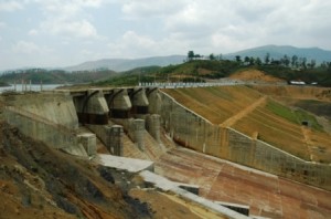
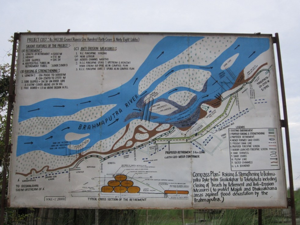

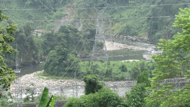
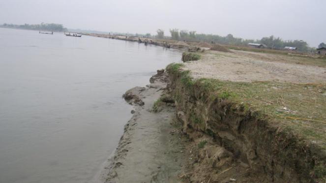


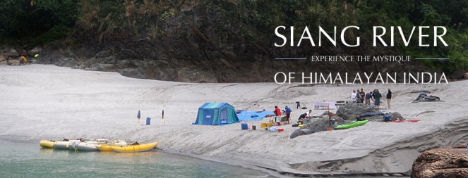


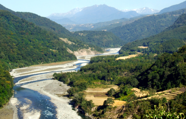


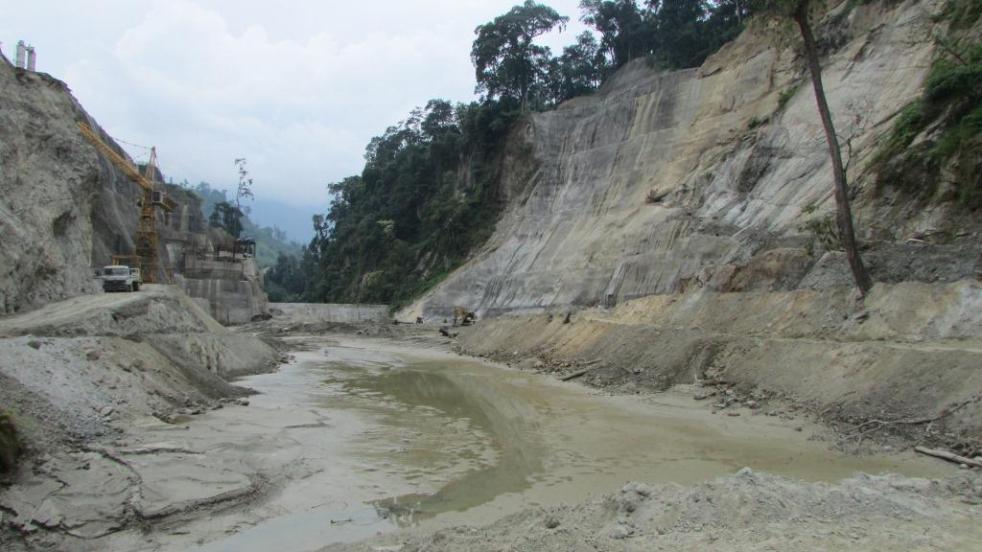


 Conflicts in South Asia: Rising tension and Policy options across the sub-continent
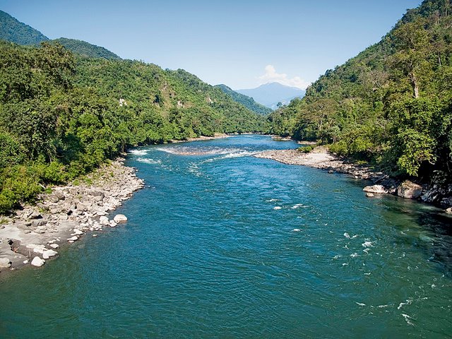
 The Study The study has been done by IRG Systems South Asia Private Limited (