This years’ flood[1] was discussed in the Bihar Legislative Assembly on the 18th September, 1948 from a different angle than what is common to political forums. Dip Narayan Singh initiated the debate saying, “…I have a feeling that the floods cannot be stopped altogether and therefore I will request the Government to find ways to reduce the losses caused by floods, provide succor to the people at the time of their emergencies and this process should continue to find innovative means to deal with floods. At the moment this job is assigned to the Sub-divisional Officer or the District Magistrate. When the floods arrive then the victims neither get boats nor the relief reaches them in time. I will request the Government, therefore, to initiate a permanent procedure to deal with floods.” He continued, “Let the Government of India constitute a Commission to go into the details of the floods in the Ganga basin and devise strategies for facing the floods so that the miseries caused by it can be reduced.”
Then and Now. 2008 Kosi Floods, in perspective if the 1948 Floods. Photo: Times of India
Prabhunath Singhsuggested that, “…all the embankments running along the Ghaghara from Darauli in the west to Kasmar in the east via Agampur, Tajpur, Naini Bundh, Sonepur Seva Samiti should be raised and strengthened. Along with this sluice gates should be installed on all the small rivers like Tel and others coming from Naini and Brahmapur to facilitate drainage of the stagnating water.”
He charged the Railway Company of obstructing the process for it felt that if all the other embankments are raised and strengthened, the railway embankments will be adversely impacted. That is the reason this district has to face floods year after year. He suggested to the Government that if it really wanted to help the people in their moment of crisis, it should help the flood victims in rebuilding their houses and arrange seeds for them to put agriculture back on rails. If the Government decides to advance loans for the purpose, it will require nearly Rs 30 million for Saran district alone. With that money it would be better for the Government to device means to make Saran a flood free district for all times to come. He further suggested that the Government must realize the money from the people that it gives to them as help and take advice about the costs involved from the engineers[2]. Saran was a rural district with high population density which was unmatched elsewhere. The villages there were beautiful with rich cultural background. The people there have a high degree of self respect. Gratutious relief should be given only to them who really need it. There are people in our villages who would prefer to die than to queue up for relief.
Timeless flood suffering in Kosi. 2008. Photo: Reuters
Girish Tiwari, also from Saran, said, “…Yesterday someone was asking what is the amount of money orders received in Saran from different places? I want to tell him that the people in Saran will have to starve if their loved ones didn’t send money orders here. The people need relief but there are various ways of providing relief. The places where there is a need of employment, open work there.”
He continued, “There is a stretch of Diyara land starting from Darauli till Sonepur. Let me tell you about Sitab Diyara, the village of Jay Prakash Narayan, which is now located west of the Ghaghara in Balia district of Uttar Pradesh. Many people from this village have shifted to Balia in Uttar Pradesh and some have moved to Rivelganj. People from Nagar Diyara have no place to go and they need land from the Government to settle down somewhere and the Government should acquire land for them. That will be a help.”
Ram Bonod Singh from Chhapra claimed that, “Not an inch of dry land is available from Manjhi to Sonepur. The current of water was so strong that all the mud houses collapsed. Cattle were in deep trouble. Most of them died or swept away and those survived fell sick. There was no fodder as all the land was under water. Fodder needs to be arranged for them and the Government must open cheap husk and straw shops to save the cattle.
Not much has changed..cattle battling the Bihar Floods now. Photo: BBC News
Dip Narayan Singhlamented that boats were not available normally when the floods struck and the officers had no clue how to face the emergency. Many boats of the traders were parked at Mahnar and Hajipur and had the officers known about their availability they could have helped in rescuing a good number of people from the flooded areas and thus saved their lives. Insisting on the opening of cheap grain shops in the flood ravaged areas he told that a huge amount of food grain was buried under the debris of the collapsed houses and the seeds for the next crop also got trapped there. Such people needed to be helped by ready to eat food and also with seedlings of paddy for immediate transplantation from the areas that were not flooded this year. This should be done without any further loss of time. Some people might need loans for house building and that should be made available to them on deferred payment. Cooperatives could also advance loans to such people wherever they existed. Crop loan might be needed for some and that should be arranged for those who asked for it.
Murli Manohar Prasad talked about floods as a long term problem and said that some years ago there was a meeting with the Government of Uttar Pradesh when it was decided that the Railway Bridge at Majhi on the Ghaghara will have to be extended and embankments should be built on the river from Dhanawari till Chinwari like that built on the Gandak. Uttar Pradesh had opposed this embankment on the ground that the proposed embankment will have adverse impact on the Balia district. He wanted to know from the minister about the fate of those discussions. He also wanted that the issue of deforestation should also be discussed with Uttar Pradesh as massive felling of trees had aggravated the flood situation in Bihar while maintaining that not much benefit is expected from the restoration of forests as, “Unfortunately, the topography of Saran is quite unique. The level of the Gandak river is above the level of its surrounding, the river flows in many streams that take off at various points from the main stream. The level of these streams is also higher than the adjoining land and embankments are built on them also (He was referring to Zamindari embankments.). The local people had developed a very efficient system of irrigation and drainage that worked well till the Moghul Rule. Sluice gates were built on the embankments at various places on the Gandak which helped in controlling various smaller rivers taking off from the Gandak. Whenever people apprehended floods, they used to drop the shutters of the sluice gates. Besides, they have connected the chaurs (depressed lands) with these rivers and could take water from the rivers or discharge water into it with the help of sluice gates. Their drainage channels used to run parallel to the embankment of the river and were connected to the chaurs and the people could manipulate the direction of flow water as they desired. Almost whole of the Saran district was somehow connected to many of its major rivers namely the Ghaghara, the Gandak and the Ganga. Unfortunately, this amazing set up of irrigation and drainage got ruined with time and the sluice gates that were functional till 1878 ceased to function because the indigo planters who were paying the water rates based on the expenses incurred on running the set up to the Government refused to pay it anymore which they were paying so far. That led to the death of a good irrigation and drainage system. When water ceased to flow through these channels then not only the zamindars but rayyats also started encroaching the river bed and the local officers of the Government helplessly watched the proceedings of dismantling law and order situation of the district. His appeal to the Government was that, “it should not end up only distributing relief to the flood victims but should think seriously over the flood problem of the district.”
2013 Kosi Floods Photo: India Today
Prabhunath Singhintervened once again to say that, “The land between Darauli to Sonepur is quite fertile. The district of Saran is rated as a deficit district not because its land is inferior but because its population is very large and per capita availability of land is too small. I want to reiterate, therefore, that the damage inflicted by floods on the district is the only reason of the misery here and the Survey and Settlement Reports confirm it.” The embankment built in Kasmar Pargana from Sonepur to Darauli was earlier looked after by the Zamindars but their attitude changed and they had virtually abandoned the maintenance of those structures which were in ruinous state. He wanted the Government to take over the up-keep and maintenance of these structures. He added that an embankment existed earlier on the left bank of the Ghaghara from Sonepur to Kasmar and all that was needed to be done was repairing this structure. If the Government of Uttar Pradesh objected to it then Bihar Government could always tell them that the embankment already existed and the State was only repairing it. The Survey and Settlement Report records stand a testimony to that effect.
Most of the members of the Assembly were of the view that the policy hitherto adopted of ‘no embankments’ along the rivers should be revisited, should now be changed and embankments must be built wherever needed or demanded by the people. The Government, however, was still not decided and used to pass the buck on the experts’ advice as it very well knew the consequences of embanking of heavily silt laden rivers.
Two ministers in the Government replied to this entire debate in the Assembly and their statements are worth studying minutely. First to reply was Ram Charitra Singh who said, “… It is quite likely that the reason for the floods in North Bihar are the people themselves living in the State. Almost all the rivers of North Bihar have their origin in the Himalayas that are covered with ice. All the rivers that discharge their water into the sea bring a lot of sediments in their flow and deposited it on their path to the sea. That is how the land was formed in this region. Then came the human race which started tampering with the rivers for its own benefits and its lack of foresight resulted in the situation that we are faced with now. The debate that has taken place in the House establishes that we are still trapped in the same mindset. The result is that many embankments have been built and many others are in the process of being built. The debate today in this House has revealed that many of our friends desire that we should continue building the embankments and they believe firmly that this will benefit them and improve the flood situation. I must say that, scientifically, had these embankments not existed the problem of this magnitude were not going to be there but what has happened has happened. We now better concentrate on the future course of action. Our policy is to control the construction of embankments. Wherever these embankments are built, their construction is illegitimate and a vigil has got to be kept on them. At some places there were constraint and embankment had to be built there although it creates problems.”
He continued, “…I went to the Saran district recently and stayed there for three days (watching the flood situation) and immediately after my return here I got 14 embankments built along the Ganga for flood protection including Dighwara, Shitalpur and Kaudimal. I am not upset that so many embankments have been destroyed this year and a sum of Rs. Two lakhs twenty thousand has been wasted but I don’t regret it and should our engineers suggest that an embankment is essential, I will not hesitate helping them build it.” He admitted that the kind of damages due to floods that were seen in Saran this year were not seen elsewhere and assured all his help to the district. Emphasizing the need for drainage of the Chhapra town he had already instructed the Chief Engineer, Special Officer and the District Magistrate to repair the roads, railway line in collaboration with the District Board even if it amounted to cutting the railway line immediately. The Kharif crop was already lost and if the water is not drained out, the chances of Rabi would also recede.
Another minister, KB Sahay had this to say. “…The problem of floods is very critical. If we construct embankments in Saran, what impact will it have on the other districts? If we control the Ganga in Saran, how will that effect the other districts in UP? I want to put all these facts before the House and want to assure you that the Government will appoint a Commission whose job will be to tell that if an embankment is to be built in Muzaffarpur, it should tell us where and how?…If in Patna then where and how and so on.”
[1] This is Third part of a series of articles Dr Dinesh Kumar Mishra has written for SANDRP based on his month long research at the National Library, Kolkata recently.
For Part 1 see: https://sandrp.wordpress.com/2015/03/09/1948-floods-in-bihar-1-inaugural-flood-after-independence-view-from-press-gallery/
Part 2: https://sandrp.wordpress.com/2015/03/10/1948-floods-in-bihar-2-inaugural-flood-after-independence-official-version-of-floods-and-its-aftermath/
[2] He meant that the Government should not give money to the flood victims just as a dole. It was to be a soft loan and the estimates etc should be suggested by engineers.
Government of Bihar, Revenue Department, Report on the Flood and Relief Operations in Bihar for 1948-49. Superintendent, Government Printing, Bihar, Patna, 1951.
Muzaffarpur [2]“During the August floods water from the River Narayani flooded the village Fatehabad. About 100 houses are reported to have collapsed as a result of the breach in the bundh due to change in course of the River Gandak. There were heavy showers and considerable damage was caused to the paddy crops and certain parts of the Sadar and major parts of Katra, Minapur and Sakra thanas experienced floods… During floods in the Ganges, Hajipur sub-division was badly affected and steps had to be taken to arrange relief.” P-15 Continue reading “1948 Floods in Bihar-2 Inaugural flood after Independence – Official Version of Floods and its Aftermath”→
Background Bihar is long known for its floods. The British had left India but their legacy of looking at rivers and their floods was still continuing in 1948[1]. They always favored ‘leaving the rivers to their own devices’ and did precious little to tame the rivers. The zamindars used to put temporary and not so temporary embankments along the rivers to provide some flood protection to their ‘ryots’ which used to breach quite often to the detriment of the people living in the flood plains of the river. The repairs of such breaches were the responsibility of the zamindars but if they did not repair the same, the British establishment used to repair it and realize the cost of it from the zamindars. There were only 160 kilometers of ‘well designed and equally well constructed’ embankments on Bihar Rivers then. Zamindars had got a hint from the Government of India that their days were numbered and had little interest in maintaining the embankments in order. It was under these circumstances that the Government of Bihar (GoB) was expected to face the floods for the first time in independent India.Continue reading “1948 Floods in Bihar-1 – Inaugural flood after Independence – View from Press Gallery”→
The Ramganga multipurpose project[1], from the point of view of the government, is an eminently successful project. From the date of its commissioning in 1974, government reports declare that it has been fulfilling its stated objectives[2]. These were to bring an area of 5.90 lakh hectares under irrigation, control floods downstream, supply 5.5 cumecs to Delhi and generate 451 million units of power annually.
Map by SANDRP
A data-based examination of each objective and whether it has actually been met by the project is outside the scope of this article, which presents the stories of people whose experience of the dam differs substantially from the ‘official’ version. These histories were gathered during several rounds of surveys and interviews with people living along the Ramganga at Kalagarh and Harewali.
Kalagarh is where the main storage dam of the Ramganga river valley project is located. The people of Kalagarh have only one reaction when it comes to the river- fear. Deveshwari Devi of Kalagarh described the situation of the people of her town as ‘The dam has brought us no benefits, only losses. Dia tale andhera. It is always darkest beneath the flame.’
Ramaganga raging fter water release from Kalagarh Photo: article.wn.com
The residents of Kalagarh and the neighbouring villages earlier approached the river for fishing, cutting grass, collecting wood, and farming. Since 2010, a fear of the river has brought all activities to a halt, says Nabab Ahmed who has not fished in the river for the last four years.
23 kilometers downstream of Kalagarh is Harewali barrage. The people near this barrage find their lives entirely governed by nebulous ‘authorities’ with total control over their lives and livelihoods.
Just a generation ago the farmers of Bhagota harvested three crops a year. These crops were a diverse array of grains such as wheat, rice and corn, along with sugarcane and vegetables. The Ramganga would bring in silt with its annual floods and replenish the fertility of the soil. The same floods would also recharge the soil’s moisture. In addition to the crops, people harvested the fish that made their way up and down the Ramganga as per their breeding cycle. This quiet and self-sufficient life was shared by many other villages including Parmawala and Shahajahanpur.
In the middle of the 1970s, life changed drastically. The villages were divided into ‘upstream’ and ‘downstream’ of the barrage. Like the world ‘through the looking-glass’, they now lead lives drastically opposed to each other.
The Harewali Barrage impounds the water let down by Kalagarh dam and diverts it to the Khoh river, from where it is taken to the Upper Ganga canal system. Confusing, isn’t it? This confusion pales in front of the upside-down river cycle that the people of Bhagota, upstream of the barrage, are subject to. From 15 November to 15 June, the barrage gates are closed and the people’s farmlands are flooded. This effectively does away with the Rabi and summer crop seasons. What is left is paddy cultivation during the Kharif season, and even that is at the mercy of the Dam gods. Often, the dam authorities do not open the dam gates till long after the scheduled 15 June date. This means that the farmers lose out on the sowing period. Similarly, often the gates are closed before the middle of November, which means that they lose the harvest.
Fishing is no longer as per the migratory cycle of the fish, but as per dam releases. When Kalagarh opens its gates, the fish from the reservoir are washed downstream, only to be trapped at Harewali. Thus, the fish upstream of Kalagarh are isolated, their breeding rhythms broken. Just a generation after the building of the dams, the fishers are already seeing the impact of this isolation of the fish breeding populations. Fish sizes have decreased, and the relative proportions of different species are changing.
The agricultural cycle of the downstream villages of Shahajahanpur and Parmawala is forced to move on a diametrically different level. For them, the months between June and November are a time of intense floods. They are well able to live full flows during the ‘chaumasa’, the monsoon. What causes them distress are the unannounced releases prior to and after the chaumasa. They confirmed the Bhagota residents’ claims that releases outside the scheduled dates cause great damage to crops.
‘Paalej’ farming is the cultivation of cucurbits- melons, gourds and cucumbers- along the silty banks of the river after it recedes post-monsoon. This crop is sown immediately after the monsoon as increasing areas of the banks emerge from the river, and harvested in the summer before the floods come. Now, often unexpected releases come in the late monsoon, or early in the season. Razia, a paalej farmer, sowed the fields she rents from a landed farmer three times in 2013- and lost the crop anyway. Further, the dam has altered the sediment characteristics so that instead of bringing in fine silt the river brings in coarse sand. This decreases yield even further. Razia is the last of the Paalej farmers in her village. People no longer practise what they term a gamble.
Those farmers lucky enough to own land have gone in for growing sugarcane, withstands most flooding. It too can be flattened by the sand brought in during ’emergency’ releases. Om Prakash told me that such a release this year took away both his fields in Parmawala, and also his 20-year old son. Three days after Raksha Bandhan, the young man had gone to the fields to strip the cane leaves for fodder. There was a sudden release of water, and the young man was never seen again. A sign posted on the barrage relieves the dam authorities of any culpability in such incidents.
Where do our Technocrats stand on this issue? At a recent meeting in Kanpur, several authorities including Dr. Tare, IIT consortium and Mr. Singh, retired official of UP irrigation expressed their opinion it is the people that need to adapt to the situation. Progress is needed, they said.
Dubious progress in the canal command area, sure devastation along the river. Progress.
[2] Agricultural Finance Corporation ltd. 2012. Report on environmental evaluation study of Ramganga major irrigation project. Volume 1. Central Water Commission, Environmental impact assessment directorate. February 2012
A study done by the National University of Singapore (NUS) predicted that dam related activity in the Himalayas will submerge and destroy 17,000 ha of land. The Himalayas have a dam density which is 62 times greater than the current global average[i]. The trouble is that Professor Maharaj K Pandit, who led the NUS study, has deep entrenched interests in hydropower business, having led seriously problematic Environmental Impact Assessment and Cumulative Impact Assessment studies that have never said NO to any project, never raised the issues he is raising in NUS study in any of the EIA or CIA study he has led. Several of his EIAs have been found to be seriously inadequate, incomplete and supporting hydropower lobby.
In 2010, a Comptroller and Auditor General (CAG) had stated that more than 40 hydro projects in the region was a serious threat to nature and bio-diversity of the region[ii]. The impact these dams have on the environment and people has been clearly seen in the light of the 2013 floods which wrecked havoc in the state. There are constant delays and faulty constructions due to lack of strict supervision which then endanger the lives and livelihoods of the local population. Despite this, the government pushes on for more and more projects.
American Met Society confirms role of Climate Change in Uttarakhand floods In an annual extreme-weather report of September 2014, the Bulletin of the American Meteorological Society has[iii] listed the Uttarakhand disaster of June 2013 as among the 16 extreme weather events of 2013 where role of climate change is undeniable. Unfortunately, Indian government is neither clearly acknowledging this reality, nor identifying the victims and demanding justice for them. While Uttarakhand disaster was a clear warning in this regard, the Sept 2014 floods of Jammu and Kashmir is another one showing how vulnerable the Himalayas are to the climate change.
American Meteorology Society confirms role of Climate Change in Uttarakhand Disaster of June 2013 (climatecentral.org)
Post-flood scenario: In the 2013 floods, about 19 projects were completely washed away resulting in affecting 35 % of the state generation capacity[iv].
Estimated losses from damage to hydropower projects on the Ganga
Project
Location
Capacity
Estimated Loss
Dhauli Ganga
Pithoragarh
280 MW
Rs 30 crore (project completely submerged)
Kaliganga I
Rudraprayag
4 MW
Rs 18-19 crore (power house and 4 houses washed away)
Kaliganga II
Rudraprayag
6 MW
Rs 16 crore (power house and 4 houses washed away)
Following the orders of the Supreme Court on Aug 13, 2013[v] in the after math of the June 2013 flood disaster, an Expert Body (EB) was formed under Dr. Ravi Chopra to assess the role of dams in the flood disaster. In its report it was recommended that 23 projects be dropped altogether in the Bhagirathi-Alaknanda basin and studies be initiated in all other basins. The court had stayed work on 24 out of 39 projects last year after the floods[vi] and had also stayed clearance to any more projects in the state. (To know more about the recommendations of the EB read SANDRP’s blog: https://sandrp.wordpress.com/2014/04/29/report-of-expert-committee-on-uttarakhand-flood-disaster-role-of-heps-welcome-recommendations/.)
The major reasons for amplification of floods according to the report were the mountains of silt, sand, and boulders that “construction crews excavated to make room for at least 30 big and small hydropower projects, and left unmanaged along the riverbanks. The rushing high water scoured the banks, dissolved the mountains of construction spoils, and pushed the mud and boulders downstream, burying low lying communities”[vii]. SANDRP has been continuously demanding an assessment of the hydropower projects and the potential danger they cause, even before the Supreme Court order (see: https://sandrp.wordpress.com/2013/07/20/uttarakhand-disaster-moef-should-suspect-clearances-to-hydropower-projects-and-institute-enquiry-in-the-role-of-heps/).
Despite the report of the Expert Body, the Central Electricity Authority and the Central Water Commission, working like a lobby for big dams and hydropower projects, do not agree that dams had a role to play in the 2013 disaster[viii]. This led the CWC to even cause violations of the order which it thought it could hide under the register (to know more about this visit SANDRP’s blog https://sandrp.wordpress.com/2014/05/15/cwcs-national-dam-register-violates-laws-and-sc-orders-on-uttarakhand-dams/’)
Also, despite the stay on clearances, the 300 MW Lakhwar Project in the Upper Yamuna River Basin in Dehradun District has been given a green signal by the MoEF[ix].
Creation of eco-sensitive zones:
5 km stretch between Gomukh and Uttarkashi was declared as an eco-sensitive zone which has led to the shutting down of various projects in that stretch. The bigger projects which have been affected are the 600 MW Loharinag-Pala under the NTPC, which is still appealing to receive its reimbursement to the tune of Rs. 536.30 crore. Apart from this, the 480 MW Maneri project under UJVNL and the 380 MW Bhaironghati project have been scrapped[x].
The collapsed basin walls of desilting basin of Srinagar HEP (Matu Jan Sangathan)
Damages:
The Srinagar Hydro Electric Project on the Alaknanda River has increased installed capacity from 200 to 330 MW which was already a cause for concern for the people of the area and other experts who say that the land is too unstable to hold such a big project. Previously, the project faced problems due to damage to its coffer dam. The GVK company owned project was also the centre of controversy due to the Dhari Devi temple which was ultimately relocated in undue hurry just before the Uttarakhand floods.
Damaged Vishnuprayag Dam filled with boulders after the June 2013 floods. Source: MATU Jansangathan
In July 2014, it faced another disruption due to the collapse of the 19 metre high and 100 metre long wall of its de-silting basin during a test run of the project[xi]. The heavy rainfall and raging waters in the Alaknanda led to the breaking of the walls which caused flooding and inundation of land and houses. The earlier complaints of the residents of nearby villages regarding the leakage from the power channel canal of the project were not taken seriously by the authorities[xii].
The 171 MW Lata Tapovan project was overrun by floodwaters that damaged concrete work and forced at least a year-long delay in its commissioning. The delay could grow longer because of the badly damaged highway which makes transportation unsafe.
Another affected project is the 520 MW Tapovan Vishnugad HEP in the Chamoli district. The project was already under scrutiny because of the unfavourable geographical characteristics of the area it is in. The added damage was done during the floods which led to damages in the power channel and the approach road to chormi adit. This could lead to a 12 month delay. Its diversion dyke was also washed away and in June 2014, BHEL refused to start work. Even the head race tunnel (HRT) contractors L&T and Alpine Mayreder Bau Gmbh (AM) have terminated their contract leaving NTPC searching for new contractors[xiii].
The 400 MW Vishnuprayag HEP in the Chamoli district was also affected in the floods as muck and debris filled its reservoir, causing electricity generation to stop. It was also under controversy for being responsible for causing floods downstream as it did not open one of its gates to let the water out, resulting in water finally being left under great pressure causing flooding and destruction of downstream area, people and properties.
Apart from this, the project authorities are also engaging in the disposal of muck and debris on the Alaknanda river bed and not in a safe site. The Jaypee group has been asked to to file a comprehensive affidavit on disposal of river bed material lying in the Vishnupryag HEP on Alakhnanda River, Joshimath by a bench of five judges of the National Green Tribunal. After the floods in 2013, a huge amount of muck and debris were deposited in the reservoir. To clean this and restart electricity generation, the company removed it from the reservoir but dumped it in the Alaknanda river bed, hoping that in the next monsoon it would open its gates enough to let the debris flow downstream. But this is highly dangerous for the downstream areas and population as pointed out by Vimal bhai, founder of the Matu Jansangathan, an NGO[xiv]. The NGT, however, has not taken necessary punitive measures against the company.
Delays:
Contract for construction of the Koteshwar dam was awarded to PCL Intertech Lenhydro Consortium JV in 2002 for a contract value of Rs 334.52 crore. The scheduled completion was specified for May 2006, but project was delayed due to non handling of project and quarry land by the owner to the contractor. Only Rs 99 crore worth work was done upto March 2007[xv].
Another case for delay is the Tehri Pumped Storage Plant (PSP) under the Tehri Hydro Development Corporation (THDC). The contract was given to Alstom-HCC Consortium which had only completed 10% work even after 25 months had elapsed since its commencement and until October 2013[xvi]. Even till April 2014, only 16% of the work was done while only 37 months are left to complete the rest[xvii]. Various problems pointed out by the THDC were that the consortium did not employ sufficient people or deploy enough machinery on site.
The 444 MW Vishnugad-Pipalkoti project under the THDC also faced delays in obtaining the clearances from the forest department to divert 80.507 ha of forest land for the project. The delay was caused in obtaining the stage II forest clearance which was in the hands of the State Wildlife Board, which finally gave its clearance in March 2013. But the surprise is that the World Bank approved the project even before it got its clearances but claimed that work would begin only after all clearances are obtained. But like a lot of other projects, work had already begun for the power house near Harsari village, affecting the villagers. Unfortunately, the inspection panel of the World Bank that was looking into the complaints against the project have completely failed to understand or show the courage to point out the failures of the project and the Bank right from impact assessment to consultations to violations in clearance procedures. The joint statement of the Inspection panel and the World Bank Management on Oct 2, 2014 exposes both the parties. The World Bank, while funding destruction of Alaknanda River, one of the two major head sources of the Ganga, is claiming to fund river rejuvenation efforts in the downstream!
Even one year after the floods, there is no comprehensive report about the disaster that would give a blow by blow account and fix accountability. The villagers are still awaiting resettlement[xviii].
Residents of 29 villages in Tehri district who already faced danger from landslides are now in a worse situation as the landslide occurrence has increased since the 2013 floods. But the villagers say that the state has made no efforts into their relocation and they live in fear of their life. The government had claimed that these villages would be relocated for their safety but due to the laxity of the authorities, work has not started on that yet.[xix]
To know more about the situation of hydropower dams in Uttarakhand in the context of June 2013 disaster, read SANDRP’s blogs:
During Sept 4-6, 2014 Jammu and Kashmir in North India is facing one of the worst floods. NDTV[1] has reported that these are the worst floods in 60 years (The Times of India reported that this was worst flood of the state since independence based on number of casualties.). More than 160 people have died and some 2500 villages are affected (1615 in the valley, rest in Jammu), out of which 450 are completely submerged (390 in valley)[2]. Over 10 000 people are stranded across the state. The flood has affected almost all 10 districts in the Jammu region. J&K Chief Minister admitted that the rescuers have yet to reach the worst affected South Kashmir region. Jammu Srinagar Highway has remained blocked for over three days. Several rivers have been flowing above the danger mark and most parts of south Kashmir, including Pulwama, Anantnag and Kulgam districts have been submerged. Jhelum was flowing at 30.7 ft in South Kashmir, 7 ft above the danger mark. Chenab river was also flowing above the danger mark at several places.
Authorities have declared the bridge over the Chenab in Akhnoor unsafe for traffic. Source: Vinay Saraf’s facebook post
Unprecedented floods Landslides triggered by heavy rainfall have damaged roads, dozens of bridges, buildings and crops. As many as 40 people went missing after a landslide in Thanamandi area of Rajouri district in Jammu region. Heavy rain in the catchment areas of Jhelum river has so far submerged more than 100 villages in the south Kashmir districts of Anantnag, Kulgam, Shopian, Pulwama, where the river was still rising, as well as the north Kashmir districts of Ganderbal, Srinagar and Badgam[3]. The flood has surpassed the 1992 memories and revived the 1959 flood memories[4].
Flood Forecast map of CWC has no sites to forecast floods in J & K
Vehicular traffic has been stopped on the Jammu-Pathankot highway due to incessant rain. Jammu is on red alert and Tawi bridge is also in danger.
Flood image from Vinay Saraf’s Facebook post
State Finance Minister Abdul Rahim Rather said Chenab was flowing at 38 ft at Akhnoor which is four ft above the danger mark cumulatively discharging 2.75 lakh cusecs, a quantum of discharge which equals all other rivers of the state.
The situation is very grim indeed: “According to the Army, the situation in the state is as grim as it was in Uttarakhand last year.” Union Home Minister has visited the state and the prime minister has expressed grief.
VERY HEAVY Rainfall during Sept 3-6 The state received massive 250 mm of rainfall in just three days between Sept 3-4, out of its seasonal monsoon rainfall of 568 mm till Sept 6, 2014. Rainfall just on Sept 6 was 106 mm, which is unbelievable 3116% of the normal rainfall for that date for J&K.
Rainfall Map from IMD showing that J&K received 558 mm rainfall till Sept 6, progressing to excess rainfall category in three days from deficit category on Sept 3, see the next map below
It can be seen from the season rainfall map see above of India Meteorology Department as on Sept 6, 2014 that J&K had received 558 mm rainfall till that date, progressing to Excess Rainfall category (blue colour code) from Deficit season rainfall of 308 mm as on Sept 3, 2014 (see IMD map below), in just three days.
IMD Map of Sept 3, 2014, showing J&K in deficit rainfall category (brown colour) with seasonal rainfall of 308 mm
CWC has no flood forecasts for J&K However, shockingly, India’s premier water resources body, Central Water Commission, responsible for flood forecasting and providing advisory to the states for tackling floods, has no flood forecast for any place in the state. The CWC’s flood forecast list[5] on Sept 6, 2014 has 18 level forecasts and 8 inflow forecasts, but NONE from J&K. CWC’s Flood forecast site has another option[6] that provides hydrographs for various rivers and location. Again for J&K it provides NO hydrographs. The options on CWC’s Flood Forecast site for list based selection[7] and map based selection[8] again has no information about Jammu & Kashmir.
J&K Flood Control Chief Engineer called the situation Alarming. Photo Source – NNIS
This seems like shocking omission on the part of CWC, which functions under Union Ministry of Water Resources and reminds one that CWC completely failed to provide any flood forecast when Uttarakhand faced its worst floods in June 2013[9]. We hope CWC will urgently include the flood vulnerable sites of J&K in its flood forecasting and also explain to the people of J&K and rest of the country why these sites were not included so far.
Akhnoor flood image from Vinay Saraf’s Facebook post
Mismanaged hydro projects increase the damage In this context, media has reported[10] that Dulhasti Hydropower project on Chenab river decided to open its flood gates DURING the worst flood period, which lead to further increase in flood levels in the downstream areas: “Release of water by NHPC dam is expected to increase the levels of the Chenab massively between Kishtwar and Ramban. Surged level can lead to submergence of the highway.” Such additional floods could have been avoided if the gates were kept opened in anticipation of floods. Such opening of gates during the floods can lead to catastrophic consequences for the downstream areas as happened in case of Srinagar Hydropower project in Uttarakhand in June 2013.
Kids crossing flooded bridge in flood hit J&K Photo Sources – NNIS
MoEF’s wrong decisions The Union Ministry of Environment and Forests have been clearing hydropower projects in the Chenab basin even without proper social and environment impact assessment as was evident in case of Sach Khas project most recently. As SANDRP pointed out in a submission to the Expert Appraisal Committee[11], the EIA and public hearing process of the Sach Khas HEP has been fundamentally inadequate and flawed and yet without even acknowledging the issues raised in this submission the EAC has recommended approval of the project. This is bound to be legally untenable decision. Such decisions by the EAC and MoEF are likely to add to the disaster potential in Chanab and other basins in J&K. There is also no cumulative impact assessment of such massive number of big hydropower projects any basins of J&K.
It is well known, as witnessed in case of Uttarakhand in 2013, that hydropower projects hugely add to the disaster potential of the vulnerable areas. We hope the J&K and central governments make this assessment on urgent basis and we hope the apex court does not have to intervene for such assessment as the Supreme Court had to do through its order of Aug 13, 2013 in case of Uttarakhand.
SANDRP
POST SCRIPT: This is one possible fall out of this, also flashed by several newspaper and following CWC questioned by media: http://www.cwc.nic.in/main/webpages/Flood%20Forecasting%20in%20uncovered%20Himalayan%20and%20interstate%20inflow%20forecasting%2011092014.pdf
Stumbled upon this on January 14, 2015. Hope the government will be now implementing this.
This year has witnessed erratic rainfall, increased snowfall, rising sea levels and other extreme weather conditions and the situation is not likely to improve in the coming months. Recent assessments have declared that this is the result of climate change, which we so conveniently blame for every untoward weather condition without properly addressing our own role in bringing it about or perhaps minimizing its effects. The climate is changing and the urgency to address this now is more than ever. Climate change acts as a catalyst and multiplies the threat we already face from certain environmental circumstances. The effects of climate change are being felt worldwide and global urgency is being expressed through various seminars and assessments being carried out by different international bodies like the IPCC (Intergovernmental Panel on Climate Change). Scientists have warned that extreme weather events will increase in intensity if climate change goes unchecked. Unchecked climatic change is also responsible for loss of life and property. According to the World Bank Report ‘Building Resilience: Integrating Climate and Disaster Risk into Development’, “from 1980 to 2012, disaster-related losses amounted to US$3,800 billion worldwide. Some 87% of these reported disasters (18,200 events), 74% of losses (US$2,800 billion) and 61% of lives lost (1.4 million in total) were caused by weather extremes (Munich Re 2013)[i].”
These weather extremes can cause and are in turn caused by changes in various water resources such as seas, lakes, rivers and glaciers. The Himalayas, spreading across over 2500 kms are the source of various life giving rivers in India and other parts of South Asia. The Ganga, Brahmaputra and the Indus, among the most important rivers for the South Asian region, originate in the Himalayan glaciers. The Himalayas have the highest concentration of glaciers outside the polar caps. These glaciers are natural stores and regulators of water in these rivers, which in turn support needs and livelihoods of millions of people, provide water for irrigation, domestic consumption and energy generation. Climate change is likely to result in smaller glaciers and less melt water. For rivers like the Indus, which gets almost half of its water from the melting of glaciers, this can lead to the endangering of the livelihood of millions of people living in low lying areas.
Rapid retreat of Himalayan Glaciers as compared to global averages Courtesy ICIMOD
Even though such fears are being expressed by various groups of people, studies done by the ICIMOD in collaboration with Netherlands’ Utrecht University and research organization FutureWater, observe that the water levels in the Indus, Ganga and the Brahmaputra are likely to increase at least until 2050[ii]. This, they say, is due to an increase in melt-water in the Indus and an increase in precipitation in the Ganges and the Brahmaputra. But these projections, as even the scientists acknowledge, do not say anything about the future of these rivers. With retreating glaciers, what will the fate of rivers like the Indus be, which depend largely on melt-water, is still to be ascertained.
Soaring temperatures, melting glaciers A study prepared by the Uttarakhand government has predicted that the mean annual temperature (MAT) in the Himalayan region is likely to rise by up to 2 degree centigrade by 2030. It has also predicted a rise of 5-13% in rainfall in the next 2 decades. This was disclosed in the Rajya Sabha on 5th of August, 2013 by the then Science and Technology minister, S Jaipal Reddy[iii].
According to a report presented in the Second India Water Forum in 2013, melting of glaciers will lead to a reduction in the critical water supplies for the people of the Himalayas. The International Centre for Integrated Mountain Development (ICIMOD) predicted that Himalayan water flow from the glaciers to the basin would reduce by about 25-50% by the end of this century[iv]. The significant effects of this will be seen in the upper reaches. Taking the case of Ganga, it is seen that though its snow and ice melts contributes only about 1-5% of the water in the Ganga and its tributaries, this is only an annual averageiv. The percentage of melt water becomes higher in the months of March, April and May. This then becomes a very crucial amount of water in the rivers in those summer months where it cannot be recharged through rain.
This is also very important for the hydro projects downstream. Seasonal melt-water serves as the main source of power for an increasing number of hydroelectric dams on the rivers served by the glaciers. The amount of electricity generated depends on the amount of water flow in the river. Thus with changing river patterns in South Asia, the hydropower production will be disrupted. A 1% reduction in stream flow can reduce electricity output by roughly 3%[v]. The unreliable and potentially decreasing flow of water implies that whole hydropower development plans need a comprehensive rethink, also considering the increaed threat of flashfloods and related disasters in changing climate.
Another report by the ICIMOD has found that glacier runoff contributes majorly to river flow for about 2-4 months, mainly from early/mid-summer, till late summer/early fall and reaches its maximum in the Northern hemisphere in July-August. The total mass of the glaciers is much more than what is recharged every year, thus leading to smooth inter-annual flow variability and thus reducing risks of the late summer droughts in hot and dry summers. Climate Change, however, may lead to consistent mass loss in glaciers, hence reducing their inter-annual storage capacity[vi].
The report further reads:
The withdrawal of glaciers and seasonal snow covers as the transient storages for precipitation in certain areas implies first and foremost the loss of flow regulation capacity in basin’s headwaters… Combined effect of the reduction of glacier area and seasonal snow extent on the seasonality of flow from the alpine catchments will be characterized by an increase of the magnitude of the short-term flow variability, in particular, an increase of autumn and winter flow, shift of late spring-early summer peak to earlier dates and possible decrease of mid-late summer flow (assuming no changes in precipitation). Hydrological regimes will be gradually changing from glacio-nival to fluvial, i.e., dependent primarily on rainfall… The glacier runoff simulation results suggest that relative shares of renewable and nonrenewable components in total glacier runoff have undergone a remarkable change: the nonrenewable component increased from 16-30% of total glacier runoff in 1961-1990 to 26-46% in 2001-2010 in all the study basins. However, the increase of non-renewable runoff in none of the basins has been large enough to overweigh the decrease of the renewable component of glacier runoff due to overall reduction of the glacier-covered area.[vii]
According to another study co-authored by Anil Kulkarni, visiting scientist at the Divecha Centre for Climatic Change, entitled, The state and fate of Himalayan glaciers, the rate of loss of glacial mass in the Himalayan and Karakoram (H-K) region, has increased after roughly 1995. Rough estimates suggest that glaciers in the Indian Himalaya are losing mass at the rate of 16 Billion T per year[viii]. The loss in mass for many small glaciers located in low altitude range could be larger than the average suggests, being as high as 1 m per year. This is substantial loss considering mean depth of small glaciers could be between 30 and 50 mviii. These small glaciers and ice fields are important source of water for many mountain communities. This source of water is and could be significantly influenced in near future and could affect sustainability of many mountain communities. There is today neither a mapping of such vulnerable communities, nor any plans to compensate them for the losses they are suffering and will suffer for no fault of theirs.
This loss of mass, especially if it comprises of non-renewable runoff, can also lead to further complications. According to geophysicist and seismologist, Geological Survey of India, Mr. O.P. Mishra, melting of glaciers due to increasing temperatures and high rainfall also add to the already existing complex of factors influencing earthquake activity in the Himalayan region[ix]. According to him, the ice sheet melting leads to the loosening of the litho static pressure (vertical pressure on the underlying crust)ix. As a glacier retreats and its weight eases, the earth could show a tendency to bounce back up in the form of a moderate or even a strong earthquake. According to him, there is a strong correlation between the retreat of ice sheets and increased seismic activityix. This increase in seismic activity can also lead to further melting of glaciers and a change in their behavior as it has the capacity to alter the axis of rotation, which can then lead to changes in surrounding areas.
According to a study conducted by the Chinese Academy of Sciences (CAS), the glaciers in the Tibetan plateau, which form the source of vital rivers such as the Brahmaputra, have shrunk by about 15%, which would mean about 8,000 square kms since 1980[x].
Retreating glaciers in Tibet Photo: ecns.cn
They also found that the perennial frozen earth in the plateau had decreased by 16% over the past 30 yearsviii. This does not present a favourable scenario for water security in the region and downstream areas of the Brahmaputra. According to scientists, this glacial retreat has accelerated since the 1990s and is making the plateau more vulnerable to the effects of climate change. This again means the plans for hydropower projects in North East India will need a review, but unfortunately, the Environmental and Social Impact Assessments of these projects are not even considering these factors and the MoEFCC’s (Ministry of Environment and Forests and Climate Change) Expert Appraisal Committee on River Valley Projects is not even taking these into consideration while appraising these projects in spite of repeated submissions on this by SANDRP.
The situation is similar in the case of the Gangotri glacier. Scientists at the GB Pant University of Himalayan Environment and Development have observed that the gangotri glacier is reducing in volume and size. The glacier is 30.2 km long and is the origin of the Bhagirathi, one of the main tributaries of the Ganga. This has retreated more than 1500 metres in the last 70 years. According to researchers, from the year 2000 onwards, the average rate of retreat of the glacier per year has been about 12-13 metres[xi].
Even while this is happening, there have not been any efforts to sensitize the scores of pilgrims who flock to Gangotri every year towards the condition the glacier is in, and how they can help in not letting it deteriorate further or at least in slowing down the process. They need to be made aware of the danger that the environment is faced with and should be encouraged to take steps towards its conservation. The state and union government also needs to ensure that local projects do not lead to worsening the situation. It is also the responsibility of the local people of the area to conserve what is important for them. They have to come out and take responsible action to ensure that they have a say in the plans made for their area.
The impact of glacier melting is felt in the upper reaches of the river and also in low-lying areas. For example, the Tawi river in Jammu has become shallow over time so much so that one does not need a boat to cross it anymore at certain locations and certain times. According to the retired director of operations M.M. Munshi, Geological Survey of India, “the glaciers and barrier lakes in the Jujdhar and Seojdhar ranges, which contribute a larger share of water to Tawi, have almost disappeared… water flow in all the rivers is declining… the perpetual snow line in Jammu and Kashmir has gone up to 16,000 feet from 13,000 feet in the last hundred years”[xii]. Such changes affect those who mainly rely on water for their livelihoods, i.e., farmers as also ground water recharge. It is not only the unavailability of water, but also the floods caused due to untimely or heavy rains. In such situations, which are recorded to be increasingly occurring in this region, people have to suffer the loss of land, livestock and thus even livelihood.
Such floods in the upper reaches by the headwaters can also be caused due to the flooding/breaking of glacial lakes. These glacial lakes can either already exist or even get formed in case the precipitation and/or glaciers melt increases. Global warming is seen as one of the key causal factors in their formation. According to recent reports, melting of glaciers is leading to the formation of small lakes in the high reaches of Himachal Pradesh. These lakes pose danger to the villages downstream. Out of the 249 glacial lakes in Himachal, 11 have been identified as having high potential for breach. Glaciers and ice-bodies cover a total of 2472.49 sq km (4.44%) of the total area of 55673 sq km in the state[xiii]. This is made worse by the uncertainty of rainfall and increasing frequency of higher intensity rainfall.
These kind of glacial lakes are forming in many areas in the Himalayas. Such lakes can also have loose moraines with them, which pose a greater threat to downstream areas as there could be a sudden breach of the moraine dams leading to flooding. One of the ways to prevent excessive harm to the people is if the rate of glacier melting can be studied with some degree of attentiveness, then alarm systems can be installed in areas downstream to warn the people in case of a Glacial Lake Outburst Flood (GLOF).
Rapidly increasing frequency of flash floods and GLOFs in Hindukush Himalayas Courtesy: ICIMOD
The monsoon is likely to become even more unpredictable in the coming years. Thus the threat to our environment from climate change is on the rise and it increases every day that we choose to ignore it. The government had set up the National Action Plan on Climate Change (NAPCC) in 2008 which was intended to serve as a road map on how India plans to combat climate change. There are various missions under the NAPCC amongst which are the National Water Mission and the National Mission for Sustaining the Himalayan Ecosystem, which has been constituted primarily to understand to what extent the glaciers are retreating and how the problem can be addressed. The government plans to review all the missions in 2017. However, as SANDRP publication “Review of NAPCC: There is little Hope here” showed, both content and process of formulation of the NAPCC had nothing to be hoped for particularly as far as vulnerable communities were concerned. A more detailed review of the National Water Mission in SANDRP’s 2012 publication “Water Sector Options for India in a Changing Climate” showed, the process, content and implementation of the National Water Mission is not going to bring any help to sustainable water resources development or to the vulnerable sections.
We have seen various so-called natural disasters happen since 2008, a very significant one of which was the Uttarakhand flood disaster of June 2013. The Uttarakhand government, at the end of last year, proposed a Rs 9,000 crore action plan to minimize the effects of climate change. Under this plan, it had allocated Rs 108 crore to be spent on water resources, like the treatment of catchment areas and flood control, etc. These measures just show the desperation of the government to show that something is being done in the namesake, even though it is not based on any scientific studies or participatory process. It seems to be the same way in which the Disaster Management cell was set up in Uttarakhand to try and manage any disaster that might strike the region, the campus of which was affected in the 2013 floods. The affected people have still not received sufficient help from the government. Even the basic minimum facility like the road that leads into Uttarkashi has not been constructed. The local people have to cross tracts of dusty and congested roads to reach from one place to the other when it has been over a year since disaster struck the town.
What we need is for the community to be involved at every stage from planning, impact assessments, decision making, implementation, operation and maintenance process and awareness creation in the areas which are most vulnerable. The current top-down approach that pushes business as usual situation will clearly not help.
Attempt to blast the dam starts; 8 killed, many more at missing, at risk;
Google map of the location, the landslide location seems just upstream of the dam
A massive landslide at around 2.30 am on Aug 2, 2014 has blocked the flow of the river Sunkoshi in Nepal. Twelve hours later and after first failed attempt by the Nepali army to blast the artificial dam, the reservoir behind the dam continues to swell. Already eight people have been confirmed dead, over 300 are reported missing[1]. Many more are at risk in the downstream Nepal and further downstream India. Sunami Power house has already been inundated. The Landslide seems close to an existing dam on the river. If this is true, when the landslide dam bursts either due to the army efforts or due to the water pressure, it is likely to take the dam with it and this could increase the downstream impacts.
A view of the landslide dam photo courtesy Setopati.com
Prof David Petley wrote to SANDRP about this: “It is very dangerous indeed. I know this site very well as we have been working in that valley for a decade or so. I suspect that the breach will happen quite quickly and will be very damaging.”
“Bishyari much more devastating than GLOFs” Former Water Resources Minister and well known water expert Dipak Gyawali told SANDRP: “Bishyari is the Nepali word for this kind of a “landslide dammed lake outburst flood” much more devastating than the GLOFs . This is a geo-hydrological phenomenon and as the pictures show, brings down entire mountains with thick forests on them. This one was on an old landslide still active but exacerbated by the recent spate of hydropower as well as road blasting.” Jayanta Bandyopadhyay and Dipak Gyawali were the first to put the word ‘bishyari’ in English, in a 1994 much-quoted article in Mountain Research and Development.
Massive scale of the landslide dam, photo thanks to Kathmandu Post
Indian border is about 260 kilometers downstream from the landslide when measured along the river and on the way there is also the Kosi Barrage at Bhaimanagar / Rajbiraj (correction from earlier reported distance).
A view of the massive landslide dam, photo courtesy Nepalhub.com
This morning, an email from our friend Ratan Bhandari from Kathmandu informed of this development, and it seems like a bad news to precede Indian Prime Minister Narendra Modi’s visit to Nepal, but it could also be a timely wake up call not to go for massive interventions in the Himalayan states.
Rising reservoir behind landslide on Sunkoshi river, Nepalhub.com
The massive landslide blocked Sunkoshi River at Mankha VDC in Sindhupalchowk[2] district. Around two dozens houses were buried in the landslide. The landslide has also buried Arniko Highway at Dam Site in Mankha VDC. Locals in Barhabishe, Lamesanghu, Khadichaur, Dolalghat, among other surrounding areas have moved to safety fearing that the blocked river may burst anytime. A Nepal Army chopper has been deployed to intensify the rescue work. The government has mobilized security forces to break a landslide dam that has blocked the flow of water in Sunkoshi River[3] in Jure of Mankha VDC, Sindhupalchowk.
A view of the dam and the river, photo courtesy Setopati.com
The Central Natural Disaster Relief Committee (CNDRC) has asked the Ministry of Home Affairs[4] to declare the areas downstream the blocked Sunkoshi River, from Jure of Sindhupalchok to Nepal-India border, “crisis-hit region” as the threat of outburst floods loomed large. It is hoped that the Indian authorities in downstream Indian areas are alert and doing necessary steps for the protection of life and property in India.
Landslide and the dam photo courtesy onlinekhabar.com
According to the Ministry of Home Affairs, the water level rose to above 130 metres. About 100 houses on the bank of the river have been submerged in Jure of Ramche VDC-5[5], the Araniko highway itself has been blocked.
Houses affected by landslide, photo courtesy onlinekhabar.com
The Sunima hydropower project (constructed in 2004-5) that has already been inundated is a 2.6 MW project built by Himal Hydro[6]. The dam of the 10.5 MW Sunkoshi hydro project (completed in 1972 with Chinese aid) is immediately downstream from the landslide, and is likely to face damage along with its power station further downstream whenever the dam breaches.
A view of Sanima Power House in Sindhupalchok, photo courtsy Himalayan Times, Nepal
Dr David Petley, who has traveled in the area writes in his blog[7]: “However, it is now a crisis. In the peak of monsoon season the river flow is high, and the images show that the lake is filling quickly. The images suggest that there is no reason to be confident that the dam will not breach rapidly when overtopped – indeed, quite the opposite I think as the length of the dam is not large and the materials appear to be fine grained. A breach now could generate a very large flood; when full the effects could be very serious… So what to do? Well of course the first measure is to evacuate people downstream, and this has started. The second is to put a warning system in place, probably at this stage consisting of an observation team with appropriate communications. The third will be to start to excavate a channel, which will require heavy machinery… This is a very difficult problem to manage, so Nepal should seek international help. The best qualified people are the teams that dealt with the valley blocking landslide crisis after the Wenchuan earthquake in China. Given the strategic importance of this road, the Chinese may want to help. However, time is very limited.”
About the possible causes of the massive landslide, this article says it is partly due to the after effects of last year’s landslide at the same site: http://www.myrepublica.com/portal/index.php?action=news_details&news_id=80211.
It also says that the district has seen such landslide blocked rivers causing disasters in the past too including the ones in 1982 (in Balephi village of the district when 97 people had lost their lives) and 1996 (54 people had died due to a landslide caused by dam outburst flood in Larcha, another village of the district).
A view of the blocked Sunkoshi River in Sindhupalchok, Photo courtesy Himalayan Times Nepal
We hope all such necessary steps are urgently taken and Indian government, Bihar state government and Nepal government coordinates in this on urgent basis.
A man taking a photo of the artificial lake formed due to Sunkoshi River Blockade in Sindhupalchok
Himanshu Thakkar, SANDRP
PS: According to http://hydrology.gov.np/new/bull3/index.php/hydrology/station/graph_view?stationId=104&deviceId=91&categoryId=6, the inflow is about 150 cubic meters per second, so in 11 hrs the volume stored would be about 6 million cubic meters. The impact on the downstream would depend on the way this water gets released. (This link thanks to comment on Dave Petley blog.) The lake overflow could have just started at around 1.30 Indian Std Time, but it is not clear what is the outflow rate.
PS 2: Comments from Dr Dinesh Kumar Mishra:
A. Flood warning has already being issued by the district administration in Saharsa about 3 hours ago that there is an imminent danger of floods along the embankment and the most vulnerable point is the site of 1984 breach.
Map with orange line showing the path that the flood pulse from the landslide dam will take to reach Kosi in India, FMIS map
B. There is some activity at the Bhimnagar barrage with officials and engineers keeping an eye over the situation. I am told that the Government has asked its officers of the Kosi Project at Birpur to move to safer places. Otherwise, there is calm at Birpur.
C. I have just received a message from a friend of mine from village Bela in Marauna block of Supaul district (this village is located within the Kosi embankments) and they have not received any warning from the Government and only know that something odd has happened in Nepal.
D. Villages near Madhepur block along the western embankment of the Kosi have not received any warning. They are not aware if anything wrong has happened in Nepal.
E. खबर है की सुन कोसी नदी की धारा पहाड़ धंसने की वजह से बाधित हो गयी है। इस की वजह से नदी के सामने बाँध बन गया है और ये किसी भी समय टूट सकता है जिस से निचले इलाकों को खतरा हो सकता है। मेरी अभी सहरसा शहर, सिमरी बख्तियारपुर के कठघरा गावों, ग्राम बेला (मारौना प्रखंड), जिला सुपौल; बीरपुर (कोसी बराज के निकट), कमलपुर (प्रखंड निर्मली) – जिला सुपौल और मधेपुर के अपने मित्रों से बात हुई है। सहरसा से खबर है कि वहां प्रशासन ने संभावित बाढ़ की चेतावनी दी है मगर सुपौल में अभी तक ऐसा नहीं हुआ है। बेला, कठघरा, भेजा में लोगों को इतनी जानकारी तो है की नेपाल में कुछ गड़बड़ हुआ है और नदी मे ज़्यादा पानी छोड़े जाने की आशंका है पर उस से ज़्यादा जानकारी नहीं है। सहरसा में कोसी तटबंध के किनारे बसे लोगों को संभावित बाढ़ के प्रति आगाह किया गया है।
F. (1700 hrs) ये जगह त्रिबेनी के ऊपर सुन कोसी नदी पर है. त्रिबेनी भारत – नेपाल सीमा से करीब ६० की। मी। पर है और जहां भू स्खलन हुआ है वो करीब ७० की. मी. दूर होगा। अगर ये मिट्टी का बाँध टूट जाता है या तोड़ दिया जाता है जैसा की नेपाली सेना कोशिश कर रही है, ऐसा बताते हैं, तो पानी को भारतीय सीमा तक आने मे समय लगेगा और तय्यारी के लिये कुछ समय मिल जायेगा।मेरी अभी बिहार राज्य आपदा प्रबंधन प्राधिकार से बात हुई है और उन्होने बताया की राज्य का आपदा प्रबंधन विभाग सक्रिय है और एन। डी। आर। एफ। के जवान सीमा पर पहुंच रहे हैं। बेला (मारौना प्रखंड , जी सुपौल) वालों ने स्थानीय प्रशासन से बात की थी। उनका कहना है कि आप लोगों का गाओं ऊँची जगह पर बसा हुआ है इसलिये चिंता की कोई बात नहीं है।
PS 3: Just (1600 hrs) called Control Room of NDMA (ph no: 011 26701728) and Mr Kulwinder informed me that Nepal govt informed NDMA at 1136 hrs about this and NDMA in turn has alerted Bihar Govt, Home Ministry, Cabinet Secretariat and others, he said PMO would also be aware of this when I told him PM is going to Nepal tomorrow. They have kept 9th NDRF battalion at Patna/ Kolkata on alert. He was aware that Koshi would be affected. He is not aware of any cooperation from Indian side on this.
PS 4: 1730 hrs: According to reliable sources, there is debate between Nepalese authorities saying that all the gates of the Koshi barrage should be kept open for the flood wave to safely pass and elements on Indian side that, that should wait for the flood wave to come. A contingent of senior officials are being airdropped to the barrage site with letter from CM. The second blast at the landslide dam in the meantime managed to lower the upstream reservoir water level by 2 m, but it is not clear if the outflow is continuing or has stopped.
1820 hrs: All 56 gates of Kosi Barrage have been opened, good to see that better sense have prevailed.
PS 5: Update from http://www.myrepublica.com/portal/index.php?action=news_details&news_id=80146
(Nepali time 4:00 pm) “The Sunkoshi River has started to flow after Nepal Army (NA) detonated two explosives. The water volume in the river downstream has increased as compared to the regular one. Authorities believe resumption of river flow will put off possible damages.” The landslide dam has created reservoir of 90-100 m height.
From: http://www.myrepublica.com/portal/index.php?action=news_details&news_id=80184
“Three eastern districts, Sunsari, Saptari and Udayapur have maintained high alert to remain safe from the possible Saptakoshi River inundation. The local administration has already begun its task to alert the people of riverside in Sunsari to shift them to safer places while the administration in Udaypur and Saptari districts have made arrangements to inform people about the blockage of river and aware people about the possible flooding, said Sharma. It is possible that as many as 500 VDCs in the districts and Bihar State of India would be inundated if the blocked landslide debris opened at once and the Koshi barrage was damaged.”
“Some 14 VDCs in Khotang district are at high risk of inundation after the landslide in Sindhupalchok district blocked the passage of Bhote Koshi River. Bahunidanda, Dikuwa, Chyasmitar, Durchhim, Dhitung, Rajapani, Batase, Chichkiramche, Barahapokhari, Saunechaur, Suntale and other VDC that are on the side of Sunkoshi river are at high risk of flooding. The District Administration Office and District Police Office have urged the locals to shift in the safe areas to remain away from the possible risks. Assistant Chief District Officer Arjun Rai said that the locals of the low land site have been asked to move to higher ground. ”
“‘Sri Lanka tapu’, which lies in middle of Sapta Koshi River, has been declared flood crisis zone in view of possible flash flood caused by likely bursting of artificial lake formed by landslide in Sunkoshi River. Local administration declared the area flood crisis zone which has settlements of over 12,000 persons on Saturday. Security personnel along with government and non-government organizations have been deployed to aware and shift locals to safer places in east and west of the island which is home to indigenous nationalities of Tarai and Hilly regions. Chief District Officer Sudarshan Prasad Dhakal said that security agencies have been directed to shift children and elders along with valuables to a safer place. Local administration has also urged people in seven other VDCs— Barahachhetra, Mahendra Nagar, Prakashpur, Madhuban, Paschim Kusahawa, Shreepur and Haripur— to move to a safer place. The possible flash flood will reach Sapta Koshi barrage in around 10 hours, and all 56 floodgates have been opened in view of possible danger, informed CDO Dhakal. ”
“…two iron gates, which diverted water to intake of Sunkoshi Hydropower Project (10 megawatts), was swept away by flood in the wee hours on Saturday morning… Similarly, power supply from 45 megawatts Upper Bhotekoshi Hydropower Project has also been disrupted… Likewise, 11 kV transmission line for evacuating power from Chaku Khola (total 6 megawatts) and Bhairab Kunda (3 megawatts) and another 33kV transmission line for evacuating power from Sunkoshi Hydropower Project (10 megawatts) has also been damaged… Officials at Load Dispatch Center of NEA also said Sunkoshi River flooding may breach dams and affect power supply from Khimti Hydropower Project and others hydropower projects on the Tamakoshi River basin.”
“The Central Water Commission has estimated a discharge of 14 lakh cusecs of water but the Indian embassy in Kathmandu has informed the National Disaster Management Authority about the likely discharge of 25 lakh cusecs of water post blast. In either case, 40% of the discharge will gush into Bihar.
The water will take about 12 hours to hit the Kosi barrage which has the capacity of sustaining pressure of only eight lakh cusecs. The flood, if it occurs, would affect a population of 1.5 lakh in Bihar’s eight districts, including 50,000 people in 22 panchayats of Supaul district alone.”
It is well known that Kosi embankment breached in Aug 2008 when flow was below 1.5 lakh cusecs, so even if barrage is able to take 8 lakh cusecs (seems unlikely), embankment is likely breached at much lower flows.
“As the dam resulting from the landslide grew larger by the hour, at least three human settlements became submerged. Damsite bazaar in Mankha-1, Kagune village in Mankha-5 and another settlement in Tekanpur-5 vanished into the water. Security personnel rescued 16 people from Damsite and seven from Tekanpur villages before these became submerged; no one was rescued from Kagune village.
According to Sindhupalchok District Police Office, 26 houses at Damsite, 16 at Kagune and seven houses at Tekanpur disappeared. At Damsite, a school was also buried under the landslide-induced dam.
Local authorities say explosions set off by the NA have slightly reduced the risk of flood outburst. “The risk has been reduced,” said Chief District Officer Gopal Prasad Parajuli. “The water volume in the landslide-induced dam is declining. The blocked water is now flowing through the small channels created by the explosions, albeit only partially.””
A view of water flowing out of landslide dam, photo from myrepublica.com
The last para is good news since it seems to suggest (as can also be seen from above photo) that water has slowly started flowing out and hopefully there is no more accumulation, but slow depletion.
PS 10: Some updates from Bihar (different sources):
At 06:00 AM water level was 1.06 lakh cusec at Kosi Barrage. Water level increasing at the rate of 2-3 thousand cusec per hour. Hish water flow may reach around 1-1:30 PMin Bihar on Aug 3. High alert in 9 districts. (1.Supaul, 2. Saharsa, 3.Madhepura, 4. Khagaria, 5. Bhagalpur, 6.Araria, 7.Purnia, 8.Madhubani 9. Katihar). Threat of danger till Monday morning (4th August 2014)
Three controlled blast by Nepal Army. First at 01:50 PM, Second at 02:50 PM and third at 03:30 PM for water flowing, it is not clear how much water is flowing out.
This is good to know: “‘Outflow of water normal“: Meanwhile, the Sunkoshi River is flowing out of the lake in a controlled rate today, according to the National Emergency Operation Centre (NEOC) of the Ministry of Home Affairs. Water level has not decreased significantly as the volume rate of water flowing in and out of the lake are comparable.”
The same report claims: “According to an official at the NEOC, about half of the chunk of debris that obstructed the River has been destroyed by the controlled blasts to drain out the water.” This is somewhat difficult to understand.
“Parajuli said the amount of water flowing out of the dam and pouring in was almost the same on Sunday morning, keeping the water level stable.” This seems to indicate STATUS QUO at Landslide Dam on Sunday evening?
This paints a bit scary possibility: “Vyasji and minister for water resources, Vijay Kumar Choudhary said, while the barrage is designed to withstand a pressure upto 9lakh cusecs, the highest pressure it has faced is 6 lakh cusecs. Anything above that could be a worry. Around two lakh people living within the embankments on a 256 km stretch from Birpur to Naugacchia and Khagaria near the Ganga would be in the direct path of the feared cascade, once Nepal effects an explosion to release the Sun Kosi waters. To add, the river has a gradient of 47 metres per kilometre in its upper reaches and flattens to only 1 metre per km after Chatra in Nepal. Beyond Chatra, on account of a progressive flattening of the bed gradient, the river first deposits boulders, pebble and shingles for over a distance of 32 km and sediment loads upto Hanumanagar. Officials fear, if the some estimated 27 lakh cusecs is released suddenly, these boulders could hit the Birpur barrage and cause extensive damage forcing it to give way. That would be an unprecedented disaster, the likes of which India has never seen, compromising as it would some 5 lakh people downstream, all the way upto the Ganga, some 80 km south in a straight line.”
(1988) Darbang Bajar, Myagdi: 109 people died, 94 houses damaged
(1989) Tarukhola, Bajhang: 16 people died and four houses destroyed
(1996) Larcha, Sindhupalchowk: 54 persons died and 18 households destroyed
(2010) Madikhola, Kaski: Five people died and 61 families affected
Sunkoshi Progressive Landslide: Photo of June 2013 (left) and July 2014 (right), courtesy ICIMOD
AVOIDABLE TRAGEDY? “Ajay Dixit, a water expert is as baffled as Professor Narendra Khanal at the Central Department of Geography at Tribhuvan University as to what triggered the landslide. The slope is prone to landslide as portion of debris used to fall every year. What they both knew for sure is an oversight of the government. “We totally overlooked the need to monitor such disaster-prone areas, which is not a big deal these days,” said Khanal. He said the disaster is unpredictable but mitigation measures can help avert huge loss.”
This provides some clearer picture: The landslide dam now has about 15 million cubic meters of water (much more than 6 MCM earlier estimated), that the water level is gradually reducing, it has already reduced by 3 mts from peak. “Since the landslide has not stopped completely yet, there is still the risk of Landslide Dam Outburst Flood (LDOF).” That would create BIG disaster in the downstream areas. However, there are serious doubts if the volume is 15 MCM as noted here.
Ranjan Kumar Dahal, a geologist who visited the landslide area along with Home Minister Bam Dev Gautam on Sunday, said, “If another landslide occurs in the same area, the impact could be catastrophic.” Dahal said the upper part of the mountain where the massive landslide occurred is vulnerable to more landslides. “There are cracks,” said he. “So, a little rain could lead to more landslides.”
Very interesting blog from well known Nepal Journalist Kunda Dixit, it says: The landslide zone is about 1000 m high, 500 m wide and has piled up a 100 m high dam on the river bed and the impact was so huge that it has also taken forested area from opposite bank. “In 1981, nearly 20 km of the Arniko Highway and all its bridges were washed away, the Sun Kosi power house was seriously damaged and there was loss of life and property all the way down the valley. Everyone thought it was a monsoon flood, but the event was later traced to a glacial lake high up on the northern side of the Himalaya in Tibet. Like other rivers in Nepal, the Bhote Kosi is prone to glacial lake outburst floods, and geologists have found evidence of previous events in 1935 and 1964… By the time we got to Lamosangu and approached the Sun Kosi intake barrage, the road abruptly vanished at almost the exact spot near Jure where Saturday morning’s deadly landslide occurred.” The 1981 experience is based on Kunda’s reporting experience as a young reporter.
Interestingly, Kunda writes, “As night fell, the water level was down by 2m and falling.” This is good sign.
PS 17: 1830 hours IST on Aug 5, 2014: Some worrying sings:
There is a bit of worrying sign that since last 18 hours, the water flow in Sunkoshi at Pachuwarghat, which is the nearest downstream measuring point, has been almost continuously decreasing from around 401 cumecs to now around 346 cumecs (the peak y’day morning was 569 cumecs, the bottom was 214 cumecs at 17 hrs on Aug 2) when the inflow to the landslide dam as measured at Bahrabise site, the nearest upstream site is same or in fact increased. This seems to suggest that water outflow from the landslide dam has decreased and this in turn could mean more water is getting collected behind the dam. This could possibly due to more landslide fall?
It seems (see: http://www.ekantipur.com/2014/08/05/top-story/army-carries-out-controlled-blast-at-sunkoshi-river/393184.html) Nepal Army carried out another explosion today: “In an attempt to speed up the outflow of water from the dam created after landslide in the Sunkoshi River, security personnel on Tuesday carried out a controlled explosion. A temporary dam was formed in the river in Jure of Sindhupalchok district after a massive landslip early on Saturday morning, stoking fears in the human settlements downstream. Chief District Officer Gopal Prasad Parajuli said the attempt was made to drain out the water, according to the suggestions of geologists, meteorologists and other experts, after the water level in the dam did not decrease even four days after the landslide. “A low intensity blast was carried out because powerful bombs will be risky,” said Parajuli.”
Sunkoshi flowing from Landslide dam Aug 5 2014, Photo Courtesy Circle of Blue
Outflow at Pachuwarghat has increased by 31 cumecs to 377 cumecs from 6 pm to 9 pm. Flow at Bahrabise has also increased in previous six hours by 27 cumecs.
“Arun Shrestha, manager of ICIMOD’s river basin program told Circle of Blue that three main questions must be answered in the next few days: Will the hillside collapse again? What can be done to stabilize the slope? How stable is the landslide dam across the Sun Koshi River?” The nature of the dam, comprised of rock, mud, and sediment, is the greatest concern, Shrestha said. Shrestha mentioned the catastrophic June 2013 floods in Uttarakhand as another example of natural hazards limiting national hydropower plans. But cautious development in Nepal will be easier wished than accomplished, asserted Gyawali, the former water resources minister.
When asked which authorities were responsible for approving hydropower permits, Dipak Gyawali scoffed at the question. “I am afraid these questions arise in your mind conflating Nepal with Norway,” he wrote in an email. “We have a dominating informal sector where policies are made and decisions are taken at the household level. Yes, government has policies. Can they effectively implement it? Well, more easily on the moon than in next-to-inaccessible Nepali hinterlands.” If the authorities want, the Sun Koshi example can serve as a guide for hydropower development, said Gyawali, who is now research director of the Nepal Water Conservation Foundation. “These bishyaris keep happening all the time,” Gyawali said, referring to the floods from landslide dams. “Nepal is better off developing small hydropower plants across the country. If we try to build one single plant, we’re putting a larger risk on the table. Many smaller ones cannot all be knocked out.”
Petley, the Durham University landslide expert, said that more research on natural hazards in the Himalayas is needed. “The Himalayan landscape needs to be managed very carefully,” Petley said. “There is too much indiscriminate development.”
This is clearly WRONG in this report: “The hydropower stations along the river do not use large dams. Rather, they are small facilities, no more than 45 megawatts, that divert a portion of the river’s flow to generate electricity before returning it to the channel downstream.” Most of these projects have large dams and have huge impacts locally.
The state of Assam in the northeastern India annually bears the brunt of floods and where embankment construction and repairing seems like permanent affair. Displacement of people living on the banks of rivers due to river bank erosion is another major issue here. The braiding and meandering river Brahmaputra and its tributaries continue to erode the banks rapidly. The Brahmaputra is well known for the rate in which it erodes. Among the places in the path of the river where the brunt of erosion has been felt severely include the following:
– Rohmoria and Dibrugarh town in Dibrugarh district,
– Matmora in Dhakukhana subdivsion of Lakhimpur district,
– Majuli and Nimati Ghat in Jorhat district,
– Lahorighat in Morigaon district and
– Palashbari and Gumi in Kamrup district.
Map of areas taken up for erosion protection in Assam. Source– Assam 2011, A Development Perspective, published by Planning and Development Dept., Govt. of Assam
SANDRP recently traveled to Matmora and Nimati ghat, two of these areas.
Bearing the Brunt of Erosion Silently Once a large village now only the name Matmora remains. Locals show us towards the middle of the river, to indicate where the village used to be. The rate of erosion is such that the Brahmaputra dyke from Sissikalghar to Tekeliphuta (popularly known as Sissi-Tekeliphuta dyke/embankment) takes the shape of a bow for nearly five kilometers at this place. From 2010, Matmora became very significant in the embankment history of India since country’s first embankment using geo-textile technology was constructed here. This was constructed at the bow shaped eroded line using geotextiles tubes. These tubes were filled up using water and sand from the banks of the river. This five kilometer embankment became a part of the Brahmaputra dyke from Sissikalghar to Tekeliphuta which is 13.9 km long. For the state government and Water Resources Department (WRD) of Assam, Matmora geotube embankment is a story of success of preventing floods and erosion. But what we saw in Matmora presents a different picture.
At Nimati Ghat, the river Brahmaputra is eroding its banks ferociously and people are intimidated by the river. A local person whose village used to be nearly two kilometers from the present bank line, told me, “Nothing can stop Baba Brahmaputra from claiming what he wants”. At Nimati Ghat, the Water Resources Department (WRD) is doing anti erosion work using geo-bags.
Funding for Embankments in Assam The total length of embankments in Assam is 4448 km as stated in a debate in the Legislative Assembly of Assam in 1998. Even though the present length of embankments is not known, it is very clear that the state of Assam continues to construct of newer embankments. In a recent analysis by SANDRP, it was found that the funds continue to increase for construction of embankments in the state. In five years from January 2009 to December 2013, the Advisory Committee in the Union Ministry of Water Resources for consideration of techno-economic viability of Irrigation, Flood Control and Multi-Purpose Project Proposals (TAC in short) had given clearance to projects worth Rs 1762.72 crores. A detailed list of these sanctioned projects can be found in Annexure 1 below.
Matmora Geo-tube embankment after its construction in 2010. Source– Assam 2011, A Development Perspective, published by Planning and Development Dept., Govt. of Assam.
Has Geo-tube been helpful for the people Between January 2009 to December 2013, the Brahmaputra dyke from Sissikalghar to Tekeliphuta, was considered twice by the TAC. The committee in its 95th meeting on 20th January 2009 accepted the project titled “Raising and Strengthening to Brahmaputra dyke from Sissikalghar to Tekeliphuta including closing of breach by retirement and anti-erosion measures (to protect Majuli and Dhakukhana areas against flood devastation by the Brahmaputra, Lakhimpur district, Assam). The estimated cost of this project was Rs 142.42 crore and its project proposal envisaged – (i) Raising and strengthening of embankment for a length of 13.9 km, (ii) Construction of retirement bund with geo-textile tubes of length 5000 m. (iii) Construction of 2700 m long pilot channel.
Geo-tube embankment in Matmora, three years after construction. Photo: SANDRP.
Protection work of the same dyke was considered in the 117th meeting held on 21st March 2013 under the proposal for “Protection of Brahmaputra dyke from Sissikalghar to Tekeliphuta at different reaches from Lotasur to Tekeliphuta from the erosion of river Brahmaputra Assam.” The estimated cost of this project was Rs 155.87 crore. According to the minutes of 117th TAC meeting, the scheme envisaged “restoration of existing embankment in a length of 15300m at upstream and downstream of existing geo-tube dyke, Sand filled mattress in a length of 15604 m at river side slope, geo-tube apron length of 7204 m and Reinforced concrete porcupines as pro-siltation device at different reaches to prevent floods and erosion in Dhakukhana Civil sub-division of Lakhimpur district and Majuli sub-division of Jorhat district.” In the same minutes,while referring to the previous project proposal of 95th meeting the minutes stated that, it “was taken up primarily for closure of breach in the existing embankment including raising of embankment around the breach area only. The proposed works in the present scheme were in the same river reach and these would be required to protect the bank from further erosion and provide flood protection.”
This clearly shows that the geo-tube embankment in Matmora cannot be called a success. Government documents which showed that major part of the Brahmaputra dyke from Sissikalghar to Tekeliphuta remained vulnerable even after the construction of the geo-tube embankment. In fact submitting a proposal for the whole Sissi-Tekeliphuta embankment at first and later saying that the money was spent in constructing a smaller part of the embankment also raise questions. The time gap between the two proposals also raises questions. If the whole money from first proposal was to be spent in constructing only a part of the embankment, why was it not stated clearly in the first proposal? In fact, this was not stated in the first proposal and second proposal reflects that the first project failed to achieve the objectives. If the first proposal was indeed only for part of the embankment, why the proposal to strengthen the larger part of the embankment took 5 years to appear before the committee? The latter proposal also did not mention about the breach which swept away a large part of the Sissi-Tekeliphuta embankment from Jonmichuk to Amgiri Tapit under Sissikalghar and Jorkata village panchayat. According to the local people this breach occurred in the morning hours of 25th June 2012. The photo below shows the breach happened at the Jonmichuk end.
The breached area of 2012. This photo is taken from the new embankment and the lake formed at this spot can also be seen. Photo – SANDRP
Jonminchuk area is nearly 15 km upstream of the geotube embankment in Matmora and part of the Sissi-Tekeliphuta embankment. A new embankment of nearly four kilometer long is being constructed at this place but the remnants of the old embankment still exist. The embankment was breached for nearly 3 kms and the water which entered the fields during that time could no longer go out and a large lake has been formed at this place, see the photo. It was surprising to see people living in the patches of the old embankment.
In the downstream, right from the point where the geo-tube embankment ends, the condition of the Sissi-Tekeliphuta embankment is pathetic. There were cracks in the embankment and water seepage has almost shattered the embankment. The embankment was in need of urgent repairs.
Condition of the Sissi-Tekelphuta embankment at the end point of the geo-tube embankment towards the village side. Photo – SANDRPSissi-Tekelphuta embankment at the same spot mentioned above towards the river side. Photo – SANDRP
Besides, one does not have to travel far to find erosion in the downstream of the geo-tube embankment. After travelling, less than three kilometers from the end point of the geo-tube embankment, rapid erosion was observed at the place where the Matmora and Tekeliphuta ghats join, due to low water level. This joint ghat is more than a kilometer from the toe line of Sissi-Tekeliphuta embankment but seeing the rapidity of the erosion the locals opine that the river would reach the toe of the embankment within this monsoon. It was difficult to believe that the river can erode so fast, until a young man pointed towards a black line in the middle of the river and said that that area which now seemed to be char/sand bar used to be his village three years back. He with his family now live beside the embankment. In this ghat we also witnessed that spurs constructed from the embankment inside the river, mainly to divert the flow of water, have been eroded as well.
The Spur has also been eroded. Photo – SANDRPErosion at Matmora-Tekeliphuta Ghat. Photo – SANDRP
It is also important to note that protection of Majuli from floods was one of the main aims of the geo-tube embankment project, but there were reports of devastating floods affecting Majuli in 2012 & 2013.
After geo-tube comes geo bags With the construction of geo-tube embankments being hailed as a success by the state government, construction of embankments using geo-bags followed. Geo-bags are smaller than geo-tubes and come at a cheaper cost. Embankments on many rivers were constructed using geo-bags which were also used for erosion protection. But effectiveness of the geo-bags as protective measure to flood and erosion, still remains disputed. A news report titled “ADB, river engineers differ on geo-bags” published in Assam Tribune on 9th September 2010 reported about the difference of opinion among the water resource engineers of Assam and powerful lobby of the Asian Development Bank (ADB) for the use of geo-bags to resist Brahmaputra erosion in Palasbari-Gumi and Dibrugarh. Referring to the engineers the news report stated “They have alleged that the ADB provided 23,000 geo-bags for an experiment. They were dumped in the month of September 2009 at a 150-metre-long selected erosion-prone reach at Gumi for testing their efficacy. But, a diving observation made in the month of December 2009, suggested that the bags were not launched uniformly in a single layer as it was claimed. They were found lying in a haphazard manner in staggered heaps with gaps in between and the total distance they covered was only about 8 metres, against the claimed and required 35 metres…..The ADB then carried out another diving observation at Gumi in May last (2010) and found no bag at the site. The State WRD did not get any feedback from the ADB on this issue.”
Work of piling up the geo-bags is going on in Nimati Ghat. Photo – SANDRPStatus of the geo-bags put last year. Photo – SANDRPThe spot where not a single Geo-bag was seen. Photo – SANDRP
Nimati Ghat was the other place which SANDRP visited to find out the effectiveness of geo-bags. The work of piling up the geo-bags for erosion protection was going on when SANDRP visited the area in the second week of April 2014. The bags which were used previously for the same purpose were seen to be mostly lying in water in shattered condition. Locals told us that majority of the bags are now under water. In the eroded bank line, these geo-bags were lying without any order and in a way suggesting how the river has dealt or to say played with these jumbo bags. In this bank line, there was a stretch of nearly five meters where the river has eroded more than the other parts. At this stretch none of the geo-bags were to be seen.
There were also contradictions regarding when the present erosion protection work at Nimati ghat had started. Some of the shopkeepers of the ghat said that the work of putting up geo-bags started in February 2014. But according to the contractor in charge of the work, the work started in November 2013. Construction or repairing of embankment just few months before the advent of monsoons is one of the constant criticisms, leveled against the Water Resources department of the state and in Nimati too we heard the same complaint.
Is Geo-tube really a ‘permanent solution’ to floods? In the present discourse of floods in Assam this has become a very significant question. The local people have been fed with various information about geo-tube and most of which are wrong. The life of embankment constructed using geo-tube is of 100 years, we were told by the locals when we travelled to the upstream areas of Matmora geo-tube. This is absolutely not true. In fact, for Prof Chandan Mahanta of IIT Guwahati the scouring[1] done by the river Brahmaputra will be the major cause of concern for geo-tube embankments in the long run.
The geo-tube embankment has already faced threat of scouring right after its construction in the monsoons of 2011. It was on the morning of 14th July, 2011 when two of the apron tubes at the tail of the embankment, were launched due to increase force of water. The apron tubes were laid at the toe of the geo-tube embankment and with the increased force of water scoured at the bottom by the embankment toe line. WRD engineers flung into action and immediate repairing work was taken up at the site. According to WRD engineers this had happened because the trees which were left outside the embankment had obstructed and increased the force of water and they were immediately cut down. Concrete porcupines were also thrown into the water. Asomiya Pratidin, a regional newspaper reported this on that day but thereafter no report on this could be found. The incident was almost forgotten. When we visited the geo-tube embankment, it was observed that along the toe-line of the embankment a scour line runs for substantial length of the embankment. This clearly shows that scouring by the river has increased in this area. The news report published in Assam Tribune [2]also points out a significant problem associated with geo-bags – “The lobby is mounting pressure for use of geo-bags in the form of bank revetment. Bank revetment is generally not adopted in Brahmaputra because of many reasons. Most important of them is – it produces a permanent deep channel along the existing riverbank.”
On the issue of lobbying behind geo-tube, an interesting perspective was provided by activist-researcher Keshoba Krishna Chatradhara who coordinates ‘Peoples’ Movement for Subansiri and Brahmaputra Valley (PMSBV)’. He opines that the construction of geo-tube embankment in Matmora was an experiment, done to see whether such embankments can withstand the flood and erosion of Brahmaputra. The reason for choosing Matmora first and not other severe erosion affected places like Dibrugarh or Rohmoria, was because even if the embankment fails it won’t be as significant loss for the state compared to those places. Dibrugarh is one of the most important towns of upper Assam with a glorious history whereas Rohmoria became important for the state when Oil India Limited found oil deposits in Khagorijan[3]. Infact several local people and activists also opined that the Sissi-Tekeliphuta embankment which is on the north bank of the river was cut several times, to save the areas in the upstream south bank, mainly the Dibrugarh town. They said that in the past, before the geo-tube embankment came, whenever there was any news of water rising in Dibrugarh, there would soon be a breach in Sissi-tekeliphuta embankment. In fact considering these breaches in the larger Sissi-tekeliphuta embankment, Mr. Chatradhara opined that even if the geo-tube embankment survives the flood, erosion and breaches in future, it might become a small island in midst of a submerged land as there will surely be breaches in the rest of the Sissi-Tekeliphuta embankment.
ADB loan for Geo-textile Embankments in Assam After the construction of the geo-tube embankment at Matmora, the state government is leaving no stone unturned to make it sound like a glorious success. But it is surprising to know that, even before the Matmora embankment was commissioned in December 2010, the state government have filed proposal for two more embankment project where geo-textile would be used for construction and got it cleared. The two subprojects of Assam Integrated Flood River Bank Erosion Risk Management Project (AIFRERM) in Dibrugarh and Palashbari were cleared in the 106th meeting of TAC held on 16th September 2010. It is important to note that for the total AIFRERM project ADB is giving a loan of $56.9 million. The cost of Dibrugarh and Palashbari subprojects are Rs 61.33 crore and Rs 129.49 crore respectively. But these investments have been cleared without even doing a post-construction impact assessment of Matmora geo-textile embankment. The Palashbari subproject also included erosion protection for Gumi area through the use of geo-bags but the Assam Tribune report quoted above already mentioned about how geo-bags scheme has failed in that area.
It is important to note here that, the first geo-tube embankment has been constructed only three years back and it would be premature to give any verdict of success, on the contrary there are many signs of failure. But the state government of Assam and the Assam Water Resources department are claiming it as success without really any credible basis and than have used that self certification to go on building more embankments using geo-textile and in several occasions these plans have failed. They first should have done a detailed impact assessment of the embankment at Matmora before going on building more embankments of the same nature.
It seems the Assam government, ADB and CWC are pushing these projects to deflect attention from the failure of embankments in flood management. Such attempts won’t succeed, but it is possibly a ploy to prolong the use of embankments as a flood management technique.
Parag Jyoti Saikia (meandering1800@gmail.com)
Annexure 1
Flood and Erosion Projects approved for Assam – 2009 to 2013
TAC meeting no & date
Project
Appr. year
River/ Basin
L of Emba. (m)
Original (revised) Cost-CrRs
Benefitting area (Ha)
Decision
95th -20.01.2009
Protection of Sialmari Area from the erosion of Brahmputra
2002
Brahmaputra
NA
14.29 (25.73)
NA
Accepted
Protection of Bhojaikhati, Doligaon and Ulubari area from the erosion
2002
Brahmaputra
NA
14.52 (27.92)
NA
Accepted
Raising & strengthening Brahmputra Dyke from from Sissikalghar to Tekeliphuta including closing of breach by retirement and anti erosion measures
New
Brahmaputra
NA
142.42
NA
Accepted
96th -16.02.2009
Flood protection of Majuli Island from Flood and Erosion Ph-II & III
New
Brahmaputra
NA
115.03
NA
Accepted
Restoration of Dibang & Lohit rivers to their original courses at Dholla Hattiguli
New
Brahmaputra
NA
23.32 (53.11)
NA
Accepted partly & suggested that proposal of coffer dam, pilot channel, etc. to be put up for expert opinion
101st -30.11.2009
Raising and strengthening to Puthimari embankment
New
Brahmaputra
NA
30.23
15000
Accepted
Anti Erosion measures to protect Brahmputra Dyke on left bank
New
Brahmaputra
NA
27.97
5000
Accepted
Protection of Gakhirkhitee & adjoining areas from erosion
New
Brahmaputra
NA
19.06
20,000
Accepted
102 -28.1.’10
Emergent measures for protection of Rohmoria in Dibrugarh District
New
Brahmaputra
NA
59.91
18,000
Accepted
106th -16.09.2010
Raising and strengthening of tributary dyke along both banks of Kopili River
New
Kopilli/ Brahmputra
NA
110.72
NA
Accepted
Assam Integrated Flood River Bank Erosion Risk Management Project
New
Brahmaputra
NA
61.33
NA
Accepted
Assam Integrated Flood River Bank Erosion Risk Management Project
New
Brahmaputra
NA
129.49
NA
Accepted
110th – 20.07.2011
Protection of Majuli from Flood and Erosion Ph II & III
2011
Brahmaputra
115.03
Accepted
Restoration fo rivers Dibang & Lohit to their original courses at Dholla Hatighuli
2011
Brahmaputra
54.43
Accepted
111th – 17.08.2011
Protection of Biswanath Panpur including areas of upstream Silamari and Far downstream Bhumuraguri to Borgaon against erosion
New
Brahmaputra
167.09
Accepted
117 – 21.3.’13
Protecion of Sissi-Tekeliphuta dyke from erosion – Lotasur to Tekeliphuta
New
Brahmaputra
153000 m
155.87
153000 m
Accepted
118th – 30.07.2013
Flood management of Dikrong along with river training works on both banks embankment
New
Dikrong/Brahmaputra
105.96
Accepted
Flood management of Ranganadi along with river training works on both bank embankments
New
Ranganadi/Brahmaputra
361.42
Accepted
[1] Scour can be termed as a specific form of the more general term erosion. In case of geo-tube embankments Scour is the removal of sediment from the bottom of the geo-tubes. Scour, caused by swiftly moving water, can scoop out scour holes, compromising the integrity of a structure.
[3] See ‘Rohmoria’s Challenge: Natural Disasters, Popular Protests and State Apathy’ published in Economic and Political Weekly, Vol XLVI NO 2, Janurary 8, 2011.
Drop 23 projects, do cumulative assessments & improve governance
In a significant development on role of hydropower projects in Uttarakhand flood disaster of June 2013, the Expert Body (EB) headed by Dr Ravi Chopra has recommended that at least 23 hydropower projects should be dropped, that hydropower projects played significant role in the Uttarakhand disaster and that there is urgent need to improve the environment governance of hydropower projects. The Report “Assessment of Environmental Degradation and Impact of Hydroelectric Projects During The June 2013 Disaster in Uttarakhand” dated April 2014 has been submitted to the Union Ministry of Environment and Forests on April 16, 2014 and was made public following hearing in the Supreme Court on April 28, 2014. The committee was appointed by a reluctant Union Ministry of Environment and Forests (MoEF) in October 2013, following the Supreme Court’s suo motto order of August 13 2013.
Damaged Vishnuprayag Dam in Uttarakhand floods of June 2013: Source: MATU Jansangathan
Uttarakhand floods of June 2013[1],[2]: The committee report endorses the stand taken in a letter[3] that was written to MoEF on July 20, 2013, endorsed by over 20 individuals and groups including from Uttarakhand on the role of existing and under construction hydropower projects in the Uttarakhand floods of June 2013. MoEF did not take any action on this letter, but it was Supreme Court order next month that pushed MoEF to take necessary action.
SC order of Aug 13, 2013[4]: On Aug 13, 2013, while disposing off the petition on Srinagar HEP in Uttarakhand, the Supreme Court, suo motto, made an order that asked, MoEF and Uttarakhand governments not to provide any further clearances to any more hydropower projects anywhere in Uttarakhand till further orders. Both MoEF and Uttarakhand governments have been violating this order. However, one of the fall outs of this order was formulation of Expert Body appointed by MoEF more than two months latter, through an order on Oct 15, 2013, whose report now is available in public domain.
Limited TOR[5]: The Supreme Court order of Aug 13, 2013 pertained to whole of Uttarakhand, as was the disaster of June 2013. However, the MoEF order and subsequently CWC tried to restrict the field of work of the committee to Alaknanda and Bhagirathi sub basins rather than whole of Uttarakhand.
Problematic constitution: The constitution of the Expert body was also problematic from a number of aspects. There was clear conflict of interest with respect to some of the members like Dr BP Das, former member and Vice Chair of the MoEF’s Expert Appraisal Committee on River Valley Projects, as explained below. The committee also included chairman of Central Water Commission and Central Electricity Authority, which unfortunately act like lobbies for hydropower projects. These persons were in the committee to bring in respective expertise, but in stead used their presence in the committee to discredit evidence which suggested clear role of hydropower projects, some members also advocated for more hydropower projects, in stead of adhering to the mandate given by the Supreme Court, thus raising the issue of contempt of court.
In what follows we have given some useful recommendations and conclusions of the EB, followed by some weak recommendations and conclusions of the EB report, based on a quick reading of the report (we got the over 200 page report only on April 29, 2014), following by some remarks on role of vice chair, CWC, CEA, MoEF and our conclusion.
Map of Mandakini Valley, epicenter of Uttarakhand floods of June 2013 (Source: EB report)
On 24 projects recommended to be dropped by WII “After considerable discussions and analysis, the Expert Body concluded that of the 24 proposed Hydropower Projects (HEPs) that Wildlife Institute of India (WII) recommended for Review, 23 HEPs would have significant irreversible impacts on biodiversity values.”
“The EB recommends that for the 23 proposed HEPs out of the 24 identified by WII (other than the Kotli Bhel 1A project) that would have irreversible impacts on the biodiversity of Alaknanda and Bhagirathi Basins, the HEPs that fall in any of the following conditions should not be approved for construction.
(a) Proposed HEPs that fall inside wildlife Protected Areas such National Parks and Wildlife Sanctuaries
(b) Proposed HEPs that fall within the Gangotri Eco-sensitive Zone
(c) Proposed HEPs that fall above 2,500m that encompass critical wildlife habitats, high biological diversity, movement corridors, and fragile in nature due to unpredictable glacial and paraglacial activities.
(d) Proposed HEPs that fall within 10 km from the boundary of Protected Areas and have not obtained clearance from the National Board for Wildlife.”
It would have been in fitness of things if EB had exclusively asked for stoppage of work on all these 23 projects with immediate effect.
On Kotli Bhel 1A The EB has, we believe, erroneously concluded, over ruling the conclusion of WII and expert review initiated by EB, “that the Kotli Bhel 1A project might not significantly worsen the condition of the river Bhagirathi between Koteshwar and Devprayag – already part of a highly fragmented zone”. However, EB has asked for “due modifications to its design and operations so that an adequate stretch of the river downstream of the Koteshwar dam just above KB-IA can be maintained in a free flowing state”. This means the project work should stop and it should reapply for clearances after doing the suggested modifications in credible way.
Restoration: “The river bed profiles at Phata-Byung, Singoli-Bhatwari, Vishnuprayag and Srinagar HEPs have changed significantly. This requires a fresh analysis of the project hydrology and redesigning them if necessary.
All projects must undertake river restoration works after prior clearance from MoEF. It was noticed that project developers were engaged in projects’ restoration only. MoEF needs to conduct a formal review of the environmental damages at all the HEPs in Uttarakhand and prepare guidelines for restoration. Till then none of the projects should begin power production.”
HEPs above 2 MW need EC “All projects > 2 MW, shall require prior Environmental Clearances (EC) from MoEF”.
“A multidisciplinary expert body should be constituted with members of proven expertise and experience to review every year the progress/performance of each HEP and its compliance with the sanction conditions. This body will also review the technicalities of disaster preparedness before each monsoon season and examine the impact of monsoon storm and floods on the performance of all the project components. The environmental health of the river will be a critical area for comprehensive examination.”
No projects above winter snow line “Learning from the June 2013 event, the EB believes that the enhanced sediment availability from and in paraglacial zones could be a serious problem for the longevity of the existing, under construction and proposed HEPs in Uttarakhand. Therefore the EB recommends that the terrain above the MCT in general and above the winter snow line in particular (~2200-2500 m) should be kept free from hydropower interventions in Uttarakhand.”
SIA should be carried out for all river systems in Uttarakhand “The WII study has already identified 24 proposed HEPs in the Alaknanda and Bhagirathi basins as likely to cause irreversible impacts. But comprehensive research studies of other basins in Uttarakhand are lacking at this stage… Strategic Environmental Assessment (SEA) be carried out in other major river basins of Uttarakhand such as the Yamuna and Kali basins.”
Distance between projects in a cascade “Scientific studies by subject experts should be conducted for establishing baseline data on river parameters, diversity and populations of floral and faunal species in different rivers of Uttarakhand at different elevation zones. Such studies should be used for deciding upon the minimum distances between two consecutive HEPs. Until such scientific studies are completed, no new HEPs (in S&I stage) should be cleared on the rivers of Uttarakhand within a distance that may later be revoked. Minimum distances for projects in the clearance stage should be significantly revised upward from the current consideration of 1 km.”
SANDRP Map of Bumper to Bumper hydropower projects in Alaknanda basin in Uttarakhand
National Himalayan Policy “Since the Himalaya are our vital source of growth and abundance, a National Himalayan Policy needs to be urgently created and implemented.”
“Therefore, the EB strongly recommends that a detailed study of the impacts of hydropower projects in terms of deforestation/tunneling/ blasting/reservoir formation on the hydrogeology of the area should be carried out.”
A study on the role of large artificial reservoirs on local climate change and precipitation patterns with special reference to the Tehri dam reservoir.”
Sediment transportation studies “Recent studies have highlighted serious concern about the Indian deltas, which are shrinking due to changes in river courses. The Ganga-Brahmaputra delta is also noted in this category. This seems to be a major issue in near future therefore we recommend that the studies should be carried out regarding the impacts on sediment transportation due to projects existing on Himalayan rivers.”
Cultural impacts of HEPs “Therefore EB recommends that the Ministry of Culture along with the local representatives and spiritual leaders should undertake a comprehensive study of the cultural impacts of HEPs in the spiritually rich state of Uttarakhand.”
“The river bed profiles at Phata-Byung, Singoli-Bhatwari, Vishnuprayag and Srinagar HEPs have changed significantly. This requires a fresh analysis of the project hydrology and redesigning them if necessary.”
“River Regulation Zone (R.R.Z.) guidelines should be issued immediately by the Ministry of Environment & Forests and should be executed accordingly.”
Muck Management: “The existing practices of muck management are inadequate to protect the terrain and the people from an eventuality like the June 2013 flood. Therefore, a serious revisit is required towards evolving technically better and ecologically sustainable methods for muck disposal and rehabilitation in Uttarakhand.”
Environmental Flows: “Till such time as a decision is taken on the EFlows recommendations of the IITs-consortium, the EB recommends EFlows of 50% during the lean season and 30% during the remaining non-monsoon months. Sustaining the integrity of Uttarakhand’s rivers and their eco-systems is not negotiable.”
Eco-Sensitive Zones: “It is recommended that legislation be enacted to (i) protect small but significant rivers (as done in Himachal Pradesh and also recommended by the IMG for Uttarakhand) as pristine rivers and (ii) designate Eco-Sensitive Zones for all rivers of Uttarakhand.”
Community based CA and CAT “Community-based CA and CAT plan execution must be done by the State Forest Department within the construction period of the project.” This is to be monitored by a committee that includes two representatives from local communities, a renowned environmentalist, among others.
Forests and Biodiversity Conservation: “Community based CAT programmes have to be systemically implemented for ensuring sustenance of the plantations. This requires training of forest officials to work with the communities through their Van Panchayats.”
“It was brought to the notice of the EB that clearances to start work had been granted recently to the Lakhwar (300 MW) and Vyasi (120 MW) projects. This is in violation of the spirit of the Hon’ble Supreme Court’s order of August 13, 2013. It is also noticed that these projects were approved more than 25 years ago. Consequently they do not have any EIA/EMP/DMP studies that are mandatory today. Without conducting cumulative impact assessments and disaster management studies of the Yamuna and Kali basins no such projects should be allowed at the risk of fragile ecology, biodiversity and lives of people living in and around the project sites.”[6]
SOME WEAK RECOMMENDATIONS OF EB
“The EB recommends that MoEF strengthens its personnel and procedures for post-sanction monitoring of environmental conditionalities. The MoEF should develop a programme for research studies by reputed organizations on the impacts of HEPs on river water quality (and flows). Pre-construction and post operation long term impacts monitoring studies are required.”
Geology & Social Issues: “Given the massive scale of construction of HEPs in Uttarakhand it may be worthwhile to set up a formal institution or mechanism for investigating and redressing complaints about damages to social infrastructure. The functioning of such an institution can be funded by a small cess imposed on the developers. It is also suggested that to minimize complaints of bias, investigations should be carried out by joint committees of subject experts and the community.”
Disaster Management: “Disaster preparedness is critical because all of Uttarakhand lies either in seismic Zone IV or V. These areas are most vulnerable to strong earthquakes. Disaster Management Plans (DMPs) are critical parts of EIA Reports. They need to be carefully reviewed and approved by local communities in the probable zone of influence.”
“It is necessary to establish an independent authority which may commission EIA Reports…”
CONCLUSIONS OF EB:
On Role of Dams in Uttarakhand disaster:
In Chapter 3 (p 10) chairman of EB notes, “Thus THDC’s inundation analysis results could
not be substantiated by the ground survey in Haridwar city.”
“In September 2010, to retain flood inflows in the face of water levels rising beyond the permitted FRL the (Tehri) dam authorities had to seek the permission of the Supreme Court. It led to inundation of the upstream town of Chinyalisaur and later after draw down fresh landslide zones were created around the reservoir rim.”
“Geo-chemical analysis of sediment samples taken from various locations along the river stretch in Srinagar, however, indicated a significant contribution — varying from 47% near the barrage to about 23% much further downstream (Fig. 3.19, pg 101, Main Report) — from muck eroded from muck disposal sites 6 and 9 located on the concave right bank and consequently experienced an intense current of the order of 7m/sec.
This raises a question that if there was heavy to very heavy rainfall from the glacial reaches of the Alaknanda valley, leading to numerous landslides along the banks, then why was massive damage observed only downstream of the Vishnuprayag and Srinagar HEPs? A detailed investigation is warranted in order to arrive at a scientifically viable explanation.”
“Otters appear to be nearing extinction in the Ganga, Alaknanda sub-basins.”
It is good to see that the EB has effectively rejected the critique of the WII report presented by Dr. Sabyasachi Dasgupta, HNB Garhwal University and consultant to UJVNL, following an independent review of the WII report by Prof. Brij Gopal, an eminent ecological scientist who had worked extensively on river ecosystems. Prof Brij Gopal, while finding some limitations in WII methodology, concluded: “he agreed with WII’s findings that the 24 proposed hydropower projects would impact the biodiversity of Alaknanda and Bhagirathi basins significantly. Based on his own analysis, Prof Gopal recommended that several more projects be dropped.”
SOME WEAK CONCLUSIONS:
“A ground survey of the inundation analysis carried out by THDC on the basis of which it claimed to have saved Haridwar from drowning raised doubts about the accuracy of the computer generated inundation maps. It is therefore not clear how much of Haridwar would have been affected if the Tehri dam had not been there. The problem at Haridwar, as at other towns and habitations along river banks, is that there has been wide spread encroachment and construction inside the river’s regime. Therefore it is imperative to set up river regulation zones where encroachments are forbidden. (Unscientific sand mining on river beds adds to the problem.)”
“There is some doubt about whether the Vishnuprayag project authorities were able to properly manage the opening and closing of the gates.”
Role of Dr B P Das: Dr B P Das has for close to a decade been member or vice chair or officiating chair of the Expert Appraisal Committee of MoEF on River Valley project and has in the process been involved in appraising and deciding on clearances for a no of projects and their impacts in Uttarakhand. Hence he was not likely to be in a position to take an independent view on Uttarakhand hydropower projects as there was a conflict of interest involved with respect to his earlier decisions. His biased views were also known through his article in The Hindu earlier. This got reflected in the alternate view on page 27 of chapter 3 and page 16-17 of Chapter 4 of the report authored by Dr Das. In Chapter 3 box, Dr Das’s abiding faith in the project developer could be seen. In Chapter 4 box Dr Das himself mentions that EAC has yet to take a view on WII report, but the he himself is a responsible party for EAC not having taken a view on WII report.
Role of CWC, CEA chairpersons: CWC (Central Water Commission, India’s premier technical body on water resources development under Union Ministry of Water Resources) and CEA (Central Electricity Authority, India’s premier technical body on power sector are largely known to act as lobbies for hydropower projects, in stead of the independent technical and regulatory body that they are expected to work as. In view of that, inclusion of chairperson of CWC and CEA in this committee was wrong step on the part of MoEF. We learn from a letter written by two eminent members of the committee, namely Dr Shekhar Pathak and Dr Hemant Dhyani on March 27, 2014, that indeed the chairpersons of CWC and CEA did not really participate in the way they were required to, and rather functioned in violation of the Supreme Court order.
Scanned version of last part of the letter of 27.03.2014 from Dr Shekhar Pathak and Dr Hemant Dhyani, members of EB
Role of MoEF: One had expected that the EB would take a critical view of the functioning of the MoEF around HEPs and contribution of MoEF’s failures in increasing the disaster proportions. Unfortunately we are disappointed in this. Possibly, with the committee having been appointed by MoEF and member secretary of the committee being MoEF official this was a difficult ask. However, not being able to take a critical stand on the role of MoEF (and other institutions like CWC, CEA, state environment department, state disaster management department etc) imposes a limitation on the EB report and provides a free reign to guilty party. The consequences of this became apparent when on April 28, 2014, during the Supreme Court hearing, we are told, the MoEF presented erroneous picture that there are two reports of the committee, one by 10 members(wrongly called activists) another by Vice Chair B P Das, with CWC and CEA chair persons, when at best the note from these three persons can be considered dissent note, that too in violation of SC orders. We hope the Supreme Court will take strong view of this misleading picture presented by MoEF and reprimand the responsible officials to ensure that this does not happen again.
View of the Committee working through its minutes
Minutes of the 2nd, 3rd and 4th meeting are available on the MoEF, Lucknow regional office website. Perusal of the minutes shed light of the functioning of the committee, and the biases of some specific members. Some highlights from the minutes:
THDC, Tehri and Muck Disposal Sites: Site visit reports of various members, including Dr. Amit Gupta, Dy Director of MoEF presented that THDC is managing active and non active muck disposal sites ‘poorly’. The sites do not have proper retaining wall, slop or plantations.
THDC hid drift tunnel of Koteshwar dam: Member Hemant Dhyani exposed that THDC officials did not accept the presence of a huge drift tunnel of Koteshwar Project near Payal Gaon, which was suffering from severe subsidence. Only when the local people, including the tunnel construction workers insisted that there is a tunnel that the THDC officials accept this fact!
In the 3rd meeting, the Chief Secretary of Uttarakhand told the committee that projects with EC or FC should not be closed or stopped. Note here that this suggestion is unacceptable when the SC itself has asked the committee to investigate the role of projects in the flood damages.
To top this, Additional Chief Secretary unilaterally asserted that HEP did not have any role in the mishap. He emphasised every Environmental CLearance needs an EIA. This indicates his poor knowledge about the quality of EIAs which has been accepted by most experts.
He further stressed that a umber of FC cases were peding before the MoEF. Moef official YK Singh Chauhan rebutted this claim.
In the 4th Meeting, Dr. B.P. Das, Co Chair of the committee categorized June event as a rare natural calamity and attributed the losses only to road construction ( Incidentally, many roads are being built for hydel projects, and do not even allow access to local communities.)
Dr. Ravi Chopra, Chairperson highlighted the poor data management of THDC. He highlighted that THDC could not provide HFL data, rainfall data, inlet level from Maneri Bhali II and outlet level sought by the committee members.
Conclusion: In spite of certain weaknesses, most of the recommendations of the committee need to be immediately implemented and till they are implemented in letter and spirit, the Supreme Court should order a status quo on any further hydropower projects. The EB headed by Dr Ravi Chopra should be congratulated for this report in spite of difficult circumstances under which the committee operated.
Þ We also hope the Supreme Court would ask MoEF to order stoppage of work on Lakhwar and Vyasi projects that has been started recently, violating the Supreme Court order in letter and spirit, and also as pointed out by the EB.
Þ The work on 24 hydropower projects that was part of explicit TOR of the committee should be ordered to stop immediately. The EB should have made this explicit recommendation, but even if they have not done that, it is implicit in its recommendation.
Þ The Supreme Court should ask MoEF to provide a time bound action plan on implementation of the various recommendations of the EB. The SC an also possibly appoint EB (minus Dr Das, CWC and CEA persons) to oversee the implementation of the action plan and continue to provide independent feedback on adequacy of such implementation.
Þ The Lessons from Uttarakhand are relevant for all Himalayan states of India from Kashmir to all the North East states and we hope Supreme Court to ask the follow up committee to ensure that these lessons are taken note of and necessary steps flowing there from are implemented in these Himalayan states. These will also provide guidance to our Himalayan neighbouring countries.
Þ The failure of environmental governance is one of the clearest stark message from this episode and we hope MoEF will put its house in order in this respect, revamping its entire environmental governance.
[7] Reuters report on this issue: http://in.reuters.com/article/2014/04/29/india-flood-idINL6N0NL0VC20140429
[8] The section “View of the Committee working through its minutes” has been put together by SANDRP colleague Parineeta Dandekar. I am also thankful to her for other useful suggestions from her.


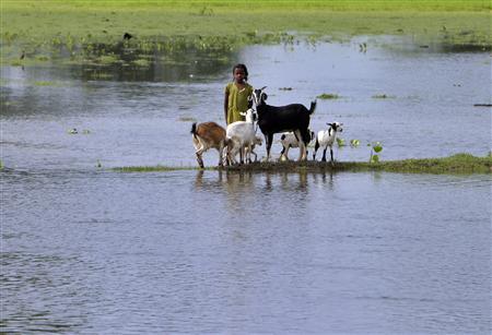
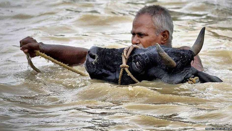
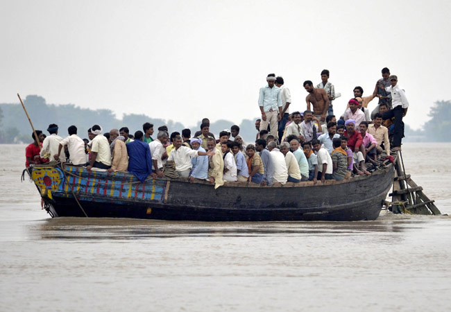


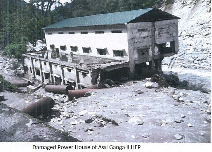

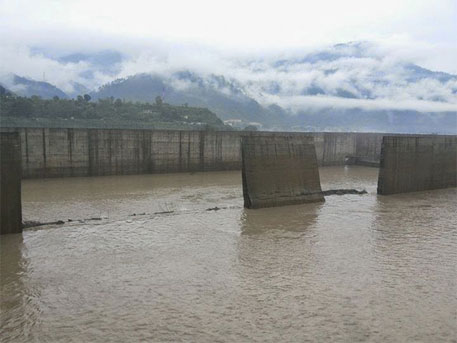

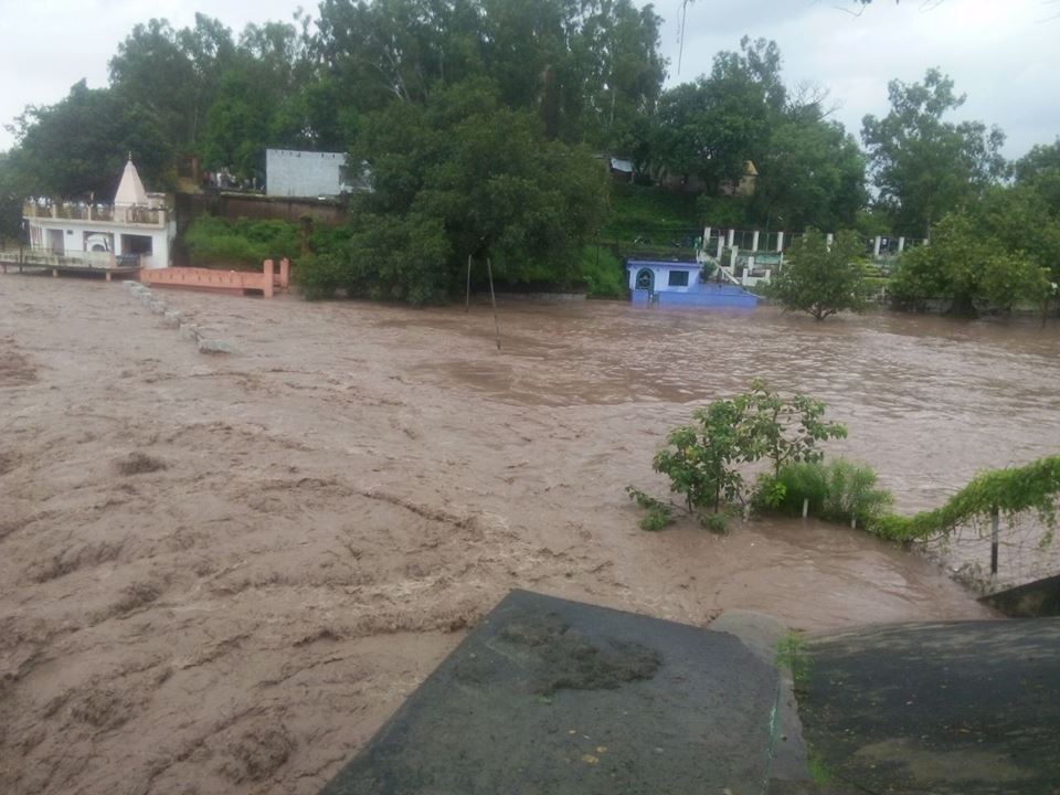


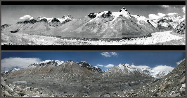


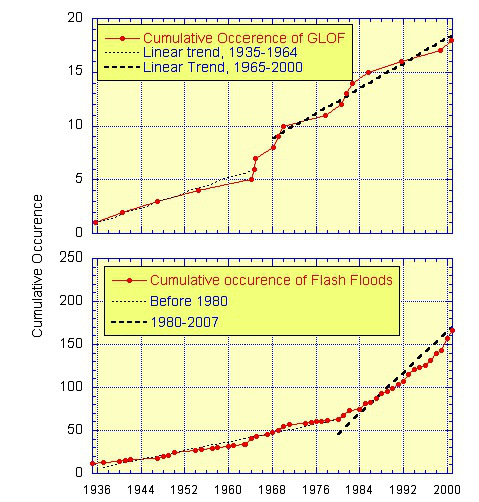


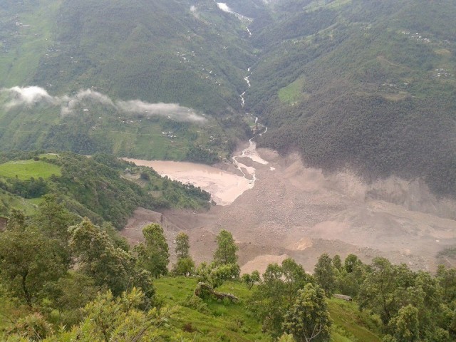


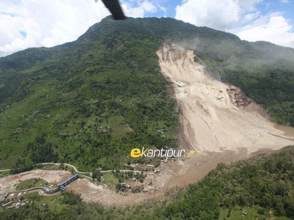


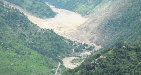


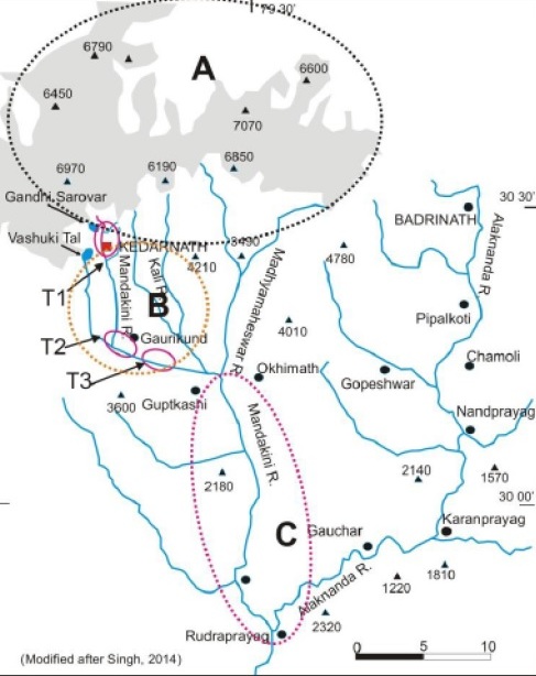


