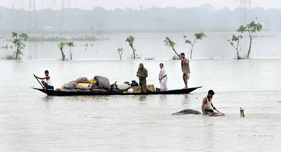
As over 4 million people in the flood prone areas of North East go through second wave of floods and Ganga basin enters the long flood season, nation’s focus should be on one particular agency, Central Water Commission which is not only the only flood forecasting agency, but is also answerable in multiple other ways for the recurring flood disaster. But the flood forecasting of CWC[i] is grossly inadequate, inconsistent and non transparent.
To illustrate, let us look at the available information about CWC’s flood forecasting and compare it with happened in 2019 flood season. Out of 29 sites[ii] (7 level monitoring sites and 22 Lavel forecasting sites) where rivers crossed the previous Highest Flood Level as per CWC’s own hydrographs of last year, CWC has not updated HFL for at least 8 sites so far this year. In case Salavad in Jhalawar district in Rajasthan, on Kali Sindh river, in stead of updating the new HFL, CWC suddenly discovered this year that that the site had higher HFL achieved 35 years ago in 1985, though till last year, it listed 1996 HFL!
Same situation for T Narasipur site in Mysore state in Karnataka on Kabini river in Cauvery basin, where on Aug 12, 2019, the water level reached 642.8 m, breaching the previous HFL of 642.4 m mentioned on CWC FF site without any date. This year, in stead of updating, CWC suddenly revealed the discovery that at this site, the HFL was 643.25 m, attained 29 years ago on July 29, 1991! Similar situation prevails at T Bekkupe (Arkavathi river in Cauvery basin in Bangalore rural district in Karnataka) and Nellithurai (Bhavani river in Cauvery basin, Coimbatore district in Tamil Nadu).
Like every year, in April 2020, CWC published “Standard Operating Procedure for Flood Forecasting”[iii], which had at Annexure 1.1, the details of the 197 Level Forecasting sites and 128 Inflow forecasting sites. The list did not have updated information about the Flood Forecasting sites, though the 2019 monsoon was over at least seven months ago by then and this SOP was for the new flood season of 2020. The callousness can be gauged from the fact that at le ast in case of 5 of the 197 sites, either HFL or HFL crossing date or both were unavailable.
In case of Inflow forecasting sites, in all cases except four, at least three columns were empty! In fact, inflow forecasting of CWC is a bit of a scandal, if one were to watch its actual forecasting and usefulness or effectiveness. Most of the key information for almost all cases is empty. The SOP document does not even mention what are the threshold levels of forecast and how is it useful.
In what follows we have given information below about each of the 29 sites where HFL was touched or crossed in 2019 monsoon and what is the status of its updating on CWC FF site now.
Brahmaputra Basin (Assam)
In Brahmaputra basin 2 sites, 1 Aie NH Xing Level Monitoring site on River Aie in Barpeta district of Assam and Dhubri (Level Forecast) site on River Brahmaputra in Dhubri district of Assam narrowly crossed the HFL in the month of July 2019.
| SN | Site | River | District | Old HFL, M | Date | New HFL, M | Date | Status on 170720 |
| 1 | AIE NH XING | Aie | Barpeta | 53.26 | 21-08-2015 | 53.27 | 11-07-2019 | Not Updated |
| 2 | Dhubri | Brahmaputra | Dhubri | 30.36 | 28-08-1988 | 30.38* | 18-07-2019 | Updated |
Mahanadi Basin, Odisha
The Ong river in Bargarh district crossed the HFL at Padampur Level Monitoring site on Aug 14, 2019.
| SN | Site | River | District | Old HFL, M | Date | New HFL, M | Date | Status on 170720 |
| 1 | Padampur | Ong | Baragarh* | 175.53 | 16-08-2018 | 176.0 | 14-08-2019 | Not Updated |
*Bargarh district is changed as Rayagarh in new hydrograph.
Ganga Basin (Bihar, Himachal Pradesh, Rajasthan, Uttar Pradesh)
In Bihar the Jhanjharpur Level Forecast site on Kamalabalan river in Madhubani district crossed the HFL.
In Rajasthan the Kalisind river breached the HFL at Salavad Level Monitoring site on Sept 14, 2019 and River Chambal at Mandawara Level Monitoring site crossed the HFL on Sept 16, 2019 by almost 8 meters.
In Uttar Pradesh Chambal River crossed the UDI Level Monitoring site on Sept 18, 2019.
| SN | Site | River | District | Old HFL, M | Date | New HFL, M | Date | Status on 170720 |
| Bihar | ||||||||
| 1 | Jhanjharpur | Kamalabalan | Madhubani | 53.01 | 10-07-2004 | 53.1 | 14-07-2019 | Updated |
| Rajasthan | ||||||||
| 2 | Salavad* | Kalisind | Jhalawar | 320.72 | 21-08-1996 | 321.700 | 14-09-2019 | Not updated |
| 3 | Mandawara | Chambal | Kota | 217.685 | 02-09-2006 | 225.700 | 16-09-2019 | Updated |
| Uttar Pradesh | ||||||||
| 4 | Udi | Chambal | Etawah | 128.4 | 24-08-1996 | 128.6 | 18-09-2019 | Not Updated |
*Old website showed HFL for Salavad site as 320.72 m dated 21-08-1996. New hydrograph shows HFL as 322.08 m dated 23-09-1985. The site reached 321.700 m on 14-09-2019. so if we see, the HFL reading from CWC old website, the level of 14-09-2019 is higher. But if we see the new HFL now shown on CWC FF site at 322.08 m on 23-09-1985, the level has not been crossed in 2019. The question is how come CWC did not know about the 1985 HFL till last year and suddenly discovered this year?
Godavari Basin (Maharashtra, Madhya Pradesh)
River Godavari at Nasik Level Forecast site breached the HFL on Aug 4, 2019. Wainganga a tributary of Godavari in Madhya Pradesh crossed the HFL at Kumhari Level Monitoring site on Sept 9, 2019.
| SN | Site | River | District | Old HFL, M | Date | New HFL, M | Date | Status on 170720 |
| Maharashtra | ||||||||
| 1 | Nasik | Godavari | Nasik | 563.01 | 02-08-2016 | 563.51 | 04-08-2019 | Updated |
| Madhya Pradesh | ||||||||
| 2 | Kumhari | Wainganga | Balaghat | 305.5 | 21-07-1994 | 306.6 | 09-09-2019 | Updated |
Krishna Basin (Maharashtra, Karnataka)
Several Rivers in Krishna basin including Panchganga, Warna in Maharashtra and Tunga, Ghatprabha, Dudhganga in Karnataka states breached the previous HFL in south west monsoon season 2019.
Out of 9 HFL crossing events, 8 took place between 7 and 11 August 2019. Out of these 9 sites only 2 Terwad on Panchganga and Huvinhedigi on Krishna are Level Monitoring sites and the rest are Level Forecast sites.
| SN | Site | River | District | Old HFL, M | Date | New HFL, M | Date | Status on 170720 |
| Maharashtra | ||||||||
| 1 | Ajunwad* | Krishna | Sangli | 543.69 | 05-08-2005 | 544.275 | NA* | Date Not updated |
| 2 | Terwad | Panchganga | Kolhapur | 540.39 | 05-08-2005 | 542.11 | 05-08-2019 | Updated |
| 3 | KURUNDWAD | Krishna | Kolhapur | 539.76 | 05-08-2005 | 541.205 | 10-08-2019 | Updated |
| 4 | Samdoli | Warna | Sangli | 546.324 | 05-08-2005 | 546.994 | 09-08-2019 | Updated |
| Karnataka | ||||||||
| 5 | Huvinhedigi | Krishna | Raichur | 358.22 | 02-10-2009 | 358.55 | 11-08-2019 | Updated |
| 6 | Shimoga | Tunga | Shimoga | 568.28 | 15-07-1994 | 570.18 | 10-08-2019 | Updated |
| 7 | Gokak Falls* | Ghatprabha | Belgaum | 546.88 | 23-08-2005 | 550.324 | 11-08-2019 | Updated |
| 8 | Mudhol | Ghatprabha | Bagalkot | 538.25 | 20-08-2019 | 544.73 | 09-08-2019 | Updated |
| 9 | Sadalga | Dudhganga | Belgaum | 538.9 | 06-08-2005 | 540.58 | 10-08-2019 | Updated |
*For Ajunwad site HFL 544.275 m is mentioned in CWC new website but date for attaining it is not mentioned. CWC 2019 hydrograph shows the level was attained on 09-08-2019.
*Hydrograph from CWC FF website last year showed HFL at Gokak Falls reaching upto 552.0 metre on 08-08-2019, however CWC website now in 2020 mentions HFL as 550.324 m attained on 11-08-2019.
Cauvery Basin (Karnataka, Kerala, Tamil Nadu)
In Cauvery basin, previous HFLs are breached or touched at 9 locations across Karnataka, Kerala and Tamil Nadu.
| SN | Site | River | District | Old HFL, M | Date | New HFL, M | Date | Status on 170720 |
| Karnataka | ||||||||
| 1 | KOLLEGAL | Cauvery | Chamaraja nagara | 630.25 | NA | 630.25 | 12-08-2019 | Updated |
| 2 | THIMMANAHALLI | Yagachi | Hassan | 909.665 | 16-07-2009 | 912.725 | 10-08-2019 | Updated |
| 3 | SAKLESHPUR | Hemavathi | Hassan | 893.4 | 17-07-2000 | 895.05 | 10-08-2019 | Updated |
| 4 | T. NARASIPUR* | Kabini | Mysore | 642.4 | NA | 642.8 | 12-08-2019 | Not updated |
| 5 | THORESHETTAHALLI | Shimsha | Mandya | 622.86 | 25-11-2018 | 623.90
|
07-10-2019 | Updated |
| 6 | T. BEKKUPE* | Arkavathi | Bangalore Rural | 606.95 | NA | 606.95 | 03-10-2019 | Not updated |
| Kerala | ||||||||
| 7 | MUTHANKERA | Kabini | Wyand | 713.26 | 17-08-2018 | 713.89 | 10-08-2019 | Updated |
| Tamil Nadu | ||||||||
| 8 | NELLITHURAI* | Bhavani | Coimbatore | 309.45 | 15-11-1992 | 309.45 | 09-08-2019 | Not updated |
| 9 | BILIGUNDULU | Cauvery | Dharmapuri | 265.84 | NA | 266.42 | 12-08-2019 | Updated |
*The CWC FF now in 2020 mentions HFL for T Narasipur site as 643.25 m attained on 29-07-1991, while information on CWC FF site last year showed the old HFL to be 642.4 with no mentioning of date. The water level at the site reached 642.8 m on 12-08-2019. However if HFL data from new website is considered, it was higher than 2019 HFL.
*The HFL for T. BEKKUPE site was mentioned as 606.95 m without attaining date. The site reached upto that level on 09-08-2019. However now CWC new website shows the HFL level for T. BEKKUPE site as 608.1 m attained on 10-09-2017. Considering this information, it seems HFL at the site has not been crossed in 2019.
*The old CWC website mentioned HFL for NELLITHURAI site as 309.45 m attained on 15-11-1992. The level was touched on 12-08-2019. However, CWC new website now mentions the HFL for the site as 309.47 attained on 16-08-2018. It shows that upto 2019, the CWC has not updated the HFL for the site.
WFR south of Tapi Basin, Kerala
| SN | Site | River | District | Old HFL, M | Date | New HFL,
M |
Date | Status on 170720 |
| 1 | PERUMANNU | Valapatnam | Kannur | 15.55 | 08-08-2018 | 18.28 | 09-08-2019 | Updated |
| 2 | KUTTYADI | Kuttyadi | Kozhikode | 8.36 | 16-08-2018 | 8.7 | 08-08-2019 | Updated |
Media needs to sharper focus in flood reporting It was great to see editorial in a national newspaper on July 17, 2020[iv] as we write this, on the issue of ongoing floods particularly in North East India. It asks some right, tough questions: “Assam needs to jettison outmoded flood control measures… the unplanned expansion of the city… has led to severe encroachments in the wetlands, low lying areas, hills and shrinkage of forest cover. The denuded hills and loss of wetlands lead to artificial floods”. But the name Central Water Commission and its sister organisation in North East, the Brahmaputra Board (BB) was completely missing in the Editorial. This is very serious omission.
The media reports in general too leave a lot to be desirable. A number of disastrous floods happen when embankment breach. But how many reports mention as to where all did the embankment breached, at what flow rate, who was responsible for that embankment, what did they do to ensure that the embankment does not beach. What did the official agencies do before and during monsoon in that respect. What did agencies like CWC & BB do before and during monsoon? What did the disaster management agencies do before the monsoon and immediately before the breaches? If the flood reporting in media does not have that kind of sharp focus on agencies and responsible persons, do we have any hope of improvement?
SANDRP (ht.sandrp@gmail.com)
END NOTES:
[ii] For details, see: https://sandrp.in/2019/10/29/rivers-that-cross-highest-flood-level-during-sw-monsoon-2019/
[iii] http://cwc.gov.in/sites/default/files/sopapril2020final_1.pdf
[iv] https://indianexpress.com/article/opinion/editorials/state-of-deluge-assam-floods-6509523/

No discussion on floods of 2020 in Assam. ?
LikeLike
It mentions 40 million affected and also the Ind Exp edit it discusses is about 2020 floods in Assam.
LikeLike