Sand Mining

East India Sand Mining 2018: Will NGT order help restore Subarnarekha River?

Bihar Unsustainable sand mining causing floods in West Champaran The sand mining in the rivers of West Champaran was causing unmitigated floods in the region, year after year but the govt failed to respond.

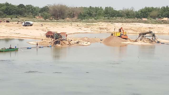
– West Champaran district also sees many floods in the non-monsoon months, many of which go unreported, and often, ignored by flood-relief schemes. The natural explanation for the flash floods is that the region is at the foothills and rivers from the hills of bordering Nepal flow through it. But the floods are not entirely a result of natural phenomena. Over the years, excessive sand mining in the river beds has led to ecological imbalances, making rivers and streams flood and even change their course, wreaking havoc in the villages along their banks.

Continue reading “East India Sand Mining 2018: Will NGT order help restore Subarnarekha River?”

Dams

Odisha Rivers Profile

About Odisha

Odisha is located on the eastern coast of India, between 17o31‟ and 22o 31‟ N latitude and 81o 31‟ and 87 o 31‟ E longitude. It covers 155,707 km2 , which represents about 4.74% of the area of India. The climate of state is tropical with 1450mm average rainfall.

The 2011 Census established the State‟s population at 41.9 million, 16% of which lived in urban centres. The average population density is 270 persons per km2, compared to 382 for India.  Odisha is a land of possibilities. The State is endowed with bountiful of resources, people, land, water, forest, minerals and other minor resources. The State is divided into 30 districts, of which Mayurbhanj is the largest (1042km2) and Jagatsinghpur the smallest (197km2). The districts are subdivided into 314 CD Blocks. There are 58 sub-divisions and 171 tahasils. According to 2001 census there are 51,349 villages and 6234 Gram Panchayats.(ORISSA STATE WATER PLAN, 2004). 

Continue reading “Odisha Rivers Profile”