(Feature Image: Asan river being trained near Sumeru Enclave to reclaim river space for road & real estate actvities. Bhim Singh Rawat/SANDRP, May 29, 2024.)
The first part of the photo blog has tried to shed some light on the pathetic condition of water sources, springs and streams forming the Asan River in Dehradun. This second part of the series covers the state of affairs all along remaining length of the river till it joins the Yamuna River.
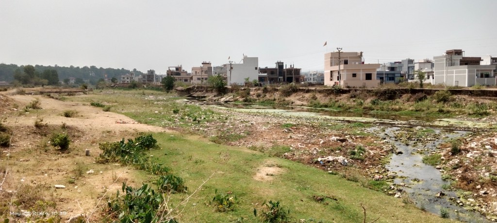
Asan River between Chandrabani temple & Budowala bridge: After confluence with Aishwarya stream at Chandrabani temple, the Asan River course runs for about 6 km through Mehuwala Mafi, Tuntowala, Badowala villages located on the right bank of the river.


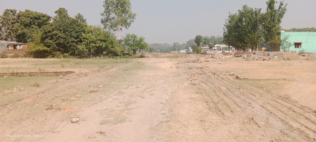
In recent years several residential colonies have come up in the area extending right upto the river bank. The plotting and house construction activities are happening unabated in these villages.

At places, the undulating natural terrain is being flattened and levelled for this. These activities are thus irreversibly damaging the Asan catchment. “Asan river is sold out by landlords”, lamented an old man from Budowala when asked about the condition of river.

Wildlife Institute of India (WII) campus and forest area covers a large part of land on the left side of the river hence it is still free from encroachments by colonies.


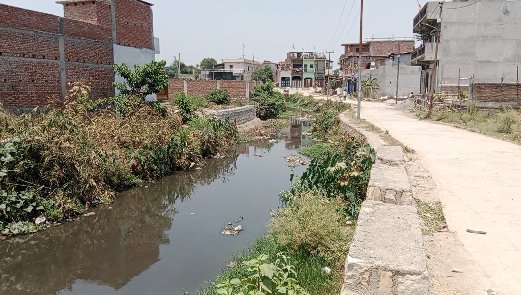
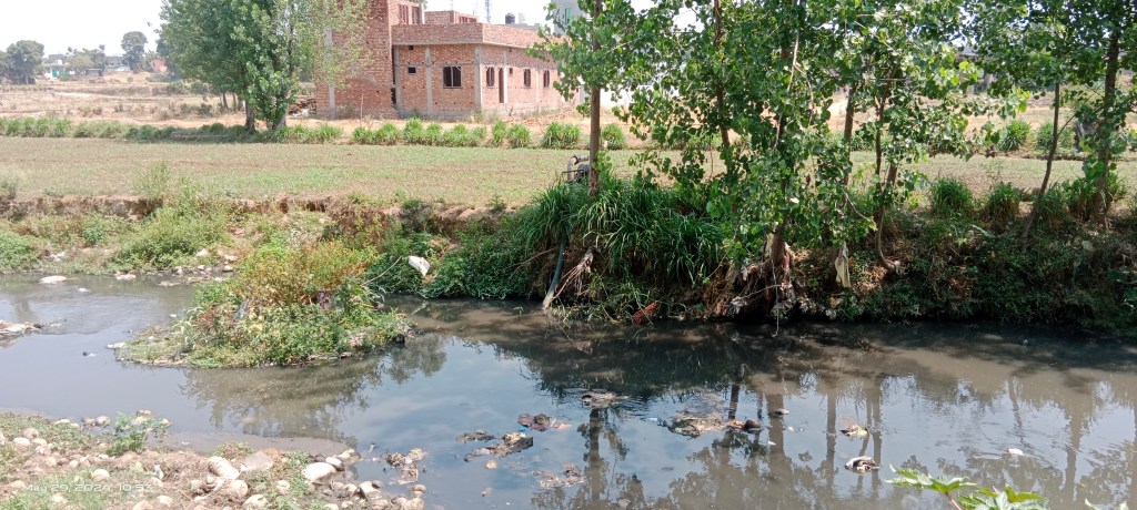
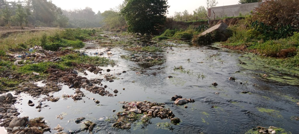
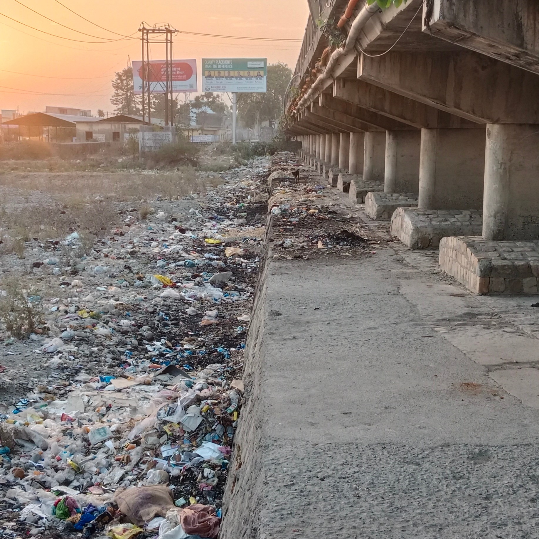
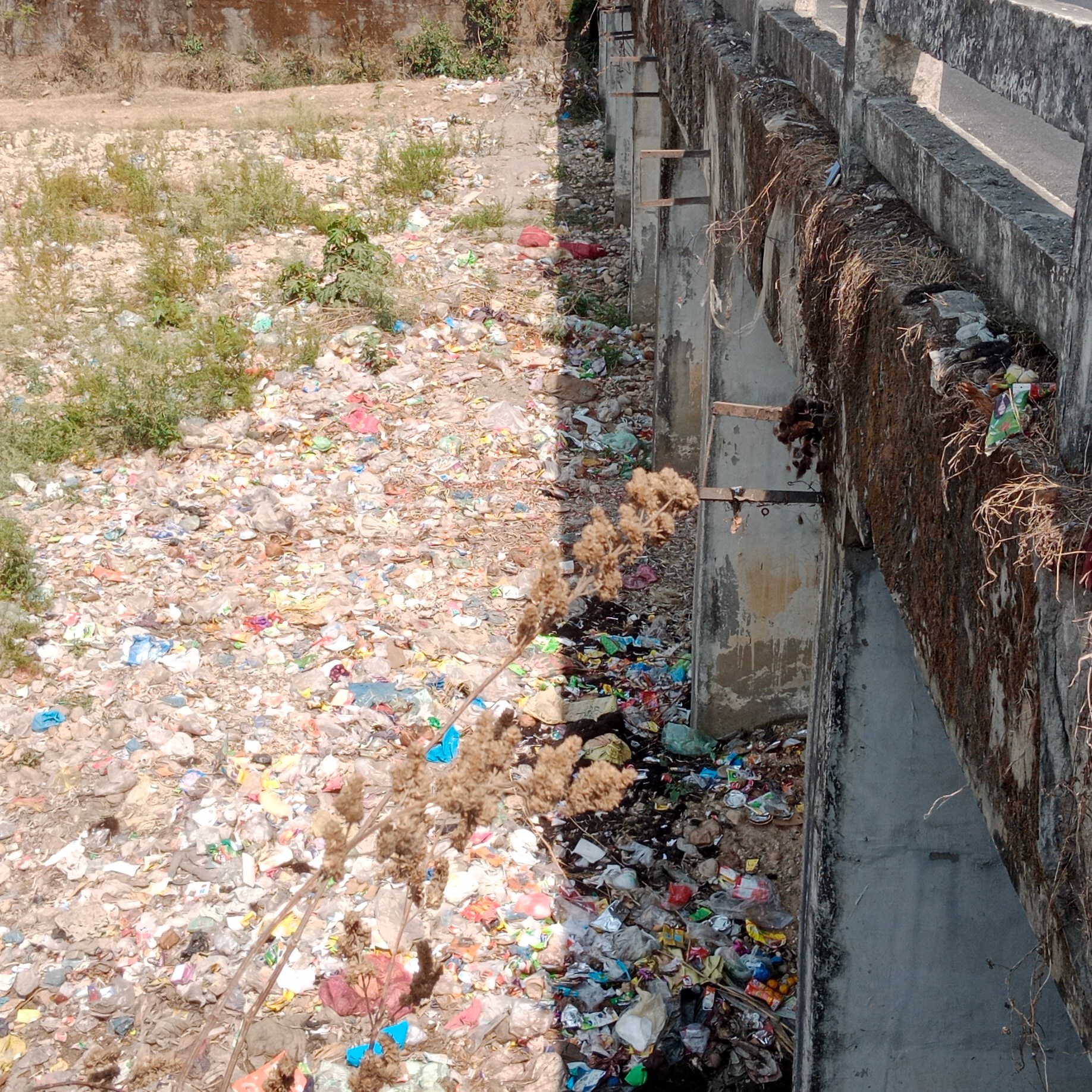
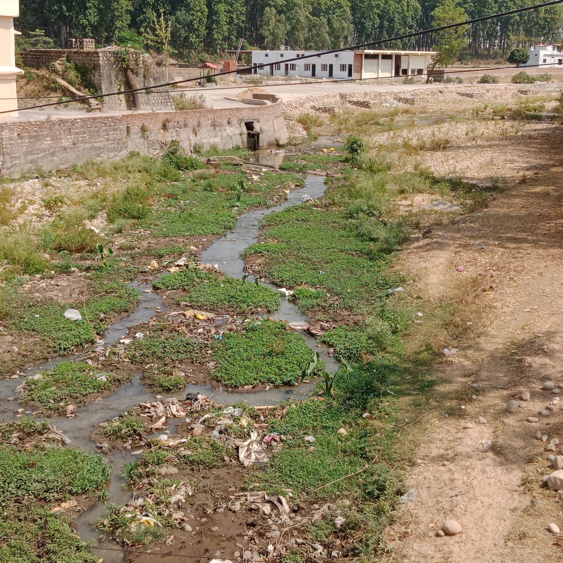
The amount of solid and liquid waste entering the river keeps increasing as the river passes through human habitation turning it into a sewage drain.

The instruction boards placed by the administration have also termed the river as a nullah.

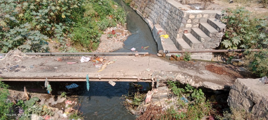
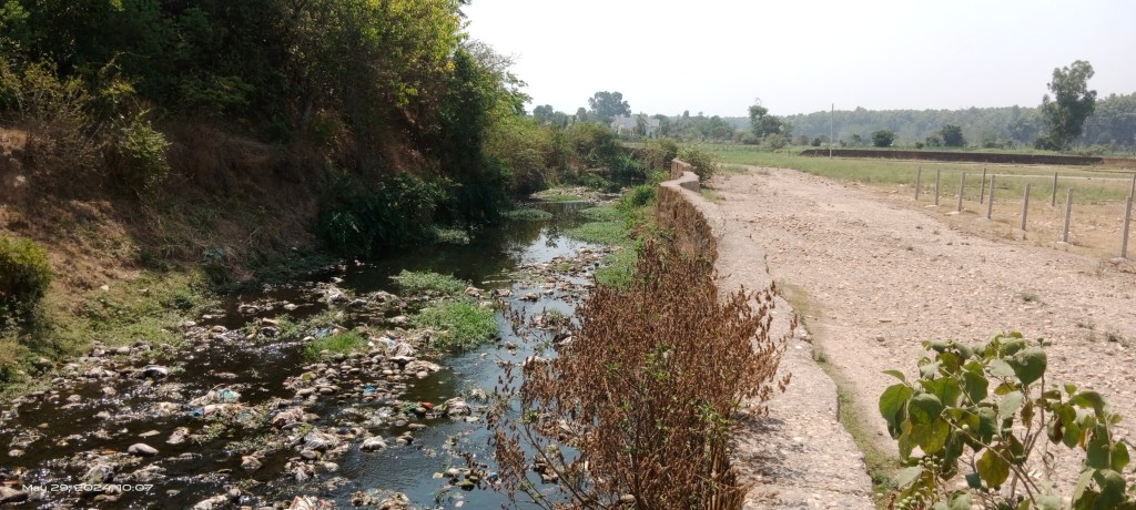
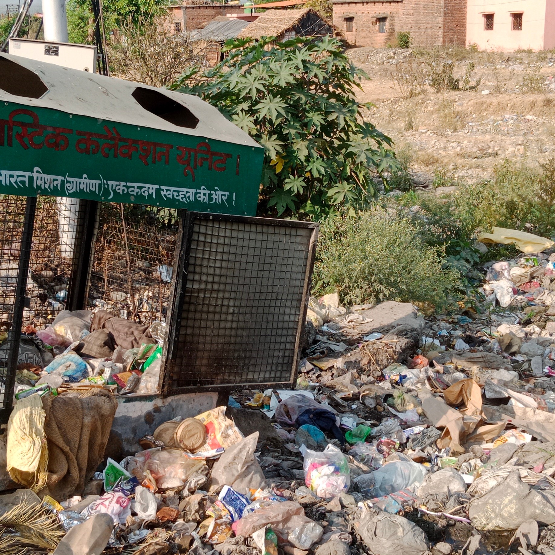
About 15-meter-long river stretch is fully covered with plastic waste at Shanidev Enclave.


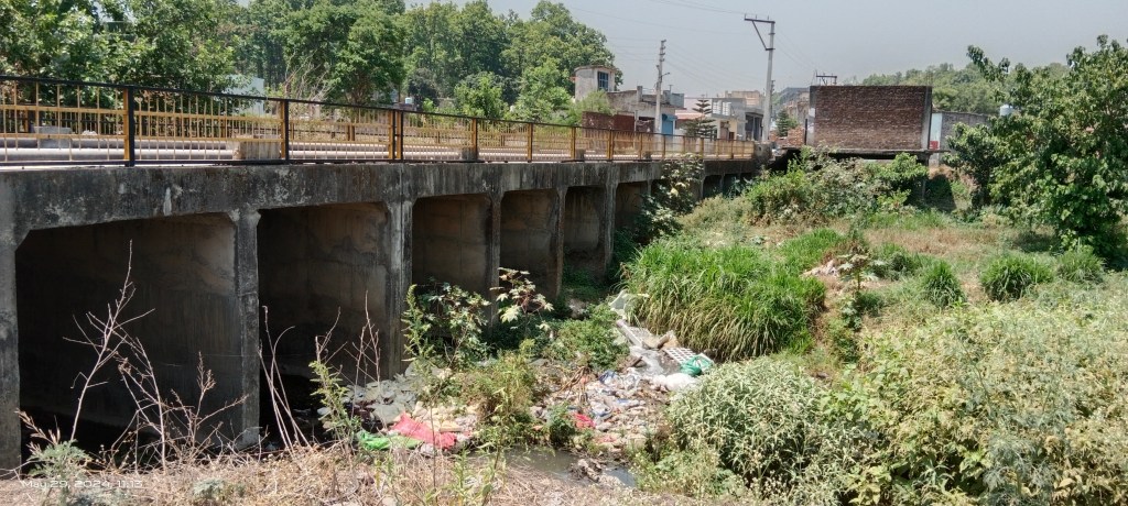

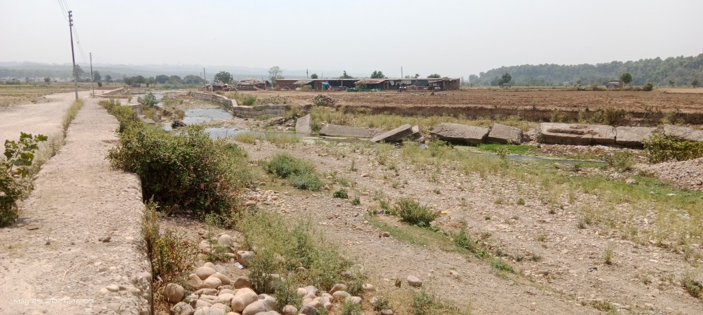
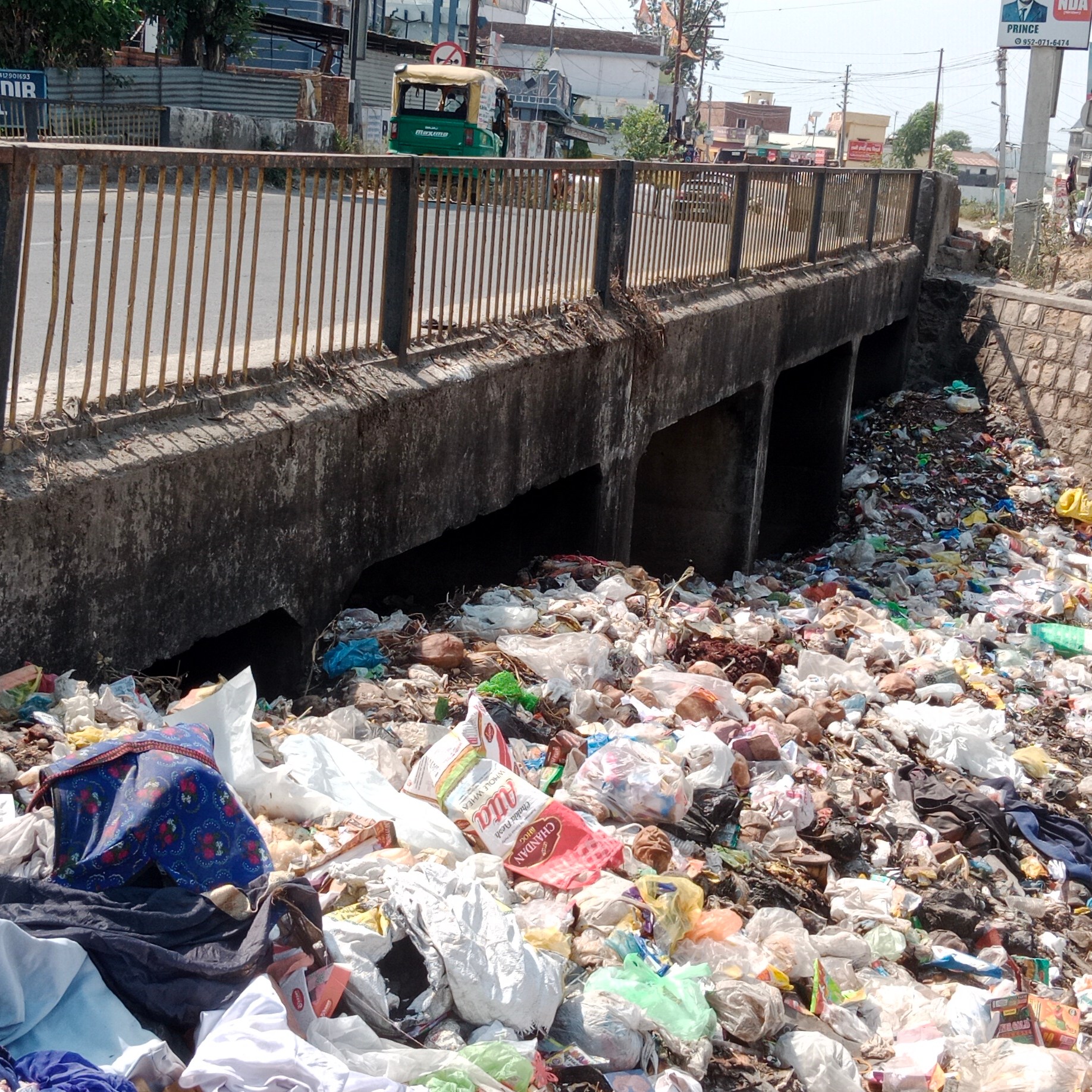
There are about 7 small and big culverts on the river between Chandrabani temple and Budowala. The solid waste mostly plastic is seen chocking the water passages on either side of the culverts.
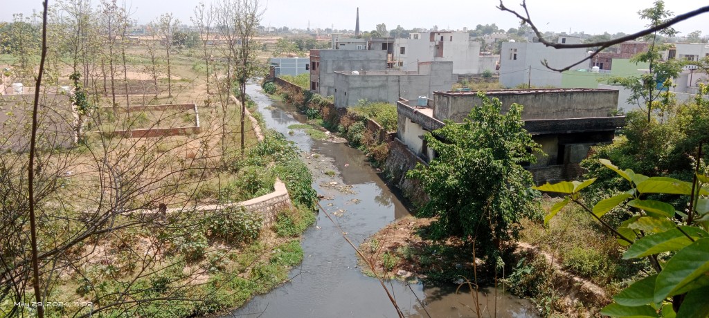

The entire course of Asan has been trained and channelized by concrete walls which at places have forced upto a 90 degree turn in river course and has disabled the meandering function of the river greatly.

Local people remember and inform about occasional violent flood spell int the river posing threats to human structures and properties.


At many locations, the flood protection concrete blocks have been damaged by the floods in the river.


The farming, dairy, poultry activities are happening on remaining ‘undeveloped’ land along the river.

There are sites where the contaminated water is being used for irrigation purposes and herd of buffalos take bath in the polluted river.

Opposite Budowala plotting and road construction is taking place along the Asan. There are property right related dispute going on in the area.


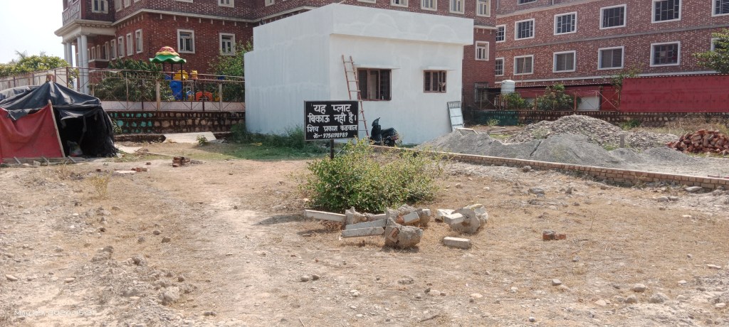
Message boards like ‘Plot/House for Sale’, ‘Land not for Sale’, ‘Trespassing Restricted through Private Land’ have been placed at several sites along the river.
It appears a well-organized builder lobby is at work in area in sale and purchase business of land adjoining the river.

The regret of not finding any landmark celebrating the existence of Asan river like Jamuna Vihar and Ganga Parisar colonies about which I mentioned in first part, was gone after I spotted a board reading Asan Vihar colony in Harbhajwala village. It was a pleasant surprise.
I also met few locals who claimed that Asan is only river flowing from east to west direction in India. In reality there are many other rivers including Narmada, Tapi, Mahi, Sabarmati, Luni, Tawa, Sharavati which are east to west flowing rivers in the country.
Asan near Budowala Bridge: Budowala is first bridge on Asan. The river span also widens at the place.


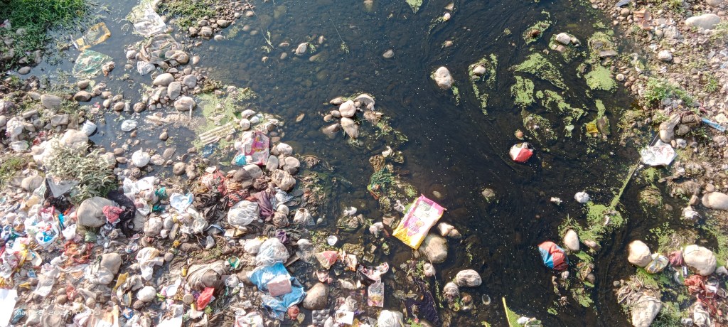
The riverbed is full of gravels and mostly covered with municipal waste. Local people also visit the bridge to dump religious waste in the river.
The polluted water quantum in the river gets reduced here. The water quality also appears slightly improving due to multiple factors including impact of running through gravel bed, vegetation cover and gradient.
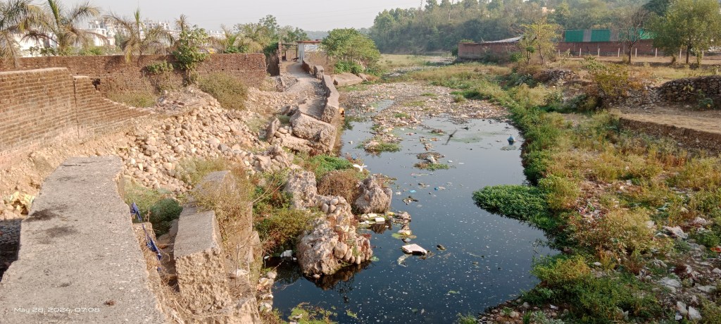

The river is eroding both banks downstream the bridge. The concrete blocks on right bank have been damaged by the floods in the river.


A commercial washing unit has been set up right upto the river bank. Part of the structure has faced flood damages in recent years. Carpets, tent house clothes are washed at the unit using groundwater.
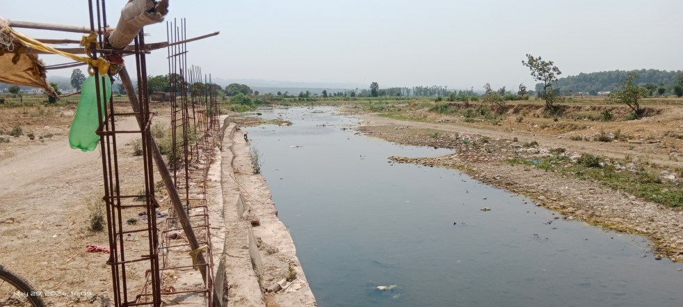
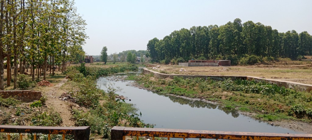
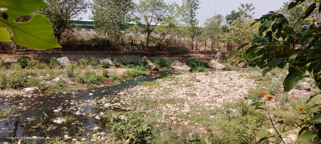
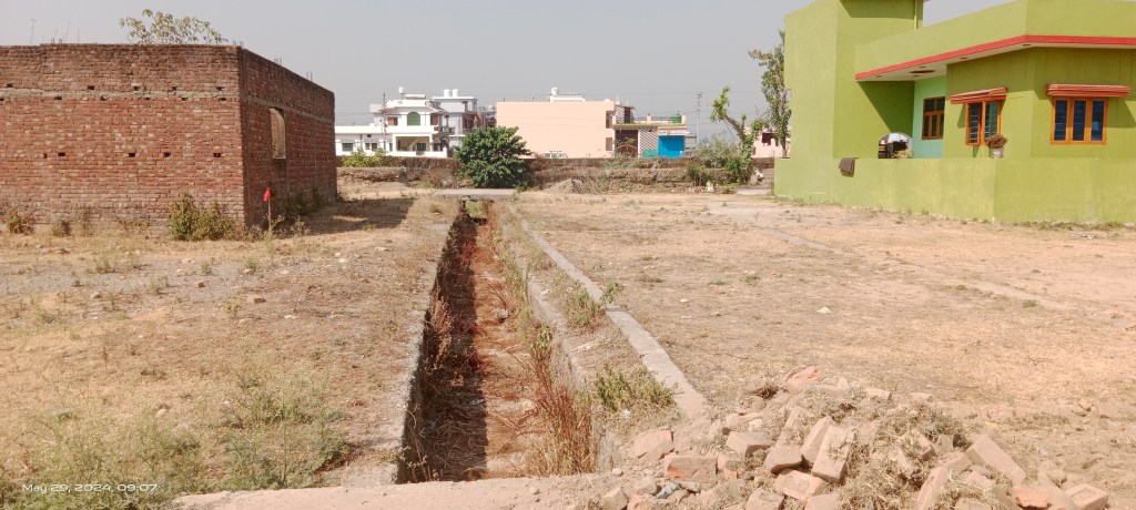
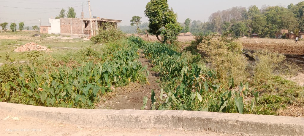
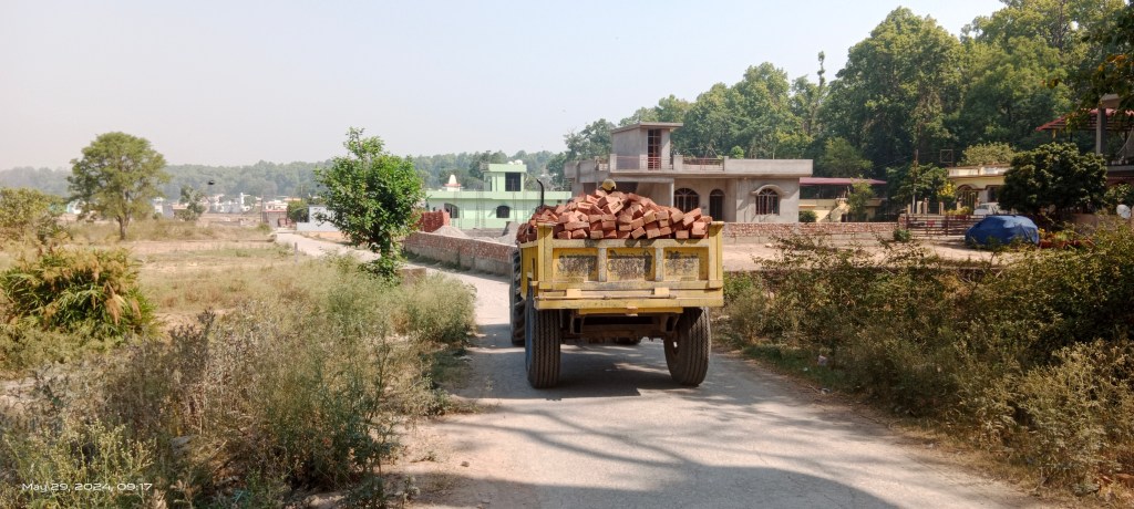
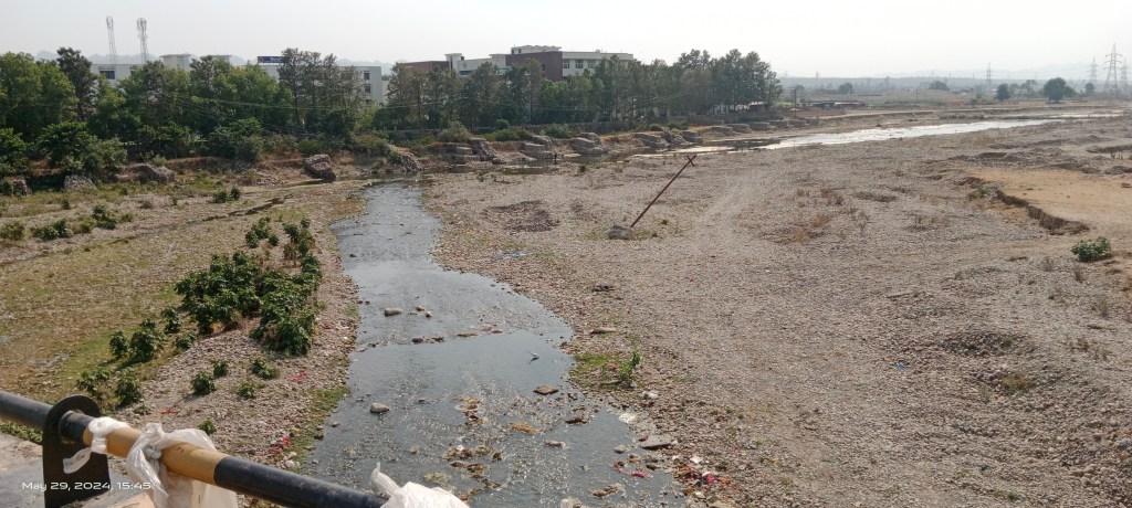
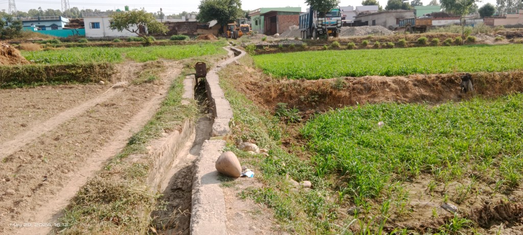
Asan between Sumeru Enclave and Saveli Village: Hardly 20 meter downstream Budowala bridge a posh residential area name Sumeru Enclave in Buddhi village has been developed over 35 hectare of land along right bank of the river.


In the process of developing the residential area, the course of Asan has been trained by raising embankment cum road and meandering feature is severely compromised as the google map of the area shows.
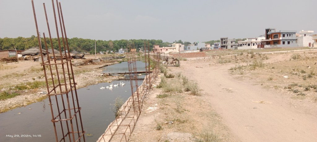

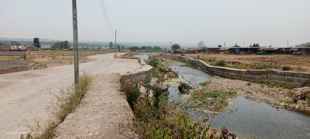
Along the embankment an additional line of concrete block has been laid to protect the area from erosion and flooding.

Still erosion is happening and river is trying to reclaim its space by damaging the concrete blocks during floods. At the same time, the plotting and construction activities are happening at full scale there.
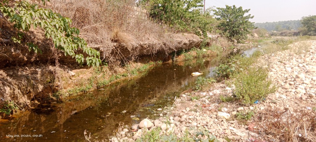
Opposite Sumeru Enclave, a relatively undeveloped land parcel belongs to the Donkwala and Saveli villages. The area was once famous for sericulture and paddy farming.


A small canal used to bring Asan river waters for irrigation and even to run a water mill (Gharat) there. But over the past decade, the farming land is being used for building houses in unplanned manner leading to decline in farming and sericulture. The canal is also running dry.


There are a few streams formed by subsurface waters coming to the surface. These streams merge together and join the Asan as sperate channel named Chhoti Asan after passing through the Shuklapur area.


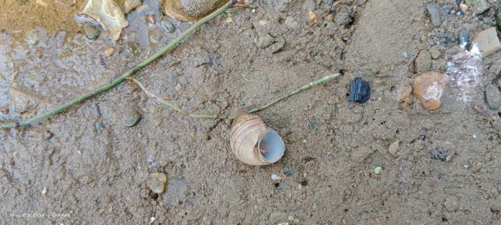
The streams are full of freshwater species including insects, crabs, fishlings, striders, snails, water birds etc.


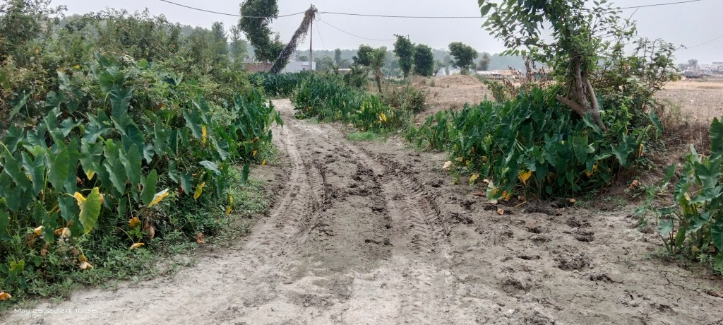
A new residential colony has come up and several homes are under construction in the area blocking and restricting the course and water flows of the streams.

Plotting is also being done on farm lands. A temple has been raised for the purpose and traditional crematoria has been shifted on a swamp of Chhoti Asan stream.
Some locals visit the streams to feed fishlings but wonder why they are running dry.


There are few Van Gurjar families rearing cattle and doing farming as crop sharer. The subsurface water coming to surface by a stream is source of potable water for these families.
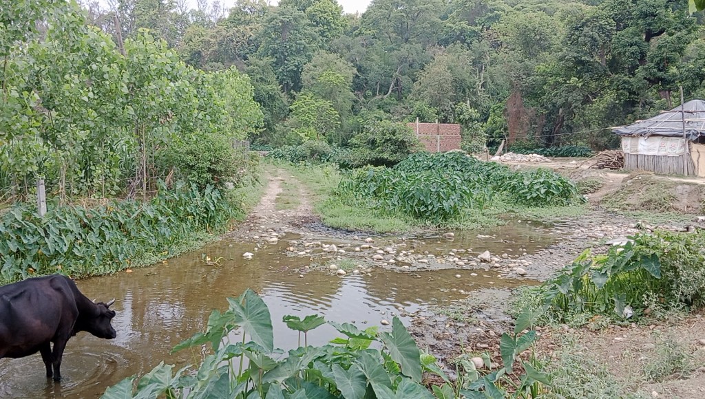
The local residents see the Van Gurjars as land encroachers. They are also blamed for polluting the stream as the cattle use the streams for drinking water and cooling off.

But the residents appear totally oblivion towards adverse impacts of land levelling, plotting activities on Asan streams. A road is proposed to be built along the river to facilitate construction of residential houses.


Like Sumeru Enclave, the main Asan River course has been trained from Donkwala & Saveli side. The concrete blocks to protect the area from floods are suffering damages during floods but are being replaced by newer and longer concrete blocks.

Surprisingly, the river water turns clearer as it flows through Donkwala area. The heron, egrets, cormorant birds forage in the shallow water of the river.

A flock of domesticated white ducks is also seen swimming the in the river.
Asan river at Polion Nathuwala Bridge: Hardly 3 km downstream the Sumeru Enclave, the Asan River starts trickling down with reduced flow.

The riverbed is filled with pits probably created by the gravel mining. There is a crematorium by the river but a half burnt pyre is seen the middle of the river.
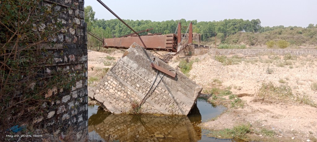

Just 30 meters downstream the Polion bridge, wreckage of a foot bridge is seen reminding one about scale of deluge the river can bring. The great flood of July 2017 had brought down the iron structure.

Downstream the broken bridge a board is placed claiming the land belonged to graveyard for Hindu kids.
Confluence of Asan and Tons Rivers: The Asan River joins the Tons as right bank tributary in Bhurpur village about 5 km downstream Polion bridge.
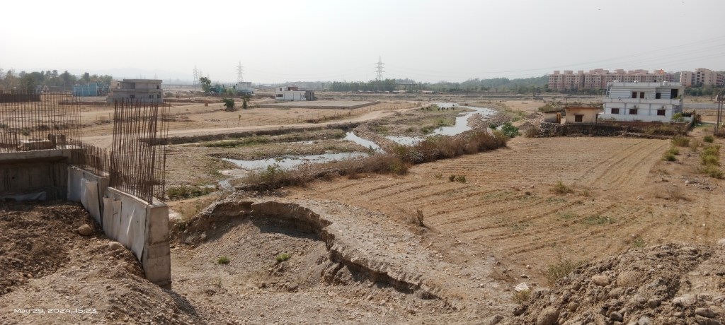
The Asan course is about 50 meters wide and in comparison, the Tons River course is over 200 meters wide. Hence, Asan looks as if a feeding stream to Tons but officially the water course after the confluence is known as Asan.


The Asan River was in a completely dry state under the Bhurpur bridge.

Solid waste in huge quantity was dumped close to the bridge despite a Municipal Corporation board placed there informing about fines against such dumping.


A crystal-clear water pit was formed in the riverbed just 100 meters downstream the bridge probably by the baseflows forming a thin water stream which added some flows in the river.
Though wider, the Tons ran as waterless channel at the confluence. Some big institutes and international schools, including Gyan International School and Tula’s Institute have come up by the Asan and Tons rivers there.
Asan River at Shishambara Bridge: After confluence with Tons, the Asan course becomes over 250 meter wide.

The river starts forming braided channels. A thin meandering water course ran under the bridge at the site. The river seemed gaining some flows due to natural gradient and baseflows.
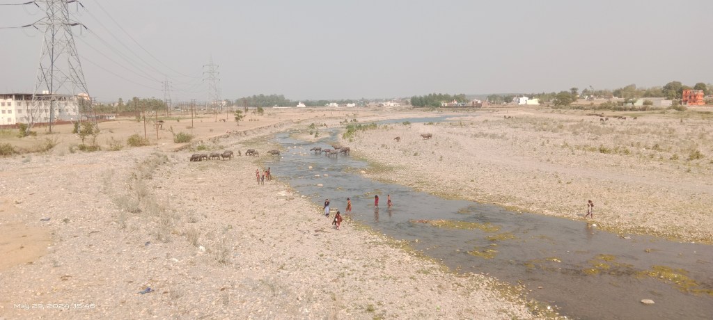

People were bathing and fishing in the shallow water of the river. Van Gurjar community had set up their tents beneath the bridge. Their cattle were roaming around the riverbed.
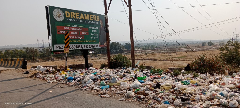
A portion of bridge was also being used to dispose-off solid waste. In fact, the government has built a landfill site at Shishambara close to the floodplain of river. Leachate from the landfill reaches the river during rains.
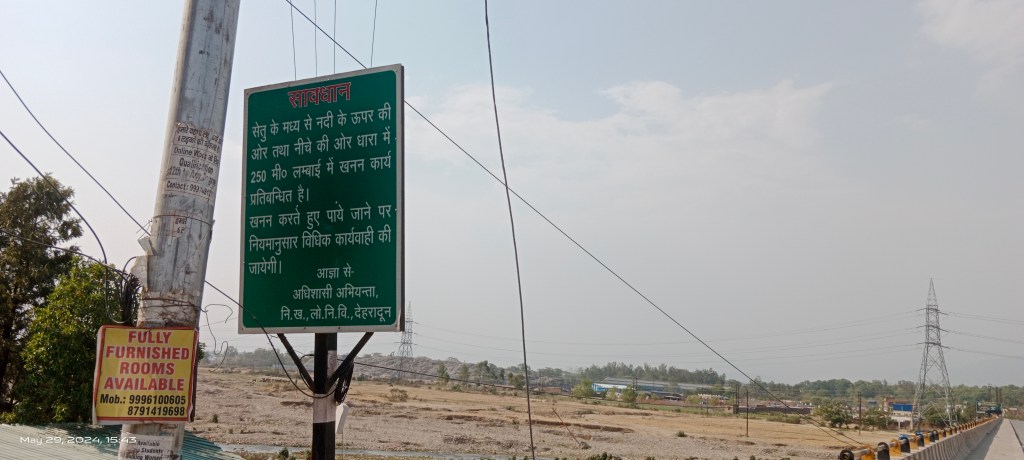
The Public Work Department (PWD), Dehradun has placed notice boards on both end of the bridge prohibiting riverbed mining upto 250 meters up and downstream from the bridge.

Despite that, there were signs of riverbed mining being done during night hours. Mechanized mining in the river was also happening about 800 meters downstream the bridge.
Asan River at Rampur Kalan: At Rampur Kalan village Suarna river as dry water channel joins Asan from right side.
There were dumpers, trucks and JCBs machine parked outside most of the houses in the village along with heaps of riverbed materials. Apparently, the machineries were being used for riverbed mining during the night hours.
The Selaqui industrial area is setup along Suarna course just across the Asan River. The industrial waste water is discharged in the Asan River.
Asan River at Sabhawala Bridge: The course of Asan becomes about 400 meter wider near Sabhawala bridge. The 300 meter long RCC bridge was built in December 2011 costing ₹12.22 crore.

The river continues forming braided channels at the site.

The water levels were shallow and it was flowing through hardly a 20-meter-wide channel.

The algal bloom had turned the water course look greenish. Few people were seen fishing in the river.
Part of river floodplain downstream the bridge was being used for farming.

There were dumps of freshly mined riverbed mineral close to the bridge. The cattle, local people had taken shelter beneath the bridge to escape intense heat spell.
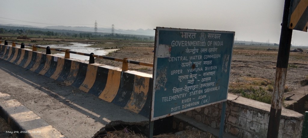
The Central Water Commission (CWC) has set up a telemetry station named Sabhawala under upper Yamuna division on Asan River here.
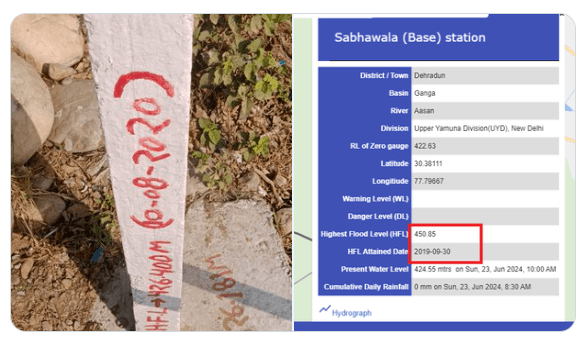
A pillar at the site mentions 426.400 meter as highest flood level (HFL) attained at the site on 10.08.2020. However, as per the CWC website the HFL for the site is 450.85 meter achieved on 30.09.2019.
Asan River at Herbertpur Bridge: The government has made a new bridge on the Asan connecting Dharmawala to Herbertpur town in Vikas Nagar.


Entry and exit to the old bridge on the river have been blocked.


The river appears carrying more flows and creating breaded bars.
Large part of floodplain is filled with heaps of cow dung manure for farming activities.
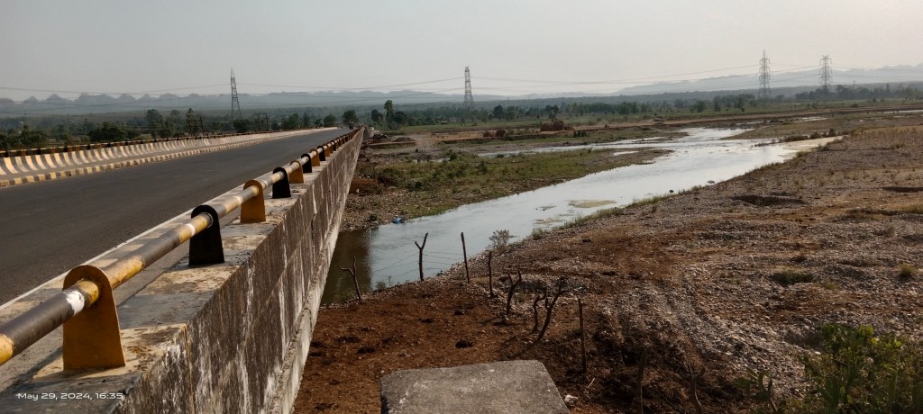
Asan River at Asan Barrage: Finally, the Asan merges into Yamuna River at Kulhal.

The Asan is dammed at the site by a barrage built in 1967. The barrage diverts maximum water from the river for hydropower generation.

It also utilizes Yamuna waters via Shakti canal branching off from Dakpathar barrage in Vikas Nagar, Dehradun.

Creation of the Asan barrage has resulted in a huge man-made wetland. The wetland is spread over 200 ha & supports hundreds of avian species and over 40 fish species. Given its rich biodiversity, it was named Asan Conservation Reserve and declared a Ramsar site in July 2020. Siltation and heavy metal pollution are among key threats impacting the wetlands biodiversity.
Highway Projects Damaging Asan Watershed: In recent years, the National Highway Authority of India (NHAI) has approved two highway projects which have potential to irreversibly damage the watersheds of Asan rivers.
The first project is Up-gradation of 51 km stretch of National Highway (NH) 72 stretch between Paonta Saheb in Sirmour and Ballupur in Dehradun. The NHAI has termed it as a Green Field project and approved a budget of Rs. 1594.33 crore in Feb 2023. The project proposes to widen the part of existing Shimla Bypass road into four lanes from two lanes and creation of about 20 km long new four lane alignment (between Prem Nagar & Dharmawala) to reduce traffic congestion in and around Dehradun city.
About 6 km length of the project lies in Poanta Saheb town of Sirmour district in Himachal Pradesh and the remaining 45 km length in Dehradun district of Uttarakhand. In total the project will divert about 145 ha of private land belonging to 31 villages including 5 in Paonta and 26 in Dehradun. It also proposes diversion of 26 ha of forest land.
Out of 20 km new alignment between Prem Nagar and Dharmawala, the highway project goes along Tons River for about 7 km length and along Asan River floodplain for about 13 km. The Uttarakhand stretch of the project has reportedly received forest clearance and work on the Prem Nagar- Dharmawala alignment along Tons and Asan rivers has started since April 2023.
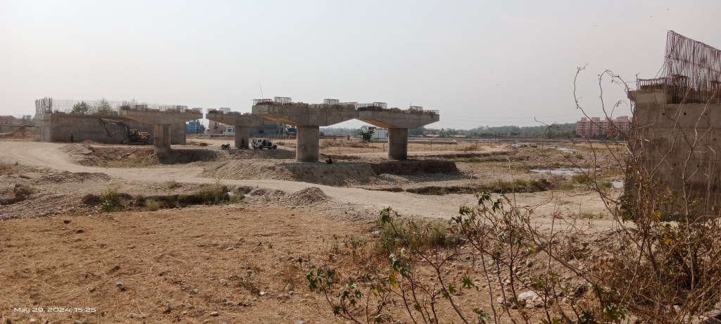
During field visit, I saw the project work was moving at full speed close to the confluence of the Asan and Tons rivers and a double lane bridge was under construction on Asan River there.

Work on the project was going on through the farmlands of Rampur Kalan village.


The highway is being built on ground raised by thousands of tons of riverbed gravel probably extracted from Asan, Tons and other local rivers. Additionally, the project has severely dissected the watersheds of Asan and impacted water courses joining the river.
The second highway project also a Green Field project by NHAI proposes to create a 12 km long 4-lane link road to connect NH-7 from Jhajhra to NH-307 (Delhi-Dehradun Expressway) at Asharori check post. The NHAI has approved Rs. 715.97 cr budget for the project in Dec 2023.
The project requires diversion of 21 ha of forest land and about 50 percent of the road length passes through the Asharori forest range in the catchment area of Asan. The project further requires diversion of 27 ha of private land belonging to 7 villages including Keshowala, Donkwala, Arcadia Grant, Chandarbani Grant, Mohobewala which form the watershed area for the river.
In fact, the highway alignment fragments the precious but already threatened Asan streams at Donkwala village. It also restricts the Asan course in Budowala village. The real estate lobby have already purchased land along the two highway project routes and plotting is being done on large scale in the floodplain and along the course of Asan. Collectively, both projects entail felling of about 10, 000 trees in the watershed area of the river.
Pathetic State of Asan Rivers: There are over 20 big and small seasonal and storm water channels including Bhanga, Ramgarh, Koluwala, Kadwa, Kasumi Raos etc. emerging from outer Shivalik range and joining Asan from south side.


But not a single water course of these is left without being abused by dumping of municipal solid and liquid waste. Most of these channels have also been trained & channelized by building flood protection walls along them.
About half a dozen such water courses including Sitla, Suarna, Chor Khala, Tons rivers etc. originating from Mussoorie range and meeting Asan from North side have met similar fate.
Bhim Singh Rawat (bhim.sandrp@gmail.com)
Note: All the images and google maps are taken and prepared by the author. I specially thank Dr. Anil Gautam, Scientist, Ram Sevak from People’s Science Institute (PSI), Megha Prakash, an independent researcher and Varsha Singh a freelance journalist all from Dehradun for sharing valuable information and assisting me during field trips to document Dehradun rivers.
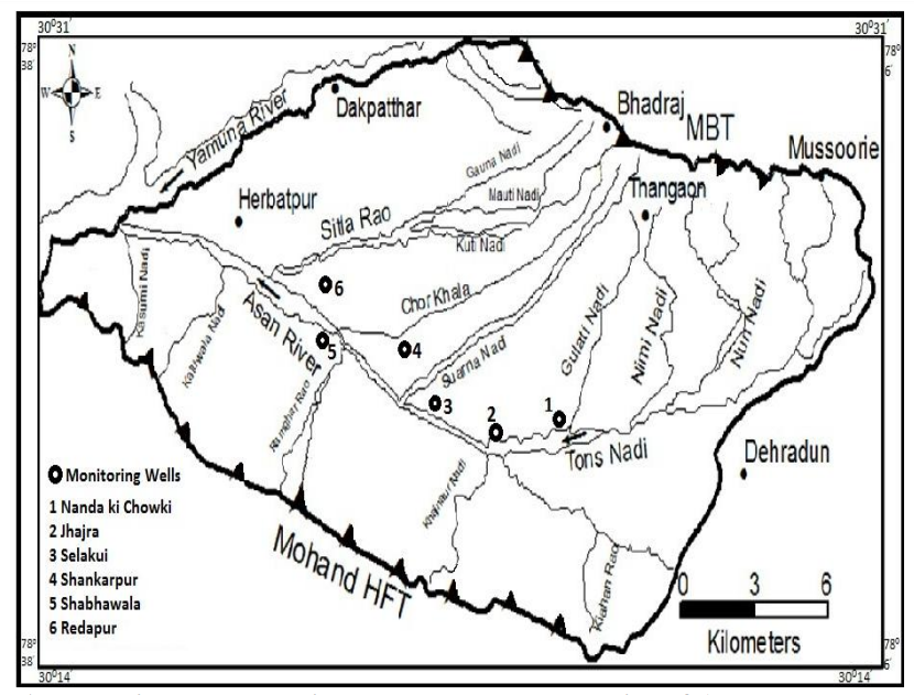


Slide showing Asan river watershed map. Souce: Estimation of contribution of springs tto Asan river watershed of Doon valley throught baseflow hydrograph method, Thematic map of Asan rivers. Source: WII GACMC & Google Earth map marking location mentioned in the blog. An interactive google map on Asan rivers can also be seen <a href=”http://<iframe src=”https://www.google.com/maps/d/u/0/embed?mid=17KwWOf1TkuzP9FDufw6iQHd2mIVA6Ko&ehbc=2E312F” width=”640″ height=”480″>here.
