
Above: The beautiful Lohit River, Arunachal Pradesh Photo: Arati Kumar Rao (http://riverdiaries.tumblr.com/)
Tag: Ganga

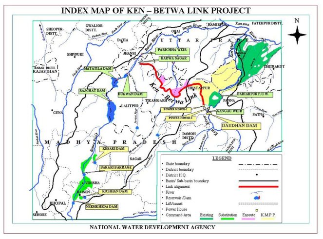
Violations in Ken Betwa Riverlink Public Hearings in last week of 2014
The public hearings required for the Ken Betwa River linking project (KBRLP) are to be held on Dec 23 and 27, 2014 at Silon in Chhattarpur and Hinouta in Panna districts of Madhya Pradesh. However, these public hearings violate fundamental legal norms in letter and spirit and should be cancelled and not held till these violations are rectified.
Firstly, the EIA (Environment Impact Assessment) notification of September 2006 clearly states that project EIA and EMP (Environment Management Plan) should be put up on the website of the Pollution Control Board a month before the actual public hearing. However, a perusal of the MPPCB website (http://www.mppcb.nic.in/) shows that the full EIA and EMP are still not uploaded on the website. When I talked with the concerned officers of the MPPCB, they confirmed that full EIA-EMP reports have NOT been uploaded on the MPPCB website.
Secondly, even the executive summary of EIA-EMP Report on the website is put up in such an obscure fashion that it is not possible for any common person to locate it. So I called up the phone number given on the MPPCB website: 0755-2464428. I was then told that I should call 0755 2466735 to talk to Mr Kuswaha about this. When I called Mr Kuswaha, he directed me to call Mr Manoj Kumar (09300770803). Mr. Manoj Kumar told me at 5.15 pm on Thursday, Dec 18 that he was already home and that I should call him at 12 noon next day. He however, confessed that even the executive summaries were not there about 15 days ago! When I called Mr Manoj Kumar next day and succeeded in connecting only after a few attempts, he told me that I need to first click on “Public Hearing” tab (Under EIA notification). On clicking this, one goes to a page with a table displaying various lists entitled List 1, List II, List III and List IV etc. Then one needs to click List IV. On clicking that one will see a list of projects from 469 to 601 and in that you go to project no 594 which is the Ken Betwa Project. There is no mention of the date of Public Hearing here.
I also called up Dr R K Jain (09425452150) at MPPCB regional office in Sagar, under whose jurisdiction Chhattarpur and Panna come to ask about the availability of the full EIA and EMP in soft copies. He said they are available at designated places, but about not being available on MPPCB website and available executive summaries not being properly displayed on MPPCB websites, he said that he is unable to do anything as that is happening from Bhopal.
When I told him that it is impossible for anyone visiting the MPPCB site to find this project and that the current public hearings need to be displayed more prominently, he hung up the phone, saying he has no time to answer such questions! In any case non-display of the public hearing date and executive summary in Hindi and English in easily searchable form is another violation of the EIA notification.
Thirdly, when we go through the Executive summaries in English and Hindi, we see that both are incomplete in many fundamental ways. The Hindi executive summary[1] has completely wrong translations. I could find nine gross translation errors in just first 16 paragraphs. The Hindi translation has not bothered to translation words like monsoon, MCM, PH, LBC, CCA, FRL, MWL, K-B, tunnel in first 16 paras, nor given their full forms. This makes the Hindi translation completely incomplete, wrong and unacceptable.
Fourthly, even the English (& Hindi) version of Executive summary on MPPCB website[2] is incomplete. It does not have a project layout map, sections like options assessment and downstream impacts.
Fifthly, the EIA claims in very second paragraph: “The scope of EIA studies inter-alia does not include water balance studies.” This is a wrong claim since water balance study of the Ken Betwa links establishes the hydrological viability of the project and by not going into the water balance study, the EIA has failed to establish hydrological viability of the project. SANDRP analysis in 2005[3] of the NWDA feasibility study of Ken Betwa Proposal[4] had established that the hydrological balance study in the Feasibility of the Ken Betwa Link Project is flawed and an exercise in manipulation to show that Ken has surplus water and Betwa is deficit. As the collector of Panna district noted in 2005 itself, if the 19633 sq km catchment of the Ken river upstream of the proposed Daudhan dam (comprising areas of eight districts: Panna, Chhatarpur, Sagar, Damoh, Satna, Narsinghpur, Katni, and Raisen) were to use the local water options optimally, then there will not be any surplus seen in Ken river at the Daudhan dam site and by going ahead with the Ken Betwa Link without exhausting the water use potential of Ken catchment, which is predominantly a tribal area, the government is planning to keep this area permanently backward. But the EIA of Ken Betwa link does not even go into this issue, making the whole exercise incomplete.
Sixthly, the Ken Betwa Link project is a joint project between Uttar Pradesh (UP) and Madhya Pradesh (MP), about half of the benefits and downstream impacts in Ken and Betwa basins are to be faced by Uttar Pradesh, but the public hearings are not being conducted in UP at all, the proposed public hearing is only in MP! Even within MP, the link canals will pass through and thus affect people in Tikamgarh district, but the public hearing is not being held in Tikamgarh district either.
Seventhly, the project had applied for the legally required Terms of Reference Clearance (TORC) and the same was discussed in the meeting of Expert Appraisal Committee (EAC) on River Valley Projects of Union Ministry of Environment, Forests & Climate Change (MoEF&CC) on Dec 20, 2010. However the public hearing is being held more than four years after EAC recommended the TORC and that is way beyond the normal term of two years for which TORC is valid and even for extended term of TORC of four years. The public hearing being conducted without valid TORC can clearly not be considered valid under EIA notification and hence there is no legal validity of this public hearing.
Eighthly, the EIA done by the Agriculture Finance Corporation of India was already completed when the project applied for TORC! I know this for a fact since copies of their (most shoddy) EIA were made available to the members of the Expert Committee on Inter Linking of Rivers set up by the Union Ministry of Water Resources in Nov 2009 itself. I having been a member of the committee had critiqued the shoddy EIA in April 2010 and this was also discussed in one of the meetings where the AFC EIA consultants were called and had no answer to the questions. The same base line data that is now more than five years old is being used in the EIA being used for this public hearing! This is again in complete violation of the EIA norms.
Ninthly, in a strange development, MoEF&CC issued TORC for the project on Sept 15, 2014, following a letter from National Water Development Agency dated 18.06.2014. This letter is clearly issued in violation of the EIA notification, since as per the EIA notification, the ministry could have either issued the TORC within 60 days of Dec 20, 2010 meeting of the EAC or the TORC would be deemed to have been given on 61st day or Feb 19, 2011. However, issuing the letter almost four years after the EAC meeting and that too without mentioning the deemed clearance is clearly in violation of the EIA notification.
The TORC letter on MoEF&CC website is also incomplete as it does not mention the Terms of Reference at all! They are supposedly in the Annexure 1 mentioned in the TORC, but the letter on MoEF&CC site does not include Annexure 1. When I asked Dr B B Barman, Director of MoEF&CC and who has signed the TORC letter, he said that the project has been given standard TORs for any River Valley Project. But Dr Barman forgot that the MoEF&CC was giving the TORC for the first ever interlinking of rivers project and the TOR for this unprecedented project CANNOT be same as any other River Valley Project. The TORC letter is invalid also from this aspect.
The MoEF&CC letter of Sept 15, 2014 is also without mandate for another reason. The letter says “Based on the recommendations of the EAC, the Ministry of Environment & Forests hereby accords clearance for pre-construction activities at the proposed site as per the provisions of the Environmental Impact Assessment Notification, 2006 and its subsequent amendment, 2009”. However, MoEF&CC seems to have forgotten here that the Daudhan dam site and most of the reservoir is inside the Panna Tiger reserve. Perusal of the 45th EAC meeting held on Dec 20-21, 2010 shows that EAC did not recommend preconstruction activity and the EIA division of the MoEF&CC that issued the Sept 15 2014 has no authority to allow pre construction activities inside the protected areas like Panna Tiger Reserve. Even the NBWL (National Board of Wild Life) Standing Committee meeting of Sept 14, 2006 allowed only survey and investigation and NOT preconstruction activity and in any case such activities inside protected areas cannot be allowed without Supreme Court clearance. It is thus clear that Sept 15, 2014 letter of MoEF&CC for Ken Betwa link is also without authority.
There is a third reason why the MoEF&CC letter of Sept 15, 2014 is legally invalid: the letter giving Terms of Reference clearance did not include the conditions EAC stipulated when it recommended the TORC in the EAC meeting of Dec 20, 2010. One of the conditions was that a downstream study will be done by Central Inland Fisheries Research Institute. This becomes particularly important since there is a Ken Ghariyal Sanctuary[5] which will be affected, as also the Raneh falls, both are also tourist attractions.
However, the EIA of the Ken Betwa links has no downstream impact assessment, no mention of Ken Ghariyal Sanctuary or Raneh falls. The EIA also does not contain the CIFRI study that EAC had asked for. This is yet another reason why this incomplete and inadequate EIA cannot be basis for the public hearing from Ken Betwa Project.
This article is not a critique of the EIA of the Ken Betwa Link, I hope to write a separate article for that. Here we only see how illegal is the Public hearing for Ken Betwa link to be held during Dec 23 and 27, 2014 in Chhatarput and Panna districts. The Ken Betwa link project itself is unviable and unjustified and should not be taken up at all. But that will need another article.
It seems the current Union Government under Mr Narendra Modi and Water Resources Ministry under Sushri Uma Bharti are trying to push ahead with their River Link agenda, putting aside even legal stipulations. They also do not seem to be bothered that the Ken Betwa link will only have adverse impact on Ganga and this will also affect the Ganga Rejuvenation that they say is their priority. The EIA does not say a word on this count.
We hope the proposed public hearing will be cancelled. In any case, any clearance given to the project based on such a public hearing will remain open to challenge.
Himanshu Thakkar, SANDRP (ht.sandrp@gmail.com)
END NOTES:
[1] http://www.mppcb.nic.in/pdf/594-hindi.pdf
[2] http://www.mppcb.nic.in/pdf/594-English.pdf
[3] Ken Betwa Link: Why it won’t click: https://sandrp.in/riverlinking/knbtwalink.pdf, a Hindi translation is also available, write to SANDRP for the same.
[4] http://nwda.gov.in/index4.asp?ssslid=35&subsubsublinkid=22&langid=1
[5] http://en.wikipedia.org/wiki/Ken_River
[7] http://nwda.gov.in/index2.asp?slid=280&sublinkid=91&langid=1
[8] https://sandrp.in/riverlinking/Why_Ken_Betwa%20_EIA_is_unacceptable_April_2010.pdf, also see AFC ltd website mentioning that they got the work for doing EIA for Ken Betwa project in 2009 itself: http://afcindia.org.in/ecology_impact2.html
Lessons from Farakka as we plan more barrages on Ganga
Introduction
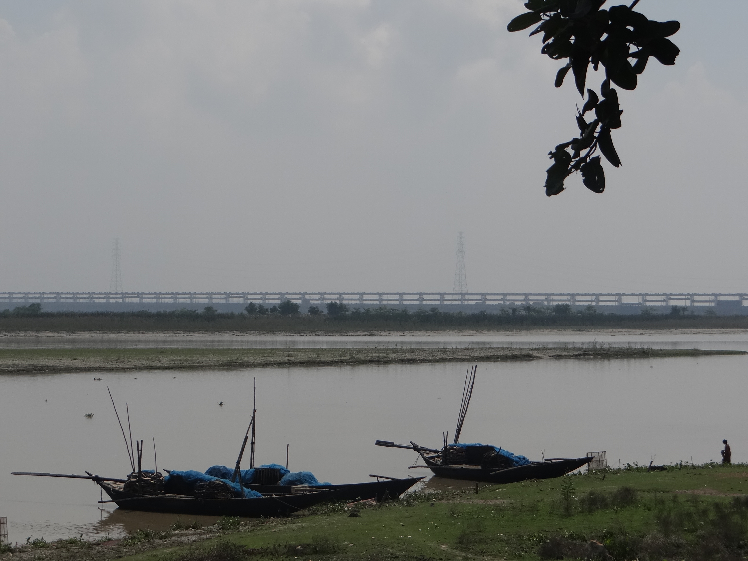
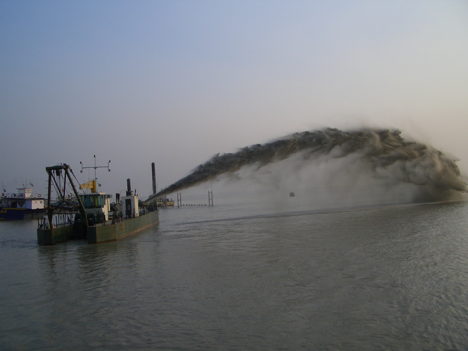
“When Farakka barrage was built, the engineers did not plan for such massive silt. But it has become one of the biggest problems of the barrage now” said Dr. P.K. Parua[1]. And he should know as he has been associated with the barrage for nearly 38 years and retired as the General Manager of Farakka Barrage Project (FBP). I remembered the vast island of silt in the middle of the river barely a kilometer upstream of the Barrage and the people who told us their homes were devastated by the swinging river.
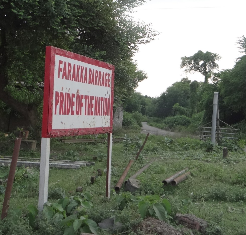
Though called a barrage, Farakka Barrage is a large dam as per ICOLD, WCD and CWC definitions, with associated large dimensions and impacts. To call it a Barrage is misleading.
Commissioned in 1975[i] across Ganga in Murshidabad District of West Bengal and just 16 kms upstream of the Bangladesh Border, Farakka Barrage has been mired in controversies from the very beginning. Its role is singular: to transfer 40,000 cusecs water from Ganga to its distributary Bhagirathi-Hooghly (hence forth referred as Hooghly). And to make Hoogly river navigable from Kolkata port upstream till Farakka barrage. It was thought that this water will push the silt that is eating up the Kolkata Port and will protect the Port for navigation and economy. In reality, Kolkata Port continues to decay and the barrage has had such severe and unforeseen impacts on the people of India and Bangladesh that the call to review Farakka Barrage entirely is getting louder by the day.
A lot has been written about Farakka Barrage by Indian (and many times by Bangladeshi) authors, so why are we discussing Farakka again? Because Political leaders like Shri. Nitin Gadkari have stated that there are plans of building a barrage after every 100 kms in Ganga from Haldia to Allahabad, a 1600 kms stretch. So we are looking at possibly 15 more barrages on Ganga. But before taking decision about building any other such structure, we need to understand the range of impacts a single barrage has had on the lives of millions of people and how inadequate has been our response in addressing these impacts. Farakka holds critical lessons for Indian politicians, policy-makers, international groups and financial institutions like World Bank dreaming of making a string of barrages across a river which has one of the highest silt loads, densest population and the largest deltas in the world.
Ganga as a “Waterway” Government of India is planning to aggressively develop 1620 kilometers of National River Ganga as “National Waterway 1” (NW1). There is a profound difference between a Highway and Waterway. A highway is simply a road while NW1 is actually River Ganga, performing several other functions, it is important to recognise how the NW1 would affect these functions and the river itself. NW 1 spans from Haldia, near the mouth of Ganga Estuary in West Bengal, to Allahabad in Uttar Pradesh, passing through four states and cities of Haldia, Howrah, Kolkata, Bhagalpur, Buxar, Patna, Ghazipur, Varanasi and Allahabad.
The Inland Waterways Authority of India (IWAI)[ii] plans to use this waterway for the transport of “coal, fly-ash, food grains, cement, stone chips, oil and over dimensional cargo.” Not surprisingly, companies keenly interested in using this waterway include “thermal power plants, cement companies, fertilizer companies, oil companies” etc. In order to make this stretch navigable, IWAI plans initiatives like “river training and conservancy, structural improvement, dredging, and Construction of terminals at Allahabad, Varansai, Gazipur in Uttar Pradesh, Sahibganj in Bihar and Katwa in West Bengal.”
Although this plan was on paper for some years, the new government has approached the World Bank for support of nearly Rs 4200 Crores (700 million dollar) for its implementation. In July 2014, the World Bank agreed to fund initial 50 million dollars including technical support (thus creating work for its own experts!). World Bank Team has already visited Patna for this project and joint meeting of IWAI and World Bank has taken place at Varanasi[iii]. No public consultation has been held thus far.
Although River Navigation has nothing to do with River Rejuvenation, Shri. Nitin Gadkari, Union Surface Transport & Shipping Minister with additional portfolio of Rural Development, who played an active role in the Ganga Manthan, announced this navigation plan as a part of ‘Ganga Rejuvenation’.[iv]
He also announced that the plan entails erecting barrages (dams) on the Ganga at every 100 kilometer interval from Haldia to Allahabad. This would mean damming the Ganga rough about 15-16 times, to maintain water levels and navigability.[v]
If the plan moves ahead, it may escape environmental clearance as the very limited EIA Notification 2006, being actively amended for dilution by the Modi government, includes only irrigation and hydropower dams in its ambit. This does not mean that these barrages will not have severe impacts on the river, its people and its ecosystems. Far from it. SANDRP has written about the impacts of Upper Ganga Barrage at Bhimgouda, the Lower Ganga Barrage at Narora and the Farakka Barrage in Murshidabad, West Bengal (SANDRP’s Report on Farakka, 1999: https://sandrp.in/dams/impct_frka_wcd.pdf).
The analysis at hand is based on official documents and research, site visit, interviews and discussions with experts and local people.
- Farakka Barrage, in the backdrop of proposed Barrages
Farakka Barrage, 2.62 kms long, commissioned in 1975 has a unique purpose. The barrage was built for diverting waters of Ganga into its distributary The Hooghly/ Bhagirtahi, for flushing sediments and maintaining the navigability of Kolkata Port (& Hooghly River) which lies at the mouth of Hooghly. Records about high sedimentation in Hooghly can be traced back to 17th Century, but is known to increase following building of Damodar Dams in post independent India. Construction of a barrage on Ganga and diverting its waters into Hooghly was suggested in the 19th Century by Sir Arthur Cotton. After independence, the historic Kolkata port was becoming hugely silted due to sluggish freshwater from upstream on the one hand and and strong saline intrusion from the sea on the other. At that time, Farakka Barrage was thought to be an answer to these problems.

Even then, some lone voices highlighted the possible impacts of Farakka Barrage. Notably Mr. Kapil Bhattacharya, Engineer-in-Chief of West Bengal had warned about absence of sufficient water, catastrophic floods and sedimentation in the upstream back in 70s. When Pakistan (current Bangladesh was part of Pakistan during 1947-1971) upheld his views, he was branded as a traitor and lost his job. He had highlighted that one of the main reasons why Hooghly was desiccating was Damodar Valley Corporation (DVC) dams on Damodar and Roopnarayan Rivers.
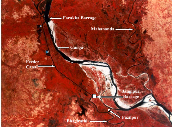
The Farakka Barrage completed in 1975 has 109 gates, and a feeder canal of 38.1 kms emanating from the right bank, carrying water from Ganga to Hooghly. There is one more barrage at Jangipur in the downstream and afflux bunds in the upstream of Farakka, diverting waters of all smaller rivers like Pagla and Choto Bhagirathi into Farakka, effectively drying them in the downstream.
The Feeder canal is supposed to divert 40,000 cusecs water continuously from Ganga into Bhagirathi/ Hooghly. Hooghly-Bhagirathi itself is not a small river. It is a system drained by 7 tributaries like Pagla, Bansloi, Mayurakshi, Ajoy, Damodar, Rupnarayan, Haldi and the two offshoots of Ganga – Jalangi and Churni.
- Impacts and performance of Farakka Barrage
Several grave questions are being posed on the utility of the barrage itself and its impacts. Some of the main points are illustrated below:
- Hooghly estuary cannot be made silt-free by 40,000 cusecs from Farakka only
River Expert Dr. Kalyan Rudra, an authority on rivers in Bengal, especially their interactions with sediment, says that the initial objective of Farakka of flushing silt from the mouth of Hooghly has been “frustrated”[vi]. This assessment has been supported by many, including the past Superintending Engineer of Farakka Dr. P.K. Parua (Pers. Comm.) According to Kolkata Port Trust, the dredging of silt at Kolkata Port has been rising from 6.40 million cubic meters (MCM) annually from Pre-Farakka days to four time increase at 21.88 MCM annually during 1999-2003.
The answer, according to Dr. Rudra, lies in the fact that freshwater flow brought by the Hooghly Estuary, even with 40,000 cusecs from Farakka is just too meagre to flush sediments deep down the estuary. The difference between volumes of freshwater brought by Hooghly, as against the tide bringing saline water from south to north is as much as 1:78, making any deep flushing due to freshwater nearly impossible. Dams in the Hooghly Bhagirathi Basin by Damodar Valley Corporation have further arrested freshwater which could have naturally replenished Hooghly estuary. At the same time the stated aims of Damodar Valley Corporation, fashioned on the lines of Tennessee Valley Authority have not been fulfilled.
Currently, the functioning of Kolkata Port and Haldia port is entirely at the mercy of Dredging Corporation of India (DCI) to desilt the river to maintain sufficient draft (allowable depth of a ship’s keel under water). DCI gets about Rs 300-350 Crores per year for dredging the channel, although several problems have been unearthed like dumping the excavated silt back in the estuary from where it is washed back in the channel. In 2009, the Government of India had actually written to the Kolkata Port Trust, saying that it has become a “liability” and it should explain why it should continue to receive dredging subsidies. A PIL has been filed[vii] in 2013 in Kolkata High Court to save Kolkata and Haldia ports by intensive dredging.
It is clear that 40,000 cusecs water from Farakka is not able to help the Kolkata Port much as was envisaged earlier. SANDRP tried to talk with officials at the Kolkata Port Trust, but they declined answering any questions saying that Farakka is a bilateral issue.
This has led to a situation where we have the barrage and the impacts of two countries and millions of people, without even achieving objective for which the project was developed.
2. Sedimentation in the upstream of Farakka Barrage and its massive implications for India and Bangladesh
It is estimated that Ganga carries a silt load of 736 Million Tonnes (MT) annually, out of which about 328 MT of sediment gets deposited in the upstream of Farakka Barrage ANNUALLY[viii]. This annual addition of enormous sediment in the upstream of the barrage has made the river extremely shallow and any ship transport past Farakka has become nearly impossible. As we saw during our visit, islands/chars have formed barely a kilometer upstream the barrage, where animals graze, making any transport nearly impossible.
This massive retention of sediments has resulted in a two-pronged problem:
3. Contribution to delta subsidence and rising sea level in Bangladesh and India
Water released below Farakka barrage has significantly less silt load as about 328 MT silt gets deposited at Farakka. This water has a higher eroding capacity and erodes downstream riverbed. But there is an additional problem: World Heritage site of Sunderbans at the mouth of the Ganga-Brahmaputra-Meghna delta, shared between India and Bangladesh is witnessing possibly the first and highest numbers of Climate Change refugees in the world due to Ingressing Sea which is eating away at smaller islands and the delta. Part reason for this delta subsidence is sea level rise due to global warming and related changes, but the driving reason for encroaching seas is not only sea level rise, but the sinking river delta due to trapping sediment in the upstream dams and barrages like Farakka. The role of river sediments in building deltas is crucial. Ganga-Brahmaputra-Meghana Delta is subsiding rapidly and is categorized as a ‘Delta in Peril’ by experts like Syvitski et al, due to reduction in sediments reaching the delta and compaction of delta, furthering sea level rise. According to recent studies, the rate of relative sea level rise per year in the Ganga Brahmaputra delta is in the range of 8-18 mm per year, one the highest in the world. The related sediment reduction has been a whopping 30% in the twentieth century. (SANDRPs report on Delta Subsidence and Effective Sea Level Rise due to sediment trapping by dams: https://sandrp.wordpress.com/2014/05/07/sinking-and-shrinking-deltas-major-role-of-dams-in-abetting-delta-subsidence-and-effective-sea-level-rise/)
Farakka Barrage has been highlighted as one of the causes for this blocking of sediments at an important juncture. Any role played by Farakka in delta subsidence of GBM Delta has a massive impact on millions of people residing in this delta. According to Prof. Md. Khallequzamman (Pers Comm.), the amount of sediment influx flowing into Bangladesh from upper reaches in India has dropped from 2 billion tons per year in the 1960s to less than 1 billion tons per year in recent years, which is not enough to keep pace with rising sea.[ix]
4. Erosion in the Upstream of the barrage due to Sedimentation
Farakka Barrage is getting silted up due to millions of tonnes of sediment being deposited in the upstream annually. Ganga has been a meandering river, changing courses over centuries, forming paleo channel and ox bows. This deposition of sediment in the upstream is accelerating swinging of Ganga alarmingly to the left bank of the river. This is leading to tremendous erosion in Malda and surrounding regions. More than 4000 hectares of land in Malda has been eroded by the Ganga since 1970s. The river has also breached 8 embankments. Although a number of authors have conclusively written about this and even Legislative Assembly of West Bengal has been unequivocal in saying that “It is accepted all levels that the construction of Farakka Barrage is solely responsible behind the erosion of river Ganges in Malda district”, Central Water Commission trivializes this fact and does not accept any responsibility of Farakka.The only issue CWC seems to be bothered about is the health of the barrage itself which is compromised by erosion on the left bank. In official correspondences of CWC and MoWR scrutinized by SANDRP, the agencies do not mention anything about plight of thousands of people, who are refugees of a swinging river, but are only concerned about the strength of the barrage.[x]
According to Audit Report on Farakka Barrage by Indian Audit and Accounts Departments, between 2006-2012, the “Unintended Consequences” of Farakka include:
- Induced water through feeder canal raised water level of Bhagirathi by about 5 meters near Jangipur and does not allow Bansloi and Pagla to join Bhagirtahi freely. A new wetland due to congestion formed Ahiron Beel which has submerged fertile land.
- The barrage has trapped substantial sediment and hence river in changing course. In homogenous situation the oscillation of river is secular but it gets aggravated due to Farakka Barrage. On account of Rajmahal hills on right bank and Farakka barrage on the channel, the river erodes the left bank.
- The 10 day cycle of increased and decreased release of water from the Barrage has resulted in a complex phenomenon of recharging ground water by river and then receiving base flow from groundwater ( when river is low). The frequent change in water level on account of 10 day altered flow adversely affects the rivers hydro geomorphology leading to escalating bank erosion.
- River bed height in Farakka pondage has increased and the river is compensating this reduction by expanding its cross section sideways
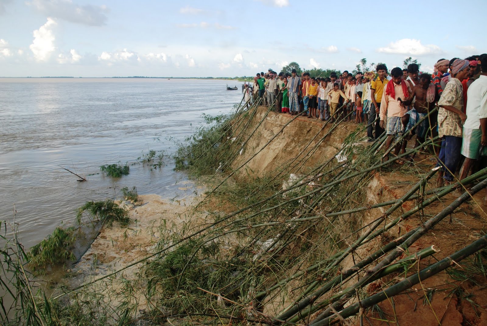
5. Erosion Downstream of the barrage, leading to loss of life and property:
Sedimentation upstream the barrage, coupled with natural swing of Ganga has meant that the river is swinging to the left, encroaching the left bank, leading to erosion in thousands of villages, roads, fields in the downstream of the Barrage in India as well as Bangladesh, causing annual floods. The Irrigation Department West Bengal (Report of the Irrigation Dept for 1997-2001) itself has agreed not only about this erosion due to Farakka Barrage, but has also cautioned about the possibility of outflanking of the Farakka Barrage itself. Many experts maintain the eminent possibility of Ganga outflanking the barrage to flow through its old course of the 15th century, which will reduce the barrage to just a bridge.
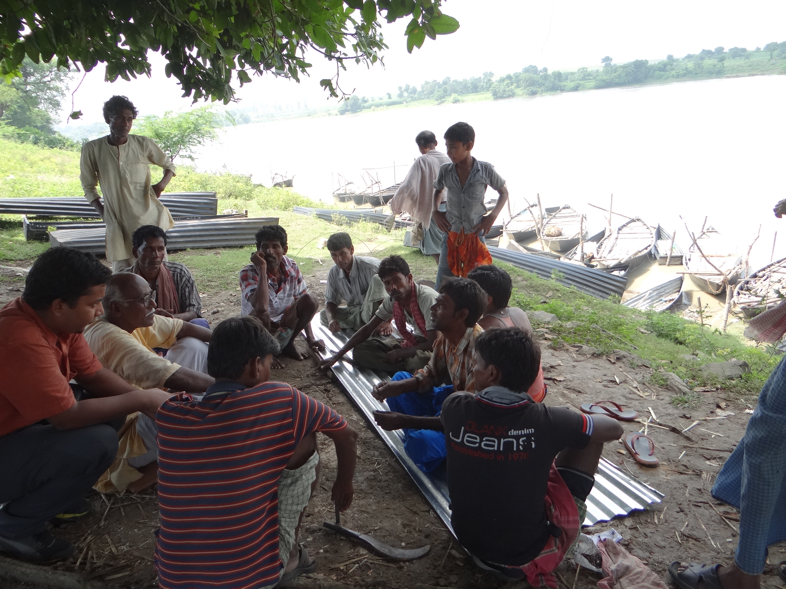
On our visit to Farakka, Kedarnath Mandal, a veteran activist working on issued of Ganga and Farakka accompanied us to see extensive erosion in the left bank of the river in the upstream at Simultola as well as downstream in Chauk Bahadurpur. In both these regions, the eroding river has paid little heed to the erosion control measures on the banks. Huge boulders have been swept with the current, destabilizing land in their wake.

We saw extensive bank erosion in the left bank on the downstream where all measures like bull headed spurs, dip trees, porcupines, gunny bags, geo-synthetic covers, boulders bars, boulder crates with nets, etc. have been eroded.
In all this din, the people residing in the chars, their leaders like Kedarnath Mandal, River experts and even the Legislative Council of West Bengal maintain that though erosion and changing courses is a character of Ganga, it has worsened and accelerated hugely since Farakka Barrage. In fact the 13th Legislative Assembly Committee (2004) in its 7th Report notes “It is accepted at all levels that the construction of Farakka Barrage is solely responsible behind the erosion of river Ganges in Malda district”.
6. Near Impossibility of desilting Farakka Barrage
To say that the challenge of desilting Farakka Barrage is Herculean, will be an understatement. The irreversible circle of events is highlighted by the fact that in order to have any appreciable impact, the amount of sediment lifted from the barrage should be at least twice the amount deposited per year, if the project is to be completed even in thirty years. But that seems impossible. According to Dr. Rudra, “Doing so will require a fourteen lane dedicated highway from Malda to Gangasagar” and the transport cost alone “would be nearly twice the revenue earned by Government of India in a year.” Dr. P.K. Parua also accepts that desilting the barrage will be next to impossible.
Such is the scale of sedimentation at Farakka.
7. Source of conflict with Bangladesh
Experts and authorities from Bangladesh have been raising the issue of impact of Farakka for several years now. Farakka Barrage not only obstructs the flow of sediments in Bangladesh, but also diverts waters of Ganga away from Bangladesh delta, depriving millions of fisherfolk and farmers from their livelihood. Water sharing from Farakka, particularly in lean season is now governed by Ganges Water Treaty of 1996. The Treaty holds force between 1 January to 31st May each year and water sharing calculations are based on 10 day flows. Some experts from Bangladesh have maintained that Ganges Water Treaty is not being implemented properly and Bangladesh is receiving less water than its due.[xi] There are issues raised by the Indian side as well of dwindling water availability. All in all, the barrage and the resultant Treaty continues to be a source of impacts for the river and people of the two nations.
- Meeting officials at Farakka Barrage
SANDRP met with the Authorities at the Farakka Barrage Project office, which is under the Ministry of Water Resources (MoWR), at New Farakka. After meeting the officials, it was clear that they have no program for silt management at all. They do not even see this as an area of concern and are only concerned with anti-erosion works, which are failing miserably, and releasing water to Kolkata Port, which is not improving its navigability.
While some may argue, rather irrelevantly (considering the warnings of Kapil Bhattacharyya), that Engineers in 1950s, 60s and 70s were not equipped or aware of the issues related to sediment and its far-reaching impacts like erosion, deposition, floods, even sea level rise, the same in any case cannot be said about the current water management. They have the privilege of better knowledge, better resources and also lessons from past experiences. But despite having clear evidence that silt of Ganga is playing havoc with millions in India as well as Bangladesh, the Farakka Barrage Authorities tell us that they have no plan for silt management the barrage except annual erosion control measures.
The mandate of the barrage authorities is also 120 kms of bank erosion works, 40kms in the upstream and 80kms in the downstream. We were told on the condition of anonymity that this extensive work leaves little time even for maintaining the barrage. The bank protection work is also not permanent and is eroded with flood waves. The bureaucratic set up at Farakka makes it impossible to take proactive decisions about Barrage maintenance. The gates of the barrage need replacement, but there is hardly any agency interested in working for Farakka Barrage due to bureaucratic delays.
The officials told SANDRP that the only desilting measure that can be adopted is opening all gates of the Barrage, but that will not be possible unless all gates are replaced as many gates are faulty. Replacing all gates of Farakka will take at least two more years and we do not know even after that whether silt can be flushed. Such a flushing will need a major flood event and the impact of such sudden flushing of billions of tonnes of silt in the downstream will be unprecedented & huge.
Meeting with Farakka Barrage Authorities leaves one with more questions than answers.
- Interview with past official of Farakka
SANDRP discussed the multiple issues of Farakka with one of the senior retired official from the Farakka Barrage Authority who has seen the work of the FBPA closely over several years. Some excerpts from these discussions.
SANDRP: Sir, do you think Farakka is fulfilling its functions?
Answer: Farakka was not only designed for diverting water for Hooghly, it was foreseen that there may be an Irrigation component and even a hydropower component. But the inflow at the barrage was over calculated. We never had that sort of inflow in the project. Add to this Treaty with Bangladesh in 1996 and India was left with little water. I would say objectives of Farakka were only partially fulfilled. The barrage has a designed discharge of 27,00,000 cusecs and we have been able to achieve that discharge only twice since commissioning the barrage. In the recent years, water flow has been declining sharply at the barrage. This further handicaps all its functions.
SANDRP: There are several problems associated with silt deposited in the upstream of the barrage like floods, change in course of the river, erosion, etc. Is there any way to tackle this deposited silt?
Answer: Yes, that is a serious problem. This is being faced by ports and barrages the world over and also across India. There are so many players responsible for the increasing silt load and reduced water in the river, right from Nepal.
We can say that the scale of the sediment issue was not understood when the barrage was designed, the engineers then did not have the knowledge or tools for this. Even now, there is no easy way this issue can be tackled. Desilting the barrage would be very costly, and what would be do with the collected silt? Malda and Murshidabad region is densely populated, we cannot dump it anywhere. If we dump it in the river, there will be other problems. It is possibly an evil we have to live with now.
SANDRP: There are plans to erect about 16 more such barrages on the Ganga main stem. What would be the lessons from Farakka for these barrages?
Answer: I think this is a horrible plan. In addition to the challenge of silt, I wonder where will the water come from? Supplies from Upper Ganga Canals are increasing, reducing water flow in the river. Uttar Pradesh is increasing the capacity of Lower Ganga Canals. More and more abstraction will happen. Such a plan does not seem feasible and will be harmful for the river as well.
- Ecological Impacts
- There’s no Hilsa here
Farakka Barrage has stopped migration of economically important species like the Hilsa (Tenualosa ilsha) and Macrobrachium prawns, both Ilish (Hilsa) and Chingri (Macrobrachium) hold a special significance to people in West Bengal and Bangladesh. A lot has been written about the Barrage’s disastrous impact on Hilsa production and impoverishment of fisherfolk in India and Bangladesh[xii]. About 2 lakh fisherfolk in Malda district alone depend on riverine fisheries and Hilsa here was the backbone of the fishing economy.
Although Central Inland Fisheries Research Institute (CIFRI) has a lab to work on Hilsa, the institute is not working on Fish passes or Hilsa Hatcheries at the Barrage itself!
Prior to com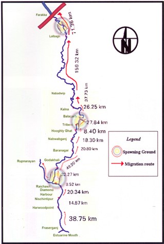 missioning Farakka Barrage in 1975, there are records of the Hilsa migrating from Bay of Bengal right upto Agra, Kanpur and even Delhi covering a distance of more than 1600 kms. Maximum abundance was observed at Buxar (Bihar), at a distance of about 650 kms from river mouth. Post Farraka, Hilsa is unheard of in Yamuna in Delhi and its yield has dropped to zero in Allahabad, from 91 kg/km in 1960s. Studies as old as those conducted in mid-seventies single out Farakka’s disastrous impacts on Hilsa, illustrating a near 100% decline of Hilsa above the barrage post construction.[xiii]
We met fishermen who have not caught a single Hilsa in the upstream of the barrage despite fishing for three days. In the downstream too, size and recruitment (population) of Hilsa is affected due to arrested migration at Farakka. Some 2 million fisherfolk in Bangladesh depend on Hilsa fishing. Hilsa in Padma river (Ganga in India) downstream Farakka has also declined sharply due to decreasing water and blockage of migration routes.[xiv]
These fisherfolk have never been compensated for the losses they suffered. They were not even counted as affected people when the barrage was designed and they are not counted even now.
- Fable of Farakka Fish Lock
The tale of Farakka Barrage Fish Lock is another tragic story. Fish Lock is a gated structure in a Barrage that needs to be operated specifically to facilitate migration of fish from the downstream to the upstream or vice versa to breed, feed or complete their lifecycles.
According to Central Inland Fisheries Research Institute (CIFRI), Farakka Barrage has two Fish Locks between gates 24 and 25. The locks need to be operated to aid fish migration and transport fish. We talked with the Engineers at Farakka Barrage Authority, local villagers, fishermen and even the Barrage Control Room officials who operate the gates of the barrage about the functioning of the Fish Lock. No one had heard about a Fish Lock. There is some information that there is one more lock further upstream in the river, but the FBP Authorities did not seem aware of this.
The control room officials kept showing us the ship lock at the Barrage (which is also rarely used due to turbulence and sedimentation) and told us categorically that “There is nothing called as fish lock here”. The locks have not been operated for a minimum of a decade, possibly much longer.
Who is responsible for the loss of fisherfolk income in the meantime? Will the Farakka Barrage Authority or the MoWR or the CWC or the Kolkata Port Trust or Inland Waterways Authority of India compensate them?
According to Dr. Parua, fish locks were operated for some time when he was posted at Farakka, but they never worked as planned. He believes that a bare 60 feet fish lock for a barrage that is more than 2.6 kms long is of little use. There should have been more fish locks planned. He also lamented about the non-functionality of Hilsa Fish Hatchery set up at the banks of the barrage. (We were not even told about the presence of this structure by any of the officials or other concerned persons we met and possibly it has now fallen to complete disrepair now.) He said despite Central Inland Fisheries Research Institute (CIFRI) is based in West Bengal and has a special cell to study Hilsa, they or the Fisheries Department have taken no interest in the functioning of the hatchery or the Fish Locks.
2. Vikramshila Dolhin Sanctuary, Bhagalpur
Bhagalpur is barely 150 kms upriver from Farakka and Dr. Sunil Chaudhary, a past Member of the Sate Wildlife Board of Bihar has been working relentlessly on conservation of Gangetic Dolphins, as well as rights of traditional fisherfolk in Bihar and around Vikramshila region.[xv] SANDRP discussed the issue of Farakka and additional barrages with him. Dr. Chaudhary states that not only barrages, but the dredging itself will have serious impacts on Dolphins. Impacts of Farakka Barrage on fish and fisherfolk in Bihar is still being felt. No Hilsa reach here from Farakka and a generation of fisherfolk has suffered due to this. Forget more barrages on the Ganga, we need a review of Farakka Barrage itself as Ganga Mukti Andolan has been asking for years now.
Any work affecting Vikramshila Dolphin Sanctuary will require clearance from State Wildlife Board, State Wildlife Warden and National Board for Wildlife. We hope that such permissions are not given without due diligence and independent application of mind and at least whatever remains of Ganga is maintained.
In conclusion
The issues arising out of Farakka are extremely serious. Our planners and decision makers may claim that many of the impacts were not foreseen (Not entirely true). But the issue cannot be ignored any longer. We need a credible independent review of the development effectiveness of Farakka Barrage, including costs, benefits and impacts.
What we seem to be doing now is to repeat the mistakes of the past with new barrages planned on the Ganga.
The existing Upper Ganga Barrage (Bhimgouda Barrage) has dried up the river in the downstream. The river is diverted in a canal, where people take ritual baths, while the original riverbed is used as a parking lot.

The Lower Ganga (Narora Barrage) has severely affected fish migration & dried up the river in the downstream at least in lean season. The Barrage has a fish ladder, but there is no monitoring or concern as to whether it is working or not. In its report to the World Bank, Uttar Pradesh Government has said that the “condition of the barrage is poor” and has lamented about increased siltation in the upstream of the barrage and the inability to flush the sediments due to poor condition of its gates.[xvi].
Beyond doubt, the existing barrages, especially the Farakka Barrage have had massive impacts on the river, its ecosystems and its people. We have many critical lessons to learn from these experiences. In stead, we are pushing for more barrages on a river which will only compound existing problems.
Ganga is much more than a waterway or a powerhouse. It is a river, supporting not only urban areas and industries, but rural communities, the basin, the ecosystem and myriad organisms in its wake and it needs to be respected as an ecosystem first, rather than for sentimental reasons like mother or goddess.
The Ganga is being fettered at its origin in the Uttarakhand by over 300 hydropower dams. In addition, if it is again dammed many times over times in its main channel, then the government will not have to worry about River Rejuvenation Plan. There will be no river left for rejuvenation.
-Parineeta Dandekar, SANDRP (parineeta.dandekar@gmail.com)
Bibliography:
Dr. Sutapa Mukhopadhyay et al, Bank Erosion of River Ganga, Eastern India –A Threat to Environmental Systems Management
G Verghese, Waters of Hope: Facing New Challenges in Himalaya-Ganga Corporation, India Research Press, 2007
Milliman et al, Environmental and economic implications of rising sea level and subsiding deltas: the Nile and Bengal examples, JSTOR, 1989
Syvitski et al Sinking deltas due to human activities Nature Geoscience, September 2009
Thakkar, Dandekar, Shrinking and Sinking Deltas, Major role of dams in delta subsidence and Effective Sea Level Rise, SANDRP, 2014
A Photo Feature on Farakka Barrage: https://sandrp.wordpress.com/2014/09/29/world-rivers-day-and-ganga-a-look-at-farakka-barrage-and-other-such-calamities/
End Notes:
[1] Pers. Comm.
[i] For a earlier SANDRP report on Farakka, see: https://sandrp.in/dams/impct_frka_wcd.pdf
[ii] http://iwai.nic.in/index1.php?lang=1&level=0&linkid=115&lid=781
[iii] http://timesofindia.indiatimes.com/city/varanasi/No-environmental-clearance-for-Haldia-Allahabad-Waterway/articleshow/39827972.cms
[iv] https://sandrp.wordpress.com/2014/07/08/will-this-ganga-manthan-help-the-river/
[v] http://www.toxicswatch.org/2014/08/work-commencing-on-ganga-waterway.html
[vi] Dr. Rudra, Kalyan, The Encroaching Ganga and Social Conflicts: The Case of West Bengal, India, 2008
[vii] http://timesofindia.indiatimes.com/city/kolkata/PIL-to-save-Kolkata-and-Haldia-ports-filed/articleshow/20526985.cms
[viii] Dr. Rudra, Kalyan, The Encroaching Ganga and Social Conflicts: The Case of West Bengal, India, 2008
[ix] For more details see: https://sandrp.in/Shrinking_and_sinking_delta_major_role_of_Dams_May_2014.pdf
[x] http://www.environmentportal.in/files/Farakka%20Barrage.pdf
[xi] Khalequzzaman, Md., and Islam. Z., 2012, ‘Success and Failure of the Ganges Water-sharing Treaty’ on WRE Forum http://wreforum.org/khaleq/blog/5689
[xii] https://sandrp.wordpress.com/2014/09/01/collapsing-hilsa-can-the-dams-compensate-for-the-loss/
http://wwf.panda.org/wwf_news/?186621/Climate-change-could-drown-out-Sundarbans-tigers—study
http://www.the-south-asian.com/april-june2009/Climate-refugees-of-Sunderbans.htm
http://www.sciencedirect.com/science/article/pii/092181819190118G
[xiii] Ghosh, 1976 quoted in Review of the biology and fisheries of Hilsa, Upper Bengal Estuary, FAO, 1985
[xiv] http://www.downtoearth.org.in/node/2071
[xv] https://sandrp.in/rivers/Dolphins_of_the_Ganga-few_fading_fewer_frolicking.pdf
[xvi] World Bank, Uttar Pradesh Water Restructuring Project Phase II, 2013
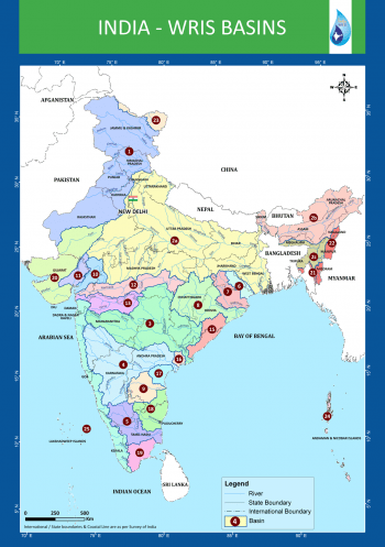
WRIS River Basin Reports: Hits and Misses
Reliable data and information that is both correct and validated on ground, is a pre requisite to understand any feature or activity. And for a river, a constantly evolving and truly complex entity, it becomes even more crucial. The wellness quotient of rivers, their present health status, all these and more can only be understood, once we have the rudimentary knowledge of the river and the basins that they form.
A step in this direction has been taken up by the India WRIS (Water Resources Information System) project (A joint venture between Central Water Commission and Indian Space Research Organisation), that aims “to provide a ‘Single Window Solution’ for water resources data & information in a standardized national GIS framework”[i]. This project has generated 20 basin level reports that share important information on the salient features of the basin, their division into sub basins, the river systems that flow through it and the water resource structures, such as irrigation & hydro electric projects in the basin. Another crucial inclusion is the length of major rivers in each basin, which have been GIS calculated (Geographic information system)[ii] and in a few reports the place of origin of the rivers too is mentioned. (Ganga Basin Report). This is an improvement over the earlier documented river lengths that included the canal length along with the river lengths, in earlier CWC documents (e.g. water and related statistics)!
The Basin reports include basin level maps which also show the proposed inter basin transfer links and the major water resource structures & projects. Individual maps at the sub basin level mark the rivers & their watersheds. The report gives details on the topography, climate, the land use / land cover area , and also the information on hydro meteorological stations like groundwater observation cells, flood forecasting sites and even water tourism sites.
These reports can be downloaded from the WRIS site.[iii]
The reports are an attempt to document the water resources data & information for a better and more integrated planning, at the basin level. A table below tabulates some important parameters from the 20 basin reports.
Missing Dams! It can be seen from table on next page that total number of dams in all the 20 basins come to 4572. Assuming that this includes all the completed large dams in India by Dec 2013 (WRIS report is dated March 2014), if we look at the number of large dams in India as in Dec 2013 in the National Register of Large Dams (NRLD), the figure is 4845. This leaves a difference of 273 large dams, which are missing from the WRIS list! This seems like a big descripancy. Unfortunately, since NRLD gives only statewise list and does not provide river basin wise list and since WRIS list provides only river basin wise list and does not provide the names of districts and states, it is not possible to check which are the missing dams, but WRIS need to answer that.
Sub Basins These 20 basins have been further delineated into a number of sub basins. The sub basins details include the geographical extent of the sub basin, the rivers flowing in it, the states that they travel through, number and size range of watersheds and also the details of dams, weirs, barrages, anicuts, lifts & power houses, accompanied by maps at this level. The irrigation and hydro electric projects in the area are detailed and mapped for greater convenience. The sub basin list is given here to get a detailed picure.
Indus Basin Sub-basins:
- Beas Sub Basin
- Chenab Sub Basin
- Ghaghar and others Sub Basin
- Gilgit Sub Basin
- Jhelum Sub Basin
- Lower Indus Sub Basin
- Ravi Sub Basin
- Shyok Sub Basin
- Satluj Lower Sub Basin
- Satluj Upper Sub Basin
- Upper Indus Sub Basin
| S. No | River Basin | Major river | No. of sub basins | No. of watersheds | No. of water resource structures | No. of water resource projects | |||||||||
| Irrigation | Hydro Electric | ||||||||||||||
| Dams | Barrages | Weirs | Anicuts | Lifts | Power Houses | Major | Medium | ERM* | |||||||
| 1 | Indus (Upto border) | Indus (India) | 11 | 497 | 39 | 13 | 18 | 0 | 45 | 59 | 30 | 40 | 21 | 55 | |
| 2a | Ganga | Ganga | 19 | 980 | 784 | 66 | 92 | 1 | 45 | 56 | 144 | 334 | 63 | 39 | |
| b | Brahmaputra | Brahmaputra (India) | 2 | 180 | 16 | 17 | 5 | 0 | 4 | 21 | 9 | 13 | 3 | 17 | |
| c | Barak & others basin | Barak | 3 | 77 | 4 | 3 | 0 | 0 | 0 | 3 | 0 | 6 | 3 | 3 | |
| 3 | Godavari | Godavari | 8 | 466 | 921 | 28 | 18 | 1 | 62 | 16 | 70 | 216 | 6 | 14 | |
| 4 | Krishna | Krishna | 7 | 391 | 660 | 12 | 58 | 6 | 119 | 35 | 76 | 135 | 10 | 30 | |
| 5 | Cauvery | Cauvery | 3 | 132 | 96 | 10 | 16 | 9 | 24 | 16 | 42 | 3 | 15 | ||
| 6 | Subernarekha | Subernarekha & Burhabalang | 1 | 45 | 38 | 4 | 12 | 0 | 0 | 3 | 5 | 34 | 0 | 1 | |
| 7 | Brahmani & Baitarni | Brahmani & Baitarni | 2 | 79 | 61 | 5 | 4 | 1 | 0 | 1 | 8 | 35 | 4 | 1 | |
| 8 | Mahanadi | Mahanadi | 3 | 227 | 253 | 14 | 13 | 0 | 1 | 6 | 24 | 50 | 16 | 5 | |
| 9 | Pennar | Pennar | 2 | 90 | 58 | 0 | 1 | 2 | 0 | 1 | 7 | 14 | 0 | 1 | |
| 10 | Mahi | Mahi | 2 | 63 | 134 | 0 | 4 | 0 | 0 | 3 | 10 | 29 | 3 | 2 | |
| 11 | Sabarmati | Sabarmati | 2 | 51 | 50 | 2 | 10 | 0 | 0 | 0 | 9 | 11 | 4 | – | |
| 12 | Narmada | Narmada | 3 | 150 | 277 | 2 | 2 | 0 | 4 | 9 | 21 | 23 | 1 | 6 | |
| 13 | Tapi | Tapi | 3 | 100 | 356 | 8 | 11 | 0 | 13 | 2 | 13 | 68 | 2 | 1 | |
| 14 | WFR Tapi to Tadri | Many independent rivers flowing | 2 | 96 | 219 | 0 | 3 | 0 | 1 | 18 | 13 | 15 | 1 | 12 | |
| 15 | WFR Tadri to Kanyakumari | 3 | 92 | 69 | 6 | 6 | 4 | 0 | 29 | 19 | 12 | 7 | 21 | ||
| 16 | EFR Mahanadi_ Pennar | 4 | 132 | 64 | 5 | 12 | 12 | 0 | 0 | 12 | 46 | 10 | 0 | ||
| 17 | EFR Pennar _ Kanyakumari | 4 | 165 | 61 | 2 | 2 | 11 | 0 | 6 | 13 | 33 | 4 | 5 | ||
| 18 | WFR Kutch _ Saurashtra | Luni | 6 | 268 | 408 | 1 | 10 | 0 | 0 | 0 | 8 | 100 | 4 | 15 | |
| 19 | Area of inland drainage in Rajasthan | Many independent rivers flowing | – | – | 1 | 0 | 0 | 0 | 48 | 0 | 11 | 1 | 1 | 0 | |
| 20 | Minor rivers draining into Myanmar(Burma) & Bangladesh | Many independent rivers flowing | 4 | 54 | 3 | 5 | 0 | 0 | 3 | – | 3 | 4 | 1 | – | |
| Total | 94 | 4335 | 4572 | 203 | 335 | ||||||||||
* Extension, Renovation and Modernization ** Data has been accumulated from the individual Basin Reports from India WRIS[iv]
Ganga Basin
- Yamuna Lower
- Yamuna Middle
- Yamuna Upper
- Chambal Upper
- Chambal Lower
- Tons
- Kosi
- Sone
- Ramganga
- Gomti
- Ghaghara
- Ghaghara confluence to Gomti confluence
- Gandak & others
- Damodar
- Above Ramganaga Confluence
- Banas
- Bhagirathi & others ( Ganga Lower)
- Upstream of Gomti confluence to Muzaffarnagar
- Kali Sindh and others up to Confluence with Parbati
Brahmaputra Basin It is strange to see that the profile divides this huge basin into just two sub basins, when it could have easily divided into many others like: Lohit, Kameng, Siang, Subansiri, Tawang, Pare, Teesta, Manas, Sankosh, among others.
- Brahmaputra Lower
- Brahmaputra Upper
Barak & Others Basin
- Barak and Others
- Kynchiang & Other south flowing rivers
- Naochchara & Others
Godavri Basin
- Wardha
- Weinganga
- Godavari Lower
- Godavari Middle
- Godavari Upper
- Indravati
- Manjra
- Pranhita and others
Krishna Basin
- Bhima Lower Sub-basin
- Bhima Upper Sub-basin
- Krishna Lower Sub-basin
- Krishna Middle Sub-basin
- Krishna Upper Sub-basin
- Tungabhadra Lower Sub-basin
- Tungabhadra upper Sub-basin
Cauvery Basin
- Cauvery upper
- Cauvery middle
- Cauvery lower
Subernarekha Basin No sub-basins.
Brahmani & Baitarani Basin
- Brahmani
- Baitarani
Mahanadi Basin
- Mahanadi Upper Sub- basin
- Mahanadi Middle Sub- basin
- Mahanadi Lower Sub- basin
Pennar Basin
- Pennar Upper Sub-basin
- Pennar Lower Sub-basin
Mahi Basin
- Mahi Upper Sub-basin
- Mahi Lower Sub-basin
Sabarmati Basin
- Sabarmati Upper Sub- basin
- Sabarmati Lower Sub-basin
Narmada Basin
- Narmada Upper Sub-basin
- Narmada Middle Sub-basin
- Narmada Lower Sub-basin
Tapi Basin
- Upper Tapi Sub- Basin
- Middle Tapi Sub- Basin
- Lower Tapi Sub- Basin
West flowing rivers from Tapi to Tadri Basin
- Bhastol & other Sub- basin
- Vasisthi & other Sub- basin
West flowing rivers from Tadri to Kanyakumari Basin
- Netravati and others Sub- basin
- Varrar and others Sub- basin
- Periyar and others Sub- basin
East flowing rivers between Mahanadi & Pennar Basin
- Vamsadhara & other Sub- basin
- Nagvati & other Sub- basin
- East Flowing River between Godavari and Krishna Sub- basin
- East flowing River between Krishna and Pennar Sub- basin
East flowing rivers between Pennar and Kanyakumari Basin
- Palar and other Sub-basin
- Ponnaiyar and other Sub-basin
- Vaippar and other Sub-basin
- Pamba and other Sub-basin
West Flowing Rivers of Kutch and Saurashtra including Luni Basin
- Luni Upper Sub-basin
- Luni Lower Sub-basin
- Saraswati Sub-basin
- Drainage of Rann Sub-basin
- Bhadar and other West Flowing Rivers
- Shetrunji and other East Flowing Rivers Sub-basin
Area of inland drainage in Rajasthan Due to very flat terrain and non-existence of permanent drainage network, this basin has not been further sub divided.
Minor rivers draining into Myanmar and Bangladesh
- Imphal and Others sub basin
- Karnaphuli and Others sub basin
- Mangpui Lui and Others sub basin
- Muhury and Others sub basin
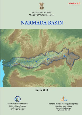
Narmada Basin: Some details To understand the compiled information at the basin level, we take a look at the one of the basin level reports, the Narmada Basin Report[v] (dated March 2014) as an illustrative example. An overview of the basin area right at the beginning, gives its geographical location, shape, size, topography, climate & population. This basic relevant information is tabulated in a concise table for easy access, as given below:
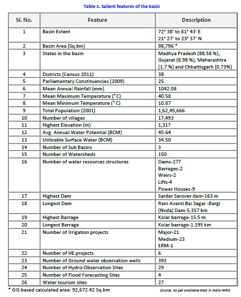
River information The major river flowing in the basin, the Narmada River (also called Rewa) that flows through the 3 states of Madhya Pradesh, Maharashtra & Gujarat, its length (1333 km) and the length of its 19 major tributaries out of a total of 41 is given, based on GIS calculations. There is also a clear river network map of the Narmada basin that demarcates the 3 sub basins along with the watersheds, and shows the dams / weirs /barrages and the rivers in the basin.
- Narmada Upper Sub-Basin, with 16 watersheds
- Narmada Middle Sub-Basin, having 63 watersheds
- Narmada Lower Sub-Basin, with 71 watersheds
The surface water bodies details include the size (less than 25 ha to more than 2500 ha) and type (Tanks, lakes, reservoirs, abandoned quarries or ponds) of existing bodies. Nearly 91.8% of these are tanks.
Irrigation Projects The water resource projects in the basin are as follows:
- 21 Major Irrigation Projects
- 23 Medium Irrigation Projects
- 1 ERM Project
- 6 Hydro-Electric Projects
Interestingly description is only of the major and medium irrigation projects, information on minor projects is completely absent. An attempt to include the details of minor irrigation projects would have made the report more useful. The reports seem to not understand the significance of the smaller projects and their importance for the people and in the conext of the River Basin too.
Water resource structures The number and type of big manmade structures in the basin is given. These are a total of 277 dams, 2 barrages, 2 weirs and 4 lifts, of which again the major structures are marked on a map, and details given as in table below. Dams are classified on the basis of storage and purpose they are used for, and the dam numbers are available at sub basin level.
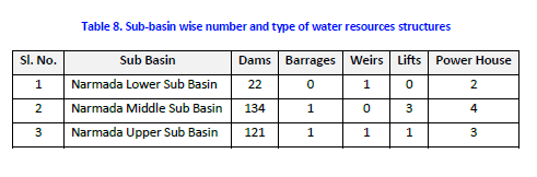
The report gives tabulated data for each of the dams, which is supposed to have name of the river, height, length, purpose, year of commissioning, etc. Since GIS is the strength of ISRO, they could have easily given latitude and longitudes of each dam, but they have not. Shockingly, in case of 186 of the dams, name of the river on which it is built is given as ‘Local Nallah’, and in case of 10 they have left the column blank. This means for nearly 71% (196 out of 277) of the dams they do not even know the name of the river they are build on. This is actually an improvement over the performance of CWC. The CWC’s National Register of Large Dams[vi], we just checked, mentions Narmada only 13 times (for 12 dams of Gujarat and 1 dam of Madhya Pradesh).[vii]
It is well known that Narmada Basin is the theatre of India’s longest and most famous anti dam movement, Narmada Bachao Andolan. The movement involves opposition to Sardar Sarovar, Indira Sagar, Omkareshwar, Maheshwar, Jobat dams, among others. Such social aspects should also form part of any river basin report.
Surface water quality There are 19 surface water quality observation sites in the basin, that collect water data and the report spells out , “As compared to the other rivers, the quality of Narmada water is quite good. Even near the point of origin, the quality of river water was in class ‘C’ in the year 2001 while it was in class ‘B’ in earlier years. As was observed for most other rivers, in case of Narmada also, BOD and Total Coliform are critical parameters.” This shows that even in Narmada Basin, water quality is deteriorating. The statement also remains vague in absence of specifics.
Inter basin transfer links Details of the Par-Tapi-Narmada Link, which is a 401 km long gravity canal and its proposal to transfer 1,350 MCM (Million Cubic metre) of water from ‘surplus rivers’ to ‘water deficit’ areas is given, along with a map. How has the conclusion of surplus or deficit been reached? Does the assessment exhaust all the options including rainwater harvesting, watershed development, groundwater recharge, better cropping patterns and methods, demand side management, optimising use of existing infrastructure, etc? Is this is the least cost option? Does the water balance include groundwater? Who all will be affected by this or even how much land area will be affected by this proposal, there is absolutely no talk of this? No answers in the report.

There’s more to a river There is no information in basin reports on the regulating or statutory bodies that have a say in the basin in the report. However, some information on the existing organisations and inter-state agreements at the various basin level is given at another WRIS location.[viii]
The Basin reports for 20 basins are clearly an asset for understanding and analysing water resource situation. However, there is no mention of the numerous ecological, social and environmental services these rivers provide us with. The demographic details of the basin are available, but there is no information on the flora and fauna, who also need and thrive on the river waters. A good navigation tool for water resource information and river management projects at basin level, nevertheless, for a broader and more comprehensive outlook these reports should have included the following essential aspects too:
- River status: The present water quality & pollution level of the major rivers as well as their tributaries
- River governance: The local committees, civil bodies and institutions that play a role in river basin development
- River safety measures: Effect of the existing and planned river management projects on the state of the river, people and society.
- River ecology: Status of biodiversity, and other ecological aspects of the rivers
Sabita Kausal, SANDRP (sabikaushal06@gmail.com)
END NOTES:
[i] India WRIS: http://india-wris.nrsc.gov.in/wrpinfo/index.php?title=Main_Page
[ii] GIS: http://en.wikipedia.org/wiki/Geographic_information_system
[iii] http://india-wris.nrsc.gov.in/
[iv] Basin Reports available for download: http://india-wris.nrsc.gov.in/
[v] http://india-wris.nrsc.gov.in/Publications/BasinReports/Narmada%20Basin.pdf
[vi] http://www.cwc.nic.in/main/downloads/New%20NRLD.pdf
[vii] For more details, see: https://sandrp.wordpress.com/2013/03/14/how-much-do-we-know-about-our-dams-and-rivers/
[viii] http://india-wris.nrsc.gov.in/wrpinfo/index.php?title=Basins
Who governs our rivers: Too many cooks without care or coordination?
By law, rivers in India belong to the government, however, government has no particular agency that governs our rivers. Our constitution or law does not provide any direct protection to rivers. A large number of entities at centre and state level take decisions that affect our rivers but they do not even seem aware of such impacts. That the decisions and working of a large number of agencies affect the rivers is expected considering the landscape level existence of rivers and society’s wide ranging needs for water and other services provided by the rivers. But the complete neglect of the rivers is certainly not expected. More importantly, people seem to have no role in governance of our rivers! There seems to be neither an understanding nor a recognition that lives and livelihoods of so many people depend on rivers. Nor an understanding as to what is a river and what are its role in the ecosystem, in current and future well being of the society. These blindspots about our understanding of rivers get reflected in our governance of rivers.
India remains an agrarian country, and our water use practices have prioritised use of water for irrigation. Archaic water laws during the British rule looked at water as a resource to be exploited under the jurisdiction of the government. The 1873 Northern India Canal and Drainage Act, stated ‘use and control for public purposes the water of all rivers and streams flowing in natural channels’ as a right of the Government, without any credible and democratic way of deciding what is public purpose.[1] In the same vein the Madhya Pradesh Irrigation Act of 1931 asserted direct state control over water, which find an echo even today in the Bihar Irrigation Act, of 1997 that stresses that all rights in surface water vest with the Government.[2] In fact post colonial water governance did not see any break from the past and essentially the same paradigm prevalant during colonial times continued after independence.
Water in India, as per our constitution is a state (government) subject, and by the same logic water laws in the country too are mostly state based. Thus the state has the constitutional power to make laws, to implement & regulate water supplies, irrigation and canals, drainage and embankments, water storage & hydropower. However, there is nothing in the constitution or law that shows an understanding of what is a river, what services it provides or if there is anything worth conserving in rivers. There is no legal protection for rivers in India.
Moreover as most of the rivers flow through more than one states, the rivers become cause of major interstate disputes when they are seen as sites of big dams. Smaller projects are rarely the reason for intractable interstate disputes. Unfortunately, in post-indepednence India, politicians love big dams and they are seen as most important, if not the only saleable development projects.
The centre can intervene for any interstate differences by constituting a Water Dispute Tribunal for the mediation of the water dispute, but only if invited to do so by the state government. It is within the Central Government powers to regulate and develop inter-State rivers under entry 56 of the constitution, but these powers are rarely used. Entry 56 reads: “Regulation and development of inter-State rivers and river valleys to the extent to which such regulation and development under the control of the Union is declared by Parliament by law to be expedient in the public interest.”
Instead many different regulatory mechanisms have been harnessed and committees formed under various ministries for water management in inter state river basins.
Let’s take a tour of the various agencies involved in governance of rivers in India.
AT THE CENTRE:
Ministry for Water Resources, River Development and Ganga Rejuvenation

It is the apex body[3] at the union level responsible for the country’s water resources and its functions from the river perspective are:
- Rejuvenation of Ganga River and also National Ganga River Basin Authority
- To resolve differences relating to inter-state rivers
- To oversee implementation of inter-state projects occasionally
- To manage, monitor and sanction funds for centrally funded schemes like Accelerated Irrigation Benefits Program, Command Area Development, Rehabilitation of Water Bodies, Bharat Nirman, etc.
- Operation of central network for flood forecasting and warning on inter-state rivers (CWC task)
- Preparation of flood control master plans for the Ganga and the Brahmaputra
- Talks and negotiations on river waters with neighbouring countries
- Operation of the Indus Water Treaty with Pakistan, Ganga Water Treaty with Bangladesh, Mahakali, Kosi, Gandak and other treaties with Nepal, Water Cooperation with Bhutan, Exchange of Data with China under MoU, etc.
There are a plethora of offices/bodies under the water resource ministry, who work under their control. These include the following:
Central Water Commission (CWC) Supposed to be a premier Technical Organization, the CWC[4] is responsible for schemes for control, conservation and utilization of all water resources for various purposes, which includes flood control & irrigation, and overall planning& development of river basins. It also monitors the river water quality at 396 stations located in all the major river basins of India.[5] It is also responsible for co-ordination with states for establishing River Basin Organisations [6], like
- Krishna and Godavari Basin Organization, KGBO [7]
- Brahmputra & Barak Basin Organisation (B&BBO)
- Cauvery & Southern River Organisation (CSRO)
- Indus Basin Organisation (IBO)
- Lower Ganga Basin Organisation (LGBO)
- Mahanadi & Eastern River Organisation (MERO)
- Narmada Basin Organisation (NBO)
- Central Monitoring Organisation (Mon-c)
- Narmada & Tapi Basin Organisation (NTBO)
- Upper Ganga Basin Organisation (UGBO)
- Yamuna Basin Organisation (YBO)
This gives a misleading picture that for practically every river basin there is a basin organisation. In reality, review of CWC annual reports show that there is hardly any activity of these organisations, they in any case do not work to protect the rivers.
CWC is enormously powerful and a big engineering bureaucracy, that hates any sense of participatory governance & accountability. It works more like a big dam lobby, unfortunately. See for example: 1. https://sandrp.wordpress.com/2013/03/14/how-much-do-we-know-about-our-dams-and-rivers/, 2. https://sandrp.wordpress.com/2014/07/12/guesstimating-a-future-questioning-knowledge-formation-expertise-and-development-in-post-independence-india/, 3. https://sandrp.wordpress.com/2014/09/06/why-does-central-water-commission-have-no-flood-forecasting-for-jammu-kashmir-why-this-neglect-by-central-government/, 4. https://sandrp.wordpress.com/2013/06/25/central-water-commissions-flood-forecasting-pathetic-performance-in-uttarkhand-disaster/
Central Ground Water Board (CGWB)
 A multidisciplinary scientific organization for the scientific & sustainable development and management of India’s ground water resources. A Central Ground Water Authority has been in 1996 through a Supreme Court order with powers under Environment Protection Act, 1986. On the face of it, CGWB and CGWA may not have any direct role in governance of rivers, the fact is they have a huge role. Firstly, destruction of rivers mean that the groundwater recharge that happens by flowing rivers would stop. CGWB and CGWA should be concerned about this, but have shown no such concern. Secondly, when there is over exploitation of groundwater, it has impact on flow of downstream rivers, particularly in lean season and in low rainfall areas.
Central Water and Power Research Station (CWPRS): A principal central agency that provides R&D, and deals with research, services and support pertaining to projects on water resources, energy & water borne transport including those related to rivers.
Central Soil and Materials Research Station (CMRS): It deals with field explorations, laboratory investigations and research in the field of geotechnical engineering and civil engineering materials, particularly for construction of river valley projects and safety evaluation of existing dams.
National Water Development Agency (NWDA)
 Set up in 1981-82, the main task of this organisation is to do studies related to inter-linking of rivers. In that sense, it is an anti-river organisation! An autonomous society, some of NWDA’s[8] river related functions include to:
- Carry out detailed surveys about the quantum of water that can be transferred to other basins/States
- Prepare feasibility report of the various components of the scheme relating to Peninsular Rivers development and Himalayan Rivers development
- Prepare detailed project report of river link proposals
- Prepare pre-feasibility/feasibility report of the intra-state links
NWDA has not been confident enough to put any of its work in public domain. Some feasibility reports are out following repeated Supreme Court orders in 2002. A perusal of some of these studies shows that it has no concern for the rivers or the services provided by the rivers. It sees all water flowing to the sea as a waste! Which means rivers are a wasteful resource! In its environment impact assessments or in its cost benefit analysis there is no accounting of the services of rivers that would be destroyed if the proposed project go ahead!
National Institute of Hydrology (NIH)
 A “premier” Institute in the area of hydrology and water resources, it aids, promotes & coordinates work in the field of hydrology and water resources development.[9] However, it is not known to stand up or speak up for rivers. Its classification of rivers, as mentioned in an earlier blog[10], leaves a lot to be desired. The non participatory tendencies of NIH was apparent in the way it organised a workshop on Environment Flows in Oct 2013[11]. NIH did not find it necessary to invite even the Union Ministry of Environment and Forests for the workshop! NIH also parterned with CIFRI for a flawed assessment of e-flows for Teesta IV project, among other such studies[12].
Farakka Barrage Authority It is responsible for the operation and maintenance of the Farakka Barrage Project, (FBP), which regulate the flow of water to the Bhagirathi-Hooghly through the feeder canal to maintain navigability of the Kolkata Port.
National Water Academy Earlier known as Central Training Unit, it has been established to impart in house training to water resources personnel from government organisations. Its curriculum includes watershed management, flood forecast &management, environmental management for river valley projects and workshop on River Basin Organisations.
Technical Advisory Committee (TAC) The techno-economic appraisal of irrigation, flood control and multipurpose projects proposed by the State/ Central Governments or other organisations is done by TAC of Ministry for Water Resources, River Development and Ganga Rejuvenation, for Irrigation, Flood Control and Multipurpose Projects and thereafter make appropriate recommendation. Once found acceptable by the TAC, it is recommended for investment clearance by the Planning Commission and inclusion in the Five Year Plan/Annual Plan.[13] In the functioning of TAC, lack of transparency, participatory governance is the norm[14]. TAC has no member from outside the government, nor does it put up its agenda or minutes of the meeings in public domain. At the initiative of SANDRP, following a letter written to the government in April 2011[15], minutes of some of the TAC meetings were for the first time put up in public domain, but even that has stopped since July 2012[16].
Interstate River Basin Boards For several Inter State Basins, Boards have been set up for co-ordination and implementation and to deal with individual basins/ projects/ interstate disputes. Some of them are listed here.
- Bansagar Control Board for execution of Bansagar Dam on Sone river and connected works
- Betwa River Board for the execution of the Rajghat Dam Project
- Upper Yamuna River Board (UYRB), which refers to the reach of Yamuna from its origin at Yamunotri to Okhla Barrage at Delhi and includes all the states in this basin.
- The Brahmaputra Board: Its objective is planning & integrated implementation of measures for control of floods and bank erosion in Brahmaputra and for matters connected therewith
- Narmada Control Authority (NCA): For proper implementation of the decisions & directions of the Narmada Water Disputes Tribunal. There are number of supporting statutory mechanisms: Environment Sub Group of NCA, Rehabilitation Sub Group of NCA, Review Committee of NCA and Sardar Sarovar Construction Advisory Committee.
- The Tungabhadra Board: Regulates water for irrigation, hydro-power generation and other uses from the Tungabhadra reservoir
- Ganga Flood Conrol Commission has been set up for specific tasks related to floods in the Ganga basin, including coordination with upstream Nepal.
Public Sector Enterprises under Union Ministry of Water Resources:
- Water and Power Consultancy Services (WAPCOS) Limited: Provides consultancy services in Water Resources, Power and Infrastructure Sectors. The shoddy work of WAPCOS in doing environmental impact assessment and cumulative basin level impact assessment has been repeatedly highlighted by SANDRP[17]. WAPCOS is also involved in Water projects that India funds abroad including in Afghanistan, Bhutan, etc. During a recent visit to Bhutan, SANDRP heard similar complaints about shoddy EIAs and over charging by WAPCOS and also about Bhutan government having no option, but to give the work to WAPCOS, since India as a funder was dictating the terms.
- National Projects Construction Corporation Limited (NPCC): Carries out infrastructure work and other related activities for development of the nation that includes dam construction
Ministry of Environment, Forest and Climate Change (MoEF & CC)
 The nodal agency that plans, promotes, co-ordinates and oversees the implementation of the country’s environmental & forestry policies and programmes, its primary concern is implementation of policies and programmes relating to conserve our natural resources that includes rivers.[18]
The ministry also accords environment and forest clearance to hydropower projects and dams all over India. The Environment Clearnace is given by the ministry for hydropower projects above 50 MW and for irrigation projects with command area above 10 000 ha. For the environment appraisal of these projects, the ministry has set up Expert Appraisal Committee on River Valley and Hydropower Projects. The functioning of the ministry and EAC on this score is most shoddy, inadequate, inconsistent and far from any concern for rivers[19]. In fact if you pick up Environmental Impact Assessment of any project cleared by the EAC and the ministry, you would not find anything about the value of rivers in any of its reports.
The Forest Department (FD) under MoEF & CC governs rivers that flow through the forests. Since a huge about 23% of land of the country or about 76 million ha of land comes under this department a very large segment of India’s rivers come under the FD. However, there is no evidence of FD taking any action to protect the rivers or aquatic biodiversity. In fact we have been reading the FD proposals for diversion of forest land that come before the Forest Advisory Committee over the years and we see absolutely no concern or even recognition of the impact of such diversions on rivers or aquatic biodiversity, the FD does not even seem to acknowledge the existence of river and aquatic biodiversity.
The Wildlife Department (WLD) under MoEF & CC has powers under the Wildlife Act of 1972 to have their say whenever any activity or development project affects the aquatic life in protected areas or even flows into or out of any protected areas. However there is little evidence to show that WLD has used these powers to protect rivers, flows & aquatic life therein even as projects are well into implementation, without even taking consent of the Chief Wildlife Warden, State Board of Wildlife or National Board of Wildlife.
The MoEF & CC has been sitting for years over a proposal to notify River Regulation Zone for protection so that riverbeds and floodplains are protected.
It is well known how important are wetlands as part of the River Basins. However, the MoEF & CC has shown little genuine action to protect wetlands. Ramsar, International Convention for Protection of wetlands, includes rivers in the definition of the wetlands. India, in spite of being signatories, has excluded rivers from the definition of wetlands. The Wetlands (Conservation and Management) Rules 2010 of MoEF & CC are not helpful in protecting our wetlands. India’s wetlands, remain in peril.
National River Conservation Directorate (NRCD) The name is misleading here, as the name suggests it works for conservation of rivers, but its only focus is pollution. So either the name is misleading or it reflects poor understanding of the government when they equate river conservation with pollution control work. It is supposed to be governed by National River Conservaion Authority, chaired by Prime Minister, but that authority has never met during the 10 years of UPA government and now almost six months of NDA government. This shows how much of a priority rivers are for the government.
Under the MoEF & CC, NRCD[20] works for conservation of rivers, lakes and wetlands through 2 central schemes:
- National River Conservation Plan (NRCP) : To improve water quality of rivers through implementation of pollution abatement schemes in identified polluted stretches of rivers
- National Plan for Conservation of Aquatic Eco-systems (NPCA): To conserve aquatic ecosystems (lakes and wetlands)
Central Pollution Control Board (CPCB)
 A statutory organisation, under MoEF & CC, the CPCB sets standards and regulations for prevention and control of pollution. It also monitors water quality of all important water bodies located on 206 rivers of the country. CPCB, along with state pollution control boards and the whole pollution control machinery were set up following the 1974 water pollution control act. 40 years after setting up of this elaborate bureaucracy, we have not heard of a single success story where this machinery has achieved a clean river. However, there are large number of examples of its failure and the machinery being a den of corruption. The Supreme Court of India on Oct 29, 2014 said[21]: “This is an institutional failure and your story is a complete story of failure, frustration and disaster.”
National Ganga River Basin Authority (NGRBA)
Set up in 2009 through a notification under Environment Protection Act (EPA) of 1986, it’s functions include development of a Ganga River Basin Management Plan, regulation of activities aimed at prevention, control and abatement of pollution, to maintain water flow and quality and to take measures relevant to the river ecology in the Ganga basin states. So far there has been absoltely no sign of impact of functioning of this authority on the Ganga. The authority met just three times during first five years of its existence and frustated independent members twice resigned. The NDA government at the centre that took office in May 2014 reconstituted it without either public process or even public information, in fact even the earlier members did not know they have been removed!
Water Quality Assessment Authority
Established under EPA 1986 in 2001, WQAA’s[22] functions include issuing direction and taking measures on the following matters:
- Investigate and carry out research on problems of water pollution
- Prepare manuals, codes or guides to prevent, control and for abatement of water pollution
- Direct agencies to take measures to restore water quality of the river / water bodies
- Restrict water abstraction of treated sewage / trade effluent on land, rivers and other water bodies to mitigate crisis of water quality
- Maintain minimum discharge for sustenance of aquatic life forms in riverine system
- Utilize self-assimilation capacities at the critical river stretches to minimise cost of effluent treatment
- Review the status of quality of national water resources (both surface water & ground water) and identify “Hot Spots” for taking necessary actions
It is amazing that more than 13 years after constitution of WQAA, we see no sign of its functioning either on the state of our rivers or in governance of our rivers.
Ministry of Power
 MoP is primarily responsible for the development of electrical energy in the country and all matters relating to hydro-electric power (except small/mini/micro hydel projects of and below 25 MW capacity). It also deals with matters relating to these agencies:
- Central Electricity Authority
CEA accords techno economic clearance to hydropower projects under Electricity Act 2003. The Section 8(2) of the Act states, “The (Central Electricity) Authority shall, before concurring in any (hydropower) scheme submitted to it under sub-section (1) have particular regard to, whether or not in its opinion,- (a) the proposed river-works will prejudice the prospects for the best ultimate development of the river or its tributaries for power generation, consistent with the requirements of drinking water, irrigation, navigation, flood-control, or other public purposes, and for this purpose the Authority shall satisfy itself, after consultation with the State Government, the Central Government, or such other agencies as it may deem appropriate, that an adequate study has been made of the optimum location of dams and other river-works”. (Emphasis added.)
This provision could have been used for the protection of rivers, since it requires the Central Electricity Authority (CEA) to give concurrence to hydro projects only after satisfying that the proposal is optimum with respect to all other uses of the rivers. Unfortunately, as the South Asia Network on Dams, Rivers and People (SANDRP) found out through applications under the Right to Information Act, while giving concurrence to hydropower schemes under this Act, the CEA consults only two organisations, namely the Geological Society of India (GSI) and the Central Water Commission (CWC). GSI and CWC evaluate the scheme from specific parameters of geology and hydrology, but do not look at basin wide issues as required under the Act. The CEA itself is not capable of ensuring basin wide optimisation that the Act requires, nor does it consult the concerned stakeholders. Thus the Act is not being followed.
- The Damodar Valley Corporation
- The Bhakra Beas Management Board (except matters relating to irrigation)
- National Thermal Power Corporation Limited
- National Hydro-electric Power Corporation Limited
- North Eastern Electric Power Corporation Limited
- Tehri Hydro Development Corporation
- Satluj Jal Vidyut Nigam Ltd.
- Power Grid Corporation of India Limited
- Power Finance Corporation Limited
- Centra and state electricity regulatory commissions
All of these authorities, involved in sanctioning, developing, regulating, financing and operating hydropower projects have direct impact on rivers.
Ministry of Agriculture (MoA)
Agriculture remains the biggest user of water in India. MoA is the apex body for formulation and administration of the rules,regulations and laws relating to agriculture in India, it’s portfolio also includes research on matters relating to irrigation, flood control, anti-water-logging, drainage, soil and water conservation, watershed development and anti-erosion.
Department of Animal Husbandry, Dairying and Fisheries
This department under MoA also looks at Riverine fisheries on which more than 10 million Indians depend directly. The Department or corresponding State Fisheries Departments in respective states have absolutely no interest in welfare of rivers, despite the fact that damming and pollution is directly affecting fish yield. We looked at the way how Maharashtra Fisheries Department functions vis a vis rivers and Riverine Fisheries and we were clearly told that rivers are not a part of their jurisdiction!
Department of Agriculture And Cooperation
It focuses on sustaining the current momentum by stabilizing food grain production to ensure food security. Its water related agenda includes increased availability of irrigation water leading to increase in the irrigated area, farm productivity and crop production.
Soil and Land Use Survey of India (SLUSI), a pivotal organisation under it carries out survey and soil conservation activities for catchment of river valley projects & flood prone rivers for demarcation of watersheds.[23]
Department of Agricultural Research and Education (DARE)
It coordinates and promotes agricultural research and education.
Ministry of Rural Development
Though this nodal Ministry is mainly responsible for most of the development and welfare activities in the rural areas, water supply & sanitation schemes involve the rivers as a water source or affects rivers directly or indirectly. In some areas, projects involve rivers, as in the case of the MGNREGS (Mahatma Gandhi National Rural Employment Guarantee Scheme) in Madhya Pradesh, which was to revive a river in Khargone district, and increase surface flows.[24]
Ministry of Urban Development
The apex body for formulation and administration of the rules and regulations and laws relating to the housing and urban development, of which urban water supply & sanitation is an essential division. Increasingly, Urban areas are dependent for its water sources on rivers from farther and farther areas and they are invariably dumping mostly untreated sewage and even solid waste into the nearby rivers without any impunity[25]. Urban areas are also destroying the water bodies in the cities and encroaching on the floodplains and even riverbeds.
National Environmental Engineering Research Institute (NEERI)
NEERI conducts research and innovations in environmental science and engineering to help find solutions to environmental pollution and natural resource problems. It has 5 zonal laboratories at Chennai, Delhi, Hyderabad, Kolkata and Mumbai.[26] NEERI is also into the Environmental Impact Assessment business and some of the EIAs it has done of hydropoer projects are pretty shoddy[27].
State Level Agencies
As per India’s constitution, water remains a state subject and hence state governmnet role in the fate of rivers is also very crucial. At each state level, the involved agencies related to Rivers include the following :
Environment Department: Responsibility includes environment protection, pollution monitoring, control abatement and awareness. The department is also involved in regulating and sanctioning hydropower projects of 25-50 MW capacity and also smaller irrigation projects through State Environment Impact Assessment Agency and State Environment Appraisal Agency.
- State Pollution Control Boards
- SPCBs have been set up in all states under the Water Pollution Control Act of 1974. At the State level, this board is responsible for implementation of legislations relating to prevention & control of environmental pollution, and conservation of natural resources. The SPCBs are also required to give consent to establish and consent to operate for all the major projects, including dams and hydropower projects. They also conduct public hearings required under the EIA notification of Sept 2006. As mentioned earlier, we do not see a success story in functioning of any SPCB in either achieving a clean river or protection of rivers.
Water Resources (or Irrigation) Department: Aim is to regulate water resources within the State (e.g. Department of Irrigation, Government of Punjab[28]) as per State Water Policy and to facilitate & ensure judicious, equitable and sustainable management, allocation and utilization of water resources. Some special state level agencies include the Maharashtra Water Resources Regulatory Authority.[29] Besides these, there are Irrigation Development Corporations, to accelerate the completion of irrigation projects in Maharashtra State.[30] Such corporations have been set up in a number of states including Karnataka, Gujarat, among others.
Power Department: Responsible for generation, transmission, distribution and despatching of electric power supply, including hydropower, for example Energy & Power Department of Sikkim and Power & Electricity Department, Mizoram. Some states have also set up state level corporations for hydropower development (e.g. Himachal Pradesh Power Development Corporation).
Judiciary, Media, Religion, Civil Society & Society at large All these agencies also have a big role in deciding the fate of our rivers and need to play that role effectively. Unfortunately, considering the state of our rivers, we can conclude that inspite of some notable exceptions in case of all these, in general, we have not succeedded in protecting our rivers.
As far as role of political parties & leaders are concerned, we do not seem to have even any positive exceptions in terms of achieving better state of our rivers.
Some rare bright lights in this scenario, apart from community efforts at coordination, communication and governance include the WRIS (Water Resources Information System of India), a joint venture between MoWR and ISRO. The site is indeed a useful reference for information about many basins in the country (although the claimed focus is on “Water Resources” and not rivers!). It also includes Watershed Atlas, River Basin Atlas of the country and individual basin profiles which look comprehensive.
In Conclusion: Rivers are more than just a water source We have a complex network of river systems in the country. The myriad government agencies listed here majorly affect rivers, and a close co ordination and involvement between these institutions is essential to implement any river policy or project to ensure continued existence and sustenance of rivers. River management and their judicious use encompasses a whole lot of diverse characteristics and these fall under the jurisdiction of many of the above mentioned agencies, who need to work in a together in a cohesive manner. The river governance need to be democratic and communities should have a key role in informed, participatory decision making. This is certainly possible if there is a will.
Even though humans have built homes and civilisations along river banks since time immemorial, and water has been vital for life and growth, used for drinking, irrigation, transportation and energy sources, our society and governance system seem to have failed to understand the true value of our rivers. Today, these rivers that are our lifeline seem to be more often misused than used.
The fact that a large number of entities are involved in governing the fate of the rivers should not be such a problem as long as each of them is aware that their decisions are affecting the fate of the rivers and that they are involved in governing the rivers. The second major problem is that there are no river specific, legally empowered coordinating agency that will ensure that rivers continue to survive and exist in a healthy state. In effect, while the government has monoploy over rivers, it is not bothered to ensure continued and healthy existence for rivers.
We may have created these techno legal frameworks for our short sighted priorities, but what would be a first step of help for rivers is recognition of rivers, its services, need for their continued and sustained existence and legal protection for the same. A legally empowered and participatory coordination mechanism that is willing to understand and speak from the rivers perspective, for each river could also help. An agency that will understand and appreciate rivers, rather than see it as a simple linear source of water, power or transport system.
Even though the new NDA govt at the centre since May 2014 has claimed that river rejuvenation is its priority, we see that the government so far has only indulged in tokenism and symbolism. On the contrary, in terms of deeds a large of their actions are against the interest of sustained existence of rivers.
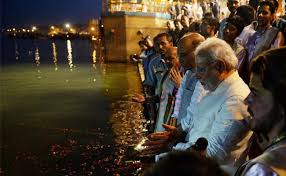
Himanshu Thakkar, SANDRP (ht.sandrp@gmail.com), Sabita Kaushal, SANDRP (sabikaushal06@gmail.com), with inputs from Parineeta Dandekar, SANDRP (parineeta.dandekar@gmail.com)
End Notes:
[1] Water Law in India: Philippe Cullet, IELRC,2007: http://www.ielrc.org/content/w0701.pdf
[2] Bihar Irrigation Act, 1997 , IELRC http://www.cseindia.org/userfiles/Biharirract97.pdf
[3] Ministry for Water Resources, River Development and Ganga Rejuvenation: http://wrmin.nic.in/
[4] Central Water Commission: http://cwc.gov.in/
[5] Water Quality Hot Spots in Rivers of India:
http://wqaa.gov.in/Content/Water%20Quality%20Hot%20Spots%20in%20Rivers%20of%20India.aspx
[6]Central Water Commission: http://cwc.gov.in/RTI-Item-2.htm
[7] http://www.kgbo-cwc.ap.nic.in/
[8] National Water Development Agency (NWDA): http://nwda.gov.in/
[9] NIH: http://www.nih.ernet.in/
[10] https://sandrp.wordpress.com/2014/11/15/know-your-rivers-a-beginners-guide-to-river-classification/
[11] https://sandrp.wordpress.com/2013/09/30/nih-roorkees-workshop-on-eflows-where-is-the-credibility/
[12] For details, see: https://sandrp.wordpress.com/2013/11/12/eflows-in-india-groping-in-darkness/
[13] Decision making process, TAC: http://www.cwc.nic.in/main/webpages/rti/rti_item3.html
[14] See for example: https://sandrp.wordpress.com/2014/03/19/lack-of-transparency-and-accountability-remains-the-norm-of-functioning-for-mowrs-advisory-committee/, https://sandrp.wordpress.com/2014/04/02/analysis-mowrs-advisory-committees-decisions-for-northeast-january-2009-to-dec-2013/
[15] See for details: https://sandrp.in/dams/Letter%20to%20Union%20Ministry%20of%20Water%20Resources%20for%20transparecny%2C%20participation%20in%20Decision%20making%20process%20APR2011.pdf, for detailed analysis of TAC miniutes, see cover story in April May 2011 issue of “Dams, Rivers & People” magazine: https://sandrp.in/drp/April%20May%202011.pdf
[16] See: http://www.cwc.gov.in/main/webpages/TAC%20minutes.html, the minutes have stopped after the July 2012 TAC meeting.
[17] For example, see: i. https://sandrp.wordpress.com/2014/08/19/sach-khas-hydro-project-in-chenab-basin-another-example-of-wapcoss-shoddy-eia/, ii. https://sandrp.wordpress.com/2014/02/22/chinki-major-irrigation-project-on-narmada-yet-another-evidence-of-mps-obsession-with-large-irrigation-dams-wapcoss-shoddy-reports/, iii. https://sandrp.wordpress.com/2013/11/15/mohanpura-dam-in-madhya-pradesh/, iv. https://sandrp.wordpress.com/2013/11/12/bansujara-irrigation-project-in-mp/, v. https://sandrp.wordpress.com/2014/03/12/tragedy-of-errors-environmental-governance-and-the-sonthi-lift-irrigation-scheme/, vi. https://sandrp.wordpress.com/2014/01/15/critique-of-the-eia_emp-kalai-ii-hep/
[18]Ministry of Environment & Forests: http://envfor.nic.in/
[19] For detailed analysis of functioning of EAC and MoEF & CC, see: https://sandrp.in/env_governance/TOR_and_EC_Clearance_status_all_India_Overview_Feb2013.pdf and https://sandrp.in/env_governance/EAC_meetings_Decisions_All_India_Apr_2007_to_Dec_2012.pdf
[20]National River Conservation Directorate (NRCD): http://envfor.nic.in/division/national-river-conservation-directorate-nrcd
[21] http://www.firstpost.com/india/industries-polluting-ganga-sc-asks-national-green-tribunal-take-action-1778413.html
[22] Water Quality Assessment Authority: http://wqaa.gov.in/
[23] Annual Report, Department of Agriculture & Cooperation, 2011-12: http://agricoop.nic.in/imagedefault/ARE2012.pdf
[24] Greening rural development in India: http://rural.nic.in/sites/downloads/NewReleases/Greening_RD_Report.pdf
[25] For example, see in case of Mumbai Metropolitcan Region: https://sandrp.in/Dams_in_tribal_belt_of_Western_Ghats_for_the_Mumbai_Metropolitan_Region.pdf
[26] NEERI: http://www.neeri.res.in/aboutus.php
[27] For example, see: https://sandrp.in/hydropower/kw_sandrp_critq.pdf
[28] Department of Irrigation, GoP: http://www.pbirrigation.gov.in/
[29] Maharashtra Water Resources Regulatory Authority (MWRRA): http://www.mwrra.org/

Why is the IIT Consortium acting like a hydropower lobby?
In a shocking development, Consortium of Indian Institute of Technology (IITC) has submitted a report that is a shot in the arm for the hydropower lobby in Ganga basin in Uttarakhand. This IITC report is being used by the Union Ministry of Environment, Forests and Climate Change (MoEF&CC) to push ahead 24 Hydropower Projects in Uttarakhand which were recommended to be cancelled by two official expert reports, both commissioned on the orders of the Supreme Court of India. It seems the authors of the IITC report are jeopardizing the formidable reputation of the IITs and over a dozen other institutes which are a part of IITC, possibly for some short term gains.
Sounds ridiculous? Read on..
WII report The first expert report mentioned above is the report of the Wildlife Institute of India (WII), commissioned by the MoEF & CC to assess the cumulative impact of some 70 hydropower projects in Alaknanda-Bhagirathi basin in Uttarakhand. WII submitted the report to MoEF&CC in April 2012 and among other recommendations, said that 24 of these projects should be dropped due to their irreversible & long term impact on aquatic and terrestrial biodiversity. At the outset it should be mentioned that the WII (“an internationally acclaimed”, “autonomous institute of MoEF&CC”, see: http://www.wii.gov.in/) recommendation of dropping 24 projects was based on assessment of aquatic and terrestrial biodiversity impacts of the series of hydropower projects in Bhagirathi-Alaknanda basins in Uttarakhand. WII was commissioned to do this study by the MoEF&CC following an earlier SC order based on CEC (Central Empowered Committee) recommendation.
MoEF&CC, did not want to take the recommended action, so it sat on the recommendation of the WII report.
EB report following SC directions to Ministry to take stand on WII report On Aug 13, 2013, following the Uttarakhand disaster of June 2013, the Supreme Court directions, among other things included, “MoEF is directed to examine, as noticed by WII in its report, as to whether the proposed 24 projects are causing significant impact on the biodiversity of Alaknanda and Bhagirath River basins.” Again, MoEF&CC did not want to do any such examination on its own. Since MoEF&CC was setting up an expert body to examine the role of hydropower projects in the Uttarakhand disaster as per other directions of the same SC order of Aug 13, 2013, the ministry included such examination also in the Terms of Reference of the Expert Body (EB) under chairmanship of Dr Ravi Chopra.
The EB terms of reference were even wider than that of WII study and the expertise available with EB was also wider. With such expertise and terms of reference, the EB report (by 11 of the 13 members of EB) submitted to MoEF&CC in April 2014 came to the conclusion that 23 of the 24 projects in WII list should be dropped and even the 24th project, namely the Kotli Bhel 1A should go ahead only after significant modifications. Thus, essentially, EB too endorsed the WII recommendation.
It should be noted here that the WII recommendations were peer reviewed (during the work of Expert Body in 2013-14) by renowned biodiversity expert Dr Brij Gopal. Dr Brij Gopal too endorsed WII recommendation that the 24 projects should be dropped. The peer review was sought by the Central Water Commission representative at the 2nd EB Meeting. Despite objections from some EB members, the Chairman agreed to such a review and proposed the name of Dr. Brij Gopal which was promptly seconded by the Vice-Chairman, Dr. B.P. Das – a former Chief Engineer (Irr), Govt of Odisha and former Vice Chairman of the MOEF&CC’s Expert Appraisal Committee on River Valley Projects. In fact Dr. Brij Gopal suggested that more projects needed to be dropped.
MoEF&CC still did not want to take action on the 24 projects. So using the dissenting report by two government agencies which were largely toeing their official position in EB, the MoEF&CC suggested to the Supreme Court of India on May 7, 2014 that it wants to set up another committee. Seeing no validity in this, the Honorable SC rejected this suggestion and asked MoEF&CC to take a stand. SC has also since then put a stay on any further work on these 24 projects.
Still not ready to take a stand, MoEF&CC, used the reason that since IITC was already working on Ganga River Basin Management Plan (GRBMP) for the ministry since 2010 went ahead and gave the task of reconciling the two EB reports to IITC. In effect this is tantamount to violating the SC directions of not appointing another committee. However, unlike the picture it tried to give to SC, this task was not part of GRBMP work, but given to IITC through a fresh TOR.
Perturbed at not receiving any serious required response from MoEF&CC after repeated orders, the apex court judges of the Supreme Court rightly said the ministry was behaving like Kumbhakarna and Rip Van Winkle.
On Oct 9, 2014, the MoEF&CC submitted an affidavit to the SC, relying entirely on a report from IITC. And lo and behold, IITC had provided a report to the MoEF&CC, certifying that with some vaguely defined criteria, all the 24 projects can go ahead and there is no need to cancel any project! Serendipitously, this is exactly what the MoEF&CC & the hydropower lobby wanted!
It needs to be stated here that IITC had no mandate to submit such a report and the report is unprofessional, inadequate, unwarranted and inconsistent.
Let us see how.
Authors of the IITC report IITC report was authored by eight persons: Dr Vinod Tare (Civil Engineering Dept, IIT Kanpur, see: http://www.iitk.ac.in/ce/CIVIL/faculty.htm), Dr I M Mishra (Department of Chemical Engineering, IIT Roorkee, see: http://www.iitr.ac.in/departments/CH/pages/People+Faculty+imishfch.html#), Dr Purnendu Bose (Civil Engineering Department, IIT Kanpur, see: http://www.iitk.ac.in/ce/CIVIL/faculty.htm), Dr Ligy Philip (Civil Engineering Dept, IIT Madras, see: http://www.civil.iitm.ac.in/people/faculty/ligy/about.html), Dr B S Murty (Civil Engineering Dept, IIT Madras, see: http://www.civil.iitm.ac.in/?q=murty_edu), Dr R P Mathur (formerly Prof of Civil Engineering, University of Roorkee), Dr M Jawed (Dept of Civil Engineering, IIT Guwahati, see: http://www.iitg.ac.in/jawed/homepage/index.html) & Dr Gautam Roy (Consultant GRBMP and former student of Civil Engineering Department at IIT Kanpur). A perusal of the available information on professional background of these persons shows that none of them have expertise on the aquatic and terrestrial biodiversity of the Bhagirathi-Alaknanda basin, to decide on the appropriateness of the WII recommendations. Hence at the outset it seems inappropriate for IITC to sit on judgment over recommendation of an expert body, on subject matter of which IITC has no expertise.
The IITC team of 8 persons listed above, all with essentially engineering background have now also reviewed the EB report and made their own recommendations, again without having the expertise that was available at EB command. It is thus inappropriate for IITC to comment on the recommendations of the EB which had two biodiversity experts from FRI (Forest Research Institute) and WII, besides experts from Uttarakhand in various other disciplines. IITC is thus being unprofessional.
What does IITC report say The IITC report essentially says that ALL the 24 projects can go ahead if they satisfy three criteria: Aviral Dhara, Environmental flows and longitudinal connectivity. The first thing that strikes about these three terms is that they are all vaguely defined and can have flexible interpretations. They are also interconnected and not necessarily independent of each other. Most importantly, they do not take care of the issues based on which the two expert reports said that these 23 projects should be dropped and even the 24th Project, namely the Kotli Bhel 1A may be dropped or modified. But first let us understand these three vaguely defined, flexible and interconnected terms.
Aviral Dhara: According to the IITC report para 2.1 (see also: “Ganga River Basin Management Plan Extended Summary” of June 2014 available at: http://gangapedia.iitk.ac.in/sites/default/files/2014-06-12_GRBMP_Extended%20Summary.pdf): “Aviral Dhara in this context means that the flow of water, sediments and other natural constituents are continuous and adequate over the entire length of the river throughout the year.” There is no definition of what is adequate here, nor it is clarified as to adequacy is from what point of view. Here it should be noted that Aviral literally means uninterrupted, but neither IITC nor MOEF&CC provide this interpretation. According to MOEF&CC affidavit of Oct 9, 2014 (para 8(c)), Aviral means “to flow round the clock” or “continuous flow”.
Environment Flows: For Environmental flows, the “objective” of GRBMP is (see p 9 of the GRMBP Extended Summary) “Environmental Flows shall be maintained in all rivers and tributaries of Ganga River System to fulfill their geological, ecological, socio‐economic and cultural functions.” The E-flows thus would than depend on identifying functions of the river from geology, ecology, socio-economic and cultural perspectives, which can vary. The GRMBP extended summary does not provide clarity on e-flows for any of these aspects and how to go about arriving at required environment flow. It should be mentioned here that to arrive at environment flows, there are about 200 methodologies available globally. The IITC report attached with the MOEF&CC affidavit remains even vaguer as it says maintenance of E-flow should lead “to river stability and ecological balance in the downstream areas.”
Clarity on environmental flows is crucial as the affidavit from MOEF&CC itself agrees that MOEF&CC did not address the issue of eflows adequately while granting environmental clearances in Uttarakhand. One of the basic reasons behind this was lack of clarity on the issue and the same mistake is being repeated in the IITC Report.
Longitudinal Connectivity: In MOEF&CC affidavit of Oct 9, 2014, it is stated (para 6(b)/ 8(b)) that longitudinal connectivity is necessary to ensure “non-disruptive biota movement and silt transportation along the river course that are essential ingredients of a river ecology and its wholesomeness. Otherwise, a fragmented river stands to lose its basic character along with its native aquatic bio-diversity and ecological integrity.”
One of the two places where the term longitudinal connectivity appears in the GRMBP Extended Summary quoted earlier, says: “For dams and barrages, a precondition is essential that they cannot violate the longitudinal connectivity in River Ganga and her major tributaries. Besides they must allow E‐Flows (Environmental Flows) all along the river. A potential method for ensuring river connectivity through dams/ barrages has been suggested.”
The only other place in the GRBMP Extended Summary where the term longitudinal connectivity appears is interesting as it connects all the three terms that IITC has used: “Thus, while longitudinal connectivity in river network is an essential first step to maintain “Aviral Dhara”, having adequate river flows depends much on basin’s overall water status.” This statement is thus also making all three terms even more flexible, subjective and vague since they are dependent on “basin’s overall water status”. This leaves the door open to later reduce the quantum of E-Flows.
It is thus clear that the IITC report annexed by the MOEF&CC with their Oct 9, 2014 affidavit says that if these three vaguely defined terms that are flexible and prone to subjective interpretations are satisfied, then all the 24 projects can go ahead.
While these three, when clearly defined and properly implemented, are necessary conditions for any hydropower project, to say that they are sufficient condition is not only misleading, but also showing lack of understanding of the environmental issues related to hydropower projects. The MOEF&CC affidavit of Oct 9, 2014 relies exclusively on this IITC report and wants to allow all 24 project based on these three vaguely defined, flexible criteria from IITC report.
However, these three criteria are not sufficient to take a decision about these 24 projects as they exclude large number of criteria that the two expert reports considered, including: terrestrial biodiversity (completely absent in IITC report), cumulative impact (completely absent in IITC report it only looks at project specific issues), projects’ location in hazardous zone, projects increasing the disaster potential of the area, among many others.
The SC’s original direction was to examine if the 24 projects would have significant impact on the biodiversity. So the examination for these 24 projects must be done from the total biodiversity aspect and not on the basis of flow alone. The IITC itself has said in the GRBMP Interim Report of Sept 2013 that if biodiversity impact is significant then the project should be disallowed. It is clear IITC has again been inconsistent.
IITC is inconsistent It should be added here that in table 4.2 of their “Interim GRBMP” of Sept 2013 (see: https://nmcg.nic.in/writereaddata/fileupload/25_GRBMPInterim_Rep.pdf), IITC provides larger set of criteria for deciding permissibility of dams and barrages in the Ganga Basin, which include criteria like threat to terrestrial biodiversity, rare, endangered and threatened (RET) species, geological hazards, loss of historical, religious and cultural sites, among others. But these are no longer considered by the IITC in their current report under discussion. The IITC is also being inconsistent, besides being unprofessional and vague.
IITC report shows lack of understanding on basic environmental issues It is also disturbing to read the IITC report saying (section 2.1, last but one para), “However, projects on streams/ rivers with negligible biota may be allowed to proceed as per the environmental and other clearances already given to such projects provided that adequate provision is made to ensure the mandated E-flows. The adverse environmental impacts of such projects on the Ganga river system as a whole are expected to be negligible. Such projects may, therefore, be kept out of Cumulative Environmental Impact Assessment (CEIA) for their approval.”
Firstly, this shows that IITC is out-rightly overruling the recommendation of the WII and EB on criteria of terrestrial biodiversity, geological stability and so on. IITC is doing that too without providing any reasoning or basis. Significant number of the 24 projects have been recommended for rejection by WII and EB based on these criteria. Such baseless rejection of the recommendation by IITC not only shows their poor understanding of environmental and geological issues, but also shows their pro hydro bias.
Secondly, IITC makes the contention that the adverse environment impacts of such projects on Ganga river system is expected to be negligible, without providing any basis or scientific logic or reasoning.
Thirdly, suggesting that all such projects may be kept out of the CEIA seems to show poor understanding of the basics CEIA by the authors of IITC report. Large number of even so called low impact interventions can also cumulatively have big impacts and to exclude them is against the very spirit of CEIA. It also then raises doubts about competence of IITC to prepare GRBMP, since GRBMP is supposed to also look at the cumulative impact assessment and carrying capacity of major interventions in the Ganga Basin. IITC authors do not seem to understand that even aquatic biota gets affected by geological and other factors, that fish is not the only aquatic biota and that there is upstream downstream linkages in lifecycle of the aquatic biota and that there are linkages between aquatic and terrestrial biota life cycles, affected by hydrology.
The above stated issues raise serious doubts about the appropriateness of the IITC report and MOEF&CC’s attempts to push ahead with the 24 hydropower projects in fragile and disaster prone Bhagirathi-Alaknanda basin based on the inappropriate IITC report. Particularly when these projects were to be cancelled as per two expert reports, both commissioned following two separate apex court orders.
Issue of cumulative impacts cannot be taken care of through project specific actions Here it should be noted that the WII report has made its recommendation about dropping 24 HEPs based on cumulative impact assessment of all the operating, under construction and planned projects in the Bhagirathi-Alaknanda River basins. The same is true with respect to EB recommendation. The conclusions arrived at based on cumulative impact assessment by the WII and EB cannot and should not be sought to be addressed by looking at project specific steps or actions as MOEF&CC affidavit and IITC reports are doing.
Did Project Management Board allow IITC to do this report? The IITC task of GRBMP is being overseen by a Project Management Board (PMB) comprising of senior persons of all the seven IITs and some invited members. The IITC report dated July 21, 2014 mentions, “The PMB in its fifth meeting held on Tuesday, June 24, 2014 at IIT Delhi agreed to examine the two reports in the broader framework developed for GRMBP.”
While this is what IITC claims in its July 21, 2014 report, this claim is not supported by the Minutes of the relevant meeting of PMB, as we see below. From the reading of the minutes, it seems that the IITC had no mandate or clearance to do this report.
In the minutes of the fifth meeting of PMB held on June 24, 2014, para 7 seems to be the only relevant para in this context, which reads as follows: “Project Coordinator sought the directions from PMB about the modus operandi for follow-up actions after submission of the final draft of GRBMP – such as responding to queries and comments on GRBMP and dealing with requests for other inputs on Ganga Basin received from government and other agencies. He mentioned that IITC is obliged to respond to such requests based on the work done in preparing GRBMP, and the help of only active contributors of IITC would be needed rather than the existing mechanism of going through PICC and PMB. Professor Manna, Director, IIT Kanpur stated that IIT Kanpur is willing to take the responsibility on behalf of IITC of such matters and Project Coordinator may take the help and advice of concerned IIT Team members as and when needed. It was opined that each IIT may compile the list of new faculty members who may have joined after GRBMP project was started and communicate the same to the Project Coordinator. Professor Khakhar suggested that Directors of the 7 IITs may discuss the matter and communicate the decision to the Project Coordinator on modus operandi for submission of first version of GRBMP, and responding to queries and comments on GRBMP and dealing with requests for other inputs on Ganga Basin received from government and other agencies.”
The first thing that strikes about this para is that the Project Coordinator (Dr Vinod Tare) raised this in the context of “follow-up actions after submission of the final draft of GRBMP”, which is not the case with respect to current issue, since the final draft of the GRBMP is yet to be submitted. There is nothing in this para to support the contention quoted above from the preface of the IITC report that PMB “agreed to examine the two reports in the broader framework developed for GRMBP.”
If this is the only para that is relevant in the context of IITC report to MOEF&CC dated July 21, 2014 and if this para is not applicable at this stage since it is applicable only after submission of final draft of GRBMP, then the question arises, if the IITC had the permission from PMB to submit such a report and if the MOEF&CC should have submitted this report as authorized IITC report? These questions can be answered by only the IITC, its PMB and MOEF&CC, but they are relevant since it is this report purportedly from IITC that is sought to be used by MOEF&CC to ensure that all the 24 projects under discussion go ahead. In fact PMB and all concerned from IITC should quickly clarify that this report cannot be called IITC report, but only from the specific 8 persons listed above. The authors should be asked to remove the claim that this is IITC report.
IITR has poor track record and conflict of interest Here it is pertinent to note that of the four IITs involved in this report of IITC, IIT Roorkee (IITR) has already proven to have a poor and biased track record and should not have been involved in any case. The IITR was in fact commissioned in July 2010 by MOEF&CC to do cumulative impact assessment of the hydropower projects in Bhagirathi-Alaknanda basin. The report submitted by IITR was so pathetic that it was not accepted and it invited adverse comments from official agencies like the Expert Appraisal Committee on River Valley Projects, the Inter Ministerial Group on Ganga Basin Projects and also the Supreme Court of India in Aug 2013 order. (The report was also criticized by other organisations[1].)
Thus, IITR stands discredited on the precise issue of cumulative impacts of hydropower projects in Bhagirathi-Alaknanda basin. To include such an institute for another IITC report now on the same issue not only brings discredit to the whole effort, but raises the issue of conflict of interest.
While some issues are based on procedures and propriety, other issues relate to merit of IITC recommendations as they do not hold the experience or expertise to deal with serious problems related to cumulative impacts, terrestrial biodiversity and RET species, deforestation, and disaster potential of the region.
Thus, on both these counts (technical and merit based), the IITC Report is under cloud and does not hold enough ground to base further informed decisions.
Conclusion In view of the above, it is clear that IITC report is not adequate, reliable, or consistent to take a decision about 23 hydropower projects which have been recommended to be dropped and 24th project, namely the Kotli Bhel 1A project which has been recommended to be dropped/ modified by the WII and EB. IITC had neither the expertise nor the mandate to submit such a report. The MOEF&CC should not be relying on this report and rather coming out with its own position as directed by the Supreme Court of India repeatedly, keeping in mind the issues and merits of the two expert reports, both submitted following two separate apex court orders.
It is unfortunate that IITC has submitted a report that is obviously music to both hydropower developers and government. MoEF&CC has already offered more such work to IITC. We hope IITC will go beyond such short term interests and be more consistent, professional and work towards rejuvenation of the Ganga and other rivers.
This current work is discrediting their future work of GRBMP too.
-Himanshu Thakkar, SANDRP (Being an IIT Mumbai alumni myself, I am writing this with a sense of sadness)
[1] For example, see: http://www.sandrp.in/hydropower/Pathetic_Cumulative_Impact_Assessment_of_Ganga_Hydro_projects.pdf
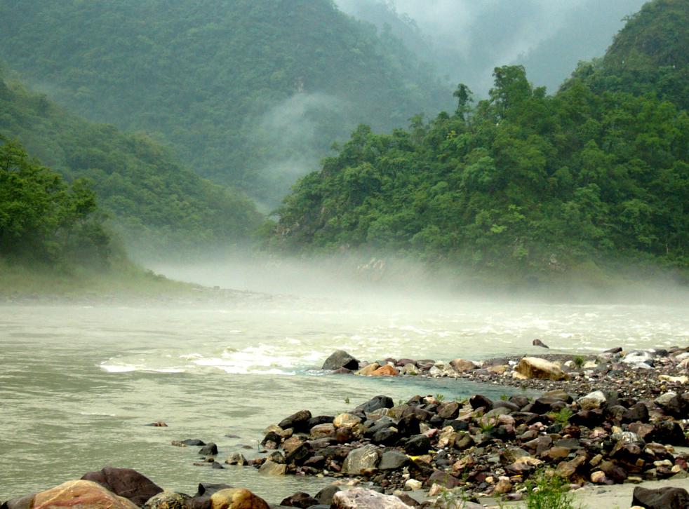
A RIVER MAP FOR REJUVENATING GANGA
(Above: River Ganga at Rishikesh Photo with thanks from Ramesh Rawat, India Travelz)
– Guest Blog by: Manoj Misra (manojmisra@peaceinst.org. Author is the Convener of Yamuna Jiye Abhiyaan)
A ‘road map’ might be an inappropriate term for a ‘river’ rejuvenation plan. Thus I am using the term, a ‘river map’.
It is well known that despite the Ganga Action Plan (GAP) being in place since the year 1985 and the Supreme Court adjudicating public interest litigation on it since 1993 the river has become increasingly sick with some stretches notably in Kanpur deserving a biologically ‘dead’ status. So it came as a huge sign of hope when the Prime Minister Modi took upon Ganga rejuvenation as a personal mission and appointed Sushri Uma Bharti, a well known Ganga devotee and activist as the Union Minister of the renamed Ministry of Water resources, River development and Ganga rejuvenation. Soon the Finance Minister in the new government allocated financial resources to the tune of Rs 2037 Crores in the name of Nemami Gange (devotional bow to river Ganga) a flagship scheme of the new government, which is aimed at the rejuvenation of river Ganga.
Yet in recent days the Supreme Court time and again has chided the state on the lack of a sound action plan for its avowed objective of a rejuvenated river Ganga. So much so that it once, in an obvious exasperation on the state’s ‘business as usual’ approach to the issue, commented that “it might well be another 200 years before Ganga is actually rejuvenated”? Clearly notwithstanding its firm intent, the state continues to struggle with defining a ‘road (river) map’ that could while convincing the highest court in the land of its utility, set a clear and effective action plan on the ground for a rejuvenated Maa (mother) Ganga?
REJUVENATION
Let us try and see what does Ganga really require for its rejuvenation?
Term ‘rejuvenation’, which includes restoration, is a return of any living entity from what it is today to an agreed state of previous health and wellness. To unravel that we might first need to understand ‘what is’ and ‘where is’ river Ganga?
Most planners tend to view Ganga as a 2500 km long river from Gaumukh to Ganga Sagar, passing through the cities of Uttarkashi, Devprayag, Rishikesh and Hardwar in the state of Uttarakhand; Kanpur, Allahabad and Varanasi in the state of Uttar Pradesh; Patna in the state of Bihar and Kolkata in the state of West Bengal before merging with the sea in the Bay of Bengal.
Herein, we understand lay the first fundamental planning mistake. For if Ganga were a simple linear entity as planners hold, then King Bhagirath would have unnecessarily carried out tapasya (penance) placating Lord Shiva to hold Ganga in his jata (matted locks) as she descended with massive force from the Brahm Lok (abode of the gods) with a presumed potential to wreck absolute havoc on the mrityu lok (earth) unless its speed had been broken. This mythical tale translates itself into an earthly reality whereby Ganga actually resides in each and every spring, in every water fall and in every stream that together form the vast network of its tributaries spread over its vast basin. So Ganga rejuvenation plan to make sense and desired impact must encompass actions to revive and restore all these numerous streams and tributaries.
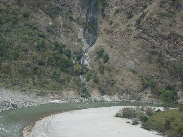
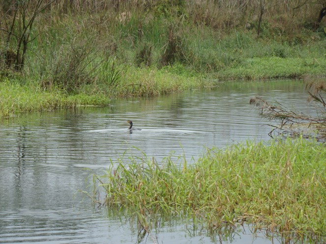
Thus any rejuvenation plan that fails to look at and factor in the Ganga’s larger reality is destined to fail, a la all the previous Ganga Action Plans. All put together Ganga is no less than 25,000 km in length, with a basin spread of some 1,086,000 sq km. (see map) These include areas in the states of Himachal Pradesh, Uttarakhand, Haryana, UP, Rajasthan, Madhya Pradesh, Chhattisgarh, Bihar, Jharkhand and West Bengal within and China, Nepal and Bangladesh outside of India. With such a huge basin, the rejuvenational challenge might appear daunting, leading to an alluring thought that let us first try and rejuvenate the 2500 km of the main stem of the river and then may be tackle the rest. This we believe to be a fatal approach akin to fire fighting, without getting to the root cause, with the most immediate organ of a cancer afflicted human resulting ultimately organ by organ in the latter’s demise. Let us not forget that a healthy river system is like a multi-strand chain which is ‘as strong as its weakest link’. Hence as long as even one tributary remains sick, there can be no respite or rejuvenation of Maa Ganga!
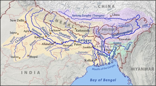
In other words there is no single river Ganga. It is actually ‘Ganga Rivers’ spread all over its basin and carrying names like the Yamuna; Ramganga; Gomti; Mahakali (Ghaghara); Son; Gandak, Koshi etc with each in turn having their own network of rivers and their rejuvenational requirements, since over time majority of them have as well gone ‘sick’.
RIVER INHIBITING PROJECTS
Some might ask, but then what could be done with tributaries lying or originating in Nepal, Bangladesh or in China? A lot actually, beginning with not promoting or supporting river ‘inhibiting’ projects there and then taking lead in a common futures dialogue (an International Ganga Rivers Commission) program on Ganga as the Ganga rivers are in need of rejuvenation there as well.
Dwelling more on what are the river ‘inhibiting’ projects we are led to what constitutes a river’s integrity?
A ‘healthy’ river must ‘run’ freely and must ‘flood’ freely. (Floods in Indian rivers are natural monsoonal occurrence which could become devastating when obstructed).
That is its longitudinal and lateral connectivities must not be allowed to be compromised through manmade structures like dams, barrages and embankments. Such connectivities are essential for a river system to fulfill its ecological roles of transport of water, sediment and energy from source to the sea; recharge of ground water; provision of habitat to aquatic and riparian biota and completion of the water cycle.
In other words, a healthy river is essentially an ‘aviral’ (unbroken in its various dimensions) river. Thus the key challenge and objective of any Ganga rejuvenation plan has to be first and foremost its restoration back to a truly ‘aviral’ state.
FIVE STEPS
Accordingly the following five steps are suggested as the ‘river map’ to a rejuvenated river Ganga.
Step 1 – Establish local level Ganga rejuvenation governance systems to ensure participatory bottom up planning and action plan execution. Support this with the establishment of a Ganga Rivers governance research centre.
Step 2 – Prioritise tributaries (Ganga Rivers) for restorative actions on the basis of their current level of threats and develop restorative action plans utilizing the governance systems as mentioned in step 1.
Step 3 – Establish through a participatory process a desired state of the rejuvenated Ganga; devise a national Ganga rivers policy and a Ganga rejuvenation law. Initiate dialogue with the Ganga nations for an International Ganga rivers Commission.
Step 4 – Review through independent experts, all past, present and planned river ‘inhibiting’ projects on the Ganga Rivers and then either re-design them to become river friendly or decommission / drop them. There should be a moratorium placed on any new structure (barrage, HEP, embankment) on Ganga Rivers till such time that all local level options of water harvesting and energy production (including solar and wind) have been exhausted with a policy that river waters and HEPs shall be the last resort for meeting such needs.
Step 5 – Set a time bound plan of action for ensuring aviral and wholesome Ganga ‘rivers’, with plans for ensuring their flows (water, sediment and energy) as well as the restoration of their catchment, flood plains and the associated biodiversity (aquatic, riparian and terrestrial).
The steps as suggested above are not sequential in nature and many could progress concurrently.
To a query “what then about the hydropower and water supply for fulfilling various human needs”, the response is twofold.
Firstly, this is the Ganga rejuvenation plan based on what Ganga Rivers need for the restoration of their health. Secondly, hydro-power generation and water diversion cannot be in excess of the thresholds as defined by the rejuvenational requirements of the healthy Ganga Rivers.
A rejuvenated Ganga has to be seen as a ‘provider within strict limits’ (as enunciated by the Prime Minister Modi on the banks of Maa Ganga in Varanasi, when he defined what a Maa (mother) is) and not what we in our flawed wisdom might wish to harness from her, with little concern for her deteriorating health and in disregard to the principle of inter-generational equity.
RIVER AND SEWER
The Indian state under the Ganga Action Plan had been investing time, money and efforts to restore the river Ganga through creation of pollution abatement infrastructure like the Sewage treatment plants (STPs) and the Effluent treatment plants (ETPs) in various cities and industries on the river in the name of ‘river cleaning’ with little ameliorative impact on the health of the river. In our understanding despite the poor maintenance being the cause of the failure of the created infrastructure, this approach to river restoration is fundamentally misplaced and hence wrong.
We believe that our rivers require restoration (based on the steps suggested before) of their ecological integrity in terms of their freedom to ‘flow’ and ‘flood’. Once thus freed, they possess all the power of self cleansing, subject to the observance of the fundamental principle of no mixing of ‘sewer’ with ‘river’. Here by ‘sewer’ we mean all kinds of grey water produced both by the cities and the industries.
Thus there is no mention of any river ‘cleaning’ or creation of STPs / ETPs as part of the suggested Ganga rejuvenation plan. The installation of such infrastructure is we believe to be an essential element of the process of urbanization and industrialization whereby the grey water from the cities and industries is converted into utilizable water for recycle and reuse to meet the non potable water needs both of the cities and the industries. But to do so in the name of river cleaning is in our understanding an ostrich like approach which takes away the attention and resource allocation from the real needs of river restoration based on the sound principles of river science.
Prime Minister Modi’s another oft quoted aphorism of “Zero defect and zero effect/ impact” should be made applicable not just to good manufacturing practices but also to good urban management practices with mandatory zero impact on any river that happens to pass by. AMEN!
–Manoj Misra (manojmisra@peaceinst.org)
World Rivers Day and Ganga: A look at Farakka Barrage and other such calamities
Last Sunday of every September is celebrated as ‘World Rivers Day’. It is a recent phenomenon, but in many senses more significant than World Water Day. While ‘Water’ is seen more as a resource than the life-blood of the global ecosystem, ‘River’ provides water with its ecological, social, cultural and spiritual context. One this day, SANDRP looks at India’s ‘National River’ Ganga. The river seems to be a symbol of all that is right and wrong with water governance in India. It depicts crystallisation of challenges faced by rivers across the country, albeit at a much larger scale. The rich canvass and the deep spiritual value of Ganga for many cultures make it more riveting. The new government at the centre has declared that rejuvenation of the Ganga River is one of its priorities. However, in addition to several infrastructure projects planned and ongoing on the river and its tributaries (Ganga is not just 2525 kms long river, its is more than 25,000 kms long, with all its tributaries), the new Government is planing to build a series of barrages on the River to make it navigable, from Haldia, at the mouth of Hooghly, a major distributary of the Ganga to Allahabad which is some 1620 kms upstream from Haldia. Before we go further into the advantages or the disadvantages of more barrages on Ganga, let us take a look at what one only existing Barrage on this 1620 km stretch of the river, The Farakka Barrage, has done to the river in the past 39 years since the Barrage was commissioned. Let us see how we have managed the issues which have arisen, how human lives have been impacted, what has been our response, how the main objective of building the barrage has been frustrated, how we have dealt with this realization, how the Barrage has furthered more conflicts and how a thriving fishing activity has been nearly killed by Farakka in the upstream as well as in the downstream. SANDRP visited the region of Farakka Barrage, Malda, Murshidabad, talked with the affected people, fisherfolk, authorities at the Barrage as well as the Director and other officials at the Central Inland Fisheries Research Institute (CIFRI) to understand the complex issues. Prior to detailed analysis, here’s looking at Ganga, Hooghly and Farakka in photos.

Farakka Barrage was commissioned in 1975 to transfer 40,000 cusecs ( Cubic Feet per second) of water from Ganga into its distributary Hooghly to save the Kolkata Port on the Hooghly from silting up. The barrage is just 16 kms upstream from Bangladesh border.


As a part of Farakka Barrage Project, an afflux bund was constructed over several rivers upstream of Farakka, like Choto Bhagirathi, Pagla, etc., to divert water into the Barrage. The complete diversion of water killed these rivers in the downstream, severely affecting people. Here we see Choto Bhagirathi flowing after many years, thanks to a pipeline and sluice sanctioned this year to supply meager water to the river. This does not help the fish though, there are hardly any left.


Not withstanding the anti-erosion works completed upstream the Farakka Barrage in Malda, the Ganga has deposited huge sediment load in the upstream of the barrage and this has accelerated the swing in its channel. The channel is swinging rapidly to the left bank, eroding and eating away thousands of hectares of villages, farms, mango plantations and chars (islands) in the way, endangering the Barrage itself. Although sediment-laden Ganga has a history of changing courses, this has been aggravated to a great extent by the sedimentation and obsrtuction caused by Farakka.


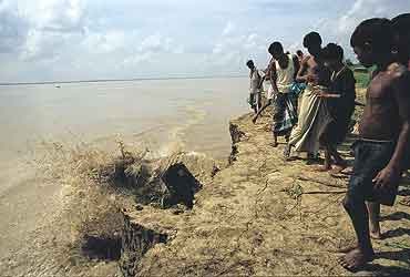
Even before you arrive at the heavily guarded Barrage, you can see the heavily silted river, with cattle grazing peacefully on islands (chars) just 500 meters-1 km upstream of the barrage. According to River Expert Kalyan Rudra, Farakka hordes nearly 350 million tonnes of sediment flow of Ganga every year in the upstream!!


The Barrage also severely affected navigation through the river. A separate ship lock was made on the Feeder Canal and it is managed by Inland Waterways Authority of India (IWAI). Hardly any ships pass through due to high sedimentation.


Downstream the barrage, due to trapping of silt in the upstream, silt free water erodes banks with vengeance, especially the left bank. We saw several anti-erosion measures failing miserably in front of the river’s fury.

 Farakka has profoundly changed the character, sediment regime and flow of Ganga. It is affecting lives of lakhs of people in India and Bangladesh through cycles of erosion, sedimentation, floods and affected fishing. Our response to the issue has been dismal. We have not conducted a single review of costs, benefits and impacts of Farakka Project so far. In addition to Farakka , Lower Ganga (Narora), Middle Ganga, Upper Ganga Barrages (Bhimgoda), Kanpur Barrage, Hydropower projects in Uttarakhand and other upstream states have affected the river in most profound ways. If we want to rejuvenate the Ganga, we need to institute a credible independent review the existing Barrages, not plan new ones. May be we can begin with a demand for such a review for Farakka on urgent basis. One World Rivers Day, let us wish for a long and healthy flow for the Ganga River, a symbol of all flowing rivers in India!
-Parineeta Dandekar (parineeta.dandekar@gmail.com)
POST SCRIPT on April 28, 2015:
An edited version of this article and photoessay on The Nowhere People — Environmental Refugees around Farakka, was published in the Mint on March 28th, 2015. Here it is in full: http://www.ficusmedia.com/traildiaries/2015/03/28/the-nowhere-people/
This article was made possible with a grant from The Third Pole and Asia Foundation.
Arati Kumar Rao

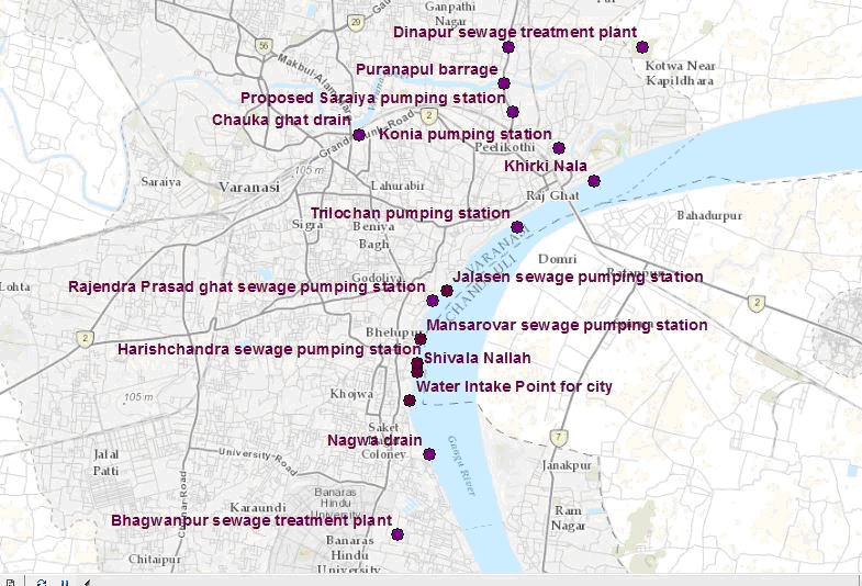
Ganga and Varanasi’s Waste-water Management: Why has it remained such an Intractable Problem?
Guest blog by: Dr Kelly D. Alley (ALLEYKD@auburn.edu), Auburn University, USA
Varanasi is newsworthy these days, situated symbolically and politically in the new Prime Minister’s agenda. In his victory speech, the PM-elect Narendra Modi vowed to clean the sacred river Ganga. After assuming the office of Prime Minister, he reiterated the vow and pledged renewed efforts for Ganga cleanup.
Three months later, a skeptical Supreme Court reviewed the new government’s Ganga Plan and remarked that with this approach the river will not be cleaned in 200 years. The Supreme Court asked for the full details of the cleanup plan, and inserted its role as a monitor over central government plans. The government has reportedly submitted a new plan to the court, but no details are available yet in the public domain. However, from media reports, it seems the plan is not very different from what has been done in the name of the Ganga Action Plan so far.
As residents and sympathetic outsiders know, the wastewater problem in this sacred, ancient city is seemingly intractable. In order to implement lasting solutions to the recurring river pollution scenario, we need to investigate the current situation. I just completed a field trip to this special city that many call Banaras. I visited all the existing and planned components of the wastewater collection, treatment, and disposal system. In this article I will try to create a visual map of the wastewater infrastructure and management problems and define the current lines of command and control within the vast and overlapping water, environment, and public health bureaucracies. This should help to identify systemic problems in each that need to be addressed when charting a new direction.
The seemingly intractable problems of Ganga clean up (rejuvenation will need so much more than just a clean up) in Banaras can be divided into three categories. First, there are governance problems that are related to how decisions on technologies, scale, operators and siting are made. These include problems with the solicitation, selection, and implementation of projects, especially the design and construction and operation and maintenance of sewers, sewage pumping stations and sewage treatment plants. Second, there are serious infrastructure problems that are part of the complexity of this ancient city.
Third, there is a real electrical power supply problem. Securing continuous electrical power for sewage pumping stations and wastewater treatment facilities is a low priority, and emergency standby generators are not used when the grid-provided power is unavailable. As a result, the intermittent operation of sewage pumping stations and sewage treatment plants is ineffective in protecting water quality in Ganga and in provisioning safe drinking water and sanitation in Varanasi.
When the sewerage infrastructure is operated intermittently, the treatment technology cannot treat the wastewater adequately, and the concentration of contaminants and water quality indicators such as total suspended sewage solids (TSS) and biological oxygen demand (BOD), heavy metals, toxic organic compounds, and the Most Probable Number (MPN/100ml) of fecal coliform bacteria–indicating the presence of enteric waterborne disease pathogens in the treated effluent–remain high. So in a way providing partial power to a sewage treatment plant does not do the work and is therefore a largely inoperable, non-functional, sunk cost.
Governance
The Government of India established the Ganga Action Plan in 1986 to lead the way in river pollution control programs. In 2009, the Government declared the Ganga a national river and established the National Ganga River Basin Authority. The National Mission Clean Ganga (NMCG)–the implementing agency under this Authority–is now housed in the Ministry of Water Resources, River Development and Ganga Rejuvenation under the Government of India. The Mission Director is the chief executive of the NMCG.
At the state level in Uttar Pradesh, there is a state Project Management Group (PMG) chaired by the Chief Minister. It includes members from the State Ministries of Environment and Irrigation, the Uttar Pradesh Pollution Control Board and the state water commissions. The State PMG decides whom to select for work, and in most cases uses the Uttar Pradesh Jal Nigam (the state level sewage engineers) to execute wastewater project work.
The State PMG can outsource consultancy work and allocate projects to NGOs as well; although in all cases, it has allocated the wastewater engineering work to the Uttar Pradesh Jal Nigam. These layers of committee membership create a vast water bureaucracy at the state level in addition to the committee memberships and officers at the Central level. They are not independent regulators, monitors and compliance officers (which are needed) but contributors and benefactors of political and profitable decisions in the ongoing issuing of contracts, clearances and other approvals.
This is a big problem because any contract for sewerage work must pass through all these departments and boards, with money wasted on bids and approvals for specific projects. In addition there is no other implementing agency in Varanasi so if the UP Jal Nigam’s work is shoddy or even fraudulent, then the Ganga River and the whole city suffers without an alternative. This situation is well known to Banaras residents who will complain daily that funds meant to improve the sewerage system are simply eaten up by various agencies while wastewater is diverted into the sacred river without treatment.
In addition, the foreign donor agency, the Japan International Cooperation Agency or JICA, has been present in Varanasi for many years to advise and assist with capacity building and technological cooperation for the Ganga Action Plan. Apart from controlling the flow of funds, however, it appears that JICA has worked within the current lines of command and control, thereby helping to perpetuate rather than reform the system.
Infrastructure
So what is the current situation with the main wastewater drains? The main drains for the city are the Nagwa drain, located in the south and upstream of the main city, and Khirki nallah, located in the north downstream of the main bathing ghats. The Ganga flows northward at Banaras (see map). The Varuna River enters from the west and circles the outer part of the older sacred city complex before draining into the Ganga at the downstream or northern end. In the last year the Varuna River has turned into a wastewater pond upstream of the barrage recently built under the Puranapul Bridge that crosses the Varuna River. The Varuna river banks downstream of that barrage have also become the dumping grounds for all forms of solid waste and the entire landscape is hellish. One wonders how the communities in the vicinity can survive.
The existing wastewater management facilities include three sewage treatment plants, five sewage pumping stations along the ghats, and one main sewage pumping station at Konia. The Konia pumps are supposed to pump up to 80 million liters of sewage per day to the Dinapur treatment plant located in the trans-Varuna neighborhood of Dinapur village, if they work at full capacity. However they rarely do.
For instance, only one screw pump was working on the day of my visit, so that means it was running at 1/3 its capacity. This would also mean that the Dinapur treatment plant was receiving only 1/3 of the wastewater it is capable of treating, according to its nominal treatment capacity, and therefore it was running at 1/3 capacity. However to be exact one would have to know how many hours the one pump operates each day of the week and then the capacity factor can be calculated. For instance, if the pumping station runs at 1/3 capacity for only 6 of the 24 hours each day then the capacity factor would be 1/12 or about 8%.
If capacity factors of the pumping stations and treatment plants are taken into account in a Life Cycle Cost assessment then the cost per unit volume (ML) of treated sewage would sky rocket. The UP Jal Nigam does not keep a daily operational log with data like energy usage data, and thus there are no metrics, no measures, and no good management practices. This adds up to a lack of proper governance. Many monitoring committees have made visits to site facilities but have failed to correct the daily malfunctioning of the entire system. On my trip to videotape the Khirki wastewater drain in late June, I said to the boatman taking me, “So they release this water into Ganga ji at night and in early morning, right? Like chup ke?” He replied, “No Madam not chup ke. It is right there running wastewater all the time. Everyone can see it, and they are not even bothering to hide it!”
Below are current pictures of parts of the system that have been damaged, destroyed or poorly maintained. The map can be used to place these pictures in the city space.


Power
We have to think about wastewater problems in the context of public health, environmental health, electrical power supply and national and state priorities for power distribution. In the current scenario using existing technologies and scales (there are better options for technology and scale), a significant amount of energy is required to pump and treat wastewater using sewage pumping stations and the activated sludge treatment process. In India energy supplies are allocated to industrial and urban needs long before they are distributed to sewage treatment plants. Looking at the current energy scenario in India it is not hard to see that wastewater pumping and treatment require continuous power and are not sustainable in the context of the current power deficit. Biological secondary treatment using the Activated Sludge Process (ASP) uses a significant amount of electricity to operate aeration equipment and mixers. Another technology used in Kanpur, the Upflow Anaerobic Sludge Blanket (UASB), is also a capital and energy intensive process. With other demands high on the agenda, it is unlikely that precious power will be available to run all the existing and proposed sewage pumping stations and sewage treatment plants on a daily basis now and into the future if the existing technologies and scales continue to be used.
Take Away Points
If wastewater infrastructure is built, it is done with large government investments of public funds, sometimes with capital from international banks; there is little private equity to drive the process. Instead the costs of building (and also poorly building) these facilities are absorbed across a range of human services including public health, education, housing and infrastructure. The costs of operating and maintaining sewage pumping stations and treatment plants are also high and operation and maintenance of the facilities become a low priority after construction.
For instance, the sewage treatment plant laboratories are ill-equipped and this means that the UP Jal Nigam operators are unable to monitor, measure, and report operational and water quality data. Due to the absence of laboratory equipment, instruments and analytical capacity, they are not able to optimize the treatment process. Generally the functional components of the sewerage infrastructure – the sewage pumping stations and treatment plants – are overwhelmed by the dysfunctional components and by the enormous pollution load. In this way the functioning units in the system become important, not for effectively treating the waste but for projecting a façade of functional infrastructure, especially when site visits by monitoring agencies are underway. Yet the norm is that facilities are operated only periodically and usually below capacity, and the result is that untreated wastewater is passed through open drains to agricultural fields or rivers. During rains and the monsoon, wastewater combined with storm water flows directly into the Assi, Varuna, and Ganga Rivers.
This sacred city requires a competent participatory authority to master plan, design, select the right scales and technology, construct, operate and effectively maintain a comprehensive wastewater collection, treatment and reuse system. Its governance requires clearly defined norms of transparency, accountability and participation.
A competent authority should connect central, state and municipal levels and be accountable to the residents of the city not just through the municipal corporation and its elected officials, but also directly through norms of participatory governance. These governance reforms should include clearly defined norms of transparency, accountability and participation that pertain to the entire system and to each component part–the pumping stations, sewage and water treatment plants, sewers and associated facilities. A piecemeal approach with the Jal Nigam exclusively at the helm has not worked thus far and it has sunk crores of rupees into poorly operated and maintained infrastructure, even in the face of national and global attention and numerous judicial interventions to the cause of Ganga cleanup. A careful constitution of accountable engineering agencies, a welcoming approach in planning and implementation to citizen contributions, and a vigilant monitoring of operations and maintenance practices by concerned citizen groups can go a long way to reforming the system. There is no doubt that this cause runs deep in the hearts of every Banaras resident.
[For PDF file containing this blog, see: https://sandrp.in/otherissues/Varanasi_Ganga_Wastewater_Management.pdf.]
Additional Information:
1) Video of the run off coming through the Rajendra Prasad ghat pumping station after a heavy rain in June 2014: https://www.youtube.com/watch?v=ujBB2FLYkZM
2) Video of Khirki Nallah in June 2014: https://www.youtube.com/watch?v=S0KUXEw7DRg
3) Video of Nagwa Nallah in June 2014:
https://www.youtube.com/watch?v=7xraLNjdPg4&feature=youtu.be
4) POST SCRIPT For further reading: http://www.thethirdpole.net/2015/11/06/tibet-dams-hold-back-silt-not-water
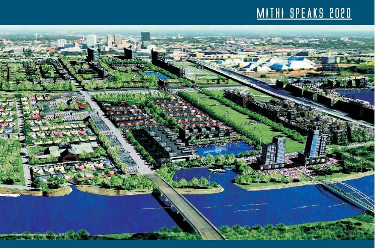
Riverfront Development in India: Cosmetic make up on deep wounds
There is a rush of riverfront development schemes in India. We have heard of Sabarmati Riverfront development being drummed many times, followed by the proposed rejuvenation of Ganga, supposedly on the lines of Sabarmati.
What does Riverfront Development entail? Is it River Restoration? Are the millions of rupees spent on Riverfront Development schemes justified? Will it help in saving our damaged rivers?
A cursory glance at the existing river restoration/ improvement/beautification schemes indicates that the discourse revolves mainly around recreational and commercial activities. It is more about real estate than river. Activities that are promoted on the riverfronts typically include promenades, boat trips, shopping, petty shops, restaurants, theme parks, walk ways and even parking lots in the encroached river bed.

Pioneering project in Riverfront Development was claimed to be the Sabarmati Riverfront Development project of Ahmedabad city which was supposed to be designed based on riverfronts of Thames in London and Seine in Paris. The project which began as an urban development project is lately being pushed as a role model for many urban rivers in India. This kind of riverfront development essentially changes the ecological and social scape of the river transforming it into an urban commercial space rather than a natural, social, cultural, ecological landscape. Is it wise to go for this kind of development on riverfronts? What does it do to the river ecosystem, its hydrological cycle? What does it do to the downstream of river? These questions need to be explored before accepting the current model of riverfront development as replicable or laudable.
Reclaim and beautify!
Most of the currently ongoing projects lay a heavy emphasis on beautification of rivers. Riverfronts are treated as extension of urban spaces and are often conceived as ‘vibrant’, ‘throbbing’ or ‘breathing’ spaces by the designers. Concrete Wall Embankments, reclamation of the riverine floodplains and commercialization of the reclaimed land are the innate components of these projects. Quick glimpse at various Riverfront Development Projects confirms this.
Sabarmati Riverfront Development Project
Sabarmati Riverfront Development Project of Ahmedabad city which is presented as a pioneer in urban transformation[1] has been proposed by Environmental Planning Collaborative (EPC), an Ahmedabad-based urban planning consultancy firm, in 1997 and envisaged to develop a stretch of 10.4 km of the banks on both sides of the river by creating concrete embankment walls on both banks with walkways. A Special Purpose Vehicle called the Sabarmati Riverfront Development Corporation Ltd. (SRFDCL) was formed in the same year for implementation of the project. The financial cost of the initiative was estimated to be in the range of around INR 11520 million[2]. Around two thirds of this amount has already been spent.
Construction of the project started in 2005. The project sought to develop the riverfront on either side of the Sabarmati for 10.4 kms by constructing embankments and roads, laying water supply lines and trunk sewers, building pumping stations, and developing gardens and promenades[3]. Mainstay of the project was the sale of riverfront property. Land along the 10.4 km stretch on both the banks was reclaimed by constructing retaining walls of height ranging from 4 to 6m[4]. 21% of the 185 ha of reclaimed land which was developed by concretizing the river bank[5] was sold to private developers for commercial purpose.[6] Activities hosted on this reclaimed land were recreational and commercial activities like restaurants, shops, waterfront settlements, gardens, walkways, amusement parks, golf course, water sports and some for public purpose like roads etc. The sale of reclaimed land created by the project is expected to cover the full cost of the project. Ahmedabad Municipal Corporation (AMC) claims that the after the project “river has added vibrancy to the urban landscape of Ahmadabad with its open spaces, walkways, well-designed gardens along with activities which contribute to economic growth.”[7]
Even though the project has been modeled as “best practice” by several financing institutions[8], it has also drawn severe criticism for poor rehabilitation of the displaced (rehabilitation happened only after High Court orders following a public interest petition) disrupting the nexus of shelter, livelihood and services of urban poor, lack of transparency in the execution and for tampering with the carrying capacity of the river. No Environment Impact Assessment of the project has been conducted nor any credible public consultation process held.
Sabarmati channel has been uniformly narrowed to 275 metres during the riverfront development project, when naturally average width of the channel was 382 metres and the narrowest cross-section was 330 metres[9]. In this attempt of “pinching the river”[10], the original character of the river is changed completely from seasonally flowing river to an impounded tank illegally taking water from Narmada Canal[11]. River banks have been treated as land that is wasted on which value could be created by reclaiming and not as seasonal ecological systems with floodplains as an integral part of its flows (Baviskar 2011). Seasonality of the river is destroyed and fauna and avi fauna on edges have been damaged. No thought has been given for protection, sustenance or enhancement of the riverine ecosystem. The water that is now impounded in this stretch is not even Sabarmati river water, but Narmada River Water, on which the city of Ahmedabad or Sabarmati has no right, it’s the water meant for drought prone areas of Kutch, Saurashtra and North Gujarat.
The River Sabarmati itself was a perennial river till the Dharoi Dam in the upstream stopped all water at least in non Monsoon months, making the river dry. The stretch flowing through Ahmedabad was carrying the mostly untreated sewage of Ahmedabad city and toxic effluents from the City and district industries.
In the name of Sabarmati River front development, no cleaning of the river has happened, the project has only transferred the water from both banks to the river downstream from Vasna barrage, which is situated downstream from the city. The Vasna barrage stops and stores the water released from Narmada Main Canal that crosses the river about 10.4 km upstream from the barrage. Thus this 10.4 km stretch of the river now holds the Narmada water and huge losses from the stretch are losses for the drought prone areas.

The reclaimed land and the narrowing of the channel have been tampering with the carrying capacity of the river. The project was stalled during August 2006 to March 2007 due to heavy floods[12]. Prior to the floods, the river’s maximum carrying capacity was calculated at 4.75 lakh cusecs on basis of the rainfall over last 100 years[13]. The floods however proved the calculation wrong. National Institute of Hydrology (NIH) and Indian Institute of Technology Roorkee (IITR) were asked to re-evaluate the project design, in the light of the river’s carrying capacity, and see whether the execution of the project would damage the river’s ecology[14]. Report by the NIH, Roorkee in 2007 said “the calculations did not take into account any simultaneous rainfall over the entire catchment area”[15]. This means that the carrying capacity was based only on the water flow from the Dharoi Dam (which is upstream of Ahmedabad City) and not from other places in the river’s catchment until Ahmedabad that also contribute to the volume of water in the Sabarmati. This report states that the riverfront development is “not a flood control scheme”, and that the municipal corporation will have to work out other measures to meet the impending challenge of floods.
The project is also heavily criticized for the poor rehabilitation of the evicted slum population. Large scale eviction was being carried out in an utmost non-transparent manner. A public interest litigation (PIL) was filed in the Gujarat High Court by Sabarmati Nagarik Adhikar Manch (SNAM) or Sabarmati Citizens Rights Forum, supported by several other non-governmental organisations (NGOs) to ensure that the rehabilitation plan was shared with them and to bring transparency to the process. According to the high court orders, at least 11,000 affected families were to be rehabilitated and resettled by AMC. Demolition drive went on without ensuring rehabilitation. Over 3,000 people have moved to a marshland in the outskirts of city with negligible compensation, little & infrequent access to drinking water and minimal sanitation facilities[16].
“The ecology of the river is being transformed to satisfy the commercial greed of a select few,” said Darshni Mahadevia of CEPT, expressing concerns about riverfront ‘beautification’[17].
The project that has converted the Sabarmati River into an urban space by reclaiming nearly 200 ha of land and has sustained by borrowing water from Narmada Canal today is claimed to be a role model for many riverfront development projects in the country. Should this model really be replicated? Many of the rivers like Yamuna, Ganga, Mithi, Brahmaputra etc. that are being ‘developed’, have had a flood history which is being ignored in the process. With having no regards to the hazards of floods, several riverfront projects are being pushed across the country by different government agencies.
The fact that even after a Riverfront Development Project, Water Quality of Sabarmati downstream the Vasna Barrage is extremely poor and the cosmetic treatment of flowing water stretch at Ahmedabad is actually water from Narmada, which was promised for the drought hit regions of Kutch and Saurashtra, highlights the contradictory and superficial nature of such Riverfront development schemes.
Yamuna Riverfront Development inspired from Sabarmati Model
Recently the newly elected BJP led Central Government sent a team of bureaucrats to Gujarat to study the feasibility of replicating the successful model of the Sabarmati Riverfront Development Project for cleaning the Yamuna[18]. Despite the concerns about flooding of Yamuna, the team is exploring ways of replicating Sabarmati Model. In 2009, the Sheila Dikshit administration was also planning channelizing the Yamuna and putting up a waterfront like Paris and London with recreational facilities, parking lots and promenades etc[19].
Reclamation of the floodplains to create a concrete riverfront, like in Ahmedabad, could be ecologically unsound and even dangerous for Delhi that is already extremely vulnerable to floods[20]. The sediment load in Yamuna is very high. The non-channelized river rises by over four metres during peak monsoon flooding[21]. Risk of flooding will increase multifold for a channelized river. The Inter-governmental Panel on Climate Change last year put Delhi among three world cities at high risk of floods. Tokyo and Shanghai are the two other cities.
An expert committee appointed by the Ministry of Environment & Forests (MoEF) to examine the Yamuna River Front Development Scheme of the Delhi Development Authority (DDA) recommended that DDA should scrap its ambitious plan for developing recreational facilities, parking lots and promenades. [22] The committee was formed following order from National Green Tribunal which was drawn in response to a petition filed by activists and Yamuna Jiye Abhiyaan convener Manoj Misra.[23] The committee pointed out that recreational spots located in active floodplain areas would kill the river and cause floods in the city. About the Sabarmati Model Being followed, CR Babu, Chair of the committee said: “There is no Sabarmati river. It’s stagnant water with concrete walls on two sides. The floodplains have been concretized to make pathways and real estate projects. It cannot be replicated for our Yamuna”.
The committee report says the Yamuna Riverfront Development scheme will reduce the river’s flood-carrying capacity and increase flooding and pollution and it recommended a ban on developmental activity in the river’s Zone ‘O’ and its active floodplains on the Uttar Pradesh side. It also said that a 52-km stretch of the Yamuna in Delhi and Uttar Pradesh be declared a ‘conservation zone’ as restoring the river’s ecological functions is heavily dependent on the environmental flow through this stretch, particularly in the lean season.
Manoj Misra of Yamuna Jiye Abhiyan, dismisses the Sabarmati solution saying “We cannot call it a Sabarmati model… It’s like a mirage created for a brief stretch. Let’s be clear about it. If the Delhi bureaucrats have gone there to learn from the Gujarat model, it’s up to them to figure out if it can be implemented. I cannot call the Sabarmati project a river rejuvenation project – it’s more of a real estate project… That is not advisable for Delhi.” [24]
Another important aspect which does not feature at all during the talks of Yamuna Riverfront Development is the massive displacement that will take place. Over a dozen unauthorised colonies are located on the riverbed. These colonies which have been in existence for over 40 years will have to be uprooted which again may lead to Sabarmati like situation where urban poor are brushed aside to serve interests of real estate developers and urban middle class.[25]

City of Noida on the other hand has decided to go ahead with the Rs 200 crore Yamuna Riverfront Development Project that Greater Noida Authority (GNA) has been planning[26]. The project involves developing recreational facilities like parks, Yoga centres, picnic spots and sports centres, polo grounds, golf course etc. on Hindon and Yamuna floodplains. Officials from GNA claim that these facilities will be for recreational purpose and will be developed without disrupting the natural flow of Yamuna. Here again the project has nothing to do with sustaining, cleaning, rejuvenation of the river.
Ganga cannot be ‘developed’ as Sabarmati
Prime Minister Narendra Modi made a promise during his election campaign in Varanasi to clean up Ganga.[27] The National Ganga River Basin Authority (NGRBA) was shifted from the environment ministry to the water resources ministry.[28] New name for the Ministry of Water Resources is Ministry of Water Resources, River Development and Ganga Rejuvenation. Uma Bharati was assigned with this specially created ministry for cleaning Ganga by the PM. “If Sabarmati can be cleaned, all other rivers can also be made better.” print media has quoted Uma Bharati.[29] Ms Uma Bharati seems to have no idea that Sabarmati has NOT been cleaned, the Sabarmati project just transferred the polluted water downstream of the 10.4 km stretch. Can Sabarmati Model be replicated at Ganga? Even if it is replicated, will it help the cause or river or river rejuvenation? The answer is clearly a BIG NO. A number of apprehensions have been raised in this regard. “The so-called Sabarmati model won’t work for the Ganga. The Sabarmati has neither been cleaned nor rejuvenated,” Openindia News quotes Himanshu Thakkar, environmentalist and coordinator of SANDRP[30]. He further points out that
Sabarmati Model survives on water from Narmada canal in the stretch of 10.4 km which flows through the Ahmedabad city. This is not possible in case of Ganga.
Priority for the river rejuvenation is restoring its water quality, freshwater flow and not riverbank beautification. More than Rs. 5,000 crore (some estimates this figure to be over Rs 20 000 crores) has been spent on cleaning the Ganga in the past 28 years. The Ganga Action Plan was launched in 1986 and was in 1994 extended to the Yamuna, Gomti and other tributaries of the Ganga. The second phase of the Ganga Action Plan was launched in 2000 and NGRBA was created in 2009.[31] The plan however has not achieved what it set out to achieve. Water quality for Ganga River has been declining and is unfit even for irrigation or bathing. Potable use is out of question. The count of harmful organisms, including hazardous faecal bacteria, at many locations is more than 100 times the limit set by the government. The water’s biochemical oxygen content, which is vital for the survival of aquatic wildlife, has dipped drastically.[32] Any “cosmetic treatments”[33] will not work for Ganga, like they have not worked for Sabarmati.
Several Riverfront Development Projects springing up across nation
While there are experts opposing replication of Sabarmati Riverfront Project on Ganga and Yamuna River, there are several other riverfront projects which are inspired by the Sabarmati Project and which are being pushed without any kind of studies or impact assessment. Their possible impacts on the riverine ecology, flood patterns, downstream areas etc. are going unchecked.
Brahmaputra Riverfront Development Project: Another “multi-dimensional environment improvement and urban rejuvenation project” that is set to come up with plans for reclaimed river banks is on Brahmaputra River in Guwahati[34]. While on one hand the city is struggling to cope up with the flood prone nature of the Brahmaputra River, State Government of Assam plans to take up an ambitious project to develop the city riverfront named ‘Brahmaputra Riverfront Development Project’ under the Assam Infrastructure Financing Authority. The riverfront project will be implemented by the Guwahati Metropolitan Development Authority (GMDA) in phases[35]. Foundation of the beautification project was laid by the Chief Minister Tarun Gogoi in February 2013. The project plans to achieve maximum possible reclamation[36].While the plan talks of revitalization of the river ecology and Strengthening of riverbanks through soil bio engineering it has several urban features on its agenda like promenade, Ghats, Plazas and Parks; buildings, conference facilities, Parking lots, ferry terminals, Bus and para transport stops, Urban utilities and drainage, Improved infrastructure for floating restaurants, Public amenities; Dhobi Ghats, etc.[37]
Will such a huge real estate development leave any room for river or its revitalization?
Tendency to flood is an important feature of River Brahmaputra. The river also has one of the highest sediment loads in the world. Every year during the successive floods, most of the areas in the valley of Assam remain submerged for a considerable numbers of days causing wide spread damages. In a phenomenon as recent as June 27, 2014 Guwahati experienced heavy downpour for 15 hours, setting off flash floods[38]. Half of the city was submerged under flood water. The authorities blamed illegal encroachments on watersheds across the state capital for the flash floods, which had choked the natural outlets for the gushing water. National Institute of Hydrology (NIH), Roorkee; upon being requested by the GMDA; is carrying out a study which includes river shifting analysis for studying stability of the river banks, flow variations to determine the perennial water depth, estimate of floods of various return periods for design of river embankments, estimate of water surface profiles employing hydro-dynamic river flow model and design parameters for river embankments[39]. The Bramhaputra Riverfront Development Project however has been inaugurated even before the requisite studies have been completed.

Gomti Riverfront Development Project in Lucknow: The project by the Lucknow Development Authority is based on the Sabarmati Riverfront Model. It plans to “beautify” Gomti River between Gomti Barrage and Bridge on Bye-pass road connecting Lucknow-Hardoi road and Lucknow-Sitapur road, a length of about 15 Km. According to the Technical Bid Document released by the Lucknow Development Authority, the Riverfront Project has no component of water treatment or river restoration, but is a landscape-based development project, which will also look at “reclaiming” the river banks for activities like shops, entertainment area, promenades, etc. The inspiration for the project swings from Thames Rivefront in London, to Sabarmati in Gujarat, depending on the political party in power.[40]
In all this discussion, there is no mention of maintaining adequate flow in Gomti, treating sewage, conserving its floodplains, or any other ecological angles.
River Improvement and Restoration are also about real estate!
For many government agencies, ironically, not just river beautification, but the idea of river improvement and restoration is also about channelizing rivers and providing recreational facilities.
Pune Rivefront Project: Pune Municipal Corporation, the Pune city also known for chronically polluting Mula and Mutha rivers that flow through the heart of the city, has sanctioned a River Improvement Project, under the aegis of JNNURM (Jawaharlal Nehru National Urban Renewal Mission). The Project envisages channelizing the river, introducing barrages to maintain water levels, development of riparian zone as entertainment and shopping groups, even Parking lots, introducing navigation in the river etc. There are several issues with this “improvement” project. Firstly, it is not planned according to the once in a hundred years flood in Pune, it plans to constrict the river further, thus encroaching the riverbed. Creation of stagnant pools through barrages will result in backwater effect on the many nallahs that join the river. These Nallahs routinely flood in rainy season and additional backwater in these nallahs will worsen the situation further. The project does not say a word about treating water quality, but envisages to build drainage lines inside the riverbed and carry the sewage out of Pune city limits. This hardly qualifies as river rejuvenation or restoration. A case has been filed against this project in National Green Tribunal.
Goda Park (Godavari Riverfront Project) in Nashik, Maharashtra: Godavari emerging from the Brahmagiri Hills in Nashik is famed not only for being one of the longest rivers in India, but also because Kumbh Mela is held on its banks every 12 years in Nashik. Nashik and Trimbakeshwar have had no dearth of funding for cleaning Godavari. They have received funds from the National River Conservation Directorate as well as JNNURM. Despite this, Godavari is extremely filthy in Nashik. Ignoring the pressing issues of water quality, Nashik Municipal Corporation and a specific political party have been hankering after beatification of Godavari’s banks. In fact, the project has been handed over to Reliance Foundation by the Nashik Municipal Corporation[41] without any public consultations or discussions. As per reports, the components of this 13.5 kms long project will be laser shows, musical fountains, rope-way, multi-purpose meeting hall, garden, water sports, canteen, etc.[42]
In the meantime, there are several court orders against Nashik Municipal Corporation pending about severe water pollution in the River including Ram Kund where holy dip on Kumbh Mela is supposed to be taken.
Mithi Riverfront Development: Stretch of 18 km of Mithi River flows through city of Mumbai. Course of Mithi has been modified throughout the city to host range of activities.[43] On 26 July 2005, the river flooded some of the most densely populated areas claiming nearly 1000 lives[44].
After these catastrophic floods, the Municipal Corporation of Greater Mumbai (MCGM) and Mumbai Metropolitan Region Development Authority (MMRDA) made a plan to “restore” the river. BMC and MMRDA’s definition of restoration involves desilting, beautification and building of a retaining wall. Stretch of 4.5 km of the total six km stretch of the river that falls within MMRDA’s jurisdiction is covered with mangroves. MMRDA has planned to beautify the stretch of remaining 1.5 km (10 Ha) which lies right amidst mangroves by developing a promenade. MMRDA plans developing this project on a PPP (Public Private Partnership) basis. Interestingly, the Mukesh Ambani-led Reliance Foundation and Standard Chartered bank have been selected for this project.[45]
As per the Coastal Zone Management Plan (CZMP) of the area, the proposed Mithi Riverfront Development Project falls in Coastal Regulation Zone (CRZ) II and III. The proposal was presented to CRZ authority in its 82nd meeting on 10th June, 2013[46]. CRZ authority has not allowed any reclamation or construction activities in this stretch. For Widening, lengthening & reconstruction of the existing bridge CRZ has referred the proposal to MoEF and asked MMRDA to take prior permission of High Court if the proposal involves destruction of mangroves[47].
Observer Research Foundation, a private, not for profit organization (funded by Reliance India[48]) from Mumbai has come up with a study that recommends a 21-point programme for reclaiming the Mithi, envisaging a single and unbroken river-park corridor spanning across the entire 18-km length of the Mithi with dedicated bicycle tracks, gardens, amphitheatres, sports and recreation.[49]

Riverfront Development is NOT River Restoration
As is evident, the riverfront projects discussed above are essentially river bank beautification & Real Estate Development projects and not helping restoration of the river. The projects aim at comodifying rivers to develop urban scapes. Such riverfront development changes the essential character of the river. Stream channelization and alteration of shoreline disconnects the river stretch from adjacent ecosystems and leads to risks of habitat degradation, changes in the flow regime and siltation[50].
While the water of the rivers flows in the natural landscapes, there are many processes that are happening. Sediments are carried, fertile land is created along the banks, river channel is widened, flooding, deposition of sediments during flooding, cleansing of river etc.[51] However the urban rivers are alienated from this natural landscape to such an extent that the rivers are reduced to merely nallas carrying city’s sewage and filth.
Flow, connectivity and flood are fundamental characteristics of rivers and rivers need space for that. If these are violated the river water spreads uncontrolled through the habitation causing catastrophic events like Mithi Flooding.
Creating more room for rivers
While Indian cities are busy replicating Riverfronts of Thames and Seine, there are some remarkable projects going on in some other countries which actually talk of giving more room to the rivers during floods. They are trying to restore the river and not beautify, concretize, channelise or encroach on it.
In the Netherlands, such an integrated approach has been adopted for ‘Room for the River Program’[52]. The program is currently being implemented in the Dutch Rhine River Basin of the country.
The programme started in 2006 is scheduled to be completed by 2015. The objectives of the programme are improving safety against flooding of riverine areas of Rivers Rhine and Meuse by increasing the discharge capacity and improving of spatial quality of the riverine area.
At 39 locations, measures will be taken to give the river space to flood safely through flood bypasses, excavation of flood plains, dike relocation and lowering of groynes etc. Moreover, the measures will be designed in such a way that they improve the quality of the immediate surroundings.
While Room for the River programme focuses on flood management in sustainable way, Yolo Bypass is another unique initiative aimed at keeping intact the benefits to the ecosystem without causing a negative impact on water supply[53]. The Yolo Bypass is a flood bypass in the Sacramento Valley located in Yolo and Solano Counties of California State in USA. The primary function of the bypass is flood damage reduction. It is a designated floodway that encompasses 60,000 acres in eastern Yolo County between the cities of Davis and Sacramento. All the properties within the bypass are subject to a flood easement that allows the state to flood the land for public safety and ecological benefit.
Conclusion
Riverfront of Thames in London and Seine in Paris are often cited as successful models of riverfront development in India. However, the ecological as well as social setting of Indian rivers and the challenges that we face are significantly different from these foreign models. A Blind replication will only be wastage of public funds and degradation of the rivers further. Riverfront development projects across the country seem to be alienated from the river, and talk only about its urban banks, trying to achieve cosmetic changes on deeper wounds by encroachment and real estate development on the belly of the rivers. The need of the hour is river rejuvenation and not river FRONT development. Let us hope that we see central place for rivers in all these projects. Moreover, there is neither any social or environmental impact assessment, nor any regulation or democratic participatory decision making process. Such projects will only be at the cost of the poor, the environment, future generation and to short term benefits of real estate developers and a section of urban middle class.
Amruta Pradhan, SANDRP (With Inputs from Himanshu Thakkar & Parineeta Dandekar)
An edited version of this article has been published at: http://indiatogether.org/gujarat-sabarmati-riverfront-development-model-for-ganga-yamuna-environment
END NOTES:
[1] http://www.egovamc.com/SRFDCL/SRFDCL.pdf
[2] http://www.egovamc.com/SRFDCL/SRFDCL.pdf
[3] http://www.frontline.in/static/html/fl2802/stories/20110128280208500.htm
[4] http://www.frontline.in/static/html/fl2802/stories/20110128280208500.htm
[5]http://www.business-standard.com/article/current-affairs/amc-bets-on-huge-returns-from-riverfront-property-sale-114032000894_1.html
[6] http://indiaenvironmentportal.org.in/files/file/Sabarmati%20Riverfront.pdf
[7] http://www.egovamc.com/SRFDCL/SRFDCL.pdf
[8] http://indiaenvironmentportal.org.in/files/file/Sabarmati%20Riverfront.pdf
[9] http://www.downtoearth.org.in/node/5786
[10] http://www.frontline.in/static/html/fl2802/stories/20110128280208500.htm
[11] http://landscapeindiapbb.wordpress.com/2013/10/30/riverfront-development-ahmedabad/
[12] http://www.downtoearth.org.in/node/5786
[13] http://archive.indianexpress.com/news/flood-control-in-sabarmati-a-challenge-for-amc/654704/
[14] http://www.downtoearth.org.in/node/5786
[15] http://archive.indianexpress.com/news/flood-control-in-sabarmati-a-challenge-for-amc/654704/
[16] http://indiaenvironmentportal.org.in/files/file/Sabarmati%20Riverfront.pdf
[17] http://www.downtoearth.org.in/node/5786
[18] http://timesofindia.indiatimes.com/city/delhi/Delhi-babu-all-praise-for-Sabarmati-plan/articleshow/36363896.cms
[19] http://timesofindia.indiatimes.com/city/delhi/Scientist-cautions-against-riverfront-plan/articleshow/38500711.cms
[20]http://timesofindia.indiatimes.com/city/delhi/River-experts-say-Sabarmati-no-model-for-Yamuna/articleshow/36222968.cms
[21] http://timesofindia.indiatimes.com/city/delhi/Scientist-cautions-against-riverfront-plan/articleshow/38500711.cms
[22]http://timesofindia.indiatimes.com/city/delhi/Scientist-opposes-Sabarmati-model-says-reclaiming-floodplain-not-a-good-idea-for-Yamuna/articleshow/36679502.cms
[23] http://www.newindianexpress.com/nation/Yamuna-Action-Plan-Soon-Promises-MoEF/2013/12/19/article1953318.ece,
http://www.indiaenvironmentportal.org.in/files/Yamuna%20River%20Front%20NGT%2018Dec2013.pdf
[24]http://timesofindia.indiatimes.com/city/delhi/River-experts-say-Sabarmati-no-model-for-Yamuna/articleshow/36222968.cms
[25] http://www.asianage.com/delhi/illegal-colonies-near-river-may-be-shifted-946
[26] http://timesofindia.indiatimes.com/city/noida/Twin-cities-to-go-ahead-with-riverfront-project/articleshow/34845006.cms
[27] http://indianexpress.com/article/india/politics/modi-assigns-task-of-cleaning-ganga-to-uma-bharti/,
[28]http://www.hindustantimes.com/india-news/clean-up-act-superbody-headed-by-pm-modi-to-drive-mission-ganga/article1-1253158.aspx
[29] http://www.firstpost.com/politics/cleaning-up-the-ganga-yamuna-why-modi-must-forget-sabarmati-model-1560939.html
[30] http://news.oneindia.in/india/sabarmati-model-not-enough-for-ganga-1478033.html
[31] http://news.oneindia.in/india/sabarmati-model-not-enough-for-ganga-1478033.html
[32] http://www.business-standard.com/article/opinion/rejuvenating-a-river-114052801804_1.html
[33] http://www.business-standard.com/article/opinion/rejuvenating-a-river-114052801804_1.html
[34] http://www.assamtribune.com/scripts/detailsnew.asp?id=aug3113/city05
[35] http://guwahatilife.blogspot.in/2011/02/cm-lays-foundation-of-beautification-of.html
[36] http://www.assamtribune.com/scripts/detailsnew.asp?id=aug3113/city05
[37] http://www.psda.in/guwahati.asp
[38] http://www.ndtv.com/article/india/flash-floods-in-guwahati-seven-dead-in-last-15-hours-548974
[39] http://www.assamtribune.com/scripts/detailsnew.asp?id=aug3113/city05
[40]http://timesofindia.indiatimes.com/city/lucknow/Lucknow-Development-Authority-to-get-new-blueprint-of-Gomti-riverfront-development-project/articleshow/19687344.cms
http://m.financialexpress.com/news/akhilesh-wants-london-eye-in-lucknow/975999/
[41] http://www.reliancefoundation.org/urban_renewal.html
[42]http://articles.economictimes.indiatimes.com/2013-09-20/news/42252355_1_goda-park-project-reliance-foundation-mns-chief-raj-thackeray
[43] The Mumbai airport has its domestic and international terminals, and its cargo complex along the Mithi River. There are five major railway stations along the Mithi River including Mahim and Bandra on the western line andSion, Chunnabhatti and Kurla on the central line. The upcoming V ersova-Andheri-Ghatkopar corridor of the Mumbai Metro project that also crosses over the Mithi River has two stations planned along the Mithi River at Marol and Saki Naka. There are also several bus stops located close to the river all along its banks.
(Source: http://orfonline.org/cms/sites/orfonline/modules/report/ReportDetail.html?cmaid=23400&mmacmaid=23401)
[44] http://orfonline.org/cms/sites/orfonline/modules/report/ReportDetail.html?cmaid=23400&mmacmaid=23401
[45] http://indianexpress.com/article/cities/mumbai/beautification-plans-of-mithi-river-promenade-stuck-over-crz-norms/
[46] https://mczma.maharashtra.gov.in/pdf/MCZMA_MoM82.pdf
[47] The proposal was cleared subject to compliance of following conditions
(i) The proposed construction should be carried out strictly as per the provisions of CRZ Notification, 2011 (as amended from time to time) and guidelines/ clarifications given by MoEF time to time.
(ii) Disposal of debris during construction phase should be as per MSW (M&H) rules. 2000.
(iii) Tidal flow of river should not be obstructed.
(iv) The project proponent should obtain prior High Court permission, if the proposal involves destruction of mangroves or construction falls with 50 nil buffer zone.
(v) All other required permissions from different statutory authorities should be obtained prior to commencement of work
[48] http://www.rediff.com/news/report/najeeb-jung-the-man-who-may-run-delhi/20131213.htm
[49]http://www.indiawaterportal.org/sites/indiawaterportal.org/files/why_mumbai_must_reclaim_its_mithi_gautam_kirtane_orf_2011.pdf
[50] http://water.epa.gov/type/wetlands/restore/principles.cfm
[51] Nature Conservation by Ketki Ghate, Manasi Karandikar
[52] http://www.downtoearth.org.in/node/5786
[53] http://www.americanrivers.org/initiative/floods/projects/yolo-bypass-and-the-fremont-weir/
