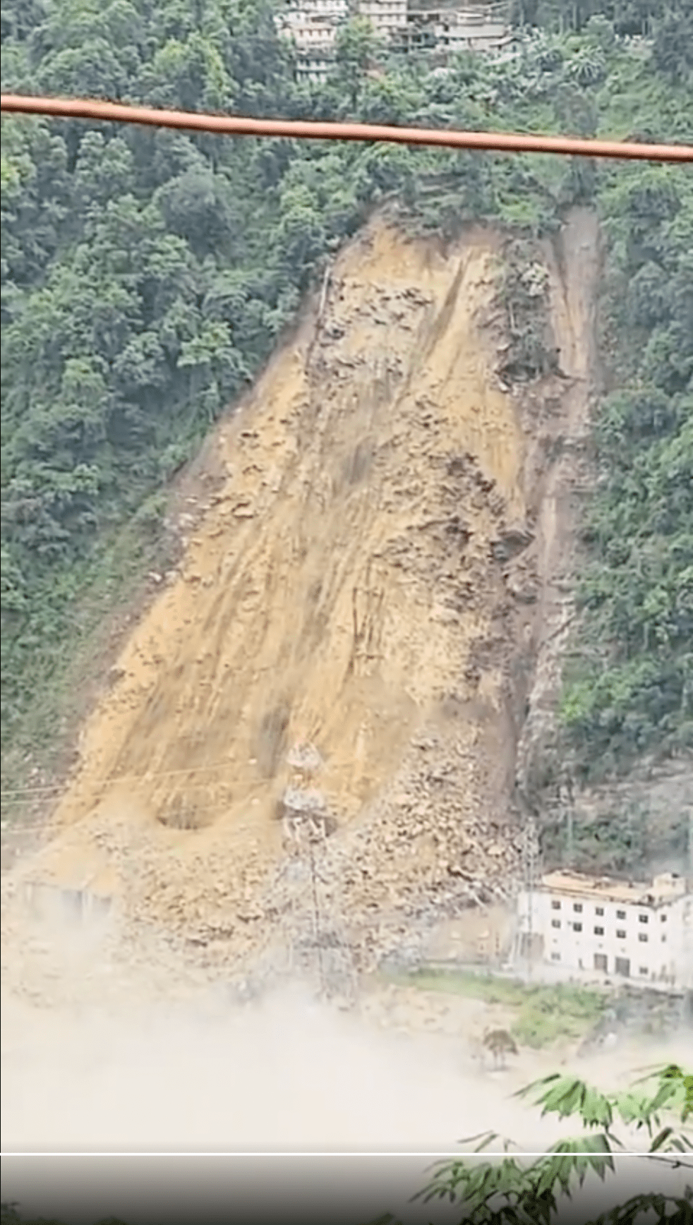
A massive landslide (location: [27.2515, 88.4594]) at Dipu Data near Singtam in Gangtok district that brought down a huge part of a hill above the power house of the NHPC’s 510 MW Teesta V hydropower project on Teesta river in Sikkim at 7.30 in the morning of Aug 20 2024 has damaged the power house. The GIS building above the underground power house located at Balutar can be seen getting destroyed in the massive landslide and getting buried under the debris. The project has been out of operation since the Oct 4 2023 GLOF disaster in Teesta river[i] had over topped the dam and seriously damaged the project.
Continue reading “Aug 2024: Massive Landslide damages NHPC’s Teesta V Hydropower station”Category: Teesta

Changing Course: Teesta Mahananda Rivers in North Bengal
Guest Article: Steve Lockett, Mahseer Trust
(Above: Teesta-Mahananda Link Canal, part of a water-use strategy that seems broken. Copyright: Adrian Pinder, Mahseer Trust)
Rivers change course, it is part of their being. A river changing course can bring unexpected or unwanted ramifications. Sometimes they can be quite devastating. But when they come as a result of deliberate actions to alter the river’s course how can we expect people, whole communities or wildlife to cope?
Continue reading “Changing Course: Teesta Mahananda Rivers in North Bengal”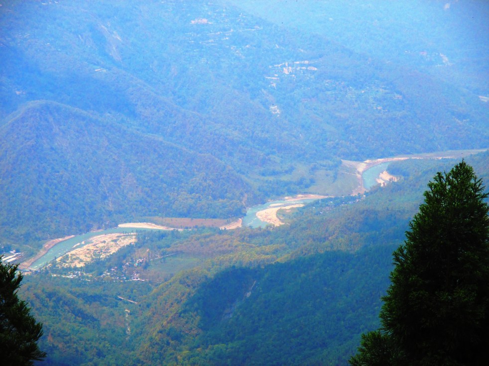
Retracing Her Path -3: A Journey along the Teesta River in Sikkim
Above: The Teesta valley (photo: Gauri Noolkar-Oak)
Guest Blog by Gauri Noolkar-Oak
A day later, I set out on the last leg of my journey – through Sikkim, to the source. The journey from Kalimpong to Singtam and further to Mangan was breathtaking. The mountains grew taller as I climbed higher, the Teesta keeping me company all the while. It rained breezily and the clouds came down, clinging to the thick cloak of green that draped the mountains. Beauty was all around me and at one point, I just had to put my camera away and take in the splendour of nature.
Continue reading “Retracing Her Path -3: A Journey along the Teesta River in Sikkim”
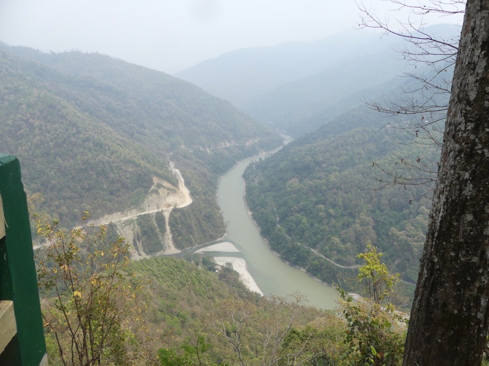
Retracing Her Path 2: A Journey along the Teesta River in W Bengal
Above: Fabulous view of Rangeet Teesta Confluence (Photo: AJT Johnsingh)
Guest Blog by Gauri Noolkar-Oak
The minute I crossed over the Indo-Bangladesh border into India at Chengrabandha, the atmosphere changed instantly; more briskness, more people and more English and Hindi surrounded me. I also spotted posters of Baahubali 2, and a few flags of Bhartiya Janata Party fluttered at the local bus station of Chengrabandha. I set out for Mainaguri, and through the pitter-patter of a weak drizzle, as the first tea plantations came into view.
Continue reading “Retracing Her Path 2: A Journey along the Teesta River in W Bengal”
Retracing Her Path 1: A Journey along the Teesta River in Bangladesh
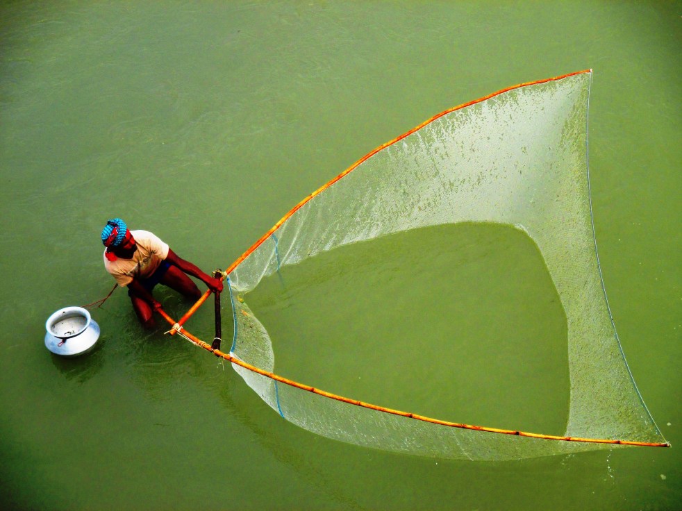
Above: A local fisherman fishing upstream of the barrage (Photo: Gauri Noolkar-Oak)
Guest Blog by Gauri Noolkar-Oak
Few journeys take us through a string of experiences that nourish the senses and the soul. A thoroughbred urban, city-lover, I nevertheless knew deep down that my journey of such nourishment would be with a river. I began researching rivers by chance, but with time, I grew to first like and then worship the entity. In early 2017, I acquired a grant from the Joke Waller-Hunter Initiative to study water conflicts in the Teesta basin, and I knew: this was going to be it.
My journey was inspired by the book “Empires of the Indus” written by Alice Albania, a brave woman who travelled the Indus river from mouth to source, and explored her history and cultures. But beyond that, I hardly had a plan; I did not know how long the journey would take, whether I would be able to see the whole river, and when I would return home. When I landed in Dhaka at the end of April this year, all I knew was that I wanted to see the Teesta right from her confluence with the Brahmaputra River in Bangladesh all the way up to her source at Tso Lamo in Sikkim, on the Indo-China border. Continue reading “Retracing Her Path 1: A Journey along the Teesta River in Bangladesh”
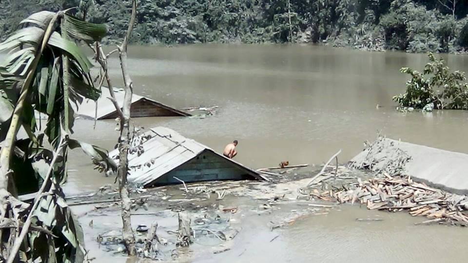
TEESTA LANDSLIDE DAM IN DZONGU: RIVER OVERFLOWS OVER DAM BUT RISK CONTINUE
Above: Submerged houses in reservoir behind landslide dam. Photo from Darjeeling Chronicle
The Kanaka River is flowing over the dam that was created on Aug 13, 2016, it is confirmed now, but the risk of the dam failure and disaster downstream continues. In the meanwhile, the upstream villages, cut off due to road damaged and bridge submerged, are facing serious problems.[i] Continue reading “TEESTA LANDSLIDE DAM IN DZONGU: RIVER OVERFLOWS OVER DAM BUT RISK CONTINUE”
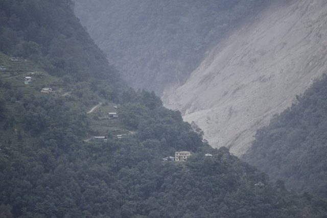
LANDSLIDE DAM BLOCKS TEESTA TRIBUTARY IN NORTH SIKKIM: MAJOR RISK TO TEESTA RIVER BANK COMMUNITIES
(Above: Lower part of the Dzongu Landslide, Photo from Save the Hills)
According to a number of reports[i], at around 1230 hours on Aug 13, 2016, a massive landslide completely blocked the flow of Kanaka (Rongyoung) River near Mentam village in Dzongu region in North Sikkim. A hillock called “So Bhir” came crashing down, it is reported. The Landslide dam is about 50 m high, about 45 m wide, the landslide top point is about 900 m above the river. Darjeeling Chronicle reports, the river downstream is totally dry as the water has started collecting behind the landslide dam (that situation seems to have changed on 14th Aug morning around 830 am). Continue reading “LANDSLIDE DAM BLOCKS TEESTA TRIBUTARY IN NORTH SIKKIM: MAJOR RISK TO TEESTA RIVER BANK COMMUNITIES”
