Draft National Policy Guidelines for Water Sharing[1]: Comments[2]
Copied below are the Comments sent by SANDRP to the Union Ministry of Water Resources in response to MWR’s invitation to send comments by July 31, 2013.
1. What is the value added by these Draft National Policy Guidelines on Water Sharing? What is the immediate reason for bring out these guidelines? The guidelines do not make this clear. This becomes particularly important as under constitution, water is a state subject and among states there is increasing suspicion that centre is trying to take over the rights of deciding about the water resources. If that is the case, as it seems (see comments below), than the guidelines also seem to violate the constitutional provisions.
2. The guidelines use the word “National Interest” at least four times, without explaining who will decide this and how. This is likely to raise suspicions among the states. This is particularly true with provisions like that in section 4.6 (c) saying, “The quantum of water exported from the surplus basin in overall national interest will not be counted as water available for sharing in that basin.” This seems to give unfettered rights to the centre to decide about inter basin transfer of water citing “national interest”.
3. If the Union Ministry of water resources is going to decide what is in National Interest than it is likely to invite risk of ridiculous and risky propositions. For example, the ministry some years ago came out with a scheme of National Projects, but most of the projects under this scheme did not have statutory clearances, or were unviable or were controversial and involved unresolved interstate issues. Thus use of such terms without clear definition and clear checks and balances is not likely to be acceptable.
4. It is pertinent to note that conflicts over river waters, whether inter-country or intra-country, invariably seem to arise only in the context of large projects. So long as the river is flowing freely without any such big projects, there is no cause for any conflict between the upper and lower riparians. As soon as any riparian State plans an intervention (dam or barrage or other diversion structure), anxiety in other riparians is triggered, and a potential for conflict arises. It would appear that large projects tend to become the foci of conflicts. This is essentially because (a) they tend to drastically alter geography and hydrological regimes, and (b) they involve issues of control, power and political relations, social justice and equity. The best course to avoid conflicts is to refrain from such interventions as far as possible, keep them minimal, give advance notice of an intended intervention to all the other riparians, provide full information, take the concerns and consent of the lower riparian into account, and refrain from causing ‘substantial harm’ or ‘significant injury’ to the lower riparian. This point has not been covered in the guidelines.
5. On similar lines, the guidelines basically take a macro view and do not seem to have a place for micro, local, bottom up process or democratic perspective.
6. The sharing should be only of what is available for sharing after the ecological functions of the river (in all its manifestation and catchments) are ensured. These would include the sustaining of wildlife, aquatic life and vegetation; the maintenance of the river regime and the capacity of the river to cope with pollution and regenerate itself; the maintenance of the micro climate; the support of the lives and livelihoods of people dependent on the river on both sides of the political or administrative border; the recharging of aquifers; the preservation of wetlands; the protection of the health of the estuary; and so on. This does not find mention in the guidelines.
7. Its very important to note here that groundwater is increasingly the main source of water for all sources and more and more areas. This is likely to remain the situation whether we like it or not. Under the circumstances, sustenance of rivers flowing all round the year with freshwater as one of the most important groundwater recharge mechanism is also important, both at intrastate as well as interstate level. This aspect should have found a key place in these guidelines.
8. An inter-State river is not a sequence of Statewise segments, it is one continuous flow, one integral whole as a hydrological/ecological system. Allocating so much of its waters to State A, so much to State B, etc, involves a segmentation – a chopping up – of the river. The ideal course would be a joint, agreed, integrated, holistic, harmonious use of its waters by all the basin States coming together. Any statement of sharing principles should begin with this recognition.
9. If a sharing becomes necessary, equitable sharing for beneficial uses must of course be the governing principle, and the Ministry’s draft says this in section 4.3.
The word ‘apportionment’ is best avoided because it suggests an imposition by a judicial or other agency. As mutual agreement is also possible, the word ‘sharing’ seems better. As contending States often argue on the basis of other principles such as ‘territorial sovereignty’ (the Harmon doctrine) or ‘prior use’ or ‘prescriptive rights’, the National Statement of Principles should not merely lay down the principle of equitable sharing but specifically rule out other principles such as those referred to above. Three, it is not enough to say ‘equitable sharing’; the words ‘for beneficial and justifiable uses’ must be added, because the sharing is not for non-use or waste.
The term ‘equitable sharing’ immediately leads to the question of what constitutes ‘equity’, and the draft has something to say about this. The Helsinki Rules enumerate a large number of criteria and leave the actual applicable criteria and the relative weights to be attached to each criterion to be determined in accordance with the circumstances of each case. These are missing here.
Thus, it is not clear how this equitable sharing will be applied and how it will get change with other principles like prior use, high economic value use, etc come in the picture. This principle has always been there, and in spite of such principles, in Maharashtra, a state with largest number of big dams, 70% of irrigation water gets used up by 2% land under sugarcane. Similarly while parts of Krishna basin is highly drought prone, over 3 billion cubic meters of water get transferred from that basin to the high rainfall area of Konkan while the downstream areas in the Krishna basin is severely drought prone. This is also applicable at interstate level as is clear from the reservoir filling methods applicable in all basins, where the upstream dams will release water only when they are full and till than downstream areas wont get any water, irrespective of if the downstream areas are in the same state or another one. So in absence of clearly defined publicly accountable mechanism to implement this principle, it is of little value.
10. Incidentally, one of the criteria, namely the ‘contribution’ of each BasinState, is a bit dicey. Can that fact give unfettered rights over that water to that state? If not what will limit those rights? This is because, the State that receives the precipitation also needs downstream state to provide drainage; it follows that by virtue of providing that crucial drainage the lower State also acquires a certain right over those waters. This factor is not mentioned here.
11. The upper riparian tends to assume a primacy of rights, and in any case has control over the waters, putting the lower riparian at a disadvantage. The upper riparian often talks in terms of ‘giving’ water to the lower riparian or ‘sparing’ water for the lower riparian. It is necessary for the Statement of Principles to make it clear that there is no hierarchy of rights; that all co-riparians have equal use-rights over the waters of the inter-State river; that the lower riparian has a right to the waters. If there is a hierarchy, than the hierarchy should be made clear and also how that hierarchy is going to be ensured in real situation.
12. One of the key issues that a statement of principles must deal with is the problem of sharing in a low-flow year. This is clearly recognised in the India-Bangladesh Ganges Water-Sharing Treaty 1996. However, the draft guidelines do not make this clear.
13. The upper riparian, in using the waters, must not cause ‘substantial harm’ (Helsinki language) or ‘significant injury’ (UN convention language) to the lower riparian. (The India-Bangladesh Ganges Treaty contains a ‘no harm to either party’ clause.) The draft guidelines must include this.
14. Under the law as it stands at present, the parties to an adjudication under the ISWD Act are the State Governments. A more inclusive approach seems desirable so as to allow water-users (agriculture, industry, citizens, etc), as well as those likely to be affected by the projects in dispute, to be heard in the adjudication process.
15. Data of all kinds needed for the purposes these guidelines (e.g. section 6.1.1) shall be freely shared by the States concerned and put in the public domain for the information of all without any restrictions on the grounds of confidentiality or secrecy.
16. Section 4.3 mentions that storage of rainwater shall not qualify as direct use of rainwater. However, there are many techniques that require local storage of rainwater and such local storage should not disqualify from being considered as direct user of rainwater. This may be modified to say that storage of water beyond a certain quantity at one place (say 1 million cubic meter) may not qualify as direct use of rainwater.
17. The guidelines are only pertaining to interstate water sharing. However, any such (non binding) guidelines should also include provisions for intra-state, inter-sectoral water sharing.
18. Section 4.8 is problematic as it does not define what “existing use” is. Is the use of water by fish, plants and nature “existing use”? Does it count? It seems the existing use is entirely anthropocentric, but in case of an ecologically embedded entity like water this may be seriously problematic. Secondly, it seems to recognise use only when done through projects approved through due process. But there is a lot of informal use of water (e.g. by tribals) that is beyond the project-generated use. Does it count? Thirdly it makes a strange distinction of preplanned use. Do we have well documented and well recognised pre plan uses of water? Fourthly, the use of phrase “Every effort shall be made to protect the existing utilization” creates serious doubts as it gives an escape route that nothing is sacrosanct.
19. Section 4.9.1 also raises serious suspicions since it says even where an existing interstate agreement has approval of all the basin states, it may still not be good enough before “national interests”. This is bound to raise suspicion of all the states.
20. Section 4.10.2 is also likely to raise suspicions as it reads: “In the process of water sharing/distribution, in consultation with the co-basin States, the Centre would take care of the water sharing/distributions required in the national interest… Any State affected adversely due to such sharing/distribution would be adequately compensated by alternative means.” This seems to give rights to centre that so far belongs to the state. As far as the interests of the ecology and environmental flows are concerned, centre has the powers under Environment Protection Act, 1986 and do not have to resort to such seemingly extra constitutional guidelines.
21. The presence of section 4.12 on interlinking further raises the suspicion that this whole effort is geared towards pushing such projects. This should have had no place in these guidelines.
22. In section 5.1b there should have been explicit mention of groundwater use and climate change implications on water use and availability.
23. In section 5.4b(i) it is not clear what is the basis for review after 40 years.
24. The whole guidelines have no place for people, and also has no value for transparency, accountability or participatory processes.
25. Conclusion This exercise may be redone with more open ended terms of reference and holistic way of considering water in nature and with greater faith in the people and democratic processes.
The Ministry should not rush through this. It should give more time for feedback, take up extensive consultation and make the draft available in regional languages.
MITHILA (North Bihar) can be called a land of ponds. There are 9115 ponds in 1269 villages of Darbhanga district. Area of pond varies from about 1 acre (0.3 hectare) to 150 acres (60 hectares). Some of them are 500 to 1000 years old. The excavation of a pond was considered as a very pious act. After excavation of a pond, it is dedicated (UTSARGA) by its excavator to all living beings (human, cattle, bird, insect and species which survive in water) for their survival and need of water.
This way, community has an age old tradition of customary rights over a pond for irrigating agricultural land; to use water for bathing, washing and cooking purpose; and water for bathing & drinking their cattle. Besides, these ponds help in recharging ground water; about 70 to 80 varieties of birds survive on small fishes and insects provided by these.
Moreover, the ponds in Mithila provide nutritional food in the forms of fish, snail, crabs to people and livelihood to weaker section/fish farmers; pond bund covered with trees, grasses and bush/shrub/herbs become a natural shelter/forest-belt for wild animals in rural areas. In fact, many ponds are a centre of religious and cultural festivals of all castes and sects.
They also play a vital role in mitigation of flood and drought, and in harvesting of rain and river water.
In spite of several laws and judicial orders for protection of ponds, their very existence is in danger. Hundreds of ponds have been leveled to the ground and illegally sold by land mafia. Pond bund, slope of pond bund to water bed, and inlet & outlet of pond have been illegally sold/occupied or encroached for construction of houses, shops, schools, hospitals and commercial complex by greedy, criminals and influential persons. People’s right to the ponds is denied and prevented by land/pond mafia. Sewage, garbage and medical garbage are routed to ponds, which is polluting its water to dangerous level.
With this background, Mithila Gram Vikas Parishad (MGVP) has started an initiative for protecting Mithila’s and Bihar’s Ponds through Advocacy and an extensive awareness-raising campaign:
— to protect community’s traditional right to the ponds and safe water.
— to protect livelihood, pond’s diversity and ecosystem including water security .
— to influence policy makers & planners to set up a ‘Bihar Pond Development Authority’ with clear
defined responsibility to protect & conserve the ponds with local participation
—to prevent encroachment and illegal building construction over pond’s area, and health
hazards due to dangerous pollution of pond water.
—to prepare Technical Guidelines, based on community practices and traditional wisdom of pond conservation, for protection, reclamation and conservation of ponds in Bihar, in consultation with environmentalist & experts.
Contact Details of MGVP:
MITHILA GRAM VIKAS PARISHAD, Professor Colony, West of Dighi Pond, Darbhanga, Bihar, India, PIN: 846004,
IMPACT OF UTTARKHAND FLASH FLOODS IN MID JUNE 2013 ON LOCAL PEOPLE AT KHARADI VILLAGE (BARKOT BLOCK) IN UTTARKASHI DISTRICT RESULTING FROM A DIVERSION/ REDIRECTION OF THE YAMUNA RIVER TOWARDS POPULATED BANK OF THE RIVER DUE TO THE 8 MW GANGANI HEP. IMPACT IS ALSO THERE ON THE HEP INFRASTRUCTURE ITSELF PUTTING A QUESTION MARK ON ITS QUALITY OF CONSTRUCTION AS ON ITS SUSTAINABILITY.
YAMUNA JIYE ABHIYAAN, JULY 2013 Text by Manoj Mishra
Kharadi is a small road side market place on river Yamuna, some 40 km short of the holy shrine of Yamunotri. It is also a popular night halt site on the Char Dham Yatra route. Resultantly over the period of time a number of hotels and residential properties have come up along the road and the river side.
Redirection of the river to the left due to the project head. All Photos taken on 20 July 2013, by Bhim Rawat, Yamuna Jiye Abhiyaan
Some time in 2008-09 works, started by a pvt firm called Regency Gangani Energy Private Limited, immediately upstream of the Kharadi village for the construction of a 8 MW run of the river HEP. The works involved a diversion head, laying of pipes to convey the diverted river water and a power house around 5 km down stream of Kharadi at a place called Gangani. It is notable that the planned HEP is on the proper river Yamuna
By the year 2012, construction works had progressed to a considerable extent, when on the night of 3 August 2012 a cloud burst at Hanuman Chatti area resulted in a flash flood in the river Yamuna. Flow of Yamuna was obstructed by the diversion head of the HEP and was diverted towards its more populated left bank. This diversion swept away of around 9 hotels and residential properties of the local people at Kharadi. It also resulted in damages to the pipes laid in and near the river bed by the HEP.
If the above was not enough then on 17 June 2013, another cloud burst and heavy rains over most of higher reaches of Uttarakhand led to yet another diversion of the river and sweeping away of around 28 properties (see list at the end of this report) in the market village of Kharadi.
Washing away of structures in Kharadi some 500 m downstream from the river diversion head of the Gangani HEP by the flash flood in the river Yamuna on 17 June 2013
The Project also applied for Clean Development Mechanism (CDM) status under United Nations Framework Convention on Climate Change to get Carbon Emission Reduction Credits. Yamuna Jiye Abhiyaan and others have objected to this application at the Validation stage earlier and at registration stage now in August 2013 as the project is not only unsustainable, but its application was full of contradictions and misleading claims. The project is in any case not a sustainable Development Project, is business as usual project and hence non additional as per UNFCCC criteria. The project is also not sustainable development project, but India’s National CDM Authority, namely the Union Ministry of Environment and Forests, has never done credible assessment of this, and never rejected any application of CDM hydro projects!
Road and structures washed away by the flash flood in the Yamuna river downstream from diversion head of the Gangani HEP.Damaged pipes (meant to carry the river water to the Gangani HEP power plant some 3 km d/s from the diversion head) and the damaged approach bridge on the river
List of Hotels and residential properties destroyed in Kharadi village by the flash floods in river Yamuna made worse due to the diversion head of the HEP upstream of the Kharadi village on the night of 16 and morning of 17 June 2013 and on the night of 3 August 2012 around 11 PM made worse (as per local people) due to the Gangnani HEP structure (head) in the river upstream of the village
Property/Hotel Owner Name Father’s Name Village Name No. of Rooms
1 Neel Kanth Hukum Singh Rawat, Sri Lal Singh Khanera Three Storey, 20 rooms
2 Unnamed Jagdish, Chandar Mohan, Ajay Sri Attar Singh Khanera 2 rooms + Provision Shop
3 Yamuna Darshan Jaidev Singh Rana Sri Jandar Singh Khanera 25 rooms
4 Bhupendar Place Rajendar Singh Chouhan, Sri Narendar Singh Syalna 12 Rooms
5 Bhupendar Palace (Joint) Gajendar Singh , Sri Narendar Singh Syalna 04 Rooms
6 Bhupendar Palace (Joint) Arjun Singh, Kesar Singh Syalna 04 Rooms
7 Amit Restaurant Jogindar singh, Sri Chandan Singh Bhansadi 05 Rooms
8 Govind Palace Janak Singh Sri Ranjor Singh Khanera 12 rooms 9 Him Darshan (August 12) Atol Singh, Sri Jai Singh Chouhan Nagon Gaon 22 Rooms
10 Naveen Palace Jag Mohan Chouhan, Sri Jhoon Singh Khanera 06 Rooms
11 Naveen Palace Man Mohan Singh, Sri Jhoon Singh Khanera 04
12 Naveen Palace Dharmendar , Sri Jhoon Singh Khanera 04
13 Vijay Restaurant Vijay Chouhan, Sri Jhoon Singh Khanera 1 Hall, 1 Cottage
14 Naveen Palace Darmyan Singh, Sri Kamal Singh Syalna 07
15 Provision Singh Jagveer Singh chouhan Sri Surveer Chouhan Khanera Provision Shop
16 Ravindar Palace Ravindar Singh Sri Budhi Singh Khanera 04 Rooms 17 Kahniya Palace Shailendar Singh Sri Shiv Singh Khanera 04 Rooms + Restaurant 18 Rana Place Kitab Singh Rana Sri Surb Singh Rana Khanera 04 Rooms
19 Residence Gabar Singh Sri Sultan Singh Khanera 04 Rooms 20 Residence Bijendar Singh Sri Sabal Singh Khanera 07 Rooms
21 Residence Brij Mohan Sri Jogolia Khanera 06 Cottages
23 Residence Chojen Lal Sri Kuta Singh Syalna 04 Rooms 24 Residence Basant Lal Sri Khelan Singh Khanera 03 Rooms 25 Residence Trepan Lal Sri Sadhu Lal Syalna 02 Rooms 26 Residence Jogi Lal Sri Jhapuliyan Khanera 02 Rooms
27 Aneesh Place Aneesh Sri Janbeer Khanera 06 Rooms
28 Residence Jendar Singh Sri Keval Singh Khanera 02 Rooms
29 Residence Praveen Singh Sri Jandar Singh Khanera 02 Rooms
30 Residence Jagendar Singh Sri Keval Singh Khanera 02 Rooms 31 Narayan Place Kendar Singh Payal Sri Ram Singh Syalna 05 Rooms
32 Residence Chain Singh Sri Rompal Singh Syalna 04 Rooms
33 Residence Ispal Singh Sri Khajan Singh Syalna 04 Rooms 34 Narayan Palace (Joint) Ranbeer Singh Sri Ghayan Chand Syalna 04 Cottage
35 Narayan Palace (Joint) Chain Singh Sri Daya Ram Singh Khanera 02 Rooms + Canteen= 02 cottage (About to fall)
36 Giri Ashram Saint Giri Kharadi
37 Trishul Hotel Kandra Singh Payal Sri Ram Singh Syalna Verandah Damaged Bold entry relates to properties washed away in Aug 2012.
NOTE:
About 25 additional Households have now (after June 2013 floods) come with in the slip zone, which can now slip or get washed away any time in the event of high rainfall or another flood.
Entire Kharadi village has now been declared as disaster affected by the District Administration.
YAMUNA JIYE ABHIYAAN, JULY 2013 (Text by Manoj Mishra)
The Forest Advisory Committee (FAC) of the MoEF in its meeting on the 11th and 12th of July did not recommend Forest Clearance to Kikvi Drinking water project coming up in Nashik.The proposal entailed diverting 172 hectares of forest land and a massive 761.52 hectares of agricultural land, totalling 933.98 hectares, without even a rehabilitation or resettlement plan. The project proponents pushed the project claiming that Gangapur dam is being silted up, but shockingly, did not present any alternative of desilting Gangapur Dam or even mentioning that Nashik already has three more drinking water supply sources in the upstream and downstream of Gangapur Dam.
In its decision, the FAC noted that
· “The project proponent has not given due diligence in assessing water requirement of the area and available resources already in existence to meet this requirement.
· No evidence is made available to prove that an authenticated study has been conducted to assess water requirement
· There are three more drinking water/irrigation projects in Nashik but user agency could not establish any link between capacity of these and future water requirement.
· Possibility of enhancing storage capacity of Gangapur dam to its installed capacity of 7.2 TMC by way of desiltation has not been explored.
· It is also not understood how rehabilitation plan is not required if submergence of agricultural and is involved.”
FAC has asked for further clarification and reports before the project can be considered again. This includes a detailed study to assess present and future requirement of water for drinking irrigation and vis a vis available sources, an integrated plan which may include desilting study for Gangapur dam as well as a Rehabilitation and Resettlement Plan for the population whose agricultural land will be submerged. It has also asked for compliance of Forest Rights Act.
This is indeed a welcome decision by the FAC. The proposal highlighted callous and casual approach of the Nashik Municipal Corporation while diverting an entire river and affecting agricultural lands in over 10 villages in Nashik, without even mentioning agricultural submergence clearly in its application.
“No country in the world is as vulnerable, on so many dimensions to climate change as India. We need to build our own independent and credible research capacity on these issues.”
-Jairam Ramesh, erstwhile Union Environment Minister in Preface to CLIMATE CHANGE AND INDIA: A 4X4 ASSESSMENT: A SECTORAL AND REGIONAL ANALYSIS FOR 2030s
As India is struggling to cope with the extent and scope of the Uttarakhand Disaster[1], it is high time that we take the very real and urgent challenges of Climate Change seriously. India has several regions and communities significantly vulnerable to climate change. Himalayan glaciers are receding faster than global averages, precipitation across India is becoming more intense and unpredictable, biodiversity is under stress, sea levels are rising affecting thousands of coastal communities. And despite all this, destructive development in fragile regions is happening with utter disregard to this reality.
Maximum impacts of climate change are being faced by local poor communities and ecosystems.
With this in mind, we take a look at 4X4 Climate Assessment report (4X4 Report for short), brought out in 2010 by Ministry of Environment and forests (MoEF) which assessed Climate Change impacts by 2030 on four ecologically sensitive sectors: the Himalayan region, Western Ghats (WG), Coastal areas and North-east regions of the country and four issues: Agriculture, Forests, Human health and Water together. We also look at other reports on climate change in Western Ghats and compare these with actual challenges faced by WG. Till date this report remains the only official and definitive report about assessment of impact of climate change in India, to the best of our information (Readers, please let us know if there are other relevant reports in this regard).
The report is prepared by Indian network on Climate Change Assessment (INCCA)[2], which consists of 120 Indian Institutes and research laboratories, geared towards data analysis and impact predictions of the climate change scenarios. The network was launched by MoEF on 14th October 2009. 4X4 Report was published in November 2010 when Mr. Jairam Ramesh was the Union Minister for Environment and Forests.
A1 B Scenario Predictions
The climate change impact predictions need the to assume of socio-economic context for which predictions are made. IPCC has classified socio-economic scenarios under A & B categories with further sub-divisions under each of them. 4X4 Report uses the A1B prediction scenario for India. This scenario assumes significant innovations in energy technologies, which improve energy efficiency and reducethe cost of energy supply with a balance across all sources. A1B assumes drastic reductions in power generation costs through the use of solar, wind, and other modern renewable energies and end use products.[3],[4].
Ironically, this assumption of A1B scenario for 2030 seems baseless when we look at the current dependence on non-sustainable energy sources like coal based thermal and large hydro.
PRECIS (Providing Regional Climates for Impact Studies)[5] tool used in this report considers data from large time scale of 5-7 decades in order to predict impact for coming 3-4 decades.
We look at Water in Western Ghats and what the Report predicts for this most populated biodiversity hotspot in the World.
1. Western Ghats: The Water Tower of Peninsular India
Western Ghats (WG) are one of the oldest mountain ranges– older than the Himalayas- occupying around 6 % of Indian landmass. According to High Level Working Group Report on Western Ghats (HLWG/Kasturirangan Committee Report), geographical area of WG is over 1,64,280 sq. km. WG harbor high degree of endemism with more than 78% of amphibian and about 41% fish species[6] and similar high RET (Rare, endemic and Threatened) floral and faunal groups. They also support numerous tribal and forest dwelling communities. In 2012 UNESCO has declared 38 sites from Western Ghats as World-heritage sites. Most of the Peninsular east flowing or west flowing rivers originate from Western Ghats making it the water tower of peninsular India. Millions depend on these rivers like Krishna, Godavari, Cauvery, Malaprabha, Ghataprabha, Bhima, Tungabhadra for water and ecosystem goods and services. West flowing rivers are shorter and swifter. Examples include Vaitarna, Ulhas, Kali, Sharavati, Chalakudy, Pamba, Bharatpuzha, Nethravathy, Hemavathy, Bhawani etc. There are many complex community- water relationships which could be found in the region.
Rivers from Western Ghats drain almost 40% of Indian drainage. Therefore, it is essential to understand the impacts of the climate change on water resources in Western Ghats.
Pristine Forests set for submergence under the 24 MW Kukke Mini hydel Plant in Dakshin Kannada, Karnataka. Photo: SANDRP
2. Predictions from 4X4 Report for Water and Western Ghats for 2030s
2.1 Precipitation and temperature:
In the Western Ghats, annual temperatures are likely to increase to 26.8 °C–27.5 °C in the 2030s. The rise in temperature with respect to the 1970s will be between 1.7° C and 1.8° C. The mean annual rainfall is likely to vary from 935± 185.33mm to 1794±247mm, which is an increase of 6%–8% with respect to the 1970s. The minimum temperatures may rise by 2.0 °C to 4.5° C, with minimum increase in those parts of Karnataka that lie in the Western Ghats. Within the region bordering the state of Kerala, the maximum temperature is likely to rise by 1° C–3° C.
The number of rainy days are likely decrease along the entire Western coast, including in the Western Ghats.
The intensity of rainfall is likely to increase by 1-2 mm/day.
2.2 Water yield, sedimentation the predictions for Western Coastal region, including the Western Ghats:
The west coast region exhibits a wide variability in the change in precipitation under the 2030s scenario. The northern portion of the west coast, consisting of areas of Gujarat and Maharashtra, shows an increase in precipitation for the 2030s scenario, and the increase varies from 4% to over 25%. However, areas of Karnataka and Kerala show a marginal decrease upto 4%.
The west coast region shows a general reduction in Evapotranspiration (ET), which varies from a very nominal value to about 5% for the 2030s scenario. Areas of Gujarat and Maharashtra, which had shown an increase in precipitation, still show a reduction in ET perhaps because of high intensity of the rainfall.
The reduction in water yield for Karnataka and Kerala is up to about 10%. Gujarat and Maharashtra areas see an increase in water yield[7], and the magnitude is up to about 50%.
The west coast region also shows a considerable increase inthe sediment yield for majority of the areas. Even those areas that are expected to receive less precipitation show an increase in sediment yield of up to 25%. The increase in sediment yield in these areas can possibly be explained due to an increase in the intensity of precipitation. This will have major impacts on water resource projects.
It is also seen that there is an increase in the moderate drought development for Krishna, Pennar, and Cauvery basins, which have either predicted decrease in precipitation or have enhanced level of evapo-transpiration. The maximum water withdrawal takes place from Godavari and Krishna river basins in Western Ghats in all the years[8]
2.3 Flood Analysis According to 4×4 Report, all the regions show an increase in the flooding varying between 10 to over 30% of the existing magnitudes. This has a very severe implication for the existing infrastructure such as dams for the areas and shall require appropriate adaptation and dam safety and operation measures to be taken up.
2.4 Impacts on crops:
a. Coconut: Coconut yields are projected to increase by up to 30% in majority of the region. Increase in coconut yield may be mainly attributed to projected increase in rainfall (~10%) and relatively less increase in temperatures. However, some areas like south-west Karnataka, parts of Tamil Nadu and parts of Maharashtra, may lose yield up to 24%.
b. Rice: Productivity of irrigated rice in Western Ghats region is likely to change +5 to –11% depending upon the location. Majority of the region is projected to lose the yield by about 4%. However, irrigated rice in parts of southern Karnataka and northern-most districts of Kerala is likely to gain. In the case of rain-fed rice, the projected change in yield is in the range of –35 to +35% with a large portion of the region likely to lose rice yields up to 10%.
c. Maize and sorghum: Climate change is likely to reduce yields of maize and sorghum by up to a whopping 50% depending upon the region.
The entire Western Ghats region is covered by 54 grids, out of which 10 (18%) are projected to undergo change. 18% forested grids in the region are projected to be vulnerable to climate change. The projection of the NPP (Net Primary Productivity) for the Western Ghats region is projected to have approximately 20% increase in NPP on an average.
2.6 Temperature Humidity Index (THI) and its possible impact on biodiversity: While the report uses this index for studying analyzing impacts on livestock, its conclusions can also be used for biodiversity and fisheries. The report predicts “A severe thermal discomfort and stress is expected in most parts of Western Ghats and the Coastal region in the month of May.” This will not only affect the biodiversity, but also fisheries. However, the report makes no such correlation.
Seetha Nadi, free flowing river in Karnataka Western Ghats. Photo: SANDRP
3. Limitations and Way Forward:
The report accepts its limitation in terms of data sources, details which have been gathered, lack of integration of existing data, etc. The authors seem aware that the report in this form is of little use to policy makers or communities.
4. Conclusions:
While the report has its severe gray areas, and there are variations within Western Ghats, it is clear that for Western Ghats:
Precipitation will be more intense with less rainy days
Temperatures will see a gradual increase
Crops will be affected
Forests (and dependent biodiversity) will be made more vulnerable
Sedimentation will increase sharply
Incidence of floods and droughts will rise sharply
5. Problems with 4 X 4 Assessment:
Apart from the limitations admitted by INCAA, the report suffers several other limitations.
It does not offer any recommendations for policy makers.
Neither does it hold any recommendations for communities. In fact in its way forward, when it mentions that cooperation has to be sought from several departments and organizations, it does not even mention local communities who will face major impacts!
In the task of assessing impacts and devising solutions to mitigate and adapt to impacts of climate change, local communities have proved to be extremely adept. At the same time, the impacts of climate change affect these communities the most and hence they have to be made a part of ongoing research. 4 X 4 Report does not even attempt this.
Some big questions:
The report says that “Thenorthern portion of the west coast, consisting of areas of Gujarat and Maharashtra, shows an increase in precipitation for the 2030s scenario, and the increase varies from 4% to over 25%. Gujarat and Maharashtra areas see an increase in water yield, and the magnitude is up to about 50%. As per the maps, this region also includes the Western Ghats.
Now Northern Western Ghats is exactly the same region where Indian Institute of Tropical Meteorology (IITM, also a part of INCA) has said that there have been drastic, ongoing reductions in rainfall!
In fact, Centre for Climate change, IITM has said that in the last 110 years (1901-2011) rainfall in Mahabaleshwar, origin of five rivers in northern Western Ghats has decreased by 800 mm! In northern Westenr Ghats of Maharashtra, rainfall has decreased at the rate of 2% per decade while the rate of decrease is lower in Southen Western Ghats for Kerala at 1%.[9]
This aspects needs some more clarity.
No reference to the ongoing destructive development in Western Ghats: Western Ghats are facing severe threat from Mining, Hydropower projects, Irrigation Projects, mini hydel projects, which affect water cycle, sedimentation, forests and biodiversity of the region and displacement and impoverishment of very large number of people. However, the report does not dwell on any of these practical problems and their impact in compounding climate change challenges.
Mining in Goa Photo: Damodar Pujari
No reference to biodiversity, freshwater fisheries: The report has no predictions or recommendations to offer for biodiversity in Western Ghats. While there is a section on coastal fisheries, there is no mention of rich freshwater fisheries in Western Ghats!
A1B Scenario: There is no evidence that India is adopting the A1B scenario which considers growth through a mix of energy sources like solar and wind, etc. We still depend heavily on non-sustainable energy sources like Thermal and large hydro. Hence, this assumption itself is flawed and predictions based on this assumption cannot be considered seriously. In fact, the actual predictions, looking at India’s and Western Ghat’s track record, (with over 10 coal based thermal power plants, several other nuclear power projects, ports and large dams coming up in Maharashtra, concentrated and non-sustainable mines in Goa) could be much more severe.
6. Impacts of climate Change on Western Ghats from Western Ghats Expert Ecology Panel report and High Level Working Group on Western Ghats Report:
Western Ghat Expert Ecology Panel Report: WGEEP does not refer to 4 X 4 Report. It considers A2 and B2 scenarios, and concludes that northern region of Ghats is more sensitive to climate change than southern region. Though the report does not deal with climate change in detail, the recommendations of WGEEP are extremely climate friendly.
High Level Working Group Report: HLWG report has considered 4×4 Report in its analysis and includes a Chapter on Climate Change. This chapter is more effective in dealing with ground challenges than the 4×4 report. However there are some major problems in this.
The HLWG Report states:
a. “Biodiversity: In the Western Ghats, climate change is expected to increase species losses. Changes in phenology are expected to occur for many species. Ecosystems dominated by long-lived species (like forests in WG) will be slow to show evidence of change and slow to recover from the climate related stress
b. Water, Irrigation and Hydro Power: Impacts of climate change and climate variability on the water resources are likely to affect irrigated agriculture, installed power capacity, environmental flows in the dry season, and higher flows during the wet season, thereby causing severe droughts and flood problems. “It is seen that there is an increase in the moderate drought development for Krishna, Pennar, and Cauvery basins, which have either predicted decrease in precipitation or have enhanced level of evapo-transpiration. The maximum water withdrawal takes place from Godavari and Krishna river basins in Western Ghats in all the years.”
c. Hydro capacity “is expected to increase, but its share decreases from the total installed capacity by 2100. The slow growth in capacity is due to barriers of high investment requirements and long gestation periods. A number of socio-environmental issues are related to dam construction, flooding of areas, damages to the ecology, and resettlement and rehabilitation of the population.”
Though HLWG dedicates an entire chapter to Climate Change Impacts on Western Ghats, it still does not comment on destructive hydropower projects and such other plans which decrease resilience and adaptation capacities of ecosystems and communities and in fact contributes to climate change by deforestation and methane emissions! In fact, by not opposing projects like 163 MW Athirappilly and 200 MW Gundia, the HLWG report supports projects which have huge potential on increasing climate change impacts[10],[11],[12]
Shockingly, the HLWG report certifies all hydro as green and renewable source of energy, something that even developed countries or UNFCCC does not do.
According to the Second National Communication on Climate Change (NATCOM, 2012), the Western Ghats is expected to experience increase in temperature regimes, rainfall and extreme events due to climate change. There is also a high probability of significant decrease in the duration of the precipitation (NATCOM, 2012). The projected changes in the precipitation may induce changes in the hydrological regimes especially increase in evapo-transpiration and increased runoff .
7. Way Forward of Water, communities and ecosystems in Western Ghats
India has been witnessing several climate related disasters in the recent years. Instead of going into a ‘climate change or no climate change’ debate, it is time to adopt no-regrets strategies and build climate resilience of communities and ecosystems. Unfortunately, we do not see evidence of decreasing emissions or adopting climate friendly strategies from India, or even other developed countries which support and fun destructive projects in India. The Clean Development Mechanism introduced by UNFCCC has in fact been supporting and pushing destructive projects in developing countries, while legitimizing pollution in developed countries.
Some possible measures:
Natural ecosystems are resilient in coping with climate change challenges: natural ecosystems like rivers, streams, forests need to be protected for their resilience to climate change impact as well as the goods and services they provide to local communities, who are most vulnerable and least able to cope with the climate change implications.
Free flowing rivers are more resilient than their dammed counterparts: Free flowing rivers in western Ghats need to be protected on priority
Fragmented Forests are more vulnerable to climate change impacts: Deforestation and fragmentation of forests in Western Ghats should be avoided at all costs. Large Hydro power, irrigation projects, mini hydel, mines, hills station projects affecting forests should be dropped urgently. Local projects should be considered only with free, prior and informed consent of the communities. All projects related t the mega Inter Linking of Rivers in the western Ghats should be dropped, including Par Tapi Narmada, Damanganga Pinjal, Nethrawati, Hemawati, Pamba, Achankovil, among others.
Old and unsafe large dam projects like the Mullaperiyar and others should be considered for decommissioning as recommended by WGEEP.
The diversion of east flowing rivers to the west in Maharashtra should be reversed in a time bound manner and no more such projects should be considered.
All projects in Western Ghats: large or small should be brought under the ambit of environmental clearance which should look specifically at climate change impacts on these projects and should also require FPIC.
Community water harvesting systems, traditional water harvesting systems, watershed measures need to be encouraged. Western Ghats is rich in these examples
Efficient and water saving measures like System of Rice Intensification should be adopted for the entire Ghat region.
Recommendations of WGEEP need to be implemented urgently
Most importantly, communities need to be made an integral part of decision making surrounding natural resources. Currently, mega projects like Athirappilly, Gundia, Talamba and Tillari dams in Maharashtra, drinking water dams near Mumbai, etc. completely neglect community concerns. Communities will not only face direct impacts of displacement and losing rights, the long term impacts on adaptation and mitigation capacities of communities will also be jeopardized due to destructive projects.
[6] Western Ghats Ecology Expert Panel Group: WGEEP
[7] Water yield (water crop or runout). The runoff from the drainage basin, including ground-water outflow that appears in the stream plus ground-water outflow that bypasses the gaging station and leaves the basin underground. Water yield is the precipitation minus the evpotranspiration. (http://water.usgs.gov/wsc/glossary.html)
“At the ground level people are really interested and they want to get involved and our report if nothing else, seem to have serve the purpose of triggering such kind of an interest” said Prof. Madhav Gadgil who delivered a lecture on “Democracy and ecology in contemporary India” at the Nehru Memorial Museum and Library (NMML) on 17th July 2013. His lecture was part of the public lecture series on ‘Science Society and Nature’ and the event was attended by more than 400 people, the second highest audience NMML has witnessed for public lecture as Director Mahesh Rangarajan revealed at the end of the lecture. The lecture was chaired by Jairam Ramesh, the former Minister of Environment and Forests and currently the minister for Rural Development and also in charge of Ministry of Drinking Water and Sanitation.
Prof. Gadgil in his lecture presented several case studies through which he showed how in the name of ‘development’ only lip service has been paid to the environmental norms and all democratic processes have been sidelined. Dr. Gadgil also shared his experiences of working for the Western Ghats Ecology Expert Panel (the report submitted by this panel can be accessed here – http://moef.nic.in/downloads/public-information/wg-23052012.pdf) which was formed by the Ministry of Environment and Forests (MoEF) to study the ecological and environmental concerns of the Western Ghats under his aegis.
Talking about iron mining in Goa, Prof Gadgil said the government of Goa even does not have any account of how much ore has been extracted by the mining contractors, leaving aside environmental concerns. Bringing the issue of unprecedented dam construction in Western Ghats, he gave the example of Athirappilly dam in ChalakudyRiver in Kerela which was the eight dam proposed in the river. There was a clear violation of Forest Rights Act, as construction of this dam would lead to displacement and subsequent extinction of the ‘primitive tribal’ community named Kadar. The government officials were claiming that if this dam was not constructed Kerela would starve for electricity. But a detailed presentation by RiverResearchCenter, Kerela covering technical, economic and social aspects of the proposed dam showed this dam was not viable as there would be not be sufficient water left in the river for this dam as the water would already be harnessed in the seven upstream dams. The government officials, who were claiming that Kerela would go power hungry, had no reply to this.
Presenting the case of Plachimada village in Perumatti Panchayat in Palakkad district of same state, he said that Coca Cola Company had not paid any compensation that it was supposed to pay to the farmers of Plachimada as ordered by the Supreme Court. Coca Cola was also supposed to pay a tax of Rs 60 cores to the government of Kerela but the government had surprisingly given tax exemption of Rs 6 crores to the company. In both these examples he showed how the acts of democratically elected government were actually against people and environment. But he hailed the Plachimada struggle against Coca Cola as a ray of hope since this was a struggle led by a Panchayat, a local level democratic institution which brought a multi-national company to its knees. He also pointed out how law and order mechanism of state had been used to suppress people’s protests against illegal pollution in Lotte, in Ratnagiri district of Maharashtra.
Throughout his lecture Dr. Gadgil strongly argued for decentralization of power in order to protect ecology and environment. He mentioned about the powers given in the hands of the local bodies through the 73rd and 74th amendment of the constitution of India. He said that there are several laws and policies e.g. Bio-logical Diversity Act (2002), National Gene Funds which talked about participation of citizens in the decision making but this was never implemented on the ground. He said that the Environmental Impact Assessment (EIA) documents and the whole environmental clearance process should be reconsidered and reviewed (a press release on the functioning of Expert Appraisal Committee which grants environment clearance termed the committee as Expert Approval Committee – https://sandrp.wordpress.com/2013/02/05/analysis-of-moefs-eac-on-river-valley-projects-the-expert-approval-committee-has-zero-rejection-in-six-years/).
Taking the case of mining in Goa, he said that his team of the Ecology Expert Panel reviewed EIA documents of 75 mines and found that all the mines had made fraudulent statements about how the mines would impact the rivers and rivulets. There were EIA documents of these mines which even denied the existence of perennial streams in the hill plateau where these mines existed. In one case when he wrote to one of the mine managers about the existence of a famous stream near that mine, but the reply was that since there were no blue lines in the geological map of Goa, there are no streams.
He stressed on the need to engage local people in the decision making process and increase dissemination of information. He took the example of ‘Australian River Watch’ programme where the citizens are trained to monitor the health of a river just by looking at the bio-logical indicators. He opined that India should take lessons from this and should initiate such programmes. He said that in our democracy we have many possibilities of engaging in decision making. He ended his speech by saying that for India to progress, India should take bottom up approach and strengthen its democracy, rule of law, scientific temperament and traditional ecological knowledge.
Q&A session brought out more issues – The question-answer session which followed the lecture also brought several important issues in to the foray. Answering a question about how much scientific peoples’ knowledge is, he said that one must understand that peoples’ knowledge is historical and locality specific and traditional. So the people of a certain locality would know better about the ecology and environment of a specific place rather than experts or engineers. Here again he emphasized on the need to include of common people in the decision making process.
Answering a question about the climate change impacts in the Western Ghats, he said that there are no immediately visible impacts of climate change in Western Ghats. But he said that Himalayan range already had visible impacts of climate change in the form of glacier melting and increased precipitation. But he warned that Western Ghats will surely have climate change impacts in the future.
When asked about his opinion on the future of Western Ghats if the diluted version of his report, i.e. Report of the High Level Working Group headed by Dr Kasturirangan (A blog that compares Kasturirangan and Gadgil Panel report can be found here – https://sandrp.wordpress.com/2013/04/24/how-much-does-the-kasturirangan-committee-understand-about-water-issues-in-western-ghats/) gets accepted by the government, Dr. Gadgil laughingly said that he knew that his report would not be accepted but he was sure that Kasturirangan’s report would also not be implemented (A letter by Prof Gadgil on Kasturirangan committee can be found here: https://sandrp.wordpress.com/2013/05/18/prof-madhav-gadgil-writes-to-dr-kasturirangan/). But he expressed his surprise on the fact that after his report, people are really awakened and they are now paying attention to these issues. He is happy to see that at the people in the ground level are really interested to know about the environmental issues. He said that the report by his group, had served the purpose of triggering this interest if not anything else. He expressed his optimism about the report. (SANDRP comment on Kasturirangan Committee submitted to MoEF can be found at: https://sandrp.wordpress.com/2013/05/20/comments-on-hlwg-report-submitted-to-ministry-of-environment-and-forests/)
Talking about gender imbalance he narrated an experience of 1984 of a Zila Parishad in Uttar Kannada district in Karnataka. There he organized a meeting of all the Zila Parishad members to know their views on environmental issues in their zila (district). In that meeting it was mainly the women members who vociferously talked about the environmental concerns and they gave excellent feedback on the issue. He added that from his experience of working on such issues all these years, he has found that in the local elected bodies it is the women members who are more concerned with environmental issues.
Answering a question regarding dam construction in northeast he said that very less knowledge is available about the geology of young HimalayanMountain. Giving the example of the recent Uttarakhand disaster he said that one of renowned environmentalist from the state, Dr. K. S. Valdiya have been completely ignored and was never consulted for any of the developmental activity in the state even though he has written extensively about the geology of the hilly state. This is actually ignoring scientific knowledge about the area and he expressed his fear that similar things might be happening in the northeast as well.
Answering a question about recent flood devastation in Uttarakhand, he said that from Dr. K. S. Valdiya what he had come to know is that lawless and a mindless construction activity like dhabas and hotels, in the river bed of Mandakini in Uttarakhand is one of the major reasons for the increased amount of devastation in the recent flood. He said that traditionally the people of Uttarakhand used to construct houses far from the river in order to save themselves from the fury of floods. He was also informed that for hydroelectric dam the residences of project engineers and labour have been constructed at wrong places and in the recent floods these constructions must have been affected (a detailed report on Uttarakhand floods is available here – https://sandrp.wordpress.com/2013/06/21/uttarakhand-deluge-how-human-actions-and-neglect-converted-a-natural-phenomenon-into-a-massive-disaster/).
Answering a question about whether inter-linking of rivers in justified or not and if environmental movements have taken a view of ‘changelessness’, Professor Gadgil said he is not sure whether environmental movements are trying to suppress debate and pushing for only one kind of debate, which is undermining scientific spirit. Regarding inter-linking of rivers, he said that all the pros and cons should be thoroughly studied and then only the decision should be taken. However what he has been informed by Dr. K. S. Valdiya that those who are in favour of pushing through the projects are often suppressing all kinds of debates. Here he brought the issue of Athirappilly dam again and said that River Research Centre which had been long talking about the pros and cons of the project, their voices had been suppressed. He said that if environmentalists are trying to suppress the debate then that is clearly wrong but he has got no evidence of that. But he has seen evidences of things happening in the other way round where project proponents are suppressing questioning of project proposals.
On a question regarding faster growth versus sustainable growth, he said that if faster growth is genuinely leading to employment generation and improve quality of life, then following the path of faster growth is right. But if this is not happening, he said there were many evidences that faster is obviously not better. He ended the question answer session by quoting a German proverb which said ‘if you are running in the wrong direction then it is better to run slowly than fast.’
Concluding Remarks by Former MoEF – Jairam Ramesh in his concluding remarks highlighted couple of points which Prof. Gadgil has raised. He said that the greatest contribution of the work done by Prof. Gadgil is that it had brought high levels of ecological sensitivity which is grounded in the primacy of local democratic institutions and anchored in a belief on the scientific method. He said for the younger generation Prof. Gadgil is a role model. But he also points out that as a democracy India has to make a choice between growth and environmental concerns and he warned against the romanticization with environmental movements. He pointed out that India faces a unique challenge of adding 10 million jobs to its labour force every year. He opined that India cannot choose between faster or sustainable growth but India’s growth has to be faster and sustainable. The responsibility of the scholars, activists and government here, according to him is to find ways and means to reach this. The twin pillars to reach this have to be what Prof. Gadgil has mentioned in his talk – 1. Organized skepticism or the respect for the scientific methods and 2. Respect for full functioning of democratic institutions at all levels, from bottom to the top. Emphasizing on the need for laws to implement environment policies in a fast growing economy, he said that Indian Parliament has passed some of the most progressive laws in the world but it is in the implementation and enforcement of these laws where India has failed again and again.
Institute independent enquiry into the role of HEPs in increasing the disaster
in Uttarakhand
July 20, 2013
To
1. Union Minister of State (IC) of Environment and Forests
Paryavaran Bhawan, CGO Complex,
Lodhi Road, New Delhi11003
2. Secretary,
Union Ministry of Environment and Forests
Paryavaran Bhawan, CGO Complex,
Lodhi Road, New Delhi11003
Respected Minister and Secretary,
Sub: Suspend ECs to Hydropower Projects in Uttarakhand
Institute independent enquiry into the role of HEPs in increasing the disaster
in Uttarakhand
1. Uttarakhand Disaster and Hydropower projects It is now beyond doubt that existing and under construction hydropower projects in Uttarakhand have played a significant role in increasing the proportions of disaster in Uttarakhand this June 2013. Here are a few examples just to illustrate:
Þ Srinagar HEP This 330 MW project under construction had been illegally dumping the muck into the river or piling heaps on the slope without an adequate retaining wall. Moreover, it is learnt that the project closed the gates of the dam on the evening of June 16, 2013, but opened them up suddenly in the early hours of next morning, which led to flooding of hundreds of houses and buildings in the downstream Srinagar town. The piled muck heaps were washed into the town. The town was submerged in not only water, but also 10-30 feet of muck. The project itself has suffered damages.
Þ Singoli Bhatwari and Phata Byung HEPs on Mandakini river The 99 MW Singoli Bhatwari and the 76 MW Phata Byung HEPs are both under construction projects on Mandakini river in Rudraprayag district. Both projects have been illegally dumping muck along the river banks, which was carried by the river to the downstream villages and towns upto Rudrapayag and beyond. Both the projects have suffered severe damages. Water levels in the MandakiniRiver rose 30 to 40 feet at various locations, destroying roads, private and public properties. All bridges downstram of the S-B project were washed away snapping links across the river and causing enormous hardships to the local people, rescue, relief anf rehabilitation efforts.
Þ Vishnuprayag HEP on Alaknanda River The operators of the 400 MW project did not open the gates in time, leading to the reservoir behind the gates filled with boulders, see before and after photos at: http://matuganga.blogspot.in/2013/06/press-note-30-6-2013.html. The river than bypassed the project and created a new path as can be seen in the photos, firstly, creating a huge flash flood in the downstream area and also eroding the banks and the road. Lambagad market and Govindghat township have suffered massive destruction of private property and public property, including the bridge to the Hemkund Sahib trek, endangering the lives of pilgrims and tourists.
Þ Maneri Bhali I and II Due to lack of protection wall and lack of timely opening of the gates, the people residing on the banks of the project suffered huge flood disaster, large number of houses were washed away and lives lost. Maneri Bhali I is itself damaged and yet to start generation, even Maneri Bhali II started generation only after July 12, 2013.
Þ Dhouliganga HEP This 280 MW Dhouliganga HEP of NHPC is also being held responsible for floods in the downstream area, the power house of the project itself was submerged and project is yet to start generation.
Þ Small HEPs A large number of small HEPs have suffered damages and are also being held responsible for increased disaster impacts. Such projects include 4 MW Kaliganga I and 10 MW Kaliganga II, 9.5 MW Madhyamaheshwar HEP, 5 MW Motighat HEP, Assiganga I and II HEPs, among others. We have been urging the MoEF to amend the EIA notification to include all hydro projects above 1 MW under category B1 so that they all have EIAs, EMPs, ECs, EAC sanction and public consultation process. Kindly make this change urgently.
2. List of Uttarakhand Hydropower projects with EC on the MoEF webiste As per the legal norms under the EPA 1986 and EIA notifications of 1994 and Sept 2006 (both are relevant since some of the projects got clearance under earlier notification), the developers are supposed to send six monthly compliance reports to MoEF and it is also legal obligation of MoEF to put such compliance reports on the MoEF website, see section 10(i) and (ii) of the EIA notification of Sept 2006. It is very important to note that these reports are supposed to reflect the extent to which the projects are complying with the conditions of environment clearance and environment management plans. These reports are an important mechanism for MoEF to know about the status of compliance of the projects. A perusal of the Environment clearance site of the MoEF (See: http://environmentclearance.nic.in/Search.aspx) and looking for the Uttarakhand river valley projects granted Environment clearance, we find that the site displays a list of seven hydro projects, in which since Srinagar project figures twice, the site effectively contains only six names. In the first place this is the first illegality of MoEF, since this is not a complete list. To illustrate, the 76 MW Phata Byung HEP under construction on Mandakini river does not figure on this, there are other projects too that does not figure on this list. We urge MoEF to kindly put up the full list here and also fix responsibility for this legal lapse for not putting up full list.
3. Compliance reports of Under Construction of HEPs not available Since full list of under construction HEPs of Uttarakhand is not displayed on MoEF website, the MoEF is also unable to fulfill its legal duty of putting up compliance reports. Even among the project displayed on the MoEF website, latest compliance report is available only for one project, namely Singoli Bhatwari HEP (it is file of massive size at 30 MB, most people wont be able to download this, MoEF should ask for file size of 1 MB or below and upload them in smaller size segments). So for the rest of the projects there is no compliance report on the MoEF website. This is clearly a serious violations on the part of the MoEF and MoEF needs to urgently hold accountable those who are responsible for this serious legal lapse. The MoEF also needs to take urgent action against those that have not submitted the reports as required, suspension of their environment clearance can be the first step.
4. Suspend Environment Clearance of the projects prime facie responsible for disaster damages MoEF should urgently suspend environment clearance of those projects that have been found to be prime facie responsible for the damages. We urge MoEF to suspend the clearances of following projects: Singoli Bhatwari, Phata Byung, Srinagar (all under construction projects), Vishnuprayag, Dhouliganga, Maneri Bhali I and II (all operating projects), for the reasons described in para 1 above. As a direct consequence there off, MoEF should also ask these projects to suspend their work including repair and reconstruction work till further orders. These are also required from the point of view of future safety of the downstream people and areas and also revisit the features of the projects from this perspective.
Such suspension is also necessary since the projects need a review considering that following issues have not been considered by giving clearances to the projects:
1. Change in climate due to HEPs leading to, among other changes, more erosion and landslides, more irregular rainfall patterns, more violent cloudbursts.
2 Inadequate assessment of landslide impacts of the project by GSI and MoEF.
3 The only norm for use of explosives has been made by Director General of Mines Safety for mines and pucca houses. These norms are being mindlessly applied to the fragile Uttarakhand hills and structures there.
4 Impact on forests of explosives via (1) losening of soil; (2) depletion of aquifers.
5 Impact on global warming by deforestation and depletion of aquifers.
6 Impact of project on disaster potential and implied cost of disaster.
7 Reservoir Induced Seismicity. NCSDP only looks at the safety of the dam structure. There is not agency that looks into the impact on the area, including hills, forests, water sources, houses and other structures.
8. The performance of the projects in view of changing climate, receding glaciers, possibilities of increased flashfloods, landslides and so on.
5. Institute credible, independent enquiry MoEF should urgently institute credible, independent enquiry into the disaster impacts due to the wrong and illegal functioning of the projects mentioned in first para above, including the impacts on people, their lives and property, on the property of the state and other institutions. This should be done on urgent basis so that an assessment of the existing situation can be done urgently before the ground realities change significantly and while the memory of the events are fresh in everyone’s mind.
6. Change EIA notification to include all hydro projects above 1 MW As noted in last bullet points in para 1 above, we urge the MoEF to amend the EIA notification to include all hydro projects above 1 MW under category B1 so that they all have EIAs, EMPs, ECs, EAC sanction and public consultation process.
7. Change EIA notification to include commissioned projects to send six monthly compliance reports and also undergo 5 yearly review For example, in US, the Federal Electricity Regulatory Commission has detailed regulations as to what happens once a project undergoes such emergency situation, see: http://www.ferc.gov/industries/hydropower/gen-info/regulation/dam-safety.asp. This includes, “Every 5 years an independent consulting engineer, approved by the Commission, must inspect and evaluate projects with dams higher than 32.8 feet (10 meters), or with a total storage capacity of more than 2,000 acre-feet (2.5 million cubic meters)… The Commission staff also evaluates the effects of potential and actual large floods on the safety of dams. During and following floods, the Commission staff visits project dams and licensed projects, determines the extent of damage, if any, and directs any necessary studies or remedial measures the licensee must undertake.”
Most hydropower projects of Uttarakhand would come under above description and MoEF as a regulator should be following similar review process for all projects sanctioned by it every five years and also ensure that even projects once commissioned also send six monthly reports to MoEF ensuring compliance of the norms. Such a mechanism has also been recommended by the BK Chaturvedi committee.
Hence we urge MoEF to urgently review the EIA notification to ensure submission of six monthly compliance reports for commissioned projects and also ensure 5 yearly review of the environment clearances.
We will look forward to your urgent response on these issues.
As on March 2012, Rs 80,000 crores spent on the projects under Jalyagnam, which was launched in the year 2004 by the then CM Rajshekhar Reddy, involving 86 projects involving cost of over Rs 1.86 lakh crore.
Almost all test checked projects were taken up and contract awarded without obtaining necessary clearances such as investment clearance (24 projects) from Planning Commission, forest clearance (21 projects) and environment clearance (18 projects) from Ministry of Environment and Forests; in principle clearance (16 projects) from CWC and R&R clearance (14 projects) from Ministry of Tribal Affairs.
Out of 74 irrigation projects, 31 were Lift Irrigation Schemes. The power required for these schemes amounted to nearly 54.43 percent of total Installed Capacity of the state and around 30.93 percent of total consumption of the state.
Audit scrutiny revealed that state government was yet to approve the draft plan for R&R of over 50 percent of displaced from 546 villages. Out of 281 villages for which the draft R & R plan is yet to be submitted, 206 villages pertain the controversial Polavaram project.
CAG noted that while the state government show an extra ordinary commitment in expediting the task of awarding the contract for Spillway (in March 2005) and ECRF dam work (in August 2006) for Polavaram project, it had not even initiated the socio-economic survey of the submergence zone and not yet identified the PAFs.
Some of the contractors garnered most of the work packages, largely through cross-formation of Joint Ventures amongst themselves. CAG found several flaws in tendering process such as, awarding contract on single tender basis, keeping qualification criteria fixed for empanelment of contractors at less stringent levels etc.
Jalyagnam, the most ambitious irrigation scheme of Andhra Pradesh has come under severe indictment in a recent performance audit carried out by CAG of India. The report got tabled in Andhra Pradesh assembly on June 21st, the last day of the budget session. The program comprised 86 projects (44 major, 30 medium, 4 flood banks and 8 modernisation works) and was estimated to cost Rs 1.86 lakh crore. While 12 under implementation projects (with an approved cost of Rs 2139 crore) were brought under Jalyagnam with an express aim of expediting their completion, the rest of the projects got sanctioned between 2004-’05 and 2008-’09. The programme aimed at extending irrigation in an ayacut of 97.40 lakh acres and stabilise another 22.53 lakh acres of existing ayacut in parched and drought prone areas of Telangana and Rayalseema. It also promised to provide drinking water to 1/4th of the state’s population and generate 2700 MW of power.
CAG audits for Andhra Pradesh have been reviewing irrigation projects in Andhra Pradesh every year. During the period 2004-2010, it had examined 18 irrigation projects. Almost all of those projects formed a part of Jalyagnam and those audit findings are under discussion by Public Accounts Committee. Those earlier audit reports have raised mainly two concerns: i) the need for building safeguards in the EPC (i.e. Engineering, Procurement and Construction) mode of contracts with regard to variation in scope, specifications, design etc. and ii) the impact of non-acquisition of land and non-obtaining statutory clearances from CWC, MoEF and MoTA before awarding the contracts.
CAG carried out performance audit of 26 out of 74 major and medium irrigation projects, involving a capital outlay of Rs 1.43 lakh crore, taken up under Jalyagnam during June – December 2011 with a focus on irrigation benefits. As on March 2012, Rs 61,498 crore were spent on these projects. Some of these 26 projects had also come audit scrutiny earlier as individual projects or as part of performance audit of AIBP and Godawari Water Utilisation Authority. Those audit findings haven’t been repeated in the present report.
Audit scrutiny of project related documents around feasibility issues revealed that many projects were taken up without adequate planning on ensuring the availability of water and power (in the case of Lift Irrigation Shcmes), and inadequate delineation of the targeted ayacut in some cases. It was especially so, in respect of projects on river Krishna and Pennar, where the water required for successful implementation of the projects is far above the quantity available in these two river basins. The state government was conscious of this aspect and hence made a claim that it proposed to utilise the surplus/ flood flow in the two river basins. CAG audit observation noted that there was evidence in the records made available to audit that the flood data of these rivers were analysed to assess the average number of days that flood flows are available annually. There was also no uniformity in the number of flood days adopted for the designing of the projects that were supposed to use flood flows of Krishna.
National Park Area W Godavari District Photo: Anil Kumar
Where is water for the projects? CAG cites an opinion expressed by an expert committee constituted by the state government in July 1997, to examine the feasibility of implementing Galeru Nagari project. This expert committee had stated at that point almost 15 years ago that the number of flood days in Krishna was only 30 per annum that too with only 40 percent dependability. Examined alongside this observation, some of the projects taken up on river Krishna are not viable and this is corroborated by the fact that CWC has returned the project proposals of Galeru Nagari, Veligonda and Srisailam Left Bank Canal projects to state government, stating that the state government had failed to establish clear and firm availability of water on a long term basis for these projects. CAG audit scrutiny also underlined a Planning Commission stipulation that all projects that have inter-state ramifications should be cleared by CWC, but state government had not obtained for these projects as of September 2012. CAG also noticed that there was no evidence in the records produced for audit to show that the proposals in respect of Gandikota-CBR lift scheme and CBR Lingala canal were sent to the CWC at any stage for approval.
Contracts before statutory clearances Not only was it an issue of an abysmally poor planning of Jalyagnam projects, audit scrutiny revealed that four projects were taken up without even feasibility studies and another 11 projects were taken up without preparation of Detailed Project Reports. CAG’s audit scrutiny also revealed that almost all test checked projects were taken up and contracts awarded without obtaining necessary clearances such as investment clearance (24 projects) from Planning Commission, forest clearance (21 projects) and environment clearance (18 projects) from MoEF, in-principle clearance (16 projects) from CWC and R&R clearance (14 projects) from MoTA. The much touted Jalyagnam had clearly bulldozed its way through the environmental regulation regime. It would be informative to find out if Planning Commission, CWC, MoEF and MoTA ever tried to engage the Andhra Pradesh state government to abide by the laws of the land. If this is not an example of brazen disregard for laws unleashed by development intoxication, where else shall we look?
As per annexure 3.1 in the audit report even as of July 2012 the following projects had not received Forest Clearances even as contracts for works on the same were awarded for quite some time now: Uttar Andhra, Galeru Nagari, Somasila Swarnmukhi Link Canal, Somasila Project, Rajiv Dummugudem, Pranahita Chevella, Dummugudem NS Tail pond, Telugu Ganga, Handri Neeva, Veligonda, Komaram Bheem, Kanthanapally, Devadula and Yellampally.
The same annexure states that following projects had not received Environment Clearance as of July 2012: Venkatnagaram, Uttar Andhra, SomasilaSwarnamukhiLinkCanal, Gandhikota – CBR Lift, CBRLingalaCanal, Pranhita Chevella, Dummuguddem NS Tail pond and Kanthanpally.
55% of AP power for Lift Irrigation Schemes? Out of 74 irrigation projects, 31 are Lift Irrigation Schemes. The power required for these projects, taken up over the river Krishna and Godavari, works out to be nearly 54.43 percent of total installed capacity of the state, and around 30.39 percent of the total consumption of the state! Andhra being a power deficit state, providing the requisite power to operate these schemes would pose a big challenge for the state government and expose the wisdom of mad push for the Jalyagnam.
The Engineering Procurement and Construction (EPC) mode of contracting, currently the system followed by many governments for time bound execution of the project and minimising the risks to state, as adopted by state government did not ensure commensurate benefits to the State. Audit scrutiny noticed that several contracts were awarded on a single tender basis, and sufficient time was not given to ensure fair competition. Technical sanctions were obtained after the receipt and opening of bids in several cases. Audit also found cases where finalisations of Iinternational Bench Mark values were delayed and post tender changes to INMs were allowed.
MEIL Company got as many as 28 packages worth Rs 36,916 crore by entering into joint ventures with 23 companies. SEW construction company also garnered 51 packages worth Rs 25,369 crore by entering into JV with 20 different companies. Maytas, which was in the hands of Ramalinga Raju’s son Teja Raju during 2004-10, had successfully grabbed 28 packages worth Rs 23,186 crore by entering into joint venture with 17 companies. CAG also pointed that MEIL, AAG, BHEL and ABB companies were not in the original empanelled list but have teamed up with several empanelled firms to obtain contracts under open category.
No concern for Rehabilitation A program that was taken up and marketed all around in a mission mode to fast track the irrigation projects proceeded at snail pace when it came to ensuring resettlement and rehabilitation of affected people. Audit scrutiny revealed that state government was yet to approve the draft plan for R&R of over 50 percent of displaced from 546 villages. Out of 281 villages for which the draft R & R plan is yet to be submitted, 206 villages pertain the controversial Polavaram project. The Commissioner, R&R stated in a reply dated July 2012 that the government had prioritised 191 villages in different irrigation projects as of March 2012, and all the activities in this regard will have to be completed within the next two to three years. CAG was not quite convinced with this explanation and noted that “the reply confirms that Government is unable to complete even the planning process, despite expiry of the original agreement periods, for a majority of the projects”.
Photo: Tony Stewart
Further, provision of houses for the populated slated to be affected by the projects was abysmally slow, with just about 13 percent progress in constructing houses for these families. In respect of nine projects, namely Pulichintala, Veligonda, Bheema, Nettempadu, Tarakaram Tirth Sagar, Neelwai, Kalwakurthy, Handri Neeva and Devdula; as against 23166 houses contemplated, not a single house was completed as of March 2012! Further, in two projects, namely Polavaram and Yelampally involving five districts, the progress in completion of houses was only marginal.
Photo: Tony Stewart
Polavaram CAG indicted the controversial Polavaram project, which involved submergence of 277 villages, affecting 42,712 Project Affected Families with 131045 persons in 3 districts in Andhra Pradesh, apart from affecting 2335 PAFs with 11766 persons from 4 villages in Chhatisgarh and 1002 PAFs with 6316 persons from 8 villages in Odisha for visible delay in R & R activity. CAG noted that while the state government show an extra ordinary commitment in expediting the task of awarding the contract for Spillway (in March 2005) and ECRF dam work (in August 2006), it had not even initiated the socio economic survey of the submergence zone and had not yet identified the PAFs. Audit scrutiny also found out that the first phase of R & R activity, which was due for completion by June 2008, was not completed even as of March 2012. Even those 9 villages that are situated in close vicinity of the dam have not been shifted as noted by the audit. The state government has resettled only 277 families with 1136 persons so far despite incurring expenditure worth Rs 108 crore on R & R. Thus the progress on R & R front in Polavaram was a mere 5 percent during the last seven years. Isn’t it time for social scientists and researchers who have worked on the issue of displacement and rehabilitation to ask why is it that in projects after projects we witness that rehabilitation work is almost never carried out pari passu with civil construction work, let alone it being completed prior to embarking on the stages of construction!
Papi Hills National Park. Photo: Anil Kumar
However, when it came to acquire land for the projects the state government appeared to be trying to put up a brave performance! CAG audit revealed that out of 9.19 lakh acres of land required for projects, state government had acquired 5.97 lakh acres (i.e. almost 65 percent).
Common Command Area
CAG also noted that delays completion of projects, along with changes to the specification and scope of work pursuant to detailed study and investigation and designs, pushed up the costs by Rs 52,116 crores compared to the origination sanction.
This performance audit points at how Jalyagnam that was used by the successive regimes in Andhra Pradesh to build a grandiose image rang hollow on the issue of due diligence in planning, showing due regards to the environmental regulations and dealing with the displaced people sensitively. It drives home the message that citizens must probe into the lofty claims churn out by propaganda machinery of the state. Will citizens start asking some tough questions on what plagues irrigation sector in India?
Bigger than Maharashtra Irrigatoin scam? From the figures available so far, it seems to be larger than the irrigation scam of Maharashtra. Will the media take this up with equal zeal as they took up the case of Maharashtra irrigation scam and do persistent investigations into specific projects, specific irregularities, specific contracts, specific contractors, specific links of contractors with politicians, specific failure of regulatory agencies?
Himanshu Upadhyaya (He is a research scholar at Centre for Studies in Science Policies, JNU, New Delhi)
The Brahmaputra River, geologically is the youngest among the major rivers in the world yet it is known as a moving ocean. The river Brahmaputra travels 2880 km from its origin in the young Himalayan range through the Tibet and India and finally merges with the sea in Bangladesh by opening its streams like the roots of a large Banyan tree. While traversing through India the river is astonishingly wide at some areas. In Upper Assam near Dibrugarh the river is 16 km wide where as in lower Assam at Pandu, near Guwahati the river is 1.2 km wide but in the immediate downstream it is nearly 18 km wide. Brahmaputra which is mainly a glacier fed river has also the distinction of being the river with highest sediment yield 852.4 t/km2/y in the world and second highest water yield at delta, next only to Amazon.[1]
Origin and Path
The BrahmaputraRiver originates in the Chemayungdung mountain ranges which nearly sixty miles south-east of Mansarovar lake in the MountKailash range in Southern Tibet at an elevation of 5300 m.A spring called Tamchok Khambab spills from the glaciers which later gather breath and volume to become the Tsangpo, the highest river in world.
Out of its total length of 2,880 km the Brahmaputra covers a major part of its journey in Tibet as Tsangpo. Tsangpo or the BrahmaputraRiver flows 1625 km in Tibet parallel to the main range of Himalayas before entering India through Arunachal Pradesh.
Apart from the name Tsangpo, the Brahmaputra is also known by its Chinese name, Yarlung Zangbo in Tibet. There are several tributaries of Tsangpo in Tibet. According to Encyclopedia Britannica, Raka Zangbo (Raka Tsangpo), Lhasa (Kyi) and Nyang Qu (Gyamda) are prominent north bank tributaries where as Nyang Qu (Nyang Chu) is a tributary on the south bank. The Raka Zangbo (Raka Tsangpo) joins Tsangpo in the west of Xigazê (Shigatse) and Nyang Qu (Gyamda) River joins the river from the north at Zela (Tsela Dzong). The Lhasa (Kyi) river flows past the Tibetan capital of Lhasa and joins the Tsangpo at Qüxü. The right bank tributary Nyang Qu (Nyang Chu) meets the Tsangpo at Xigazê.
Before entering India, the river passes Pi (Pe) in Tibet and suddenly turns to the north and northeast and cuts a course through a succession of great narrow gorges between the mountain Gyala Peri and Namjabarwa (Namcha Barwa) in a series of rapids and cascades.
The river then turns south and southwest and flows through a deep gorge across the eastern extremity of the Himalayas with canyon walls that extends upward for 16,500 feet (5,000 meters) and more on each side. This is the celebrated great bend where China has plans to build the world’s biggest hydropower project of 40 000 MW capacity and also divert water from here to the North China, though China is currently denying any such plans.
The river enters Arunachal Pradesh near Gelling where it is known as the Siang or Dihang. The total length of Siang River is 294.5 km till its point of confluence with Dibang and Lohit River. The elevation of Siang river catchment area ranges from 90 m to around 5800 m. In India the total catchment of Siang river up to its confluence with Dibang is 14965.30 sq km.[2]
The SiangRiver meets two other major tributaries of Brahmaputra, Dibang and Lohit in the west of Sadiya, at a place named Kobo. From this confluence point, the river is known as the Brahmaputra till it enters Bangladesh. In India the journey of the river Brahmaputra is 918 km long.
A recent study has shown that Kobo used to be confluence point in 1915. By 1975 the confluence shifted to a place called Laikaghat which is 16 km downstream of the earlier point of confluence. In 2005 through satellite images it was observed that the confluence point has shifted “19 km farther downstream”.[3]
The river crosses Assam below Dhubri and enters Bangladesh where the river is known as Jamuna and it flows for 337 km. Regarding Brahmaputra’s role in Bangladesh a study writes “The Jamuna is the local name given to the river for its entire length in Bangladesh to the Ganges junction.
The Brahmaputra-Jamuna has one principal tributary input, the TeestaRiver in the north-west, and two major offtakes on the left bank that are the Old Brahmaputra and the Dhaleswari. The Brahmaputra/Jamuna River contributes ~51% of the water discharge and 38% of the sediment yield to the Padma (Schumm and Winkley, 1994), with the sediment yield being estimated at 590 MT/ yr and the sand fraction contributing 34% of this total (Sarker, 1996).”[4] The Jamuna joins the Ganges at Goalundo Ghat and from here the combined flows of these two mighty rivers are known as Padma which joins Meghna in the downstream. The united stream thereafter known as the Meghna and with this name the river Brahmaputra ends its journey, entering the Bay of Bengal.
Bhutan forms an integral part of the Brahmaputra river basin even though it does not come in the path of the river. In our subsequent blogs we will bring a detail account of Bhutan’s role in Brahmaputra river basin.
The Brahmaputra River Basin
The Brahmaputra river is an international river and its river basin is spread over four countries Bhutan, Tibet , India and Bangladesh with a total basin area of 5,80,000 sq. km. Out of this total catchment area 50.5% lies in Tibet, 33.6% in India, 8.1% in Bangladesh and 7.8% in Bhutan. For geologist and environmentalist the Brahmaputra is a very unique river because “drains such diverse environments as the cold dry plateau of Tibet, the rain-drenched Himalayan slopes, the landlocked alluvial plains of Assam and the vast deltaic lowlands of Bangladesh.”[5]
In India the total basin area of BrahmaputraRiver is 197 316 sq. km. which 5.9% of the total geographic area of the country. In India the river is spread over states of Arunachal Pradesh, Assam, West Bengal, Meghalaya, Nagaland and Sikkim.
In India state-wise the drainage area of the BrahmaputraRiver is as follows:
State
Drainage area (sq. km)
% of state area in Brahmaputra basin
Arunachal Pradesh
83 740
100%
Assam
71 216
90.79%
West Bengal
12 585
14.18%
Meghalaya
11 780
52.52%
Nagaland
10 895
65.71%
Sikkim
7 100
100%
Total
197 316
—
Source: ‘Intregrated Water Resource Development: A Plan for Action’, MoWR, Govt. of India, September, 1999
The Arunachal Pradesh and Nagaland portion of the Brahmaputra river basin is mainly covered by mountain ranges and narrow valleys. Meghalaya part of the basin is majorly covered by hills where as Assam and West Bengal are mostly plain areas.
Politically in India the basin is spread over 22 parliamentary constituencies (2009) comprising 12 in Assam, 4 in West Bengal, 2 in Arunachal Pradesh, 2 in Meghalaya, 1 in Sikkim and 1 in Nagaland.
Projected Water Use for Diverse Purposes in the Brahmaputra Basin
Catchment Area
197 316 km2
Population (1991 census)
29.1 million
Surface-Water Potential (Av Annual)
629 km3/year
Utilisable Surface Water
24 km3/year
Total Replenishable Ground Water (Av. Annual)
26.55 km3/year
Natural Groundwater Recharge from Rainfall
25.72 km3/year
Estimated Utilisable Flow excluding Ground Water
21 km3/year
Source: ‘Integrated Water Resource Development: A Plan for Action’, MoWR, Govt. of India, September, 1999
Tributaries of Brahmaputra
Sub-basin map of Siang River Source: Environment Assessment Report Siang Basin In Arunachal Pradesh, Interim Report June 2012
Studies have stated that the Brahmaputra river in its entire course receive water from a large number of tributaries. A study called “Study of Brahmaputra River Erosion and Its Control” done by IIT Roorkee[6] stated “the Brahmaputra receives as many as 22 major tributaries in Tibet, 33 in India and three in Bangladesh.” However this study did not mention anything about the river in Arunachal. We have already mentioned about the few of the tributaries Tibet. In Arunachal the major tributaries of Siang River are Ringong Asi, Yang Sang Chhu, Sigong/ Sirapateng, Niyikgong, Angong, Simang, Yamne, Siyom, Yargyap, Hirit Korong.[7]
In the course of journey through Assam from east to west, some of the important tributaries of the BrahmaputraRiver which join the river on the north bank are Lohit, Dibang, Subansiri, Jiabharali, Barnadi, Puthimari, Pagladia, Beki, Manas, Ai, Gabhoru, Chompawati, Sankosh, Raidhak, Torsa, Teesta etc. Burhidihing, Desang, Dikhow, Jamji, Bhogdoi, Kakdonga, Dhansiri, Kopili, Kolong, Sonai, Digaru, Bharalu, Krishnai, Dudhnoi are the major tributaries on the left bank. The actual number of rivers and rivulets which joins the mighty river is much larger than this list. In subsequent blogs we will try to go into details of some of the tributaries of the river Brahmaputra.
Hydrology of Brahmaputra
For the river Brahmaputra the average annual flow (water discharge) throughout Assam vary from 8500 to 17000 cubic meters per second. At Pandu Ghat near SaraighatBridge the average annual floods recorded was 16,000 cubic meters per second. During floods water discharge reaches its peak and the yearly average peak flow recorded was approximately 51,000 cubic meters per second.[8] At its mouth in Bangladesh, the average annual discharge of the river is 19,830 cubic meters per second. This is the fourth highest average annual discharge in the world. For the river Brahmaputra the highest daily discharge was recorded in August 1962 at Pandu which was 72,726 cubic meters per second. The lowest daily discharge at the same place was 1757 cubic meters per second in February 1968.[9]
Satellite image of the river Brahmaputra (2008) just downstream of Guwahati city indicating intense braiding Source: ‘Riverbank erosion: a perspective” presentation by Dr. Bipul Talukdar, Assam Engineering College
Though the Brahmaputra has been described as a braided river, recent studies have shown that the river does not fit into the conventional definition of braided river. A recent study states “In the study reach of the upper Assam area, the Brahmaputra appears to be a multichannel and multi-pattern river that has a tendency to very frequently generate ananabranching[10] (Latrubesse, 2008) pattern in decadal scale.” [11]
The Brahmaputra has been widening its (riverbed) size continuously from the last century. Reports from Water Resource Department showed that in Assam the river Brahmaputra was spread over for 4000 sq km in 1920 but in 2008 this has increased to 6000 sq km.[12]
The Brahmaputra along with several of its major tributaries like Subansiri, Jia Bharali, Manas had very high water yields[13] which are higher than most of the major rivers in the world. The reason behind such high water yield for Dr. D.C. Goswami, one of the renowned environmental scientist from Assam is “High monsoon rainfall in the upper catchments and their steep gradients are considered to be the major factors responsible for the high rates of unit discharge which in turn help generate the high sediment yield from the basin and contribute significantly towards causing drainage congestion in the valley.”[14]
Seismicity and Brahmaputra Basin
The Brahmaputra river basin and its adjoining hill ranges are seismically very unstable because it is located in the Eurasian (Chinese) and Indian tectonic plates. The most severe earthquakes with Richter magnitude 8.7 was recorded twice in the valley, in 1897 and 1950. The latter one particularly had severe impacts on the river Brahmaputra. As a result of this earthquake river bed was raised at least by three meters at Dibrugarh which had increased the flood and erosion intensity of the river. In the opinion of geomorphologists “the region’s active seismicity has a significant impact on the hydro-geomorphic regime of the Brahmaputra system of rivers, causing landslides that result in the natural damming of rivers, flash floods due to the bursting of landslide-induced temporary dams, raising of riverbeds by siltation, fissuring and sand venting, elevation of existing river and lake bottoms and margins, creation of new water bodies and waterfalls due to faulting.”[15]
Climate Regime
The Brahmaputra in its path from snow covered mountains of Himalaya to the deltaic flood plains of Bangladesh covers different climatic regimes. The mean annual rainfall in the Brahmaputra basin excluding the Tibetan portion is 2300 mm. The distribution of rainfall is different at different parts of the basin. In the southern slopes of Himalaya the rainfall is over 6000 mm but in parts of Nagaland this is 1200 mm. The monsoon rainfall (June to September) contribute 60-70% to the annual rainfall of the basin.[16]
In this basin, areas which are above or equal to the elevation of 1500 m experience snowfall. In the Indian part of Brahmaputra basin there are 610 glaciers which covers an area of 928.91 sq km and the volume of these glaciers are 49.57 cubic km. Out of these 449 glaciers are in Teesta basin and 161 glaciers are in Arunachal.[17] In the Brahmaputra basin, Himalayan snow and glacial melt waters play a very significant role in water availability and climate change will have severe impacts on this. Climate change will also impact the rainfall and snowfall pattern in the Brahmaputra basin. This issue needs more serious attention and we will come up with more detailed blogs on this.
Bio-Diversity in the Brahmaputra Basin
The Lohit flooplains, immediately dowsntream of Lower Demwe HEP, constitute an Important Bird Area as per international criteria and is also a potential Ramsar site Photo: Neeraj Vagholikar
The Brahmaputra river basin hosts very rich and unique bio-diversity. The whole of northeastern region is a globally recognized bio-diversity hot spot. In the Indian territory the total forest cover of the Brahmaputra basin is 1,14,894 sq. km. which is 54% of the total basin area. In the distribution of forest cover among 6 states in Brahmaputra basin, Arunachal Pradesh tops the list with 82.8% forest cover but it is sad that the highest number of hydro-electric dams are planned in this state inviting disastrous impacts for the biodiversity, forests, people and environment. The tally of rest of the five states is as follows – Nagaland (68.9%), Meghalaya (63.5%), Sikkim (38.1%), West Bengal (21.4 %) and Assam (20.6 %).
Besides, the aquatic bio-diversity of the Brahmaputra and its tributaries is also very rich. Here we should also take the case of ‘beel’ or wetlands in the Brahmaputra flood plains which according to experts work as ”ecotonal zones” and ”play an important role in the dynamics of the Brahmaputra ecosystem, as these are natural feeding and breeding grounds for a number of fish species and other aquatic fauna.”[18]
Flood and Erosion
Brahmaputra river basin is known to be very prone to flood and erosion and these two hazards have led to many problems in the basin. In India, out of the eight northeastern states, Assam faces the most severe brunt of flood and erosion. Both flood erosion has been severely affecting the economy as well political, social and cultural milieu of Assam.
Experts opine that natural as well anthropogenic factors lead to devastating floods in northeastern region. “The unique geo-environmental setting of the region vis-à-vis the eastern Himalayas, the highly potent monsoon regime, weak geological formation, active seismicity, accelerated erosion, rapid channel aggradations, massive deforestation, intense land use pressure and high population growth especially in the floodplain belt, and ad hoc type temporary flood control measures are some of the dominant factors that cause and/or intensify floods in the Brahmaputra and the Barak basins (Goswami, 1998).”[19] The Brahmaputra river basin is also prone to flash floods and some of the worst flash floods have occurred in the valley in the new millennium.
Along with floods, erosion is also threatening the lives of the people in the state of Assam as it leads to permanent loss of land. Here we can take the case of the river island Majuli, which had been one of the worst sufferers of the erosion done by Brahmaputra. In 1853 the total area of Majuli was 1129 sq km but it has now reduced to 3.55 sq km.[20]
In Bangladesh the Brahmaputra river which known as Jamuna is also infamous for severe floods and erosion. The river carries huge water and sediment discharge in this deltaic region. Because of its geographical setting, Bangladesh is very much dependent on its river for fertile fields and diverse flora and aqua culture but rivers also brings several hazards in the form of floods and erosion. Bangladesh has witnessed severe annual floods but the floods in 1987, 1988, 1998 and 2004 were the most severe ones in recent decades. But studies have shown that, “The people of Bangladesh have adapted their lifestyle for centuries to live with river flooding – frequently moving their temporary bank-side homes, planting on newly emergent river bars, and sometimes raising their homesteads above water level in flood periods (Paul, 1997). However, a growing population, coupled with the expansion of infrastructure and economic development, has resulted in an increase in the intensity of flood damage (FPCO, 1995; Paul, 1997; CPD, 2004). The lives of many millions of Bangladeshi citizens is thus reliant on these rivers, with up to 600,000 people living on the riverine islands and bars alone (Sarker et al., 2003).”[21]
In order to protect people from the fury of floods and erosion the main measure taken in India as well in Bangladesh is the construction of embankments. In Assam the total length of embankment is 4,473.83 km constructed on a total of 130 small and big rivers. But recent reports say that out this, 3376 km embankments are in a vulnerable condition and need immediate strengthening and repair.[22] As a deltaic region Bangladesh too has put its thrust on increasing length of embankments. In 1989 Bangladesh launched an elaborate flood control programme through construction of embankments which was named as ‘Flood Action Plan’. But this plan was vehemently criticized both at national and international level.
In order to control the floods in Brahmaputra valley one of the proposed solution is construction of multi-purpose dams. In fact flood control was one of the pretexts for hydro-development in the northeastern region. But the idea that multipurpose dams can lead to flood control along with hydro-power generation is actually contradictory and unviable as seen from experience of such projects. Studies done on some of the biggest multi-purpose river valley projects of independent India, e.g. ‘Unravelling Bhakra’ by Shripad Dharmadhikary, ‘Drown and Dammed’ done on Hirakud by Prof Rohan D’Souza, “One Valley and a Thousand: Dams, Nationalism, and Development, Studies in Social Ecology & Environmental History” on Damodar Valley dams by Daniel Klingensmith have shown how unviable this proposition is. A number of these dams have actually created avoidable flood disasters in the downstream areas due to wrong operation of the dams[23]. In case of the mightly Brahmaputra river, this is likely to prove even greater disastrous considering its characteristics described above.
Today Brahmaputra valley is witnessing severe opposition against hydro-power dams. The struggle against the Lower Subansiri hydro-electric project can be regarded as milestone. In the Brahmaputra valley the hydropower projects have been opposed also because of the impacts which it will going to have in the downstream as well as on the biodiversity, seismicity, society and culture of one of the most ecological sensitive areas. .
Institutional Mechanism over Brahmaputra in India
The Brahmaputra Board is the foremost body on Brahmaputra established by Government of India under an Act of Parliament i.e. The Brahmaputra Board Act, 1980 (46 of 1980) under the Ministry of Irrigation which now renamed as Ministry of Water Resources. The main task entrusted on Brahmaputra Board is ‘planning and integrated implementation of measures for the control of floods and bank erosion in the BrahmaputraValley and for matters connected therewith.’BothBrahmaputra and Barak valleys are under the jurisdiction of Brahmaputra Board. Even though this independent board was established to better manage the flood and erosion problem of the two river basins, but its activities have come under severe public criticism. Besides Brahmaputra Board, the State Water Resource Department and Central Water Commission also looks after water issues in the river basin. Recently international funding agency Asian Development Bank (ADB) has come to be associated with flood and erosion control in the Assam but from the experiences of Bangladesh, the advent such agencies must be dealt with precaution.
Brahmaputra Valley as the Point of Confluence for People and Cultures
The Brahmaputra is a dynamic river whose dynamism is not only limited to its physical characters or features of the river, but immersed in social, political, economic and cultural aspects. The Brahmaputra valley has been the space of assimilation for people from different races and the one can find large variety of languages and dialects being spoken in this valley. The northeastern region falls under the Brahmaputra and Barak River basin[24] which is home for more than 166 separate tribes, 160 scheduled tribes and over 400 other tribal and sub-tribal communities and groups, speaking a wide range of languages (Climate Change in India: A 4×4 Assessment, 2010). The northeastern region can also be considered as an ‘ethnological transition zone’ between India and the neighbouring countries of Bhutan, Tibet, Burma and Bangladesh. In this region one can find 220 languages belonging to three language families – Indo-Aryan, Sino-Tibetan and Austric.[25]
Relevance of Brahmaputra for Assam
For Assam, the state located at the center of the northeastern region, the river Brahmaputra paves its way through this state like the lifeline of the state. The river ‘Brahmaputra’ literally means ‘Son of Brahma’. It is also one of the few rivers in India which is regarded as a ‘male’ river. There are several myths and legends about the Brahmaputra’s origin and we will bring those together in our coming blogs.
Bogibeel, the fourth bridge on Brahmaputra is under construction between Dhemaji and Dibrugarh district. Photo – Parag Jyoti Saikia
In Assam Brahmaputra River is also known by several other names i.e. ‘Luit’, ‘Siri Luit’, ‘Bor Luit’ ‘Bor Noi’. For the people of Assam, the Brahmaputra is a symbol of great pride due to its ‘moving ocean’ size but this also ignites fear when it rises to its strength during floods. People of Assam have faced difficult times when the river has come to its full strength. Famous singer Jayanta Hazarika wrote, when he formed ‘Xur bahini’ to gather relief for flood victims “Luitor Bolia baan, toloi koloi nu dhapoli meliso, hir hir sowode kal roop dhori loi kaak nu bare bare khediso (Oh the maddening floods of Luit, where are you heading this time. Whom are you chasing again with frightening sound of your waves)”.
But this river is also the source of strength for the people of Assam. Time and again, they have expressed their unity as ‘Luitporia’ or ‘people from the banks of Luit’. The famous cultural icon of Assam, Jyoti Prasad Agarwala wrote in 1942 during Indian Freedom movement “Luitor parore ami deka lora, moriboloi bhoi nai (we are the youth from the banks of Luit and we don’t have any fear of death)”. For another legendary cultural icon, Dr. Bhupen Hazarika who is known as the bard of Brahmaputra, the river’s power of destruction was the source which will awaken the people. In his famous song “Bistirno parore” he asked the river – “Sahasro barishar, unmadonar, avigyotare, pangu manobok sawal songrami aru agrogami kori nutula kiyo (with your maddening experience of thousand monsoons, why don’t you arouse the disabled human beings for struggle and progress)”.
This blog is a small step to document the various aspects of the river Brahmaputra. It is the need of the hour since a flood of dams are proposed to submerge the Brahmaputra valley. Chinese plans of dam construction is not very much in the public domain but the impacts of dam construction of in the upstream Tibet will have severe impacts on the Brahmaputra river. Besides, the bogey of Chinese threat to divert the waters of Siang is used by the Indian government to push for rapid dam construction sidelining all the social, environmental, safety, sustainability, climate change concerns and impacts on the river ecosystem. The government very shamelessly has also put aside all the democratic processes to push for rapid dam construction. Though there is no proposal for a dam on the Brahmaputra in Assam, there are proposals to dam its major upstream tributaries. This upsurge of dams, if they do get constructed will have huge impacts on the Brahmaputra River which are yet not known due to lack of credible projects specific or cumulative impacts assessment studies. These studies should include issues like the river ecosystem, river bio-diversity, forests and wildlife, climate change, floods and erosion and economic and socio-cultural impacts. However, we are hopeful that the ongoing struggles against such unjustifiable projects will succeed and all these projects won’t come up. Through a series of blogs we will also try to bring together all these different streams of concerns.
Himanshu Thakkar, Parag Jyoti Saikia
South Asia Network on Dams, Rivers & People (www.sandrp.in) Email: ht.sandrp@gmail.com, meandering1800@gmail.com
[1] Lahiri, S.K., Sinha, R., Tectonic controls on the morphodynamics of the Brahmaputra River system in the upper As-sam valley, India, Geomorphology (2012)
[2]EnvironmentAssessmentReport SiangBasin In Arunachal Pradesh, Interim Report June 2012, Prepared for Central Water Commission(CWC
[3] Lahiri, S.K., Sinha, R., Tectonic controls on the morphodynamics of the Brahmaputra River system in the upper As-sam valley, India, Geomorphology (2012)
[10] An anabranch is a section of a river or stream that diverts from the main channel or stem of the watercourse and rejoins the main stem downstream.
[11] Lahiri, S.K., Sinha, R., Tectonic controls on the morphodynamics of the Brahmaputra River system in the upper As-sam valley, India, Geomorphology (2012)
Through this series, will be trying to publish issues related to dams in the World Heritage site of Western Ghats. The dilemma of Conservation Vs Development of this ‘most populated biodiversity hotspot in the world’ has been highlighted with the WGEEP and HLWG Report. Through this series, we will try to look at the way in which rivers, forests and communities in the Ghats are being affected by dam construction and to what extent do these dams contribute to development of teh region whihc suffers the impacts.
1. Nardawe Dam, Sindhudurga District, Northern Western Ghats, Maharashtra
Introduction
Nardawe dam is being built on GadRiver in Kanakavali taluka of Sindhudurg district by Konkan Irrigation Development Corporation (KIDC), under the Water Resources Department, Maharashtra. Gad is a small west flowing river originating from the Western Ghats, meeting the Arabian Sea. According to the White Paper on Irrigation Projects in Maharashtra brought out by the Water Resource Department (WRD) in December 2012, Administrative approval for Nardawe Dam was granted in 1989 for Rs. 32 Crores. Due to a number of delays, the project could not be started for more than a decade. By the third administrative approval in 2007, the sanctioned cost shot up to ₹ 446 Crores.
Rice sowing at Nardawe Photo: Damodar Pujari
A brief reading of the White Paper and actual situation in Maharashtra indicates that this is a typical tale of most dams, where cost and time estimates have been escalated multiple times.
By June 2012, the KIDC has spent ₹ 311 Crores on this project. Costs have escalated despite the fact that canals in the original proposal have been cancelled and converted into 16 ‘Kolhapur Type’ gated weirs (KT Weirs).Its Command area (after the dam completion) is supposed to be 12, 530 ha, through 16 KT weirs.It will store 123.74 Million Cubic Meters (MCM)water .Total submergence of Nardawe Dam is625 hawhich will affect3849 people from 967 families.1 village is completely affected (Jambhalgaon) and 4 (Naradawe, Yavateshwar, Bhairavgaon, Durganagar) villages are partially affected. 34.13 ha of identified forests will have to be diverted for the project
Actualwork on the project started in 2001.
According to white paper, 61% work on the dam is complete, which includes the earthen dam wall and 10 KT weirs.
This project finds itself mired in violations of several kinds That it is coming from KIDC comes as no surprise. This section of the WRD Maharashtra has been a regular in violating several norms while pushing its projects. KIDC was also found to have indulged in corruption in the case of Konadhane Dam in Raigad, has started work on Dams like Kalu and Balganga without Forest Clearances or rehabilitation plans.
Illegal Work without Environment Clearance The project has a command area more than 10,000 hectares and hence, requires an Environmental clearance according to the EIA Notification of 1994 which was in effect when the construction work for the dam started. Legally, work cannot start on the dam without an Environmental Clearance. In Nardawe, work has been 61% complete even without an Environment Impact Assessment or Public Hearing.
Work at Nardawe Dam. Photo; Damodar Pujari
Executive Engineer of the Project, Mr Godse, while speaking to SANDRP on the 7th July 2013 accepted that the project has just applied for Terms of Reference (TORs) with the Ministry of Environment and Forests (MoEF) and had started work without an Environment Impact Assessment, Public Hearing or Environmental clearance.
Forest Clearance The project affects 34 ha of identified forest land (वन संज्ञा क्षेत्र) and hence requires Forest clearance from Divisional Forest Office, Bhopal. It does not have final forest clearance. Violating the Forest Conservation Act 1980, work on the project went on, even in Forest area.
Work at Nardawe Dam Photo: Damodar Pujari
The Executive Engineer, while speaking to SANDRP stated that a number of queries have been raised by the Forest Office, Bhopal, one of which is that the project is in vicinity of Radhanagari Wildlife Sanctuary and may need clearance from National Board for Wildlife too.
Forest Rights Act: Individual and community Rights of people dependent on Forest areas are not yet settled. This is serious as these are private forest lands and there is a strong dependence of people on these forests.
High Level Working Group (HLWG) and Western Ghats Expert ecology Panel (WGEEP) Reports All of the affected villages fall under Ecological Sensitive Areas as per the HLWG report and entire Kanakavali Taluka was considered as Ecologically Sensitive Zone (ESZ) – I by WGEEP. WGEEP Report has recommended that no large dams should be built in ESZ 1. According to HLWG Report, peoples’ consultation and resolution are a must prior to starting work in Ecologically Sensitive Areas.
These committees were formed after work on the Nardawe Dam started. However, these reports highlight the high ecological richness of the area. If KIDC had conducted a credible Environment Impact Assessment, as it is legally bound to conduct, these issues could be highlighted before starting work. Current ecological and related social loss could have been avoided.
Officials agree to violations, say that it is more of a norm When SANDRP talked with the Executive Engineer of the project, Mr. Godse on 7th July 2013, he agreed that work on the project is in advanced stage without an Environmental Clearance or Forest clearance in place. As a justification, he said that many projects in Maharashtra indulge in these violations! He said that the project has just applied for TORs for Environmental Clearance with the Ministry of Environment and Forests’. However, the project is yet to come up before the Expert Appraisal Committee of MoEF on River Valley Projects.
Dubious role of EIA Agencies While the Executive Engineer himself agrees that the project has progressed without an Environmental and Forest Clearance in place, The EIA agency for this project, namely Science and Technology Park, Pune[i] did not bat an eyelid while agreeing to do an EIA for this project. They did not point it out to KIDC that applying for an Environmental Clearance when the work is supposedly 61% complete is illegal, neither did they refuse to be a party of such a violation. When SANDRP talked with official from Science and Technology Park involved in this work, he admitted that have visited the region and know that work is at advanced stage. He also agreed that this is a violation and there is little meaning in doing an EIA in such a case. This same agency has worked on EIA Reports of other dams in Konkan region as well.
KT Weirs instead of Canals Letter written by Upper Secretary, Irrigation Department dated 23rd November 1994, claims that the proposal of building RBC (85 km) and LBC (45 km) can generate less irrigated area compared to their length and hence appear to be inefficient in terms of cost as well as irrigation potential. The letter further asks the executive engineer to change the cropping pattern to arecanut and floricultural crops in the command area which require less water which could be supplied from gated barrages through lift irrigation. With this letter as support, canals have been cancelled and KT weirs are being installed, at an increased cost.
Abandoned site office of the Nardawe Dam at Nardawe Photo: Damodar Pujari
Issues of rehabilitation and resettlement When a survey was conducted in 1997, it concluded that 967 families were affected by Nardawe Dam. Sixteen years after the survey, villagers say that the number of affected families has grown to 1245. This means that more than 6000 people may be affected by this project. The villages where resettlement will take place are nothing but sections of hill slopes, as I saw for myself.
Figure 5. Santosh Sawant. One of the affected people and non-governmental member on rehabilitation committee at district administration level
Currently, No resettlement has taken place and villagers are not moving out of their homes.
In a bid to force the affected families out from their homes, administration has stopped construction and repairing of basic civic facilities in the affected villages since 2001.No new water connections, repairing of roads and even ZP schools has taken place in the affected villages in order to push the residents accepting lands in resettlement villages.
Response of the administration has been to assert that local opposition has been the main reason behind the delay in the project. Actually, work on the project has been going on irrespective of local protests, morchas or sit-ins, in complete disregard of the local demands and concerns.
In Conclusion According to villagers, KT weirs built downstream the dam are largely unused because of the cropping pattern, which depends mainly on monsoon and availability of groundwater. Before the KT weirs too, the river was used for some seasonal irrigation.
Time and again it has been proved that major and medium irrigation projects are not a solution for Konkan’s agriculture. According to the White Paper, while the ‘Created’ Irrigation potential of a large dam ‘Tillari’ in Sindhudurga is 7,295 hectares, the actual irrigation potential utilized is just 162 ha!
According to Economic Survey Report of Sindhudurg District in 2012 (Please see table below), large and medium projects have performed dismally. Of the total command area of 49878 hectares, the area actually irrigated by major projects is a mere 158 hectares that is 0.31% and for medium projects with command area of 40821 hectares, area irrigated is an unbelievable 82 ha that is 0.2%!
As against this, minor projects seem to have done better with 4619 hectares irrigated in command of 12851 hectares (around 36%).
Performance of water resources projects in Sindhudurg
No
Taluk
Small
Medium
Large
Command area
Actual irrigated area
Command area
Actual irrigated area
Command area
Actual irrigated area
1
Devgad
1205
533
0
0
0
0
2
Vaibhavwadi
770
114
9027
0
0
0
3
Kankavali
2697
453
20652
82
0
0
4
Malvan
2650
1201
0
0
0
0
5
Vengurla
942
313
0
0
0
0
6
Kudal
3298
1218
0
0
26285
0
7
Sawantwadi
904
598
11142
0
0
0
8
Dodamarg
385
189
0
0
23654
158
Total
12851
4619
40821
82
49939
158
Source- District Economic Survey of Sindhudurg, 2012
The region receives more than 2500 mm of rainfall and decentralized rainwater harvesting, watershed management, revival and renovation of traditional irrigation systems like temple tanks and paats can be cost effective, ecologically sustainable, equitable and efficient solution for this region. The entire Sindhudurg district has several small, decentralized traditional irrigation systems like paats. There exist intricate conflict resolution and water sharing arrangements at the community level about using these paats. Sindhudurg is also rich in irrigation through Temple tanks. TempleTanks in Dhamapur and Nerur stand testimony to the fact that even today, these systems are being utilized.
So then, why are projects like Nardawe, which are costly, unviable, ecologically destructive and stemming unrest in the region being pushed and promoted?
The primary motive behind these irrigation project does not seem to be irrigation or public welfare, for which number of benign options are available. These projects are an easy source profits for contractors, engineers and politicians. Issues like sustainability, efficiency and equity do not seem to matter for the KIDC or Water Resources Department in Maharashtra.
Nardawe Dam is just one example of the large dam centric water management prevalent in Maharashtra. The Irrigation scam which is still unfolding, has demonstrated how hollow this dependence on large infrastructure projects is. If we weigh the meager benefits of these projects against the ecological, social and economic losses to the local communities, environment and public exchequer, it becomes clear that specifically in Konkan region, large dams like Nardawe have no case.
Damodar Pujari, SANDRP
[i] According to its website (http://www.scitechpark.org.in/): “The Science and TechnologyPark is an institute set up jointly by Department of Science and Technology, Ministry of Science and Technology, Govt. of India and University of Pune in the year 1988.”


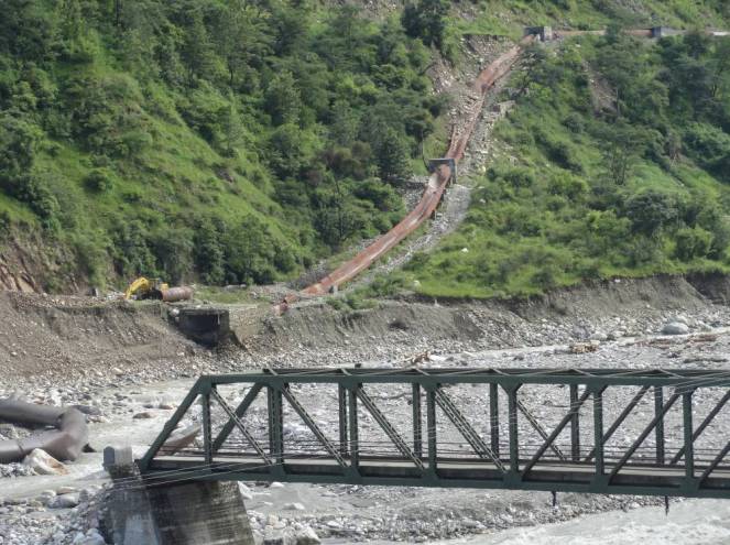


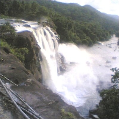


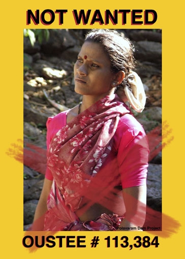


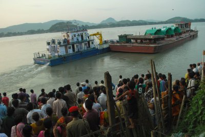

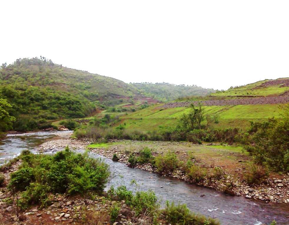
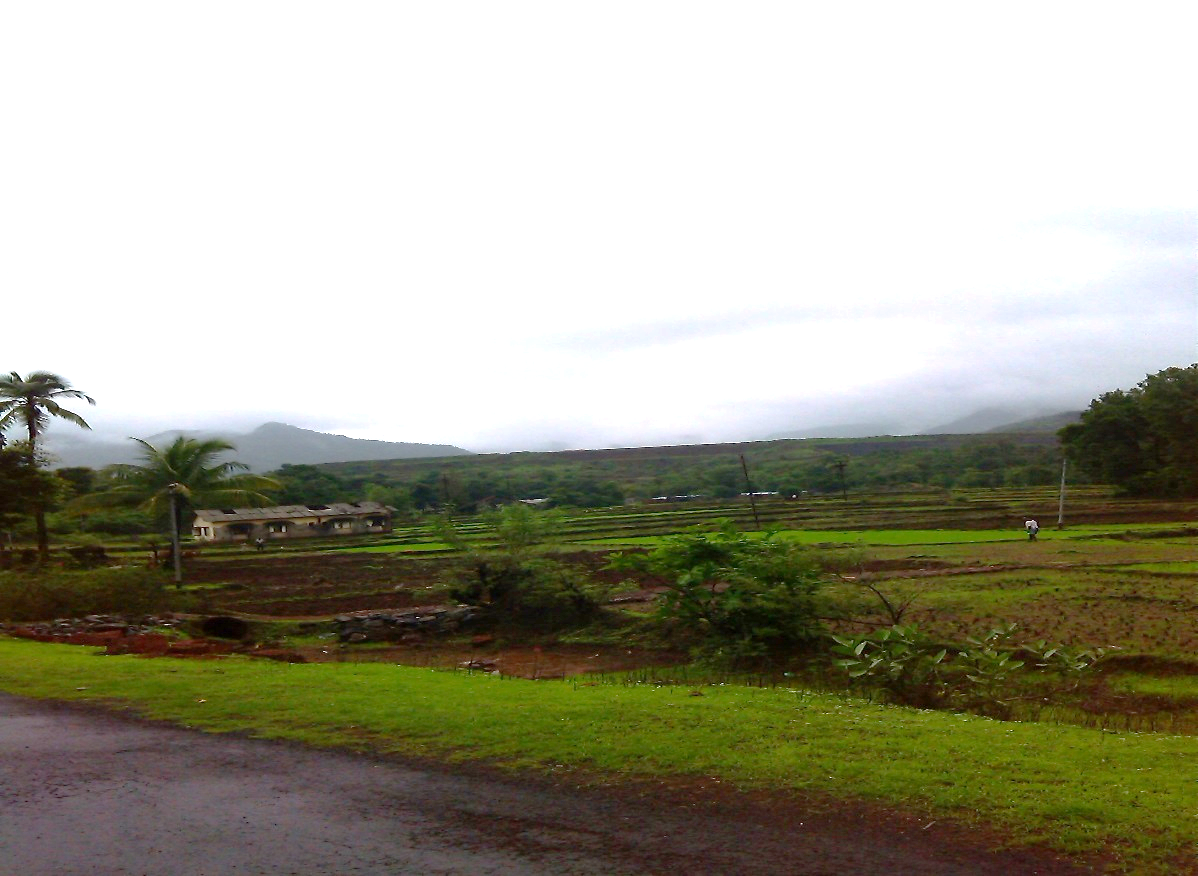


