Hydro Power Projects

2022: Environment & Forest Clearances to Dams, Hydro, Irrigation Projects

SANDRP’s 2020 and 2021 overviews on the subject can be seen by clicking the links. You may also like to visit our 2022 overviews on (1) Dam induced floods & damages, (2) Fly ash dam breach incidents, (3) Impact of floods on Polavaram project, (4) People’s resistance against dams and hydro projects, (5) Disasters and accidents at HEPs sites, (6) Dam Safety Issues, (7) Hydro projects opposition and accidents in South Asia.

Continue reading “2022: Environment & Forest Clearances to Dams, Hydro, Irrigation Projects”
Disasters · Landslide dam · Manipur

Manipur’s Ejei river blocking landslide at under construction railway line involved violations, no EIA, NGT pending case

Eighteen Territorial Army personnel among 24 people were killed in a massive landslide in Manipur’s Noney district[i] on Wednesday (June 29, 2022), and at least another 40, including 18 soldiers, are feared trapped or buried in the rubble of an under-construction railway yard. An adjoining construction camp and security camp engulfed in the avalanche of rock and mud.[ii] The Railway line is under construction since a decade.

Continue reading “Manipur’s Ejei river blocking landslide at under construction railway line involved violations, no EIA, NGT pending case”
Expert Appraisal Committee

Environment and Forest Clearances for Dam Projects in 2021

EAC Decisions In the table below, we have given details of the proposals discussed and cleared by the Union Ministry of Environment, Forests and Climate Change’s (MoEF) Expert Appraisal Committee (EAC) for River Valley and Hydropower Projects from Dec. 22, 2020 to Dec. 23, 2021.

Continue reading “Environment and Forest Clearances for Dam Projects in 2021”
Dams · DRP News Bulletin

DRP News Bulletin 15 October 2018: Reuters Corroborates that Dams Played Major Role in Kerala Floods

International news agency, after independent research, have corroborated what SANDRP has been saying: Mismanagement of dams played big role in worsening Kerala floods.

-“The release could have started earlier so that by Aug. 9 there would have been left-over capacities in the reservoirs to store the water,” said Biswajit Mukhopadhyay, director of water resources at U.S-based engineering firm IEA, who analysed some of the publicly available data at the request of Reuters.

– Still, dozens of flood victims interviewed by Reuters, who live in villages dotting the banks of Kerala’s biggest river, the ‎244 km Periyar, say they faced no floods despite torrential rain in late July and early August. All of them said waters only rose overnight on Aug. 15. That was when more intense rainfall forced KSEB to rapidly ramp-up releases of water from Idukki and Idamalayar reservoirs, which feed into the Periyar.

– Kerala’s revenue secretary and head of disaster management, P.H. Kurien, told Reuters he has twice written to KSEB requesting EAPs and has yet to receive them. KSEB’s Pillai said EAPs and dam operation manuals were still being prepared. CWC said it was working with Kerala’s government to speed this up. The Kerala Chief Minister’s office did not respond to requests for comment. https://widerimage.reuters.com/story/did-dams-make-indias-once-in-century-floods-worse  (11 Oct. 2018)

And this fantastic infographic: https://fingfx.thomsonreuters.com/gfx/rngs/INDIA-FLOOD/010080MF18N/index.html  (11 Oct. 2018)

Continue reading “DRP News Bulletin 15 October 2018: Reuters Corroborates that Dams Played Major Role in Kerala Floods”

Irrigation · Madhya Pradesh

Pawai Dam Project displacing people without Rehabilitation, allege PAFs

Above: Broken, Silted Canals of under construction Pawai Project on Ken River in MP (SANDRP photo)

The Ken Yatra while going through the Panna district were told by Project Affected People that the Pawai Medium Irrigation Project (PMP) under construction is displacing the people without just compensation or rehabilitation.

The Ken Yatra observed that the construction work of the PMP is happening in full swing in Madhya Pradesh. The dam is being built at ‘Tendu Ghat’ on Ken River in Panna district to supply irrigation water to 9952 hectares (the board at the project site erroneously says it will irrigate 30 000 ha) of agricultural land falling in Pawai and Gunnor tehsils. The construction work also involves creation of a massive canal, including a few aqua-ducts on Ken river and its tributaries.  Continue reading “Pawai Dam Project displacing people without Rehabilitation, allege PAFs”

Environment Impact Assessment · Interlinking of RIvers · NWDA

REUTER’s biased, misleading, erroneous reporting about Ken Betwa Project

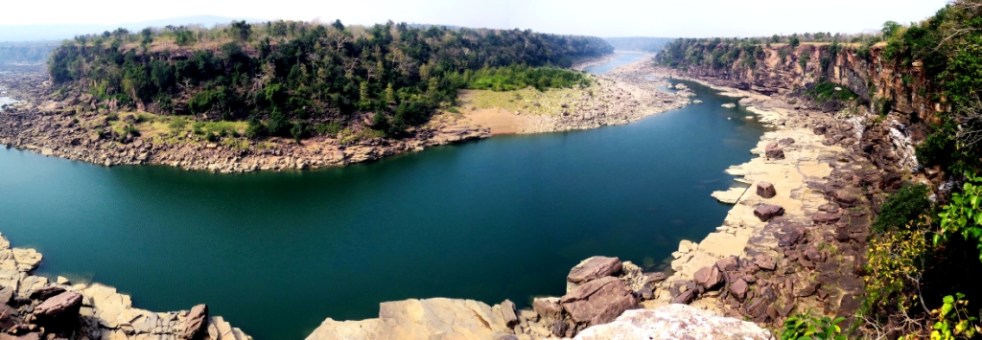
ABOVE: A fabulous view of Ken river. Nesting sites of Long-billed vultures are to the right. All will go under water if Ken-Betwa linkup is carried out, Photo by AJT Johnsingh

On Sept 1, 2017, Reuters published a report[i] about Interlinking of Rivers, with focus on Modi flagging off work on Ken Betwa Project. The report was carried VERY widely, including in local, national and international media. [This note was sent as a letter to a number of persons at Reuters and Thomson Reuters on Sept 2, 2017, there has been no response so far as I publish this several hours later.]

Unfortunately, it’s a biased, very misleading, erroneous report with factual inaccuracies that one does not expect in a Reuters report.  Continue reading “REUTER’s biased, misleading, erroneous reporting about Ken Betwa Project”

Godavari · Interlinking of RIvers · Krishna River · Telangana

Pranahita-Chevella Project: Gargantuan Project with Gargantuan Violations

Can you imagine a project-not any project, perhaps India’s largest irrigation project till date- going on for years without most statutory clearances? Can you imagine a project on which Rs 7000 Crores[1] have been spent already but its Dam height (FRL – Full Reservoir Level) is yet undecided? Can you imagine a project whose canal works are ongoing in full swing, without having any idea of the submergence? Can you imagine a Public Hearing where the Project Engineer says that the meeting is only about compensation not about environmental impacts or fundamental questions? Can you imagine a state which is set to lose thousands of hectares of rich forests, protected areas, villages for a project of a different state, but is happy to oblige? Can you imagine a Ministry which turns a stony Nelson’s Eye to a project continuing right under its nose without Environmental Clearance, Wildlife Clearance or Forest Clearance?

Continue reading “Pranahita-Chevella Project: Gargantuan Project with Gargantuan Violations”

Arunachal Pradesh · Environment Impact Assessment · Expert Appraisal Committee

Submerged – what to expect if the Dibang river is dammed

Guest Blog by: : Karthik Teegalapalli (kartix@gmail.com) a researcher with the Nature Conservation Foundation

In April 2014, the Forest Advisory Committee (FAC) decided to deny clearance to the 3000 MW Dibang Multipurpose Hydro-electric Project, the largest capacity hydro project in the country proposed to be developed by the National Hydropower Power Corporation (NHPC) in the biodiversity-rich Arunachal Pradesh State (Saikia 2014). The project was also denied clearance in July 2013. More recently though, the project has been recommended forest clearance by the FAC and Environment Clearance by the Expert Appraisal Committee. Therefore it is pertinent to look at the impacts the project may have in some detail.

Ecological impacts The project, in its earlier version involved diversion of more than 5000 hectares of relatively undisturbed grassland and tropical forest habitat. These and the adjoining forests harbour endangered species such as tiger, leopard, serow as well as the critically endangered takin, all of which are protected under Schedule I of the Wildlife (Protection) Act, 1972 (these species are also listed as present in the area in the Environmental Impact Assessment report of the project, undertaken by National Productivity Council, Guwahati). The grasslands in the area harbour the critically endangered Bengal Florican, a grassland habitat specialist (Sinha et al. 2014). Other species recorded from the area include the critically endangered white-rumped vulture, the slender-billed vulture and the white-winged wood duck. The project site lies in an area identified by the Bombay Natural History Society as a Ramsar site and an Important Bird Area (Islam & Rahmani 2004). The habitat of six endangered plants (Aconitum ferox, Coelogyne mossiae, Dendrobium aurantiacum, Paphiopedilum fairieanum, Paphiopedilum venustum and Vanda coerulea) will be submerged by the reservoir (Chernaik 2007).

The project will also affect aquatic species; the dam will block the breeding migration of four species of fish: the Vulnerable snow trout Schizothorax richardsonii, Endangered golden mahseer Tor putitora, Near-Threatened mahseer Tor tor, and chaguni Chagunius chagunio. The recommendation of the Environmental Management Plan of the Project to establish fish hatcheries for these species is impractical and can have further damaging effects on the species due to collection of eggs and spawn from the wild population.

The project will have other collateral damages such as through Compensatory Afforestation (CA) that often involves converting an area with diverse native species into monocultures, as has been shown for other dams such as the Sardar Sarovar Dam on the Narmada river (Bhatnagar 2004). The project involves CA of a relatively large area of over 100 sq. km (double the area of forest being affected by the project). The ill-effects of this conversion particularly for the project can be expected to be higher if tree-less natural grassland habitats in Dibang Forest Division, Namsai Forest Division and Anini Social Forestry that harbour grassland habitat specialists are planted with undesired native or non-native tree species. Perhaps the irreversible loss of biodiversity in the forests and grasslands that will be diverted for the project could never be ‘compensated’.

During the construction phase of the project, an estimated 32 lakh truckloads of boulders and 16 lakh truckloads of sand is to be extracted from the Dibang river basin. Unsustainable extraction of sand and boulders has significant negative effects on geomorphology, bank stability, flood character of the river, water quality, river flow, and the biodiversity in the river basin (Padmalal et al. 2008). The project during the construction is to generate 198 lakh cubic meters of muck which will be disposed in the river bank which will cause further loss of 120 ha of river habitat. Construction of new roads (64 km) and widening of existing roads (19.5 km) will also lead to removal of trees and increase the vulnerability of the region to landslides and erosion (Chernaik 2007).

Social impacts The Lower Dibang valley is currently a region of relatively low human population density (~14/km2); the entire population of the Idu-Mishmi tribe is about 12,000. The influx of approximately 6,000 project staff (which is very likely an underestimate) for a period of 8 years or more will affect their way of life, their culture and their tradition as well as open up access to relatively moderately disturbed habitat and biodiversity in the region.

Downstream effects include those on fisheries, agricultural lands and wetlands (beels) and the dam will also increase the vulnerability of the region to flash floods. For instance, in the year 2007, flash floods caused due to sudden release of water from the relatively smaller 405 MW Ranganadi project in the Lower Subansiri district in Arunachal Pradesh swamped 83 villages and caused huge loss of lives and property in the Assam State. The project will have a considerable impact on the Dibru-Saikhowa National Park in Assam which has not been studied in detail in the EIA.

On shaky grounds A critical issue with the project is that the site lies close to an active Fault Line in the Mishmi Thrust of the Mayudia Group in Eastern Arunachal Pradesh with a history of several seismic activities including the Great Assam earthquake of 8.6 magnitude in 1950 (Figure 1, Misra 2009). In the event of an earthquake, the project poses a risk of catastrophic submergence of several villages and vast areas of forests downstream. The recommendations of the Environmental Impact Assessment (EIA) report of the project are cursory and suggest further research on the natural seismicity of the region as well as reservoir-induced seismicity, which should be the basis for the decision about the project.

Figure 1 (reproduced from Misra, 2009) showing the location of the fault lines around the proposed project site. 1 is the location of the Fault line and 2 is the location of the proposed site.
Figure 1 (Modified from Misra, 2009) showing the location of the fault lines around the proposed project site. 1 is the location of the Fault line and 2 is the location of the proposed site.

Notwithstanding these, in Oct 2014 the project was cleared by the FAC constituted by the new Government, although the committee still had four of the six members who had earlier twice recommended rejection of clearance. Is this decision driven by changes made by NHPC in their project plan? Clearly not. Diversion of forests has now been reduced by a mere 9% to about 4600 hectares; instead of 3.55 lakh trees, the felling has been reduced to 3.24 lakh trees, the power generation capacity has been reduced by 2.3% and the height of the proposed dam reduced by 10 m. In fact, the FAC rejection of April 2014 was for this 10 m rejection proposal!

The beautiful Dibang valley, that faces the threat of submergence due to the Dibang Multipurpose Project (Photography by Soumya Dasgupta).

NHPC misleadingly and baselessly claimed that they ‘were not in a position to reduce the height of the dam any further, as it would significantly affect the power generation’. The decision to provide clearance to the project seems like a hasty one driven by the blinders of development and the consequences of such projects is evident from the fate of the Lower Subansiri Hydropower Project in the same State, also by NHPC. After 12 years since the LSHP was initiated and after an expenditure of over Rs. 5000 crores, the work has been on a standstill for the last 35 months as a result of India’s biggest anti-dam people’s movement (Dandekar & Thakkar 2014). Considering the economic, ecological, environmental and social costs of the project as well as the geophysical risk it poses, it would be prudent to withdraw the project till a credible, detailed cumulative study covering these aspects is undertaken in a transparent and participatory way. While the rest of the world is recognising the ill-effects of dams, with the largest dam removal project on the Elwha river in the United States completed just three months back, it is paradoxical that we are heading in the other direction; of building the highest dam in the country and largest capacity reservoir of the North East India without even basic studies, credible impact assessment and democratic decision making process.

References:

Bhatnagar, D. (2004) Uprooting Forests, Planting Trees: Success of Compensatory Afforestation Measures Mitigating the Deforestation for the Sardar Sarovar Dam, India. University of California at Berkeley.

Chernaik, M. (2007) Evaluation of the Environmental Impact Assessment Report & Environmental Management Plan for the Dibang Multipurpose Project (3000 MW) https://www.elaw.org/system/files/Evaluation+of+the+EIA+report+for+the+proposed+Dibang+dam.doc

Dandekar, P. & Thakkar, H. (2014). Manipulating Environment & Forest Clearances for Dibang Project: Déjà vu: LSHP History repeated: Will it be tragedy or comedy https://sandrp.wordpress.com/2014/10/06/manipulating-environment-forest-clearances-for-dibang-project-deja-vu-lshp-history-repeated-will-it-be-tragedy-or-comedy/

Islam, M. Z. & Rahmani, A. R. (2004) Important bird areas in India: priority sites for conservation. Indian Bird Conservation Network, Bombay Natural History Society and BirdLife International (UK).

Misra, D. K. (2009) Litho-tectonic sequence and their regional correlation along the Lohit and Dibang Valleys, Eastern Arunachal Pradesh. Journal of the Geological Society of India, 73: 213-219.

Padmalal, D., Maya, K., Sreebha, S. & Sreeja, R. (2008) Environmental effects of river sand mining: a case from the river catchments of Vembanad lake, Southwest coast of India. Environmental Geology, 54(4): 879-889.

Saikia, P. J. (2014). Six years after PM laying the foundation ston: No clearance, no work for 3000 MW Dibang Dam.

https://sandrp.wordpress.com/2014/01/31/six-years-after-pm-laying-foundation-stone-no-clearance-no-work-for-3000-mw-dibang-dam/

Sinha, A., Hoque, J., Pradhan, T., Bakshi, M. K., Pulu, J., Singh, A. K. & Ahmed, F. (2012) Sighting record of Bengal Florican Houbaropsis bengalensis (Gmelin, 1789) (Aves: Gruiformes: Otididae) in Lower Dibang Valley District, Arunachal Pradesh, India. Journal of Threatened Taxa, 4(14): 3375-3376.

Also see:
https://sandrp.wordpress.com/2014/10/23/insensitivity-analysis-of-dibang-multipurpose-project-fac-recommends-dibang-at-10-mt-height-reduction-will-destroy-4577-hectares-forest/

https://sandrp.wordpress.com/2014/05/17/dibang-project-rejected-forest-clearance-for-the-second-time/

Arunachal Pradesh · Dams

Dibang Project Rejected Forest Clearance for the Second Time

PROJECT UNABLE TO SUBMIT SATISFACTORY PROPOSAL EVEN SIX YEARS AFTER PM LAID FOUNDATION STONE!

In a remarkable decision, the Forest Advisory Committee (FAC) of MoEF has rejected the forest clearance to 3000 MW Dibang multipurpose project for the second time in its meeting held on 29 -30 April 2014. In that meeting FAC considered the Dibang multipurpose project for diversion of massive 4577.84 ha of biodiversity rich forest land which would lead to cutting down of huge 3.24 lac trees.

Continue reading “Dibang Project Rejected Forest Clearance for the Second Time”