Above: Pandhapur wari, the yearly pilgrimage on Bhima banks (Source: pandharpurwari.com)
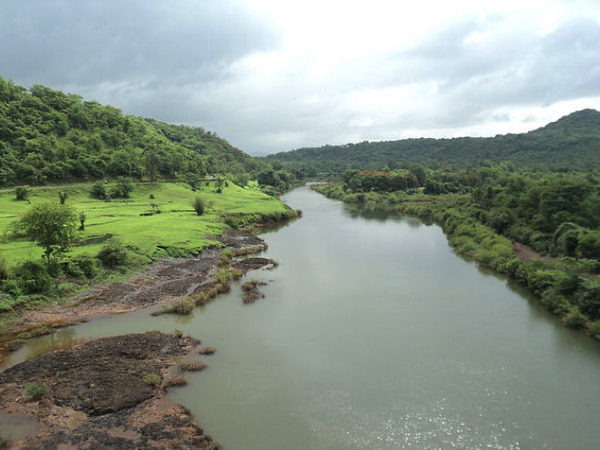
Bhima River, the largest tributary of Krishna River holds a special significance for the state of Maharashtra. The river is closely woven with the spiritual fabric of the state. The river is also referred to as Chandrabhaga River, especially at Pandharpur- the famous pilgrimage city, as it resembles the shape of the Moon. Bhima basin occupies nearly 70% area of the Krishna Basin falling in Maharashtra. Though the river originates in Maharashtra, it merges with Krishna river in Karnataka state, thus can be viewed as an independent basin.
In recent years Bhima basin has been subjected to excessive pressure of anthropogenic activities such as religious festivals attracting millions of pilgrims through the year, growing pollution by urban centres, growing sugarcane cultivation and over extraction of the river water to feed the water guzzling crop. These activities are taking toll in the river’s health and its water availability. Maharashtra state’s haste of building more and more dams in Krishna basin is most prominently visible in Bhima basin.
In this sense this sub-basin of Krishna River Basin, is its perfect miniature.
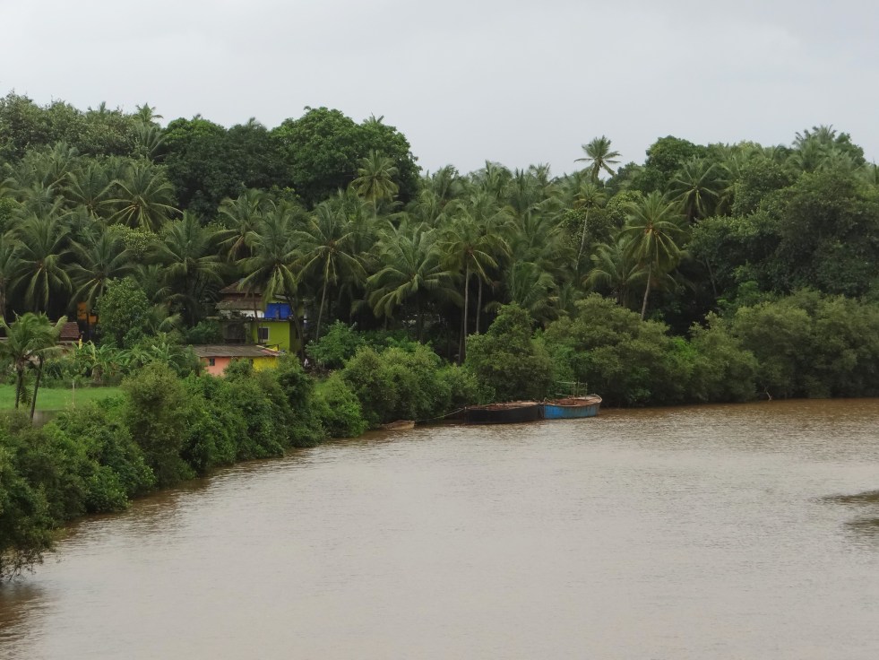
Goa, twenty fifth state of the Indian Union, is small but picturesque state, famous all over the world as “The Tropical Paradise of Tourists”. Ensconced on the slopes of Western Ghats which skirts its eastern boundary and lapped by the blue expanse of the Arabian Sea in the West, Goa admeasures an area of about 3,702 sqkm. Situated between Karnataka and Maharashtra, Goa is bounded on the North by the Terekhol river, surrounded on the South and East by Karnataka while on the West is the Arabian sea. This state is divided into two districts, North and South, administered from Panaji, the capital city and Margao, respectively.
Eleven rivers are sustaining the Goan ecosystems. These rivers have sustained the earliest forms of human habitation. The discovery of rare Stone Age carvings on the banks of Kushavati and Zarme rivers stands testimony to this. From the period of Satvahanas, Chalukyas of Badami, Bhojas Kshatrapas and Abhiras, Traikutas of Konkan, Kalachuris, Mauryas of Konkan, Shilaharas, Kadambas…. the Goan rivers have encouraged development of civilization. However excessive load of anthropogenic activities such as mining, tourism etc. have been affecting these rivers from past few decades. While many of the big rivers are critically polluted, many small ones face threat of extinction. Urgent steps need to be taken to protect the rivers of this state which is more intimately linked with its rivers due to unique physiography. Continue reading “Goa River Profile”→
Karnataka is still reeling from the protests, rasta roko, bandhs, burning effigies, etc., resulting from the anger over the Interim Verdict of Mahadayi Water Disputes Tribunal[i] (MWDT) of the 27.07.16 which did not allow Karnataka’s Appeal to temporarily lift 7 TMC (Thousand Million Cubic Feet) water from Mahadayi Basin into Malaprabha Basin (a sub basin of Krishna basin). Twin cities of Hubali and Dharwad, likely beneficiaries from the diversion, are centers of agitation. Schools and colleges were closed, government offices and buses were burnt, major roads were blocked by protesters. Pro-Karnataka Organizations and even Film stars have joined this protest. Karnataka Home Minister has called on the Prime Minister to look into the decision. Goa, on the other hand, is quietly celebrating this one positive step[ii]. I was reminded of Rajendra Singh’s uncritical support to the project and also what Dr. T V Ramchandra from IISC, Bangalore said about this, “Do the film stars know the details of the issue or even where their water comes from? The day we push Pudharis away, solutions to our water woes will be easy and closer to home.”
I have returned from Mhadei/Mandovi Basin recently, tracing her footsteps near her origin to the sea and it is difficult to conceive that this veritable treasure trove of serenity and beauty is today a bone of contention, leading to unrest and violence. Continue reading “Mahadayi Water Disputes Tribunal: Trouble brewing in Paradise”→
“Konkan” is the narrow strip of land encompassing coastlines, estuaries, lateritic plateaus, foothills of Western Ghats and dense forests, which runs from Maharashtra to Goa. It is bound by the Arabian Sea to its west and the mighty Sahyadri ranges (Western Ghats) to its east. The isolated region has a distinct and rich culture of folklore, performing arts, music, literature, culinary art, with subtle changes from north to south. The region receives heavy rainfall of about 2500-3500 mm in summer monsoons, with the lofty Sahyadri ranges blocking the moisture-laden clouds.
The rivers in the region are as spectacular: gushing and gurgling over steep hilly paths and meeting the Arabian Sea in just about 100-150 kilometers from their origin in the Western Ghats. The steep and hilly terrain makes it difficult to build large dams, (though we keep trying unsuccessfully as can be seen here: https://sandrp.wordpress.com/2016/02/09/large-dams-in-konkan-western-ghats-costs-benefits-and-impacts/) and water resource managers never fail to point out that of the total yield of rivers in Maharashtra, 45% is from of the West-flowing rives of Konkan!
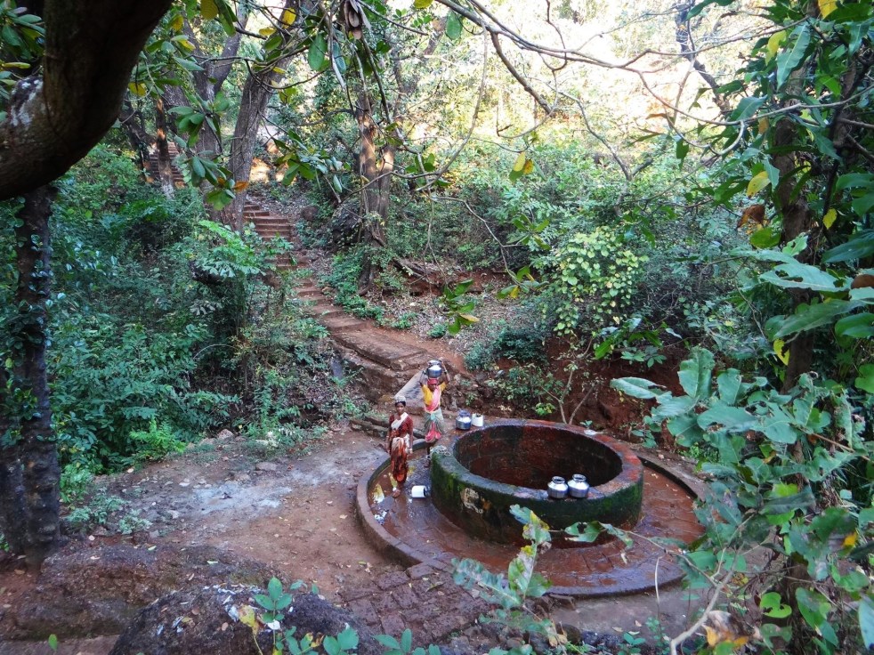
Having said that, the tempestuous nature of rives, rocky terrain and steep slopes mean that rives dry up as fast as they swell. The lifeline here is not surface water, but groundwater…Groundwater that emerges from springsas the predominant porous laterite rock meets a layer of clay..or dug wells…or unique water harvesting structures crafted by local communities.
Here is a glimpse of some such structures…to appreciate not only the utility and appropriateness, but beauty of small, local structures and traditional wisdom. Also important to note is the diversity and independence of water management in Konkan: as in India..where communities own, maintain and manage their own water. There is a special kind of power and magic in this independence.Continue reading “Many colors of groundwater in a tiny Western Ghats village”→
Konkan is that narrow and spectacular strip of land encompassing coastlines, estuaries, lateritic plateaus, foothills of Western Ghats and dense forests, which runs from Maharashtra to Goa. Bound by the Arabian Sea to its west and the mighty Sahyadri ranges (Western Ghats) to its east, the region has a distinct and rich culture of folklore, performing arts, music, literature, culinary art. Konkan, its temples, rivers and forests have an entire Sahyadrikand of the SkandPurana dedicated to it. Several poems and songs have been penned about the beauty, the mystery and the people of this region. Many of our celebrated singers, poets and authors come from Konkan. Community conservation practices that thrive here include some of the most pristine Sacred Groves, Temple Tanks, Fish Sanctuaries and sacred trees.Continue reading “Large Dams in Konkan Western Ghats: Costs, Benefits and Impacts”→
How a 15 MW project with 55 mts high dam threatens 5 villages and a fish sanctuary
After an analysis of a particularly nasty dam, I felt like going back to flowing rivers. It is monsoon after all. The plan was to visit Kal River in Western Ghats of Raigad District in Maharashtra to understand how a community in a small village called Walen Kondh is protecting the river and Mahseer fish. Mahseer (Deccan Mahseer, Tor tor) is classified as endangered as per IUCN classification and most wild Deccan Mahseer populations have been wiped out in India. And hence a small, out of the way place, protecting these fish as well as the river voluntarily was like a breeze of fresh air. Continue reading “White Elephant, Black Fish”→
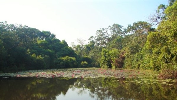
Above: Wetlands in Western Ghats Photo: Parineeta Dandekar
On this World Environment Day, a number of images leap to mind from the past year: Prime Minister of India performing the famous Ganga Arati after elections to new species of fish and frogs discovered (again) from Western Ghats. From TSR Subramaniam justifying his Committee Report which seeks to disintegrate the environmental governance of the country to Jadav Payang, single-handedly planting thousands of trees in Assam. From the filthy Yamuna flowing through the national capital to the unseasonal rains that damaged crops of millions of farmers. Continue reading “Remembering Wetlands on World Environment Day”→
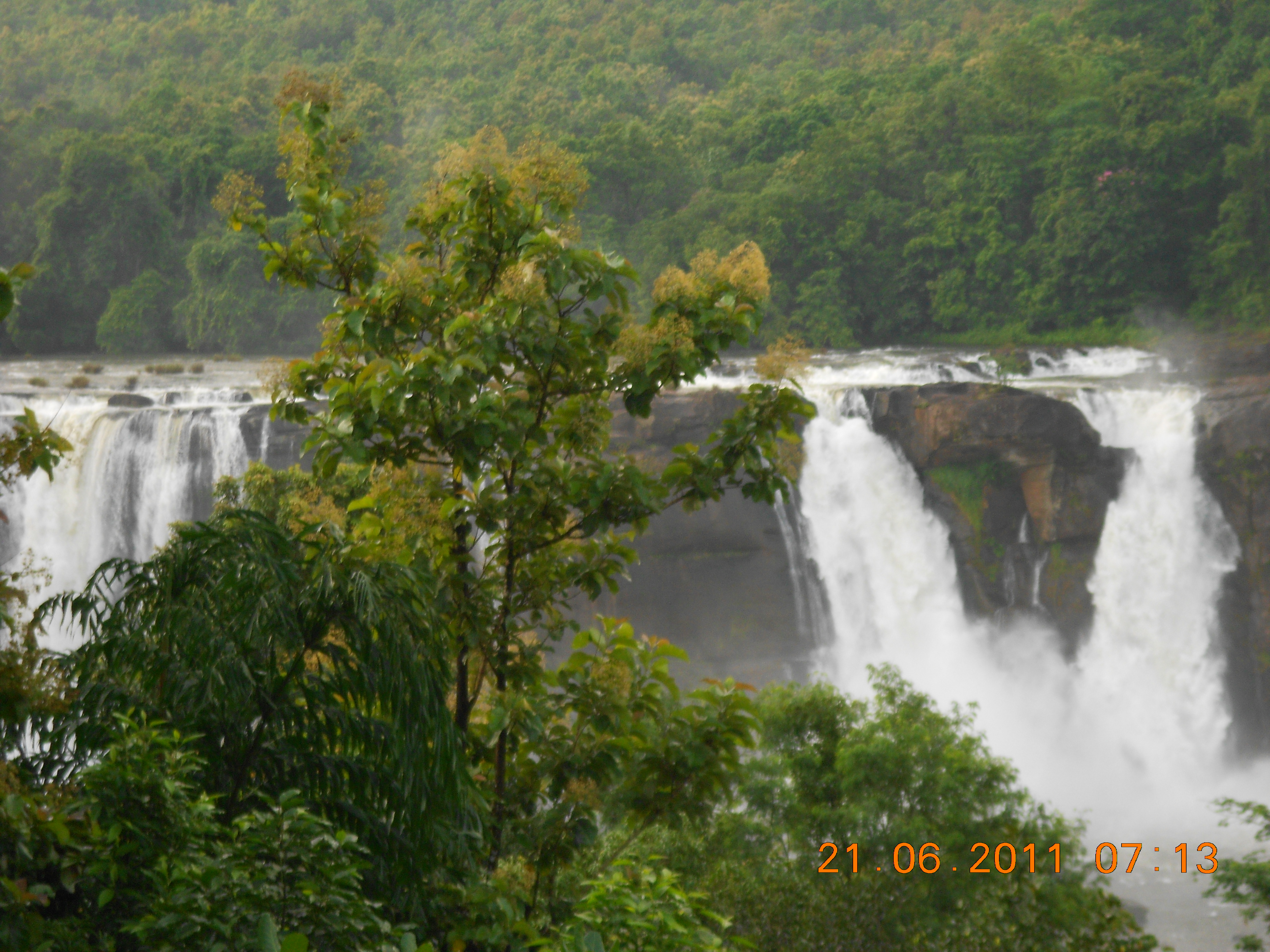
Above: Latha with her friends at Athirappilly Falls. Photo: Parineeta Dandekar
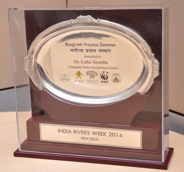
It is difficult for me to write impersonally about the work of Bhagirath Prayas Samman recipient Dr. Latha Anantha. She is Latha Chechi to me, a close friend and more of a sister. The bond is based on water and rivers, possibly stronger than blood. This is only an attempt to introduce the readers to the exemplary work of Latha Chechi (and that of the River Research Centre and Chalakudy Puza Samarakshan Samithi team) as the recipient of the first Bhagirath Prayas Samman for “exemplary capacity for combining sound research with the mobilization of community, political and state agencies, and for ushering in a unique methodology of consensus- based conservation of rivers in the country’”.
Ravi from CPSS receiving Bhagirath Prayas Samman Award on behalf of Dr. Latha, from Justice Madan Lokur
Latha is an agricultural scientist by education and holds a doctorate in the subject. But how did she start working with rivers? In 1989, Latha was a part of a nature camp which took her and many like her into the Silent Valley National Forest. Then, Silent Valley National Forest was declared as a protected area only 4 years back after protracted, and possibly one of India’s foremost anti-destructive dam struggle, led by people. (A fascinating account here )
It was here that, under the guidance of Dr. Sathish Chandran Nair, Latha saw that while forests of Silent Valley are the birth place of beautiful river Kunti, Attapadi region was devoid of forests and most streams were dried up. The Bhavani river was hardly flowing there. The contrast was self revealing. It was here that the connections between forests and water and rivers and tribals and wildlife were forged. She says she was a changed person after witnessing all this.
In 1995, Latha married Unnikrishnan, also an ardent river lover and activist (and a poet!) and together they conducted several nature camps for children and young adults all over Kerala, always coming back to the Chalakudy River and her thick forests near Vazachal and around. By then, she had made friends not only with the river, but with the Kadar tribes who lived with the Chalakudy, on her banks, one amongst them was young Geeta. The learning and exploring continued for a few years, until in 1998 they heard that a dam project on Chalakudy, the Athirappilly dam, had received sanctions from Delhi. They were shell shocked. Back in 1998, this couple and their friends like Ravi, in a remote part of Kerala knew nothing of EIA Notification, sad monotony of sham EIAs, compromised EIA agents, project-friendly meetings at MoEF, nothing. But they persevered.
Helped by stalwarts like Dr. V.S Vijayan, Dr. Sathish Chandran Nair, this tenacious group slowly put the jigsaw puzzle together, piece by piece. They understood the EIA Notification of 1994, got hold of the EIA and saw how the Kadar tribe, living just by the river was not even mentioned. They say how the fact that Chalakudy was already dammed six times before it comes to Athirappilly and how 35% of its flows are already diverted was hidden from the EIA. .Kadar tribal settlement was mentioned incorrectly outside the project impact area. Latha by then also realized that the mandatory public hearing was also not conducted for this project.
Now there was no stopping this group, which also included hydrologist Madhusoodan and botanist K Amitha Bachan. Ravi and Unni filed a case in Kerala High Court in 2001, challenging the EC granted to Athirappilly and Latha & team did all the research, putting together a water-tight case. The court ruled in favor and asked for a fresh public hearing.
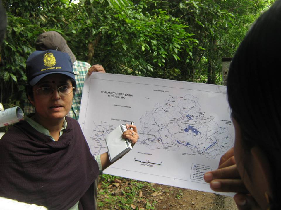
Latha and friends already had strong ties in the Chalakudy region. This was not a single day affair, but a trusted relation built over years. The tribals knew this team’s love for them and their river. They listened and they discussed. They were aghast at the dam building plans. The public hearing saw overwhelming participation not only from the tribal communities, but from scientists, shop keepers, hotel owners, farmers, gram panchayat members, etc. The District Collector witnessed this and would not push the project until a river basin study was done, possibly the first such in India.
Public Hearing of Athirappilly Project
There was a lull in the meantime, giving a false sense of security for these Chalakudy lovers. But it also gave them time to get introduced and work with friends like Himanshu Thakkar from South Asia Network on Dams, Rivers & People (SANDRP), Shripad Dharmadhikary from Manthan with whom they had been in touch for long, supporters like Dr. Ramaswmay Iyer, etc. Through SANDRP, in 1998 itself, the group had made submission to the World Commission on Dams opposing the Athirapally project. The CPSS, in collaboration with SANDRP, organized a meeting on the report of the World Commission on Dams at Thrissur on June 22-23, 2002. A meeting against Interlinking of Rivers in Kerala was organized by CPSS and SANDRP on July 12-13, 2003. A book “Tragedy of Commons: The Kerala Experience in River Linking” was published in 2004 by River Research Centre & SANDRP.
Shripad Dharmadhikary at Charpa Falls, also threatened by the Athirappilly project
But Athirappilly dam plan put up its head again in February 2005 when the project gained Environmental Clearance through back door from the MoEF. This time the EC was challenged by none other than the young Geeta, the Kadar woman, living on the banks of the Chalakudy who filed a PIL in the High Court of Kerala in April 2005 challenging the new Clearance granted to the project. The Athirappilly Gram Panchayat President also filed a PIL on EIA violations. The High court again upheld the plea and ordered for a public hearing afresh! This public hearing in 2006 witnessed massive turnout of the tribal community members.
Geeta ji, the petitioner for Athirappilly Project in the backdrop of the falls. Photo: Parineeta Dandekar
In the meantime, Latha also wrote to Jairam Ramesh to intervene in the issue and Unni and Lathachechi met him personally when he was in Kochi. He issued stop Memo to KSEB on January 4th 2010. After this KSEB again approached MoEF. Once again PIL was filed in HC challenging the EIA in 2007 and is still pending in the HC.
This proposal was again recommended environmental clearance by the Ministry of Environment, Forests & Climate Change’s Expert Appraisal Committee (EAC) on River Valley Committee in their meeting in May 2007. However, following directions by Kerala High Court to KSEB, the project came back before EAC in March 2010 and was again discussed in April 2010 and July 2010, till when no conclusion could be reached by EAC and EAC had asked for more information and clarifications. There is no mention of the project in any of the minutes of the subsequent EAC meetings[1].
Since then there has been a lull on the plans though it has not died out completely. River Research Centre, though existing since many years back informally, was formally registered as a Trust. RRC, Chalakudy Puzha Samrakshan Samiti and Latha’s dedication is one of the strengths of Athirappilly waterfalls, which would have been dammed and dried long before if it was not for this people-led, nonviolent struggle.
The Athirappilly Falls
Latha was simultaneously working on campaign against the proposed Pathrakkadave HEP across Kunti River near Silent Valley National Park on several angles such as community mobilisation, EIA, Public hearing, etc. The very destructive dam project has been stalled and the public sentiment and pressure is very big on this project as not to build the dam.
Since early 2000, she has also been involved in education program for children along the banks of the Chalakudy River. RRC and the Schools for Rivers program were instrumental in forming a ‘Kuttikoottam’ (meaning a group of children) of more than 50 children aged between 10-20 years who would set out to know more about their panchayath, its natural resources, human resource potential, culture, folklore, institutions, governance, destruction of environment, problems faced by the river and related livelihoods etc. ( More on it here)
While working on environmental governance and advocacy, CPSS has also worked on novel and promising initiatives like Reservoir Reoperation Model. The project is steered by CPSS and Forum for Policy Dialogue on Water Conflicts in India of which Latha is a Steering Committee member.This model is specifically aimed at dammed rivers, where impacts are supposed to be a way of life. In the much-dammed Chalakudy, RRC, with its dedicated members like Ravi and others demonstrated how operations of a hydropower scheme can be and should be changed to maintain summer irrigation in the downstream and also rudimentary flows for the river. This is far from perfect, but a great step in the direction. At the heart of these processes is joining the dots and bringing people together: from power company, irrigation department, farmers, local self-governments, etc. In April 2013, the CM of Kerala agreed to increase the off peak generation of Poringalkuthu Left Bank Hydro Electric Project. More on this here.
Latha also played an active role in the Save Western Ghats Movement group. In a meeting of this group Kothagiri in Keystone Campus, Environment Minister Jairam Ramesh made the announcement of Western Ghats Expert Ecology Panel, after relentless advocacy by the group, including Latha. The subsequent Panel under the leadership of Dr. Madav Gadgil and what followed had deeply affected the environmental discourse in India. The way MoEF and government of India hid Gadgil report was a shameful, underlining the unwillingness of the administration to take any visionary or long term actions towards people-led environmental governance. Along with organization like Goa Foundation, RRC was a part of the petition filed in the NGT against this opacity and for implementation of the Gadgil Report. The court ordered the MoeF to bring out the Gadgil report. The din that followed, especially in Kerala, was massive and bewildering. Gadgil Report was then subsumed to the problematic Kasturirangan Committee, which decision itself was flawed. Powerful interest lobbies, including religious groups, did not miss a single opportunity at misleading locals about eco sensitive areas. If Western Ghats was tense, Kerala was in the eye of the storm. At this juncture, Latha chechi came out and wrote about Kasturirangan Committee report as one of the reason for political polarization for Kerala, and asked for a sane and democratic approach through the Gadgil Report. Latha organised meetings as well as participated in many meetings and debates organised on the subject all over Kerala.
She has also been working endlessly on the issue of eflows, from upcoming as well as existing dams and has engaged consistently with the MoEF on this. Way back in 2009 RRC, along with SANDRP and Svaraj organized the first consultative National Workshop on Eflows. She has also co-authored the first Primer on Environmental flows, aimed not at scientists, but at community groups and activists who are more likely to urge for the implementation of the concept of eflows. (http://www.internationalrivers.org/files/attached-files/eflows_primer_062012.pdf)
While keeping a balanced, soft spoken and people friendly stand she has not shied from criticizing consultants like NIH and CIFRI for their shoddy eflows assessments. She has served on several government appointed committees in Kerala and has been a resource person for countless programs on rivers and forests. She also serves as the South Asia Advisor, International Rivers and is the Ashoka Fellow, 2012.
Latha’s story, intrinsically linked with River Research Centre, CPSS, Chalakudy River and beyond is a story of soft spoken courage. It is a story of bringing people together and looking at a river as a shared heritage, not only as a part of a conflict.
Today, Latha is undergoing a challenging time physically, undergoing several rounds of treatments. But mentally, she is the same strong and sensitive river woman of the Western Ghats.
She is a natural recipient of the Bhagirath Prayas Samman and we look forward to having her back with us soon in her full form: singing, laughing and loving rivers as she does..
Parineeta Dandekar (parineeta.dandekar@gmail.com)
Near Jog Falls on Sharavati, made dry by the Linganmakki Hydropower Project Photo: Parineeta Dandekar
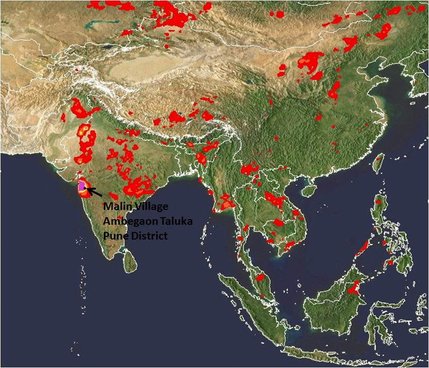
In the tragedy at a tiny village of Malin in Ambegaon, Maharashtra, as per reports till now, around 40 houses are under huge debris created by a landslide that occurred early in the morning on the 30th July 2014. The death toll till now is reported to be 44 with 150-300 missing as per different estimates. Unfortunately, the chances of survival of the missing are dim as per the Chief of Rescue operations.
Destruction at Malin Photo by Atul Kumar Kale Local activistPhoto by Atul Kumar Kale
Let us look at some key factors at play here:
VERY HEAVY RAINFALL: This region is nestled in the Northern Western Ghats which receives heavy rainfall in the monsoons. The region was receiving particularly very heavy rainfall in the week between 25th to 31st July. SANDRP had posted an alert on this on SANDRP Facebook page (https://www.facebook.com/sandrp.in) on the night of 29th July.
Cumulative rainfall in the week as recorded by NASA’s (The National Aeronautics and Space Administration of US) TRMM (Tropical Rainfall Measuring Mission, see: http://trmm.gsfc.nasa.gov/publications_dir/instant_2.html) was more than 600 mm, most of it between 29th-30th July. In fact on the 29th July, the region including Malin was shown purple in 24 hr rainfall map, which signifies the highest range of rainfall, exceeding 175 mm.
The region is still experiencing heavy to very heavy rainfall as we write this on Aug 1, 2014.
Malin receives very heavy rainfall on the 29th July, 9 pm by NASA TRMMMalin receiving high rainfall on the 30th July 2014, 9 pm IST NASA TRMM
It was surprising to read report from Down to Earth about “mere 4 mm rainfall in 24 hours” before the landslide, which is clearly not the case.
With changing climate, frequency of such high intensity rainfall events is predicted to increase, making these areas even more vulnerable to disasters like landslides.
Landslide Warning
Following the very heavy rainfall in the regions around Northern Western Ghats, extending till Gujarat, NASA’s TRMM had also highlighted this region to be strongly landslide prone on the 30thof July.
See NASA TRMM Landslide Prone Area Map on the 30th July 2014 below which highlights Bhimashankar and Malin region:
NASA Landslide potential Map, 6 pm IST on July 30, 2014
The dam connection:
The Malin village is approximately 1.5 kms from backwaters of the Dimbhe Dam, which is an irrigation project involving a big dam completed in 2000. On the 31st July, the dam held 44% of its live storage, that is about 156 MCM (Million Cubic Meters) of water. The link between water level fluctuations in dams and landslides in the rim of the reservoir and backwaters is well documented. Some geologists have also recorded increased landslides activity in areas surrounding Dimbhe Dam in the past. ( http://timesofindia.indiatimes.com/City/Mumbai/More-landslides-likely-in-5km-radius-of-Dimbhe-dam/articleshow/39314716.cms) Even if the dam was not overflowing when the tragedy occurred, it is well known that the dams can induce such landslides around the rim in view of standing water with fluctuating levels, change in drainage pattern and underground water flow pattern.
Google map showing Dimbhe Dam and location of Malin village close to the backwaters
Key salient features of Dimbhe dam: Ht: 67.21 m; Lengh: 852 m; Live Storage Capacity: 354 MCM (www.mahawrd.org); Reservoir Area: 1754.7 ha.
The role played by the dam and its operations on the geology of the region and its possible connection with the landslide needs to be investigated in depth.
Landslides are not entirely new for the region
The region has seen some landslides in the past (e.g. in 2006-7) according to Saili Palande Datar, an ecologist and historian with Kalpavriksh. According to Anand Kapoor of NGO Shashwat active for decades in the region, a landslide had occurred earlier than that, where some cattle were buried and people had to be rescued. In a massive landslide on July 23, 1989, in village Bhaja in Mawal about 60 km from Pune, 39 people were killed.
In the Western Ghats of Pune as well as Maharashtra, a number of landslide-related tragedies have happened. According to a resident of village Tikona Peth in the catchment of Pavana Dam in Mawal tehsil of Pune, a landslide took place in in her village July, 1994 after heavy rains. There were no casualties, four houses were demolished by huge rocks. In August 2004, one person died due to landslide in Male, near Pune, in 2004 again, a worker died due to landslide in work related to a tunnel for a lift irrigation scheme, in June 2005, 4 workers died due to landslide at a tunnel of Ghatghar hydroelectric project.
Role of large scale land modifications in the region
Indeed according to a landslide map developed by Dr. David Petley, International Expert on Hazards and Risks in the Department of Geography at Durham University, the entire region of Western ghats has experienced landslides.
Dr. Petley has also written about the Malin Landslide here: http://blogs.agu.org/landslideblog/2014/07/31/malin-landslide-1/.
Dr. Petley told SANDRP, “Large scale land use modification and deforestation is the issue here”. He further said: “I would hypothesise here that the very heavy rainfall was the trigger, thick weathered soil, the shape of the slope and poor management of development and of water. A proper investigation should be able to ascertain whether this is right, but such large-scale modification of the landscape should be resisted.”
From Dr. David Petley: Landslide events where fatalities have occurred. We can see that Northern Western Ghats also features regularly in the map.
Landscape modifications around Bhimashankar
Bhimashankar region, the origin of river Bhima which is an important tributary of Krishna, is a high rainfall region with spectacular biodiversity. It is also home to Maharashtra’s state animal Malabar Giant Squirrel. The region is home to a vibrant tribal community which has seen several assaults on its way of life through the formation of the sanctuary, displacement caused by Dimbhe & other Dams, recent windmill projects, etc.,
In the recent years, some of the major landscape changes occurring in this region are through mechanised terracing of slopes for cultivation as well as developments related to windmill projects on mountain tops, which entail deforestation as well as road cutting on steep slopes. Although there are no windmill farms in Malin, such farms exist in the neighbouring Khed tehsil. Plans for such farms in Ambegaon are in the pipeline.
It needs to be understood that terracing for cultivation has been a traditional occupation of the tribals in this region, as in most of the Western Ghats. Not only is it an important livelihood support factor, but it has been limited by its scale, location and implementation due to its inherent manual nature. According to Anand Kapoor of Shashwat, tribals themselves do not prefer terraces made by JCBs and other machines as these are not entirely suitable for cultivation.
However, it is also a fact that now some government departments are using heavy machinery like JCBs in their bid to push terracing program. Unscientific mechanized terracing, which comes together with muck dumping, slope instability, affected drainage etc., can play a huge role in magnifying the impacts on a naturally vulnerable, high rainfall region.
In fact, a preliminary report by the Geological Survey of India (GSI) has singled out land flattening and terracing by heavy machinery as one of the primary causes for the tragedy. As per the preliminary report, a team of GSI experts noticed cracks where heavy soil erosion had occurred. The Deputy Director General of GSI has said that these cracks are a result of improper drainage system of rainwater. The flattening of land would have affected the water drainage resulting in the cracks. He says: “The slope of the hill was flattened almost halfway for agricultural purpose to such an extent that the hilltop had become unstable. The experts have also reported excessive deforestation disrupting the ecology of the hill. Added to this was the damage caused by use of heavy machinery over two years.” The Director General and Deputy Director General will be visiting the site on the 2nd and 3rd August for further analysis.
An independent credible review of the way the land levelling activities are going on under government policies and programs should be immediately instituted and till its report is available, use of heavy machines like JCB may be minimised.
Management of the region according to Western Ghats Expert Ecology Panel (WGEEP) Report and High Level Working Group Report (HLWG)
Both reports place Malin in Ecologically Sensitive Zone I and Ecologically Sensitive Area (ESA) respectively.
An ESZ I tag by the WGEEP report regulates a number of activities in the region, with participation of local communities. The report has specifically mentioned threat of landslides in this region.
While noting the impacts of windmills in the region surrounding Malin, WGEEP notes: “Apart from substantial forest destruction (including Forest Department estimates of about 28,000 trees being cut) via wide roads cutting huge swathes through Reserve Forest, the wind mill project has triggered large scale erosion and landslides through poor construction of roads with steep gradients, and all this rubble is ending up on fertile farmland and in reservoirs of tributaries of the Krishna.
The Forest Department is colluding with wind mill project operators in also illegally denying citizens access to these hills. Boards and check-posts have been put up by the company, falsely claiming to be authorized by the Forest Department. There are many traditional forest dwellers on these hills. Not only are their rights under the Forest Rights Act not being recognized, they are being illegally restrained in their movements on hills they have inhabited for centuries.”
If the WGEEP was accepted by the MoEF and state governments, this would have led to a more people-centred and ecologically-sound management of the Western Ghats region, but Maharashtra has been vehemently opposing WGEEP on the most unjustified grounds and the MoEF too has been busy downplaying the WGEEP.
While HLWG did include Malin village in its list of Ecologically sensitive Areas, however, this ESA tag did not mean much for the region it only regulates mining and red category industries. Most of the development activities that might threaten the region are not regulated by the HLWG. More importantly, HLWG has no role for the local communities in democratic decision making. There is also no mention of this region being landslide-prone in the HLWG, whereas the WGEEP specifically highlights this issue.
It is clear that HLWG is not much help for the region in avoiding tragedies like the Malin tragedy, but WGEEP report certainly would have helped.
Way forward
Northern Western Ghats which are characterized by heavy rainfall, rich biodiversity and predominant tribal population need more sensitive management approach than what it is subjected to right now. Although WGEEP had paved way for a more democratic, equitable and people-centred management of the region, the report was hidden, downplayed and finally rejected by the state as well as the central government. Episodes like Malin highlight the vulnerability and complex inter-linkages that affect the region which require a long term planning vision, integrating a number of components.
Despite this, several ill-conceived projects like townships, windmill farms, large dams and river linking projects like Damanganga-Pinjal and Paar Tapi Narmada are proposed in the region. Close to Bhimashankar region, Mumbai Metropolitan Regional Development Authority (MMRDA) as well as the Greater Mumbai Municipal Corporation are pushing more than 12 large dams. Some of these dams entail huge tunnels under the mountain ranges of Western Ghats. Despite the several risks and impacts, many of these massive dams may also escape scientific Impact Assessments or public hearings. These projects needs to be opposed and urgently dropped as there is little justification of the projects in view of huge number of options available in the cities for which these dams are proposed.
Similarly, Maharashtra Government has plans to build three huge hydropower dams in the Velhe and Mulshi region, which also falls in the Pune District. Velhe region has already seen slope instability and also falls in Seismic zone IV, making any such development highly risky there.
Let us hope that the heart-breaking tragedy at Malin is a wake-up call for all of us, paving way towards more sensitive,responsive, democratic and sustainable management of the Western Ghats. As a first step, the state and central government need to accept and implement the recommendations of the WGEEP immediately in Malin and for the entire Western Ghats.
Maharashtra SBWL The State Board for Wildlife has been formed under the Section 6 of the Wildlife Protection Act (1972) (and its subsequent Amendment in 2002) in all states of the country. The main functions of this Board are conservation and protection of wildlife in Protected areas, selection and appraisal of areas to be declared as sanctuaries, etc. It also appraises proposals which affect Protected areas or buffer zones around Protected areas and only after the recommendation of the State Board for Wildlife (SBWL), is the proposal forwarded to the Standing Committee of the National Board for Wildlife.
In Maharashtra, Chief Minister is the Chairperson of the Board, while chief wildlife warden is the member-secretary. Forest minister is the vice-president of the board and minister of state for forest, FDCM (Forest Development Corporation of Maharashtra) managing director, head of forest force (HoFF), field directors of tiger reserves, principal secretary (forest), and principal secretary (tribal development) among others are on the board.
Apart from the government representation, the SBWL also has sizable representation from reputed Wildlife Experts and organizations, some of which have been the members of the SBWL for more than a decade now. Some members include: Sanctuary Asia editor Bittu Sahgal, Bombay Natural History Society’s (BNHS) Dr. Asad Rehmani, Satpuda Foundation’s Kishor Rithe, Bharati Vidyapeeth’s Dr. Erach Bharucha, Executive Director of Wildlife Protection Society of India (WPSI) Belinda Wright, Wildlife expert Anish Andheria, Wildlife Conservation Trust’s (WCT) Hemendra Kothari, Eco-Pro president Bandu Dhotre, MLAs Anandrao Gedam from Armori and Jagdishchandra Valvi, Honorary Wildlife Warden of Pune Anuj Khare etc.
SBWL minutes, Agenda not in public domain Due to some problematic projects considered in the NBWL from Maharashtra, SANDRP tried to access the minutes of the SBWL to understand it’s functioning and decision making. We could not find the minutes in the open domain, the minutes should have been available on the website. Even the agenda and minutes of the National Board for Wildlife which recommends Wildlife Clearance, Expert Appraisal Committee of MoEF which recommends Environmental Clearance or the Forest Advisory Committee which recommends Forest Clearance are available in public domain.
RTI gets no reply We wrote to the Principal Secretary, Revenue and Forests, and PCCF, requesting them to share the minutes but we received no response. We wrote to some members of the SBWL for the minutes, we received no response. ( We could not write to all members as the constitution of the Board and list if members too is not available in the open domain).We contacted the media persons who wrote on SBWL meetings, but they did not have access to minutes. In the meantime, many problematic projects like Gargai Project involving 750 hectares inside the Tansa Sanctuary, Nardawe Irrigation Project, Shirapur Lift Irrigation Scheme, which involved clear violations, were recommended by the SBWL. We wrote about these projects and violations involved to some members, but received no response.
Nardawe Dam is more than 60% complete and has violated EPA (1986), EIA Notification (2006), Forest COnservation Act (1980), FOrest Rights Act (2006) as well as WPA (1972). This project was recommended by the SBWL in its last meeting Photo: SANDRP
Finally we filed an RTI for all past agenda items and minutes of the SBWL. We filed this RTI in April 2014 with the Wildlife Department, Nagpur. Again we received no response. When we called the PIO, Wildlife Division, we were told “There are 32 PIOs in the department, How on earth would they know where our application is?” We talked with the Principal Chief Conservator of Forests, but he asked us to file an RTI again as the original application was untraceable at the office. We filed a new application, even this time we did not get a response in the mandated 30 days. To cut the long story sort, we received half of the information we asked for 3 months after the application. In the meantime we were also told by the office that these proposals are considered by NBWL again, so why are you worried?
Of the 8 Meetings of the SBWL conducted, we received agenda notes and minutes for 4 meetings exactly over 4 years: from 4th meeting in 20.02.2009 to the 8th Meeting in 20.02.2014. The decisions of the SBWL in these meetings on WRD projects are compiled in the table at the end of this report.
As we will see below there are many concerns about the way SBWL is functioning. This is worrisome because the current 33-member committee has ample number of non-government representatives, some noted wild lifers who are passionate about their work. Some of these organisations and individuals have been a part of the SBWL for more than decade now. Although the SBWL is not functioning transparently and accountably, we hear no protest from these members or demands that SBWL needs to function in a transparent way in the open domain. Neither is any dissent minuted in the SBWL meeting minutes.
At the same time, we are aware that some members are trying to fight this situation and have been raising issues, this too gets hidden due to lack of transparency about the functioning of the Board.
Some of the major issues about the functioning of SBWL include:
Many projects are cleared despite clear violations. There is nothing in the minutes to reflect if SBWL members are aware of the ground realities.
Decisions taken in an earlier meeting are changed in the next with no explanations given.
Contradictory decisions being taken, no consistency in decision making.
SBWL Members do not respond to submissions, even if they outline serious issues.
Agenda and Minutes not in open domain. Forest Officials do not share these even when requested
Minutes of the SBWL meetings have no discussions, only decisions.
SANDRP analyzed agenda items of 4 meetings from 2009 to 2014 which were provided to us under RTI. During this period, the SBWL did seem to be taking some good decisions and initiatives about wildlife conservation. This mainly included declaration of new Protected Areas and some conservation reserves. This is commendable, although here too we see only a few members of the SBWL being active on these proposals.
On the other hand, SBWL’s decision making about sanctioning projects is seriously problematic. As SANDRP deals with issues concerning rivers and dams, we are specifically looking at these examples as illustrated below:
Ignoring clear violations: In the 8th meeting the SBWL (on 20.02.14) recommended:
Alewadi Irrigation project in Buldana, 1 km from Melghat Tiger Reserve
Ar Kacheri Irrigation project in Buldana, 1 km from Melghat Tiger Reserve
Shirapur Lift Irrigation Scheme in Solapur parts of it inside Great Indian Bustard Sanctuary, Solapur
Nardawe Irrigation Project, Sindhudurg, 2.5 kms from Radhanagari Sanctuary
It can be seen that part of Shirapur Lift Irrigation Project was completed back in 2009. The project was considered by SBWL in its Feb 2014 meeting . Photo: SANDRPCanals of Shirapur LIS completed and close to Great Indian Bustard Sanctuary Photo: SANDRP
Shockingly, ALL of these projects are already under construction when they came before SBWL, in clear violation of WPA (1972) and Supreme Court Orders. Projects are supposed to obtain the Wildlife clearances before even starting survey works and of course before initiating the work. And the fact that no-one raised the issue of these violations seems to indicate that either the members did not know of this ground reality or they chose to ignore it.
In this case, all of the projects are in violation of the WPA and should undergo necessary punitive action. But what we see in the minutes is that all these projects are recommended for clearance! This indicates the serious issues with the SBWL. When the same projects were considered for Environmental Clearance by the EAC of the MoEF, this committee did not clear these projects and passed strictures against GOM for violations. Note that this was BEFORE these projects were considered by the SBWL.
In April 2014, SANDRP sent an email to some members[1] of the SBWL as well as the Chief Minster, Principal Secretary and PCCF, drawing their attention to the violations, strictures passed on these projects by MoEF’s Expert Appraisal Committee on River Valley Projects[2], requesting the SBWL to take back their recommendation of clearance to these violating projects. But we have received no response till now.
Hugely Contradictory Decisions:
While considering the Tambadi Irrigation Project in Roha, Raigad (Buffer Zone of Phansad Sanctuary) in the 7th SBWL Meeting on 24.1.13, the SBWL passed strict comments on the Water Resources Department , Maharashtra (WRD), stating that:
“All members were of the opinion that no proposal of Irrigation Department should be recommended as the department did not comply with the instructions about mitigation measures which should be taken up like construction of over passes and steps in canals within wildlife corridors. It was reiterated by the Board that unless required action is taken, no proposal would be considered by the board.”
Please note this is the part of the APPROVED minutes circulated to the members on the 7th March 2013. Reading this, anyone would get an impression that all further projects from WRD would not be considered. Shockingly, Action Taken Report for the same project attached to the Agenda of the 8th Meeting (20.02.14) states that: “As decided in the 7th meeting a committee comprising 4 members has been constituted to study this and….it came out with possible mitigation measures.”
Firstly, approved minutes do not reflect this decision and secondly, the approved minutes had taken a completely opposite stand than what is decided. This indicates serious problems in not only minuting the meetings but also inconsistency in decision-making.
Similarly, the committee considered diversion proposal of Savarde Irrigaton project in its 5th Meeting on the 28.06.11.
Dr Asad Rahmani after conducting a Site visit to the project recommended several strong conditions for the project which included:
Cumulative impact assessment of major and medium projects on Radhanagari Wildlife Sanactuary,
Permission from Western Ghats Expert appraisal Panel headed by Prof Gadgil and
WRD to give in writing that no new project impinging directly or indirectly or Radhanagari Sanctuary will be taken up.
WRD provided no responses on this.
When the proposal was discussed for the third time in NBWL on the 24th April 2011, the CCF told the NBWL that Maharashtra Government agreed with ALL conditions raised by Dr. Rahmani, except the one on sharing water[3]. The WRD had still not provided any response.
This indicates that the Maharashtra Government, especially WRD (Water Resources Department) is not bothered about any statutory clearance related processes surrounding its projects and that the GOM (Government of Maharashtra) has agreed that no new WRD projects will be undertake affecting Radhanagari Sanctuary.
Disturbingly, the same SBWL considered Nardawe Irrigation Project in its 8th meeting, which was affecting Radhanagari Sanctuary and also cleared it, without even mentioning its earlier commitment from WRD.
Add to this the fact that Nardawe Irrigation project was an ongoing project which had violated Forest Conservation Act (1980), Environment Protection Act (1986) and EIA notification 2006.
State Level Appraisal Bodies facing problems in Maharashtra Exactly one year back in July 2013, the Chairperson and majority members of the State Expert Appraisal Committee resigned together stating political and industrial pressures as the reasons.[4][5]
When SANDRP talked with some present and past SBWL members, it was clear that there are several serious issues and hindrances in functioning of SBWL. Agenda is not sent even a week before the meeting giving the members no time to understand the projects, in some meetings agenda was put on the table at the time of the meeting. It is significant to note that the Agenda notes received by SANDRP under RTI do not carry dates.
Many of the meetings are “clearance” meetings where projects are set out, expected to be cleared, like the 8th Meeting before the Lok Sabha Election, which had a number of proposals from WRD, when it was stated by the SBWL itself that it will not consider any further proposal from WRD. Not surprisingly, 4 project considered and recommended by the SBWL in its last meetings were in violation of the WPA (1972) as noted above.
At the same time, some active members on the condition of anonymity stated that many members do not raise voice against problematic projects and it is left only to a few members, who raise issues all the time. Some members are happy being a part of a board which is headed by the CM and attend meetings where CM is present and will not raise issues. Some members and organizations have to be in the good books of the Forest and Environment Departments as well as the politicians.
We have stated upfront that the SBWL has also taken some commendable decisions, like the formation of new protected areas. However there is no denying the fact that functioning of SBWL is seriously problematic, opaque, non-transparent and contradictory.
It is high time that the Forest Officials, bureaucracy, politicians as well as the non-officials members take steps to improve the functioning of SBWL. Many of their current decisions will not stand legal scrutiny. The SBWL is a regulatory body and its functioning needs to be governed with some ‘rules of business’, rather than be arbitrary. For starters, the SBWL needs to put their agenda notes and minutes in open domain and invite comments on the same, as is being done by several other decision making bodies.
Dam projects considered in the past 4 Maharashtra SBWL Meetings
No
Name
District
PA Affected
Decision & issues
Meeting
1.
Kukadi Left Bank Caal through GIB Santuary
Ahmedanagar- Solapur
Great Indian Bustard Sanctuary
Recommended
4th20.02.09
2.
Survey & Invstigation for Savarde Irigation Project
Kolhapur
Radhanagari Wildlife Sanctuary
RecommendedMinutes note no new projects of WRD to be considered
5th28.06.11
3.
400 MW Humbarli Pumped Storage HEP
Satara
Koyna Sanctuary
Recommended
5th28.6.11
4.
Baglinga Irrigation Project
Melghat Sanctuary
Recommended
6th7.6.12
5.
Survey and investigation Gargai Dam Project
750 hectares inside Tansa Sanctuary
Recommended.No discussion of site visit, further studies, etc.
6th7.6.12
6.
Dams at Chena and Yeoor for drinking water of Thane
Thane
80 hectares inside Sanjay Gandhi National Park
Not recommended.Thane EE gave letter that after Shai, no new drinking water source will be required till 2031
6th7.6.12
7.
Survey & Investigation for dams at Deokhinpada Vasai. Water supply of Vasai Virar
Tungareshwar Sanctuary
Recommended.CCF refused recommendation, but SBWL recommend clearance for Survey and investigation
6th7.6.12
8.
Tambadi Irrigation Project
Roha, Raigad
Phansad Sanctuary
Initially stated that no project to be considered from WRD, but later suggested mitigation measures for the project
7th24.1.13
9.
Khindsi Feeder Canal Pench Irrigation Project
Nagpur
Pench Tiger Reserve
Recommended after site visit and mitigation measures
7th24.1.13
10.
Raperi Irrigation Project
Washim
Recommended
7th24.1.13
11.
Naradwe Irrigation Project
Sindhudurg
Radhanagari Sanctuary
Recommendeddespite clear violation and ongoing work. Despite SBWLs decision of not considering projects in Radhanagari WLS
7th24.1.13
12.
KholsapadaIrrigation tank
Wasai, Thane
Tungareshwar WLS
Recommended
8th20.02.14
13.
Patiya Irrigation Project
Amravati
Melghat Tiger Reserve
Recommended
8th20.02.14
14.
Shirapur LIS
Solapur
Great Indian Bustard Sanctuary
Recommended(Clear violation, nearly 75% scheme is complete)
8th20.02.14
15.
Alewadi Irrigation Project
Buldana
Ambabarva Sanctuary
Recommended(Violation: Work has started, MoEF has passed strictures)
8th20.02.14
16.
Ar Kacheri Irrigation Project
Buldana
Ambabarva Sanctuary
Recommended(Violation: Work has started, MoEF has passed strictures)
8th20.02.14
Current Constitution of the Maharashtra SBWL as per the RTI Response from Wildlife Department
Chief Minister
Chairperson
Minister, Forests
Vice Chair
State Minister for Forests
Member
Anandrao Gedam, MLA, Gadchiroli
Member
Jagdishchandra Valvi, MLA,
Member
Representative, BNHS (Dr. Asad Rehmani)
Representative from Sahyadri Nisarg Mitra, Chiplun, Ratnagiri
Member
Representative from Satpuda Foundation (Dr. Kishor Rithe)
Member
Dilip Yardi, Aurangabad
Member
Anuj Khare, Pune
Member
Devaji Tofa, Mendha Lekha, Gadchiroli
Member
Dr. Erach Bharucha, Pune
Member
Prakash Amte, Hemlkasa, Gadchiroli
Member
Anish Andheria, Mumbai
Member
Hemendra Kothari, Wildlife Conservation Trust
Member
Ramratan Bhart Bapu Raut
Member
Gopal Bodhe, Mumbai
Member
Papa Patil, Sangli
Member
Bittu Sahgal, Sanctuary Asia
Member
Ms. Belinda Wright, WPSI
Member
Principal Secy, Forests and Revenue
Member
PCCF
Member
Principal Secy, Tribal Development Department
Member
Managing Director, MTDC
Member
Representative Police, not below the rank of Superintendent
Member
Representative from Armed Forces ( not below the rank of Brigadier)
Member
Commissioner, Animal Husbandry, GOM
Member
Commissioner, Fisheries Development
Member
Representative from WII, Dehradun
Member
Representative from Botanical Survey of India
Member
Representative from Zoological Survey of India
Member
Principal Chief Conservator of Forests (Wildlife) Nagpur
Member Secy
Forests inside Tansa Sanctuary which will be submerged if Gargai Dam comes up. The dam has survey and investigation clearance from SBWL Photo: SANDRP
Balganga Dam, nearly complete in the buffer zone of Karnala Bird Sanctuary,without any permission from the SBWL or NBWL Photo: SANDRPCanals of Shirapur Lift Irrigation Scheme, adjacent to Great Indian Bustard WLS. Photo: SANDRP
END NOTES:
[1] We could not send a letter to all the members as even the information about constitution of the Board and its present members is not available in the open domain.