Salun village, perched roughly 50 feet above the Ravi River, had its moment of fame on the 26th August 2025 — a moment that also became its last. On the dark, rainy afternoon, the small village with homes, rajma fields, apple orchards and cattle sheds collapsed into the flooded River Ravi like a house of cards. In a matter of 30 minutes, ancestral homes with warm hearths, blankets for the coming winter, old report cards and wedding albums, adhar cards and bankbooks-entire archives of living-were erased. Villagers, who managed to escape in time stood in awe and saw their village going extinct before their eyes.
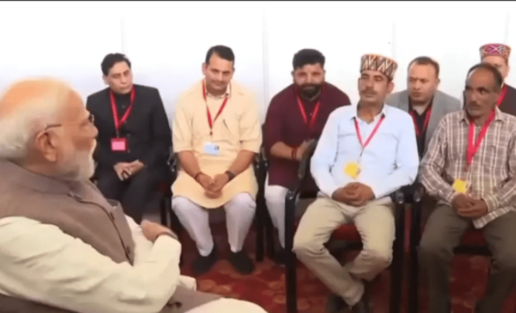
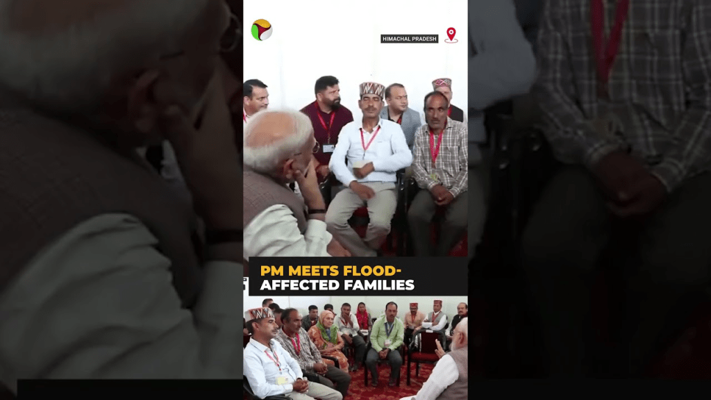
Fifteen days later, Santosh Kumar from Salun met with Prime Minister Modi in Dharamshala when the PM toured flood affected areas of Himachal Pradesh. The Prime Minister promised rapid action and relief through coordination of Central and State agencies. But 4 months later, the situation has not changed in the slightest. The story of Salun represents the unmitigated and compounded impacts of bumper-to-bumper hydropower development in the Himalayas as also the highhandedness and arrogance of local, state and central agencies in addressing any of these issues.
~
Visit to a village that was
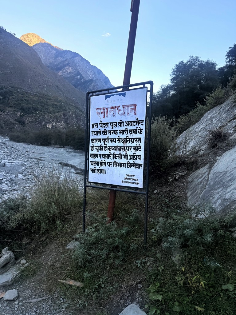
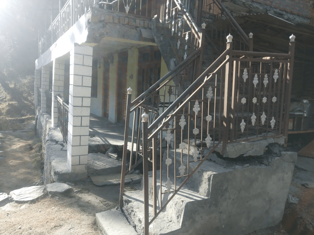
Under the wooden planks of the Tiyari bridge, Ravi was rumbling. An notice board from Public Works Department warned us “The abutment of this bridge is completely damaged. Do not use light vehicles. The department will not be responsible for any untoward incidents.” We ran across the bridge, along with several school children returning home, hoping for the best. As I reached the center, a loose wooden plank swung straight up, opening a gaping window into the river below. I screamed and blundered across, embarrassed and scared. The gap was wide enough to swallow a child and everyday hundreds of children walk across this bridge. This is the only bridge connecting the Chamba-Bharmour Highway to Tiyari Panchayat of about 1200 people. The board absolving the Department of Public Works from any responsibility has stood their since 2023.

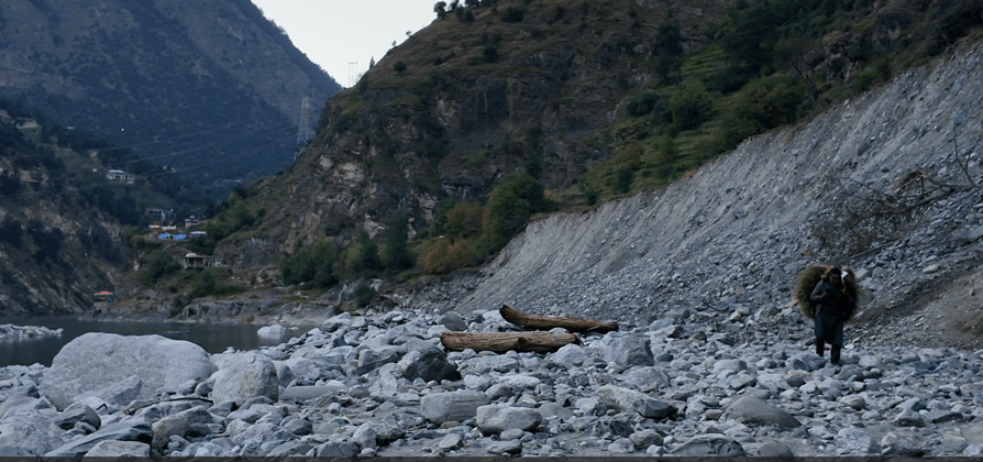
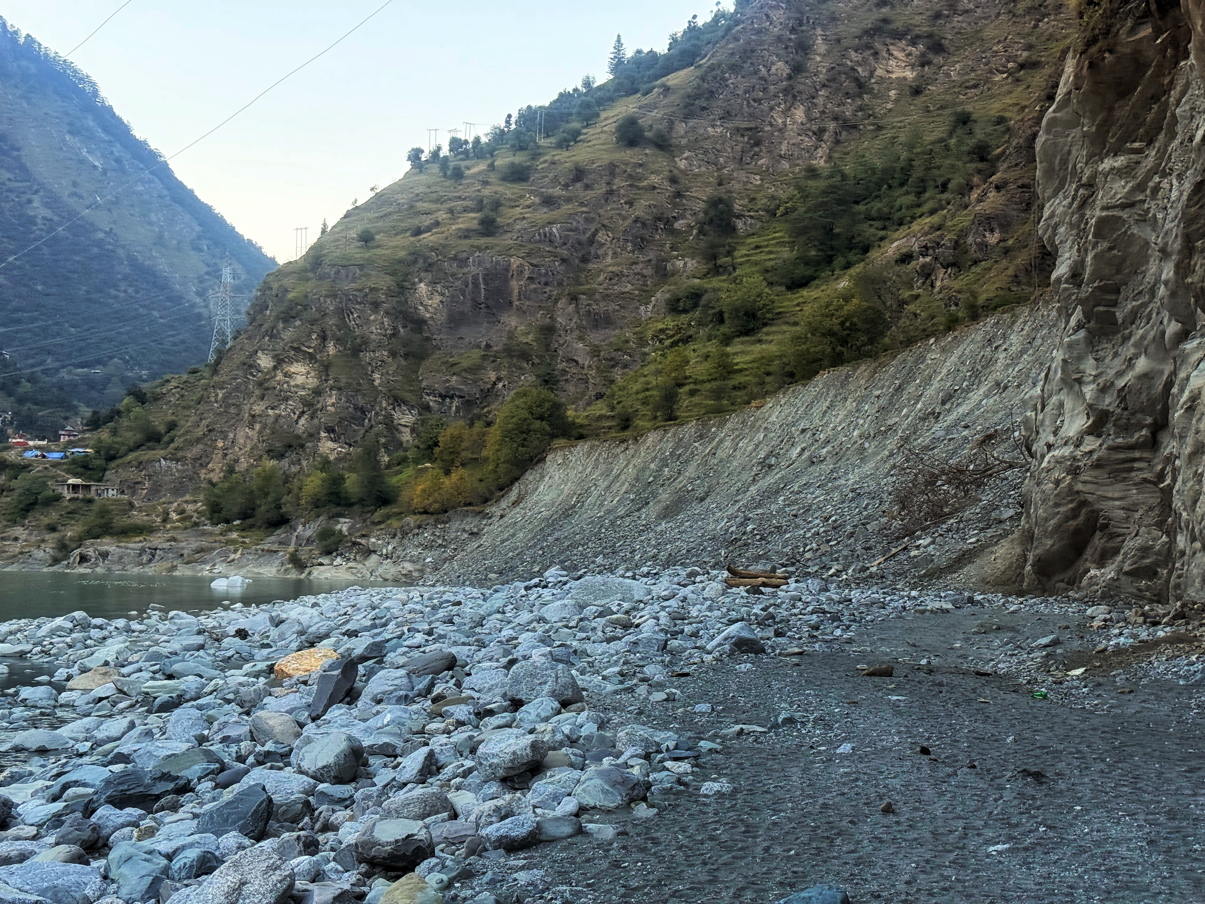
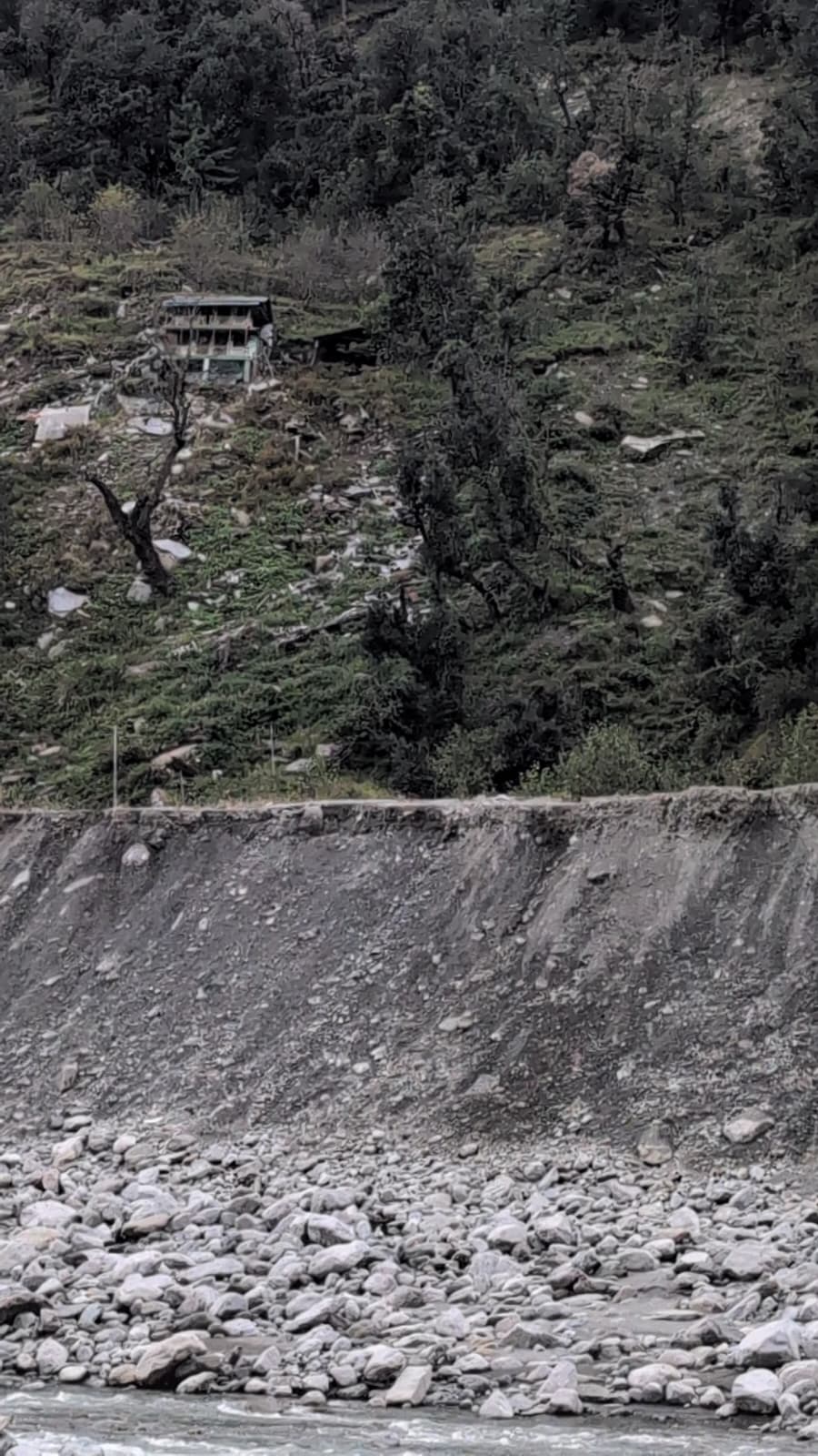
On the other bank, erosion had eaten up much of the bridge foundation, laying the steel cables open like bare bones. A house with almost all its ground eroded, stood drunkenly on the bank. “This was an ancient, inhabited area, but it has been abandoned since the 2018 floods.” said Anup Kumar, who is a teacher and lives in the nearby village of Jhadota. Anup has been joining the dots of the erosion damage caused by hydropower projects, along with the villagers. We clambered down to the river channel and forded a rumbling nallah from the right bank. Surely, this is not the road to Salun village? “Well, it is the only one.” said Anup.
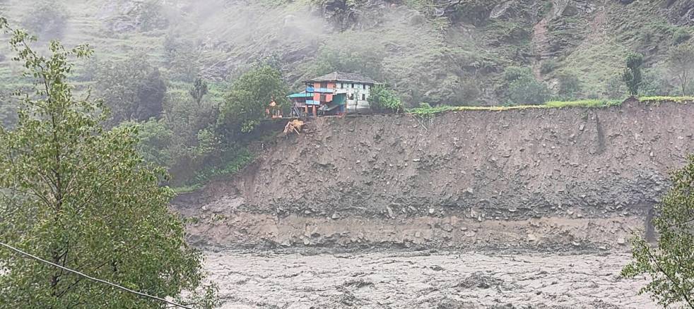
After a difficult walk we came across a grey-white scar on the riverbank, the only remnants of Salun village. A few plastic tents fluttered atop a mountain: temporary shelters for the homeless. When the village collapsed, there were no human casualties only because it happened in the afternoon and people could escape.
2025 Floods in Ravi have been one of the worst on record causing extensive loss of life and property. But the collapse of Salun was something else. This tragedy highlights the vulnerability of communities and the major vacuum in environmental governance around hydropower in Himalayas.
Trapped between two hydropower dams
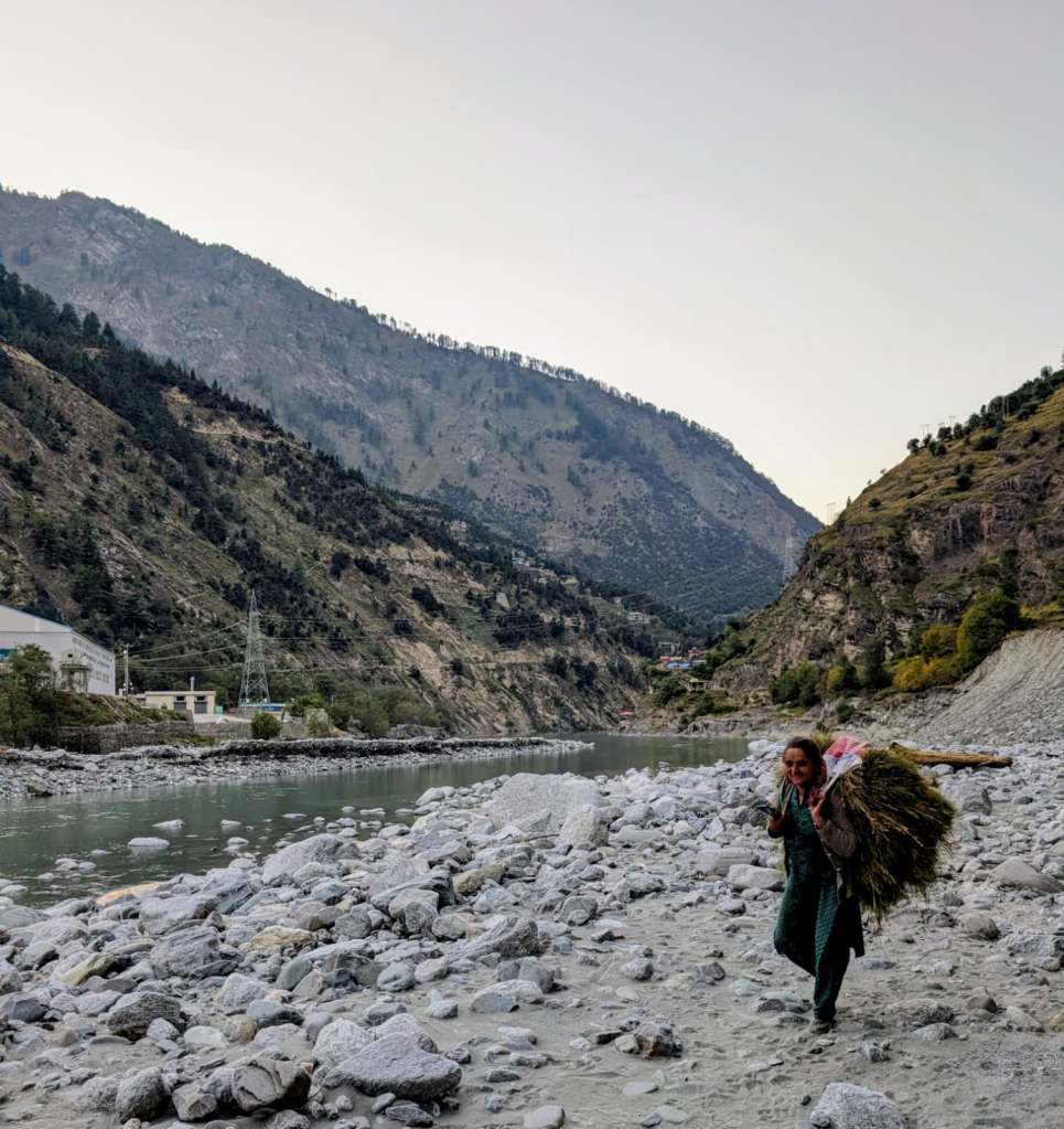
As we walked further on the pebbles, we could see a lady walking briskly with a huge haystack on her back. Anup introduced us to Beena Devi, resident of the extinct Salun and also an active ward member.
What can you ask a lady whose home has been wiped away by the river she is walking through? “Did River Ravi veer towards the village on the 26th August?” we attempted.
Beenadevi hitched up the load on her back and looked at us wearily “It’s a river, it can sway as it likes. It’s been doing that for centuries, hasn’t it? But our village was washed up only when these people came up.” She pointed to a mountain of muck dumped on the opposite bank, jutting inside the river and contained by a retaining wall. “This dumping ground by the project upstream and the constantly lapping water from the project in the downstream ate up our village. We have been trapped between these dams.”
Did you not protest? We ventured. She smiled in a way I have seen many affected communities smile: a mixture of resignation, irritation and amusement at our limited understanding. “Winter is coming. We need to find home for our sheep and cattle. We cannot spend more time in arguments.” She walked on.
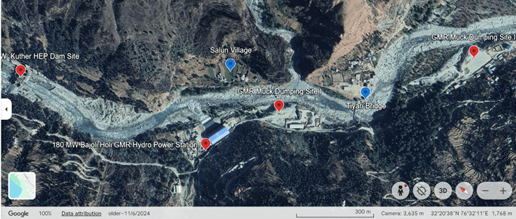
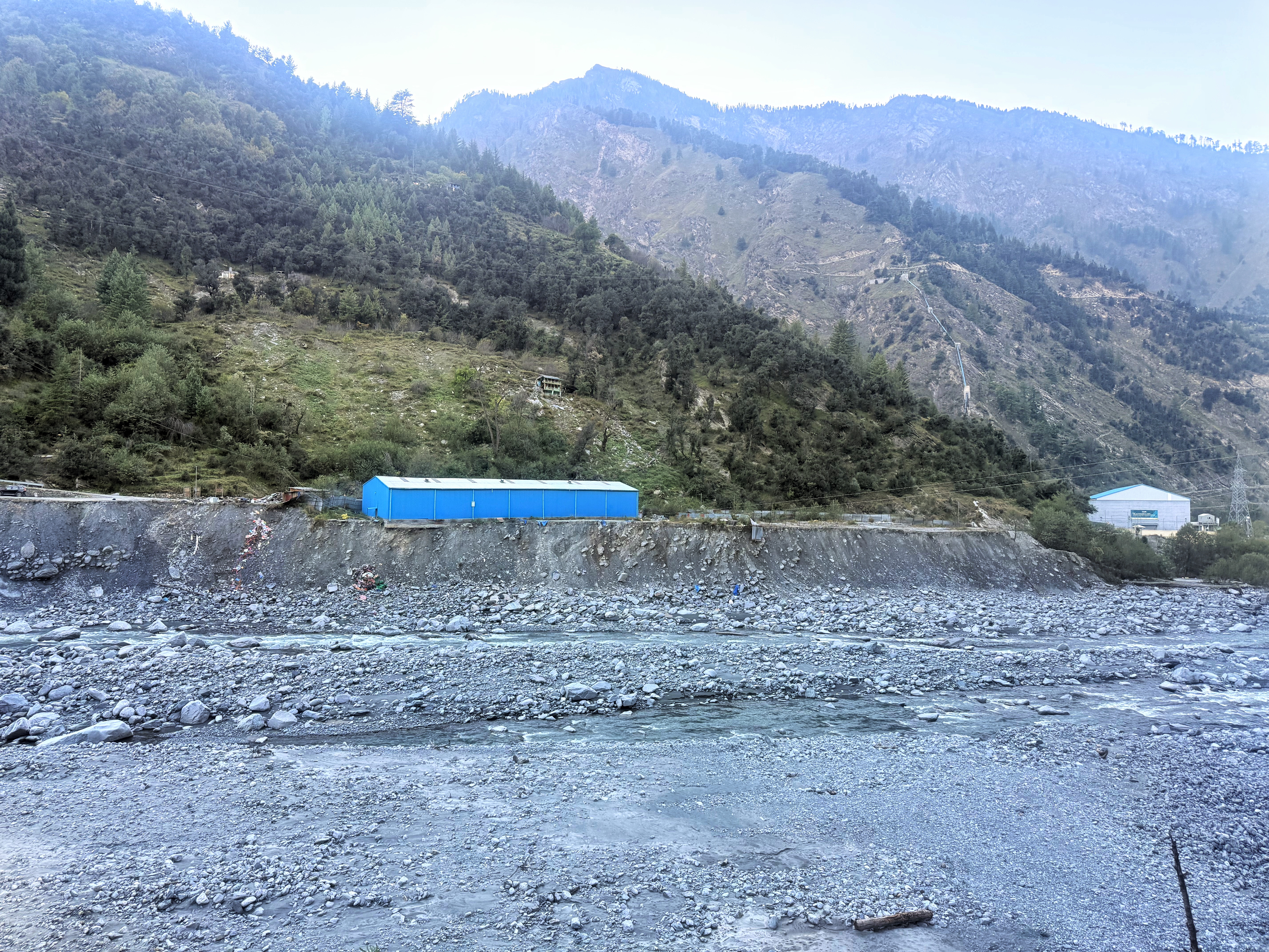
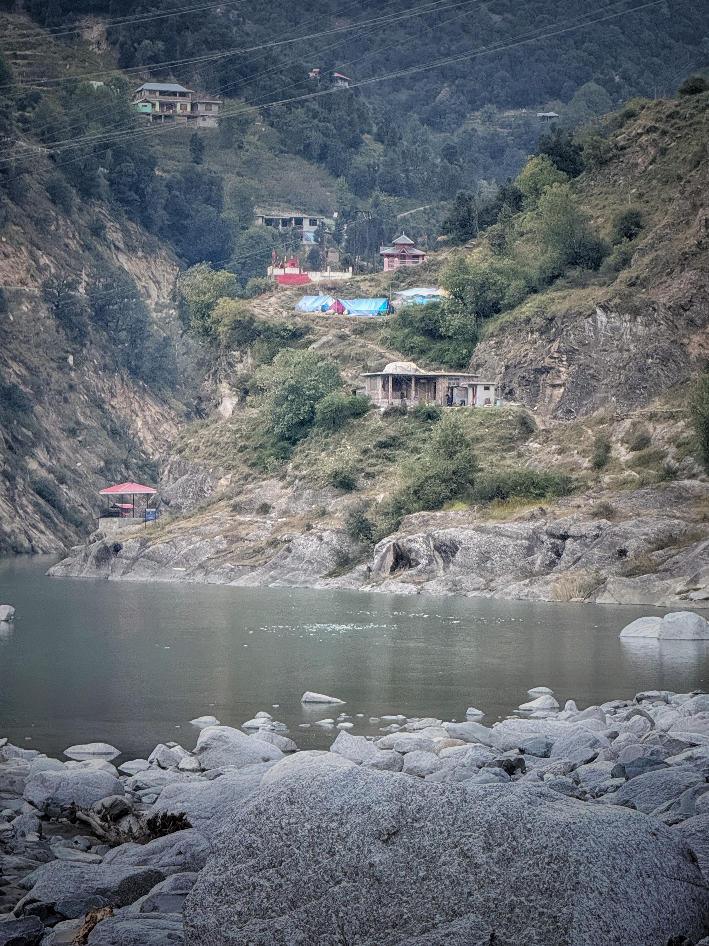
GMR’s muck dumping site inside River Ravi, opposite Salun village ( top corner), Blue tents of villagers who lost their homes (left bottom corner), mountains of muck inside the river by GMR Bajoli Holi Project ( bottom right corner)
Dammed Ravi
Ravi is a dammed river. From its origin near Bara Bhangal to the last dam on the border of Punjab-Himachal Pradesh, the Ranjit Sagar Dam, the river is a series of reservoirs and tunnels. Most of this length falls in the Chamba District of which 93 per cent of area is already vulnerable to landslide hazard from severe to high level.[i] 50% of Chamba falls in the “severest seismic intensity zone”. [ii]A Chief Additional Secretary Avay Shukla in his report to the High Court of Himachal Pradesh had warned that if all the hydropower dams planned on Ravi get built, the river will flow only for 3 kms in Himachal Pradesh and it will be an environmental catastrophe. All those dams are built. As are many others. And Ravi does not have even 3 kms of flowing distance. The catastrophe is unfolding before our eyes.
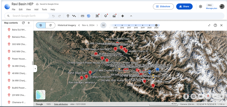
First Hydropower project on Ravi (for now) is GMR’s 180 MW Bajoli Holi Project, at an elevation of about 2000 mts[iii], which has a tunnel 15.5 kms long and 5.6 mts dia, bored through the fragile Himalayas. Tunneling and blasting for Head Race tunnel, surge shaft and penstock has caused severe damage to the villages on the way. Several homes collapsed and developed deep cracks and subsidence like Joshi Math. [iv] The dam is about 15 kms upstream Salun village.
The powerhouse of Bajoli Holi project is directly on the opposite bank of the Salun village, less than 150 meters away. When the project generates power, there is intermittent but rapid discharge of water from the powerhouse into the river, creating pressure on the opposite bank where Salun was situated. Hydropeaking (rapid rise and fall of water in the river) is a documented reason for riverbank erosion and bank failures.
Adjacent to the powerhouse, along the river are two muck dumping grounds and one helipad of GMR Bajoli Holi Project. All are protected with retaining walls, but the opposite banks where the abutment of Tiyari Bridge and Salun village lie, are unprotected and open to erosion. It is well documented that retaining walls act like deflectors, taking the river’s energy that would have been used to shape the protected bank and transferring it across the channel to attack the unprotected opposite bank.[v] The muck disposal site II and Helipad has deflected the flow of Ravi and lead to tremendous damage to Tiyari bridge, used by hundreds everyday.
Just 500 downstream the now-extinct Salun village is the reservoir of Jindal Steel Work’s (JSW Energy) 240 MW Kuther HEP. The water from its reservoir used to reach beyond Salun Village. The levels rose and fell every day, based on electricity generation. When we met the company engineers at site, they claimed that their reservoir submergence did not reach the village however, the villagers have videos to prove that the stagnant reservoir water reached not only below Salun but went much further. We saw the videos and agree with the villagers.
Hydropeaking induced bank failures,[vi] seepage induced erosion, increased pore pressure, deflection of the river to one side, constriction of the river channel seem to be the causes that led to collapse of Salun and erosion of Tiyari Bridge. Floods were a last straw not the primary reason behind Salun’s collapse. Collapse of Tiyari bridge is a tragedy that is waiting to happen.
Reservoir of Chamera III Hydropower project also showed this bank collapse. See below:

“If nothing changes even after meeting the Prime Minister, what can one hope for?”
As the skies darkened, we hurried towards the bridge where we met Santosh Kumar, one of the affected residents of Salun. When he heard that there were some people asking about Salun village, he had left his work to reach us. Not many people are willing to listen to residents of Salun these days. “This is a man-made tragedy. If a mountain fell upon us I would accept it as a natural tragedy. But we wrote letters to Jindal’s Kuther HEP and GMR’s Bajoli Holi HEP for three years. We continuously told them that you have protected your project, your muck dumping site, but what about our village? Water lapped at the foot of our village from Kuther HEP’s reservoir for years. GMR’s muck dumping site left no room for the river to move in the floods. Where would it go? It had to come for our village! Who can help us now? What is the point now?”
“I will say over and over again, these two projects have caused this disaster, and they know it very well.”
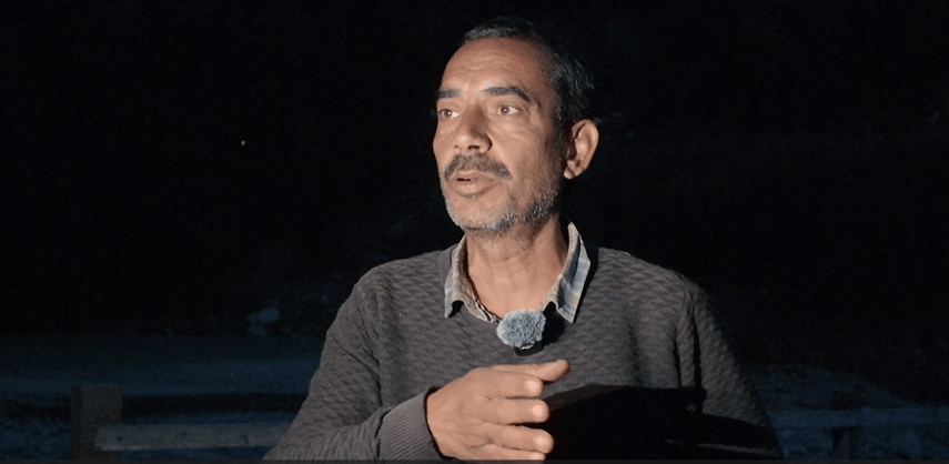
We were taken aback by the clear and razor-sharp words coming from Santosh Kumar. He owned an ancestral home, fields and orchards in Salun and is now renting a tiny room in Batola village with his family.
“Our village has a known history of 200 years. We have seen bigger floods than this in 1995. But our homes, our apple orchards did not collapse into the river. Because there was no dumping ground constricting the river. The river has space to flood. Look at this bridge now. See how it is eaten. Next time you come, the bridge will have been washed away. Small school children use the bridge everyday. The hydropower companies, our local leaders all see the damage they did everyday but there is no response.”
“Did you not raise this with the local MPs and MLAs?”
“We have been sending letters of the Additional District Magistrate (ADM), Subdivisional Magistrate (SDM), local legislators and politicians for years. We have records of past three years. They only tell us we will do something and nothing gets done.”
He pointed at the ominous notice about not crossing the bridge. “You see this? We have to use this bridge daily; there is no alternate way for nearly 1000 people. When Manimahesh Yatra happens, hundreds of devotees use this bridge. Now this board has been hanging here for two years. They say it’s not their responsibility if the bridge collapses. Whose responsibility is it then?”
Santosh Kumar was part of the team that met with PM Modi when the latter came to Dharamshala, Himachal to oversee flood response. The PM had promised relief and coordinated efforts. But nothing happened even after the meeting.
“If nothing changes even after meeting the Prime Minister, what can one hope for?” he asks.
We have the copies of letters Santosh Kumar jee sent to GMR, Jindal’s Kuther and local administration.
Meetings with dam officials and administration
We met with dam engineers at GMRs Bajoli Holi and Jindal’s Kuther project. The engineers at Kuther categorically told us that their water does not reach Salun village. This has been proved to be untrue. The engineers at both sites were concerned about the project and their electricity production and accepted no role in the collapse of the village. The Catchment Area Treatment Plan (CAT Plan) of Kuther reads[vii] like a fiction novel, enumerating the various nallahs where they plan to build retention walls.
The CAT plan even goes on to say, “Rainfall pattern in the area and water seepage coupled with geological formations lead to landslides. Water plays an important role in triggering landslides. However, most landslides are caused by human negligence. Gabion structures shall be provided at the base of landslide zones to control toe erosion by water.”
While allocating crores of rupees to CAT Plans on paper, the dam authorities did not provide any protection to a village exposed to reservoir water and drawdown actions even when it was 500 meters away from the reservoir and even when multiple representations had reached them over three years.
We also met with Additional Divisional Magistrate of Bharmour under whose jurisdiction Salun falls. He accepted that the collapse may have been caused by GMR’s muck dumping site, powerhouse and Jindal’s reservoir, he also accepted that he had received multiple letters from the locals but said that he needs a report to take any further action.
It is unfortunate to see that local representations mean so little in administrative corridors. We hope that this report will lead to firm steps taken by the administration to remedy the harm being done by hydropower in Ravi Basin.
Immediate and long-term steps needed
- Immediate rehabilitation of Salun village at a safer place, compensation for homes, cattle and fields to the residents.
- Immediate repair of Tiyari bridge connecting Chamba-Bharmour Highway to around 5 villages and a population of more than 1000.
- Immediate scrutiny and audit of the Catchment Area Treatment Plans of 240 MW Kuther HEP and 180 MW Bajoli Holi HEP. It needs to be urgently implemented and those responsible for non-implementation so far needs to be held accountable.
- Immediate audit of muck dumping sites along the Ravi River: Muck dumping sites, their siting, capacity, functioning and impacts is a major issue with bumper-to-bumper dams that involve tunneling and blasting. Avay Shukla Committee has also noted that muck dumping sites in Ravi Basin are along the river and can cause impediment to the flow of the river. We witnessed several muck dumping sites on the outer meanders of rivers where erosion is high.
- For the time being, all the villages that lie on the riverbanks on the opposite side of retaining walls need to be protected by appropriate engineering/ bioengineering methods. In the absence of this, the liability and culpability of any damage to that location lies squarely with the hydropower project.
- Considering the location of hydropower projects in Seismic zone VI (old and new zonation) with the severest seismicity and severe landslide and landslip risks, a cumulative impact assessment of the geological impacts of hydropower development in Ravi is imperative.
- Cumulative Impact Assessment of all the existing hydropower projects and their performance in the 2025 floods, their impacts on the community as well as riverine and riparian habitat has to be initiated immediately. No new hydropower projects like the planned 200 MW Bara Bhangal HEP near the source of Ravi can be considered before this CIA is completed and its public hearings are held in affected villages.
In 2010, Avay Shukla Committee had specifically warned against cascade damming of Himalayan rivers like Ravi without any Cumulative Impact Studies. The Report, submitted to the High Court said, “The approximate length of Ravi between Chamba to Bajoli is 70 kms. There are 4 HEPs sanctioned on this stretch: Bajoli Holi (Clearance stage), Kuther (Clearance stage), Chamera III (under execution) and Chamera II (commissioned). When all the projects are completed, there shall only be 500 mts open river between Bajoli Holi and Kuther, 500 mts between Kuther and Chamera III and 2 kms between Chamera III and Chamera II. In other words, in the 70 kms, only 3 kms river will flow in its original channel and 67 kms shall disappear below the ground. This cannot be anything but an unmitigated disaster. State and central governments have not carried out any EIAs of such cascading pattern from independent experts before allowing this.”
Individual EIA and EMPs of individual projects do not address the larger concerns. Where environmental impacts are concerned, the whole is larger than the sum of the parts. The committee recommends the state to carry out basin wide EIAs for all river basins in the state and till they are finalized, no new projects should be allotted or where allotted their clearance should be withheld.”
Avay Shukla Committee stands vindicated. Though I’m sure he will not be happy about it.
Parineeta Dandekar, parineeta.dandekar@gmail.com;
Photos: Abhay Kanvinde, abhay.kanvinde@gmail.com
NOTE: Team consisting of Madhumita Dutta, Parineeta Dandekar, Abhay Kanvinde and Anup Kumar travelled in the flood-ravaged Ravi Basin in October 2025.

End Notes
[i] Sharma et al, Assessing landslide susceptibility in the Upper Ravi river catchment, Himachal Pradesh, India: a comprehensive analysis using the logistic regression model, 2025, https://link.springer.com/article/10.1186/s40677-025-00327-7
[ii] Chandel et al, Seismicity and vulnerability in Himalayas: the case of Himachal Pradesh, India, 2009 https://www.tandfonline.com/doi/full/10.1080/19475701003643441#d1e232
[iii] Ravi Chopra Committee Report had recommended no hydropower projects should be built above 2000 mts in Himalayas.
[iv] Asher et al, A fact-finding report on the recent hazards: 180MW Bajoli Holi Hydropower Project in Bharmour Tehsil, Chamba, Himachal Pradesh, 2021, Himadhara, https://www.himdhara.org/wp-content/uploads/2022/01/Increased-risk-and-tunnel-testing-menace-by-180MW-Bajoli-Holi-HEP_Finalfinal1.pdf
https://timesofindia.indiatimes.com/india/in-chamba-a-village-cracks-under-shadow-of-another-hydro-tunnel/articleshow/96952802.cms, https://india.mongabay.com/2022/03/hydropower-project-nudges-a-tribal-community-out-of-their-land-in-himachal-pradesh/
[v] Sipos et al, Bank Processes and Revetment Erosion of a Large Lowland River: Case Study of the Lower Tisza River, Hungary, Water (MDPI), 2019 (https://www.mdpi.com/2073-4441/11/6/1313)
Bank Protection/Erosion Repair Guide, https://www.valleywater.org/sites/default/files/GS%20Ch%204%20Bank%20Protection%20Erosion_0.pdf,
Reidar et al, Numerical modelling of bank failures during reservoir draw-down, 2018, Batalla et al, Hydropeaked rivers need attention, 2021
[vi] https://sandrp.in/2017/03/09/river-bank-failure-due-to-sudden-water-flow-changes/,
Hauer et al, Impact Analysis of River Morphology and Roughness Variability on Hydropeaking Based on Numerical Modelling, 2013. https://www.researchgate.net/publication/260957982_Impact_Analysis_of_River_Morphology_and_Roughness_Variability_on_Hydropeaking_Based_on_Numerical_Modelling
Locher et al, Environmental Issues and Management for Hydropower Peaking Operations, United Nations, https://www.un.org/esa/sustdev/sdissues/energy/op/hydro_locher_peakingoperations.pdf
[vii] https://hpforest.gov.in/storage/files/1/pdf/CAMPA/CAT%20Plan/Kutehr%20Hudro%20Electric%20Project.pdf
