Chenab, which translates as the Moon River is the largest of the five tributaries of River Indus. It flows for about 974 kilometers from the High Himalayas of Lahaul to the forests of Jammu and Kashmir and onto the plains of Pakistan. Its main tributaries in India include Miyar, Marusudhar and Tawi. In the vast plains of Punjab in Pakistan, it is met by Jhelum, Ravi and Sutlej to form the mighty Panjnad before it meets the Indus. Its catchment, spread across 67,430 km2, is shared between the two countries.
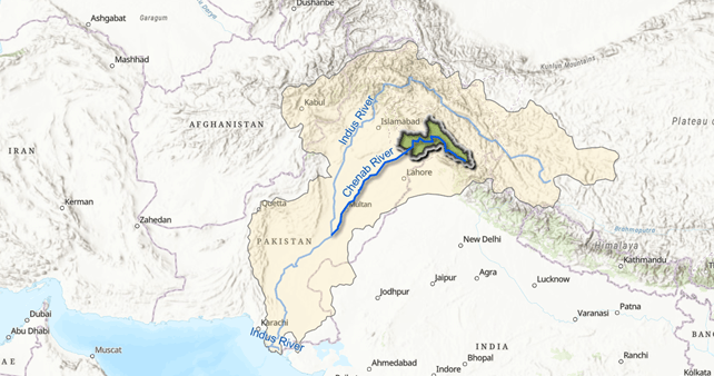
Chenab is Chandrabhaga (Crescent Moon) in its headwaters. It was the River Asikni in Rigveda, and the Acesines for the ancient Greek. From sparse mountain settlements of Lahaul to the bustling urban centers of Sialkot, more than 10 million people live and prosper along the Chenab. Hydropower projects operational and under constructions on the river have an installed capacity of more than 5000 MW (Central Electricity Authority 2024), and its canals irrigate hundreds of thousands of acres in Pakistan and India (Shakir et al).
Even as the river supports human settlements, agriculture, hydropower and wildlife, it is facing stark impacts of climate change, damming, pollution, encroachments, ever-increasing abstractions and catastrophic floods.
The Indus Water Treaty (1960) classifies Chenab as a ‘Western River’ and states that “India shall be under an obligation to let flow all the waters of the Western Rivers.” Today, Chenab has been dammed several times over for hydropower in the Indian Union Territory of Jammu and Kashmir and for irrigation in Pakistan. It’s last free flowing stretch is in Himachal Pradesh, but a cascade of hydropower dams is planned here too.
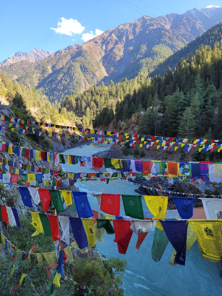
As squabbles over water-sharing darken in the Indus Basin and around Chenab, it is easy to forget that Chenab has always been the river of love and union. It has been bringing together faiths, languages, arts, trade routes, humans and non-humans throughout its basin. Its origin is a ‘Sacred mandala’ in Buddhist texts and a meeting place of lovers in the Hindu lore. Its fish sanctuaries protect and celebrate endangered fish. Shrines along its banks welcome both Hindus and Muslims. Late Punjabi poet Mohan Singh, who wanted his ashes spread across the Chenab once wrote,
Ganga Banawe Devte Te Jamuna Deviyan,
Ashiq Magar Bana Sake Paani Chenab Da
Ganga makes Gods, Yamuna makes goddesses,
But it takes the waters of Chenab to make a Lover.
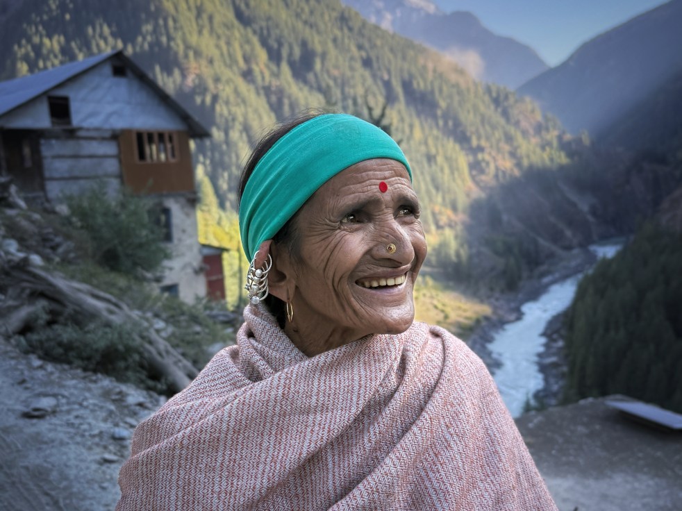
The river is a pivotal character in the abiding love stories of the subcontinent, right from its origin to its confluence with Indus. Couples like Bhonka Soni, Heer Ranjha, Sohni Mahiwal and Mirza Sahiban found home on the banks of Chenab. The headwaters of the river are rich in the stories of shepherds, their cattle, sheep and loyal dogs, while the middle reaches worship sacred fish. The plains in Punjab sing of the buffalo herders and tell the story of the dolphins. Chenab is a not just a channel of flowing water, to be harnessed for irrigation and hydropower, but a part of the rich, syncretic biocultural heritage of South Asia . Between the rhetorical statements of political leaders and conflict-driven media narratives, stories of the people along the Chenab have been overshadowed. However, these inspiring, complex and sometimes heartbreaking stories provide a fuller, richer picture of the basin.
This photo-story takes the reader down the Chenab, from its headwaters to its borders in India where it enters Pakistan. It hopes to provide glimpses of the people’s story of Chenab.

Climate Change and the Headwaters of Chenab
Rivers Chandra and Bhaga meet to form Chandrabhaga, as River Chenab is known in its headwaters, at the sacred confluence in village Tandi of Himachal Pradesh. The rivers bring together waters from Greater Himalayas, Zanskar Himalayas and Pir Panjal Ranges. While their origins are less than a mile from each other, the rivers circumambulate the Baralachala peak (4950 masl) in opposite directions to meet at Tandi. This epic journey is immortalized in several folktales and songs of the region.
Glaciers feeding the headwaters of Chenab are receding, like most glaciers in the Himalayas. The region has witnessed warming of more than 1.14° C in the past 60 years (Das et al) and in the last 25 years, the area of glaciers in the headwaters has decreased by 23 sq kms (Vatsal et al). Studies estimate that the basin is likely to retain only 50%–52% of the area of of glaciers by the end of the century in the changing climate (Tawde et al).
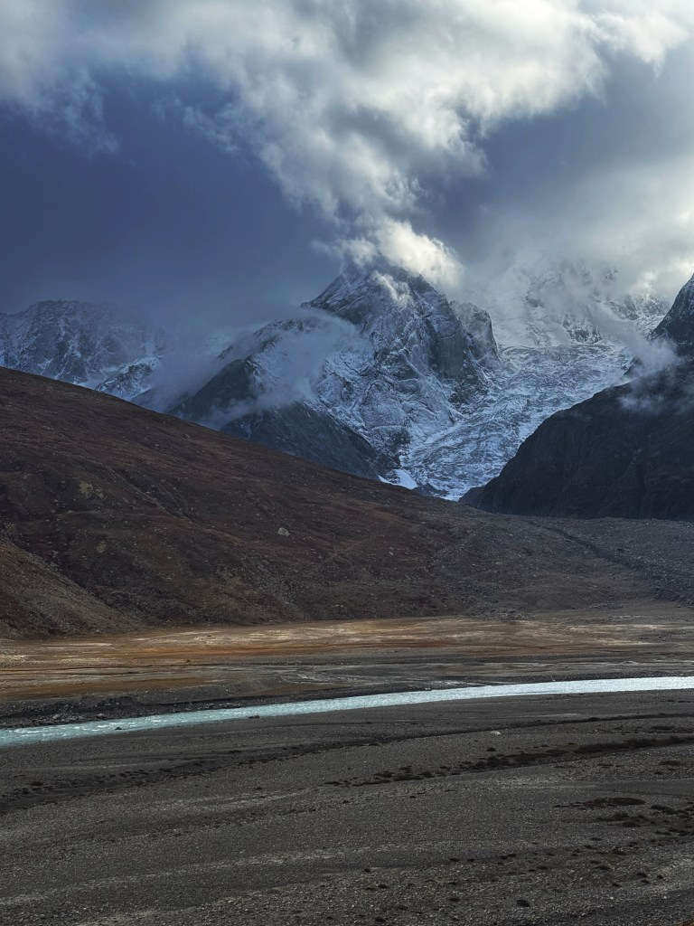
Bara Shigri, largest glacier in Himachal Pradesh which feeds River Chandra, is receding at an alarming rate and now has more than 60 glacial lakes growing on its surface (Prakash et al). Mulkila group of glaciers which feed River Bhaga have reduced in area and their rate of deglaciation has increased significantly compared to the previous decades. Ghepan Gath glacier overlooking River Chandra upstream the shrine of Ghyepan Devta, a syncretic protector of Lahaul valley has developed a lake that has increased by 178% in the last 30 years. Several glacial lakes in the basin are at the risk of GLOFs (Sattar et al).
Flash floods are repeating, taking away precious valley soils, crops, roads and bridges with them. Villages like Lindur are cracking and subsiding as the underlying glacier melts. Water supply has become increasingly erratic and the centuries-old dependence on glacial springs is shaken.
Climate change and its effects are being felt strongly in this region where sparse communities practice organic farming, live a life of hardship and have an extremely low carbon footprint.

Hydropower Projects on Chenab

More than 39 large hydropower projects are commissioned, under construction or in the planning stage in the Chenab Basin of India (Cumulative Impact Assessment of Chenab Basin Projects, Ministry of Environment and Forests, Government of India). If all the projects are constructed, less than 10% of the river will flow free (SANDRP 2013). Local communities in most places have been up in arms against these projects.

Chenab basin in Indian Union Territory of Jammu and Kashmir is dammed heavily with completed and under-construction projects including 900 MW Baglihar, 690 MW Salal, 1000 MW Dul Hasti, 390 MW Dul Hasti, 850 MW Ratle, 540 MW Kwar, and 624 MW Kiru Hydropower Projects (cea.nic.in ).

In Pakistan, Chenab is highly engineered with headworks and water diversions including Marala Headworks, Khanqi Headworks, Qadirabad Headworks and the Trimmu Barrage where River Jhelum meets the Chenab (Ali et al).
The last free flowing frontier of Chenab remains in the headwaters in Himachal Pradesh, India. Here too, 16 large Hydropower dams are planned in the Lahaul district including 300 MW Gyspa Dam (sandrp 2013).
Agriculture in Chenab Basin
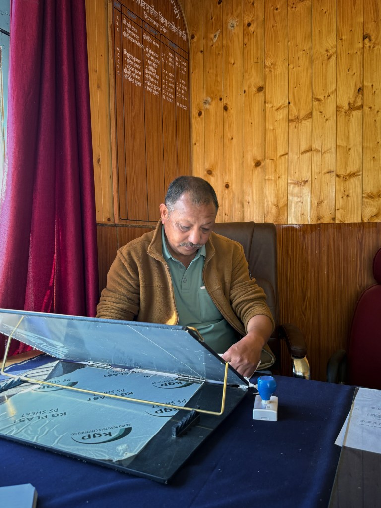
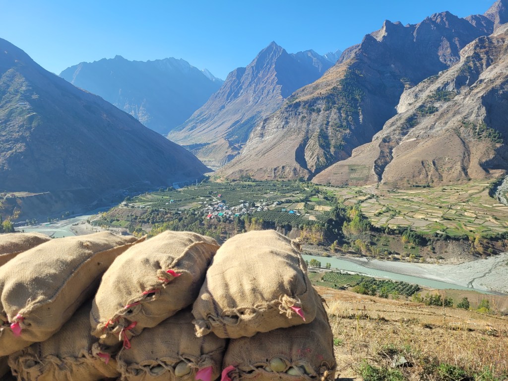
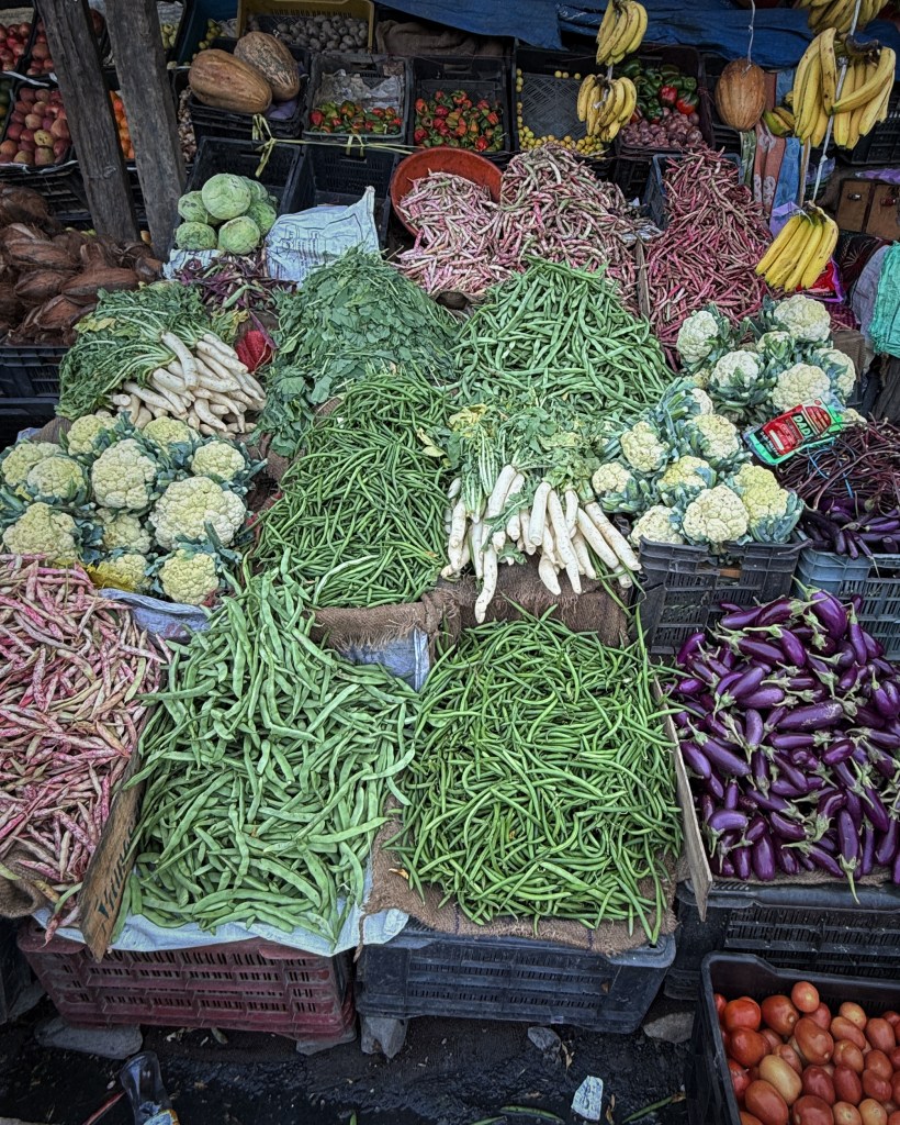
Agriculture is the primary occupation of communities in the headwaters of Chenab. Farmers of Lahaul and Spiti have one of the highest per capita incomes in the state of Himachal. The cropping profile of Lahaul valley is changing from barley and potatoes to vegetables like lettuce, peas, cauliflower, broccoli and kale. Apples in the Lahaul valley ripen late in the season and are supposed to be remarkably sweet.
Agriculture is lucrative, but water is a limiting factor. As glacial melt decreases and spring yields go down, newer techniques like Lift Irrigation Schemes, Siphon Irrigation, Sprinkler Irrigation are emerging. Traditional dug out canals called Kuhls fall in disrepair as Irrigation and Public Health Department places PVC pipes inside earthen canals for increasing irrigation efficiency. Flash floods, mudslips and landslides have washed away more than 100 acres of cropland in the Chandrabhaga basin.


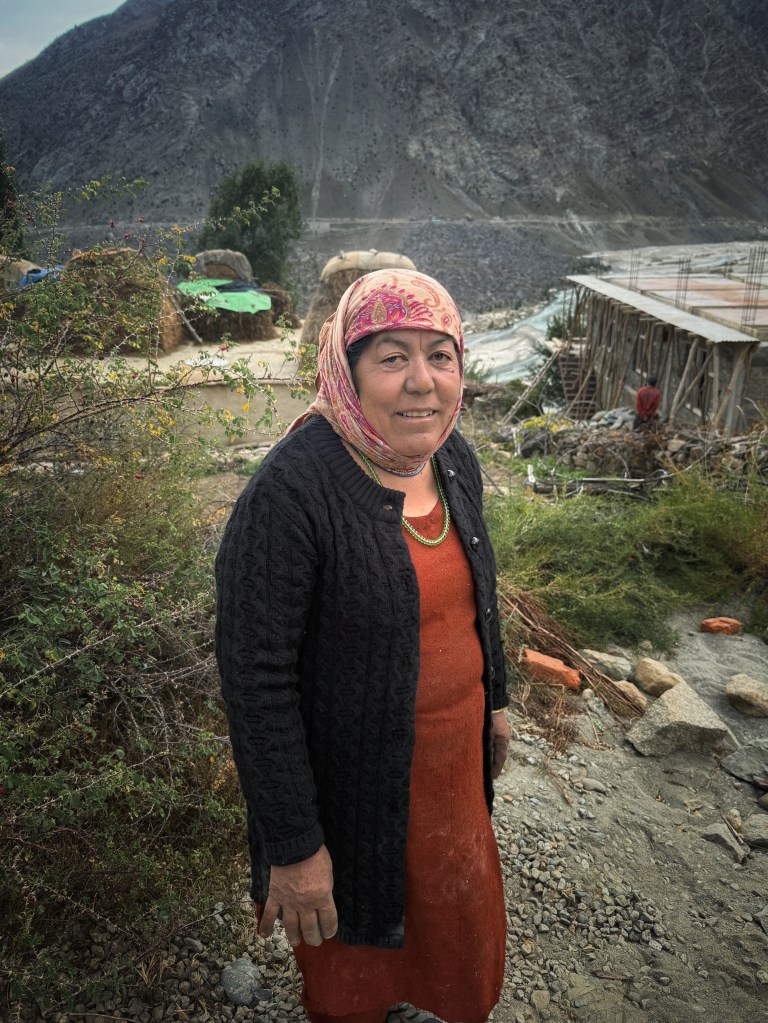
Mountain slopes of Paddar region in Jammu are irrigated by dug out canals and are rain-fed. Traditional crops like Amaranthus, corn and Bajarbhang or Himalayan Quinoa are grown in this region. Personal vegetable gardens are ubiquitous throughout the Himalayas.
Further downstream, Akhnoor plains and Shivalik region is known as the ‘Kandi’ region with sandy soils. Parts of this region are irrigated by the waters of Chenab through the Ranbir Canal, built in late 19th Century. Main crops here include wheat, maize and sugarcane. Marigold flowers are grown in abundance during October-November festival season.
Groundwater in Chenab Basin
India is the largest groundwater user in the world and a majority of drinking and irrigation supply depends on groundwater. While the same holds true for Chenab Basin, the way groundwater is used here, especially in the hills, is different than the rest of the country.
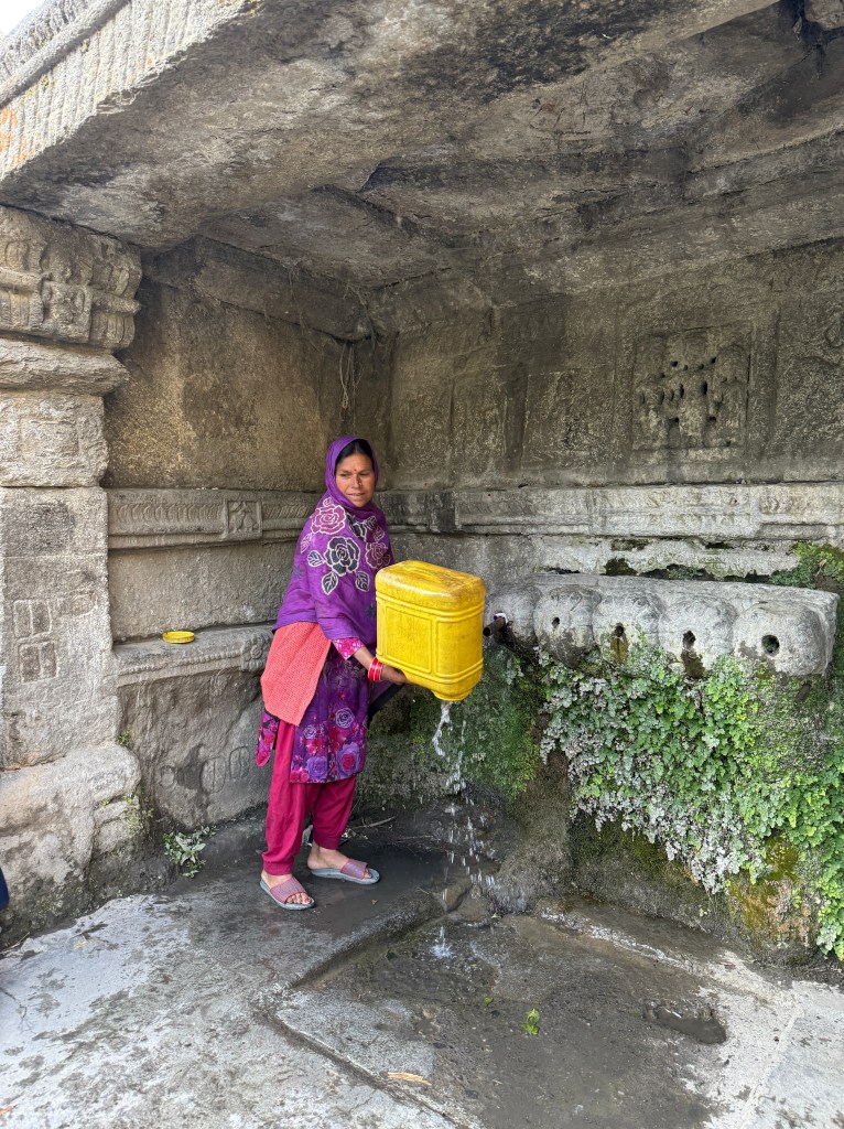
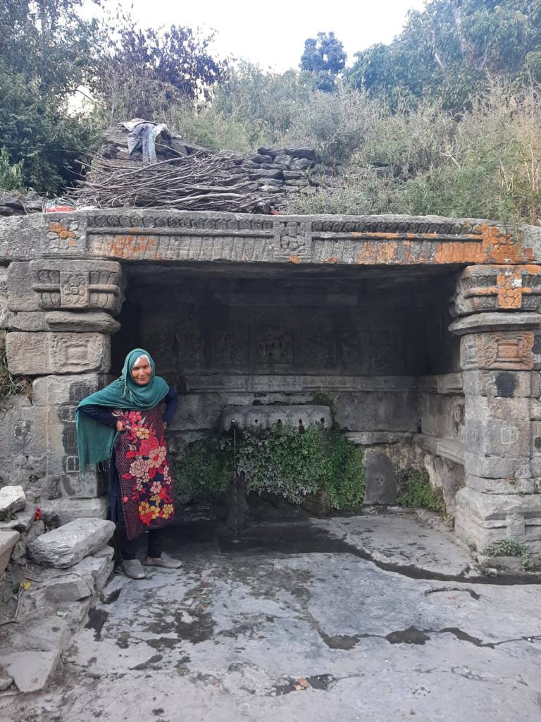
Unlike the dependence on dug wells or tubewells in India and Pakistan, groundwater in the hilly regions of Chenab is harvested from mountain springs or unique harvesting structures. Groundwater comes from rainwater or glacial melt which infiltrates fractures of rocks like granite, phyllite, schist and slate and emerges as springs, or in the form of seepage collected in ancient water harvesting structures called Bawlis or Nauns. Springs and water sources are also called as ‘Nags’ (serpent gods). Rate of infiltration is very low in the mountainous region and yet majority of drinking water or irrigation schemes depend on groundwater.
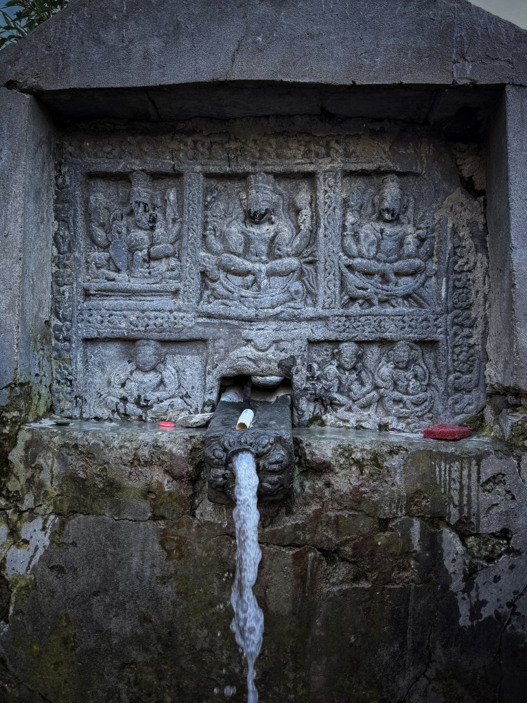
Baolis are small stepwells constructed to collect trickling spring water. Duggar region in Jammu is spectacularly rich in intricately carved Baolis dating back to a thousand years. Most are in a state of disrepair and many have gone dry because of unplanned development in the upstream including roads, dumping of garbage, blasting etc. Declining groundwater levels have serious implications for drinking water and irrigation security.
Plateaus like Kishtwar depend exceedingly on springs. In addition, Central Ground Water Board estimates that 50% of the shortfall in Kishtwar’s water supply (8 hundred thousand gallon/day) can be fulfilled by tapping springs (CGWB 2016-17). However, groundwater contamination with fluoride, iron and pesticides is a threat here.
Deforestation, change in land use pattern, intense grazing and climate change has affected the discharge and water quality of springs across Chenab Basin.
Groundwater use in the basin is not only utilitarian. The sources have evocative names, are surrounded with stories, songs and lore and are worshipped with evocative traditions in the valleys.
Pehad Baba Fish Sanctuary
This syncretic shrine on the banks of River Tawi flowing through the Shivalik hills is a sanctuary to Mahseer fish, which are dwindling in the wild. Mahseer fish need clear, flowing water with high dissolved oxygen, deep river pools and good river connectivity. A population of a Mahseer in a river stretch indicates a healthy river.
Tawi river meanders here forming a deep pool called ‘Davar’ in dogri language which holds water even in periods of drought. This pool provides a habitat for a sizable population of Mahseer fish. Devotees from diverse religions consider the fish as “devta” or the deity itself. They are fed with flour balls and not hunted.
Pehad Baba or Bhed Baba Shrine and Fish Sanctuary remains one of the important in-situ conservation site of Mahseer fish in Chenab Basin. There are a few more Pehad Baba shrines in the Tawi Basin which protect the Mahseer.

Community Fish Sanctuaries spread across India are the last bastions for fish species like Mahseer which have gone locally extinct in Indian rivers due to dams, diversions, pollution, encroachments, mining, invasive fish and overfishing. Fish sanctuaries protect not only brood stock of fish but also provide a habitat for other aquatic species (SANDRP 2023). These sites protect the river from pollution and infrastructure development. Pehad Baba Fish Sanctuay welcomes devotees from various religions and backgrounds.
Unity of Chenab
Poets and storytellers of yore attributed human-like characteristics to each of the five rivers of Punjab: Indus is said to be the river of masters, Ravi of Honor, Sutlej of Seekers and Jhelum of transgressors.
Chenab, however, is the River of Lovers (Chenab Ashqaan).
True to its nature, Chenab basin showcases beautiful syncretism of deities, places of worship and beliefs. Origin lakes of Rivers Chandra and Bhaga are sacred for Buddhists and Hindus and the confluence of these rivers at Tandi, where the Chandrabhaga begins is worshipped in both faiths. One can see buddhist tsa tsa and Hindu lamps at the confluence, standing in the memory of the departed. Deities like Gyephan Devta, Trilokinath and Mrikula Devi are worshipped by all communities.
At Bandarkoot where River Marusudhar meets Chandrabhaga and Chenab gets its monicker, syncretic shrines like Baba Zain ud din Reshi welcome Muslims and Hindus to celebrate the winter harvest festival of Baisakhi.
At Pehad Baba Fish Sanctuary on the Tawi River in Jammu, Hindus, Sikhs and Muslims pay homage to the river and the fish. On the riverbanks of Akhnoor where Chenab leaves India, a Sikh Gurudwara, Hindu temple and archeological sites and Muslim darghas stand together peeping into the river. The love story of Sohni Mahiwal travels upstream from Pakistan to India and no one bothers about the religion of the lovers who lost their lives in Chenab.

Chenab has been inherently shared since time immemorial. This unity has resulted in a complex cultural richness of the basin. Unity, sharing and syncretism is the immutable character of Chenab, the Moon River.
Text: Parineeta Dandekar, SANDRP (parineeta.dandekar@gmail.com);
Photos: Abhay Kanvinde (abhay.kanvinde@gmail.com)
NOTE: This was earlier published at Ohio State University and was published as a Storymap here: https://storymaps.arcgis.com/stories/9f929c262ac34952b88f2ee3d4c08b4a
References:
1. Central Electricity Authority, 2024, https://cea.nic.in/wp-content/uploads/hpi/2024/02/State_profile_on_hydro_development.pdf
2. Shakir et al, Canal water management: Case study of upper Chenab Canal in Pakistan, 2010
3. Das et al, Half-a-century (1971–2020) of glacier shrinkage and climatic variability in the Bhaga basin, western Himalaya, 2023, https://www.researchgate.net/publication/367961162_Half-a-century_1971-2020_of_glacier_shrinkage_and_climatic_variability_in_the_Bhaga_basin_western_Himalaya
4. Vatsal et al Glacier area change (1993-2019) and its relationship to debris cover, proglacial lakes, and 2 morphological parameters in the Chandra-Bhaga Basin, Western Himalaya, India, 2024, https://ui.adsabs.harvard.edu/abs/2024JMouS..21.1287V/abstract
5. Tawde et al, An assessment of climate change impacts on glacier mass balance and geometry in the Chandra Basin, Western Himalaya for the 21st century, Environmental Research Communications, 2019
6. Chander Prakash et al, IIT Mumbai, Glacial lake changes and outburst flood hazard in Chandra basin, North-Western Indian Himalaya, 2018
7. Sattar et al, Modeling Potential Glacial Lake Outburst Flood Process Chains and Effects From Artificial Lake-Level Lowering at Gepang Gath Lake, Indian Himalaya, 2023, https://agupubs.onlinelibrary.wiley.com/doi/full/10.1029/2022JF006826
8. https://sandrp.in/wp-content/uploads/2018/03/dams_on_chenab_how_many_are_too_many_dec2012.pdf
9. https://cea.nic.in/wp-content/uploads/hpi/2024/02/State_profile_on_hydro_development.pdf , https://sandrp.in/2016/05/23/
10. https://sandrp.in/2013/06/21/hydropower-generation-performance-in-chenab-river-basin/
11. https://indiawris.gov.in/wiki/doku.php?id=dams_in_indus_basin
12. Ali et al, Flood Mitigation in the Transboundary Chenab River Basin: A Basin-Wise Approach from Flood Forecasting to Management , 2021
13. SANDRP, https://sandrp.in/2016/05/23/
14. Dams on Chenab: How many are too Many? https://sandrp.in/wp-content/uploads/2018/03/dams_on_chenab_how_many_are_too_many_dec2012.pdf
15. Central Ground Water Board, Report on Aquifer Mapping, Outer Plains of Kishtwar Plateau, Jammu &Kashmir , 2016-17
16. SANDRP, https://sandrp.in/2023/07/20/tilase-fish-sanctuary-vaitarnas-community-conserved-sanctuary-needs-protection/ , 2023
