In a welcome move, Hon. Bombay High Court vacation bench of Justices Bhushan Gavai and Shalini Phansalkar-Joshi, while hearing multiple clubbed petitions about drought and the state’s response, has passed a strong order recommending release of water stored in PRIVATE DAMS and sources for drinking water purposes of drought hit region.
Above:Red arrows indicate diversion of water from Tata Dams into surplus basin. Source: Google earth images and SANDRP
Since past three years, SANDRP has been raising the issue of West-ward water transfer during drought years by hydropower dams. Maharashtra annually diverts 3324 Million Cubic Meters of water from its water deficit Bhima and Krishna basins into the water surplus Konkan basin for hydropower generation. This happens though 6 dams on Bhima Basin privately owned by Tata Power and the Koyana Hydropower Project. Although drinking water is the first priority for any society and this is enshrined in the National and State Water Policies, there is no system in place to allocate the waters of these dams to the downstream, when there is dire need. During this drought, which is possibly Independent India’s worst droughts, Tata Dams have released nearly no water to the Bhima Basin and Maharashtra Government on its part has taken no stand on this issue.
Above: Near the fish Sanctuary at Tekpowale, Pune Photo: Sarosh Ali
Introduction .
In India, there has been a rich tradition of communities trying to conserve a part of their ecosystem as a microcosm for the rest. The Western Ghats in particular was home to myriad of such community sanctuaries. These, however, diminished as government policies from the time of the British, and even post-independence, did not realize the importance of community involvement.
There are many community conserved areas (CCAs), some that have existed from ancient times, and some which have emerged in recent times, after having observed some form of degradation, related to local communities are trying to salvage the ecosystem in Western Ghats. While Sacred Groves, or protected patches of forests are relatively well documented, sacred fish sanctuaries which protect the fish as well as rivers, are lesser known. This is an attempt to briefly document a few such sanctuaries in Western Ghats of Maharashtra.Continue reading “Fish Sanctuaries in Western Ghats of Maharashtra”→
How a 15 MW project with 55 mts high dam threatens 5 villages and a fish sanctuary
After an analysis of a particularly nasty dam, I felt like going back to flowing rivers. It is monsoon after all. The plan was to visit Kal River in Western Ghats of Raigad District in Maharashtra to understand how a community in a small village called Walen Kondh is protecting the river and Mahseer fish. Mahseer (Deccan Mahseer, Tor tor) is classified as endangered as per IUCN classification and most wild Deccan Mahseer populations have been wiped out in India. And hence a small, out of the way place, protecting these fish as well as the river voluntarily was like a breeze of fresh air. Continue reading “White Elephant, Black Fish”→
Above: Just a few hundred meters upstream the proposed Jhari Dam, a tribal woman struggles to find water in the dry Par river bed Photo: Parineeta Dandekar
Village of Jhari at the northern most corner of Western Ghats has some of the loveliest houses I have seen. Appreciation for the evolved vernacular architecture goes beyond the obvious urban romanticisng of anything tribal. Homes in this region of tribes like Kokani, Warli, Thakurs, etc, are unique in their architecture, building materials, craftsmanship and the seamless mix of beauty and functionality. The tiled roof of our host Haribhau had intricate wooden trimmings, the mudfloor was cool and the door frame was carved in exquisite motifs. Vines arched and spread in disarray over courtyards. We were assembled under a passion fruit or ‘Rasna’ vine, bursting with white flowers. Inside, cane baskets creaked under the weight of Ragi, Udid and Rice filled to the brim: This year’s harvest has been good, though that’s not always the case. The hosts, both men and women, were busy with lunch preparations. Continue reading “Par-Tapi-Narmada Link: Divided States, United Tribals”→
As Prime Minister Narendra Modi inaugurated the RE-Invest 2015, India’s first Renewable Energy Global Investors’ Meet and Expo in New Delhi on February 15, 2015, full-page advertisements in the National Capital declared the target of adding 5000 MW of small hydro capacity by 2022, in addition to other renewable energy targets. A part of this renewed focus on small hydro, a subset of India’s new push for Renewable Energy, involves a new Mission for Small Hydro Projects. Even as it has some welcome features, the new Mission will not help if the government continues to ignore significant social and environmental impacts of small hydro projects. Continue reading “Mission on Small Hydro Projects: Ignoring social and environmental impacts will not help”→
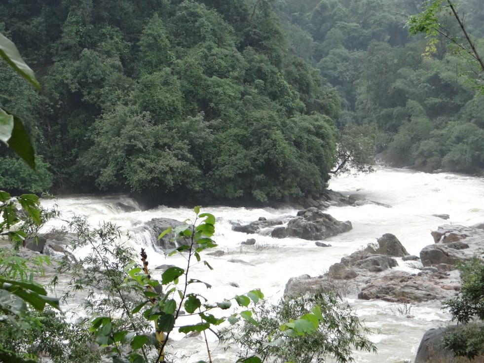
River Netravathi in the upper reaches Photo: Parineeta Dandekar, SANDRP
Like a many-headed serpent, Yettinahole (Netravathi) Diversion Project refuses to die. Every time one of its head is cut, it grows a new head.
Following criticism of the Project Report [i](based on which Karnataka Government had already made budget provisions in 2013), a new DPR of the project has been prepared in December 2013 by EIT RIP JV [ii] which tries to amend blatantly illegal stands taken earlier. However, after scratching the surface, it is clear that the DPR is just as illegal and dangerous as the interim Project Report was.
Yettinahole, or rightly the Netravathi Diversion Project has always been a political project, visualized to earn political mileage and brownie points. Veerappa Moily originally from Dakshin Kannada, moved to Chikkaballpur constituency in 2009, from when he started pushing the project strongly. As the Environment Minister, Moily also laid the foundation stone of the project in Chikkaballapur, just before the Loksabaha Elections in March 2014 [iii]. Strategically, the stone was laid in Chikkaballapur and not in Hassan, from where the water actually be diverted. No political party has opposed the project consistently.
Even before a complete DPR, Karnataka 12-14 Budget of the Congress Government allocated nearly 2800 crores for this scheme. The current govt lost no time and directly awarded contracts worth nearly 1000 Crores to Hindustan Construction Company, in a joint venture with GVPRL, without any clearances or any public consultations[iv].
Before the laying of the foundation stone of the project, SANDRP had presented a detailed analyses if the Project Report proving how the project is violating Environmental Protection Act by evading Environmental Clearance.[v] A number of eminent personalities from Karnataka had jointly written to the MoEF to appraise the Project for EC. In response to this, the MoEF had written to the Karnataka Govt and Karnataka Neeravari Nigam Limited (KNNL), seeking clarifications on the nature of the project. Although this move was triggered due to the submission made by SANDRP and other groups, we never saw KNNL’s response despite specifically asking for it. We only saw MoEF’s lame justification, bailing out KNNL and Karnataka Government and turning a blind eye to the huge impacts of the project.
Students protesting against Yettinahole Project Photo: DaijiWolrd
When Karnataka CM Siddramaiah was about to lay the foundation stone along with Mr. Moily, SANDRP wrote an open letter to him[vi], as the Environment Minister, asking a direct question as to how can he himself formally initiate a scheme which is blatantly violating laws governed by his own Ministry. Following this, the ceremony was cancelled[vii], only to be held surreptitiously later.
During all this, there was huge and unprecedented opposition to the project from Dakshin Kannada and Mangalore. Farmers, students, workers, women groups all came together, united in their opposition against a project that would divert their Netravathi. People stopped trains, organized hundreds of dharnas, boycotted voting, organised signature drives, etc. Leaders in all hues came together in a rare show of discontent. On the day of foundation stone laying, people in Dakshin Kannada voluntarily observed a strict Bandh. Funnily enough, even the beneficiary district of Chikkaballpur opposed the project as the 2.82 TMC water that it would be getting after so much of fanfare was too meager, in the face of the grand promises of lush fields and no worries.
More Protests against the Project Photo: The HinduProtest in Hassan against Yettinahole Photo: The HinduProtesters stopping a train Photo: News Karnataka
Despite these unprecedented protests and in the face of 2014 Loksabha Elections, foundation stone was laid on a dais in Chikkaballapur. The dais was burgeoning under the weight of several political strongmen.
This event stands out as an example of undemocratic behavior for an elected government.
Foundation Stone laying Ceremony Photo: The Hindu
The Government of Karnataka did not hold a single public meeting in Dakshin Kannada, trying to understand and address people’s apprehensions. When eminent personalities from Dakshin Kannada planned to hold a National Consultation on Yettinahole Diversion in NIT Suratkhal in August 2013, the meeting was cancelled at the last minute due to political pressure on the organizers.
As things stand now, the project does not have Environmental Clearance, Forest Clearance, Wildlife Clearance, has not started rehabilitation and resettlement of over 10 villages that it will submerge, but its work can start at any moment.
SANDRP accessed the Detailed Project Report (DPR) of the Project from local activists, who obtained it under RTI. Analysis of the DPR reveals a number of issues. KNNL has drastically changed the initial Project Report, avoiding mention of contentious issues we had raised like hydropower generation, irrigation component, etc., thus strongly vindicating the objections raised. However, going further, it is clear that these changes are cosmetic. Deeper problems and severe unstudied impacts of the scheme remain.
SANDRP analyzed 4 volumes of the DPR and Annexures of the Project. What follows is some myth busting about the Yettinahole Detailed Project Report.
1. What is the Current Project? Is it different from the last Project Report?
While the Project Report of June 2012 was titled: ‘Scheme for diversion of flood water from Sakleshpura (West) to Kolar/ Chikkaballapura Districts (East)’, the DPR dated December 2013 has taken out all the random stuff on Kolar and Chikkaballapura and simple calls it as “Yettinahole Project”.
Current Project as per the DPR, is divided in Two Phases.
Phase I: 8 weirs will be built in the Western Ghats, on the streams Yettinahole, Kerihole, Kadumanehole and Hongadahalla. It also includes several pump houses next to weirs, raising mains that run for several kilometers are nearly 5 kms wide, 3 Delivery Chambers (DC) and a gravity canal taking waters from Weirs 3, 4 and 5 to Doddanagara (DC 3) in the Western Ghats forests.
From the weirs, 85 cumecs (Cubic Meters per second) water will be drawn 24*7 in the six months of June-November.
This will be delivered through 4 Delivery Chambers with the last DC: DC 4 at Haravanahalli.
Phase II: From DC 4, water will be diverted to a canal running 274 kilometers, cutting across the ridge line dividing Cauvery and Krishna Basins and culminating at a Balancing Reservoir at Byragondlu and Thumbadi, in Koratgere Taluk. Thumbadi Reservoir will store about 3 TMC water and will submerge nearly 700 hectares of land and three villages[viii] while Balancing Reservoir at Byragondlu will store 5.7 TMC water and will submerge 7 villages [ix]and an area of about 2000 hectares. The Reservoir at Devaranyadurga, which was proposed in the Project Report has been replaced by these two.
It includes construction of several storage tanks and reservoirs for en route water supply. It will also delivery water to T.G. Halli and Hesarghatta Reservoirs, which supply water to Bangalore. It also plans to supply water to Devanhalli Industrial Area.
The project envisages constructing 7 additional storage reservoirs and 10 major canals. Water will also be used to fill morethan 500 Minor Irrigation (MI) Tanks in many districts and taluks.
It is amazing how the project envisages filling MI Tanks to 50% capacity: The DPR says that water will be pumped and released to the highest point and an additional sluice gate will be made to all MI tanks to let water flow into the cascading MI tank. This sounds highly impractical.
The project also includes constructing over 100 bridges in villages and nearly 100 road brides on major roads.
So although details have changed, the basic of the project remain the same. There is no change in Western Ghats, except for the fact that not 24 TMC, but 47 TMC water will be pumped now!
Survey markings in Sakaleshpur on peoples homes. People had no idea why the survey was carried out and no information was given. Photo: Parineeta Dandekar
2. What is the cost of this current Project? Can the cost be borne easily by KNNL or Karnataka Government?
The cost of the Project as per DPR stands at nearly 13000 Crores as per 12-13 price line. This exceeds the entire 13-14 years’ budget of the Karnataka Water Resources Department, which stands at 8007 Crores and is nearly five times the annual budget of KNNL, the implementing agency.[x] This is a colossal amount of money to spend to convey approximately 7 TMC water to Kolar and Chikkaballapur and other nonspecific projects.
3. Who are the Main Beneficiaries? Will Kolar and Chikkaballpur really get 24 TMC water as promised?
The supposed beneficiaries of the project are several towns, villages, cities and industrial areas[xi] and No, Kolar and Chikkaballapur again lose out and get only about 7 TMC water.
4. Then who will be getting this water?
The DPR puts out a diffuse list of beneficiaries ( see Annex below) including Bangalore urban area through TG Halli and Hesarghatta Reservoir and the Devanhalli Industrial Hub. There are no population projections or future need calculations for this region like all other regions and at no place does the DPR say that water will go to Bangalore. However, TG Halli and Hesaraghtaa reservoirs are both used by the Bangalore Water Supply and Sanitation Board [xii]for Bangalore City and in the last Budget, the government had itself stated that water will be used for Bangalore Urban Area’s needs.
How Bangalore treats its local water bodies Photo: The Alternative
A review of beneficiaries:
Bangalore gets 3 TMC water: The DPR says that about 3 TMC water will be released to TG Halli and Hesargahtta Reservoirs and for the Devanhalli Area.
Minor Irrigation Tanks and hence irrigation gets maximum water at 9 TMC: Nearly 9 TMC water will be used for filling more than 500 MI tanks upto 50% of their live storage capacity. This water will be supposedly used for “groundwater recharge”. There are several participatory, cheap and sustainable ways for recharging groundwater, which seem to have been rejected in favor of long distance transfer. In any case, this groundwater recharge will be used for agriculture, as most of the agriculture there depends on groundwater and hence, the project qualifies for Environmental Clearance.
The project is being pushed for the drought affected taluks in Kolar Chikkaballapur and Tumkur and even a brief glance at the calculation shows that even in 2023-24, the drinking water demand of these places cumulatively will be just 12 TMC! Then why are we diverting 24 TMC water, double of the ten years’ estimate?
5. What is the basis for diverting 24.01 TMC?
The report provides no justification about why 24 TMC is supposed to be diverted. In fact, after population calculations and making provisions for drinking water supply for the beneficiary districts and villages, the DPR simply states : “This has resulted in a balance availability of 8.9 TMC” . This is a strange statement to make. What is meant by “balance availability”? Is there compulsion for diverting 24 TMC by hook or by crook from the Western Ghats?
6. 24 TMC Diversion? No 47 TMC Diversion!
The project envisages diverting 85 cumecs (Cubic Metres per second) water[xiii], purportedly for six months of June-November. The DPR states that pumps will function 24*7 during this period. Even a simple, back-of-the-envelope calculation indicates that 85 cumecs diversion leads to nearly 47 TMC diverted over six months and not 24 TMC, as is claimed.
7. Was there a detailed hydrological study to arrive at 24 TMC diversion?
The proponents have no flow data from individual streams. The 13,000 Crores project is to be based on shoddy hydrology data.
They have used gauge data from Bantwal across Netrvathi, which is approximately 60-70 kilometers downstream and in a completely different eco-region from the hills. This gauge data is simply extrapolated based on catchment area of each stream. This is highly unscientific.
The earlier Project Report used an entirely different method for calculating this yield, based in rainfall in individual catchments. Interesting to see that although to different methods were used by two different reports, divertible yield is exactly the same to the last decimal point of 24.01 TMC!
The fact of the matter is that there have been no scientific studies to find out the level of safe diversion. The DPR makes a fantastic statement in conclusion to the effect that:
“According to the revised computations, the divertible yield has been assessed as 22.14.TMC. However, Prof.Rama Prasad , who has conducted the Hydrology studies has opined that the yield of 22.14 TMC at 50% dependability is very much on a conservative side and 24.01 TMC of divertible yield is available across the streams. This has been taken note off and for the present proposal, 24.01 TMC of water has been considered as the divertible yield from the selected streams to proceed further regarding finalization of the scheme in total.”
This just shows the random way in which divertible yield has been fixed!
8. How about the downstream Impacts of this diversion, which was the main reason for protests in Dakshin Kannada and Mangalore? Were the impacts studied?
There has been NO assessment of downstream water needs or impacts of this diversion on the downstream people or ecosystems. The DPR just ‘assumes’ that there will not be any impact on downstream users of ecology!
This is evidently misleading. One example of the problem in such assumption is that the flow data of Hongadahalla maintained by KPCL (given in Annex) indicates that flow in streams like Hongadhalla in August near the gauging point, has not exceeded even 20 cumecs. However, the according to the DPR[xiv], arrangement has been made to divert a whopping 30 cumecs from Hongadhalla from Weir 7 during June-November. This means that in the downstream, the rivulet will be rendered dry.
9. Was Impact Assessment for Western Ghats conducted?
The project proponent has not even clarified as to what will be forest land required for diversion. The section on Impact Assessment in the EMP deals largely with the beneficiary region without dealing with impacts on Wesetrn Ghats at all. There has been no study on eflows as per the HLWG (High Level Working Group on Western Ghats/ Kasturirangan Committee Report)report, no study of estuarine fisheries, no study of drinking water needs.
Cornered Wildlife in Sakaleshpur, leading to crisis Photo: News 24 7
10. Will there be profound impacts in the downstream region?
Yes. Yettinahole Project will “divert” water out of the basin and unlike most other irrigation or hydropower projects, the water will be permanently lost from the basin. The ecosystem and livelihoods in the downstream are closely linked to the hydrology of the Netravathi. In fact even in June, which is supposed to be a “peak season” for diversion, Mangalore and other parts of Dakshin Kannada have been facing water shortages[xv]. In addition, there are several estuarine and riverine fishermen dependent on the Netravathi for their livelihoods. There are many industrial areas, SEZs coming up in Mangalore which will be needing more water. While there has been a prospective study of the population and water demand growth of the beneficiary region in the DPR, there has been not even a mention of Mangalore and its increasing needs in the future in the DPR, highlighting the bias of the proponents.
There are several functioning mini hydel projects on the individual streams as well as tributaries which depend on the assured flow from upstream. They have not even been consulted before this decision was taken.
Drying Thumbe Dam which supplies water from Netravthi to Mangalore town Photo: The Hindu
11. Will there be a severe impact on Ecology and Wildlife?
The project falls within 10 kms boundary of the Pushpagiri Sanctuary, one of the specific World Heritage Sites in the Western Ghats[xvi]. The entire region has exceptional biodiversity. The project also affects the Mysore Elephant Reserve.
The region has exceptional fish biodiversity, with several new species [xvii]being discovered from the region. There have been efforts to declare this area as a specific fish sanctuary.[xviii]Despite this, the Environmental Management Plan of the DPR states that the fish diversity in most streams is “Poor”. This is a very irresponsible and misleading statement.
Man Animal Conflicts in Sakaleshpura are on a rise. Mega infrastructural activities envisaged in Yettinahole Project will worsen the situation further. There has been no mention of this.
Canara Pearlspot, an endangered fish of many such species found in Netravathi Photo: Arkive.org
12. Considering the impacts and the strong opposition from Dakshin Kannada, were any public consultations held?
No. there has not been a single open public consultation held by the proponents or the Karnataka Government in the affected region. This indicates lack of respect for democratic values and transparency. Shockingly to the question: “ Have-public debates about utility of projects been held and the response thereof outlined in the Report?” has been answered as “Yes” in the DPR.
In fact there has been no such report in the DPR.
The DPR also states: 1.14: “Many public meetings have been held by the Govt. to make the people aware of the importance of the scheme both in the initial reaches and the end reaches of the project.”
More protest Marches in Mangalore Photo: Daiji World
This is entirely false as no such meeting has been held on Dakshin Kannada where informed discussions can be held.
To conclude:
Yettinahole diversion or Netravathi Diversion Project is an extremely costly ( 13000 Crores +) project of the Karnataka Government. It has been based on weak hydrology, nonexistent impact assessment of the downstream region, no Forest Clearance, no Wildlife Clearance and no public consultations. It is violating Environment (Protection) Act 1986, Forest (Conservation) Act 1980 and Wildlife (Protection)Act 1972. As has been proved by SANDRP, Karnataka has violated Environmental Laws in the recent past[xix].
The project provides no justification for diverting 24 TMC, plans to divert more volume than that, most of which is meant for urban areas and irrigation, without options assessment of cheaper and more sustainable options.
The project has illegally awarded tenders worth Rs 1000 crores without clearances.
In the interest of ecology, downstream population of Dakshin Kannada, public resources, wildlife, World Heritage sites and even future generations, at least until we have basis for informed decisions including a credible EIA, SIA, Options assessment and participatory decision making process, Projects like Yettinahole need to be shelved. Already multiple PILs against the project have been filed in the High Court and routed to the NGT. We hope NGT will also take a strong view on the serious issues involved here.
Severe downstream impacts and drying up of streams due to Yettinahole project reminds one of the tale of Sage Durvasa, meditating on the banks of the Tunga, not very far from Dakshin Kannada. Durvasa loved the river and was known for his short temper. As Bheema dammed the flowing River, Durvasa was agitated to see dried up river bed in the downstream. Yudhishthira saw this and advised Bheema to break the dam himself, to avoid the wrath of Sage Durvasa. Bheema relented and broke the dam, to allow the free flow of the river once more. (One of India’s first decommissioned dams?)
Let us hope that Netravathi flows unhindered and continues to support human and non-humans alike like she has been doing for centuries. Even for the areas claimed to be benefiting from the project, there are cheaper, sustainable and credible options available than this mega project.
Tumkur district comprising of areas in Palar and Pennar basins including Chiknayakanahalli and Sira Taluks along with selected villages in Tiptur and Gubbi Taluks.
Hassan district comprising of villages in Arasikere taluk
Chikamagalore district comprising of selected villages in Kadur taluk
Ramanagara district
Bangalore Rural district comprising of Nelamangala, Doddaballapura, Devanahalli and Hoskote Taluks
Augmenting the water to T.G.Halli reservoir
Augmenting water to Hesaraghatta reservoir
Drinking water supply to Devanahalli Industrial area and surrounding areas
Providing water for tank filling purposes to fill selected M I Tanks to their 50 % capacity (average) in the M I tanks falling under Palar and Pennar basins and Arasikere taluk
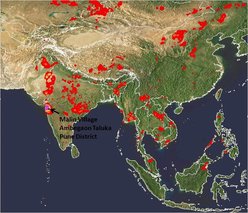
In the tragedy at a tiny village of Malin in Ambegaon, Maharashtra, as per reports till now, around 40 houses are under huge debris created by a landslide that occurred early in the morning on the 30th July 2014. The death toll till now is reported to be 44 with 150-300 missing as per different estimates. Unfortunately, the chances of survival of the missing are dim as per the Chief of Rescue operations.
Destruction at Malin Photo by Atul Kumar Kale Local activistPhoto by Atul Kumar Kale
Let us look at some key factors at play here:
VERY HEAVY RAINFALL: This region is nestled in the Northern Western Ghats which receives heavy rainfall in the monsoons. The region was receiving particularly very heavy rainfall in the week between 25th to 31st July. SANDRP had posted an alert on this on SANDRP Facebook page (https://www.facebook.com/sandrp.in) on the night of 29th July.
Cumulative rainfall in the week as recorded by NASA’s (The National Aeronautics and Space Administration of US) TRMM (Tropical Rainfall Measuring Mission, see: http://trmm.gsfc.nasa.gov/publications_dir/instant_2.html) was more than 600 mm, most of it between 29th-30th July. In fact on the 29th July, the region including Malin was shown purple in 24 hr rainfall map, which signifies the highest range of rainfall, exceeding 175 mm.
The region is still experiencing heavy to very heavy rainfall as we write this on Aug 1, 2014.
Malin receives very heavy rainfall on the 29th July, 9 pm by NASA TRMMMalin receiving high rainfall on the 30th July 2014, 9 pm IST NASA TRMM
It was surprising to read report from Down to Earth about “mere 4 mm rainfall in 24 hours” before the landslide, which is clearly not the case.
With changing climate, frequency of such high intensity rainfall events is predicted to increase, making these areas even more vulnerable to disasters like landslides.
Landslide Warning
Following the very heavy rainfall in the regions around Northern Western Ghats, extending till Gujarat, NASA’s TRMM had also highlighted this region to be strongly landslide prone on the 30thof July.
See NASA TRMM Landslide Prone Area Map on the 30th July 2014 below which highlights Bhimashankar and Malin region:
NASA Landslide potential Map, 6 pm IST on July 30, 2014
The dam connection:
The Malin village is approximately 1.5 kms from backwaters of the Dimbhe Dam, which is an irrigation project involving a big dam completed in 2000. On the 31st July, the dam held 44% of its live storage, that is about 156 MCM (Million Cubic Meters) of water. The link between water level fluctuations in dams and landslides in the rim of the reservoir and backwaters is well documented. Some geologists have also recorded increased landslides activity in areas surrounding Dimbhe Dam in the past. ( http://timesofindia.indiatimes.com/City/Mumbai/More-landslides-likely-in-5km-radius-of-Dimbhe-dam/articleshow/39314716.cms) Even if the dam was not overflowing when the tragedy occurred, it is well known that the dams can induce such landslides around the rim in view of standing water with fluctuating levels, change in drainage pattern and underground water flow pattern.
Google map showing Dimbhe Dam and location of Malin village close to the backwaters
Key salient features of Dimbhe dam: Ht: 67.21 m; Lengh: 852 m; Live Storage Capacity: 354 MCM (www.mahawrd.org); Reservoir Area: 1754.7 ha.
The role played by the dam and its operations on the geology of the region and its possible connection with the landslide needs to be investigated in depth.
Landslides are not entirely new for the region
The region has seen some landslides in the past (e.g. in 2006-7) according to Saili Palande Datar, an ecologist and historian with Kalpavriksh. According to Anand Kapoor of NGO Shashwat active for decades in the region, a landslide had occurred earlier than that, where some cattle were buried and people had to be rescued. In a massive landslide on July 23, 1989, in village Bhaja in Mawal about 60 km from Pune, 39 people were killed.
In the Western Ghats of Pune as well as Maharashtra, a number of landslide-related tragedies have happened. According to a resident of village Tikona Peth in the catchment of Pavana Dam in Mawal tehsil of Pune, a landslide took place in in her village July, 1994 after heavy rains. There were no casualties, four houses were demolished by huge rocks. In August 2004, one person died due to landslide in Male, near Pune, in 2004 again, a worker died due to landslide in work related to a tunnel for a lift irrigation scheme, in June 2005, 4 workers died due to landslide at a tunnel of Ghatghar hydroelectric project.
Role of large scale land modifications in the region
Indeed according to a landslide map developed by Dr. David Petley, International Expert on Hazards and Risks in the Department of Geography at Durham University, the entire region of Western ghats has experienced landslides.
Dr. Petley has also written about the Malin Landslide here: http://blogs.agu.org/landslideblog/2014/07/31/malin-landslide-1/.
Dr. Petley told SANDRP, “Large scale land use modification and deforestation is the issue here”. He further said: “I would hypothesise here that the very heavy rainfall was the trigger, thick weathered soil, the shape of the slope and poor management of development and of water. A proper investigation should be able to ascertain whether this is right, but such large-scale modification of the landscape should be resisted.”
From Dr. David Petley: Landslide events where fatalities have occurred. We can see that Northern Western Ghats also features regularly in the map.
Landscape modifications around Bhimashankar
Bhimashankar region, the origin of river Bhima which is an important tributary of Krishna, is a high rainfall region with spectacular biodiversity. It is also home to Maharashtra’s state animal Malabar Giant Squirrel. The region is home to a vibrant tribal community which has seen several assaults on its way of life through the formation of the sanctuary, displacement caused by Dimbhe & other Dams, recent windmill projects, etc.,
In the recent years, some of the major landscape changes occurring in this region are through mechanised terracing of slopes for cultivation as well as developments related to windmill projects on mountain tops, which entail deforestation as well as road cutting on steep slopes. Although there are no windmill farms in Malin, such farms exist in the neighbouring Khed tehsil. Plans for such farms in Ambegaon are in the pipeline.
It needs to be understood that terracing for cultivation has been a traditional occupation of the tribals in this region, as in most of the Western Ghats. Not only is it an important livelihood support factor, but it has been limited by its scale, location and implementation due to its inherent manual nature. According to Anand Kapoor of Shashwat, tribals themselves do not prefer terraces made by JCBs and other machines as these are not entirely suitable for cultivation.
However, it is also a fact that now some government departments are using heavy machinery like JCBs in their bid to push terracing program. Unscientific mechanized terracing, which comes together with muck dumping, slope instability, affected drainage etc., can play a huge role in magnifying the impacts on a naturally vulnerable, high rainfall region.
In fact, a preliminary report by the Geological Survey of India (GSI) has singled out land flattening and terracing by heavy machinery as one of the primary causes for the tragedy. As per the preliminary report, a team of GSI experts noticed cracks where heavy soil erosion had occurred. The Deputy Director General of GSI has said that these cracks are a result of improper drainage system of rainwater. The flattening of land would have affected the water drainage resulting in the cracks. He says: “The slope of the hill was flattened almost halfway for agricultural purpose to such an extent that the hilltop had become unstable. The experts have also reported excessive deforestation disrupting the ecology of the hill. Added to this was the damage caused by use of heavy machinery over two years.” The Director General and Deputy Director General will be visiting the site on the 2nd and 3rd August for further analysis.
An independent credible review of the way the land levelling activities are going on under government policies and programs should be immediately instituted and till its report is available, use of heavy machines like JCB may be minimised.
Management of the region according to Western Ghats Expert Ecology Panel (WGEEP) Report and High Level Working Group Report (HLWG)
Both reports place Malin in Ecologically Sensitive Zone I and Ecologically Sensitive Area (ESA) respectively.
An ESZ I tag by the WGEEP report regulates a number of activities in the region, with participation of local communities. The report has specifically mentioned threat of landslides in this region.
While noting the impacts of windmills in the region surrounding Malin, WGEEP notes: “Apart from substantial forest destruction (including Forest Department estimates of about 28,000 trees being cut) via wide roads cutting huge swathes through Reserve Forest, the wind mill project has triggered large scale erosion and landslides through poor construction of roads with steep gradients, and all this rubble is ending up on fertile farmland and in reservoirs of tributaries of the Krishna.
The Forest Department is colluding with wind mill project operators in also illegally denying citizens access to these hills. Boards and check-posts have been put up by the company, falsely claiming to be authorized by the Forest Department. There are many traditional forest dwellers on these hills. Not only are their rights under the Forest Rights Act not being recognized, they are being illegally restrained in their movements on hills they have inhabited for centuries.”
If the WGEEP was accepted by the MoEF and state governments, this would have led to a more people-centred and ecologically-sound management of the Western Ghats region, but Maharashtra has been vehemently opposing WGEEP on the most unjustified grounds and the MoEF too has been busy downplaying the WGEEP.
While HLWG did include Malin village in its list of Ecologically sensitive Areas, however, this ESA tag did not mean much for the region it only regulates mining and red category industries. Most of the development activities that might threaten the region are not regulated by the HLWG. More importantly, HLWG has no role for the local communities in democratic decision making. There is also no mention of this region being landslide-prone in the HLWG, whereas the WGEEP specifically highlights this issue.
It is clear that HLWG is not much help for the region in avoiding tragedies like the Malin tragedy, but WGEEP report certainly would have helped.
Way forward
Northern Western Ghats which are characterized by heavy rainfall, rich biodiversity and predominant tribal population need more sensitive management approach than what it is subjected to right now. Although WGEEP had paved way for a more democratic, equitable and people-centred management of the region, the report was hidden, downplayed and finally rejected by the state as well as the central government. Episodes like Malin highlight the vulnerability and complex inter-linkages that affect the region which require a long term planning vision, integrating a number of components.
Despite this, several ill-conceived projects like townships, windmill farms, large dams and river linking projects like Damanganga-Pinjal and Paar Tapi Narmada are proposed in the region. Close to Bhimashankar region, Mumbai Metropolitan Regional Development Authority (MMRDA) as well as the Greater Mumbai Municipal Corporation are pushing more than 12 large dams. Some of these dams entail huge tunnels under the mountain ranges of Western Ghats. Despite the several risks and impacts, many of these massive dams may also escape scientific Impact Assessments or public hearings. These projects needs to be opposed and urgently dropped as there is little justification of the projects in view of huge number of options available in the cities for which these dams are proposed.
Similarly, Maharashtra Government has plans to build three huge hydropower dams in the Velhe and Mulshi region, which also falls in the Pune District. Velhe region has already seen slope instability and also falls in Seismic zone IV, making any such development highly risky there.
Let us hope that the heart-breaking tragedy at Malin is a wake-up call for all of us, paving way towards more sensitive,responsive, democratic and sustainable management of the Western Ghats. As a first step, the state and central government need to accept and implement the recommendations of the WGEEP immediately in Malin and for the entire Western Ghats.
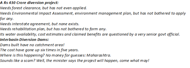
Discussions on Interlinking of Rivers are gaining momentum as new government takes charge at the centre. It is predicted that the new government will be supportive of ecologically and socially questionable plan of interlinking rivers. In this backdrop, it will be interesting to study the fate of a little known scheme of diverting west flowing water to the Godavari Basin in Maharashtra. While the entire ‘grand’ plan includes many such schemes, we are focusing on one of the biggest interbasin diversion project under this scheme. Manjarpada Phase I project which is on a shared basin between Maharashtra and Gujarat, located in the Dindori Taluka of Nashik District. We also look at the status of about 28 interbasin diversion schemes proposed and under construction in this region, their justifications, benefits as well as impacts.
Manjarpada Phase I forms part of the Upper Godavari Irrigation Project under the Water Resources Department, Maharashtra. The original proposal of the Upper Godavari Irrigation Project included Dams like Waghad, Karanjvan, Palkhed and Ozarkhed, which received administrative sanction in 1966. Work was started in 1968. From here on a number of components like Punegaon Dam, Tisgaon Dam, several canals kept getting added to the scheme. However, it remained essentially an intra basin project, there was no inter linking rivers component here.
In 2008 a radically different component was added to Upper Godavari Project. This was the inclusion of 12 diversion weirs on Paar, Taar, Damanganga Basin Rivers that in normal course would flow into Gujarat. These weirs envisaged near the ridge line, transferring waters of these into dams built in the Godavari Basin, via deep canals across the Western Ghats, which will transfer water from west flowing rivers to the east flowing Godavari. According to the White Paper on Irrigation Projects brought out by the Water Resources Department of Maharashtra in December 2012, these diversion weirs and Manjarpada Phase I scheme added an irrigation potential of about 30,000 hectares in the Upper Godavari Projects. The total irrigation potential of the entire Upper Godavari projects is estimated as 74,000 hectares (including 30,000 hectares from Diversion projects), of which potential of 69000 hectares is claimed to be created. This is unbelievable as the Diversion weirs, with a total command of 30,000 hectares, are just about half complete. The White Paper states that about 55% work on Manjarpada project and about 60% work on 11 diversion weirs has been completed.
An interbasin transfer scheme that claims a cumulative irrigation potential of 30,000 hectares will have significant impact on ecosystems, communities and downstream hydrology. But no such studies have been conducted for these projects, there has been no public consultation process and it is not even known if there is any interstate agreement for this transfer. The most striking example is Manjarpada Phase I project which envisages transferring about 500 million cubic feet (Mcft) from the Paar basin into Punegaon dam in the Godavari basin by way of a dam and two significantly big tunnels. Officials of Water Resource Department have stated that the project, submerging 95 hectares of land, also needs Forest Clearance for 65 ha forest land, which has not been granted yet, although work is in an advanced stage! This is clearly illegal as per the Forest Conservation Act (1980).
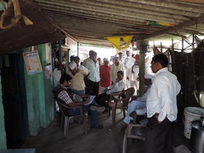
SANDRP’s visit to Manjarapada Phase I Project When we visited the site of Manjarpada project, we were first struck by the name. The project has nothing to do with Manjarpada village, but is entirely based in Devsale Village of Dindori Taluk. Work on the main dam has been stopped for many months now. The villagers say that this is due to local protests, while the officials claim this is due to paucity of funds.
No impact assessment of the project has taken place. When we visited Devsale village, we were mobbed by villagers who wanted to show us the damages caused by the project for which they have received no compensations. The incessant blasting of the tunnel in the hardrock has resulted in cracks to many homes. More than 250 villagers claim that they have lost water from their shallow wells/ bore wells. More than 50 well owners have submitted a memorandum to the Collector and Zilla Parishad office about drying up of their wells.
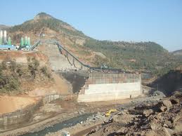
Above: Manjarpada Dam wall under construction. Photo: Amit Tillu for SANDRP
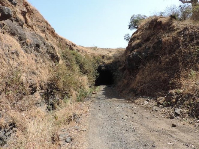
The villagers indicate 2 tunnels under construction for the same project, one of which is complete in 1 km length and the other complete in nearly 8 km length, with a huge air vent 20 m wide and over 150 m deep. The depth of the tunnel underground is about 150-300 feet.
Above: Under construction tunnel at Manjarpada Phase I Photo: Amit Tillu for SANDRP
The laborers employed by the subcontractor do not understand Marathi and cannot respond to questions asked by the villagers. Work on the main dam wall has stopped since the last 2 years. Villagers say that blasting and tunneling has severely affected groundwater in the region, which has fallen drastically after tunneling. Blasting has resulted in not only cracks in over 100 homes, it has led to collapse of more than 10 built open wells, turning them into puddles. This was witnessed by us. Displaced families have not been resettled[1] yet.
Corruption involved in the unfeasible Manjarpada Project: Whistle-blower of the Water Resources Department Vijay Pandhare has been highlighting issues about Manjarpada project since a long time, when he was in service as Chief Engineer at Maharashtra Engineering Training Academy. He had pointed serious irregularities about this project in his letters to the Secretary, Maharashtra Water Resource Department, state Chief Minister Prithviraj Chavan as well as separately to Dr. Chitale who was supposed to be investigating the Maharashtra dam scam.
Pandhare talked exclusively with SANDRP on Manjarapada Project, he said: “This project is planned to transfer about 500 million cubic feet of water and is costing about Rs 500 crores and these estimates will increase. It should have costed a fraction of this. The entire process of Manjarapada Phase 1 was driven by the politician and contractor lobby and there was never any space for rational questioning. In addition to Manjarpada Stage I, the department is now also pushing for Manjarpada phase II downstream of this project, which will divert water right into the Tapi Basin. Now the catchment area of Manjarpada Phase I and Phase II actually overlap and the projects are simply unfeasible as there is no water availability as stated in the water availability certificates. This needs to be thoroughly investigated and I had written about this to many authorities, in vain.”
Shri. Pandhare is justified in raising these issues. If we look at the internal note of MID, with SANDRP, it states that in 2008 Manjarapada project was approved Rs. 62.54 Crores. Till December 2013, Rs 122.66 Crores were spent on this project! This has resulted in 30% work on spillway, 80% on connecting tunnel, 100% on open canal, 72% on diversion tunnel.
The last line on the project drops a bomb. It states: “An estimate for Third administrative approval for Upper Godavari Project, which includes the cost of this project at Rs 430.74 crores for Manjarpada project, has been presented before the government for approval.” So within 5 years, cost of the project shot up nearly 6 folds!
Above: One of the several open wells collapsed due to balsting for Manjarpada project Photo: Amit Tillu for SANDRP
Pandhare writes in his letter to the Secretary and Chief Minister, the letter that initially shook the water management circles in Maharashtra[2]. “The system that makes cost estimates in WRD is has been nearly killed. So the field officer has been made in-charge of working on estimates. In reality the contractor makes these estimates and they are sanctioned without checking. Otherwise such unfeasible and costly work would not be undertaken… In case of Manjrapada project, the cost estimates, especially tunnel excavation costs have been bloated beyond measure. The benefits are hazy. When Phase I is questionable, unfeasible and hugely costly Manjrpada II is being pushed by political backing. This project has a water availability certificate, when in fact the catchment does not have enough water.” He has specifically requested Dr. Chitale to investigate this project.[3]
When we met the Executive Engineer, MI Projects (Local Sector), for Nashik division, he agreed that there is controversy surrounding Manjarpada Projects, especially related to feasibility and overlap of catchment area, but refused to comment further. He softly added that political interference with water resource department should reduce. In the meantime, Chagan Bhujbal, former MP from Nashik region (he lost in 2014 Parliamentary elections by huge margin of close to 2 lakh votes) has been stating that Manjrapada II will happen at any cost.[4]
One of the official stated that Manjarpada project is the ‘Boss’ of these schemes as it will route water from many schemes in the Paar Basin into the Godavari Basin. Though he later added that the main reason for pushing Manjarpada was that the Punegaon Dam, downstream Manjarpada has not been filling up in monsoon and Manjarpada will aid it. This again underlines Pandhare’s claim that water availability certificates being given for projects in Maharashtra (like Punegaon) are not scientific and driven by other motives!
Above: Villagers at Devsale talking about issues of Manjarpada Project I Photo: Amit Tillu for SANDRP
Incidentally, according to white paper, it’s interesting to see the list of water users downstream of these projects. They include Ranwad sugar factory, K Distillery, Ashokumar Hatcheries, Everest Industries, Seagram Distillery, Shivam chemical, Kadwa Sugar industry, Dinodri MIDC (which is a Wine MIDC in Maharashtra) & have a reservation on 136 MCFt. While Manmad taluka suffered acute water stress in drought in 2012-13, water supply to distilleries and wine industries continued.
This whole episode involving the project, its decision making process, lack of impact assessment and credible techno-economic appraisal and monitoring raises many questions. In the first place, the Manjarpada project highlights the need for thorough participatory processes that should be undertaken before taking up such projects, especially when they involve interbasin transfers.
Maharashtra and Gujarat have signed an MoU to transfer waters from Damanganga River into Vaitarna basin through Bhugad, Khargihill and Pinjal Dams and tunnel systems. The tunnel envisaged between Pinjal and Khargihill stretches over 64 kilometers, more than 5 times the tunnel in Manjarada. It is clear that the impacts of not only the dams, but the tunnel systems will be huge and need investigation.
More than 19 Diversion Projects diverting “unutilized water going waste to the Arabian Sea”
When we met officials at the Minor Irrigation Division (MID), they showed us the map of intricate links planned in the entire Damangagang, Paar, Naar Basin as well as parts of Vaitarna and Ulhas basin to transfer water “flowing unutilized to the Arabian Sea” into the Godavari Basin. It is difficult to imagine that a project of this massive scale, which can transfer nearly 400 MCM from West Flowing basins into the Godavari basin is going on without any project specific impact assessment, cumulative impact assessment, cost benefit studies, environmental appraisal, environment management plan, public consultations, environmental monitoring and based on questionable water availability studies.
The Maharashtra Irrigation Dept GR dated Sept 2005 approved the proposal of diversion schemes near the ridge line to divert water which was “going waste, unutilised into the Arabian Sea” to Godavari Basin in the East. 19 such schemes have received approval from the Hydrology Project (Jal Vgyan Prakalpa) Nashik. Of these 19 schemes, 13 have been included in the second administrative approval of the Upper Godavari Project, but there are in all nearly 28 diversion schemes under consideration. Table in Annexure 1 provides details of the various schemes under this project.
Above: Diversion Weirs at Dindori, with deep canal on the upstream transferring water Photo: Parineeta Dandekar, SANDRP
SANDRP team also visited some of these diversion weirs.
In case of Amboli Diversion Weir, its capacity is supposed to be close to 1 MCM (million cubic meters). It was bone dry in May when SANDRP team visited it. Sagar Marathe, who resides next to the weir states that the weir, now complete, hardly holds any water in it. The reason seems obvious. Just 200-300 mts upstream the dam wall, a high canal embankment runs, which means that the dam has nearly no catchment area! There is no study on the amount of water that is indeed diverted into Kashyapi River here, a tributary of Godavari.
Above: Dam wall and the dry Amoboli Diversion Weir reservoir can be seen on the left, on the right is a tall embankment of an older canal which runs parallel to the dam wall and is much longer. Effectively, the dam has nearly no catchment. Photo: Parineeta Dandekar
In case of Waghera diversion weir, which is supposed to be under construction, the tribal villagers told SANDRP that the mud dam has been existing since the past 20-25 years and the only work going on is digging the canals! But the MID note does not state that the dam is already existing, possibly indicating an irregularity.
These examples are only indicative. They highlight the need for transparent and participatory studies surrounding these projects.
Above: Unlined canal in Dindori, transferring water onto Waghad Dam. Photo: Parineeta Dandekar, SANDRP
Environment laws violated, but MoEF in dark and inactive! Manjarpada Diversion and other diversion dam projects are coming up in violation of the EIA Notification 2006, but MoEF seems to know nothing about it. Manjarpada or other diversion schemes cannot claim exclusion from the environmental appraisal process since it involves huge irrigation, in addition to inter basin transfer, domestic & industrial water supply.
The entire diversion scheme raises big questions about significant impacts, needs of the downstream population, local opposition and finally questionable and unassessed benefits. We hope MoEF will take cognizance of the legal violations and take stringent steps against Maharashtra government. Unfortunately Maharashtra is mired with too many of such examples, in addition to the dam scam.
– Parineeta Dandekar ( parineeta.dandekar@gmail.com), Amit Tillu ( amittillu@gmail.com) with inputs from Himanshu Thakkar ( ht.sandrp@gmail.com)
~~~~~~~~~~~~~~~~~~~
Annexure 1
Table 1 Overview of Interbasin diversion projects planned to divert water into the Godavari Basin.
Name
Basin
Basin in which water is transferred
Quantity
Remark
Manjarpada Diversion Project Nashik
Par
Godavari: Punegaon and Karanjvan Dams
17.16 MCM
Golshi Mahaji Flow Diversion Project, Dindori
Damanganga origin 10 nallahs to be diverted
Waghad Dam, Godavari
0.47 MCMto be transferred
Current cost around 32 Crores( 12.97 spent, 21.31 requested)
Nanashi Flow Diversion Project, DindoriNashik
Nar-Par. Dam at the origin of Par, from here to Hattipada DW, from there to Karanjvan Dam
Karanjvan Dam, Godavari
1 MCM into Godavari 0.55 MCM for local use
Initial estimate was 3.04 crores in 2008. Actually 3.81 crores spent, Now application for 17.1 crores made for 3rd administrative approval
4.
Golshi 1, Flow Diversion Project, Dindori Dindori
Damanganga Basin
Waghad Dam
3.11 MCM
1.29 crores in 2008.3.15 crores asked in 3rd administrative approval
Schemes which do not have administrative approval, but are included in the Upper Godavari Project by the Godavari Irrigation Development Corp.
Velunje-Amboli Dvrsn Prjct
Damanganga
Godavari
1.447 MCM
16.07 crores estimated
Kalmuste Diversion project
Damanganga
Godavari
23.141 MCM by a diversion weir
333 Crores estimated price
3.
Kapwadi Diversion Project
Ulhas
Godavari
7.04 MCM
Estimated cost 60.8 Cr
Sub Total
31.62 MCM
Projects with survey permissions and administrative approval
Lift dvrsn prjct 3, Surgana
Paar
Godavari
94.37 MCM
Lift dvrsn prjct 4, Surgana
Paar
Godavari
89.12 MCM
Sub Total
183.49 MCM
Water Diversion from Upper Vaitarna Basin to Godavari Basin
Note: GOM approved the scheme to fit doors to the saddle dam of Vaitarna project and transfer water into Godavari. However, Thane Circle of KIDC had acquired 4689 hectares of Upper Vaitarna Project. Eventually, Dam height was reduced and 623 hectares was additional land left which should have been returned to the PAPs. But this was not done. There is a strong opposition of local people to any survey without this return. No has been conducted as yet.
28.50 MCM.
6 Diversion projects for Ahmednagar under very primary planning
Hivra Walvani Diversion Weir
Pravara
18.46 MCM
13 hectares forest land
Samrand Diversion weir
Pravara
17.98 MCM
6 hectares forest land bot fall in PA. Hydrology Project communicated that the project is not supported by the GOM. CE, KIDC has written in 2012 that there is no water to transfer to the east.
Sub Total
36.44 MCM
Transfer water from Shai and Kalu Basins into Akole between Harishchandragad and Ajoba Mountain into Mula basin
Tolarkhind Tunnel Project
18.08 MCM
CE, KIDC has written in 2012 that no surplus water available in Shai & Kalu Basins for dvrsion.
Khirehwarer Tunnel Prject
40.01 MCM
Sadada Tunnel Project
11.13 MCM
Pathar Ghat dvrsn canal pr
7.67 MCM
Diverion from Kalu and Shai Basin
76.89 MCM
TOTAL PLANNED DIVERISON FROM WEST TO EAST in Godavari Basin
391.77 MCM
Source: Minor Irrigation Department, Nashik Division
Middle Vaitarna Dam across the west flowing Vaitarna River near Mumbai is supposed to be a state-of-the-art technological feat. It’s a 102 meters tall concrete dam, the second tallest in Maharashtra. It was built with an what is claimed to be innovative mix of cement and fly ash from Eklahere Thermal Power Plant. The dam is also claimed to be completed in a record time. Additional Commissioner, Municipal Corporation of Greater Mumbai (MCGM), Mr. Jalota claims that Middle Vaitarna was completed in 15.5 months out of the total project duration of 42 months. This speed is supposed to be ninth fastest globally for RCC Dams[i].
Middle Vaitarna Project Photo with thanks from mmmhydropower.blogspot.com
The project was partly funded by the Jawarharlal Nehru National Urban Renewal Mission (JNNURM). When fully functional, the dam will be supplying 455 MLD (Million Liters per Day) water to MCGM (Municipal Corporation of Greater Mumbai), one of the biggest Municipal Corporations of the world.
So many exceptional performances claimed for one dam!
One would expect the similar concern for efficiency and speed while dealing with rehabilitation and resettlement of project affected population.
The project submerged over 3473 hectares of land (8581 acres land) including over 634 hectares forests (1566 acres forest). It also affected about 8 villages and several adivasi padas in the region. Of these, only 35 families who lost their homes were rehabilitated in a colony near the project site of Kochale village.
A visit to the rehabilitation colony in 2012 and in January 2014 where the project affected families moved in last year reveals:
Extremely poor construction quality. Just one year after families moved in, roofs of one of the houses collapsed. Human injury was narrowly avoided.
Resettlement Colony of the Middle Vaitarna Dam. Photo: Amit Tillu
Almost all of the homes are chronically leaking.
There is no drinking water supply to this colony. The main supply tank does not get water. So no taps are working.
Middle Vaitarna Colony Photo: Amit Tillu
There is no water in the toilets. Site-in-charge and contractor orders a tanker when they feel like.
Common electric connections are defunct: Contractor took away the meters. No electricity at Hospital, Temple and Community Hall.
No Doctor has been appointed at the hospital. It’s an empty building.
Middle Vaitarna resettlement colony Photo: Amit Tillu
Completely disillusioned by these houses, many affected people have built separate mud and thatch houses next to the ‘Sarkari’ homes.
Middle Vaitarna Resettlement Colony Photo: Amit Tillu
What is the state of other Project affected people?
The affected people from Kochale, Karegaon, Vihigaon have received paltry compensation sums at Rs. 28000 per hectare for cultivated land. This is much lower than per hectare compensation given to the Forest Department for trees lost.
Smt. Sangeeta Vare from Kochale village, struggling to get a project affected certificate Photo: Parineeta Dandekar
Project affected were told that one member from each affected family will get a government job. Land acquisition for Middle Vaitarna has been done under the article 52 A of the Maharashtra Land Acquisition Act, which includes provisions for ‘Urgent’ land acquisition. Special Land Acquisition officer promised that action will be taken about securing some jobs. After a long follow up, none of the project affected have received jobs. Requests for recommendations for temporary jobs at the dam site have also been denied.
Regarding “Project Affected” Certificate (Government Resolution 21 Jan 1980): According to the Maharashtra Project Affected Persons Rehabilitation Act 1999, it is the duty of the Collector “to issue a certificate to a person who is nominated by the project affected person for being employed against the quota reserved for the nominees of the affected persons”.
None of the PAs from Middle Vaitarna have received these Certificates, even after repeated and expensive follow up with a number of agencies.
When they contacted the Tahasildar, they were given a list of 12 documents that they have to compile in order to get this Certificate.
These documents include certificates from 4 other officials.
Considering the fact that all the Project affected persons of Middle Vaitarna Project are financially vulnerable tribals, with minimum education and considering that this small number of population is bearing the brunt of displacement and loss of livelihood for a mega city, they could have been helped with in this task.
In the case of Bhatsa Dam near Middle Vaitarna, the same conditions prevails for over 35 years. Project affected have not received full compensation, have not been given project affected certificates or any jobs.
The state of rehabilitation and resettlement for the claimed state of art dam seems dismal to say the least. More than 12 dams are coming up around Mumbai Metropolitan Region for drinking water supply. These will together affect more than one lakh tribals and over 7000 hectares of forest.


 Discussions on Interlinking of Rivers are gaining momentum as new government takes charge at the centre. It is predicted that the new government will be supportive of ecologically and socially questionable plan of interlinking rivers. In this backdrop, it will be interesting to study the fate of a little known scheme of diverting west flowing water to the Godavari Basin in Maharashtra. While the entire ‘grand’ plan includes many such schemes, we are focusing on one of the biggest interbasin diversion project under this scheme. Manjarpada Phase I project which is on a shared basin between Maharashtra and Gujarat, located in the Dindori Taluka of Nashik District. We also look at the status of about 28 interbasin diversion schemes proposed and under construction in this region, their justifications, benefits as well as impacts.
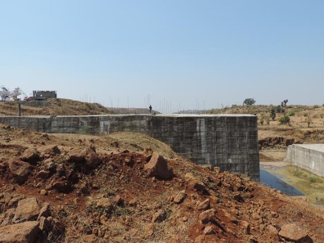
 Above: One of the several open wells collapsed due to balsting for Manjarpada project Photo: Amit Tillu for SANDRP