In recent years Madhya Pradesh has been on a Major Irrigation project spree. Some such projects at various stages of Environmental and forest clearance from MP recently include the Kundaliya Major Irrigation Project which will submerge nearly 8000 hectares of land and displace more than 8000 people, Kalisindh Major Irrigation project which will submerge nearly 5000 hectares of land and displace more than 2000 people, Mohanpura Major Irrigation project which will submerge more than 7000 hectares of land and displace more than 10,000 people and Bansujara Multipurpose project on Dhasan river (Betwa/Yamuna basin) which will submerge more than 5200 hectares (though the EMP of the project also done by WAPCOS (Water and Power Consultancy Services) then says that submergence will be 7476 hectares!) and displace at least 25,000 people .[i],[ii]
Projects in Narmada Basin Photo: NVDA
It is significant to note that Madhya Pradesh has one of the worst records of dealing with rehabilitation and resettlement of affected population. The state is struggling with several serious issues including mining (including illegal mining), sand mining, deforestation, alienation of tribals from their lands and rights, etc.
Affected tribal population of the Kharak Dam in Khargone District who were brutalised by police force for peacefully protesting against the dam Photo: The Hindu
It is also significant that it was at the behest of Madhya Pradesh Chief Minister Shivraj Chouhan that the clause of Social impact Assessment for Irrigation Projects and land for land compensation for affected population was deliberately removed from the new Land Acquisition Act 2013 (The Right to Fair Compensation and Transparency in Land Acquisition, Rehabilitation and Resettlement Act, 2013).[iii] How the Union government agreed to this blackmail is another question.
Chinki Project Latest addition to the long list of irrigation projects in MP is the Chinki Major irrigation Project in Narsinghpur District, proposed by the Narmada Valley Development Authority (NVDA). The project envisages irrigation for 89,029 ha of gross command area in Narsinghpur and Raisen Districts and 15 MW of hydro power generation. This project will affect more than 8000 hectares of land and affect a whopping 49 villages in Narsinghpur and Jabalpur according to its preliminary estimate. The project was awarded Terms of Reference Clearance by the EAC of the MoEF in its 58th meeting in June 2012. Recommending TORs (Terms of Reference, which is the first stage clearance) implies that the pre-feasibility study has been done thoroughly and the same is appraised in detail by the MoEF’s (Ministry of Environment and Forests) EAC (Expert Appraisal Committee) for River Valley Projects.
Narsinghpur in Madhya PradeshChinki Irrigation Project Plan
Shattering all these assumptions, we see that Chinki Multipurpose project has applied for TORs again and is on agenda for the 72nd EAC meeting being held on Feb 20-21, 2014 for strange reasons. A perusal of the new PFR (Pre Feasibility Report) exposes that the initial PFR and assumptions were flawed beyond imagination! The initial PFR was done by WAPCOS, which is under the Ministry of Water Resources of India. WAPCOS has been routinely churning out studies of substandard quality and seems to have a strong bias AGAINST environment and people. At the same time, this incidence raises a question mark over the so called “detailed scrutiny” that is done by the EAC of the MoEF while appraising a project. SANDRP studied the new proposal in detail and sent comments to the EAC, MoEF. Excerpts from the submission are given here.
Vast difference between two PFRs! The EAC had issued TORs to Chinki Project in its 58th meeting in June 2012 9PFR by WAPCOS). It is shocking to see the drastic changes between the two PFRs, considering that the dam site and command is staying exactly the same.Comparison of original project features with revised features reveals that the changes in project features include-
Catchment area decreased by more than half the original from 8,802 sq. km to 4,377 Sq. km
Dam height decreased from 35.5 m to 30 m.
Submergence increased more than twice from 3,250 Ha to 6,995 Ha
Land to be acquired nearly doubled from 4,150 Ha to 7,895 Ha
FRL decreased from 348 m to 340 m.
So with lesser catchment area, same dam location, lower dam height, the submergence area has more than doubled!!
These facts highlights how shoddy and unreliable the initial PFR done by WAPCOS and put forward to the EAC was, which was cleared by the EAC. This is a clear case of providing factually wrong reports to the EAC and MOEF and EAC and MoEF should take a clear stand on this instance and suggest necessary punitive steps against the Project Proponent and WAPCOS. This is yet another instance of shoddy work of WAPCOS.
It is high time that the EAC and MoEF blacklist WAPCOS for its conflict of interest and poor quality work. The EAC should not award a new TOR for this scheme, but should ask the MP government to change its EIA consultant, enquire into the reasons and persons responsible for this fraud and undertake necessary steps, including points raised below.
Cumulative Impact Assessment of Projects on Narmada should be mandatory before considering any more projects: The 58th Meeting itself noted the severe over-development of NarmadaBasin in Madhya Pradesh and beyond. The Chinki Multipurpose Project on the Narmada is sixth project after the Upper Narmada, Raghavpur, Rosara, Basania and Bargi Projects, amongst the schemes proposed in the upstream of this site on river Narmada. There are 7 existing projects in the Narmada Basin namely, Karjan (Karjan River), Sukta (Sukta River), Tawa (Tawa River), Barna (Barna River), Bargi (Narmada River) and Matiyari Major (Matiyari River). There are 7 on- going projects namely; Sardar Sarover on Narmada River, Jobat (Hathni River), Man (Man River), Upper Beda (Beda River), Maheshwar, Omkareshwar and Narmada Sagar on Narmada River. Besides these projects, there are 17 projects proposed in the basin!
Jal Satyagraha at Omkareshwar Dam Photo: The Hindu
Most of these projects are fraught with serious issues related to massive displacement, forest submergence, poor rehabilitation and resettlement, tribal issues and forest rights, reservoir fishing leases, legal and procedural issues, questionable benefits, lack of assessments or appraisals, etc. Considering these issues and also MoEF’s Office Memorandum of May 28, 2013, a cumulative impact assessment of all projects in Narmada, including the carrying capacity study should be carried out. This was recommended by the EAC also in its 58th meeting. However, this study should not be conducted by MP Govt or NVDA or WAPCOS, as this is a clear conflict of interest. The study should be carried out involving a multidisciplinary team of experts & local participation after TORs of the study are discussed in public domain. Only after such a study has been approved through a participatory process should other projects be considered. Looking at the severe impact of ongoing projects on Narmada and its people, this is needed to uphold the principle of sustainable development.
Madhya Pradesh’s extremely poor track record of rehabilitation & resettlement For almost three decades now agitations have been going on against MP Govt’s poor R&R. In one of the latest episodes, in Aug 2012, several affected people from Omakareshwar and Indira Sagar Dam undertook a Jal Satyagrah for 17 days together against absence of rehabilitation by MP Govt. The Supreme Court issued a show cause notice to MP Govt and again in 2013, the SC passed strictures against MP Govt when the latter tried to demand an undertaking from farmers affected by the Omkareshwar dam to the effect that they will not demand compensatory land under the rehabilitation policy[iv]. The MP Government has indulged in a number of unfair and unjust practices about rehabilitation and resettlement. It is to be noted here that at least 5 villages submerged by the Omkareshwar dam were not even envisaged to be submerged, indicating the blunders in planning, as well as insensitivity to the displaced population. Affected population of Omkareshwar had to risk their lives while protesting against the unjust ways of MP Government. MP govt’s injustice to SSP affected people is well known, the govt just refused to provide land to the displaced people. MP govt has also shown least concern of the impacts of such projects on the downstream states[v].
Again last year, oustees from Omkareshwar, Indira Sagar, Maheshwar, Maan and Upper Beda all protested together[vi] in Bhopal. The EAC should be aware of the past performance of MP govt in this regard, it should not give TOR clearance for Chinki project which will submerge nearly 8000 ha of land.
WAPCOS’s poor track record: Time and again WAPCOS reports have proved to be of poor quality, aimed only at pushing projects and not concerned at all with any objective or rigorous analysis of the impacts. We have pointed this out to the EAC several times, latest related to Kundaliya, Bansujara[vii] and Mohanpura[viii] Irrigation Projects in MP, and Kangtangshiri HEP in Arunachal Pradesh, but the EAC and MoEF do not seem to be bothered by these serious problems. NGT has indicated that problematic EIA agents need to be blacklisted, but MoEF is not ready to blacklist WAPCOS. Even the Forest Advisory Committee, a statutory body, has passed strictures against WAPCOS.
Plagiarisation: In Chinki Project too, section on wildlife and forests is in fact a description of Kanha National Park, which is far away from the project site. The section says: “At times one is surprised that wild life has survived so well despite the decades of senseless slaughter indulged in by the so called big-game hunters.” This seems unrelated to the project site and is plagiarized from a MP tourist website![ix]
No mention of cumulative impacts: The PFR makes no mention of evident cumulative impacts. The entire section on environmental impacts is superficial.
Discrepancies: The EAC had specifically noted the impact of 2 kms tunnel on forest land. At page 6 and 24, PFR mentions length of tunnel to be 66 meters. At page VII-4, the length of the same tunnel becomes 2.025 kms and at VII- 49, it becomes 2.5 kms!
Form I: In the section 9 on Cumulative impacts, the Form I says there are no cumulative impacts! This is absolutely incorrect when the hydrology, sociology and ecology of the Narmada basin is being changed by several existing, planned and u/construction dams in the basin.
Rainfall in command is nearly 1200 mm! Options Assessment needed: The PFR states: “The purpose is to develop irrigation to about 74273 ha culturable command area spread over the Narsinghpur and Raisen Districts to improve the irrigation system by supplementing limited and erratic rainfall.” (Emphasis added.) Now the average rainfall of Raisen and Narsinghpur Districts is 1200 and 1192 mm each! This is by no means limited. The taluks to be services by the project: Kareli, Tendukheda, Barely and Udaipura have good groundwater irrigation. Barely is the biggest Gud Mandi in India and also has a good network of canal irrigation. In such a situation, rainwater harvesting, groundwater recharge & watershed management should be the first options rather than large dams.
In fact, looking at the dependence on groundwater and the groundwater potential of the region, the Central Groundwater Board recommends creation of several percolation tanks.[xi]
Considering all these issues, we have requested the EAC not to award TORs to Chinki Irrigation Project unless Cumulative Impact Assessment is completed, thorough options assessment is done and a holistic view of human and ecological development in NarmadaBasin in Madhya Pradesh is adopted. We also expect the EAC to recommend action against the Project Proponent and WAPCOS for submitted factually wrong reports to EAC and MoEF.
[ii] Other recent projects include Pancham Nagar Multipurpose project in Ken River Basin requiring 2260 ha of land, Pawai irrigation project on Ken River in Panna district, Runjh irrigation project in Panna district, Datuni irrigation project in Dewas district, Sip Kolar River link project, Upper Ghogra irrigation project in Sehore district in Narmada basin and Tori Tank project in Badwani district.
Lohit Basin Peoples’ forum for Project Affected Families
Tezu, Arunachal Pradesh
Press Note January 20, 2014
Kalai II Public hearing was full of violations, must be cancelled
Affected people intimidated, beaten up and not allowed to speak by police & politicians
The statutory Public hearing conducted on Saturday, January 18, 2014 at Hawaii in Anjaw district in Arunachal Pradesh about the proposed 1200 MW Kalai II hydropower project in Lohit River Basin was marked by some serious violations that included intimidation of the affected people who wanted to raise questions and speak up, several people getting beaten up by the police and others, people that were not allowed to speak up, taking over of the public hearing by the MLA with his six hour long speech and public hearing stretched beyond midnight, apparently to manipulate the minutes of the public hearing. All these are serious violations of all the accepted norms of public hearing and cannot be acceptable. This is in addition to many procedural violations that were communicated through our written letter to Arunachal Pradesh State Pollution Control Board, Deputy Commissioner of the Anjaw district and members of the Expert Appraisal Committee on River Valley Projects in Union Ministry of Environment and Forests, the letter remains unanswered.
A public hearing without public: Chairs remain vacant at the Kalai II public hearing venue
The hearing began at 10 AM with officials of WAPCOS (the EIA consultant agency) briefing the public about the EIA report. When Mr. Bihenso Pul, one of the project affected person stood up to question the officials on their false claim that a consultation was held with the affected land owners in the third stage of EIA, all of a sudden, the local MLA Mr. Kalikho Pul along with his close relatives and workers started threatening him and warning him of dire consequences. Witnessing this, the whole project affected public who had come to take part in the public hearing stood up in support and defense of Mr. Bihenso Pul. Following this, the personnel of Arunachal Pradesh Police started indiscriminately assaulting and lathi charging the public. Mr. Soti Tawsik, a Gram Panchayat Member from Nukung village from INC ticket was also grievously injured due to the lathi charge by police personnel when he tried to raise questions and express his opinion on the project. He was referred to Dibrugarh for further treatment as he was in a critical condition. Others injured include Baah Tawsik and Checheso Tawsik.
A Public hearing held by Suppressing the Public: The Injury Mark from the Lathi charge is Clear on his Forehead
During the presentation on EIA by WAPCOS (it is an agency under Union Ministry of Water Resources, which itself functions like a Big Dam lobby and hence there is conflict of interest in WAPCOS doing any impact assessment work since impact assessment is supposed to be done by an unbiased, independent agency. Moreover WAPCOS is also involved in feasibility studies and detailed project reports for justification of projects, its track record is also very poor with both Expert Appraisal Committee and Forest Adivosry Committee of MoEF having crticised their work), even the illiterate villagers started expressing resentment over WAPCOS’s complete lack of knowledge on the topology, flora and fauna of the project affected region which was evident from the multiple factual mistakes made by the during the presentation. They were showing pictures of common fishes found in Parshuram Kund region and telling the villagers that the fishes were photographed from must higher elevation Kalai II project affected region. They did not even recognize the species of common Mynah available in the region and were calling it with different names.
The Public hearing was completely dominated by Shri. Kalikho Pul, the local MLA who spoke for 6 hours at a stretch starting from 6 pm, trying to convince the project affected families with misleading facts, while his workers and the Police personnel were highhandedly suppressing and manhandling every single person who stood to express his opinion or raise a question. Mr. Kalikho Pul also levelled baseless allegation of corruption against Mr. Bihenso Pul who is not even a government servant. Eventually, after being frustrated by the arbitrary, coercive and one sided conduct of the Public hearing, the project affected people started leaving the venue shouting slogans against the MLA and the administration stating they would never succumb to such illegitimate pressure tactics. If the public had not shown restrain and maturity during the mindless repressive act by police the incident could have taken an extremely dangerous turn.
An overwhelming about 60% of the affected people are against the project now being taken up. Even those 30% of affected who may be giving conditional support, have put forward a list of 23 conditions that are yet to be responded to. The rest 10% of the affected are as yet undecided. It is thus clear that the project as it stands do not have public support and with people not allowed to participate in the public hearing, the opposition will only get stronger. It may also be added that the same WAPCOS had done a shoddy EIA of the under construction Lower Subansiri project that remains stall for over 25 months now due to public opposition. The fate of Kalai II, if pushed without proper credible assessment of the project and basin level impacts and credible public hearing, will not be any different.
Finally, all the members of public left the meeting venue. The request to postpone the Public hearing in view of the incident to the next day by Mr. Bihenso Pul too was turned down and the hearing continued past 12 in midnight with only the Deputy Commissioner of Anjaw District, officials of Reliance Power Limited, Officials of WAPCOS & APSPCB and Mr. Kalikho Pul, Local MLA Anjaw district present during the meeting. This was clearly done to ensure finalization of manipulated minutes of public hearing.
This public hearing must be cancelled, an independent, credible enquiry conducted in the way in was sought to be conducted and in any case a fresh public hearing should be ordered after taking care of all the legal violations.
Kalai II HEP – Status of compliance with TOR in EIA and EMP:
Serious non compliance of EIA-EMP: EIA-EMP must go back to consultants WAPCOS
Public hearing based on such EIA-EMP will not be legally valid
The EIA EMP reports of the proposed 1200 MW Kalai II HEP in Lohit basin in Anjaw district in Arunachal Pradesh has been put up on the Arunachal Pradesh Pollution Control Board in advance of the public hearing slated for January 18, 2014. The EIA-EMP report is supposed to comply with the Terms of Reference (TOR) for the EIA-EMP given by the EAC and MoEF, this is statutory requirement as per the EIA notification of Sept 2006. We have just checked this compliance and find that the EIA and EMP reports have not fulfilled a very large number of the TOR (Terms of Reference) that the project was to cover in EIA-EMP as per the TOR clearance given for the project on 9.12.2009. Such EIA-EMP will clearly not be acceptable even from statutory and legal point of view and cannot be basis for a public hearing. Hence Arunachal Pradesh State Pollution Control Board (APSPCB) and MoEF should immediately cancel the public hearing and ask the EIA-EMP consultants to comply first with the TOR.
Invalid extension since EIA-EMP does not comply with the TOR Here it may be added that as per minutes of 70th EAC meeting dated Dec 10-11, 2013, “In the mean while, MOEF issued an Office Memorandum dated 22-Mar-10 which stipulates that the proposals which were granted TORs prior to the issue of this OM, the EIA / EMP reports should be submitted after public consultation no later than four years from the date of the grant of the TORs with primary data not older than three years. Thus the TOR issued to the project on 9th December 2009 is valid up to 8th December 2013”. By this norm, the Kalai II TOR clearance should have lapsed on Dec 8, 2013. However, EAC decided to give an extension to TOR for this project, since the project developer claimed, as noted in EAC minutes, “With the completion of all the studies, the draft EIA/EMP report for 1200MW Kalai-II HEP was prepared and submitted by the developer to Arunachal Pradesh State Pollution Control Board (APSPCB) vide letter dated 31st July 2013…”. However, this assumes that the EIA-EMP submitted complies with the TOR given by MoEF. But this analysis shows that there is serious non compliance of the EIA-EMP with the TOR and hence submission of such fundamentally inadequate EIA-EMP cannot be a valid reason for providing TOR extension beyong legally stipulated period.
Location of Kalai II HEP. Source: EIA report
A list of TOR noncompliancein the EIA-EMP is given below.
Noncompliance in EIA Report:
Geological and Geophysical Aspects
Regional Geology and structure of the catchment – some details only about has been mentioned in the EIA, the latter is not available
Seismicity , tectonics and history of past earthquakes in the area – the EIA only mentioned about seismicity, the latter two has been completely ignored
Critical review of the geological features around the project area – not available
Impact of project on geological environment – not available
Justification for location & execution of the project in relation to structural components (Dam height) – not available
Hydrology
Graph of 10 – daily discharge before and after the project at the dam site immediately below the dam should be provided i n the EIA study – Not available
The TOR mentioned “An elementary stream gauging station should be established at a suitable location downstream to the Dam site of the project” and “Installation of two Rainfall Gauge Stations at upstream of dam site” but none of these has been complied with.
Surprisingly the EIA also mentioned “No gauge and discharge (G&D) data is available at the Kalai-II project site or in the neighborhood.”
Biological resources
1) “Cropping and horticulture pattern and practices in the study area” – no mention of this in the EIA
2) Regarding identification of rare and endangered flora and fauna the EIA report mentioned only one “During the study in various seasons in Kalai-II HE project area, following IUCN Red List of threatened plant, Lagerstroemia minuticarpa falls under endangered category. Rest of the species are common in Arunachal Pradesh. However, this species though observed in the study area but not found in the land to be acquired for the project.” (section 8.7 page 8 -22) This is a strange claim that the species is observed in the study area but not found in the land for the project.
3) Fish and Fisheries
a) The 5 location of study of Fish migrations & Breeding grounds was not done
b) Impact of Barrage building on fish migration and habitat degradation was not studied
c) Overall ecological impact upto 10 Km d/ s from the confluence of the TRT with the river or reach of the river in India have not been not studied. The impact of untreated and waste water into the river was not studied and no alternatives explored.
4) In the part of impact prediction, impacts on flora and fauna due to changed water quality has not been assessed
Socio Economic aspects In terms of Socio-economic aspects the following should have been included in the EIA report.
· Land details*
· Demographic profile
· Ethnographic Profile
· Economic structure
· Development profile
· Agricultural practices
· Cultural and aesthetics sites
· Infrastructure facilities: education, health and hygiene, communication network, etc.
· Impact on socio- cultural and ethnographic aspects due to Construction of Barrage
But the EIA does not do several of these profiles and limits itself to – Demographic profile, Educational levels, Occupational Profile, Land holding pattern, Assets owned and Livestock and other socio-economic parameters etc.
In page 11- 8 EIA report says “Impacts on cultural, archeological and religious properties Monuments of cultural/ religious/ historical/ archaeological importance are not reported in the project area. Thus, no impacts on such structures is envisaged.” However, the EIA should have looked into the impact of project on places of cultural, religious importance for the local communities.
Impacts related to Land The EIA ignores what has been suggested in terms of impact prediction for land. The EIA completely ignores –
a) Changes in land use and drainage pattern
b) Changes in land quality including effects of waste disposal
c) River bank and their stability
d) Impact due to submergence
However, in page no 10-23 in the section “Impact of Impoundment on Landuse” the EIA mentions: “The construction of the dam would form the reservoir which will submerge about 640 ha of area in upstream. The area witnessed jhum/shift cultivation practiced by local inhabitants. Submergence of the area would not impact much on the prevailing land use pattern.” This is a false and misleading statement since in the hilly areas of Arunachal Pradesh, shifting cultivation is the main process of cultivation and submergence of such a large area is sure to have impacts on land environment.
TOR Noncompliance in Environment Management Plan:
Under Catchment Area Treatment Plan, the TOR letter had asked the project proponent to prepare 5 thematic maps v i z . Slope map, Drainage map, soil map, Land use/ Land cover Map, Aspect map. Basing on these maps an Erosion Intensity map should have been prepared. But the EMP only has two maps Slope map and Land use Map. No Erosion Intensity map was prepared.
Under Compensatory Afforestation Plan it was mentioned that “The choice of species for Afforestation should be suggested and the proper sites for the same should be demarcated on the maps.” There is no map in the EMP report’s chapter on Compensatory Afforestation Plan.
Under Greenbelt Plan the scoping clearance asked for “….suitable plant species should be recommended with physical and financial details. A layout map showing the proposed sites for developing the green belt should be prepared.” But the EMP report chapter on greenbelt does not at all comply with it. It makes no mention of any species and no map had been prepared.
The TOR clearance letter under “Reservoir Rim Treatment Plan” asked for “Layout map showing the landslide/ landslip zones should be prepared.” But the maps provided in chapter 17 of the EMP report are not at all clear and the when zoomed in they get blurred. So the sites, even if they exist in the maps cannot at all the located.
The TOR clearance letter under “Muck Disposal Plan” had asked for “The quantity of muck to be generated and the quantity of muck proposed to be utilized should be calculated.” This was not complied with and EMP report in chapter 6 mentioned only about the muck generated from excavation. Under the same, the scoping clearance also asked for “Layout map showing the dumping sites viz – viz other project components should be prepared.” There is no layout map showing the dumping sites.
The TOR clearance letter under “Restoration Plan For Stone Quarries” asked for “Layout map showing quarry sites vis-à-vis other project components should be prepared.” There is no map prepared for complying with this condition.
For “Landscaping and Restoration Plan” TOR letter asked for proper map showing landscaping and restoration site but this was not complied with in the EIA report.
The TOR letter asked the consultant to include a “Certificate” in EIA/EMP report regarding portion of EIA/EMP prepared by them and data provided by other organization (s)/Laboratories including status of approval of such laboratories. The consultant WAPCOS did not comply with this.
Conclusion These are crucial issues which were specifically mentioned in the TOR letter and EIA-EMP not complying with such crucial issues is unacceptable. The public hearing of the project is schedule to be held on 18.01.2014 but going for public hearing without complying with the condition mentioned in the TOR clearance is against the due process of law. The public hearing of Kalai II project should not be held and the EIA should be sent back to the projects developer. Moreover, as pointed out at the outset, the TOR extension given to the project beyond the stipulated period was based on false claim of submission of EIA-EMP that adheres to the TOR. Thus the extension given is invalid and the project must be asked to apply for TOR clearance afresh as per the MoEF norms. The public hearing if conducted on January 18, 2014 in spite of this, will not stand legal scrutiny.
Parag Jyoti Saikia (meandering1800@gmail.com)
South Asia Network on Dams, Rivers and People (SANDRP)
The 1200 MW Kalai II HEP located on LohitRiver in Anjaw district of Arunachal Pradesh is being developed by Kalai Power Private Limited (KPPL), which is the Special Purpose Vehicle of Reliance Power Limited. The company had signed the Memorandum of Agreement (MOA) with Govt. of Arunachal Pradesh on 2-Mar-09. The EIA consultant for the project is WAPCOS. The project was recommended for scoping clearance in 31st Meeting of Expert Appraisal Committee (EAC) held on 21-22 October 2009. The project was considered in the 70th EAC meeting on 10-11 Dec 2013 for extension of TOR validity. The advertisement published in Arunachal Times suggests the date as 18th January 2014.
The EIA study cannot clearly state whether Kalai II is a storage project or a run of the river project. The EIA study is also not clear about the height of the dam. Detail analysis of the EIA study reveals that the study is incomplete, inadequate and shoddy. The study cannot qualify to be called an EIA study.
Cumulative Impacts Assessment Study of Lohit Basin Prepared by WAPCOS is Farce The local people from Lohit basin have categorically stated that the cumulative impact assessment study done for the Lohit basin by WAPCOS is farce. In a news published in Arunachal Times (available in Annexure I) people have stated “Water and Power Consultancy Services (WAPCOS) had earlier conducted a cumulative impact assessment of various hydropower projects in the entire Lohit river basin, as per the directives of MoEF. WAPCOS made a farce report, completing within 2-3 weeks. The study is very poor and shoddy…..” Now for the Kalai II project the same organization is preparing the EIA report. From the track record of WAPCOS and from the experiences of the people in the Lohit basin, it is clear that an EIA prepared by WAPCOS cannot at be accepted as a complete, unbiased study.
People of Lohit Basin will not Accept Studies done by WAPCOS It is important to note that people of Lohit basin have already expressed their anger and disbelief on studies done by WAPCOS. In a letter written to the Union Minister on Environment and Forests on 15 march 2012 the, Peoples Forum For Project Affected Family (PFPAF) had clearly stated the following “….no study of WAPCOS would be acceptable to the people of the Lohit Valley and other social and environment conscious people for two main reasons. Firstly, WAPCOS is an organisation under the Union Water Resources Ministry, and Union Water Resources Ministry is basically a pro dam lobby. WAPCOS also does other pro dam studies like the feasibility reports and Detailed Project Reports for Big dams, such studies are done in favour of Big dams and an organisation that is doing such business cannot be entrusted to do an environment or cumulative impact assessment study. Secondly, WAPCOS also has had very poor track record and has done very poor quality EIA and CIA reports. Hence, in future, we will not accept any reports done by such organisations.”
It is important to note that when the people of the whole Lohit basin had raised objections against WAPCOS, the government and companies should not have hired WAPCOS the project consultant. This indicates a hidden strategy on the part of the project authorities to employ only pro-dam EIA consultants to get favourable outcomes.
Location of Kalai II HEP. Source: EIA report
Critique of the Kalai II EIA study
Biased EIA An EIA report should be an unbiased assessment of impacts of the project. The EIA report of Kalai II HEP is a biased towards hydropower, as can be seen from what has been written in section 1.3, page 1-3: “In Arunachal Pradesh so far a capacity of 423.5 MW has been developed which is just 0.84 % of the total potential. Hydro projects of about 2600 MW are being constructed which is about 5.17 % of the total potential. It is evident from the above that the capacity developed and under development will be achieved for 3023.5 MW in very near future, still leaving behind a potential of about 47304.5 MW (93.99%).” This shows clear towards hydropower project and this EIA report of Kalai II HEP prepared by WAPCOS cannot be considered a neutral assessment of impacts of the project.
EIA does not mention Maximum Water Level of the reservoir The EIA study does not mention the Maximum Water Level of the reservoir when the dam passes peak flood. It only mentions the FRL as 904.80 m.
Large Submergence Area The area which Kalai II project will submerge is very large considering that it is RoR project. The EIA document in Section 6.4 mentioned “The construction of a 198 m high concrete gravity dam shall create a reservoir of area approx. 640 Ha at FRL of El.904.8m. The reservoir will extend up to 15 km along the river Lohit. The reservoir width shall range from about 600 m to 1000 m over most of its length.” But news report published Arunachal Times states that submergence route extends upto 23 km upstream. The report also stated that the project will submerge the entire Hawai circle and all the major villages directly affecting 1500 people.
It is important to note here is that size of the total area required, the number of affected villages and population mentioned in this EIA is much higher than the numbers mentioned for the project when it was considered for TOR clearance in EAC on 21.10.2009. The minutes of that EAC for Kalai II stated that Total land requirement is 830 ha, which has now grown by 32.5% to 1100 ha (Section 2.2 of EIA), No of affected villages has grown from four villages to 25 (525% increase), No of PAFs has grown from 22 to 595 (2605% increase) and no of affected people has grown from 122 to 2279 (1768% increase). This means that the impacts were grossly understated at scoping stage. Is such gross and deliberate understatement acceptable?
Huge land requirement not justified The project claims to require 1100 ha of land, 370 ha more than the land requirement of 830 ha stated at the time of scoping. This land demand seems unjustified and inflated and cannot be accepted at face value. The EIA does not even attempt to look into this issue.
EIA under estimates the number of affected population Even though the EIA has stated 595 as PAFs it still seems a hugely under stated number of affected families. The report claims that their survey team contacted a total of 595 PAFs where the total population of the project affected area is stated as 2279. But the detailed news report of Arunachal Times says that the project will submerge the entire Hawai circle and all the major villages. If this is true then the project will affect much larger no of people.
It is also relevant to note that even as the Kalai II project will affect 595 families (according to the EIA) in order to generate electricity, 565 families or 91.6% project affected families already have electricity supply. (EIA report page 9-13)
Submergence of the existing national highway: Impacts of alternative road not assessed The reservoir of Kalai II HEP will submerge 16 km of existing national highway. The border roads organization will construct two lane road at a higher elevation in place of this. The construction of this alternative road will imply land use, more social impacts, more blasting and other construction related activities, but these impacts have not been included in the EIA.
The alternative highway is planned to be constructed at elevation 910 m. However, since MWL is not given and also backwater effect, which will be higher than MWL at times of peak flood, it is not clear if the alternative elevation would be affected by back water effect.
Many Maps are not readable The project layout map at Figure-2.1 is not legible. The map is very small and except title none of the other details or legends are legible. The EIA must provide a detailed layout map for the Kalai II HEP. The same is case with Geological Plan of Reservoir Area map (Fig 6.1 and 6.2) which are two very important maps but they are not at all legible.
In most places the project consultant have used unclear maps. e.g. ‘Fig 7.7 – Water Sampling location map’ or ‘Fig 8.1 Terrestrial Ecological sampling location map’. An EIA with such illegible maps cannot be acceptable.
Impacts on Migratory Fish Construction of Kalai HEP II will have devastating impacts on fish in the river. The path of the migratory fish will be blocked and this has been accepted by the EIA as well – “The dam construction activities will also create a problem for migratory fish species (Tor tor and Tor putitora).” (Page 8-38). The two species of Mahseer, Tor tor and Tor putitora, locally known as Ngorika and Ngauch respectively and have been listed as ‘endangered’ in IUCN list. But it is surprising to see that EIA opining that “These migratory fish species may move into the small tributaries of LohitRiver.” It is no clear what is the basis of this statement by WAPCOS, it does not seem to show sufficient ecological literacy. The EIA prepared by WAPCOS also seem to ignore that several dams have been proposed in the tributaries as well. The EIA also does not say how well the area has been studied and what kind of biodiversity we may be losing.
Wrong claims about reservoir water quality The EIA says about reservoir water quality, “The proposed project is envisaged as a runoff the river scheme, with significant diurnal variations in reservoir water level. In such a scenario, significant re-aeration from natural atmosphere takes place, which maintains Dissolved Oxygen in the water body. Thus, in the proposed project, no significant reduction in D.O. level in reservoir water is anticipated.” This conclusion is clearly wrong. The EIA says about the reservoir: “The Gross and diurnal Storage of the Kalai-II reservoir are 318.8 M cum and 29.76 M cum with FRL at El 904.80 m and MDDL at El 900.00 m respectively”. This means that 93.35% of the reservoir is dead storage and only 6.65% of the reservoir capacity acts as live storage. Such a large quantity of dead storage will have huge impact on the water quality and the claim to the otherwise by the EIA is clearly wrong and misleading. Similarly the EIA claim of no Eutrophication risk due to “significant diurnal variations in reservoir water level” is clearly wrong.
No Options Assessment The EIA of Kalai II HEP does not do any options assessment. The EIA religiously focuses on the construction of 1200 MW project without mentioning the fact that successful sub-megawatt capacity hydropower projects (Less than 1 MW) are operational in Anjaw district (see Annexure II).
Conversion of community land into forest land can have negative impacts on the communities The EIA on page 10-25 states, “The total land requirement for the project, is 1100 ha. The entire land is considered as forest land. A part of the community land also includes forest land as well. For EMP purposes, the entire quantity of land has been considered as the forest land.” This can lead to severe impacts on the communities.
Here it is important note the implications of actions of similar nature on the Meyor community in the Kithibo area of Anjaw district, in the upstream of Kalai II HEP. A news published by Asian Human Rights Commission (see Annexure III) reports, “The Asian Human Rights Commission (AHRC) has received information from civil society groups regarding death threats, arbitrary detention and harassment of members of the Meyor community, a group of indigenous people in Arunachal Pradesh. They are being targeted for their activities on conservation of community land and natural resources.” The leaders of the community reported to have “protested the conversion of the community forest land of Walong and Kibitho area into reserved forest land because it was carried out without the free, prior and informed consent of the Meyor community.” It is important to note that this report also mentioned about impact of dams and other development activities on tribal ethnic communities. However, the EIA is silent on these aspects.
Cumulative impact migrant population in Lohit valley can be catastrophic The Kalai II project EIA states that the maximum number of people coming from outside the region for construction will be 3000 and the impacts are predicted to be only in the construction phase. Here it is important note that the number of outside workers provided by EIAs have proved to be gross under-estimates. But the EIA here does not mention anything about the cumulative impacts of migrant population for other projects along with Kalai II. In fact in a letter written to the Minister of Environment and Forests by the PFPAF, it was mentioned that the whole area of Lohit valley is inhabited by tribal population. The total tribal population as according to 2011 census is 16500. The cumulative number of migrant workers will clearly surpass this population figure, leading to severe impacts on the people of the area.
Lohit river in Anjaw district. Source: EIA report
Disaster Management Plans do not mention about seismic risks Discussing the disaster management plan for the dam, the EIA study mentions only few issues and ignores the issue of earthquakes: “However, in the eventuality of dam failures in rare conditions, catastrophic condition of flooding may occur in the downstream area resulting in huge loss to human life and property. Floods resulting from the failure of constructed dams have also produced some of the most devastating disasters of the last two centuries. Major causes of failures identified by Costa are overtopping due to inadequate spillway capacity (34 percent), foundation defects (30 percent), and piping and seepage (28 percent).”
The EIA does not include the following important assessments:
a. Assessment of impacts of quarrying on the river bed and river banks The Kalai II project will require 72.6 lac cumec boulders for construction of the project and all of these will be extracted from the river bed and river banks.
Even though the EIA itself mentions how the removing of boulders and gravel from the river bed will affect spawning areas of fishes (page 10-29), but does not suggest for any detail impacts assessment. It limits itself by stating about adequate precautions during dredging period. But it is highly doubtful that any of those precautions will be followed when actual dredging will be done to extract lakh cumecs of construction material when there are no specific steps or mechanisms suggested. Without full assessment and management plan, the EIA cannot be considered adequate.
b. Assessment of impacts of blasting for tunneling and other works in the pristine and fragile hill range – Blasting in the fragile hill ranges of Arunachal can have severe impacts, especially in increasing the probability of landslides. In Such circumstances, the EIA stating that no major impacts of blasting are envisaged at the ground level is wrong and puts a big question mark on the EIA.
c. Impact of the project on disaster potential of the area has not been assessed.
d. Impacts of peaking power operation on hydrological regime, biodiversity, and life & livelihoods of people
e. Impact of flushing out of silt from the reservoir
f. Impacts of climate change on the project and project’s impacts on local climate
g. There is no assessment of the value of the river that will be destroyed by submergence in the upstream and drying up and changed hydrology in the downstream.
h. The EIA has not properly assessed the downstream impacts of the project. It may be recalled that the ongoing massive agitation in Assam against such impacts of the under construction 2000 MW Lower Subansiri HEP, that has led to stoppage of work there since Dec 2011 is focused on downstream impacts and this project will face the same fate if this is not attended to.
i. No public consultations in Assam Linked to the above issue is the need for public consultations in downstream Assam about this and all other Lohit basin projects, without which there will be no question of public acceptability of the project and the project may face the same fate as that of Lower Subansiri HEP.
Doubtful, contradictory and sweeping statements in EIA The EIA at several places have stated made such statements:
Page 10 -23, para 4: “The construction of the dam would form the reservoir which will submerge about 640 ha of area in upstream. The area witnessed jhum/shift cultivation practiced by local inhabitants. Submergence of the area would not impact much on the prevailing land use pattern.”
This is clearly wrong, since jhum cultivation is one of the key livelihood supporting activity in these areas and if such land is submerged, it will have major impacts on the land use pattern.
Page 10 – 30, para 3: “As a result, barring for monsoon season, (May to September), the river Lohit will have dry periods for few hours for generation of peaking power.”
The idea of ‘few hours’ a complete misnomer and misleading, it will happen daily for 15-20 hours. In the analysis of Lohit basin study SANDRP had found that for Kalai II, “In lean season river water will be stored for a period of 15-20 hours. As a result, downstream stretch of river from the dam site will remain dry for that period. This will be followed by a continuous flow of 1112.27 cumecs (rated discharge) for a period of 4 to 9 hours.” (Lohit Basin Study by WAPCOS: A mockery of e-flows and cumulative impacts – https://sandrp.in/rivers/Lohit_Basin_Study_by_WAPCOS_A_mockery_of_e-flows_and_cumulative_impacts.pdf)
Parag Jyoti Saikia (meandering1800@gmail.com)
with inputs from Himanshu Thakkar
——————————————————————————-
Annexure I
Villagers block road demanding scrapping of Kalai II dam
HAWAI, Jun 05: About 500 villagers of Hawai circle on Monday staged a dawn-to-dusk road blockade at Walong-Hawai road demanding scrapping of the 1200 MW Kalai II dam proposed on LohitRiver.
The villagers protested under the banner of Peoples Forum for Project Affected Families (PFPAF). Road communication at Hawai was totally disrupted for the whole day affecting even the movement of military vehicles.
Talking over telephone from Hawai, PFPAF Chairperson Behenso Pul said: We had earlier submitted memorandum demanding scrapping of Kalai II dam to Union Ministry of Forest and Environment, chief minister, local representatives putting our grievances. But no one is listening to us. So we decided to launch our democratic movement.
The villagers staging protest demanded for permanent halt of property survey, and other survey and investigation being carried out for the hydro electric project. A memorandum was submitted to deputy commissioner, Hawai placing all grievances and the demands.
We are highly encouraged by the massive participation of villagers in such short notice. It is a great moral boost for people working against dam, said Pul. But there was no participation from panchayat leaders, students union and other civil society organization.
The Kalai II Hydro Electric Project is to be developed by one of the major Reliance Power subsidiary, Kalai Power Private Limited (KPPL). It was incorporated on September 26, 2007. The project site is in LohitRiver in Kumblung and the submergence route extends upto 23 km upstream.
The project involves construction of 161 meter high concrete dam. An underground power house will be constructed to house 8 units of 150 MW turbines. The total project cost is estimated at Rs. 69,551 million and is likely to be completed in 7 years time.
The Kalai II project will lead to submergence of entire Hawai circle and all the major villages. Around 1500 people are being directly affected by the dam, said Pul. Since last week, we carried out grassroots campaign on dams. We haven’t met one single person who is in favour of dam. Everyone one is scared and against it. In Anjaw district alone, at least 6 large dams are proposed within 150 km of river route out of 13 projects in the entire Lohit basin. Water and Power Consultancy Services (WAPCOS) had earlier conducted a cumulative impact assessment of various hydropower projects in the entire Lohit river basin, as per the directives of MoEF.
WAPCOS made a farce report, completing within 2-3 weeks. The study is very poor and shoddy, said Pul.
According to PFPAF, they are, however, not opposed to all dams in Anjaw district. They view that projects along the tributaries of Lohit river can be harnessed, instead of building large dams along the main river alone. Citing a report in a national news magazine, Pul said the tributaries of Lohit alone had capacity to produce 8000 MW.
Out of the 7 circles in Anjaw district, 5 are situated along the main Lohit river. Even Hawai headquarter is in the bank of Lohit river. So, if dams are built along the main river, majority of the 18000 Mishmi population will be affected, said Pul.
In April 13 meeting with Chief Minister Nabam Tuki at Tezu, the PFPAF had suggested the government to consider harnessing power in the tributaries of Lohit river, not in the main river, where majority of population live. It is learnt that chief minster had made assurance of stopping all dams wherever not required.
If small dams are built in the tributaries, which are in the interior places, people there can benefit in the form of roads and other developments,Pul said.
ITANAGAR: The remote Anjaw district of Arunachal Pradesh is marching ahead to notch a record in the hydropower sector and is being hailed as the future powerhouse of the country with a 58,000 MW hydropower potential.
Kaho, a village in the district located near Kibithoo along the tri-junction of the China-Myanmar-India border, had created a record in 2007 by becoming the first village in the state to have round-the-clock power supply besides supplying power to the Army personnel guarding the frontier.
This feat was achieved thanks to the determination of the lone elected representative of the district, Kalikho Pul, and the equally committed deputy commissioner, Prashant S Lokhande. The two officials were instrumental in commissioning a micro hydel project in the last border village, a 24-hour trek away from last pitch road, for which all the machines and material had to be transported manually.
The duo’s efforts in turning the odds to their advantage made Anjaw the first of the 17 districts in the state to commission many of the ongoing projects.
Pul, who toured the district and inspected all the project sites recently, said the 2X100 KW Yapak, 2X50 KW Khrowtipani, 2X250 KW Matinala and 2X250 KW Teepani projects were commissioned recently and made the border district self-sufficient in power.
At the moment, Hawai, Hayuliang, Goiliang, Manchal, Walong, Kibithoo and Metengliang administrative centres and adjoining villages are getting 24-hour uninterrupted power supply, Pul said, adding that various development activities would begin now with availability of power, thereby boosting the local economy as well.
Located along the Sino-India border, the district is spread across an area of 9,936 sq km and crisscrossed by numerous perennial rivers, including Lohit, Dav, Dalai, Lati, Kulong, Syang, Helei, Yapak and Kathang, has total hydropower potential of above 7,000 MW.
The projects – 2X50 KW Hatipani at Goiliang, 2X30 KW Ashapani, 2X100 KW Kachopani, 2X30 KW Maipani and 2X200 MW Langpani at Gamliang – are likely to be commissioned within a month or two, Pul informed.
He added despite the locational and other disadvantages, the projects could register speedy growth because of proper utilization of funds and strict monitoring.
The hydropower projects were taken up with the vision to benefit the locals as well as the state in general, he said, adding the 16 MW Haleipani project, which is at an advanced stage, is likely to be commissioned within 2012. “It will cater to the needs of Lohit, Dibang and Changlang districts besides meeting the requirements of Anjaw,” he added.
However, according to official sources, no steps have been initiated so far for erecting transmission lines for evacuation of excess power to be generated by the Haleipan project. Once the transmission lines are commissioned the state would be almost self-sufficient and would not need to purchase power at high prices from outside.
Pul added as the Haleipani project is on the verge of completion, the state government, particularly the hydropower department, should take up the transmission line project proposed in Anjaw. The project is pending with the department for the last many years. Without the transmission lines, any quantity of power generated would be futile as it cannot be utilized for any purpose, he said.
Kaho, a village in the district located near Kibithoo along the tri-junction of the China-Myanmar-India border, had created a record in 2007 by becoming the first village in the state to have round-the-clock power supply
——————————————————————–
Annexure III
INDIA: Violent Attack, Arbitrary Detention, Death Threats to activists of Meyor Community, Arunachal Pradesh
ASIAN HUMAN RIGHTS COMMISSION – URGENT APPEALS PROGRAMME: Urgent Appeal Case: AHRC-UAC-152-2013
9 December 2013
—————————————————————————————
INDIA: Violent Attack, Arbitrary Detention, Death Threats to activists of Meyor Community, Arunachal Pradesh
ISSUES: Arbitrary detention, freedom of speech and expression, indigenous people’s rights, protection of environment, land rights, human rights defenders
—————————————————————————————
Dear friends,
The Asian Human Rights Commission (AHRC) has received information from civil society groups regarding death threats, arbitrary detention and harassment of members of the Meyor community, a group of indigenous people in Arunachal Pradesh. They are being targeted for their activities on conservation of community land and natural resources. The Meyor community with about 450 members is classified as one of the Scheduled Tribes under the Indian Constitution and is mostly confined to the Anjaw district of the state. They have been criticized for opposing government activities that includes conversion of community land to reserved forest land and corruption in the Public Distribution System (PDS).
CASE NARRATIVE Several representatives of the community assumed a leadership role. They are, namely:
Mr. Chung Meyor, 33, Dhanbari village
Mr.Chaping Meyor, 55, Gaon Bura (village chief), Khroati village
Mr. Unchen Meyor, 45, Barakhundun village
Mr. Chethel Meyor, 25, Dhanbari village
Mr. Tharpa Meyor, 26, Musai village
Mr. Tenzing Dorjee Meyor, 30, Sotakhundun village
Mr. Fendey Meyor, 30, Musai village of Arunachal Pradesh
These men protested the conversion of the community forest land of Walong and Kibitho area into reserved forest land because it was carried out without the free, prior and informed consent of the Meyor community.
The conversion of community land into forest land was initiated, allegedly, by Mr. Kalikho Pul, a member of the Arunachal Pradesh Legislative Assembly. He allegedly collected signatures from the Meyor community under the pretext of development works in the area. Conversion of this forest area was completed in 1995-1996 with a proposal of afforestation. Through an application, under the Right to Information Act, 2005 filed by Mr Dimso Manyu of the Meyor community, the people came to know of this development only on 14 March 2012.
The villages of the Meyor community are within a 36 square kilometer perimeter and their livelihood is dependent on natural resources. Over a period of time they faced limited access to the land resources due to the conversion of community land into ‘forest land’. Once they came to know of the conversion, the community vehemently opposed it. Due to their opposition, it is alleged that the police and unknown trouble-makers carried out frequent detentions, arrests, tortures and intimidations of community leaders and representatives of the Meyor tribe.
On 26 April 2013, armed reprobates arrived in a white Scorpio Jeep, threatened and attempted to torture Mr. Chung Meyor near Naraliang village on Tezu-Hayuliang Road. On the same day, Mr. Chung lodged a complaint about the incident at the Khupa police station. Police have not taken any action so far.
On 1 June 2013, Mr. Unchen Meyor filed a complaint at the Khupa Police Station. He cited mismanagement, corruption and illegal activities committed at a Fair Price Shop set up under the government’s Public Distribution System. Incidentally, on 12 November 2013 some local youths discovered that Mr. Agam Rai was selling PDS items illegally to people who were not subscribed under the PDS system. In connection to this discovery, a counter- police complaint was lodged by Mr.Kayawlum Tawsik, Chairperson, Zilla Parishad (local government), Anjaw Disttrict, against Mr. Unchen Meyor, Mr. Chethel Meyor and Mr. Tharpa Meyor.
On the night of 13 November 2013, Mr. Unchen and his family were brutally assaulted by a group of criminals at his residence in Barakhundun village. Mr. Unchen is still in critical condition due to injuries to his head, nose and chest. His daughter made a complaint about the attack on 15 November to the Khupa police station. However, till now, the police have not taken any action.
A second time, on 28 November 2013, Mr. Fendey Meyor, member of Gram Panchayat (local government) was arrested by the police from his village, Musai. They demanded the immediate surrender of Mr. Unchen, Mr. Chethen, Mr.Tenjing at the Khupa police. Mr. Fendey was released on 3 December on bail, with fabricated charges of vandalising still pending. Mr. Unchen is in hospital (at Aditya Diagnostic, Diburgar) struggling for his life. Mr. Chethen and Mr. Tenjing are in hiding, fearing for their lives and personal security. Similarly other community activists like Mr. Chung Meyor, Mr. Chaping Meyor and Mr. Tharpa Meyor are equally exposed to threats to their lives.
ADDITIONAL INFORMATION Arunachal Pradesh, bordering on China, is one of the most thinly populated states in India. It has 101 recognized indigenous tribal groups and about 50 languages. There are several rivers with the potential for generating hydro-electric power. The government has planned to construct some 168 mega-dams in the state, a move opposed by the indigenous people living there. There is a heavily militarized presence due to the international border. Draconian measures under the Armed Forces Special Powers Act, 1958 (AFSPA) is applicable in two districts of Arunachal Pradesh, namely Tirap and Changlang, and a 20 kilometer area bordering Assam.
SUGGESTED ACTION:
1. Urge the Government Authorities of India and the State Government of Arunachal Pradesh to guarantee the physical and psychological security of the members of the Meyor Community and its leaders.
2. Urge the authorities to protect the indigenous people’s right to land and resources.
3. Urge the authorities to protect the environment and not to grant deforestation rights.
The AHRC is writing a separate letter to the UN Special Rapporteur on the Rights of Indigenous People and the UN Special Rapporteur on Protection of Human Rights Defenders for immediate intervention in this matter.
Sub: Violations in public hearing to be held on Jan 18, 2014 for 1200 MW Kalai – II HEP
Respected Sir,
The Arunachal Pradesh State Pollution Control Board (APSPCB) has proposed to conduct a public hearing for the 1200 MW Kalai – II project at Hawai on 18–01–2014. Through this communication we urge you to cancel the public hearing which is illegal for the following reasons.
We would also like to point out that EIA and EMP reports prepared by WAPCOS have not fulfilled a very large number of the TOR (Terms of Reference) that the project was to cover in EIA-EMP as per the TOR clearance given for the project on 9.12.2009. Such EIA-EMP will clearly not be acceptable even from statutory and legal point of view and cannot be basis for a public hearing. A report on the status of compliance with TOR in EIA and EMP is attached along with a detailed critique of the EIA-EMP report. APSPCB and MoEF should immediately cancel the public hearing and ask the EIA-EMP consultants to comply with the TOR first.
1) Project currently has no valid Scoping (ToR) clearance The 1200 MW Kalai II project was granted Scoping (ToR) clearance on 9-12-2009 by the Ministry of Environment & Forests (MoEF). As per MoEF Office Memorandum (OM) dated 22-3-2010 the validity of Scoping (ToR) clearances granted for carrying out pre-construction activities is four years and therefore the clearance for Kalai II has expired on 8- 12-2013.
Hence the public notice dated 13-12-2013 issued by the APSPCB in the Arunachal Times dated 14 – 12 – 2013 for conduct of public hearing (a pre-construction activity) is illegal as the project did not have valid Scoping / ToR clearance on those dates. Such a notice can only be issued if there is a valid Scoping clearance for carrying out pre-construction activities which is also placed in the public domain, which is not the case till date.
We have noticed that the Expert Appraisal Committee (EAC) on River Valley & Hydroelectric projects discussed the issue of extension of Scoping clearance for the 1200 MW Kalai II project and recommended extension in its December 10-11 2013 meeting. However, an order granting fresh Scoping clearance for an additional year has not been issued by the MoEF, which is the concerned regulatory authority. A perusal of the MoEF website till today (11-01-2014) shows that the Scoping clearance order available for the 1200 MW Kalai II project is only the original one dated 9-12- 2009 (which has expired on 8–12–2013) and no additional/fresh Scoping clearance is available.
In such a scenario, both the announcement and conduct of the public hearing on January 18th, 2014 is illegal, as no clearance existed on the date of public notice. It is only after the MoEF issues a fresh Scoping clearance for pre-construction activities to the 1200 MW Kalai II project (which is also placed in the public domain) can the APSPCB announce and conduct a public hearing (with no less than 30 days notice).
Hence we urge you to immediately cancel the public hearing announced for the 1200 MW Kalai II project proposed for 18-1-2014. Please note that issue of fresh Scoping clearance for preconstruction activities by MoEF between now and 18-1-2014 will still render the conduct of public hearing on 18–1-2014 illegal. Fresh notice will require to be issued after MoEF issues a fresh Scoping clearance with at least 30 days notice.
2. Law does not provide powers to MoEF to provide back dated extensions There is no provision in the EIA notification of Sept 2006 that could empower MoEF to provide back dated ToR clearances. Hence since MoEF has not issued any extension of the ToR to the Kalai II HEP before 8-12-2013 when the earlier ToR clearance expired, no extension of the ToR clearance can now be issued by MoEF and the project proponent will need to apply afresh for stage I or ToR clearance for the project. This will also be in fitness of things considering that WAPCOS is the consultant for the EIA for Kalai II HEP and we had written to the Chief Minister of Arunachal Pradesh (twice) and to the Union Minister of Environment and Forests that an EIA done by the WAPCOS will not be acceptable. We reiterate that stand and suggest that the fresh EIA should be awarded to a credible independent agency and any study by WAPCOS will not be acceptable, both due to its poor track record and also due to the conflict of interest involved in the governance (WAPCOS is an agency under Union Ministry of Water Resources which is largely functioning as a lobby for large river valley projects) and functioning of WAPCOS (as business model of WAPCOS also involves doing pre-feasibility, feasibility and Detailed Project Reports.
3. Non availability of Cumulative Impact Study Non availability of cumulative impact study of all the hydropower projects (including Kalai II) in the Lohit River Basin in the designated places 30 days before pubic hearing is another reason for the lack of legal backing for the public hearing. As per section 9.4 of form I of the EIA notification, it is necessary for the project proponents to provide information about cumulative impacts of the project along with other projects in the river basin. In the case of Kalai II, it would be cumulative impacts for all the hydropower projects in the LohitRiver Basin. However, a cumulative impact study of Lohit basin is available. Hence the public hearing proposed on Jan 18, 2014 is illegal.
Breathtaking floodplains of the Lohit River, an important tributary of the Brahmaputra, threatened by the 1750 MW Lower Demwe Dam. Photo: Neeraj Vagholikar
4. ToR of Kalai II not fulfilled As per the scoping Terms of Reference clearance issued to the 1200 MW Kalai II project on Dec 9, 2009, one of the objectives is to “perform a rigorous assessment of the significance of the bio-physical, socio-cultural and cumulative effects of the project.” However, the EIA of the project now available does not fulfill this (and a number of other TORs) and hence public hearing cannot be held without fulfilling the TORs.
5. MoEF OM stands violated Further, the MoEF vide Office Memorandum dated May 28, 2013 has stated that it will assess projects based on cumulative impact assessment studies. A LohitRiver Basin study has been commissioned by EAC/ MoEF to study the cumulative impacts of all the projects in the LohitRiver Basin (including Kalai II HEP). Although the draft report of this study is supposed to have been completed, it has not been approved by the Expert Appraisal Committee and thus and approved study is not available and such an approved study has also not been placed with the individual impact assessment study of the 1200 MW Kalai II project at all the designated places (DC office, etc) 30 days prior to public hearing. Thus public hearing for the project will also be in violation of the MoEF OM of May 28, 2013. This is one more strong ground for rendering the current announcement of the public hearing on 18-1-2014 as illegal.
6. Lessons from Uttarakhand Disaster for June 2013 The Uttarakhand flood disaster of June 2013 and the Supreme Court order of Aug 13, 2013 underscore the need for learning lessons from the disaster and also doing advance and credible cumulative impact assessment of the projects and also assessment of disaster potential and how the large number of projects impact the disaster potential of the area. However, this has not been done as part of the EIA for the project or otherwise and hence conducting a public hearing without such a study will not be prudent or proper.
7. Options Assessment not done Experience has shown that Anjaw district has huge potential of sub MW capacity micro hydro projects and these are sufficient for taking care of the power needs of the district, state and region. However, taking up the public hearing without doing such assessment will be clearly violation of EIA notification as such exercise is necessary part of EIA and this has not been done for Kalai II HEP.
8. Downstream Impacts not assessed, downstream consultations not done Downstream impacts of hydropower projects have proved to be huge and this is a very important and sensitive issue as is evident from the situation with respect of Lower Subansiri HEP in Assam where the project has been stopped for over two years now. In case of Kalai II HEP, comprehensive assessment of downstream impact assessment has not been done, nor has there been public consultations organized in downstream areas, nor has there been any public consultations for the Basin study in Anjaw or downstream areas. Without all these, the project public consultation will neither be useful nor legally valid.
9. Full EIA-EMP not available in local languages The full EIA-EMP or even proper executive summary of the EIA-EMP or the basin study is not available in local languages and also to all the gram sabhas in the affected region a month in advance of the public hearing. Holding public hearing in absence of these will clearly not be valid or proper.
Hoping for the prompt action in this respect from APSPCB to cancel the illegal public hearing for the 1200 MW Kalai II HEP. A failure to take action in this respect will lead to protests and legal action at the appropriate stage.
Yours sincerely,
Himanshu Thakkar and Parag Jyoti Saikia
South Asia Network on Dams, Rivers and People (SANDRP), Delhi
The Mohanpura Project The proposed Mohanpura dam is to be constructed by the Madhya Pradesh Water Resources Deparment near the village Banskhedi of District Rajgarh, Madhya Pradesh on river Newaj in ChambalRiver Basin. The earthen dam project envisages irrigation of 97,750 ha, including the irrigable area of 62250 ha in Rabi and 35500 ha in Kharif in Rajgarh and Khilchipur Tehsils of Rajgarh district. The Environmental Impact Assessment (EIA) dated May 2013 has been done by WAPCOS, an agency under Union Water Resources Ministry.
Site of the proposed Mohanpura Dam (Source: EIA)
The EIA and the EAC We have provided below some critical comments on the EIA, these are only indicative in nature and not comprehensive. These comments were sent to the Ministry of Environment and Forests’ Expert Appraisal Committee (EAC) on River Valley Projects for its meeting in June 2013 and further comments for Sept 2013 and Nov 2013 EAC meetings. We were glad that EAC asked the project proponent to reply to our submission in detail. But we did not get any reply directly either from the project proponent or MoEF. We several times checked the relevant section of MoEF website before the Nov 11-12, 2013 EAC meeting and did not find any additional submission from the project proponent or EIA consultant except the EIA and earlier submissions. We also wrote to the EAC and MoEF officials about this absence of any response from the proponent or the EIA consultant and they did not respond to our emails.
However, while looking for something else, on Nov 13, 2013, on clicking the EIA (which we assumed was the old EIA), what we got was the Oct 2013 response from the project proponent that supposedly included the response from WAPCOS to our submission. This seems like an attempt on the part of MoEF officials to camouflage/ hide the reply so that the reply is put up, but we do no get a chance to review and respond to it. This is clearly wrong and we have written on Nov 13, 2013 to that effect to the MoEF director Mr B B Barman who is also member secretary of the EAC.
Location map of the Mohanpura Project (Source: EIA)
In any case, the WAPCOS reply of Oct 2013 does not really provide adequate response to any of the points we raised as we have discussed in the following sections. If the EAC had applied its mind, EAC too would have come to the same conclusion. However, if EAC decides to recommend clearance to the project based on this reply by WAPCOS, it will not only show lack of application of mind and bias on the part of the EAC, the project clearance would also be open to legal challenge.
In what follows we have provided main critiques of the EIA and the project.
EIA does not mention that the project is part of Inter-Linking of Rivers The Mohanpura dam is part of the Government of India’s Interlinking of Rivers scheme, specifically part of the Parbati-Kalisindh-Chambal (PKC) scheme, see for example the mention of Mohanpura dam on Newaj river in salient features of the PKC scheme at: http://nwda.gov.in/writereaddata/linkimages/7740745524.PDF, the full feasibility report of the PKC scheme can be seen at: http://nwda.gov.in/index4.asp?ssslid=36&subsubsublinkid=24&langid=1. This hiding of this crucial information by the Project Proponent is tantamount to misleading the EAC and MoEF and should invite action under EIA notification. The claim by WAPCOS (through their response in Oct 2013) that this was mentioned in DPR is clearly not tenable since this should have been mentioned in the EIA.
Much bigger Mohanpura Reservoir proposed compared to the PKC proposal It is clear from the perusal of the Feasibility of the PKC link given on the NWDA link that the project now proposed by the Govt of Madhya Pradesh is much bigger and actually an unviable scheme. The Gross and live storage of the NWDA scheme is 140 MCM and 52.5 MCM, where as the proposal now before the EAC has gross storage of 616.27 MCM and live storage of 539.42 MCM (page 1-328 mentions Live storage as 616 MCM, showing another instance of shoddy work of WAPCOS), which means the live storage proposed now is more than ten times the live storage proposed in NWDA scheme. It may be noted that there is less than 4% difference in catchment area of the two schemes, the NWDA site was slightly upstream with the catchment area of 3594 sq km, compared to catchment area of now proposed scheme being 3726 sq km, the difference between the two is only 132 sq km.
This does not warrant or justify more than ten time higher live storage. In fact the NWDA scheme had the proposal to transfer 464 MCM from the Patanpur Dam to the Mohanpura dam and yet, under the Mohanpura live storage capacity proposed under NWDA scheme was much smaller. It is clear that the proposal before NWDA is completely unviable proposal and should be rejected.
No justification for increasing the live storage capacity OVER TEN TIMES This is a very serious issue and unless this is satisfactorily resolved, EAC should not consider the proposal.
Here it should be point out that the following discussion in the 67th EAC meeting regarding the SANDRP letter is misleading: “The developers were asked to clarify doubts raised in the above letters relating to the project features that contradict with the assumptions made in the NWDA study of Parbati – Kalisindh – Chambal Scheme, a major issue is that the NWDA scheme envisaged a gross and live storage provision of 140 and 52.5 MCM respectively against the present proposal 616.27 and 539.42 MCM respectively because the NWDA proposed transferring 464 MCM from Patanpur dam to Mohanpura Reservoir to reduce the large submergence of Mohanpura Reservoir. The developers clarified that the NWDA scheme has not been accepted by the M.P. Government and is not likely to be implemented in the near future. The M. P. Government wants immediate implementation of Mohanpura Project for poverty alleviation of the backward Rajgarh District.”
The issue is not only about how NWDA plans differed from the current proposal in terms of transferring 464 MCM water to Mohanpura dam from Patanpur dam and transferring 403 MCM from Mohanpura dam to Kundaliya dam. Net effect of these two transfers is addition of less than about 61 MCM water to Mohanpura dam in NWDA proposal from outside the Newaj basin. In spite of this addition, the storage capacity of the Mohanpura dam in NWDA proposal is HUGELY LOWER than in the current GOMP proposal. There is clearly no justification for such huge storage capacity from any angle. Even the water use plan has exaggerated figures and does not change even with changed cropping pattern. The issue is the viability, desirability, need and optimality of the ten times larger reservoir than was NWDA proposed earlier.
Unfounded assumption about water availability The project assumes huge yield of 745.2 MCM, much higher than that assessed by the Chambal Master Plan, without assigning any reason. This seems to be a ploy to push for unjustifiably huge reservoir. This is clearly wrong and the proposal should be rejected. The reply by WAPCOS that “The calculated yield of dam is approved by Bureau of Design of Hydel & Irrigation Project (BODHI), M.P.” is not convincing since BODHI is government of Madhya Pradesh organisation and in any case, their approval letter and methodology details have not been attached. In any case, Newaj being in interstate Chambal river basin, it will need vetting by the interstate Chambal River Board or credible independent body.
Inadequate assessment of upstream water requirement The EIA does not do proper or adequate assessment of current and future water requirements of upstream areas and allocates almost all available water in the catchment to the project in a bid to justify unjustifiable project. The figures given in table 10.9 are not even substantiated with any basis and hence are far from adequate in the context. The PP has also not responded to the EAC query about the upstream water demand.
Unjustifiable submergence The proposal entails submergence of 7051 Ha, almost three times the submergence as per NWDA scheme of 2510 ha. The project proponent has hugely underestimated the number of affected families to 1800 against private land acquisition of 5163 ha. They have amazingly, allotted just 132 ha of land for R&R, when land for land provisions under the MP R&R policy will require much more than 5000 ha just for R&R. The social impact assessment has not been done at all. In fact the phrase Social Impact Assessment or Social Impact does not figure in the entire EIA, when the National Green Tribunal has been laying such a stress on SIA.
The whole social impact assessment of the proposal now submitted is shoddy. It is clear the huge displacement is unjustified, and the project proponent has no interest in even doing any just rehabilitation. The PP has not explained the justification for three times increasing the submergence area compared to the NWDA proposal.
Interstate aspects ignored The project is coming up on an interstate river basin and will have clear implications for the downstream state of Rajasthan, but there is no mention of this in the EIA. Several meetings have also happened between Madhya Pradesh and Rajasthan about the PKC link mentioned above. The Government of India has prioritized this link, but by taking up this project unilaterally without consent of Rajasthan or Centre (Ministry of Water Resources) the Madhya Pradesh government is violating the interstate and federal norms. The EIA does not even mention any of these issues.
Underestimation of Land required for Canal The project has command area of 97750 ha and claims that it will require just 152 ha of land for canals (table 2.6 of EIA), which is clearly a huge under estimate and is not based on any real assessment. The project will require several times more land for the canals and will have related social and environmental impacts which have not even been assessed. The response from WAPCOS that this is because most of the water conveyance system is underground is far from adequate since an assessment of land requirement should still have been done and a lot of land would still be required at the end of water conveyance system.
No Command Area Development Plan The EIA report (May 2013) mentions CAD in two sections: Section 2.8 and 10.9. However, perusal of both sections show that neither have full description of Command Area Development Plan or adverse Impacts of the project in the Command Area including drainage, health, biodiversity and other issues.
Shocking statements in Command Area Development Plan The CAD now annexed in the Additional information (dated Aug 2013) makes some shocking statements. e.g. It says: “GCA of the project is 928680 ha…” with an extra “0”. This seems to suggest that the EIA consultant is callous.
The CAD further says: “Maximum height of the spillway above the ground will be 47.90 m (measured from river bed level to top of the spillway bridge). Maximum height of spillway from expected foundation level will be 47.90 m.” So the height of the spillway above the riverbed and above the foundation is same! This means that there is no foundation of the dam below the riverbed level! This again shows the callousness and lack of understanding of basic concepts by WAPCOS.
Section 2.9 of CAD says: “The groundwater development is of the order of 6.9% to 8.7% in the command area blocks.” In reality, as the table 2-3 just below this statement shows, the groundwater draft is 69 to 89%.
Section 3.1 of CAD says: “…the catchment area intercepted upto Mohanpura dam site is 3825 sq.km.” The last sentence in the same para says: “The catchment area intercepted at the dam site is 3726 sq.km.” Such figures for the catchment area upto Mohanpura dam keeps appearing in the documents.
The CAD should start with clear statement of HOW MUCH OF THE PROPOSED COMMAND AREA IS ALREADY IRRIGATED. This is not even mentioned.
No Downstream Impact Assessment The EIA report has not done any downstream impact assessment, including the impact on biodiversity, livelihoods, draw down agriculture, water security, groundwater recharge, geo-morphological impacts, among others. The response of WAPCOS in Oct 2013 that Newaj is a monsoon fed river and hence there are no downstream impacts is completely inadequate and shows the lack of understanding of functions of the river on the part of WAPCOS.
Impact of project on National Chambal Sanctuary It may be noted that the project is to be constructed on Newaj river, a tributary of the Chambal river. The project will have significant impact of water, silt and nutrient flow pattern into the ChambalRiver, the approximate 600 km of which has been declared as National Chambal Sanctuary between 1979-1983 across three states of Madhya Pradesh, Rajasthan and Uttar Pradesh. However, the EIA does not even mention that the National Chambal Sanctuary exists down stream of the proposed project and will be impacted by the project. According to section 29 of the Wildlife Protection Act of 1972, any project that affects flow of water into or out of the protected area should be assessed for its impact on such sanctuary and necessary clearances be taken from the designated authorities including Chief Wildlife Wardens and National Wild Life Board. However, WAPCOS does not even seem aware of the existence of the sanctuary.
Another point to note is that the entire water availability in the NCS is dependent on the KaliSindh and Parbati since there is no discharge below the Kota Barrage. The response from WAPCOS (Oct 2013) that the Mohanpura catchment is about 200 km from the river and that it is just 2.5% of the Chambal catchment and hence will not have any impact is clearly untenable. Firstly, the EIA does not even mention the existence of National Chambal Sanctuary. Secondly, it is not the distance of % catchment, but the impact of the abstraction that is important and the EIA has clearly not done that.
Impact of mining of materials for the project not mentioned The EIA has some assessment of material required to be mined for the project at Table 2.7, but where will these materials come from and what will be the impacts of this is not even mentioned.
No proper Options Assessment The EIA does not do proper options assessment to arrive at the conclusion that the proposed project is the most optimum proposal. It may be noted that the area has rainfall of 972 mm (see Chapter 2 in Command Area Dev Plan in Additional Information dated Aug 2013) and there are a lot of options for local water systems. As is clear from the public hearing report, several farmers suggested that in stead of one big dam a series of smaller dams should be built and that farmers will have to commit suicide if the dam is built. The response in the EIA is most callous that this is not technically feasible is not even backed by any evidence, which again shows the shoddy nature of the EIA.
The response of WAPCOS (Oct 2013) that the project is justified for fluoride affected area is completely misleading since if that was the concern than much smaller dam and large number of rain water harvesting structures would better serve the purpose. This again shows that WAPCOS has not done any options assessment.
Public hearing in the office of the DM? Chapter 17 of the EIA says, “Public Hearing for Mohanpura Multipurpose Major Project was conducted by Madhya Pradesh State Pollution Control Board (MPPCB) on 11th March 2013 in the premises of the office of the District Magistrate, Rajgarh”. This is most shocking state of affairs. The Public hearing as per the EIA notification is supposed to be conducted at the project site and cannot be conducted in the office of the District Magistrate. The MoEF should have applied its mind on just this aspect and rejected the proposal and asked them to get the public hearing done in legal way. The public hearing report is also incomplete with several sentences not being complete. This again shows lack of application of mind on the part of the MoEF and WAPCOS. The response from WAPCOS in Oct 2013 that the DM office is just 9 km from the dam site and is convenient to all concerned is clearly wrong, the public hearing should have been conducted in the affected area and public hearing report should be full and cannot be accepted with half sentences. This public hearing will also not pass the legal scrutiny.
CUMULATIVE IMPACT ASSESSMENT FOR CHAMBAL BASIN A very large number of dams and other water use projects have been constructed, are under construction and under sanction in the ChambalRiver Basin. It is high time that a Cumulative Impact Assessment (CIA) and carrying capacity study for the ChambalBasin be done before any more projects are considered in the basin. This is also required as per the MoEF Office Memorandum (J-11013/1/2013-IA-1 dated May 28, 2013) that required states to initiate CIA in all basins within three months, that is by Aug 28, 2013.
Unacceptable EIA The whole EIA is done in most shoddy way and should be rejected for this reason and EAC should make recommendation for black listing of WAPCOS as EIA agency. Just to illustrate, the EIA says MDDL stands for Maximum Draw Down level (page 1-14), has not even mentioned the project impact on the National Chambal Sanctuary (one of the only two river sanctuaries of India also proposed as Ramsar site), for hugely inadequate R&R land and canal land requirements, for not doing impact of mining of materials for the project, for not assessing the hydrological viability of the project, for making unfounded assumptions, among other reasons mentioned above.
Issue of Conflict of Interest for WAPCOS It may be noted that WAPCOS is a Ministry of Water Resources organization, and has been in the business of doing pre-feasibility, feasibility reports and Detailed Project Reports, which are necessary for the justification of the projects. This is part of the business of the organization. Such an organization has clear conflict of interest in doing an honest EIA since an honest EIA can lead to a possible answer that the project is not viable. Hence EAC should recommend that the WAPCOS should be debarred from doing any EIAs or CIAs (Cumulative Impact Assessments).
Other Issues Besides the above, a large number of issues raised by EAC in 67th meeting remain unresolved.
Þ For example, the area to be inundated by dam break needs to be listed and shown on map, which has not been done.
Þ EAC had asked: “Details of drainage network planning be included in the report.” In response, PP has attached Annex III which is just a map!
Þ EAC had asked: “75%flow series gives a total yield of catchment as 25.77 cumec-10 days in 75% dependable year. Whereas in table-5.2 the 75% dependable yield is given as 749.71 Mcm. The same needs to be corrected. Corresponding corrections at relevant sections in Volume-II, EMP report also be done”. This has not been done except an amended table
Þ Annex XIV in Additional Info on “INCOME – EXPENDITURE DETAILS OF PAFs” leaves a lot to be desired. Here, what does the figures represent in Table 1 is also not clear.
Þ Annex XV in Additional Info volume is basically a reproduction of 10.11.6 from the EIA. Incidentally, it ends by saying: “Project planner need to understand the negative impacts with sensitivity, and formulate mitigation measures appropriately; such mitigations measures that would be acceptable to the concerned population groups and that are sustainable.” The proposed project or the R&R plan are neither acceptable to the concerned population groups, nor sustainable, in any case, there is no process to achieve this.
Þ EAC had asked for more no of villages in the sample compared to 9, but the EIA consultant has refused to do this (Annex XVI and XVII in additional Info) without any convincing reason.
CONCLUSION In view of the above, we urge EAC to:
1. Reject the proposal for environmental clearance. It will be most shocking if the project gets cleared with this kind of EIA.
2. Reject the EIA, as explained above this is most shoddy EIA.
3. Reject the Public hearing; as explained above, the public hearing has not been conducted as legally required. The public hearing also need to be conducted again since the EIA is found to be so seriously inadequate and needs to be redone. In any case, with so many additions and changes to the EIA, the public hearing clearly needs to be redone.
4. Suggest black listing of WAPCOS as EIA and CIA agency. It is high time for EAC to send a signal that such shoddy EIA would not be accepted and is in violation of law.
Submission showing how the WAPCOS EIA of Mohanpura Project is Inadequate and Plagiarised
Sep 23, 2013
To,
Chairman and members,
Expert Appraisal Committee on RiverValley Projects,
Ministry of Environment and Forests,
New Delhi Subject: Serious concerns on the Mohanpura Irrigation Project on agenda for the 68th meeting of EAC of RVP
Dear Chairman and Members of the EAC-RVP,
With reference to the Mohanpura Irrigation Project on agenda for the 68th meeting of the Expert Appraisal Committee on River Valley Projects, and WAPCOS response to EAC comments (August 2013), I believe that the concerns raised by the New Delhi based SANDRP has not been addressed. The Project Proponent has also not responded satisfactorily to the queries raised by the EAC, and I outline a few of their (WAPCOS) responses below –
EAC Comment No. 16: The source of data for faunal population is to be provided. The source of secondary information may be provided if used.
EAC Comment No. 17: The avifaunal list is good but requires a lot of typographical corrections. Also some of the species such as Golden Plover and Redshank have been shown as resident although they are migratory.
EAC Comment No. 18: The list of reptiles appears deficient for this hot and dry area of central India. This needs to be updated. The information provided by WAPCOS under-represents the faunal richness of the region and is an attempt to deceive the Expert Appraisal Committee on River Valley Projects. The sources used in the EIA are old and I would like to draw you attention to more recent work from the region (attached below).
Nair, T. & Krishna, Y. C. (2013). Vertebrate fauna of the ChambalRiver Basin, with emphasis on the National Chambal Sanctuary. Journal of Threatened Taxa, 5(2): 3620–3641; doi:10.11609/JoTT.o3238.3620-41
EAC Comment No. 19: The methodology for faunal surveys has not been provided properly. The faunal part in section 4.2.2 is too brief and fails to provide any idea about the primary effort. The source of secondary information may be provided if used. The methodology outlined in Annexure-XII by WAPCOS has simply been copied from other survey reports / studies without actually conducting them. This amounts to professional dishonesty and fraud, and is another attempt to deceive the EAC-RVP.
Eg: “Direct Count: Both terrestrial and arboreal (small and large) mammals were counted during monitoring of line transect (Burnham et al. 1980) that were walked in the early and late hours of the day, and during the night using spotlight or headlights (Duckworth 1992).” is plagiarised fromhttp://fes.org.in/studies/sitamata-report-final-july.pdf?file=ZG93bmxvYWQvd3AxOS5wZGY=
“Indirect Count: Presence and relative abundance of most of the small and large mammals was evaluated using methods that rely on indirect evidence such as animal burrows/holes, dung, pellets, scats, feeding signs, tracks, nests, digging and antler thrashing.” is also plagiarised fromhttp://fes.org.in/studies/sitamata-report-final-july.pdf?file=ZG93bmxvYWQvd3AxOS5wZGY=
“Line Transect useful in determining variation in herpetofaunal populations across continuously changing environmental gradients (Jaeger, 1994). Thus, systematic searches can be used to provide data for distribution, inventory, relative abundance, density estimates, population trends, site occupancy and territory mapping.” is plagiarised fromhttp://www.outdooralabama.com/research-mgmt/State%20Wildlife%20Grants/AL_AM_Final_Report.pdf
EAC Comment No. 20: The presence/absence of Blackbuck, a Schedule-I species, may be commented upon since it is expected in the area. WAPCOS response that ‘Blackbuck is not reported in the area’ is again not true. Please refer to the press report and scientific study which show the presence of black buck from the area. Press report: http://articles.timesofindia.indiatimes.com/2013-01-05/flora-fauna/36162066_1_blackbuck-population-stray-dogs-habitat Scientific publication: Karanth, K. K., Nichols, J. D., Hines, J. E., Karanth, K. U. and Christensen, N. L. (2009), Patterns and determinants of mammal species occurrence in India. Journal of Applied Ecology, 46: 1189–1200. doi: 10.1111/j.1365-2664.2009.01710.x I believe that such a manner of plagiarism and false claims of having used scientific methods during the Environmental Impact Assessment is reason enough to reject the project and to blacklist WAPCOS. Further, the Government must initiate civil and criminal proceedings against WAPCOS for fraud, suppressing facts and providing misleading information on an issue that has serious and negative ecological and social consequences.
The EIA of the Bansujara Multipurpose Project (BMP) dated May 2013 by WAPCOS has been submitted for Environment Clearance of the project before the Expert Appraisal Committee on River Valley Projects, in Nov 2013. WAPCOS is known to do very shoddy job of Environment Impact Assessments, this one is no different. In what follows I have given a few instances of wrong facts, contradictory facts, wrong calculations or assumptions, incomplete assessments, instances that shows it is cut and paste job and lack of options assessment by the 564 page EIA document. The conclusion is inescapable that the EAC and MoEF must reject this EIA and recommend black listing and other measures against WAPCOS. The project should be asked to get a fresh EIA done by a credible agency.
Location Map of Bansujara Irrigation Project
WRONG FACTS The EIA provides several completely wrong facts, here are a few instances:
1. River description On p 1-1 the EIA says: “The Bansujara Dam Project lies in Dhasan sub-basin of Betwa basin, River Betwa is a tributary of Yamuna river, rises in district Bhopal district at an elevation of 472 m. After traversing a length of 365 km, it joins Yamuna river in Uttar Pradesh. The river runs for nearly 240 km in Madhya Pradesh, 54 km along common border of Madhya Pradesh and Uttar Pradesh and 71 Km in Uttar Pradesh state before its confluence with Yamuna river near Hamirpur town in Hamirpur district of Uttar Pradesh.” This is actually the description of River Dhasan and not Betwa! It is exactly same as the description of river Dhasan given on the next page and several other places subsequently.
2. Land required for Canals In Table 2.3 it is stated that canals will require 44 ha land, this is clearly gross under-estimate considering even 49.9 km of main canal.
3.Private land under required for project The SIA says on page 1-2, “About 935.11 ha of culturable area, 57.49 ha of forest land and 4209.118 ha of other land including road, nallah, river, etc. will be affected.” This is blatantly wrong figure. On page 1-3/4 of SIA it is stated: “About 2935.11 ha of revenue/government land and 2894.37 ha of private land is to be acquired.” This again is wrong.
As the MoEF factsheet for the Forest clearance for the project says, “Apart from the 57.495 hectares of forest land proposed to be diverted, the project involves submergence of 287.951 hectares of government land and 4,856.276 hectares of private land.” Thus the suggestion by the SIA that only 935.11 ha of culturable land is going under submergence is clearly wrong since most of the private land is under cultivation in these villages.
4.How many families will be affected The MoEF Factsheet for the project says: “The project involves submergence of 21 villages. 2628 houses, 773 wells, 5082 trees, and 2628 families with population of 13,142 are getting affected due to submergence.” These figures are at variance with the figures mentioned in the EIA. For example, the SIA (p 1-4, repeated on page 4-1) says: “Over all 748 families of 9 Abadi Villages will be affected”. This when the project will be taking away 2628 houses as per the Fact sheet, is clearly gross wrong reporting of figures. Because of use of wrong figures, their R&R plan and R&R costs are also all wrong and gross under estimates. Moreover, now the R&R plan and costs should be as per the new Land Acquisition Act Passed by the Parliament, which has not been done in the EIA-SIA. As per the new Act, land has to be provided to each losing farmer, and this must be followed.
5. Completely impossible figures of crop yields A look at table 4.3 of SIA (repeated in table 7.1 of CADP) shows that the consultants have given crop yields before project (e.g. paddy 7 t/ha, wheat 18 t/ha, groundnut 10 t/ha and gram 10 t/ha) which are much higher than the average of even Punjab crop yields and they are expecting to double that post project! These are clearly impossible figures. This shows that the consultants are plain bluffing and seem to have no clue about possible crop yields and in any case do not seem to have done any surveys, but are only cooking up data. Amazingly, they are claiming that with 211% increase in crop yield, the profits from crops will go up by 318%! All this simply shows the manipulations they are indulging in to show the project is economically viable.
CONTRADICTORY FACTS 1.Main canal length Page 2-2 says main canal length is 90 km, the salient features on next page says Main canal length is 49.9 km.
2.Command area Tehsils and villages Section 10.2 of EIA (and again section 2.7 of the CADP) says: “The Command area of the proposed Bansujara Major Irrigation project lies within the district Tikamgarh in jatur and Baldeogarh tehsil” and than goes on to give details of these tehsils, but the rest of the document (e.g. section 6.1) says: “A total of 124 villages are likely to be benefitted by the project. 80 villages are located in Tehsil Khargapur of district Tikamgarh. About 13 villages are located in tehsil Jatara of district Tikamgarh. The remaining (31) villages are located in tehsil Palera of Chattarpur district.” Chapter 6 in fact provides full list of 124 villages in the command area. The subsequent details of the command area given in chapter 10 thus does not match with what is given say in chapter 6.
Contradicting this, page 1-4 of SIA says: “The Bansujara Multipurpose Project will benefit almost 132 villages in districts Tikamgarh and Chattarpur.” Amazingly, the SIA says Palera tehsil is in Tikamgarh district and not in Chattarpur district and that additional ten villages of Badamalhera tehsil of Chattarpur district will also be in command area!
Number of beneficiary villages in Palera tehsil are given as 31 in page 44 (chapter 6) and 30 on page 141 (chapter 11), with even names differing, e.g. Banne Khurd and Bastaguwan mentioned in chapter 6 are missing in chapter 11, village Bargram mentioned in chapter 11 is missing from the list in chapter 6.
All this is most callous and shocking. This fact alone should be sufficient to REJECT this callous EIA and recommend blacklisting and other punitive measures for WAPCOS as consultant.
3.Command area population Section 10.2.1 of EIA says: “As per 2001 Census the total population of the command area is about 38,000. The male and female population is 20,181 and 17,828”. However a look at the 10.2 that follows this sentence shows that these figures are for Jatara tehsil and not command area. Another sign of callousness.
4.Submergence villages Table 11.3 of EIA gives list of Project affected families, which is at variance with the list given in tables 10.8-10.14. Firstly, chapter 10 tables say that 14 villages of Tikamgarh Tehsil are affected, but table 11.3 lists only 13 villages. More shockingly, tables in chapter 10 say 6 villages of Bada Malhera tehsil of Chhatarpur district are affected, whereas the name of this tehsil given in chapter 11 is Bijawar. All this shows shocking callousness of WAPCOS.
5.Storage Capacity Page 11-10 says: “The storage capacity of Bansujara Reservoir is 539.42 Mm3.” This is clearly wrong, the figures for gross and live storage capacity given in salient features and elsewhere are: 313.1 MCM and 272.789 MCM respectively.
6.Water Availability As per Table 5.8, water availability at the project site from MP catchment (2788 sq km) alone is 843 MCM. Strangely, this reduces to 588.68 MCM in table 11.6 for whole of catchment (3331.776 sq km) at dam site. No explanation is given for these figures.
7.Submergence area While most of the document gives submergence area as 5201.71 ha. However, in section 2.7 of EMP, it says, “The submergence area of Bansujara Irrigation Project is 7476 ha.” This is amazing kind of contradiction.
WRONG CALCULATIONS/ ASSUMPTIONS 1.Field channel length grossly underestimated The p 6-6 of EIA says: “The Bansujara Dam Project envisages irrigation over a CCA of 54000 ha. In the areas where irrigation is proposed no field drainage, land shaping of field channels exist and used to be constructed. From general experience and existing practice, it is assessed that a length of 1600 m of field channels will be required to serve a chak of 40 ha of CCA. On this basis, an approximate network of total length of 180 km of field channels will be required for 50% of CCA proposed for irrigation.” Simple calculation suggests that the field channel length for 50% of CCA would be 1080 km (54000 ha / 40 ha per 1.6 km divided by 2 for 50% CCA).
2.Drainage requirement under estimated Section 6.9 (p 6-7) of EIA says, “The command area is being traversed by a large number of nallahs and drains, therefore field drainage should not pose any problem.” This is clearly wrong assumption since additional irrigation will certainly require additional drainage and cost calculations based on such flawed assumptions are bound to be wrong.
3.Baseless assumption about waterlogging Similarly about the assumption in section 6.13 (p 6-8): “Even after construction of Bansujara Dam Project the area will not face any waterlogging problem.”
4. Wrong claims about no floods The conclusion about flood and back water impacts is completely unfounded in section 6.14 (p 6-8): “As per information gathered from the Collectorate Tikamgarh there is no village affected due to back-water of Dhasan and Ur rivers. The existing drainage system in the command is adequate. The statistics gathered from collectorate Tikamgarh show that there is no flood affected area. The command has fairly good flood disposal capacity and not special measures are called for.” This when the Maximum water level of the dam is full 1.4 m above the FRL, the back water level is found to be high. This is also particularly relevant in flood prone basin like Betwa-Dhasan.
5.Drainage characteristics of clayey soils ignored The assumption in section 7.1 (p 7-1) shows complete lack of understanding on the part of EIA consultants: “The area is sloping gently and near its outfall into Betwa river, the slope is of the order of 0% to 3%. It is traversed by small drainage channels at short distances and they help in draining excess water efficiently. Hence, no provision for drainage has been made. The soil is generally clayey.” It is well known that clayey soils are inefficiently draining soils and to make such assumption for clayey soils is clearly wrong.
6.Unrealistic assumption of irrigation efficiency System irrigation efficiency of 54% assumed in Table 11.10 is clearly wrong, no project in India has achieved such high efficiency. The water loss will surely be much higher than the assumption of 105 MCM on page 11-14. The conclusion on that page that: “The quantum of water not being utilized is quite small and is not expected to cause any significant problem of waterlogging” is clearly wrong and baseless, since water logging also depends on many other factors including drainage, soil structure, underground geology, among other factors.
7.No industries, but 19.4 MCM for industries! The CADP (page 5-7) clearly states: “At present there is no industrial requirement in the area.” And yet the project allocates 19.4 MCM water for industries. This again shows that the project is being pushed even though there is no need for it.
INCOMPLETE ASSESSMENT 1. Dependence on fisheries incomplete It is not clear what is the area from which fisheries assessment done as reported in section 9.11.6. How many people depend on fish, what is the production market and economy of the same is also not reported.
2. Hydrology figures without basis Chapter 11 (Table 11.6) assumes that “For use on u/s of Bansujara dam for environmental and ecological balance and Misc. uses by surface water” is 10 MCM and “Quantity of water reserve for d/s release for environmental and ecological balance” is 15.18 MCM and that groundwater available upstream of dam site will be 58.86 MCM (10% of surface water). No basis is given for any of these and all these (and many other) figures given in the water balance are clearly ad hoc, unfounded assumptions. The groundwater availability is typically 40% of total water availability, so around 67% of surface water availability. Why should it be 10% in case of the Dhasan basin is not explained and in any case does not seem plausible.
However, in Table 2.2 of EMP, the environment flow suggested in monsoon months is 12.8 cumecs. This would mean that the project would need to release 132 MCM of water in four monsoon months as environment flows, when they have assumed in hydrology that only 15.18 MCM water is required for this!
3.Incomplete SIA SIA says (SIA page 1-7) that it has selected certain of the 21 villages facing submergence due to the project. Actually the SIA should have done full survey of all the villages not a sample of villages.
4.Impact of loss of river not assessed It is expected that the SIA will assess the impact of loss of river for the people in submergence and downstream zone, but no such assessment has been done. Even in section 4.4 of SIA on “Impacts of Socio-Cultural Environment”, there is no mention of impact of river (or forest or other natural resources) on the people.
5.Full Canal details not given The EIA or CADP report does not provide the full lengths of main canals, distributaries, minors, field channels and field drains, including their width, land requirements, protection measures like canal like plantations etc. Without these basic details, the EIA or the CADP cannot be considered complete.
6.Command area coinciding with command area of Ken Betwa Link canal and other such projects? A perusal of the Command area of the Ken Betwa River Link Project (TOR approved by EAC in its 45th meeting in Dec 2010) shows that all the three Tehsils (namely Baldeogarh or Khargapur in Tikamgarh district, Jatara Tehsil in Tikamgarh district and Palera Tehsil in Chhattapur district) are also benefiting from Ken Betwa Link Canal. A look at the map of the command area of Ken Betwa link canal and that of the Bansujara shows that some area are certainly common. The EIA of Bansujara should have pointed this out and also if the proposed command area is to benefit from any other such projects, but it has not done that.
CUT AND PASTE JOB? Several parts of EIA raises the suspicion that they are cut and paste from other documents. This suspicion is proved correct when we see this sentence in Table 12.2 in Disaster Management Plan (Chapter 12 of EMP): “All staff from dam site, power house & TRC outlets alerted to move to safer places”, since the Bansujara project has no power house or TRC (Tail Race Channel). The consultants forgot to remove these irrelevant aspects while doing the cut and past job[1], it seems. This is just by way of illustration.
Similarly, the title of the section 2.6 of the Command Area Development Plan says it all: “2.6 FOREST TYPES IN THE MOHANPURA PROJECT AREA”. Here again it is clear that while doing cut and paste from another EIA, the consultants forgot to change the details! There is also the sentence “Tehsil Shajapur has maximum population density of 238 persons per sq.km. (2001 Census data)” on page 2-6 of CADP, but there is no mention of any such Tehsil in the area!
NO OPTIONS ASSESSMENT The EIA does not contain any options assessment. In fact section 10.2.4 shows that 19174 ha of the 48157 ha of cropped area in the command is already irrigated. This means a substantial 40% of the command area is already irrigated.
On page 3-5 of SIA it is mentioned that out of 318 land holding respondents in the SIA survey (in submergence villages), only 4 had unirrigated land. This shows that land of over 99% of respondents is already irrigated.
Very shockingly, the report does not mention what are the levels and trends of groundwater in the catchment and command of the project. When Groundwater is India’s mainstay for all water requirements, not give this full picture of groundwater makes the report fundamentally incomplete.
The area has average rainfall of around 1100 mm and thus more area can get irrigated with better use of this rainfall and such a huge dam with such huge submergence (5202 ha) and land requirement (5887 ha, gross underestimate considering that land for canals are not properly assessed), over 25000 people displacement (at least and that too only from submergence area) and other impacts is not the best option.
CONCLUSION What is listed above is not an exhaustive list. Nor are these some typographical errors, but these show serious incompetence, callousness and worse. The conclusion is inescapable that the EAC and MoEF must reject this EIA and recommend black listing and other measures against WAPCOS. The project should be asked to get a fresh EIA done by a credible agency. The EAC in the past have failed to apply its mind about such shoddy EIAs even when this was shown to EAC through such submissions. Most recent such case is that of the Mohanpura Irrigation Project in MP, in which case too the EIA was done by WAPCOS. It is hoped that EAC will apply its mind to this issue and make appropriate recommendations.
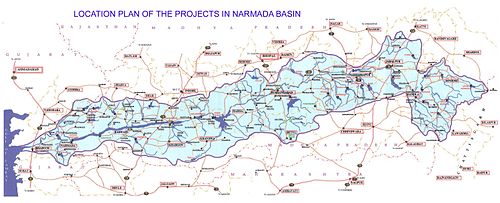

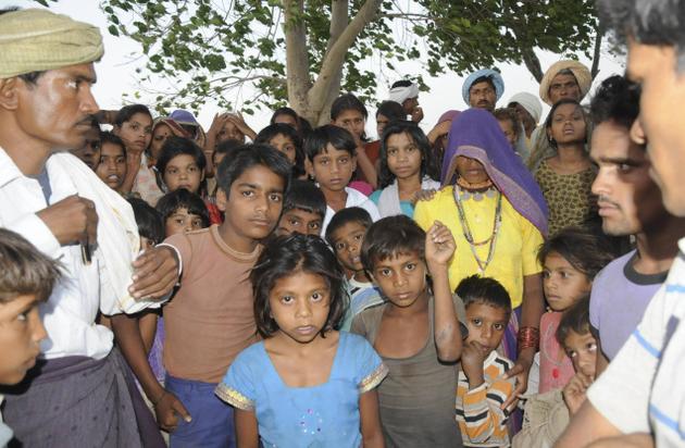

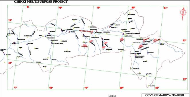

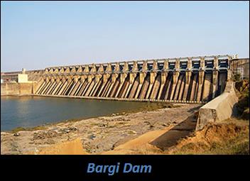
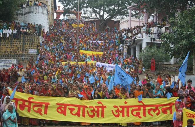


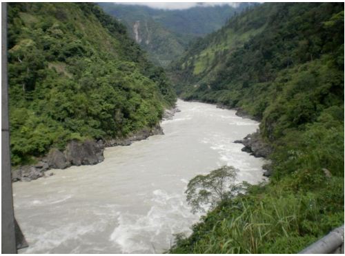
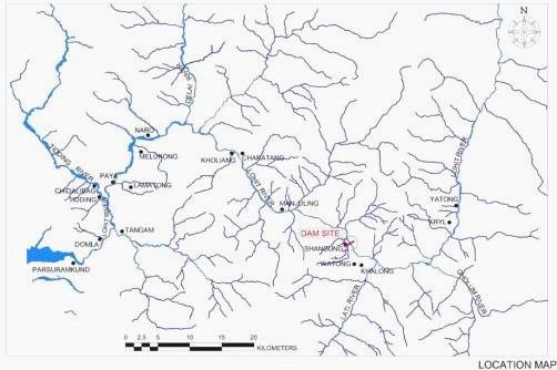


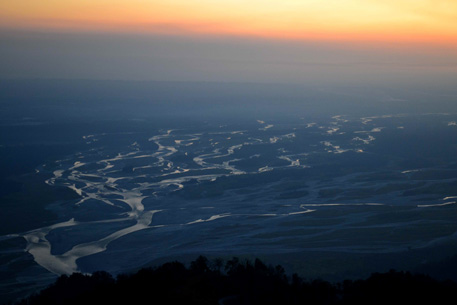


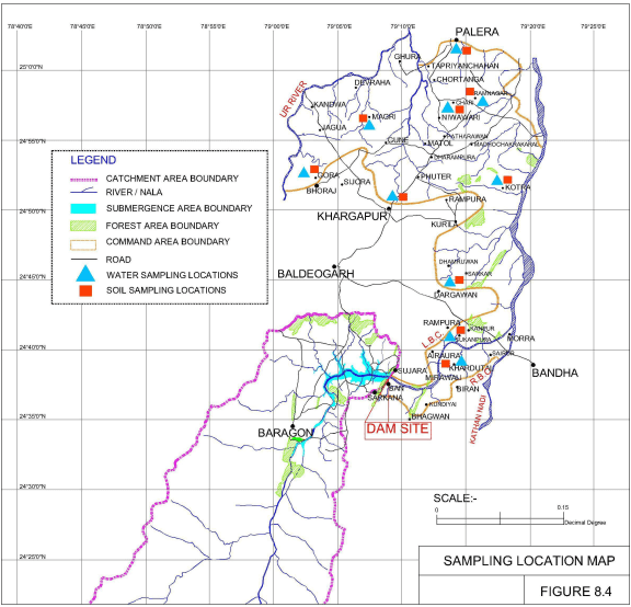

