Cauvery · Inter State Water Disputes

Cauvery: Is there will for way forward? Will constitution of CMB help?

Above Map of Cauvery basin from Indian Express, Sept 22, 2016

Higher demands than availability is the key problem in Cauvery basin. transparent, participatory, democratic, rule based management of demands over supply is the key need. Unfortunately, we do not have that. Greater misfortune is that the Cauvery Water Disputes Tribunal Award of Feb 2007, even as it is significantly flawed, is yet to be implemented since the Special Leave Petitions of Karnataka and Tamil Nadu, admitted in the Supreme Court, remain pending for over nine years now. The Supreme Court, in the meantime, (through its orders of Sept 5, 12 and 20) deals with the issue in a manner, that seems ad hoc in absence of clarity as to how all the relevant factors have been taken into account.  Continue reading “Cauvery: Is there will for way forward? Will constitution of CMB help?”

DRP News Bulletin

DRP: 5 Sept 2016: Is there hope for India’s Environment from Mr Anil Dave?

ENVIRONMENT GOVERNANCE

Is there hope for India’s Environment from Mr Anil Dave? Most shocking statements from India’s environment Minister. He says let us do Ken Betwa link when the project has NONE of the statutory clearances from his own ministries. The independent committees are yet to appraise the project and yet he is saying: “This Ken-Betwa river link we should do it and have an impact assessment after five years. If it is good, then great, if not they don’t go for other linkages.” Is there any hope for India’s environment? As he says, YE SAB CHALTA HAI!!

http://www.dnaindia.com/india/interview-won-t-put-a-cap-on-new-dams-in-uttarakhand-river-linking-should-go-ahead-anil-dave-2251391 Continue reading “DRP: 5 Sept 2016: Is there hope for India’s Environment from Mr Anil Dave?”

brahmaputra · Dams · Hydropower

WRIS River Basin Reports: Hits and Misses

Reliable data and information that is both correct and validated on ground, is a pre requisite to understand any feature or activity. And for a river, a constantly evolving and truly complex entity, it becomes even more crucial. The wellness quotient of rivers, their present health status, all these and more can only be understood, once we have the rudimentary knowledge of the river and the basins that they form.

A step in this direction has been taken up by the India WRIS (Water Resources Information System) project (A joint venture between Central Water Commission and Indian Space Research Organisation), that aims “to provide a ‘Single Window Solution’ for water resources data & information in a standardized national GIS framework”[i]. This project has generated 20 basin level reports that share important information on the salient features of the basin, their division into sub basins, the river systems that flow through it and the water resource structures, such as irrigation & hydro electric projects in the basin. Another crucial inclusion is the length of major rivers in each basin, which have been GIS calculated (Geographic information system)[ii] and in a few reports the place of origin of the rivers too is mentioned. (Ganga Basin Report). This is an improvement over the earlier documented river lengths that included the canal length along with the river lengths, in earlier CWC documents (e.g. water and related statistics)!

The Basin reports include basin level maps which also show the proposed inter basin transfer links and the major water resource structures & projects. Individual maps at the sub basin level mark the rivers & their watersheds. The report gives details on the topography, climate, the land use / land cover area , and also the information on hydro meteorological stations like groundwater observation cells, flood forecasting sites and even water tourism sites.

These reports can be downloaded from the WRIS site.[iii]

The reports are an attempt to document the water resources data & information for a better and more integrated planning, at the basin level. A table below tabulates some important parameters from the 20 basin reports.

Missing Dams! It can be seen from table on next page that total number of dams in all the 20 basins come to 4572. Assuming that this includes all the completed large dams in India by Dec 2013 (WRIS report is dated March 2014), if we look at the number of large dams  in India as in Dec 2013 in the National Register of Large Dams (NRLD), the figure is 4845. This leaves a difference of 273 large dams, which are missing from the WRIS list! This seems like a big descripancy. Unfortunately, since NRLD gives only statewise list and does not provide river basin wise list and since WRIS list provides only river basin wise list and does not provide the names of districts and states, it is not possible to check which are the missing dams, but WRIS need to answer that.

Sub Basins These 20 basins have been further delineated into a number of sub basins. The sub basins details include the geographical extent of the sub basin, the rivers flowing in it, the states that they travel through, number and size range of watersheds and also the details of dams, weirs, barrages, anicuts, lifts & power houses, accompanied by maps at this level. The irrigation and hydro electric projects in the area are detailed and mapped for greater convenience. The sub basin list is given here to get a detailed picure.

Indus Basin Sub-basins:

River Dras in Indus Basin in Jammu and Kashmir (Photo by Sabita Kaushal)
  1. Beas Sub Basin
  2. Chenab Sub Basin
  3. Ghaghar and others Sub Basin
  4. Gilgit Sub Basin
  5. Jhelum Sub Basin
  6. Lower Indus Sub Basin
  7. Ravi Sub Basin
  8. Shyok Sub Basin
  9. Satluj Lower Sub Basin
  10. Satluj Upper Sub Basin
  11. Upper Indus Sub Basin
S. No River Basin Major river No. of sub basins No. of watersheds No. of water resource structures No. of water resource projects
Irrigation Hydro  Electric
Dams Barrages Weirs Anicuts Lifts Power Houses Major Medium ERM*
1 Indus (Upto border) Indus (India) 11 497 39 13 18 0 45 59 30 40 21 55
2a Ganga Ganga 19 980 784 66 92 1 45 56 144 334 63 39
b Brahmaputra Brahmaputra (India) 2 180 16 17 5 0 4 21 9 13 3 17
c Barak & others basin Barak 3 77 4 3 0 0 0 3 0 6 3 3
3 Godavari Godavari 8 466 921 28 18 1 62 16 70 216 6 14
4 Krishna Krishna 7 391 660 12 58 6 119 35 76 135 10 30
5 Cauvery Cauvery 3 132 96 10 16 9 24 16 42 3 15
6 Subernarekha Subernarekha & Burhabalang 1 45 38 4 12 0 0 3 5 34 0 1
7 Brahmani & Baitarni Brahmani & Baitarni 2 79 61 5 4 1 0 1 8 35 4 1
8 Mahanadi Mahanadi 3 227 253 14 13 0 1 6 24 50 16 5
9 Pennar Pennar 2 90 58 0 1 2 0 1 7 14 0 1
10 Mahi Mahi 2 63 134 0 4 0 0 3 10 29 3 2
11 Sabarmati Sabarmati 2 51 50 2 10 0 0 0 9 11 4
12 Narmada Narmada 3 150 277 2 2 0 4 9 21 23 1 6
13 Tapi Tapi 3 100 356 8 11 0 13 2 13 68 2 1
14 WFR Tapi to Tadri Many independent rivers flowing 2 96 219 0 3 0 1 18 13 15 1 12
15 WFR Tadri to Kanyakumari 3 92 69 6 6 4 0 29 19 12 7 21
16 EFR  Mahanadi_ Pennar 4 132 64 5 12 12 0 0 12 46 10 0
17 EFR Pennar _ Kanyakumari 4 165 61 2 2 11 0 6 13 33 4 5
18 WFR Kutch _ Saurashtra Luni 6 268 408 1 10 0 0 0 8 100 4 15
19 Area of inland drainage in Rajasthan Many independent rivers flowing 1 0 0 0 48 0 11 1 1 0
20 Minor rivers draining into Myanmar(Burma) & Bangladesh Many independent rivers flowing 4 54 3 5 0 0 3 3 4 1
  Total 94 4335 4572 203  335

* Extension, Renovation and Modernization                                                                                                                                  ** Data has been accumulated from the individual Basin Reports from India WRIS[iv]

Ganga Basin

  1. Yamuna Lower
  2. Yamuna Middle
  3. Yamuna Upper
  4. Chambal Upper
  5. Chambal Lower
  6. Tons
  7. Kosi
  8. Sone
  9. Ramganga
  10. Gomti
  11. Ghaghara
  12. Ghaghara confluence to Gomti confluence
  13. Gandak & others
  14. Damodar
  15. Above Ramganaga Confluence
  16. Banas
  17. Bhagirathi & others ( Ganga Lower)
  18. Upstream of Gomti confluence to Muzaffarnagar
  19. Kali Sindh and others up to Confluence with Parbati

Brahmaputra Basin It is strange to see that the profile divides this huge basin into just two sub basins, when it could have easily divided into many others like: Lohit, Kameng, Siang, Subansiri, Tawang, Pare, Teesta, Manas, Sankosh, among others.

  1. Brahmaputra Lower
  2. Brahmaputra Upper

Barak & Others Basin

  1. Barak and Others
  2. Kynchiang & Other south flowing rivers
  3. Naochchara & Others

Godavri Basin

  1. Wardha
  2. Weinganga
  3. Godavari Lower
  4. Godavari Middle
  5. Godavari Upper
  6. Indravati
  7. Manjra
  8. Pranhita and others

Krishna Basin

  1. Bhima Lower Sub-basin
  2. Bhima Upper Sub-basin
  3. Krishna Lower Sub-basin
  4. Krishna Middle Sub-basin
  5. Krishna Upper Sub-basin
  6. Tungabhadra Lower Sub-basin
  7. Tungabhadra upper Sub-basin
Srisailam Dam on Krishna River (Source: Wikipedia)

Cauvery Basin

  1. Cauvery upper
  2. Cauvery middle
  3. Cauvery lower

Subernarekha Basin No sub-basins.

Brahmani & Baitarani Basin

  1. Brahmani
  2. Baitarani

Mahanadi Basin

  1. Mahanadi Upper Sub- basin
  2. Mahanadi Middle Sub- basin
  3. Mahanadi Lower Sub- basin

Pennar Basin

  1. Pennar Upper Sub-basin
  2. Pennar Lower Sub-basin

Mahi Basin

  1. Mahi Upper Sub-basin
  2. Mahi Lower Sub-basin

Sabarmati Basin

  1. Sabarmati Upper Sub- basin
  2. Sabarmati Lower Sub-basin

Narmada Basin

  1. Narmada Upper Sub-basin
  2. Narmada Middle Sub-basin
  3. Narmada Lower Sub-basin

Tapi Basin

  1. Upper Tapi Sub- Basin
  2. Middle Tapi Sub- Basin
  3. Lower Tapi Sub- Basin

West flowing rivers from Tapi to Tadri Basin

  1. Bhastol & other Sub- basin
  2. Vasisthi & other Sub- basin

West flowing rivers from Tadri to Kanyakumari Basin

  1. Netravati and others Sub- basin
  2. Varrar and others Sub- basin
  3. Periyar and others Sub- basin

East flowing rivers between Mahanadi & Pennar Basin

  1. Vamsadhara & other Sub- basin
  2. Nagvati & other Sub- basin
  3. East Flowing River between Godavari and Krishna Sub- basin
  4. East flowing River between Krishna and Pennar Sub- basin

 East flowing rivers between Pennar and Kanyakumari Basin

  1. Palar and other Sub-basin
  2. Ponnaiyar and other Sub-basin
  3. Vaippar and other Sub-basin
  4. Pamba and other Sub-basin

West Flowing Rivers of Kutch and Saurashtra including Luni Basin

  1. Luni Upper Sub-basin
  2. Luni Lower Sub-basin
  3. Saraswati Sub-basin
  4. Drainage of Rann Sub-basin
  5. Bhadar and other West Flowing Rivers
  6. Shetrunji and other East Flowing Rivers Sub-basin

Area of inland drainage in Rajasthan Due to very flat terrain and non-existence of permanent drainage network, this basin has not been further sub divided.

Minor rivers draining into Myanmar and Bangladesh

  1. Imphal and Others sub basin
  2. Karnaphuli and Others sub basin
  3. Mangpui Lui and Others sub basin
  4. Muhury and Others sub basin

Narmada Basin: Some details To understand the compiled information at the basin level, we take a look at the one of the basin level reports, the Narmada Basin Report[v] (dated March 2014) as an illustrative example. An overview of the basin area right at the beginning, gives its geographical location, shape, size, topography, climate & population. This basic relevant information is tabulated in a concise table for easy access, as given below:

Salient Features of Narmada Basin from WRIS Basin Report

River information The major river flowing in the basin, the Narmada River (also called Rewa) that flows through the 3 states of Madhya Pradesh, Maharashtra & Gujarat, its length (1333 km) and the length of its 19 major tributaries out of a total of 41 is given, based on GIS calculations. There is also a clear river network map of the Narmada basin that demarcates the 3 sub basins along with the watersheds, and shows the dams / weirs /barrages and the rivers in the basin.

Narmada Basin Report Cover Page (Source: WRIS)
  • Narmada Upper Sub-Basin, with 16 watersheds
  • Narmada Middle Sub-Basin, having 63 watersheds
  • Narmada Lower Sub-Basin, with 71 watersheds

The surface water bodies details include the size (less than 25 ha to more than 2500 ha) and type (Tanks, lakes, reservoirs, abandoned quarries or ponds) of existing bodies. Nearly 91.8% of these are tanks.

Irrigation Projects The water resource projects in the basin are as follows:

  • 21 Major Irrigation Projects
  • 23 Medium Irrigation Projects
  • 1 ERM Project
  • 6 Hydro-Electric Projects

Interestingly description is only of the major and medium irrigation projects, information on minor projects is completely absent. An attempt to include the details of minor irrigation projects would have made the report more useful. The reports seem to not understand the significance of the smaller projects  and their importance for the people and in the conext of the River Basin too.

Water resource structures The number and type of big manmade structures in the basin is given. These are a total of 277 dams, 2 barrages, 2 weirs and 4 lifts, of which again the major structures are marked on a map, and details given as in table below. Dams are classified on the basis of storage and purpose they are used for, and the dam numbers are available at sub basin level.

Narmada Sub Basin details from WRIS Basin Report

The report gives tabulated data for each of the dams, which is supposed to have name of the river, height, length, purpose, year of commissioning, etc. Since GIS is the strength of ISRO, they could have easily given latitude and longitudes of each dam, but they have not. Shockingly, in case of 186 of the dams, name of the river on which it is built is given as ‘Local Nallah’, and in case of 10 they have left the column blank. This means for nearly 71% (196 out of 277) of the dams they do not even know the name of the river they are build on. This is actually an improvement over the performance of CWC. The CWC’s National Register of Large Dams[vi], we just checked, mentions Narmada only 13 times (for 12 dams of Gujarat and 1 dam of Madhya Pradesh).[vii]

It is well known that Narmada Basin is the theatre of India’s longest and most famous anti dam movement, Narmada Bachao Andolan. The movement involves opposition to Sardar Sarovar, Indira Sagar, Omkareshwar, Maheshwar, Jobat dams, among others. Such social aspects should also form part of any river basin report.

 Surface water quality There are 19 surface water quality observation sites in the basin, that collect water data and the report spells out , “As compared to the other rivers, the quality of Narmada water is quite good. Even near the point of origin, the quality of river water was in class ‘C’ in the year 2001 while it was in class ‘B’ in earlier years. As was observed for most other rivers, in case of Narmada also, BOD and Total Coliform are critical parameters.” This shows that even in Narmada Basin, water quality is deteriorating. The statement also remains vague in absence of specifics.

Inter basin transfer links Details of the Par-Tapi-Narmada Link, which is a 401 km long gravity canal and its proposal to transfer 1,350 MCM (Million Cubic metre) of water from ‘surplus rivers’ to ‘water deficit’ areas is given, along with a map. How has the conclusion of surplus or deficit been reached? Does the assessment exhaust all the options including rainwater harvesting, watershed development, groundwater recharge, better cropping patterns and methods, demand side management, optimising use of existing infrastructure, etc? Is this is the least cost option? Does the water balance include groundwater? Who all will be affected by this or even how much land area will be affected by this proposal, there is absolutely no talk of this? No answers in the report.

India River Basins Map (Source - WRIS)
India River Basins Map (Source – WRIS)

There’s more to a river There is no information in basin reports on the regulating or statutory bodies that have a say in the basin in the report. However, some information on the existing organisations and inter-state agreements at the various basin level is given at another WRIS location.[viii]

 The Basin reports for 20 basins are clearly an asset for understanding and analysing water resource situation. However, there is no mention of the numerous ecological, social and environmental services these rivers provide us with. The demographic details of the basin are available, but there is no information on the flora and fauna, who also need and thrive on the river waters. A good navigation tool for water resource information and river management projects at basin level, nevertheless, for a broader and more comprehensive outlook these reports should have included the following essential aspects too:

  • River status: The present water quality & pollution level of the major rivers as well as their tributaries
  • River governance: The local committees, civil bodies and institutions that play a role in river basin development
  • River safety measures: Effect of the existing and planned river management projects on the state of the river, people and society.
  • River ecology: Status of biodiversity, and other ecological aspects of the rivers

Sabita Kausal, SANDRP (sabikaushal06@gmail.com

END NOTES:

[i] India WRIS: http://india-wris.nrsc.gov.in/wrpinfo/index.php?title=Main_Page

[ii] GIS: http://en.wikipedia.org/wiki/Geographic_information_system

[iii] http://india-wris.nrsc.gov.in/

[iv] Basin Reports available for download: http://india-wris.nrsc.gov.in/

[v] http://india-wris.nrsc.gov.in/Publications/BasinReports/Narmada%20Basin.pdf

[vi] http://www.cwc.nic.in/main/downloads/New%20NRLD.pdf

[vii] For more details, see: https://sandrp.wordpress.com/2013/03/14/how-much-do-we-know-about-our-dams-and-rivers/

[viii] http://india-wris.nrsc.gov.in/wrpinfo/index.php?title=Basins

Dams · Free flowing rivers

Collapsing Hilsa: Economic, ecological and cultural impact of dams

Above: Hilsa fishers in Bangladesh setting out for their journey Photo: with thanks from Arati Kumar-Rao

In addition to the Gangetic Fisheries Primer, SANDRP will shortly publish a Primer documenting the Impacts of dams on Riverine Fish and Fisher Communities. One of the most profound impacts of dams on fish is blocking migration routes and perhaps no other fish symbolizes this impact as dramatically as the Hilsa: the Silver Queen of the River.

Glimpses of the impacts of dams on Hilsa in South Asia.

~~~~~~~~~~~~~~~~~~~~~~~~~~~~~~~~~~~~~~~~~~~~~~~~~~~~~~~~~~~~~~~~

Arguably, Hilsa is not just a tasty and healthy fish species that migrates from the sea up the river to spawn. It is a cultural icon that binds Bengalis, whether from West Bengal or Bangladesh, together in their shared love for Ilish Machch. Pohela Baishakh or the new year day’s meal is not complete without Ilish. Though Hilsa is celebrated fervently by the Bengalis, it is prized in all estuaries of South Asia, from Narmada, Mahanadi, Godavari, Cauvery to Indus and Irrawaddy and takes the name of  Chaski, Palva, Ilishii, Palla, Pulasa, etc. It is also found at confluence of Tigris and Euprates in Iran, where it is as prized and known as Sbour. The fish flavours several poems, folklore, songs and phraseologies of the entire South Asia. In cultural terms, the significance of Hilsa is comparable only to Salmon and Mahseer.

Ilish on Pohela Baishakh Photo: Flickr
Ilish fish and rice, a religious offering and cultural fare on Pohela Baishakh Photo: Flickr

Tenualosa ilisha, Hilsa or Indian Shad belongs to the sub family Alosinae of Family Clupeidae. Commercially, it is the most important fisheries in the estuaries, especially in the Ganga-Hooghly region.It occurs in marine, estuarine and riverine environments and is found in Indus of Pakistan, Irrawaddy of Myanmar and Indian rivers like Ganga, Bhagirathi, Hooghly, Rupanarayan, Brahmaputra, Godavari, Narmada, Cauvery, Tapti, coastal rivers like Padma, Jamuna, Meghana, Karnafuly and others in Bangladesh. It is seen to migrate up smaller estuaries like Pennar too.

Hilsa, by habitat, is a marine fish but migrates in estuaries and rivers for spawning, normally inhabiting the lower region of the estuaries and the foreshore areas of the sea. Hilsa ascends the rivers for spawning and the spent fish and their progeny migrate down the river towards lower estuaries and coastal areas, moving in shoals. The peak upstream migration of Hilsa in most of the rivers of the country is generally in the monsoons months of July and August and continues upto October or November. The spring spawners that enter the river for spawning in January-March return to the sea during July-August when these are caught in good numbers. The monsoon spawners that enter the river during September- October return to the sea after spawning and these spent fishes are caught in good numbers during January- March. Similarly, the off springs of spring-spawners make journey for the sea from the river during November- January, whereas the off springs of monsoon spawners return to the sea from the river during July- September. (Bhaumik et al, CIFRI, 2012)

Obstruction to undertaking this spawning migration by dams and barrages has been singled out as the primary reasons for the fall of Hilsa fisheries in India as well as Bangladesh. The trade of this commercially important fish species constitutes upto 1.5% of Bangaldesh’s National Gross Domestic Product and about 2 million fishers are estimated to depend on Hilsa fisheries in Gangetic estuaries. Till August 2014, Bangladesh has stopped Hilsa exports to India to contain astronomic price rises in Bangladesh as the costs of the fish are becoming uncontainable due to its cultural importance on one hand and dwindling supply on the other. India has requested Bangladesh to lift the ban of Hilsa export, but it is yet to relent, due to a number of socio-political reasons. [2]

Fishers setting off for Hilsa from Bnagladesh Sunderbans Photo: With thanks from Arati Kumar-Rao
Fishers setting off for Hilsa from the Bangladesh Sunderbans Photo: With thanks from Arati Kumar-Rao

One of the main reasons for the phenomenal fall of Hilsa in Gangetic delta has been the Farakka Barrage built by India in the 1970’s, just a few kilometers upstream the India –Bangladesh border, to divert water from Ganga into the Hooghly river, to keep the Kolkata Port at the mouth of Hooghly, free of sediments.

Prior to commissioning Farakka Barrage in 1975, there are records of the Hilsa migrating from Bay of Bengal right upto Agra, Kanpur and Delhi covering a distance of about 1400 kms. Maximum abundance was observed at Buxar, near Allahabad, at a distance of about 650 kms from river mouth. Post Farraka, Hilsa is unheard of in Yamuna in Delhi and its yield has dropped to zero in Allahabad, from 91 kg/km in 1960s. Studies as old as those conducted in mid-seventies[3] single out Farakka’s disastrous impacts on Hilsa, illustrating a near 100% decline of Hilsa above the barrage post construction.

Migration route of Hilsa, Pre Farakka Barrage spanning about 1400 kms Source: CIFRI 2012
Highly restricted range of Hilsa post Farakka Source: CIFRI

An obligatory Fish lock provided in Farakka Barrage is non-functional and tagging experiments reveal that Hilsa cannot move across the barrage due to obstruction of three-tire sluice gates.[4] For more on how Farakka has failed its objective and continues to impact livelihoods: https://sandrp.wordpress.com/2014/11/25/lessons-from-farakka-as-we-plan-more-barrages-on-ganga/

Fishers who live off the Ganges strongly feel the pressure of dams, personified by Farakka. In north India, ‘Farakka’ –the word doesn’t mean a village on the Bangladesh border anymore, but means destruction by dams. The local Hindi dialects have borrowed new phraseology: “Farakka hua, tabse hilsa toh bas bhabis” (Farakka happened, and then Hilsa exist only in imagined future)”. The same phrase repeats up to the Yamuna River! In a recent status survey of Gangetic fisheries almost 75-80% of fishers singled out ‘Farakka’ as the root cause of all their miseries. They actually referred to multiple barrages built on the respective rivers. But destruction had a common name: Farakka.[5]

Bangladesh has been making several serious attempts to revive Hilsa fisheries and implements a strict fishing ban in certain months to avoid fishing “jatkas” or small Hilsa. It has also declared several Hilsa Sanctuaries to protect the fish and is witnessing small and steady improvements in the population. India has hardly taken any steps to protect this specie. IUCN has led a program called Ecosystems for Life: A Bangladesh-India Initiative and Hilsa fisheries is a part of this project. There is also a Norwegian project on Hilsa Aquaculture [7] ( All prior efforts of Hilsa Aquaculture have failed). However, the primary need to address the giant problem of the Farakka Barrage is being unaddressed. The barrage and reduced freshwater in the downstream is also exacerbating other stressors like sedimentation of the river mouth, high fishing pressure on limited stocks, concentrated pollution, etc.

Hilsa in other Rivers (would taste as sweet!) Hilsa is found not only in Ganges delta but most of the estuaries in India. In all of these places, Hilsa fishery is primarily affected by dams and barrages near the estuaries, blocking spawning migration and reducing freshwater from upstream.

Hilsa in Cauvery: A century of impacts In Tamizh, Hilsa caught at Sea is Kadal Ullam and the one in the River is the Aattu Ullam. Here, the impact of Mettur dam on valuable Hilsa fisheries in the Cauvery has been recorded as early as 1939 in an issue of Current Science, where it is stated: “Unfortunately the effect of the dam (Mettur on Cauvery) on the fisheries below was disastrous. The number of valuable Indian Shad or Hilsa, the most important sea fish ascending the Cauvery for breeding purposes, declined as the high floods which enabled them to ascend the rive no longer occur. The serious decline of fisheries in Cauvery would be evident from the fact that the fishery rental of the river below the dam which used to amount to 80000 Rs. annually has steadily declined since the formation of the dam to about 42,900 rupees.”[8] Puntius species also disappeared in Cauvery post dam, which formed 28% of the landings prior to dam construction.[9]

As per the Report “Fishing the Cauvery: How Mettur Changed it all,” by Ramya Swayamprakash published by SANDRP[10], It was Sir Aruthur Cotton himself, way back in 1867 who alerted the erstwhile government about the damages wrought by weirs on river fisheries. Immediately, Dr. Francis Day was commissioned to investigate the impact on fisheries and subsequently appointed Inspector-General of Fisheries in India. In his report on the fisheries of India and Burma, Day condemned dams as insurmountable barriers to fish passage; he designed a fish passage which was on the Lower Anicut on the Kollidam. The pass was primarily designed for the Hilsa who could not ascend it, as it was too wide. According to the Madras Fisheries department in 1909, the fish pass did not ensure Hilsa migration because of various practical and technical difficulties; in the first place, the expenses for the construction of a fish pass were not commensurate with the expected results and secondly, sufficient water could not be provided for the efficient working of the pass. Interestingly, Hilsa was sought to be cultivated and exported along the lines of the Salmon in north-western United States. So important was the Hilsa that a stuffed specimen made its way into the exhibits sent to the Great Exhibition from the Bombay Presidency, in 1851!

Fishing at the Lower Anicut on Cauvery Photo: Wikimedia Commons

Today, the Hilsa is unknown on the Cauvery. According to fish biologists, the Hilsa ascended the anicuts on the Cauvery up to Mettur to spawn overcoming the low anicuts. But the coming of the Mettur Dam formed an impassable barrier.

Hilsa in Godavari is known as Pulasa when caught i the river and Vilasa when caught n the sea!  Here too, the fish is declining and main reasons are said to be declining water levels and the Dowleswaram Barrage [11] (Arthur Cotton Barrage). In Andhra villages too Pulasa has a huge cultural significance.

This author made a presentation to the Standing Committee of the Lok Sabha, the lower house of Indian Parliament in June 2012 about the impacts of dam on riverine fish and discussed Hilsa, when an MP from Coastal Godavari district in  Andhra Pradesh said, “I know Pulasa! My constituency depends on riverine fisheries like Pulasa, and not marine fisheries, but we end up talking only about marine fish and not river fish and Pulasa and the impacts of upstream projects on livelihoods of river fishers”

Pulasa/ Hilsa of teh Godavari Photo: The Hindu
Pulasa/ Hilsa of the Godavari Photo: The Hindu

In Mahanadi, Orissa, Hilsa has been hit by dams and is recording a declining trend[12]. Paradip recorded about 500 tonnes Hilsa, but prices have increased astronomically.[13]

Hilsa in Narmada, Sardar Sarovar and the proposed Bhadbhut Barrage The narrative of damming the Narmada by the Narmada Valley Projects is one of the most significant stories of an on-going struggle against modifying a river and way of life of her people. Although there are many facets to the story ranging from displacement, false benefits and true costs, forest loss, non-existent rehabilitation and an all-pervasive insensitivity of the government towards weaker communities, the impacts of this project on riverine fisheries have been equally profound. Narmada River system experienced a nearly 70% decline in Hilsa catches in just a decade between 1993 to 2004 ( From 15319 t to 4866 t  ) and this decline was prominently recorded from 1998-99 onwards.[14] As per CIFRI, the most stressed species after Sardar Sarovar Project (SSP) construction is the Hilsa and Macrobrachium prawn (Jumbo River Prawn). CIFRI made some prediction about impacts of the dam after 35 years, calling it a ‘critical period’ when fisheries will be nearly lost. Shockingly, these conditions are already being witnessed in Narmada Estuary in Bharuch which records nearly 30%  Inland Fish production. More than 12,000 people from 21 villages in Bharuch alone depend on Narmada Estuary for fisheries.

Assessment of impact of commissioning of Sardar Sarovar dam and other projects in 2009 by CIFRI revealed that SSP will retain 96% of the sediment, adversely affecting biological productivity of the downstream including Narmada estuary.[17] However, already the Sardar Sarovar and upstream dams in Narmada Basin have already resulted in retention of about 95% sediment, cutting off the delta from nutrient rich silt.  Historical  sediment  discharge  of  Narmada  was  61  million  tonnes  and  the  current sediment  discharge  (average  of  last  ten  years  of  the  study)  was  found  to  be  3.23  million  tonnes.[18]

According to CIFRI, “While the annual inflow is 23.68 MAF (1981-1990), it will be reduced to 15.9 MAF after 10th year of SSP, to 4.34 MAF at the 30th year and will cease at the 45th year. This freshwater decline will severely affect Hilsa fishery and prestigious fishery contributed by M rosenbergii (Jumbo River Prawn)”. As freshwater declines, there will be “Steep hike in salinity regime with tidal ingress. Fishery not tuned to such enhanced salinity will succumb to such pressure. Mangroves will also be affected and this will impact marine fish production as Mangroves are nurseries of many marine fish.”

Gujarat Government has agreed to release 600 cusecs water from Sardar Sarovar and Bhadbhut Barrage as environmental flows. There is no study as to whether this amount is sufficient for estuarine balance, for ecological needs of Hilsa or other species, for spawning migration, etc. Also, there is no guarantee that Gujarat will release this meagre quantity. Ironically, the minimum flows of 600 cusecs agreed to be released by Gujarat through SSP come to 532. 9 Million Cubic Metre (MCM) water annually and CIFRI’s warning of a sharp fisheries decline at 30th year was for 4.34 MAF or 5353.4 MCM! So, 532.9 MCM released now as minimum flows is barely 10% of a dire scenario predicted at 30th year of commissioning SSP[i]!

It is hardly a wonder that Hilsa is falling sharply in Narmada Estuary and fishers are directly blaming the Sardar Sarovar for this decline.[19]

Last Straw for Narmada Hilsa: Bhadbhut Barrage: Gujarat Government is planning to build Bhadbhut Barrage about 17 kms from Bharuch, directly affecting the Narmada estuary and the Hilsa and Prawn fishery. The Barrage is planned for SEZ and also water sports and is a part of an infeasible scheme known as the Kalpasar project which plans to dam almost all rivers as they meet the Gulf of Khambat.

Slogans against Bhadbhut Barrage say: "The Dam will kill the fishers: This government is killing people"
Slogans against Bhadbhut Barrage say: “The Dam will kill the fishers: This government is killing people”

The Bhadbhut Barrage is being fiercely opposed by fishers in Bharuch because of its serious impacts on their livelihoods and Hilsa fisheries. Public Hearing of Bhadbhut Barrage was held in July 2013, wherein the fisher community staged a walk out, stressing that the EIA had under-reported Hilsa fisheries in the region, number of fishers and their dependence on the Estuary for fish. The walkout took place immediately after Pravin Tandel, the fisherfolks’ local leader, spoke saying the project would “adversely affect the fish catch, especially Hilsa, once it is implemented. Currently, Hisla fetches Rs 1,200 per kg, and is our main source of livelihood.”[20]

Fisherfolk protesting against Bhadbhut Barrage Photo: Counterview.org

Hilsa in the Indus: In the Indus too, Hilsa fisheries, known as Palla are the main stay of local fisher communities. Hilsa fish is a highly contested territory due to declining catches.

Before the construction of the Sukkur Barrage, the Palla used to reach to Multan as per records of 1907. The Sukkur Barrage and then later the Kotri Barrage severely restricted Palla’s range, affecting the fish and its fishers. According to M. R. Quereshi, ex-Director of Marine Fisheries Department of Pakistan, the Palla used to ascend the river (Indus) to spawn in the middle of June but its ascent is now delayed by at least one month owing to late freshets. Kotri Barrage near Hyderabad has severely restricted its breeding range. Like the Cauvery, in Kotri too the fish ladders do not work due to faulty designs and Hilsa is unable to ascend them, consequently prevented from going up to the upper reaches of the river. As a result the Hilsa fishery is being depleted and immediate action is imperative to increase its production. “Failing this, the fish will eventually disappear from the river.”

Palla fishers at Kotri, on the banks of Indus circa 1890. Photo from British Library, UK
Palla/Hilsa fishers at Kotri, on the banks of Indus circa 1890. Photo from British Library, UK

To conclude, the fate of this silvery fish hangs in a fine balance. Not only does the Hilsa enjoy huge cultural significance, it also supports millions of livelihoods. In the United States, several dams, like the recent Glines Canyon Dam on the Elwha, have been decommissioned for their impacts on migrating fish and dependent communities. Elwha river dams came down in a biggest decommissioning effort because the indigenous Klallam tribe asserted its rights on traditional Salmon fisheries which were blocked by these dams. In Japan too, Arase Dam was decommissioned because of its impact on Ayu fish and fishers.

What has happened in India to the Hilsa fish and fishers is far more serious.

Hilsa has a striking ecological, economic and cultural significance. Till date, ranching or farming of Hilsa has not worked. Till date, fisher communities continue to face conflicts, hardships and risks, go deeper and deeper in the sea to gather a few Hilsa. Till date, dam operations have not changed, nor have the fish passes been designed, built, operated or monitored to help the fish.  Till date, none of the fisher communities who suffered colossal losses when a dam affected Hilsa, have been compensated for their loss.

Is it not time to rethink these dams, to help the fish and our fishers?

-Parineeta Dandekar, SANDRP, parineeta.dandekar@gmail.com

Hilsa as a sacred offereing Photo from Flickr, with thanks to the contributor
Hilsa as a sacred offering Photo from Flickr, with thanks to Arup Kanjilal


[1] Dugan, 2008, Quoted in FAO Report No. 7, Sustainable Fisheries and Aquaculture for food security and nutrition, 2014

[2]  Chief Minister Mamata Banerjee refused to share the Teesta waters with Bangladesh, the neighbouring country has imposed a ban on export of the silver-scaled fish.

[3] Ghosh, 1976 quoted in Review of the biology and fisheries of Hilsa, Upper Bengal Estuary, FAO, 1985

[4] Bhaumik and Sharma, Present status of Hilsa in the Hooghly Bhagirathi River, CIFRI, 2012

[5] Nachiket Kelkar, Thirsty Rivers, Bygone Fishes, Hungry Societies, Dams Rivers and People, December 2012 https://sandrp.in/rivers/Thirsty_Rivers_Bygone_Fishes_Hungry_Societies_Nachiket_Kelkar_Dec2012.pdf

[6] Pathak et al, Riverirne Ecology and Fisheries, vis a vis hydrodynamic alterations: Impacts and Remedial measures, CIFRI, 2010

[7] http://www.nofima.no/filearchive/Rapport%2002-2013.pdf

[8] B. Sundara Raj, The Mettur Dam Fisheries, Current Science, October 1939

[9] Sugunan, Reservoir Fisheries of India, FAO, 1995

[10]  Ramya Swayamprakash, Fishing the Cauvery, How Mettur changed it all, SANDRP, June 2014

[11] http://www.thehindu.com/todays-paper/tp-national/tp-andhrapradesh/pricey-pulasa-is-now-everyones-favourite/article6235820.ece

[12] A Raisd,On Mahseer of Hirakud, Fishing Chime, August 2005 http://www.fishingchimes.com/onmah.htm

[13] http://timesofindia.indiatimes.com/home/environment/flora-fauna/Is-Hilsa-fish-on-its-way-out/articleshow/21932621.cms

[14] Milton, STATUS OF HILSA (Tenualosa ilisha) MANAGEMENT IN THE BAY OF BENGAL: AN ASSESSMENT OF POPULATION RISK AND DATA GAPS FOR MORE EFFECTIVE REGIONAL MANAGEMENT, Report to FAO Bay of Bengal Large Marine Ecosystem Project , 15 February 2010

[15] CIFRI, River Narmada, Its Environment and Fisheries, 2009

[16] EIA of Bhadbhut Barrage by NEERI, 2013

[17] CIFRI, River Narmada, Its Environment and Fisheries, 2009

[18] Gupta et al, quoted in Dandekar, Thakkar, Shrinking and Sinking Deltas: Major role of Dams in delta subsidence and Effective Sea Level Rise, SANDRP, 2014 https://sandrp.in/Shrinking_and_sinking_delta_major_role_of_Dams_May_2014.pdf

[19] http://articles.economictimes.indiatimes.com/2012-08-08/news/33100832_1_hilsa-catch-utpal-bhaumik-hilsa-prices

[20] http://www.counterview.net/2013/07/fisherfolk-walk-of-out-public-hearing.html

[i] While we do not know the schedule through which Gujarat Government plans to release this water, the fact remains that this figure of 600 cusecs is not supported by any studies.

Dams

Fishing the Cauvery River: How Mettur changed it all

Like us, rivers work. They absorb and emit energy; they rearrange the world.

(White 1995, 3)

Introduction: fixing water and rivers

Rivers have always stirred strong emotions in human beings. Constantly undercutting and eroding the very surfaces that sustain them while simultaneously depositing silt and making new geological forms, rivers have fashioned unique landscapes; sometimes finding safe alcoves and sometimes dropping off precipices yielding awe fluid edifices. As crucibles of civilization, rivers have left an indelible mark on the human imaginative landscape.

As an ecosystem, a river is a complex network of many elements. Since all of life lives downstream of a river in a one form or another, a river’s temperamentality affects the wafer delicate fabric we call life. Civilizations have hinged on floods and loathed droughts since time immemorial.

Rivers erode; relocate flotsam, and fashion new landscapes principally to remove obstructions from their paths. In the long run, a river’s ‘work of eliminating obstructions aids the human work of moving up and down rivers’. In the short run however it puts human beings at odds with the river, demanding greater human effort in overcoming the river and the river’s effort at removing the obstruction placed in its path.

Rivers also constantly accommodate; a silt-laden channel is abandoned for a fresher path or a human dam is countered by dropping the silt load into the reservoir. A ‘natural’ adjustment is seldom sudden or instantaneous, sometimes taking millennia to fashion. Over time, rivers build up enough potential energy to overcome these obstructions ¾  a new channel and/or filling the reservoir up with silt.

Yet, rivers are notorious for their furious floods that can wipe away entire cities. A human life is but a dot on a river’s timescale. It is only natural thus that human metaphors for rivers have been about movement. An ancient Roman law proscribed the containment of water: ‘Aqua currit et debet currere ut currere solebat’– water may be used as it flows and only as it flows.

Changing the fixation: Colonialism, modernity, India

The coming of modernity however changed that law fundamentally; the instrumentality of water occupied centre-stage, a river was forgotten about. The space occupied in mythology and imagination, the world inherently contained in a river was reduced to the simple and neat formula: H2O. This was river’s mighty fall in the imaginative and productive landscape. Rivers were seen as resources that needed to be harnessed in order to aid other productive ends.

In India, weirs, dams, canals all came up to bind a river’s flow to the predetermined ends. The fate of Indian rivers has always been a contested terrain. Whether it was mythology or a dam engineer’s drawing board, Indian rivers have seldom been controversy free. Indian rivers have always occupied a larger than life space in imagination.

These very imaginative landscapes were the focal point of the changing engineering landscape. Yet Indian rivers have seldom been eulogized as more than agricultural landscapes. Their productivity is tied inextricably to agriculture. Other residents of the riverine landscape ¾ human and non-human ¾ have been marginalized at best. For instance, fishermen who depend on the pulses and flows of a river do not form a part of the agricultural imaginative landscape.  Even today, employment guarantee schemes such as the MNREGA do not cater to the skill sets of groups such as fishermen.

Today, across the world, dams are being taken down to free up rivers and make way for fish who have returned in promising numbers. Across the continental United States, there are many examples of how quickly rivers have recovered once dams are removed. The biggest example would be the Elwha river in Washington where Salmon are showing signs of returning after a 70 year hiatus! It is being accepted that in the long run dams don’t make sense, even fish ladders often times don’t. It is being recognized that sustaining fishing and agriculture will involve re-creating a sustainable river that is able to sustain itself.  In the Indian establishment however, the dam dream continues.

Cauvery: a truly Indian river:

map030614 LowRes

Cauvery Map illustration is by Ayodh Kamath showing the various interventions mentioned here

The Cauvery is no stranger to human activity. According to Government of India audits for the agricultural year 1875-6, the Cauvery Delta Irrigation System was the most productive irrigation system in the entire Indian Sub-continent showing a remarkable rate of return of 81 percent on capital investment. Interestingly, of all the irrigation works present at the time of these audits, only about 20 percent were constructed since the beginning of British rule in 1800; 80 percent of the irrigation works were pre-1800, maintained by British military (and subsequently civil) engineers. With prodigious returns on investment, it was perhaps inevitable that the colonial lens would seek to fundamentally recast the river for absolute development.

Regulating flows:

IMG_0727 copy

(All photos by the author)

Although heavily developed before British intervention, irrigation in the Cauvery delta was primarily inundation based. At the end of the 18th century, the Grand Anicut (at the foot of Srirangam Island) was the only masonry headwork in the entire delta; a labyrinth of streams channeled river water to individual farms. Characteristic of inundation irrigation, natural plastic materials were used to impound and direct water (i.e. timber, grass, earth), which offered greater flexibility to the wide variations in rainfall and river flow. However, as early as 1804, it was observed that the Kollidam[1] was drawing more water from the main Cauvery than the branch that actually supplied the Delta due to its higher bed slope. Early measures to ‘correct’ the problem included extensive and annual repairs on the Grand Anicut. However, none of the bunds/temporary dams to divert water proved to be effective ¾ they were routinely silted and/or taken down by the river.  In 1834, drawing inspiration from the Grand Anicut, further downstream, Sir Arthur Cotton designed and directed the building of the Upper Anicut at the head of the Srirangam Island on the Kollidam. Inherently, this regulator meant that the flows of the distributaries were reversed i.e. the Cauvery carried more water than the Kollidam. Lower levels of water in the Kollidam jeopardized cultivation in the lower reaches of the delta. In order to ‘correct’ that eventuality, Cotton had submitted proposals for the Lower Anicut alongside those for the Upper Anicut. The Lower Anicut fed the Viranam Tank in South Arcot district, and irrigated Shiyali Taluk in Tanjore District. Work on the two regulators began together. Thus, the three regulators viz., the Upper, Lower and Grand Anicuts together ensured that cultivability along the Cauvery Delta was augmented and stabilized for continuous returns.

Lower Anicut Sluice gates Low Res

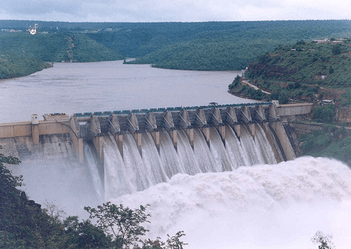
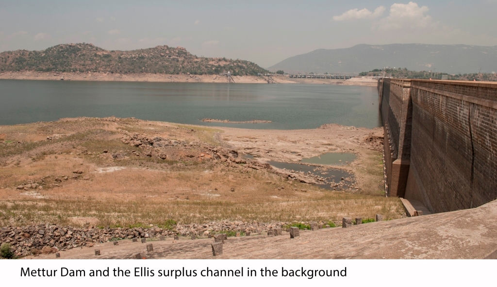
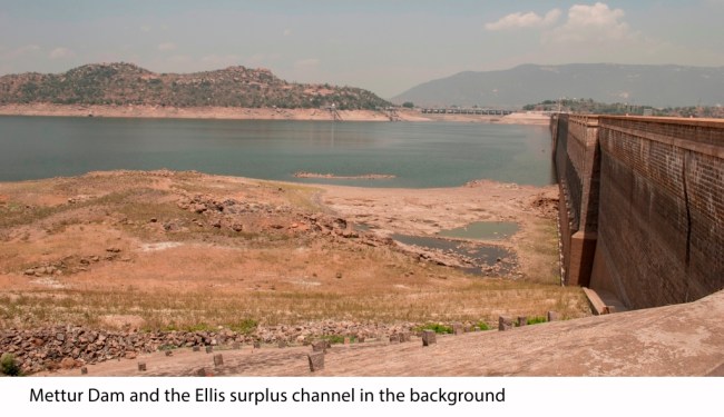
Dam(n)ing the Cauvery: Mettur

Along with the anicuts, Sir Arthur Cotton also drew the plans for a large reservoir on the Cauvery in 1834. However, it was in 1856, that earnest attempts began to think through a large dam on the Cauvery just before it entered the plains, when Major Lawford submitted proposals for the construction of a reservoir on the Cauvery near Nerinijipet (about 11 miles downstream of Mettur). From 1856 to 1901, no less than four separate proposals sought to harness the Bhavani (a tributary of the Cauvery) instead of the Cauvery (Barber 1941, 3) (Day 1873) (Sunder Raj 1941). Finally, in the early decades of the 20th century, there seemed to be some movement concerning the building of the dam.

Image

One of the major factors that held back the Mettur Dam was the Cauvery water dispute. The Mysore Government had decided to construct a dam at Kanambadi (about 20 kms from Mysore) for irrigation and augment flows for the Sivasamudram hydroelectric station. Sivasamudram (in operation since 1905 and modeled along the Niagra falls hydroelectric station) provided electricity for the Kolar Gold Mines and Bangalore city. However, given the rain dependent nature of the Cauvery’s flow, ‘stable’ flows were needed to ensure proper running of the plant.  The 1914 arbitration award however was unacceptable to Madras Presidency for it did not “provide for what were contended by Madras to be their established rights in regard to existing irrigation in the Cauvery delta” (Barber 1941, 14). While arbitration was still going on, Mysore began building the Krishnarajasagar dam in 1911. Although completed only in 1927, the dam was an important cause of disagreement since it held the Cauvery from the delta.

Image

Between 1914 and 1924, a series of negotiations were conducted between Mysore and Madras, in which, most notably were contested the regulation of Krishnarajasagar (thereby regulating how much water was actually available for Madras). The amount of water that Madras had access to also determined the height of the Mettur dam and thus its effectiveness. It was in February 1924, that an agreement was finally reached.  Given its long gestation, many figures had to be revised and on 3 March 1925, the Mettur dam was finally given a go ahead. It took nine years to build Asia’s then highest masonry dam. According to the Salem Gazetteer, 26 villages were submerged in the process and that water spread is 15346 ha.

Mettur Downstream LowRes

Fishy waters:

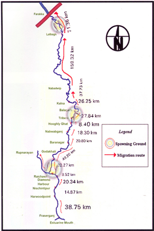
In the late 19th century, the world over, fisheries and fish passes became an important topic of discussion in response to the growing fishing industry. In 1867, Sir Cotton alerted the Government of India about the possible damage to Indian fisheries from the weirs extant at the time in Indian rivers (Sunder Raj 1941, 342). Immediately, Dr. Francis Day was commissioned to investigate the impact on fisheries and subsequently appointed Inspector-General of Fisheries in India.

In his report on the fisheries of India and Burma, Day condemned dams as insurmountable barriers to fish passage (Day 1873, 7-14); he designed a fish passage ¾ a modified form of under sluice to allow passage of fish ¾ that was tried on the Lower Anicut on the Kollidam (Sunder Raj 1941, 342). The idea was that fish could ascend the Lower Anicut through the under sluices and reach their spawning grounds without impediments. The pass was primarily designed for the Hilsa who could not ascend it, as it was too wide (Sunder Raj 1941, 343). According to the Madras Fisheries department in 1909, the fish pass did not ensure hilsa migration because of various practical and technical difficulties; in the first place, the expenses for the construction of a fish pass were not commensurate with the expected results and secondly, sufficient water could not be provided for the efficient working of the pass (Nair 1954). In light of its operational problems, the pass was abandoned. However, according to fish biologists, the pass may not have been a great disincentive either. According to Dr. Francis Day, who surveyed fish in Indian rivers and seas, the hilsa was recorded spawning near Trichinopoly (Trichy) (Day 1873, 7-14). Colonial records indicate that the hilsa was sought to be cultivated and exported along the lines of the Salmon in northwestern United States. In fact, the hatchery at the Lower Anicut was promoted to ensure consistent fish produce for export[2].  So important was the hilsa that a stuffed specimen made its way into the exhibits sent to the Great Exhibition from the Bombay Presidency, in 1851. The hatchery was later abandoned, as it could ensure sustainable fry in large numbers.

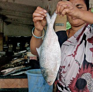
Today, the hilsa is unknown on the Cauvery. According to fish biologists, the hilsa ascended the anicuts on the Cauvery up to Mettur to spawn overcoming the low anicuts that dotted the river delta. But the coming of the Mettur Dam formed an impassable barrier (Devanesan 1942, Chacko 1954)

Reservoir Fishing:

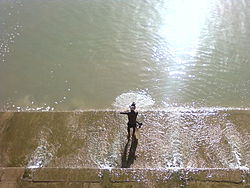
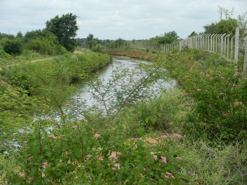
Mettur’s Stanley reservoir remains one of the largest reservoirs in South India and the oldest in Tamil Nadu. At its maximum the reservoir is 85 km long and over 8 km wide encompassing a shoreline of over 290 km . B Sundar Raj, the then Director of Fisheries in Madras remarks that the Fisheries Department was perhaps not consulted when the dam was being designed, to create a fish friendly design (Sunder Raj 1941, 344-45). Although the dam was not built with a fish pass/ladder, it was assumed that the Ellis surplus and gradual gradient of the surplus channel would allow for fish migrations upstream (Sunder Raj 1941, 344-45). According to Dr. Sunder Raj, the Gangetic Carp was introduced in 1928 while other carps such as rohu, mrigal and calbasu were introduced from 1948 (Sreenivasan 1998, 4). A fish seed farm was also established near the dam. This fish seed farm continues to supply fingerlings for release into the Stanley reservoir. Hatchlings are supplied to the Krishnagiri reservoir upstream of Mettur and other reservoirs in Tamil Nadu. Regulations such as the Indian Fisheries Act (1897) and Tamil Nadu Amendment (1927) were enforced to prevent fishing in certain areas below the dam as well as enforce mesh regulations to prevent the capture of small fry. Furthermore, fishing is prohibited for 2 km immediately downstream of the dam (in fact, all dams in Tamil Nadu), that stretch of the river has been declared a sanctuary in order to ensure that biodiversity is preserved. Visiting in the height of summer in May, it was observed that immediately downstream of the dam, the river seemed to flow. Given that Mettur is also a hydropower dam, freshwater is regularly released into the river as electricity is generated . Currently, fingerlings that are about 45 days old are released into the reservoir.

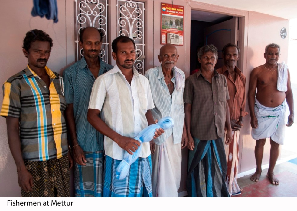
Fishing in Mettur today:

Fisherman Low Res

Today, in Mettur, fishing is organized around licenses. Fishermen are allowed to fish the reservoir if they have a valid license. Fishing licenses need to be renewed every year. Fishermen have to sell their catch to the local cooperative society, the Mettur Dam Fishermen Co-operative Marketing Society. This society in turn sells the catch to a contractor who then sells the fish to wider markets in Bengal and Kerala after retaining a certain minimum for the local market. The society buys fish from fishermen according to their weights at a guaranteed rate. Fish are graded along four categories of weight and kind. This guaranteed minimum price is pre-decided by the society every year. Every year, the society also issues a “tender for the disposal of Mettur dam fishes”.  Through this tendering process, the highest bidder over the minimum price (set by the society) wins. In the last three years, the tendering process has not been initiated in Mettur leading to a monopoly by one contractor.

Fishing License Low Res

Currently, about 200 licenses are issued every year. Each license costs about INR 1200 and is valid for a year. Fishermen have to log their daily catch according to grade of fish caught in a ‘passbook’. Their earnings depend on the grade and quantity of fish caught.

Accessing the river: On a recent visit to the reservoir area by the author, fishermen in Mettur complained that they had no access to the river, as there is rampant poaching. Illegal fishing has long been a problem in Mettur according to fishermen. According to the contractor currently holding the tender at Mettur, while licenses are issued to only 200 fishermen, over 2000 people fish the reservoir. Most of this illegal catch makes its way directly to the local market and is sold at higher than the society stipulated prices.

Fishing Net Low Res

Not enough fingerlings released: According to fishermen, not enough fingerlings are released into the reservoir. They claim that while crores of fingerlings can be released into the reservoir, only a few thousand are released. During a visit in May 2014, officials at the fish seed farm said that over 32 lakh (a number stipulated by the Director of Fisheries) fingerlings were released into the waters last year. Fishermen allege that the even if fingerlings are released into the reservoir, they do not have the opportunity to grow because of the rampant poaching. It is a sentiment echoed by the contractor too.

Smaller catches, no earnings: At Mettur, an initial daily catch of 4.5 tonnes was estimated in 1951, which was revised to 1.82 tonnes/day. Today, fishermen say they catch a few hundred grams of fish every day, sometimes they do not catch any fish at all. Catch passbooks revealed lower grade fish in quantity and weight were caught more regularly than a good grade fish. On an average fishermen say that they earn about INR 6000-7000 over the course of two months. Today the catch plateaus around 1-1.5 tonnes on a good day. Fishermen and contractor alike complained that the quality of fish stock has reduced in the reservoir. Where earlier, there were indigenous fish that have now been lost- from catches and vocabularies’.

Catch passbook low res

Nowhere else to go: Dwindling catches have forced fishermen to migrate to other reservoirs in search of catch. Fishermen complain that they cannot avail of schemes such as MNREGA because these schemes do not cover fishing. Fish production in reservoirs is on its way down. Dwindling flows and catches are fast making fishing unviable.

Changing fishing practices: Mesh size for fishing was raised from 5 cm to 10-12.5 cm to allow capture of only large sized catla and to give major carps a chance to breed at least once before being caught (Sreenivasan 1998, 4). Today, fishermen allege that poachers use smaller sized meshes and are able to catch fry that are too small to be caught. According to the contractor, these small fry are dried and sold as dried fish to markets in Andhra Pradesh.

CONCLUSION:

Fishing in Mettur is fast becoming unsustainable for fishermen. According to the contractor, the only solution remains leasing out the entire reservoir to one contractor ¾ a practice followed in all reservoirs across Tamil Nadu, except Mettur ¾ so that everything from catch to process to marketing is under one head. The fishermen think the only solution is divesting the responsibility of releasing fry away from the fisheries department to the fishermen themselves. There is little or no memory of indigenous fish in the river. Fishermen currently fishing the waters of the reservoir have no memory of the hilsa or any of the other indigenous fish such as the Puntius dubius which also became extinct after the coming of the Mettur Dam. Fishermen who have fished the waters of the dam for over 50 years do not know of any other fish than reservoir stocked fish that they have caught.

Mettur represents (like in case of other dams and rivers in India) the privileging of agriculture and electricity needs over needs of the people and ecosystems that depend on the river in other ways, the privileging of a certain imagination over all else. While initial results based on this imagination might have seemed satisfactory to some with some claim over control over floods, some water for irrigation etc, in the long run, it has turned out to be unsustainable as flows have reduced and other impacts and options could be seen.

Today, memories of migratory fish are lost; fishing is only restricted to reservoir fishing with stocked fish.  Decommissioning and deconstructing of dams in India may be a long way away. However, there is an urgent need to re-organise reservoir operations, reservoir fishing and understand the various roles that rivers flowing with freshwater play. Release of water from dams all round the year for rivers needs to be a norm for all reservoirs, old and new.

Seasonal, stricter licensing: Instead of licenses that run an entire year, it may make sense to rotate licenses amongst fishermen and giving license to fisher-people’s cooperatives to ensure greater access. This will also help in reducing poaching as more fishermen will have access to the river. In addition, the fisheries department needs to shift ownership of fishing to fishermen and not licenses.

Creating other opportunities: During my visit, fishermen pointed out that a few years ago when the fisheries department did not have enough personnel, fishermen were asked to release the fingerlings into the reservoir. That year, the catch was sustainable and higher than any other year after. In addition to fishing, fishermen who do not have the season’s license need to be encouraged to work at the fish seed farms. Fish seed farms can benefit from traditional knowledge about fish and fishing while fishermen will have another vocational avenue that uses their extant skill sets.

Creating a truly fishermen’s cooperative: Without access to the market,  access to the river may not be the most beneficial for fishermen. A fishermen’s cooperative that issues licenses and controls catch would ensure that fishermen have ownership of the entire process. Through a fishermen’s cooperative, fishing would be democratized. Fishermen are already sensitive to market forces; they point out that a strong local market exists for catch.

Populating the reservoir with other kinds of fish: Reservoir fishing in Tamil Nadu is dependent on some exotic fish and rohu, katla. While a free moving river and its biodiversity may be impossible to recreate in a reservoir, the fisheries department needs to think of other fish that might also be suited for the reservoir and thus increase the diversity of fish caught with emphasis on local varieties and fished in the reservoir.

Creating a sustainable fishing policy: There is an urgent need to re-organize fishing policy of each reservoir at the reservoir level instead of at a state or national level. Fishing policy needs to be decoupled from being premised just on catch. It needs to be sensitive to the needs of the fishermen who depend on these catches as well as flows of the river that sustain these catches.

The above suggestions could go a short and long way in creating some semblance of a balance in fishing in reservoirs & rivers. However, in the long run, there is a need to look beyond dams for irrigation and hydropower. While dams and hydropower may be inextricably linked to the way in which we currently think of rivers, as the experience of the Elwha and other rivers shows, we need to start valuing the services a river provides. There needs to be an inherent sensitivity towards to the people who live along the river that needs to be built into policy and decision making processes.

Ramya Swayamprakash (ramya.swayamprakash@gmail.com) 

Works Cited:

White, Richard. The Organic Machine: The Remaking of the Columbia River. New York: Hill and Wang, 1995.

Linton, Jamie. What is Water? The History of a Modern Abstraction. Vancourver, Toronto: University of British Columbia Press, 2010.

D’Souza, Rohan. “Colonialism, Capitalism and Nature: Debating and Origins of Mahanadi Delta’s Hydraulic Crisis (1803-1928).” Economic and Political Weekly 37, no. 1 (March 2002): 81-105.

Peterson, Indira Viswanathan. “The Kaveri in Legend and Literature.” In Waterlines: The Penguin Book of River Writings, edited by Amita Baviskar, 77-85. New Delhi: Penguin India, 2003.

Government of India, Revenue and Agricultural Department Fisheries, January 1884

Proceedings- No. 1. Madras Draft Fisheries Bill and connected papers.1884

Sunder Raj, B. “Dams and Fisheries: Mettur and its Lessons for India.” Proceedings of the Indian Academy of Sciences – Section B 14, no. 4 (1941): 341-58.

Day, Francis. Report on the Fish and Fresh Water Fisheries of India and Burma. Report, Office of the Superintendent of Government Press, Calcutta: Government Press, 1873.

Nair, K.K. “Dams and Hilsa Fisheries.” Journal of the Asiatic Society (Scientific) 20, no. 1 (1954): 77-79.

Chacko, P.I. “Past, Present and Future of Hilsa Fisheries in the Madras State.” Journal of Asiatic Society (Scientific) 20, no. 1 (1954): 55-58.

Devanesan, D.W. “Weirs in South India and their effect on the bionmics of the hilsa in South Indian rivers – The Godavari, The Krishna and the Cauvery.” Current Science 11, no. 10 (1942): 398-99.

Sreenivasan , A. “Fifty Years of Reservoir Fisheries in Mettur Dam, India : Some Lessons.” Naga: the ICLARM Quarterly, October-December 1998.

Barber, Charles Gordon. History of the Cauvery-Mettur project (Revised edition 1987). New Delhi: Central Board of Irrigation and Power, 1941.

Kingensmith, Daniel. One Valley and a Thousand: Dams, Nationalism and Development. New Delhi: Oxford University Press, 2007.

END NOTES:

[1] Srirangam Island in Trichy district is the head of the delta. The river splits in to the Kollidam (the larger distributary) and the Cauvery.

[2] Government of India, Revenue and Agricultural Department Fisheries, January 1884

Proceedings- No. 1. Madras Draft Fisheries Bill and connected papers. P 9 and 22.

[3] Cauvery Basin Map: https://sandrp.in/basin_maps/Hydropower_Projects%20_in_Cauvery_Basin.pdf

Dams

Impact of 98 Mini Hydel Projects on Cauvery on Bangalore’s Water Supply

In recent news reports, it was reported that “following the drastic fall in the water-level in the Shiva Balancing Reservoir (SBR), the Bangalore Water Supply and Sewerage Board (BWSSB) has asked Karnataka Power Transmission Corporation Ltd. (KPTCL) and Karnataka Power Corporation Ltd. (KPCL) to stop power generation from four mini-hydroelectric projects in the Cauvery basin, at least till May.”[1] The projects which were asked to stop generation include: Madhavamantri, Satyagala, Shiva Anecut and Shimsha mini-hydroelectric projects.Image

However, the fact is that KREDL (Karnataka Renewable Energy Development Limited) has allotted and commissioned a whopping 98 mini hydel projects on the Cauvery, most of them downstream Krishnaraj Sagar Dam, many of them commissioned. These projects are in the Mysore, Mandya and Chamrajanagara Districts. Actual numbers maybe higher as we have not included projects from Ramanagara in the list as we are not certain how many of those would fall in Cauvery Basin.

24 Projects are in Mysore, 62 in Mandya and 12 in Chamrajanagar.

See Annex 1 for the full list with their status (Only projects from Mandya in the Annex, contact us if you need the full list)

Some of these projects are downstream from the Shiva Anicut from where water supply to Bangalore is routed. In addition to decrease in water availability, water stored by several mini hydel projects increases the evapo-transpiration rate of water, particularly in summer.

Critically, these projects also hold back water, affecting water supply cycles to Bangalore and other towns and villages dependent on the river. Similar conditions had occurred in Mangalore, last year where water levels in the Thumbe Dam fell to alarming levels due to mini hydel projects hoarding up water in the upstream.[2]

In Cauvery, if at all the state government, BWSSB and others concerned about impact of water supply due to mini hydel projects, they need to consider the impact of these projects on the water supply, ecology and livelihoods in the downstream areas and consider halting generation of these projects during this summer when the Cauvery basin is facing sure dire water situation. Mini Hydel Projects which are below the capacity of 25 MW do not need Environmental Clearance, Environment Impact Assessment or Public Hearing. String of Mini Hydel projects on a single river, one after the other, severely affects the hydrology as well as ecology of a river system and also people and their livelihoods in surrounding areas. The same is happening with Cauvery with nearly 100 Mini Hydel projects planned or commissioned. Many projects are right next to the Cauvery Wildlife Sanctuary and are causing impediment to movement of elephants, increasing man-animal conflicts. This has been highlighted by the Karnataka Elephant Task Force.  Due to their cumulative impacts on ecology, High Court of Karnataka has halted construction of any such projects in Western Ghats.

Hence, keeping water supply, hydrology and ecology in view, project level and cumulative impact assessment of mini hydel projects planned, allotted and commissioned along the River Cauvery is an urgent need. Earlier such appeals to KREDL, Karnataka Forest Department and Karnataka Wildlife Board have fallen on deaf ears.

We hope that the Karnataka government, BWSSB, KPCL, KREDL, KPTCL, Cauvery Neeravari Nigam and all others concerned will come together and will conduct this assessment urgently and cancel the projects which are having unacceptable impacts on people, ecology, hydrology and water supply of Cauvery. Immediately, an assessment of their impact is required in the context of summer and dire water situation.

On the International Day of Action for Rivers, Cauvery needs our urgent attention. Cumulative impact Assessment and individual Impact Assessment of unprecendeted number of Mini Hydel Projects is a must.

Nisarg Prakash, Nityata Foundation, Bangalore, nisargprakash@gmail.com

Dr. Latha Anantha, River Research Centre, Kerala, rrckerala@gmail.com

Parineeta Dandekar, South Asia Network on Dams, Rivers and People (SANDRP) parineeta.dandekar@gmail.com

09860030742

(Scroll Down for a list of Commissioned and Allotted Mini Hydel Projects on Cauvery in Mandya District alone)


Annexure 1

Small Hydro Projects in mandya District on Cauvery in Karnataka. Please contact us if you need full list of 98 projects including those in Mysore and Chamrajanagara.

(Source: Karnataka Renewable Energy Development Limited, KREDL: http://www.kredltest.in/Hydroreportall.aspx)

 No. Company Company MHS Status Capacity (MW)
1 ADD Realty Ltd. New 3
2 Aparimitha Power Ventures Pvt. Ltd. Aparimitha Kuppahalli MHS Allotted 4
3 Atria Brindavan Power Ltd. Atria Hanumanahalla Commissioned 8
4 Atria Brindavan Power Ltd. Atria Brindavan Allotted 12
5 Atria Brindavan Power Ltd. Atria Visveswara Commissioned 12
6 Atria Brindavan Power Ltd. Atria KRS Commissioned 4
7 Atria Hydel Power Ltd. Atria Sheshadri Iyer Allotted 10
8 Atria Hydel Power Ltd. Atria Sheshadri Iyer II Commissioned 12
9 Atria Power Corpn. Ltd. Atria Shimsha New 24
10 Atria Power Corpn. Ltd. Atria Yelachagere MHS Allotted 5
11 B & G Energy Pvt. Ltd. B&G Allotted 3
12 B Soilmec India Pvt. Ltd. B Soilmec Hasurubore Halla Allotted 20
13 B Soilmec India Pvt. Ltd. B Soilmec Someshwara II Commissioned 15
14 Bhoruka Power Corpn. Ltd. Bhoruka Mandagere Commissioned 4.5
16 Cauvery Hydro Energy Ltd. Cauvery Shiva Commissioned 3
17 Cauvery Hydro Energy Ltd. Cauvery Akkihebbal Allotted 4.5
18 Energica Power Co. NULL Alugodu Commissioned 0.8
19 Graphite India Ltd. Graphite India Allotted 1.5
20 Hallikeshwara Energy Projects Pvt. Ltd. NULL NULL Allotted 0.5
21 IJK Power Pvt. Ltd. NULL Ganadahalli Allotted 15
22 Innoverse Eco Friendly Solutions Innoverse Thimmana hosur Allotted 0.4
23 Instrument & Systems NULL Banasamudra Allotted 1
24 Kaltronics Office Automation & Networking Pvt. Ltd. Parpikala Mahadevapura Commissioned 0.5
25 Kilara Power Pvt. Ltd. NULL NULL Commissioned 2
26 Limbavali Power Pvt. Ltd. Limbavali Hullahhalla Commissioned 12
27 LK Power Corpn. Ltd. LK Maddur Branch Canal Allotted 2
28 Manasa Gangothri Power Pvt. Ltd. New 3
29 ME Power Gen Project NULL Shree Lakshmi Narashimhaswamy Allotted 3
30 Mythree Power Developers Mythree Sampaji Allotted 0.25
31 Nimishamba Energy India Pvt. Ltd. Nimishamba Nimishamba New 3
32 Obull Power Projects Pvt. Ltd. Obull Sagya New 2
33 Obull Power Projects Pvt. Ltd. Obull Chillapura Allotted 2
34 P6 Energy Pvt. Ltd. KCP Ballenahalli New 2
35 Paramount Estate Pvt. Ltd. Ramapura New 1
36 Paramount Estate Pvt. Ltd. chaluve Allotted 1
37 Parpikala Power Pvt. Ltd. Parpikala Viraja Allotted 0.5
38 Parpikala Power Pvt. Ltd. Parpikala Sithapura Allotted 0.5
39 Penna Cements Industries Ltd. Pioneer Genco Sreeramadevara Allotted 24.75
40 Photon Energy Systems Ltd. Photon Hosaholalu Commissioned 0.5
41 Pioneer Genco Ltd. Pioneer Genco Someshwara Allotted 24.75
42 Samrudhi Hydro Energy NULL KRS Allotted 1.22
43 SLS Power Industries Ltd. Bhoruka Belakavadi Allotted 1.5
44 SM Hydro Power Pvt. Ltd. SM NULL Allotted 10
45 Soham Renewable Energy India Pvt. Ltd. Soham Mahadevapura-2 Allotted 6
46 Sree Mallikarjuna Power NULL Maddur Allotted 0.95
47 Sri Rama Enterprises Rama Doddrasinakere Allotted 0.5
48 Sri Rama Enterprises Rama Chikkarsinakere Allotted 0.5
49 Sriven Power Pvt. Ltd. NULL Heggadahalli Allotted 5
50 Subhash Kabini Power Corpn. Pvt. Ltd. SPML Varuna RBC Allotted 2
51 Subhash Kabini Power Corpn. Pvt. Ltd. SPML Hulikere New 3
52 Trinity Aero & Energy Formulations Pvt Ltd NULL Mosarahalla (Katteri Nala) Commissioned 0.25
53 Trishul Power Pvt. Ltd. Trishul Hemagir Allotted 4
54 V.Pram Power Co. Pvt. Ltd. NULL Devaraya Allotted 0.5
55 Venika Green Power Pvt. Ltd. XS Chikka Commissioned 24.75
56 Venika Green Power Pvt. Ltd. XS Malligere Commissioned 0.75
57 Vijayalakshmi Hydro Power P Ltd (2) NULL Hebbakavadi Commissioned 1.75
58 Vijayalakshmi Hydro Power P Ltd (3) Hebbakavadi Allotted 1.25
59 West Mountain Power Ltd. West Mountain Shimsha Kaveri Confluence SHP Allotted 24
60 XS Hydro Energy Pvt. Ltd. XS Commissioned 24.75
61 Yuken India Ltd. Attigala Allotted 0.35
62 Zen Power Pvt. Ltd. KGK Paschim vahini  Allotted 0.5
 TOTAL  361.47 MW