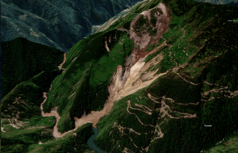
A Rapid Hazard Assessment Report by Dr Jakob Steiner a postdoc fellow at the Institute of Geography and Spatial Research, University of Graz, Austria (jakob.steiner@uni-graz.at) and Amrit Thapa a doctoral student at University of Alaska Fairbanks (aamritjnu@gmail.com). A Hindi version of this report can be seen here.
Continue reading “Pindar Valley, Uttarakhand: Potentially Dangerous Landslides Dam in Kunwari”Tag: Pindar

Aug 2023 Floods in Alaknanda-Ganga Rivers
(Feature Image: Ganga river flowing in severe flood condition in Rishikesh on August 14, 2023. Image Credit: PTI/ Source: DH)
On August 14, 2023, there was flash flood in Alaknanda rivers in Uttarakhand causing sharp rise in water level at Center Water Commission (CWC) stations along Alaknanda upto Devprayag and then along Ganga in Rishikesh and Haridwar. The volume of water was so huge that it narrowly missed breaching the June 2013 peak flood level at Rishikesh and Haridwar site. This report tries to analyze hydrographs of 15 CWC flood monitoring sites on Alaknanda and Ganga rivers to assess the actual flood levels in these rivers during this flood spell in comparison with the previous peak flood levels attained on these sites.
Continue reading “Aug 2023 Floods in Alaknanda-Ganga Rivers”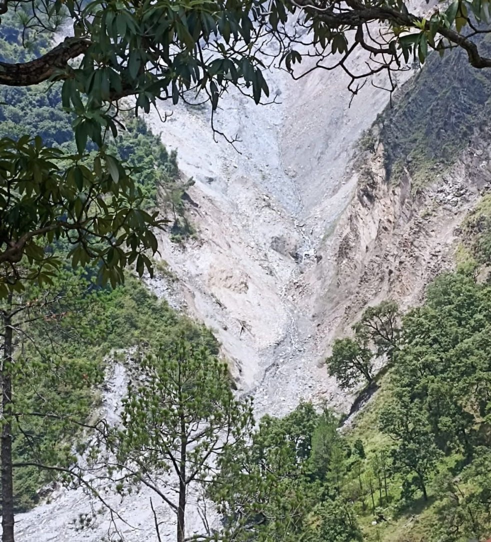
Uttarakhand June 2022: Shambhu River Landslide Lake in Alaknanda basin
(Feature Image:- बागेश्वर के कुंवारी में इस तरह हो रहे भूस्खलन के कारण पहाड़ी से शंभू नदी में गिर रहा मलबा। Image: Amar Ujala)
In last week of June 2022, a landslide lake was formed on Shambhu river in Kapkot tehsil of Bageshwar district. Shambhu originates from Shambhu glacier near Borbalda village in the district. It joins the Pindar river another glacier fed river few kilometres upstream Jhaliya village. In turn, passing through Tharali, Narayanbagad the Pindar river merges into Alaknanda river at Karanprayag in Chamoli district.
Continue reading “Uttarakhand June 2022: Shambhu River Landslide Lake in Alaknanda basin”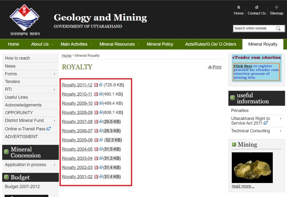
Uttarakhand Riverbed Mining 2020: Rivers, People, Revenue Robbed
The hilly state of Uttarakhand also known as land of rivers has seen increase in riverbed quarrying operations over past decade. With establishment of stone crushers industry, scale and intensity of riverbed minerals (RBM) excavation has further increased in past few years. So has become the impact on villagers and rivers.
However, the government lacks monitoring, transparency, accountability in checking the unscientific, unauthorized RBM as is evident from a review of Uttarakhand Mining and Geology Department (M&G) website and media reports. In fact the state government has neither conducted replenishment study nor formed District Mineral Foundation (DMF), suggesting that it is hand in gloves in organized loot of RBMs.
Continue reading “Uttarakhand Riverbed Mining 2020: Rivers, People, Revenue Robbed”

Uttarakhand Rivers Profile
About Uttarakhand
Geographical Location- North India largely mountainous with two plains and two partly mountain districts in the south; Area- 53483 sqkm; Population- 10.12 million; River basins- 4 River basins (R. Ganga‘s basin is subdivided in the map below into R. Bhagirathi, R, Alaknanda and R. Ganga sub-basins); Districts-13; Climate- Sub-tropical to tundra
About Uttarakhand Rivers

The water quality of Uttarakhand‘s rivers is basically good, especially in the upper reaches. Downstream of some large settlements and in the lower reaches in the Himalayan foot hills the water quality suffers due to the release of untreated sewage and industrial effluents. But the state‘s ambitious program to build 450 hydro power projects threatens the survival of the river ecosystems and the lives and livelihoods of people who live in these river valleys.
