(Feature Image: Asan river flowing through residential areas of Sevala Kalan upstream Chandrabani temple)
Despite being an important tributary to the Yamuna River in Shivalik hills of Dehradun, the Asan appears among the least explored and documented rivers. While, most of the people believe and even available online maps depict Chandrabani temple as origin place of the Asan, a field visit to track the river course reveals some interesting information.
This part one of photo blog documents the river course in its founding catchment sharing pictures and our field observations about the river’s origin place, past history and present situation. The second part of the photo blog will cover the remaining length of the river lying between Chandrabani temple and Asan barrage.
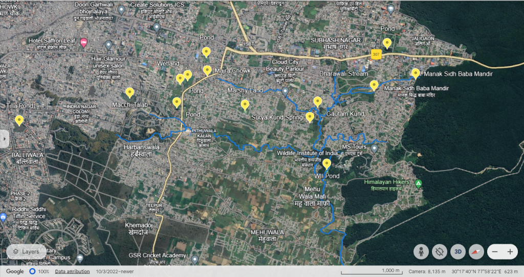
Water sources in Asan’s Southern Catchment
Aishwarya stream: For many researchers, groundwater fed tank named as Gautam Kund in Chandrabani temple is the origin place of the Asan. The google and most of academic maps also show it as starting point of river.
But, in reality the place is just a confluence point of two streams coming from north and south directions. The holy Guatam Kund also feeds into the twin streams there.

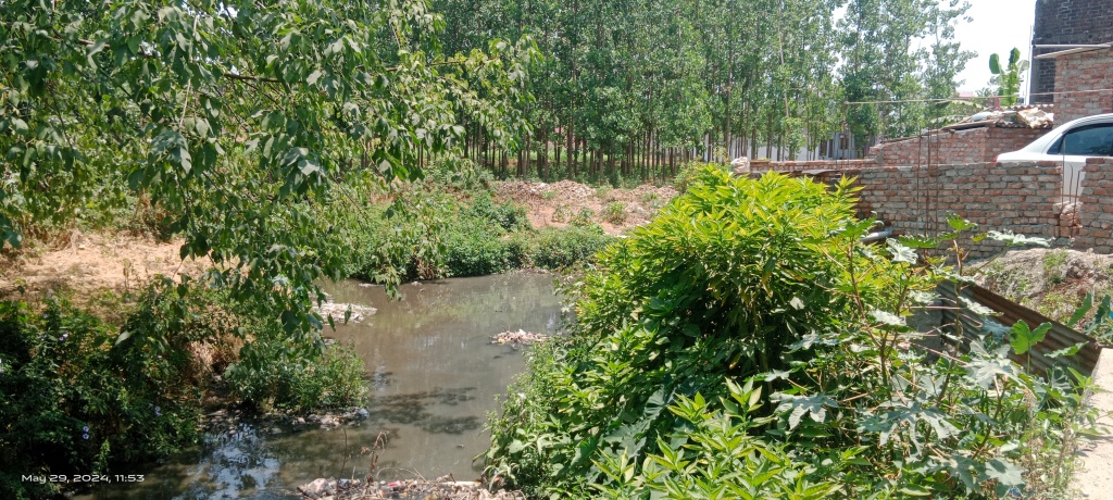
The left side stream described as Aishwarya by one of the temple priests originates from Chandrabani reserve forest in Mohabbewala area of Dehradun.
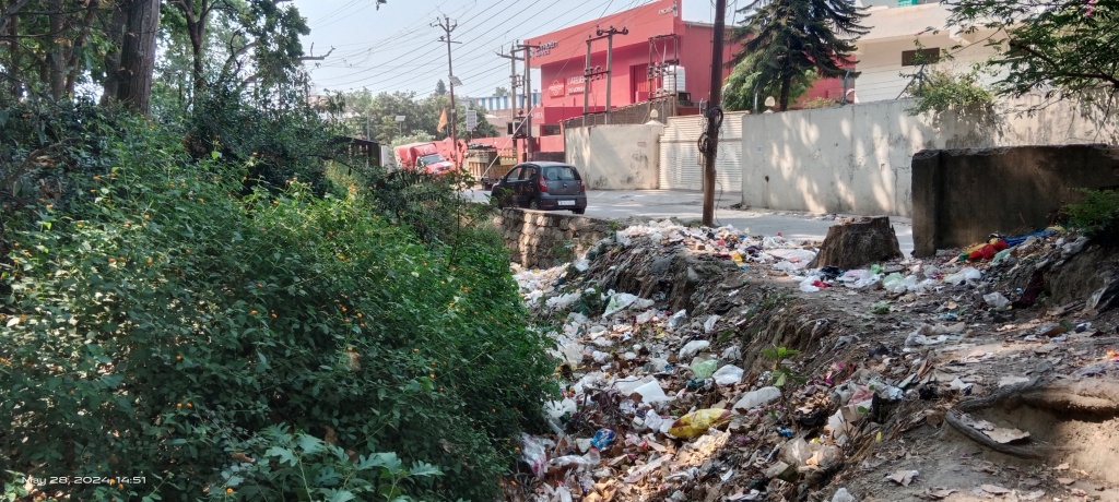
The dried-up track of the stream partly filled with solid waste is visible at the edge of the forest near Manak Sidh Mandir.

As per the inscription the temple was built in 1921 by a saint named Teen Chulhe Limbuni Bajai (Khala). The word Khala is also used for water courses in some parts of Uttarakhand.
It is not clear whether the Khala suffix in the saint’s name has any relation with the water stream. But the women devotees in the temple stated that the stream had clean flowing water about fifteen years back. They lament as it is now water less and being misused for solid waste disposal despite their pleas to stop the abuse.

In fact, the temple has tap connection from other sources and a plastic tank is also placed for potable water in the temple.
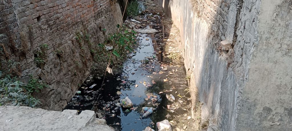
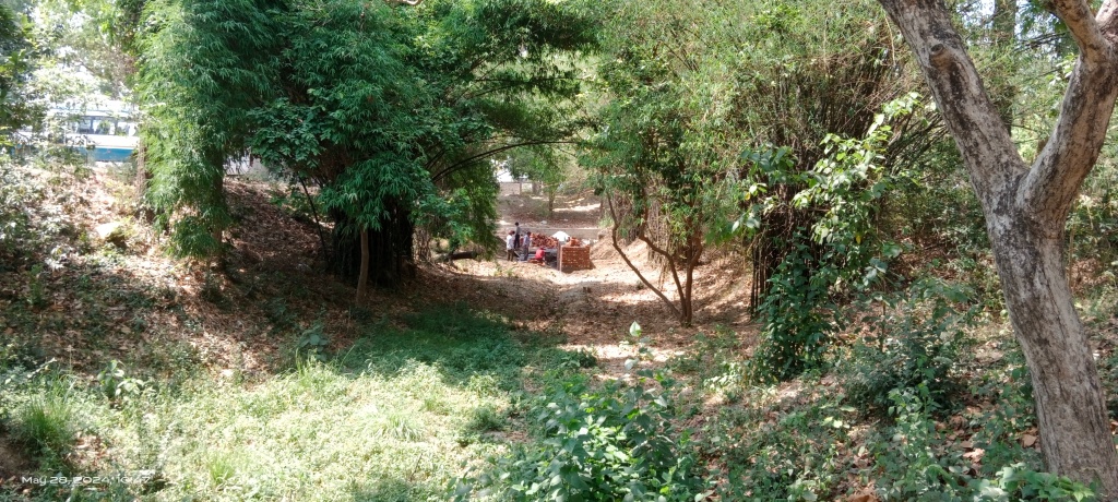
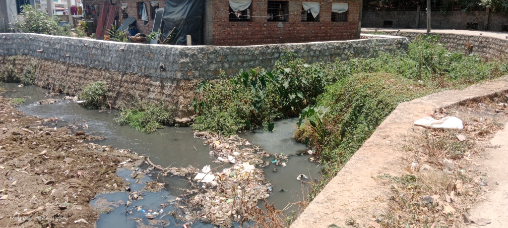
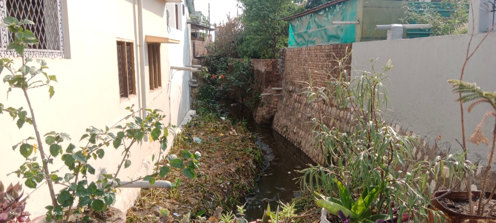
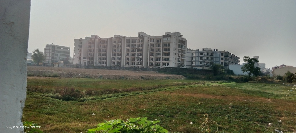
The stream then passes through industrial and residential pockets which in turn pollute the stream with waste water and solid waste.

The construction activities have also severely trained and encroached the stream course all along its length upto Chandrabani temple.

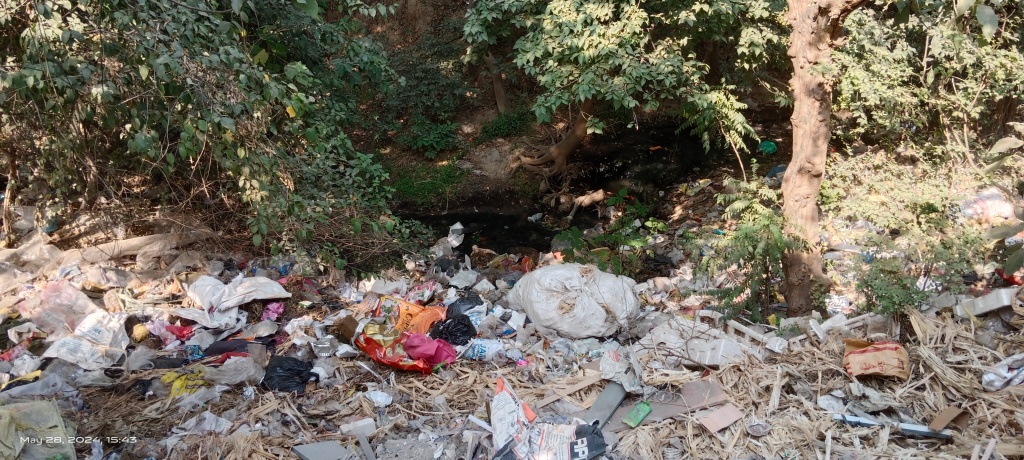
Plotting and construction activities in remaining unbuilt area of the Aishwarya catchment are at full swing. The passages of all the tributary water channels including of Aishwarya stream are woefully chocked with solid waste.


The amount of polluted water, solid waste and vegetation growth increases hugely in the Aishwarya stream by the time it joins Asan at Chandrabani temple. In fact, the air in temple premises stinks of sewage.

As per Robin Giri a temple priest, he had seen people enjoying bathing and fishing in Aishwarya stream about one a half decade ago. He also claims there was one more stream joining the Asan & Aishwarya in temple complex but it has now been levelled and disconnected from the rivers by a flood control wall.
As per him, both the Asan and Aishwarya floods dangerously inundating temple premises and washing away all the pollution load downstream.
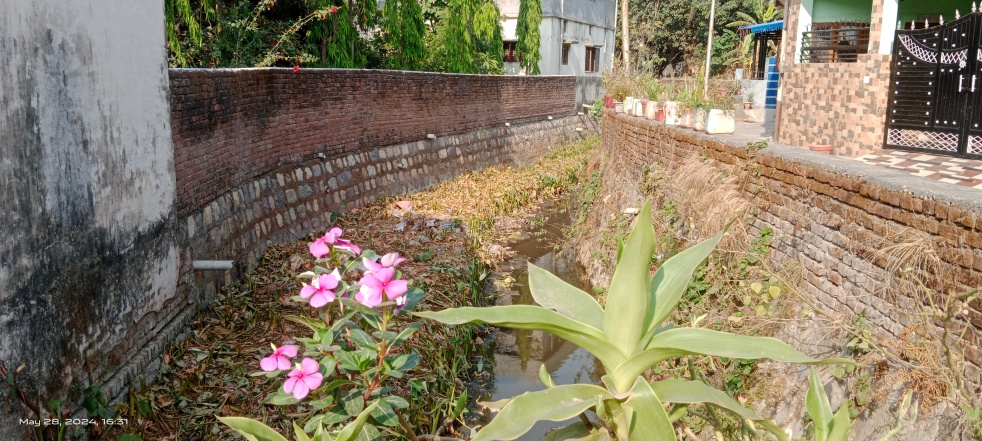
Dharawali Spring: One of the important water sources feeding the Aishwarya is Dharawali spring near Santhala Devi temple. The spring is covered with a concrete chamber with a PVC plastic pipe fitted through which the spring still provides clean water.

Till recent years, the spring had been a potable water source for local population living in Dimbak colony there. But the household tap connections have significantly reduced the reliance on the Dharawali spring. Currently the spring course is used to dispose waste water and the water channel is covered by thick vegetation growth.
Pond in Manav Seva Kendra: Another water body local people referred to is a man-made pond inside Manav Seva Kendra along Saharanpur-Dehradun national highway number 307 which apparently divides the water shed of Asan and Bindal rivers.
The pond is surrounded by a marshy area and seems located in Bindal river catchment. As per the attenders it is occasionally filled by groundwater.
Unnamed Streams: Couple of water courses (one from backside of Regenta Mercides showroom and one from Wild Life Institute (WII) colony also join the Aishwarya stream but they are no more than solid and liquid waste carrying channels. Part of their courses are untraceable.
Similarly, about 1 km westwards from Manak Sidh Mandir, there are traces of a stream starting near Foresto hills in Mohabbewala. The 2 km long stream also runs through residential areas carrying polluted water. It joins the Asan river near Budh Vihar colony close to WII boundary.
WII Stream: A small Asan stream runs through the WII campus area. Near entry point to the WII campus, a car wash is being built inside the stream course.
The outlet of the stream has been raised and trained to create a man-made lake there.
The water body is rich in aquatic diversity and supports whole range of migratory as well as native water bird species. Currently, in absence of rains, the water level of the lake has gone down sharply.
The stream joins Asan near Shani Enclave only during floods when the lake water spills over.
There seems to be a few more feeding streams in the area but are now totally untraceable due to developmental activities in the catchment of Aishwarya stream.
Water Sources in Northen Catchment of Asan
Gautam Kund: The Chandrabani temple is described as a penance spot of sage Gautam Rishi.
As per the mythology the saint had a daily ritual of taking bath in Ganga river in Haridwar. During one such occasion when the saint was away for bathing in Ganga, the Indra Devta disguised himself as Gautam Rishi to allure the sage’s wife Ahilaya in his absence. Angry over the act, Gautam Rishi cursed his wife to turn into stone.[i]
After the unfortunate incident, the Goddess Ganga blessed the saint to emerge as a water source in his Ashram so that the saint doesn’t have to visit the river every day.
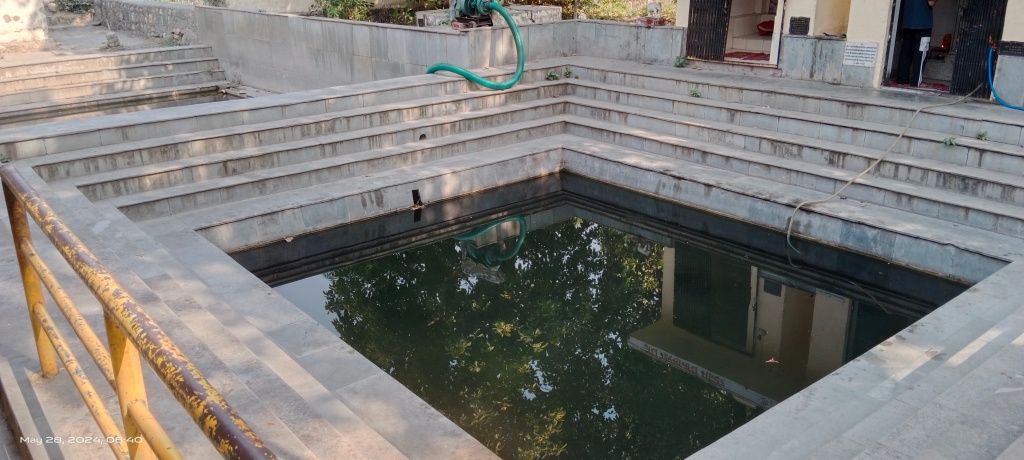
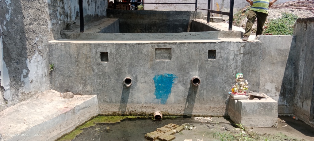
This natural water source coming out from the ground is now known as Gautam Kund. It is the water of this Kund now tapped in twin water tanks believed to be the source of Asan river.

However, when one visits the temple, Asan River course is seen passing separately close to the Gautam Kund in north. The stream carries polluted water, chocked with solid waste and vegetation at places.
It is worth mentioning that there is one more Gautam Rishi ashram which has a natural water body and goes by the same description located about 60 km away by the Yamuna River in Vikas Nagar tehsil of Dehradun.
During my field visit the primary tank of Gautam Kund was seen filled half with water, part of which goes to adjoining second tank. The algal bloom in the primary tank has turned the water colour greenish.
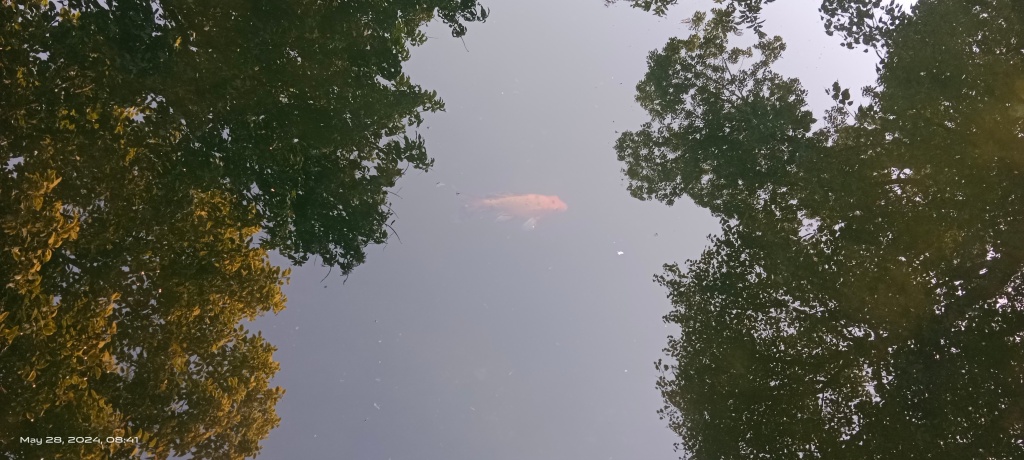
There are some invasive fish swimming in the tank which a priest says have been released by some local people.
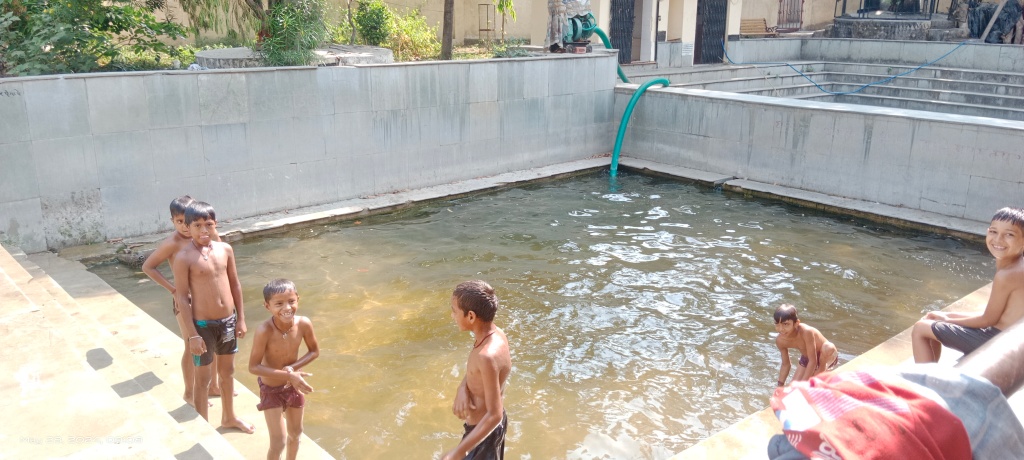
Kids were also seen enjoying bath in the lower tank.
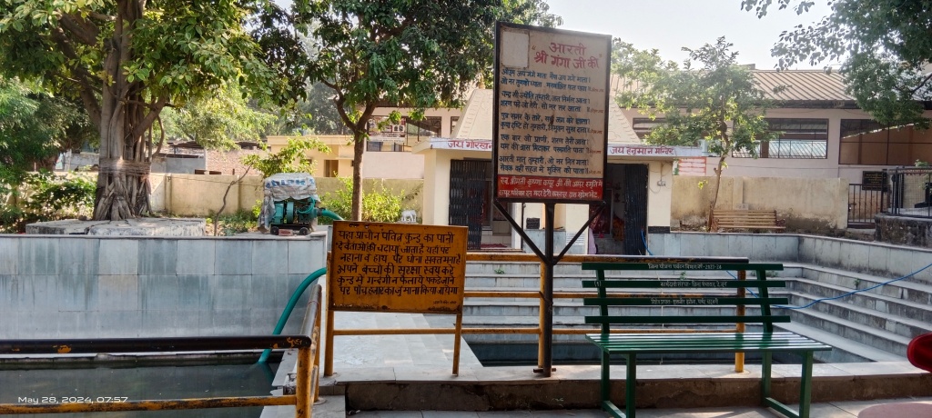
The tank water is considered holy akin to Ganga River and it is used for religious purposes. Ganga arati (hymn) is written on a board close to the Gautam Kund.

There also instruction not to pollute the tank waters. As per the priest, the tank gets polluted due to religious materials including fruits, grains and flour and the water is pumped out in the Asan twice in month to clean the tank. A motor pump is also visible in the picture above.

Though the water source is believed to be of Ganga and considered holy, but there are motor fitted handpumps in use as a potable water source for the visitors and caretakers in the temple.

The temple has idols of Goddesses Ganga and Chandrabani apart from of Gautam Rishi and Ahilaya Devi.
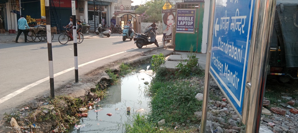
Interestingly, one of the instruction boards mentions the place as the pious Sangam (meeting point) of Chandrabani and Suhvan.

It is not clear whether these are the names for the streams. The sentence further reads “where three rivers merge into Shakini river and bathing in the holy river provides salvation to human beings”. The priests could not share any information about the Shakini river (There is also Shakini river in Chhattisgarh).
The place does appear located at a Triveni (confluence point of three rivers) and Shakini could be ancient name for Asan River. However, it requires further study of relevant religious scriptures.

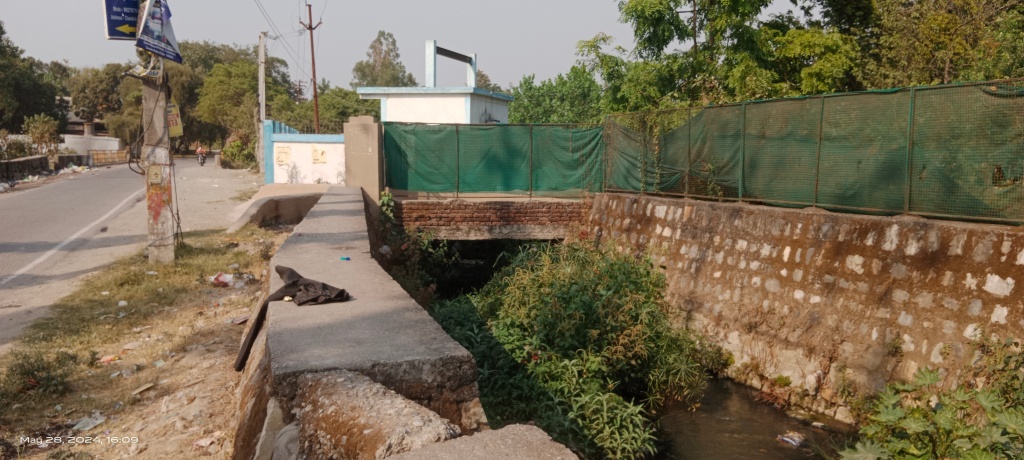
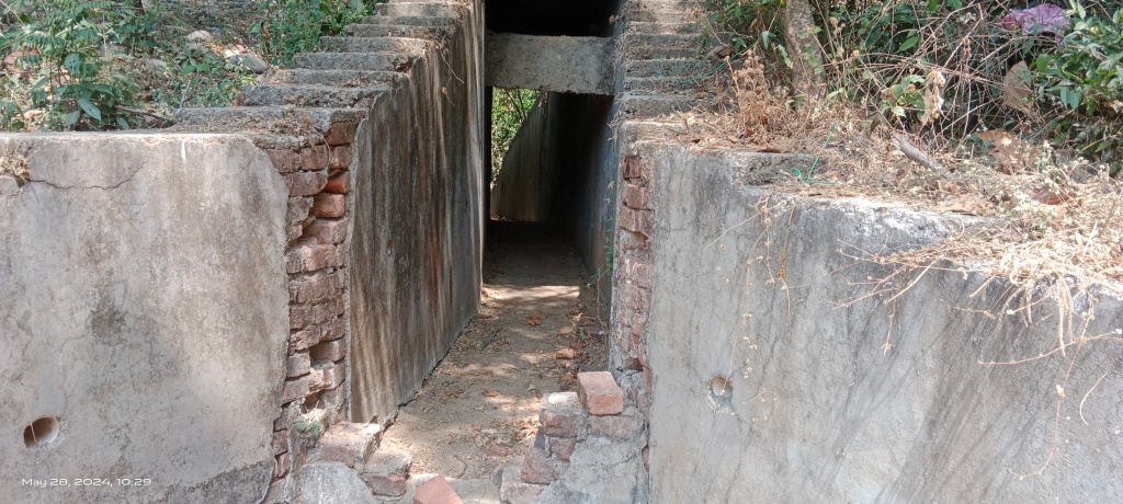
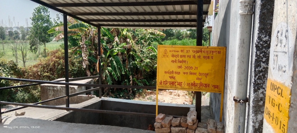
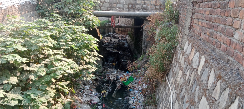
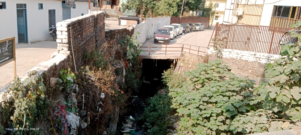
Asan Stream: Sadly, the board placed by the Asan stream just outside the temple mentions the river as a Nullah (sewage drain) warning people to refrain from dumping solid waste in it.

The entire water course of Asan is fully trained and channelized. It has been severely defiled by solid and liquid waste entering into it from adjoining residential areas.
About 2.5 km length of the stream running along the Savela Kalan road is still traceable and the initial part has totally been lost to encroachments by building of residential and commercial spaces, which also directly discharge domestic waste water in the stream.

As per locals, the stream used to start from Bansal homes near Majra Chowk but there is no trace of it around the site.
Instead, a muncipal drain starts from the place.
And my search to trace the origin of Asan river stopped there.
Water is being sold as commodity in the area.
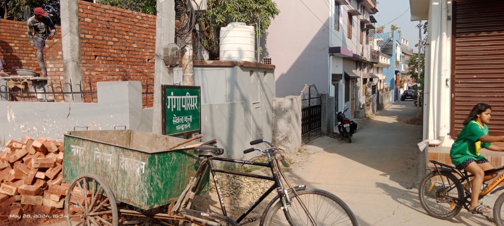
There are housing colonies named as Jamuna Vihar and Ganga Parisar but no such thing devoted to remember and celebrate the Asan River.

It appears Asan is a forgotten river and seen as filthy drain by administration as well as by the local people.
Suraj Kund Spring: There is another Dharawali like natural spring named Suraj Kund hardly 200 meters away from Chandrabani temple.
Less than a decade back, the spring was source of potable water for local population living in the area.
The large part of the spring catchment has been covered with concretized streets and human habitats. The spring water dependent population have now been connected with groundwater-based tap water supply.

Hence, the water of the spring has declined greatly and it lies in highly dejected condition.
The local administration has been spending funds on its beautification but there is no attention to protect the spring’s remaining catchment and revive water sources feeding the spring.
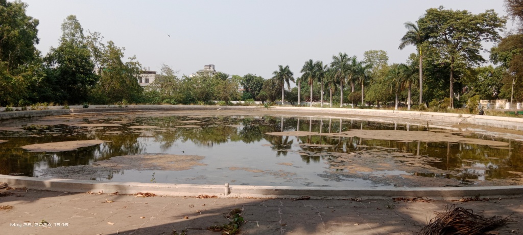
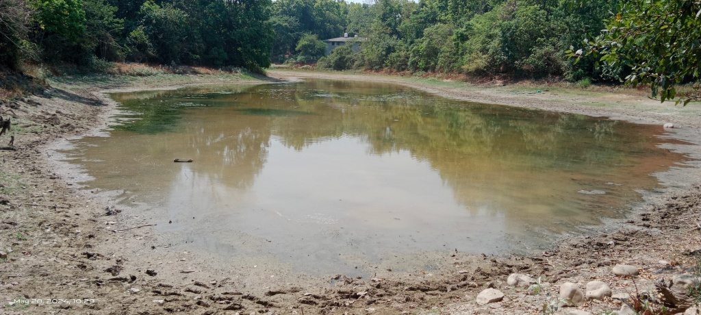
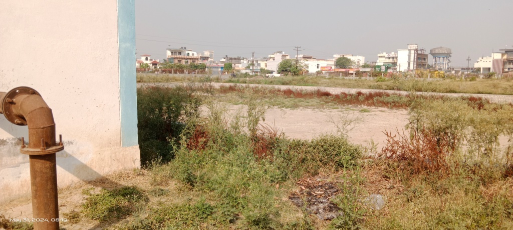
Wetlands at Majra Chowk: There is huge marshy land near Majra chowk. Large part of this land has been developed into residential areas and around 7acre patch is remaining. The Sewala Kalan-GMS road cut through the wetlands.
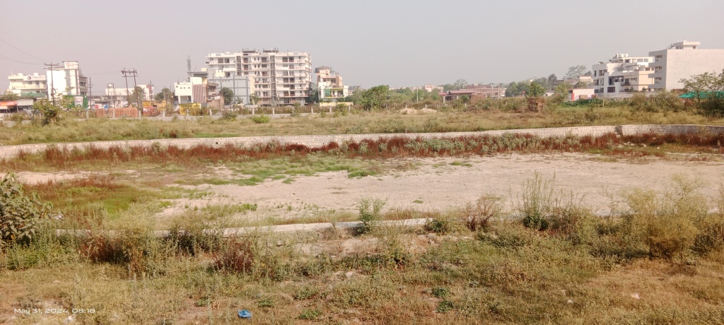
The government has developed a pond in small part of the wetlands next to Priya Lok residential area.
The pond with paved periphery is seen in dried up condition. There is tube well installed in the pond area which suggests it is usually filled with groundwater.
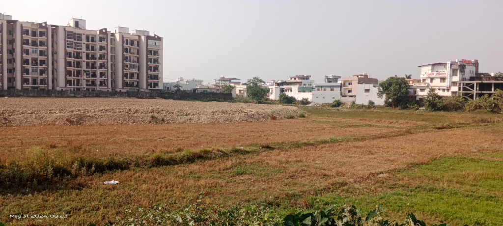
A larger marshy land patch lies close to Rocky Vally apartment complex and is being grabbed from all sides.
Presently, fresh soil dumping has covered about half of the wetlands area.
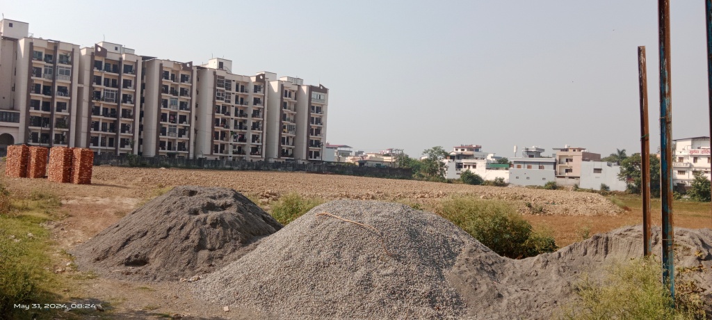
There are heaps of construction materials at the edge of marshy land. Soon, the levelled-up part of the wetlands will be converted into residential area.
Google Earth observation of the area suggests the wetlands draining into Asan stream. A few other ponds, wetlands, which are part of Asan catchment are seen degraded, polluted & encroached.
Macchi Talab: The pond is spread over 3 ha near Seema Dwar ITBP camp in Harbanswala.


The state govt had a plan to use the pond for fisheries and even released fish seeds in the waterbody but currently it has been completely covered by native & invasive vegetation.
ITBP Lake & Streams: There is man-made lake inside ITBP campus. It is reportedly being filled with groundwater. Entry in the ITBP camp area is restricted for outsiders. There is dry water course running through the ITBP campus.

Another water course runs along the western boundary wall of ITBP camp. It is being abused as a municipal drain. For most part, the water course is running underground through Harbanswala.

At one place the ITBP boundary wall displays a painting of clean flowing stream. In sharp contrast to this the water course next to the painting runs fully covered and carries waste water from the area.

Google Earth observation suggests the water courses starting from Tilla pond and Macchi Talab respectively. Tilla pond is located in Indra Nagar, Balliwala about 1.5 km from the ITBP camp and Macchi Talab is just upstream the ITBP camp. But presently, the streams are totally disconnected from the stream.

Apart from solid and liquid pollution, the top of the streams have been covered with concrete to use the area as car parking and commercial spaces just downstream Telpur-Majra road.
Both the water courses which could once be perennial or seasonal streams feeding the Asan merge together in Pithuwala Kalan area and later on it joins the Asan River near Budh Vihar at the northern edge of WII campus.
Bhim Singh Rawat (bhim.sandrp@gmail.com)
Note: The first part of the photo blog highlights the present status of water sources and streams in founding catchment of Asan river. The second part of the photo blog will cover the remaining part of the river in the similar manner. All the images and maps are and prepared by the author.
I specially thank Dr. Anil Gautam, Scientist, Ram Sevak from People’s Science Institute (PSI), Megha Prakash, an independent researcher and Varsha Singh a freelance journalist all from Dehradun for sharing valuable information and assisting me during field trips to document Dehradun rivers.
[i] There is another story in Gautami Mahatmaya in Brahma Purana about Godavari and its tributaries in the Brahmagiri mountains near Nashik in Maharashtra, see: https://sandrp.in/2024/02/12/%e0%a4%89%e0%a4%97%e0%a4%ae-story-of-godavari-and-vaitarnas-origin/
