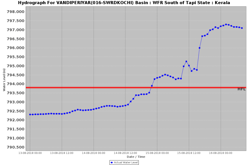
Even as the rainfall during South West Monsoon of India during June Sept 2018 was 9.4% below normal, a number of HFL (Highest Flood Level) crossing flood events were recorded on CWC’s (Central Water Commission) Flood Forecasting (FF) website[i]. Since CWC’s FF site does not provide archived information or comprehensive list of such events, we are here putting together a list of such events that we had noted during the SW monsoon, for future records and also understanding trends of high floods. Continue reading “HFL crossing flood events during India SW Monsoon 2018”
Day: November 8, 2018
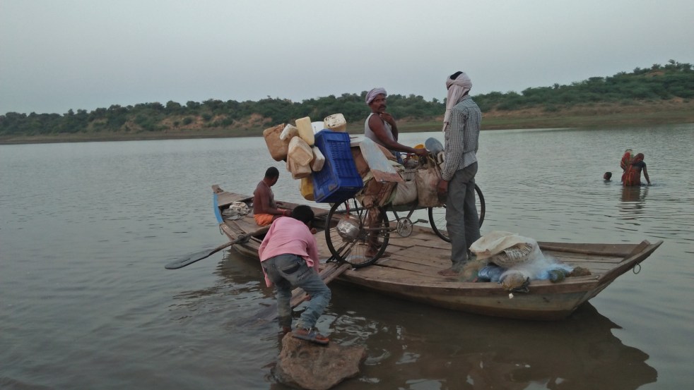
Ken River Yatra: Exploring A Threatened River And Knowing River People
Two environmentalists take a walk along a river and find that they should have brought along the policymakers, planners, engineers and politicians claiming to help it.
When heading out on an adventure, it is standard practice to look at satellite imagery of the area to chart an informed plan of action. However, when we were preparing for our walk along the Ken river, we couldn’t access a reliable map of the watercourse all the way from source to mouth.
We tried tracing the river on a map using satellite data for cues, moving upstream from an established point of identity: Chilla ghat, the confluence of the Ken with the Yamuna in Uttar Pradesh. However, this exercise proved difficult and led us astray multiple times, especially in the upper catchment area. It was only later, when walking along the river, did we realise that this was because almost all of Ken’s tributaries have a larger discharge than the Ken itself. Our virtual search for the Ken’s source kept taking us to the source of its tributaries in nearby hills. Thanks to the walk, we now have an actual and detailed map of the river that we intend to share soon.
Continue reading “Ken River Yatra: Exploring A Threatened River And Knowing River People”
