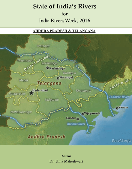
This is about two states, Andhra Pradesh and Telangana (the latter being 29th Indian state formed in 2013 after a protracted struggle). Since the discussion is on the state of rivers, it may be noted that these are two states whose historical trajectory is intrinsically linked to the history of, mainly, two major rivers—Krishna and Godavari, although the two states have many other rivers.
In fact, Telangana, was created after many years of struggle and out of one basic river-water discourse: over the utilisation of Godavari river and unequal development of the Godavari delta region vis-à-vis Telangana on account of the numerous irrigation projects and hydro-power projects commissioned and implemented in the coastal Andhra region.
In the wake of the recent contention between Telangana and Andhra Pradesh and the resolution over utilisation of the other river, Krishna, the state of rivers in Andhra Pradesh cannot be seen without addressing the same in Telangana, which have a historical trajectory that necessitates an understanding of the two states together while discussing rivers.
To some extent, this report looks at the politics over rivers and the contemporary development paradigm, involving construction of hydro-electric projects and several subsidiary projects using rivers, as one of the major threats to the life of rivers. These projects also add to pollution, displacement, protracted battles, sometimes involving violence, such as the one we are witnessing over Cauvery river between Karnataka and Tamil Nadu, where even Tribunals seem to have failed.
It is important to note that the current development politics is the most crucial threat to rivers in terms of the nature of development proposed for the country. The present state of development is fixated upon maximum use of river waters and any obstructions imposed on the river’s flow means to take away from its basic principle: flow. This paradigm is irrespective of the political parties that may rule different states and has more to do with an idea of progress and control of natural resources, including rivers.
This report will also have elements seen as common threats to rivers, such as pollution, and there are a few facts and figures which give information about the health of rivers from these parameters. But it is also important to look at the disputes over water sharing because they lead to or are preceded by projects which invariably lead to deteriorating health of the river system as a whole, not in terms of one single river, with a singular name, but the entire interconnectedness of several streams, rivulets, tributaries that give the identity to a large river, where each of these components of a river are equally important: their individual health in a particular political boundary of a state is crucial for the health of the larger / major river. And some projects promise to threaten the very flow of a river or divert its natural course, which means they impact at some level on the river system.
Following is a list of rivers in AP and Telangana states, as listed on web sources, such as Wikipedia and the websites of the respective state governments.
|
Table showing List of Rivers in Andhra Prades & Telengana States |
||
| SN. | Andhra Pradesh | Telangana |
| 1 | Arani | Bhima |
| 2 | Bendi Gedda | Dindi |
| 3 | Borramma Gedda | Godavari |
| 4 | Budameru | Krishna |
| 5 | Bahuda | Maner |
| 6 | Champtavati | Pranahita |
| 7 | Cheyyeru | Munneru |
| 8 | Chitravati | Manjira |
| 9 | Galeru | Musi |
| 10 | Garibula | Palar |
| 11 | Gedda | Penganga |
| 12 | Godavari | Tungabhadra |
| 13 | Gundlakamma | Taliperu |
| 14 | Jhanjavati | Wardha |
| 15 | Kandaleru | |
| 16 | Kandivalasa | |
| 17 | Kalangi | |
| 18 | Kinerasani | |
| 19 | Koringa | |
| 20 | Krishna | |
| 21 | Kundu | |
| 22 | Mahendratanaya | |
| 23 | Manila | |
| 24 | Maldevi | |
| 25 | Manneru | |
| 26 | Murredu | |
| 27 | Nadari | |
| 28 | Nagari | |
| 29 | Nagavalli | |
| 30 | Narava Gedda | |
| 31 | Palar | |
| 32 | Paleru | |
| 33 | Papagni | |
| 34 | Pedda Gedda | |
| 35 | Peddvagu | |
| 36 | Penna/Pennar | |
| 37 | Ponnaiyar | |
| 38 | Sabari | |
| 39 | Sileru | |
| 40 | Sarada | |
| 41 | Swarnamukhi | |
| 42 | Tammileru | |
| 43 | Tandava | |
| 44 | Tungabhadra | |
| 45 | Vamasdhara | |
| 46 | Varaha | |
| 47 | Vedavati | |
| 48 | Yeleru, | |
| 49 | Yerrakaluva | |
Many of these are names may not ring a bell in mainstream debates on river waters, because the focus tends to be on the ‘major’ rivers of a state. A holistic understanding of threat to rivers in the country can perhaps come about if each of such rivers, even the unknown ones, or streams or lakes, are taken up for individual study or if their histories are studied, in connection with the people, places, the nature of development in areas where these are located.

About Andhra and Telangana States
Telangana: The state has an area of 1, 14,840 Sq Km and has a population of 3, 52, 86,757. Hyderabad is its capital – meant to be a joint capital of AP and Telangana for ten years from the year the new state was formed. But Andhra Pradesh government has already acquired thousands of acres of land and commenced the building of a new capital city, called Amaravati in the Krishna region. Agriculture has been largely the mainstay of Telangana with most farmers depending on rain-fed cultivation, besides an extensive coverage of borewells in many farmlands, as well. Both Godavari and Krishna flow through this state, besides other rivers. Paddy, cotton, sugarcane, oilseeds, millets and mango are some of the more widely grown crops. Horticulture and floriculture have also been promoted in recent years in the state. Telangana has more than 60 Special Economic Zones (SEZ).
Andhra Pradesh: In regional terms, Rayalaseema is also part of the new AP state. Paddy, sugarcane, groundnut, tobacco are some of the main crops grown in AP. Floriculture and horticulture are also important activities in farmlands of the Godavari delta region. Some of the important birding areas in the state are the water bodies – Kolleru and Pulicat lakes, the former between Godavari and Krishna rivers. One of the important facts about Andhra Pradesh, before it became Telangana and AP, is the number of hydro power projects and irrigation projects that have been built since AP was formed in 1956.
The Polavaram multipurpose National Project is a mighty big dam project in this state which commenced in year 2005, and has a unique record of sorts for the number of violations it has managed in the course of construction and continued in spite of several petitions and protests all these years, and in spite of the opposition stated by the Odisha and Chhattisgarh governments early on regarding submergence in those states. It was the pet project of the former CM of united AP, Dr. Y.S. Rajasekhara Reddy.
Detail of some rivers flowing in Andhra and Telangana Rivers

Godavari: The Godavari river is the largest of the peninsular rivers. The catchment of the river is 3, 12, 812 sq. kms (1, 20, 777 sq.miles) and spread across six states: Maharashtra (where the source of the river is located atop a hill in Trimbak / Triambak); Karnataka, Telangana Chhattisgarh, Odisha and Andhra Pradesh. The river joins the Bay of Bengal after feeding the Mangroves of the estuary at the south eastern coast, where it branches into two streams, Vasistha and Gautami Godavari before meeting the sea.
The Godavari basin lies between latitude 16016’ N and 23043’N and longitudes 73 0 26’ to 83007’E. The basin extends over an area of 312,812 km2, which is nearly 10% of the total geographical area of the country. A total number of 25 water quality stations covering Andhra Pradesh, Chhattisgarh, Karnataka, Madhya Pradesh, Maharashtra & Odisha states are under Godavari Basin.
Godavari has an amazing journey and touches a diverse topography all through its course, being fed and nurtured by several rivulets, streams and rivers (in their own right) en-route, which makes a point about how a river is an entire system, where the constituent parts are as important as the main river that she becomes, before joining the sea.
In its long south-eastern journey from its source, Godavari receives waters mainly from Pravara, Mula, Purna, Dudhna, Wardha, Painganga and Wainganga united in Pranahita, Indravati and Sabari. The largest tributary of the Godavari is the Pranahita with about 34.9% coverage of drainage area. The Pravara, Manjira and Maner are right bank tributaries covering about 16.1%, the Purna, Pranahita, Indravati and Sabari are important left bank tributaries, covering nearly 59.7% of the total catchment area of the basin. The Godavari basin as whole receives 84% of the annual rainfall on an average, during the southwest monsoon, between mid-June and late August. The Godavari basin has rich forest and mineral wealth.
Godavari river has its once in 12 year cycle of Godavari Pushkaram or Godavari Pushkaralu, during which time the river is said to be at its purest and people take a dip in the waters at different ghats set up for the purpose along the river’s course. The event is as revered as the Kumbh in the north. There is one belief that in this period other rivers too cleanse themselves of their sins in Godavari. The last Godavari pushkaram happened in 2015.
Krishna: The Krishna basin lies between north latitude 13007’ to 19020’ and east longitudes 73022’ to 81010’. The basin extends over an area of 258,948 km2 ((99, 980 sq miles), which is nearly 8% of the total geographical area of the country. 24 water quality stations covering Andhra Pradesh, Karnataka and Maharashtra states are under Krishna Basin. The Krishna basin covers Maharashtra, Karnataka, Telangana and Andhra Pradesh states.
The source of Krishna, or Krishnaveni river (as it is also referred to in Andhra Pradesh and Telangana) is in the Western Ghats at an altitude of 1337 m, just north of Mahabaleshwar. The river flows eastwards, through the four states mentioned above, finally joining the Bay of Bengal, spanning a total length of about 1,400 km. Together with its tributaries, the river drains about 708 km of the Western Ghats, which is its chief source of supply. Agriculture is the predominant land use in the Krishna basin. Among the rivers that feed Krishna are the Koyna (west of Mahabaleshwar hills), Yerla, Varna, Panchganga, Dudhganga, Ghataprabha and Malaprabha (with sources in the Western Ghats) and as it flows down, it is joined by Bhima, Tungabhadra, Dindi, Musi, Palleru and Munneru. The important minerals found in the catchment are gold, bauxite, lime stone, iron ore, manganese ore, quartz, copper, red oxide, soapstone, etc.
Vamsadhara: The Vamsadhara flows between Mahanadi and Godavari. The river originates in Lanjigarh in Kalahandi district of Odisha, flowing 254 km before joining the Bay of Bengal at Kalingapatnam in AP. The catchment area of the river is 10,830 square kilometers. Vamsadhara river basin covers an area of 8015 sq.km in the state of Odisha and 2815 sq.km in Andhra Pradesh.
One of the major tributaries of Vamsadhara River is Mahendratanaya, which originates Gajapati district of Odisha. It joins the main river in the state of Andhra Pradesh, upstream of Gotta barrage. The Boddepalli Rajagopala Rao Project is located on this river, meant for irrigation to north Andhra through two canals, the Left Main and the Right Main Canal, for irrigation of around 148,000 acres through the RMC and 62, 280 acres through the LMC.
Nagavali: The Nagavali river lies within the geographical co-ordinates of north latitude 180 10′ to 190 44′ and east longitudes of 820 53′ and 840 05′. It is surrounded by Vamsadhara in the north, Champavati and Peddagedda in the south, Godavari in the west and the Bay of Bengal in the east. It drains parts of the districts of Kalahandi, Rayagada and Koraput of Odisha and Srikakulam, Vizianagaram and Visakhapatnam of Andhra Pradesh state. The total catchment area is 9510 sq km. The Nagavali river originates near the Lakhbahal in Kalahandi district at an elevation of about 1300m. The total length of the river is 256 km out of which the first 161 km is in Odisha and the rest in Andhra Pradesh. The important tributaries are Barha, Baldiya, Satkalnala, Sitagurha, Srikona, Jhanjavati (Odisha-AP), Gumidigedda, Vottigedda, Suvarnamukhi, Vonigedda, Vagavathi and Relligedda (north Andhra).
Thotapally, Narayanapuram and Jhanjavati are the major projects and there is a medium irrigation project in the catchment area of the Nagavali basin. Manganese, quartz, mica, graphite, limestone, bauxite and construction materials are found in abundance in the Basin.
Pennar River: Pennar, or Penna, rises in the Thenanahesava hill of the Nandidurg range in Karnataka, flowingthrough Kolar and Tumkur districts of Karnataka and enters Andhra Pradesh in the Hindupur taluk of Anantapur district, running eastwards before draining into the Bay of Bengal near Nellore. It is 597 kilometres long. Its drainage basin is 55,213 km2, of which 6,937 km2 is in Karnataka and 48, 276 km2 in Andhra Pradesh. The river basin lies in the rain shadow region of Eastern Ghats and receives an annual average rainfall of 500 mm. The Basin lies between east longitude 770 04’ to 800 10’ and north latitude 130 16′ to 150 52′. The Somasila is the only major project in the catchment area of the river basin.

There was a colonial agreement on the sharing of the Pennar river waters (1892) and then there is the post-independence Interstate River Water Disputes Act (1956) which now governs the same. Water from the Krishna river is transferred into the upper Pennar basin 600 m MSL through the Tungabhadra dam located in Karnataka — a joint project of Andhra Pradesh and Karnataka. The low-lands of Pennar basin can be supplied with Krishna river from the Srisailam dam up to 250 m MSL. The estuary of the Penna river extends 7 kilometers upstream from the Bay of Bengal.
Palar River: Palar river originates in Nandi Hills in Kolar district of Karnataka. It flows 93 kilometers in Karnataka, 33 km in Andhra Pradesh and 222 km in Tamil Nadu before merging into Bay of Bengal at Vayalur, 100 kms from Chennai. The river has seven tributaries, Cheyyar being the chief tributary.
AP government’s irrigation dam at Ganeshpuram across Palar near Kuppam initiated the dispute with the farming communities in five districts of northern Tamil Nadu – Vellore, Kanchipuram, Tiruvannamalai, Tiruvallur and Chennai. The CM of Tamil Nadu raised objection to it and referred to the Interstate River Water Disputes Act , 1956, on the point that the upstream riparian should not construct any project (for diverting, storage, etc) affecting the waters of the downstream, without consent from the downstream state. Incidentally, during the colonial period the agreement over Palar waters were made when the states of AP and Tamil Nadu were in Madras Presidency and the state of Mysore.
Kolleru Lake: Kolleru lake is a natural wet land situated between Krishna and Godavari deltas in the coastal districts of West Godavari and Krishna lying between the latitude 16o32’ and 16o47’ and longitude 81o05’ and 81o21’ E. The important activities in the lake area are agriculture and aquaculture. The lake is the drinking water source for the people living in the vicinity of the Kolleru Lake and it is a bird sanctuary for indigenous and migrating birds. The ecological degradation of the lake was set in due to extensive use of pesticides by farmers of Upper catchment and delta regions, bunding for pisciculture, draining of sewage and industrial pollutants through in-flowing drains and channels.
Pollution: ‘In the AP rivers, the freshwater shark, ‘goonch’ (Bagarius bagarius) has long disappeared. The migratory hilsa has been affected due to the barrage on the Godavari river. Such indigenous species as Labeo fimbriatus, Labeo calbasu, Tor khudree, which were abundant in the earlier years of impoundment in Nagarajunasagar, declined over years due to habitat loss and breeding failure. These were replaced by minnows, which are of little commercial significance.’ (AP Water Vision, Vol. I: 22)
There are 38 monitoring locations on rivers in Telangana out of which 18 locations are exceeding the Water Quality Criteria limit with respect to BOD. These 18 non-complying locations are situated on 7 rivers. The names of the rivers are; Godavari, Krishna, Manjeera, Musi, Nakkavagu, Sabari and Maner. These rivers are classified in three priority classes (Class – I, II and V).
Apart from pollution, rivers in both states are threatened by illegal sand mining, dams and irrigation projects, thermal power projects. Amarvati the under construction capital of Andhra has been inviting criticism for destroying the floodplains of Krishna river and damaging several other water streams. There are also reports, suggesting wide scale bank erosion being causing by Krishna river in Krishan district.
There are apparently around 95 major and medium irrigation projects ongoing, completed, on Pennar, Godavari and Krishna. There are 161 dams on Godavari and Krishna, 61 major and medium irrigation projects and 24 lift stations on both these rivers.
Thus, with so many rivers, river systems, projects, a detailed study of all the rivers must be done at some point in order to truly assess the state of rivers. Also, the state of politics over rivers is increasingly the most significant intervention in river systems.
This report does not claim to be (and cannot be) a comprehensive study of all the rivers of AP and Telangana, which is not possible in a short time span. It is just a compilation based on some parameters, over just a few rivers. One truly believes that a Red List of endangered rivers, a highly useful exercise, can only emerge through if river systems are studied in their entirety, through deeper field-level engagement—since what happens to and around and in rivers does not actually come out through official data, such as annual reports or lab studies alone. The actual conflicts are based on the ground and many a times even reports such as the CPCB of 2015, fail to make note of important political and economic changes happening in the country, especially on river interventions.
A report by Dr. Uma Maheshwari
Notes:-
- This report was commissioned for India Rivers Week 2016.
- Its a short description of a detailed report which can be seen here Telangana and Andhra Pradesh Rivers Profile
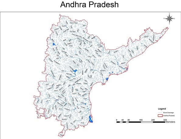
- The Andhra and Telangana Drainage maps have been put together by a WWF Team led by G Areendran, the names of the rivers have been provided by an INTACH Team led by Dr. Manu Bhatnagar.
- You may also like to see River profiles of Rajasthan, West Bengal, North-East India, Maharashtra, Haryana, Uttarakhand , Himachal Pradesh, Kerala, Karnataka Goa, Jharkhand & Odisha States
- The same report can also be seen on India Rivers Week Blog

Though it is brief history on rivers/streams traversing across the States of TS and AP, it was certainly a good attempt on river waters of the above two States. This report can further be improved by describing the dams,diversion structure,Major lift schemes existing and on going in these two states. This report does not indicate the availability of waters in both the states.
LikeLiked by 1 person
Many thanks for very useful and constructive feedback.
LikeLiked by 1 person